Top 6 Longest Rivers In Sri Lanka

Sri Lanka is a South Asian country to the south of India. Between the central highlands and the Bay of Bengal, the Mahaweli, Sri Lanka's longest river, flows ... read more...for 208 kilometers. Sri Lanka has 103 river basins, some of which are governed by dams and reservoirs thanks to modern technology. The rivers are crucial for agriculture and water supply because the majority of Sri Lanka's land mass is desert. Top longest rivers in Sri Lanka will be compiled by Toplist in this article.
-
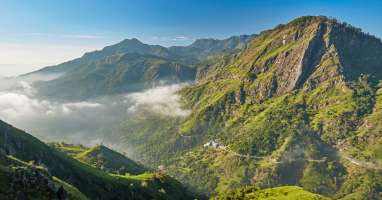
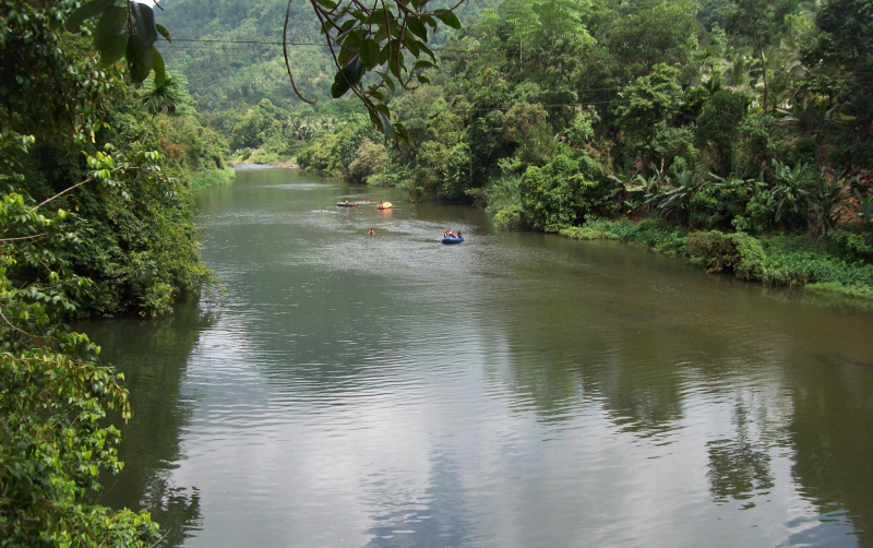
The Mahaweli River is the longest river in Sri Lanka, measuring 335 kilometers (208 miles). It possesses the country's largest drainage basin, at 10,448 km2 (4,034 sq mi), covering over one-fifth of the island's total surface. Its rank as one of the longest rivers in Sri Lanka. The Mahaweli Ganga begins in Polwathura (at Mahawila region), a rural village in Nuwara-Eliya District, on the bank of the Nawalapitiya in Kandy District, where Hatton Oya and Kotmale Oya connect. On the southwestern edge of Trincomalee Bay, the river flows into the Bay of Bengal. Trincomalee is one of the world's best natural deep-sea harbours, with the first of a series of submarine canyons.
The Mahaweli River and its tributaries have been dammed at many locations as part of the Mahaweli Development Program to allow irrigation in the dry zone, with about 1,000 km2 (386 sq mi) of land irrigated. More than 40% of Sri Lanka's electrical demands are met by hydroelectricity generated by the Mahaweli system's six dams. Throughout history, the river has provided water for agriculture in the surrounding areas. The Kotmale Oya is one of the river's several origins. Numerous freshwater fish species live in the river, which also has pockets of plantations and grassland along its banks, as well as flowering plants and ferns. Pollution, human encroachment, alien species, unlawful development in the river's reservation section, and excess hydropower projects are all major dangers to the river.
The Mahaweli is thought to begin in the Sri Pada mountain range in Sri Lanka. The Mahaweli draws its water from the Thotupola mountain range and the Horton Plains in Kirigalpoththa.
Length: 10,448 km2 (4,034 sq mi)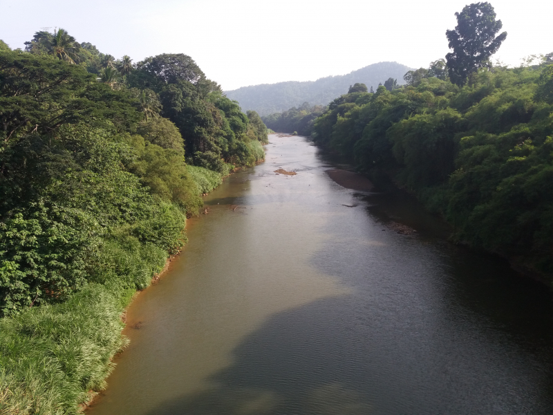
https://commons.wikimedia.org/ 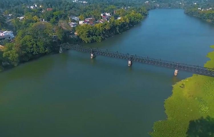
https://www.mahaweli.com/ -
With a length of 164 kilometers (102 miles), the Malwathu Oya is one of the longest rivers in Sri Lanka. The river begins in Sri Lanka's North Central Province and flows into the Gulf of Mannar near Vankalai on the northwest coast. It is a seasonal river that runs for 164 kilometers through paddy and forest fields that the locals rely on to survive.
The river basin is 3,284 km2 (1,268 sq mi) in size (with a length of 125 km (78 mi) and a maximum width of 40 km (25 mi) at an average elevation of 85.5 m (281 ft) above sea level). In the basin area, the average annual rainfall is 1,223 mm (48.1 in). In the upper portions of the river, the Ritigala mountain range, which consists of four main peaks (the largest of which is over 900 m (3,000 ft) high), serves as the main watershed.
From the North Central Province to the Palk Strait, the Malvathu River flows for 102 kilometers. The city serves as a connecting point between Anuradhapura and the Mannar Coast. For more than 15 centuries, Anuradhapura was Sri Lanka's capital, and the ancient Kings commissioned the construction of canals on the river to feed the rice farms and keep the populace afloat. As a result, the river is historically significant in Sri Lanka. Pollution and rising sedimentation are threatening the river's aquafauna.Length: 164 kilometers (102 miles)
https://en.wikipedia.org/ -
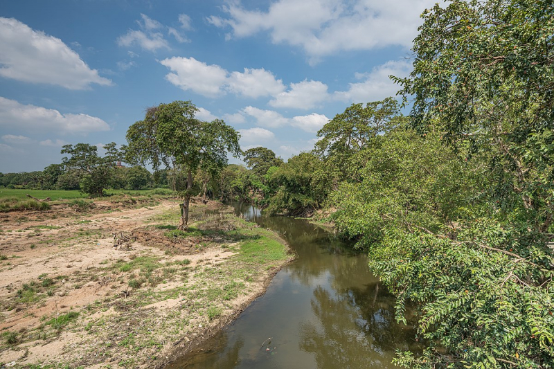
The Kala Oya is also Sri Lanka's longest rivers. It's around 145 kilometers (90 miles) long. It ranks 3rd among the longest rivers in Sri Lanka The river has a basin area of 2,873 km2 (1,109 sq mi), and it is home to almost 400,000 rural residents. In northeastern Sri Lanka, the Kala Oya River flows for 92 kilometers from Dambulla to Wilpattu. The Mahaweli River supplies around 75% of the river's water, with the rest coming from rainfall.
Its catchment area receives about 3,169 million cubic meters of rain each year, with about 5% of the water reaching the sea. It has a 1,792 square kilometer catchment area. The lower basin of the river is mostly used for rice irrigation, which is done on a large and small scale. Large-scale irrigation projects receive nearly 65 percent of the river's water.
Length: 2,873 km2 (1,109 sq mi)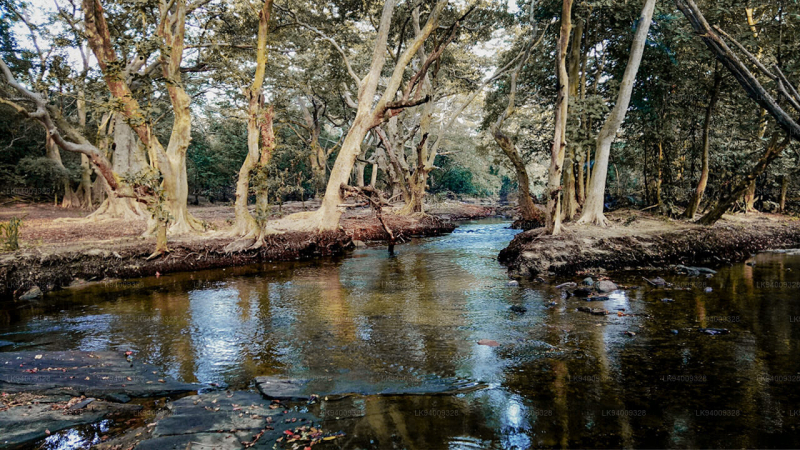
https://lakpura.com/ 
https://lakpura.com/ -
In Sri Lanka, the Kelani River is a 145-kilometer-long (90-mile) river. It spans from the Sri Pada Mountain Range to Colombo, making it the country's fourth-longest river. Nuwara Eliya, Ratnapura, Kegalle, Gampaha, and Colombo are among the Sri Lankan districts where it passes through or borders. The Kelani River also runs through Sri Lanka's capital, Colombo, and supplies 80 percent of the country's drinking water.
In its upper stages, the Kelani River contains two major tributaries: the Kehelgamu Oya and the Maskeli Oya. These two areas contribute to Sri Lanka's hydroelectric production by holding several important reservoirs, ponds, and power plants. The Kelani River has a number of tributaries in its lower reaches, the most prominent of which are the We Oya at Yatiyanthota, the Gurugoda Oya at Ruwanwella, and the Seethawaka Ganga at Avissawella.
The river holds religious and cultural significance for the people of Kelani Valley, who follow the country's Sinhala Buddhist traditions. On the river's banks, there is a Kelani temple that is recognized as a sacred location. Many people rely on the river for their livelihood because it is utilized for fishing, irrigation, and transportation. Sand mining is practiced along the river's banks, and it has harmed the river's health. Pollution and urban development can pose a threat to the river.Length: 145-kilometer-long (90-mile)
https://en.wikipedia.org/ 
https://efl.lk/ -
The Kalu Ganga is a Sri Lankan river. The river begins in Sri Padhaya and runs for 129 kilometers (80 miles) before reaching the sea at Kalutara. It is one of the longest rivers in Sri Lanka. The Ratnapura and Kalutara Districts, as well as the city of Ratnapura, are crossed by the Black River. The river's main sources of water are the Central Province's hilly forests and the Sinharaja Forest Reserve.
The Kalu Ganga basin is one of Sri Lanka's most important river basins, receiving heavy rainfall and high discharges. The lower flood plain is subject to regular flooding as a result of its hydrological and topographical characteristics, which has a significant impact on the socioeconomic profile. Many experts have looked into climatic changes in the country's major river basins in recent years, but none have looked at climatic changes in the Kalu Ganga basin. As a result, the goal of this research was to look into precipitation trends in the Kalu Ganga basin.
The Kalu Ganga rises at an altitude of 2250 meters in the wet zone's central hills, collects rainwater on the western slopes, and flows 129 kilometers to the sea at Kalutara. The upper section of the basin features severe grades, whereas the lower part has modest gradients. The river basin's lower flood plain is subjected to regular flooding during the Southwest monsoon season as a result of these hydrological and physical factors. As a result, because the lower flood plain of Kalu Ganga is heavily populated and a prospective rice production area, the socio-economic profile is greatly harmed.Length: 129 kilometers (80 miles)
https://www.dailynews.lk/ 
https://en.wikipedia.org/ -
The Attanagalu Oya is a river in Sri Lanka's Gampaha District. The river has a length of about 76 kilometers and a drainage basin of 727 square kilometers. It rises in the Galapitamada area of Kegalle district and flows as Dandugam Oya into the Negombo Lagoon. In the Gampaha district, the river is a frequent cause of flooding in low-lying areas.
The river originates in the Galapitamada area of Kegalle District's lower peneplains. The left tributaries Basnagoda Oya and Waharaka Oya join it in Karasnagala, and Algama Oya joins it lower downstream near Attanagalla town.
In Gampaha, Oruwal Oya and Diyaeli Oya join the Attanagalu Oya. The river then runs north, joining Kimbulapitiya oya and Mapalan oya in Madawala (near Katunayake) to form the Dandugam, Attanagalu, and Dandugam Oya river system, which subsequently drains into Negombo Lagoon in Dandugama Area, where Muthurajawela meets Negombo Lagoon. It is also joined by Ja-Ela, which is a diversion of the Oruwal Oya, near its mouth.
Length: 76 kilometers
https://www.colomboguardian.com/ 
https://www.dailynews.lk/