Top 11 Highest Mountains in the United States

Alaska boasts the most highest peaks of any state when it comes to mountains. Some of these mountains are rarely visited due to their isolated location in the ... read more...Last Frontier, but they nonetheless hold awe-inspiring significance as geographically iconic features of Alaska. Here are the top 11 tallest mountains in the United States
-
Denali is the highest mountain in the United States, standing at 6,190 meters. After Mount Everest and Aconcagua, Denali is the highest mountain in North America and the third highest of the Seven Summits (a mountaineering phrase for the highest mountain on each continent).
Denali and the surrounding mountains, which are located in the Alaska Range, were produced by intense tectonic activity that continues to raise the mountain's elevation year after year.
Denali is a Koyukon Athabaskan term that means "the towering one," and it carries enormous significance for indigenous Alaskans who have lived in the area since the beginning of time.
Moreover, Denali National Park and Preserve is one of Alaska's most popular tourist destinations, attracting visitors from all over the world throughout the summer months. Wolves, moose, caribou, black bears, and grizzly bears can all be observed from the park's one and only road.
Location: Denali National Park and Preserve, Alaska, U.S.
Elevation: 20,310 ft (6190 m)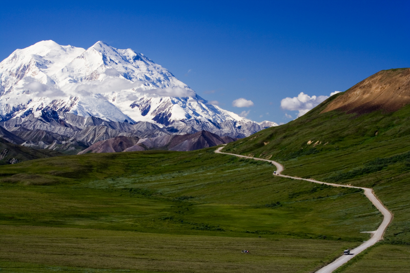
Source: Wikipedia 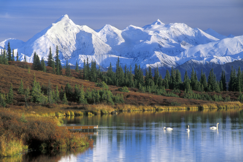
Source: NBC News -
Mount Saint Elias, in the Saint Elias Mountain Range in northern southeast Alaska, crosses the Alaska/Canadian boundary. It is the second tallest mountain in the United States and Canada, behind Mount Logan, at 18,009 feet (5,489 meters).
On the American side, Mount Saint Elias is part of the Wrangell-St. Elias National Park and Preserve, the country's largest national park. This National Park contains nine of the country's sixteen tallest peaks.
This mountain range is near Glacier Bay, which has a high density of glaciers and icefields, as well as tectonic and volcanic activity, making it a popular destination for modern and historical research. The indigenous Yakutat Tlingit people, who have lived in the area for thousands of years, refer to Mount Saint Elias as Yaséitaa Shaa or Shaa Tlein. An Italian expedition reached the summit of Mount Saint Elias for the first time in 1897.
Location: Yakutat City and Borough, Alaska, U.S./Yukon, Canada
Elevation: 18,008 ft (5,489 m)
Source: Wikimedia Commons 
Source: Pinterest -
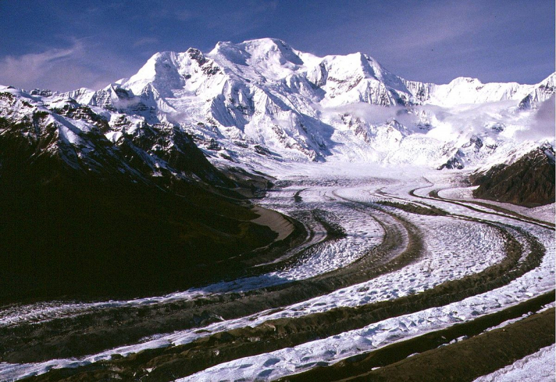
Mount Foraker is a 17,400-foot (5,304-meter) mountain in Denali National Park, 14 miles (23 kilometers) southwest of Denali. It is the third highest mountain in the United States and the second highest point in the Alaska Range. On a fork of the Kahiltna Glacier near Mount Hunter in the Alaska Range, it rises almost immediately above the usual Denali base camp.
In 1934, the north and south peaks were successfully summited for the first time. Across from Denali and Mount Hunter, the mountain is situated on a fork of the Kahiltna Glacier, the longest glacier in the Alaska Range.
Location: Denali Borough, Alaska, United States
Elevation: 17,400 ft (5304 m
Source: Pixabay 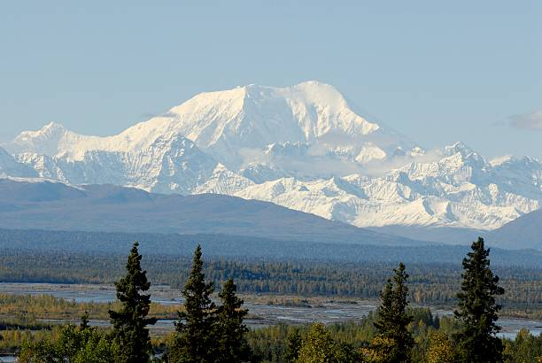
Source: iStock -
Mount Bona is the fifth-highest independent peak in the United States and one of the major summits of the Saint Elias Mountains in eastern Alaska. It is either North America's tenth or eleventh tallest summit. Mount Bona and Mount Churchill, its neighbor, are both enormous ice-covered stratovolcanoes. Only the three highest Mexican volcanoes, Pico de Orizaba, Popocatépetl, and Iztacchuatl, outrank Bona as the highest volcano in the United States and the fourth highest in North America. On top of a high platform of sedimentary rocks, it has a small stratovolcano at its summit.
The massif of the mountain is almost fully covered with icefields and glaciers, and it is the primary source of ice for the Klutlan Glacier, which flows east for over 40 miles (64 kilometers) into Canada's Yukon Territory. The mountain also supplies a significant amount of ice to the Russell Glacier system, which flows north.
In 1897, Prince Luigi Amedeo, Duke of the Abruzzi, saw Mount Bona while making the first ascent of Mount Saint Elias, about 80 miles (130 kilometers) to the southeast, and named it. He named it after his racing yacht, the Bona. Allen Carpé, Terris Moore, and Andrew Taylor were the first to climb the summit in 1930, starting from the Russell Glacier on the west side of the peak. The East Ridge is the current conventional route; a climb of nearby Mount Churchill is also a relatively easy option through this route.
Location: Wrangell–St. Elias National Park and Preserve, Alaska, U.S.
Elevation: 16,550 ft (5,040 m)
Source: Explore-Share.com 
Source: Mountain Planet -
Mount Blackburn is the tallest peak in the US state of Alaska's Wrangell Mountains. It is the United States' fifth highest peak and North America's twelfth highest point. The mountain is an eroded shield volcano that is the fifth-highest in North America and the second-highest in the United States following Mount Bona. Lt. Henry T. Allen of the United States Army named it after Kentucky senator Joseph Clay Stiles Blackburn in 1885. It's in the center of Wrangell–St. Elias National Park, the country's largest national park.
The massif of the mountain is almost fully covered in icefields and glaciers, and it is the primary source of ice for the Kennicott Glacier, which flows southeast for 20 miles (32 kilometers) until just above McCarthy. The peak also feeds a significant amount of ice to the Kuskulana Glacier system and the north-flowing Nabesna Glacier.
Location: Wrangell-St. Elias National Park and Preserve, Alaska, U.S.
Elevation: 16,390 ft (4996 m)
Source: Wikipedia 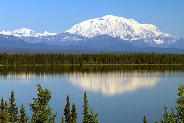
Source: iStock -
Mount Sanford is a shield volcano in the Wrangell Volcanic Field, near the Copper River, in eastern Alaska. After Mount Bona and Mount Blackburn, it is the sixth highest mountain in the United States and the third tallest volcano. The volcano's south face, at the head of the Sanford Glacier, rises 8,000 feet (2,400 meters) in 1 mile (1,600 meters), creating one of North America's highest gradients.
Mount Sanford is primarily made up of andesite and is a very old peak, likely Pleistocene in age, however some of the highest portions of the mountain may be Holocene. The mountain began to expand 900,000 years ago, when it was formed by the coalescence of three smaller shield volcanoes. The top 2,000 feet (610 meters) of the mountain look to be a lava dome filling a bigger summit crater, although being hidden by icefields.
Location: Wrangell-St. Elias National Park and Preserve, Alaska, U.S.
Elevation: 16,237 ft (4,949 m)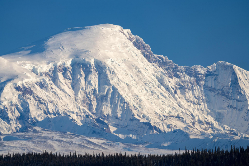
Source: Peakbagger.com 
Source: Alaska Volcano Observatory -
Mount Fairweather (formally known as Fairweather Mountain in Canada but commonly referred to as Mount Fairweather) is the tallest mountain in British Columbia, Canada, at 4,671 meters. It's 20 kilometers east of the Pacific Ocean, on the border between Alaska and western British Columbia, Canada. Although the majority of the mountain is located within Glacier Bay National Park and Preserve in Yakutat, Alaska (USA), the top borders Tatshenshini-Alsek Provincial Park in British Columbia (Canada). It's also known as US/Canada Boundary Point #164 or Boundary Peak 164.
Captain James Cook named the mountain on May 3, 1778, ostensibly because of the unusually favorable weather at the time. Many languages have been used to translate the name. It was given the names "Mt. Beautemps" by La Perouse, "Mte. Buen-tiempo" by Galiano, "Gor[a]-Khoroshy-pogody" on Russian Hydrographic Dept. Chart 1378 in 1847, and "Gor[a] Fayerveder" by Captain Tebenkov, Imperial Russian Navy. Constantin Grewingk named it "Schönwetterberg" in 1850, and Justus Perthes named it "Schönwetter Berg" in 1882.
Allen Carpé and Terris Moore were the first to climb Fairweather in 1931.
Location: Glacier Bay National Park and Preserve, Alaska / Stikine Region, British Columbia
Elevation: 4671 m (15,325 ft)
Source: Alaska Mountain Guides 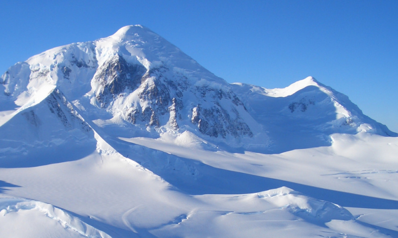
Source: Alaska Mountain Guides -
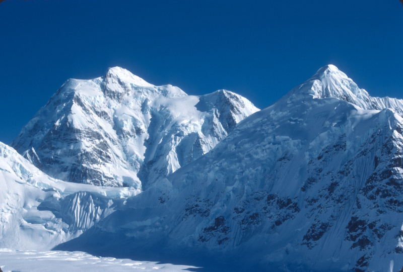
Mount Hubbard is one of the Saint Elias Range's most prominent peaks. It is located on the Alaska/Yukon border, with Kluane National Park and Reserve on the Canadian side and Wrangell–St. Elias National Park on the American side. The peak was named after Gardiner Greene Hubbard, the first president of the National Geographic Society, who had co-sponsored Russell's trip, by USGS geologist Israel Russell in 1890.
Hubbard is the highest point of a huge massif that includes three designated summits: Mount Alverstone, Mount Kennedy, and Mount Hubbard. The border between Canada and the United States runs roughly south from these peaks toward the Alaska panhandle, and roughly west toward Mount Saint Elias, which is about 100 kilometers distant. Mount Hubbard is separated from Mount Vancouver to the west by the Hubbard Glacier, while the Lowell Glacier is to the east.
Mount Hubbard is the United States' eighth highest mountain and Canada's twelfth highest summit. It's also noted for its significant elevation above the surrounding countryside. For example, its west face rises 2,300 meters above the Alverstone Glacier in less than 3.2 kilometers, while its top rises 3,350 meters above the Hubbard Glacier in less than 11.3 kilometers. Mount Hubbard lies little over 32 kilometers from Disenchantment Bay's tidewater. Despite the steep fall to the west, the eastern side of the mountain offers a non-technical route to the summit.
Location: Yukon, Canada / Yakutat City and Borough, Alaska, U.S.
Elevation: 4557 m (14,951 ft)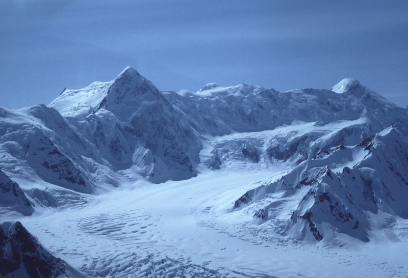
Source: PeakVisor 
Source: Wikidata -
Mount Cleveland (also known as Cleveland Volcano) is a nearly symmetrical stratovolcano on the western end of Chuginadak Island, part of the Islands of Four Mountains about west of Umnak Island in Alaska's Fox Islands. Mt. Cleveland stands at 5,675 feet (1,730 meters) and is one of the most active of the Aleutian Arc's 75 volcanoes. The island was called after Chuginadak, the Aleutian fire goddess, who they thought inhabited the volcano. Mount Cleveland was named after then-President Grover Cleveland by a team from the United States Coast and Geodetic Survey that visited the island in 1894.
Cleveland, one of the Aleutian Arc's most active volcanoes, has erupted at least 22 times in the last 230 years. The arc's lone documented volcanic fatality occurred in 1944, when a VEI 3 eruption occurred. Mount Cleveland erupted three times in 2009, twice in 2010, once in 2011, and once each in 2016, 2017 and 2018. The volcano's remoteness limits opportunities for its study, and the Alaska Volcano Observatory relies heavily on satellites for monitoring. The volcano is mostly dangerous to planes since numerous flights across the north Pacific go close to it, and volcanic ash created by eruptions can harm sensitive electronic equipment and sensors.
Location: Chuginadak Island, Alaska, United States
Elevation: 5,675 ft (1,730 m)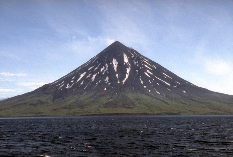
Source: Wikipedia 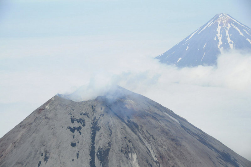
Source: Newsweek -
Mount Hunter, also known as Begguya, is a peak in Alaska's Denali National Park. It's about eight miles (13 kilometers) south of Denali, North America's tallest peak. In the Dena'ina language, "Begguya" means "child (of Denali)." Mount Hunter is the Alaska Range's third highest main mountain.
The summit of Mount Hunter is crowned by a broad, low-angled glacier plateau that connects the North (Main) Summit and the South Summit (13,965 feet or 4,257 m). Long, corniced ridges spread in all directions, with extraordinarily steep cliffs in between.
Location: Matanuska-Susitna Borough, Alaska, U.S.
Elevation: 14,573 ft (4,442 m)
Source: Mountain Madness 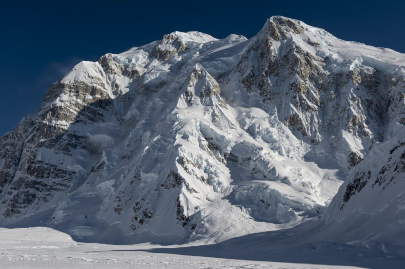
Source: Gripped Magazine -
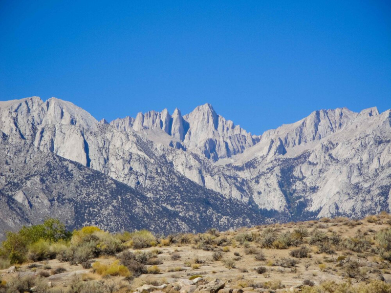
Mount Whitney, at 14,505 feet, is the highest mountain in the contiguous United States and the Sierra Nevada (4,421 m). It's located in East–Central California, on the border of Inyo and Tulare counties, 136.2 kilometers west-northwest of North America's lowest point, Badwater Basin in Death Valley National Park, which is 86 meters below sea level. The west side of the mountain is in Sequoia National Park, and the top is the southern terminus of the John Muir Trail, which stretches from Happy Isles in Yosemite Valley to the summit. Inyo County is home to the eastern slopes of the Inyo National Forest.
Location: Sequoia National Park, Inyo National Forest, Sequoia-Kings Canyon Wilderness, John Muir Wilderness, Inyo / Tulare counties, California, U.S.
Elevation: 14,505 ft (4,421 m)
Source: International Alpine Guides 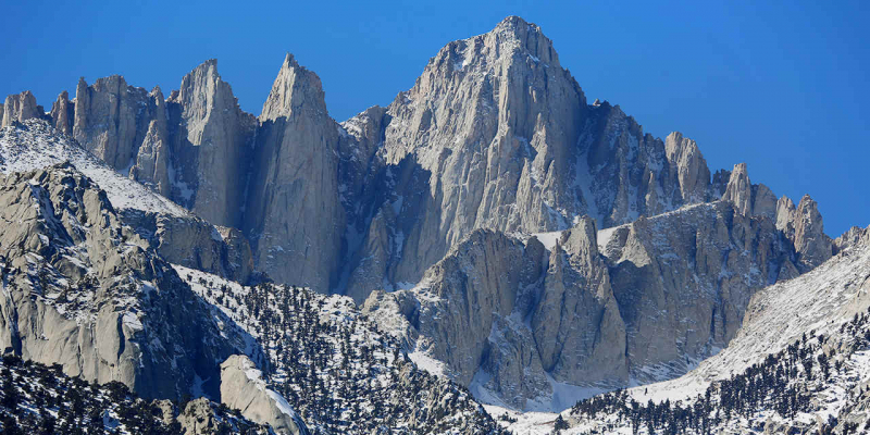
Source: Visit California