Top 10 Highest Mountains in United Kingdom

If you did not know, the United Kingdom (UK) is made up of England, Scotland, Wales, and Northern Ireland. However, all of the highest peaks are found in ... read more...Scotland. Now, let's explore the top 10 highest mountains in the UK.
-
Ben Nevis is the highest and probably most famous mountain in the United Kingdom. An estimated 160,000 people climb Ben Nevis each year. This popularity, however, is largely concentrated on the tourist route, with roughly three-quarters of summiteers opting for this route to the UK's highest point.
Although the tourist path is the most popular, Ben Nevis' steep and craggy north face has some of the best climbing and mountaineering routes in the country. You can find a route that is 100 times more exciting and dramatic than the 'Punter's Path' if you have the right experience and skill level.
You might be surprised to find ruins at the top of the Ben once you have reached the summit. These are the ruins of a former weather observatory that operated from 1883 to 1904. Surprisingly, this summit is the highest point for over 640 kilometers before reaching the Norwegian mountains.
Elevation: 1,345m
Location: Fort William
Scottish Gaelic name: Beinn Nibheis
Gaelic meaning: “Venomous mountain” or “mountain with its head in the clouds”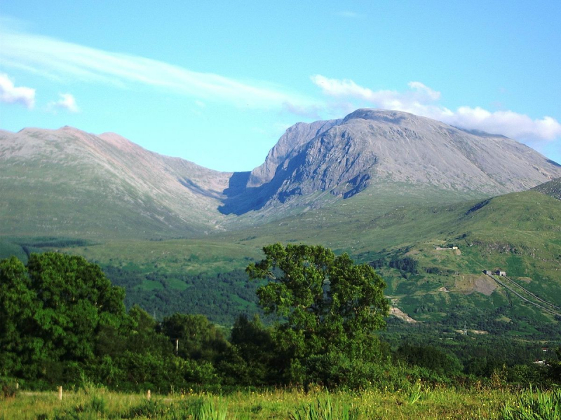
https://en.wikipedia.org/ 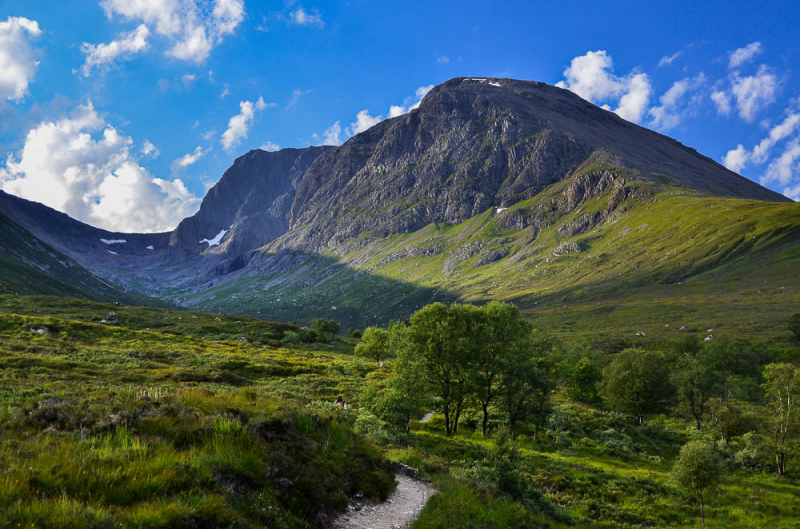
https://www.walkhighlands.co.uk/ -
It was unclear for a long time whether Ben Nevis or Ben Macdui was the highest mountain in the UK before proper mapping was invented (much of the local Aviemore community believed that their mountain was higher than Ben Nevis). However, Macdui's status as the second-highest peak in the UK and the highest peak in the Cairngorm National Park has long been established.
The path that leads up over slowly rising moorland from the Coire Cas car park at the foot of Cairngorm Ski Centre is probably the easiest route of ascent. This route is approximately 7 kilometers long; however, a slightly longer route allows for the ascent of Cairn Gorm. Another option is to take the path that leads up from Loch Etchachan. This loch can be accessed from either Loch Avon to the north or Glen Derry to the south. Other options include crossing the Derry Cairngorm or passing through the Lairig Ghru pass to the west of Ben Macdui. By Scottish standards, nearly all of these routes are long days. Bicycles are commonly used to travel the 5 km from the road end at Linn of Dee to Derry Lodge at the southern end of the massif when approaching from the south.The legendary Am Fear Liath Mr, or Greyman, is said to haunt the Ben Macdui area. Mountaineer Norman Collie claimed to have heard footsteps before fleeing from the summit in terror, and there have been several other reports of an unexplained presence.
Elevation: 1,309m
Location: Cairngorms
Scottish Gaelic name: Beinn Mac Duibh
Gaelic Meaning: Mountain of the son of Duff/MacDuff or Hill of the Black Pig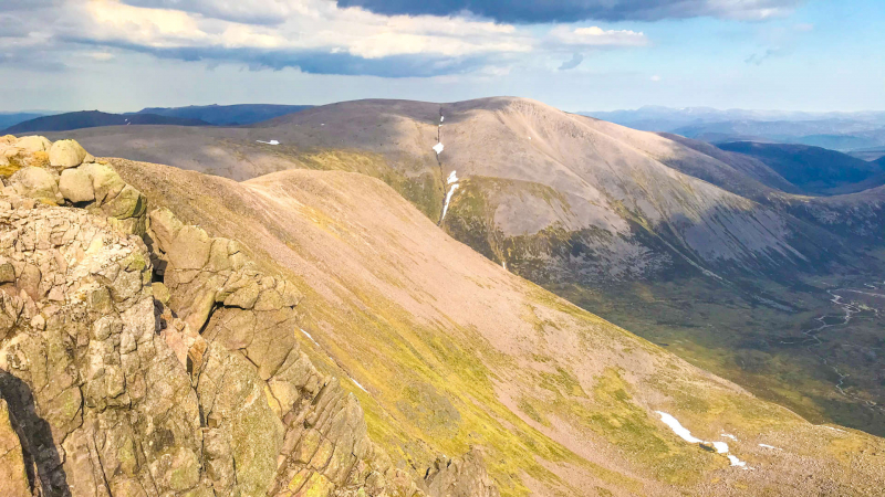
https://www.stevenfallon.co.uk/ 
https://www.walkhighlands.co.uk/ -
Braeriach is the highest mountain in the British Isles, only Ben Nevis, and Ben Macdui being higher. It is the highest point in the Cairngorms' western massif, which is separated from the central section (which includes Ben Macdui and Cairn Gorm) by the Lairig Ghru pass. The summit is shaped like a crescent and has several corries. The lingering snows of Braeriach are among Scotland's and, by extension, the British Isles' most persistent snow patches. Only seven times in the last century has the north-facing corrie of Garbh Coire Mor been snow-free: 1933, 1959, 1996, 2003, 2006, 2017, and 2021, though the rate and occurrence of melting appear to be increasing.
The most popular route up Braeriach begins at the Sugar Bowl car park, which is located on the road leading to the Cairn Gorm ski area. A path leads over the hillside to the Chalamain Gap, a steep-sided rocky ravine, before descending around 100 meters to the Lairig Ghru. After passing through this pass, the route continues on to the summit via Braeriach's north ridge, passing by Srn na Lairige, a subsidiary peak. This route takes you about 9 kilometers from the car park to the summit.
Elevation: 1,296m
Location: Cairngorms
Scottish Gaelic name: Am Bràigh Riabhach
Gaelic Meaning: Brindled greyish upper
https://www.stevenfallon.co.uk/ 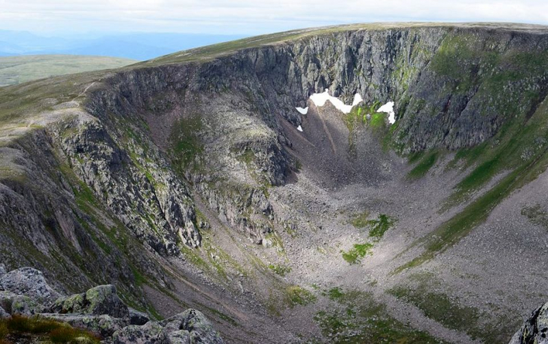
https://www.caingram.info/ -
Cairn Toul is located within the Cairngorm National Park, just beyond Braeriach. With a prominence of just over 160m, Cairn Toul is a mountain in its own right, despite sharing the same ridgeline as Braeriach.
Cairn Toul is a difficult peak to climb in a day because of the Cairngorm giants that stand in its way. It frequently necessitates either an overnight wild camp or a fast and light ascent from the Cairngorm ski center car park. You will be in a good position to tackle many of the other Cairngorm 4000+ feet peaks, such as Cairn Gorm, Ben Macdui, Cairn Toul, Sgor an Lochan Uaine, and Braeriach if you decide to go for Cairn Toul.
Cairn Toul is frequently climbed alongside other peaks. It can be combined with The Devil's Point, which is about 2.5 kilometers south-southeast, from the south. It can also be approached from the north, via Braeriach and Sgor an Lochain Uaine. Whether starting from Coire Cas above Speyside or Linn of Dee to the south, both routes are long by Scottish standards: around 15 km (plus return).
Starting from Achlean in Glen Feshie, the mountain can also be climbed from the west. The walker must negotiate a large expanse of an undulating boggy plateau in order to reach the Breariach-Cairn Toul massif, but the route is slightly shorter.Elevation: 1,291m
Location: Cairngorms
Scottish Gaelic name: Càrn an t-Sabhail
Gaelic Meaning: Hill of the barn
https://www.instagram.com/macleodharris/ 
https://www.instagram.com/awnewcomb/ -
Sgor an Lochain Uaine is a Scottish mountain in the Cairngorms. According to some estimates, it is Scotland's fifth highest peak (and the United Kingdom). It is the third highest point in the Cairngorms' western massif, located between Braeriach and Cairn Toul on the western side of the Lairig Ghru pass. The Scottish Mountaineering Club revised the tables in 1997, promoting them to Munro status. Sgor an Lochain Uaine is a remote mountain, with all routes to the summit taking at least two days by Scottish standards. It is usually climbed in conjunction with other peaks: if approaching from the south, it can be combined with Cairn Toul and The Devil's Point; if approaching from the north, it must first pass through Braeriach.
An Lochan Uaine the lochan in the corrie on the north-east side of the peak, is the mountain's name. Its name means "the peak of the little green loch" in English. The Angel's Peak is the name given to it by Alexander Copland, a founding member of the Cairngorm Club, in the 19th century, in contrast to the nearby The Devil's Point, as shown on Ordnance Survey maps.
Elevation: 1,258m
Location: Cairngorms
Scottish Gaelic name: Sgòr an Lochain Uaine
Gaelic meaning: Peak of the green lochan
https://stevenfallon.co.uk/ 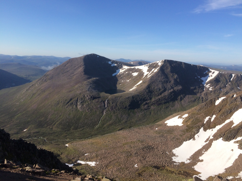
http://munromoonwalker.com/ -
Although the hills around here were originally known as Am Monadh Ruadh (the Red Hills), they have soon renamed the Cairngorm National Park after the UK's sixth highest mountain, Cairn Gorm. Cairn Gorm is not only the name of the park in which it is located; it is also the location of one of Scotland's five ski resorts.
Cairngorm Mountain, while not Chamonix or Verbier, is a ski resort with 11 lifts, including a funicular, nine button tows, and a drag tow. Cairngorm Mountain can offer 32km of pistes for skiers and snowboarders during good snow years (which are becoming increasingly rare in Scotland these days, unfortunately), with much more off-piste available for those looking to get away from the resort boundaries.
Aside from the ski resort, Cairn Gorm is a dull mountain in comparison to the peaks that surround it in the Cairngorm National Park. With a summit just 150m above the ski resort's funicular station, you are never far from the raucous and touristy atmosphere that a railway up a mountainside inevitably brings.
Elevation: 1,245m
Location: Cairngorms
Scottish Gaelic name: An Càrn Gorm
Gaelic meaning: Blue or Green cairn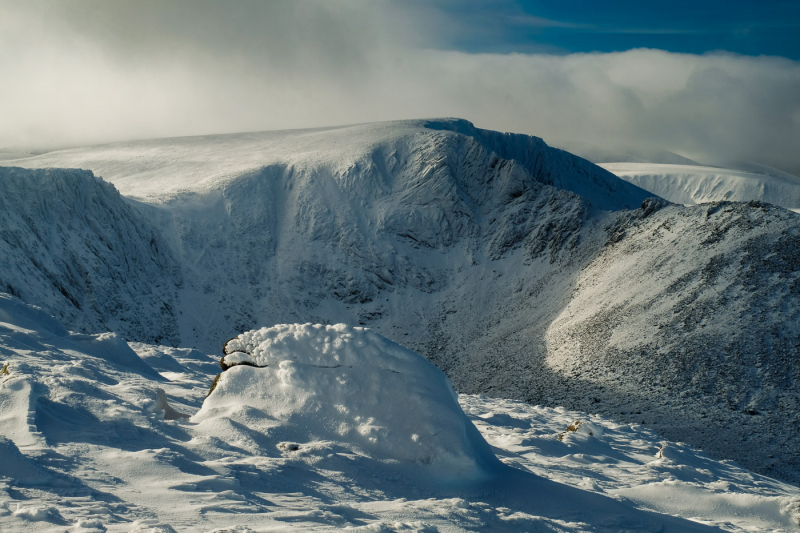
https://www.walkhighlands.co.uk/ 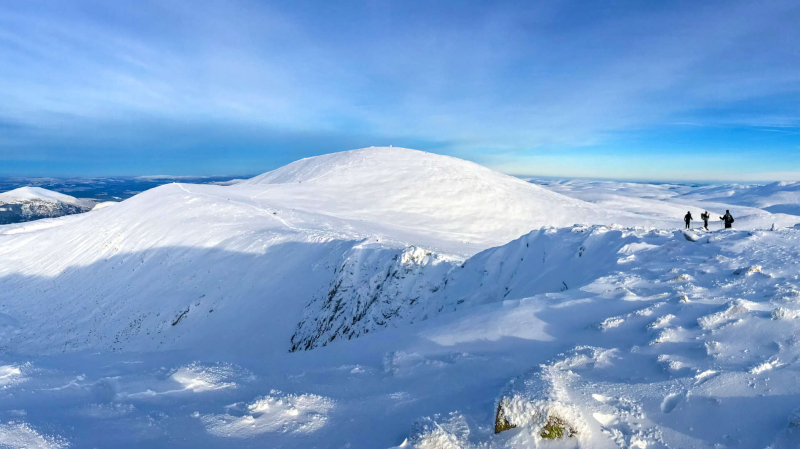
https://www.stevenfallon.co.uk/ -
Aonach Beag is linked to number eight on the UK's highest mountains list. Both Aonach Beag and Aonach Mr are connected by a ridge. It is a little confusing that Aonach Beag is the largest of the Aonachs, given that 'Beag' means small and 'Mr' means big (the names are in relation to the overall bulk of the mountains, not the height).
While there are several ways to approach Aonach Beag, many people find that ascending from Aonach Mr is the most straightforward. The gondola provides access to the summit of Aonach Mr, allowing you to complete both Munros in a single trip with the help of a lift. Because of the mountain gondola on Aonach Mr, Aonach Beag is the less visited of the two.
Aonach Beag, like Braeriach, hides one of the UK's only almost-permanent snow patches, which melts only during the hottest summers.Elevation: 1,234m
Location: Fort William
Scottish Gaelic name: Aonach Beag
Gaelic meaning: Small ridge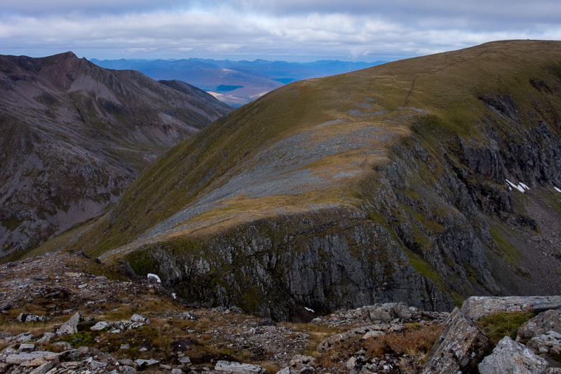
https://www.walkhighlands.co.uk/ 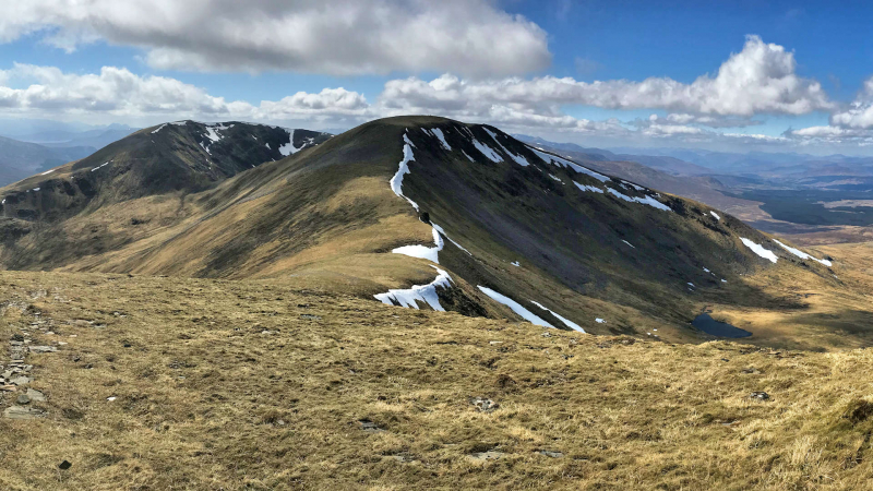
https://www.stevenfallon.co.uk/ -
Aonach Mor, the smallest of the Aonachs, is located 3 kilometers north of Ben Nevis and is best known for housing the Nevis Range mountain resort, which features the UK's only mountain gondola. The peak is most commonly ascended from the south, via Glen Nevis, and in conjunction with Aonach Beag.
Locals had been skiing around Aonach Mor for years before the ski resort was built, using the mountain's natural top bowls (ideal for collecting large amounts of snow). The Nevis Range was first opened to the public in 1989 and has grown steadily since then, becoming known for having some of Scotland's most easily accessible freeride skiing. The UHI Mountain Bike World Cup has made the Nevis Range a world-famous downhill mountain biking stop, with thousands of fans flocking to Fort William to watch bikers hurtle down the technical 2.6km downhill track as fast as they can.
Elevation: 1,221m
Location: Fort William
Scottish Gaelic name: Aonach Mòr
Gaelic meaning: Big ridge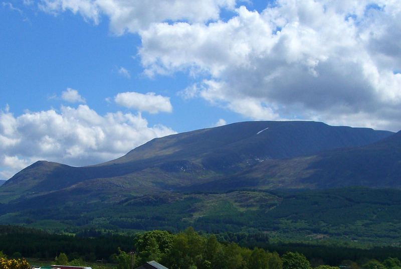
en.wikipedia.org/wiki/Aonach_Mòr 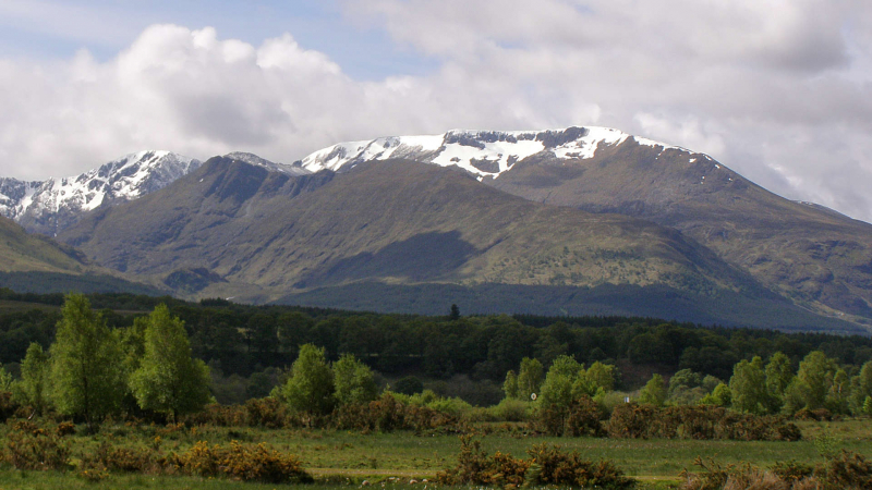
https://www.stevenfallon.co.uk/ -
Càrn Mor Dearg (1,220 m) is Scotland's ninth highest peak. It is located in Lochaber, Highland, in the west of Scotland, close to the town of Fort William. It is located just to the north-west of its much more well-known neighbor, Ben Nevis, and is connected to it by the beautiful Càrn Mr Dearg Arête. The granite at the peak has a notably crimson tinge, which gives it this name - "great red peak" in Scottish Gaelic.
This approach, which is linked to Ben Nevis through the Càrn Mr Dearg arete, is one of the most beautiful approaches to reach the summit of the UK's highest point in both summer and winter. The "CMD arete" is something to only try once you have got some reasonable hillwalking experience under your belt. It is a scramble in the summer where a strong head for heights is essential, and a more serious winter hike during the colder months.
Elevation: 1,220m
Location: Fort William
Scottish Gaelic name: Càrn Mòr Dearg
Gaelic meaning: Great red peak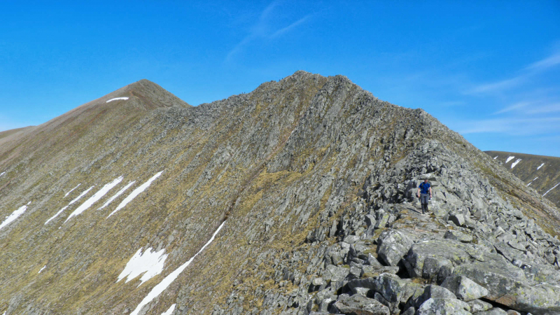
https://www.stevenfallon.co.uk/ 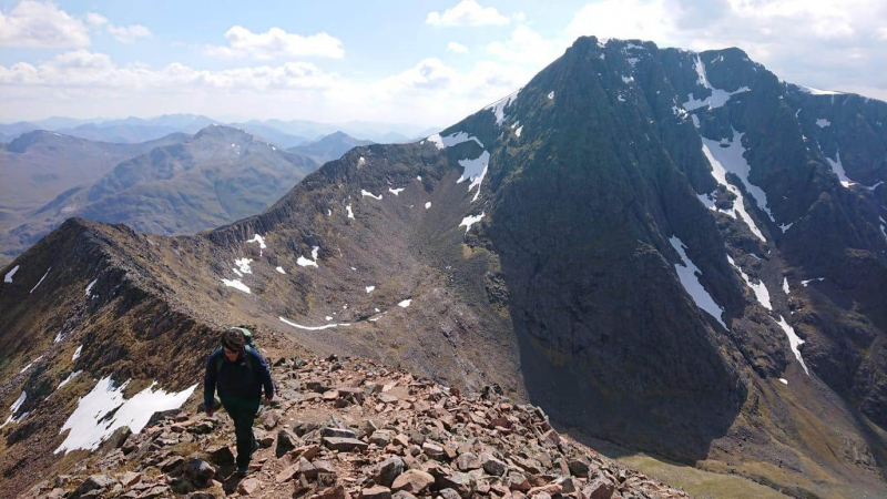
https://www.stevenfallon.co.uk/ -
Ben Lawers, which has been recognized as a National Nature Reserve (NNR) since 1964, is home to an extraordinarily rich range of arctic-alpine plant species and habitats due to its high altitude and underlying geology. Ben Lawers is the highest peak in the Scottish Highlands' southern region. It is the highest point in a lengthy ridge that encompasses seven Munros to the north of Loch Tay.
Ben Lawers was long assumed to be over 4,000 feet tall, but actual measurements taken in the 1870s revealed that it was only 17 feet short. To make up for the gap, a group of twenty men spent a day in 1878 erecting a cairn large enough to raise the mountain to 4000 feet. Ben Lawers is the only mountain on this list of the UK's tallest mountains that is not in either Fort William or the Cairngorm National Park.
Elevation: 1,214m
Location: Perth and Kinross
Scottish Gaelic name: Beinn Labhair
Gaelic meaning: Hill of the loud stream or hoof or claw mountain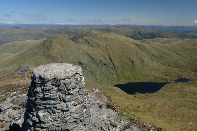
https://www.dubhmor.co.uk/ 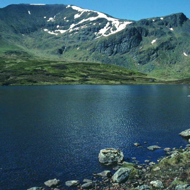
https://www.tripadvisor.com/