Top 6 Most Beautiful Caves in Pakistan

The territory of Pakistan, has been the site of many ancient cultures including the Mehrgarh culture of the Neolithic period and the Bronze Age Indus Valley ... read more...Civilization (2500 BC - 1500 BC). This place contains many caves with wild and mysterious beauty. Let's find out right here!
-
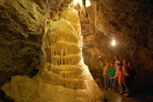
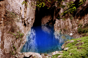
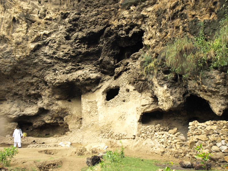
The Kai Caves are located in Sindh, Pakistan, in the ancient Kai Valley. The Kai valley is located in the Kirthar Mountains Range to the south of Sehwan Sharif, Jamshoro District. The Kai Caves are split into two sections here. The first is oriented eastward on a high hill, and the second is oriented westward on a smaller hill. "Satt Ghariyoon" (Seven Caves) refers to the lower caverns.
The top of the hill, which is close to the upper caverns, is surrounded by an ancient stone compound wall. Ancient habitation ruins and very old potsherds have been discovered. The unearthed earthenware or ceramic material dates back to the Indus Valley Civilisation, whereas the Stone Age refers to the period when people lived in caves.
Other prehistoric and Chalcolithic sites have been discovered in the vicinity of Kai Valley, near to Kai Caves, including Bulo-Ji-Buthi, Nuko-Buthi, Kai-Buthi, and Naig. In 1976, Dr. Louis Flam and local archaeologist Taj Sehrai visited the Kai Caves.
Location: Sindh, Pakistan
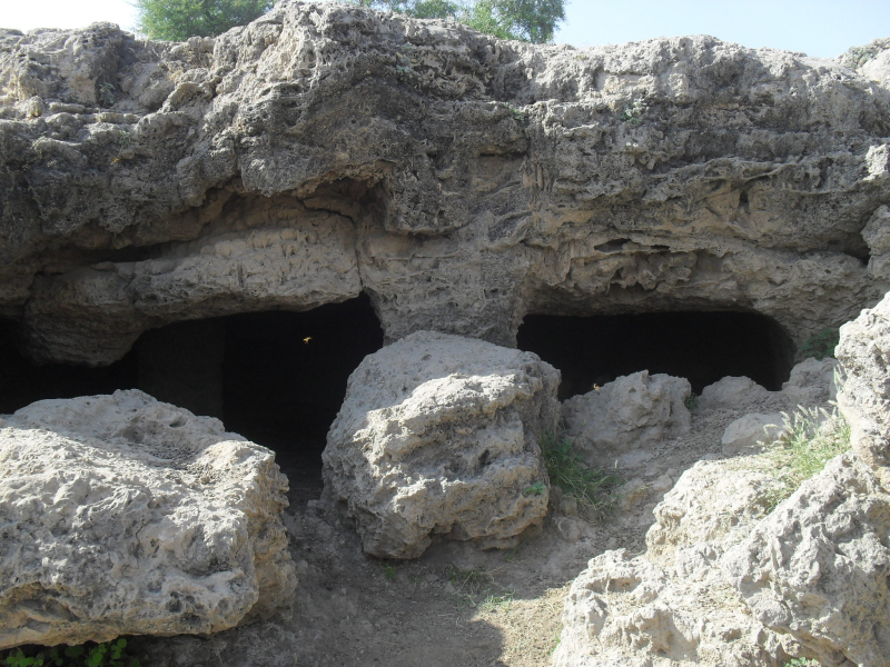
Source: Wikipedia 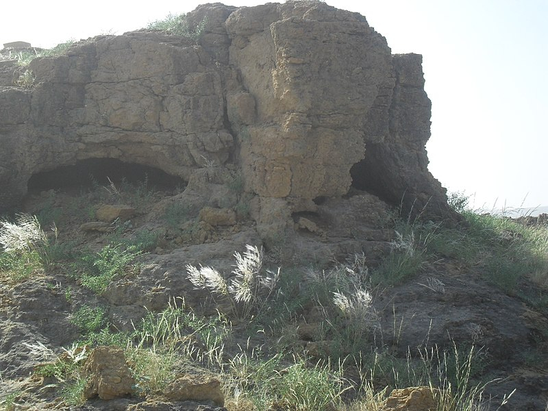
Source: Wikipedia -
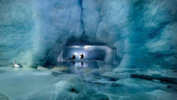
The Kashmir Smast caverns, also known as Kashmir Smats, are a collection of natural limestone caves in the Babuzai Sakrah mountains in the Katlang Valley Mardan in Northern Pakistan that were intentionally expanded from the Kushan to the Shahi eras. The caves and their adjacent valley, according to recent scholarship based on a rare series of bronze coins and artifacts discovered in the region, likely comprised a sovereign kingdom in Gandhara that maintained at least partial independence for nearly 500 years, from the 4th century AD to the 9th century AD. It was ruled for the majority of its existence by White Hun (or Hephthalite) governors or rulers.
A few of the compartments have rich Hindu and Buddhist symbolism carved into the wooden architectural interiors. The British Museum in London has examples of these panels on display. Excavations at the Kashmir Smast site revealed one of ancient Gandhara's most well-organized urban planning systems.
Given the lack of precise find data for the Kashmir Smast coins, as well as the discovery of numerous symbols, legends, and motifs on the coins that have never been seen previously in 150 years of Hunnic numismatic study, attribution and dating of these specimens becomes a difficult challenge.
Location: Katlang Valley Mardan, Pakistan
Source: Wikipedia Source: Nayab Nature TV -
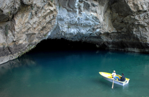
Lahoot Lamakan is a cave in Pakistan's Balochistan province. The water oozes through the cave's outer limestone shell, and believers say it began as milk, which mysteriously transformed into water when people began to sell it. This is a fantastic and eye-catching tourist destination. Natural springs' fresh water flows regularly from the mountains through the bed of a steep river. Lahoot Lamakan Caveis one of Pakistan's spiritual, sacred, mythological, and mysterious locations.
People have various religious legends concerning this location. Many people say Adam was the first to settle in Lahoot La Makan. The footprint is located in the Lahoot La Makan valley, and followers believe it to be Caliph Ali's footprint. Lahooti are the people who come to Lahoot La Makan.
They come every year on foot. The route connects Karachi with Hub in Balochistan, as well as Lahoot La Makan in Pakistan. It is located 110 kilometers north of Karachi in the Balochistan province.
Location: Balochistan, Pakistan
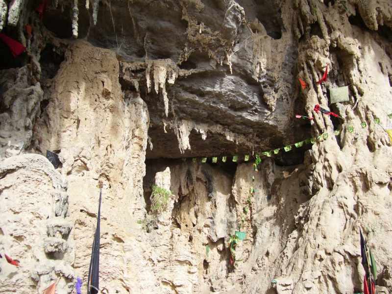
Source: Wikipedia Source: eat & discover -
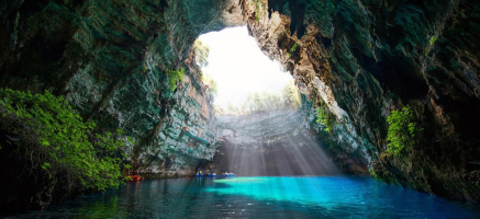
The Shah Allah Ditta caves are located on the way to Khanpu,. These caves are located near Shah Allah Ditta's shrine and mausoleum. Murals of Buddha from the Buddhist era, dating back 2,400 years, can be found on the cave walls of Shah Allah Ditta. According to archeological evidence, Buddhist monks and later Hindu sadhus used the caves and platform-like formations surrounding the area for meditation until Muslim ascetics took over during the Mughal Empire.
The place where Alexander landed and was met by Raja Ambi, King of Taxila, is marked on the ground near the caves. The Shah Allah Ditta road, which runs beside the caves and goes to the mountain's main summit, is reported to be built on the exact path taken by Pashtun monarch Sher Shah Suri during his visit.
A stepwell named Losar Baoli and a mosque erected by Shahb-ud-Din Ghori may be found on the way up the mountain from the caves. The mosque's walls are crumbling, and the road leading to it is in bad shape.
Location: Margalla Hills, Islamabad Capital Territory, Pakistan
Source: Wikipedia Source: Amin Rajput -
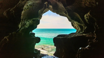
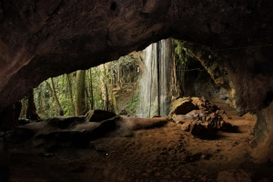
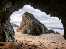
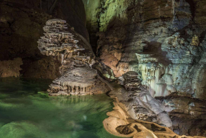
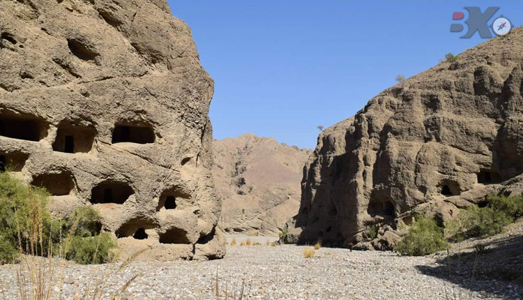
Puraney Ghar, which translates to 'Old Houses,' is the local name for the Gondrani Caves. At multiple levels, they are carved through solid conglomerate rocks and connected by paths. Small rooms with hearths and lamp niches, as well as verandahs or front porches, are found in all of the caves.
Around 1500 caves were reported during British administration, but barely 500 survive now. The caves are in bad shape and are gradually eroding. Due to inadequate accessibility and a lack of awareness about the archaeological site, no conservation attempts have been done to conserve it.
The precise history of the settlement, as well as who created the caves, is unknown. Historians think the town was originally home to a major Buddhist monastery that dates back to the ninth century, when the area was part of a Buddhist empire. In his book Early Medieval India and the Expansion of Islam: 7th-11th Centuries, André Wink writes, "In effect, the caves of Gondrani are eighteen kilometers north-west of Las Bela, at Gandakahar, near the ruins of an ancient town, and as their construction shows, these caves were unquestionably Buddhist."
Location: Bela, Balochistan, Pakistan
Source: Buddies Expeditions Source: Balochistan: Land of Beauty -
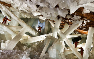
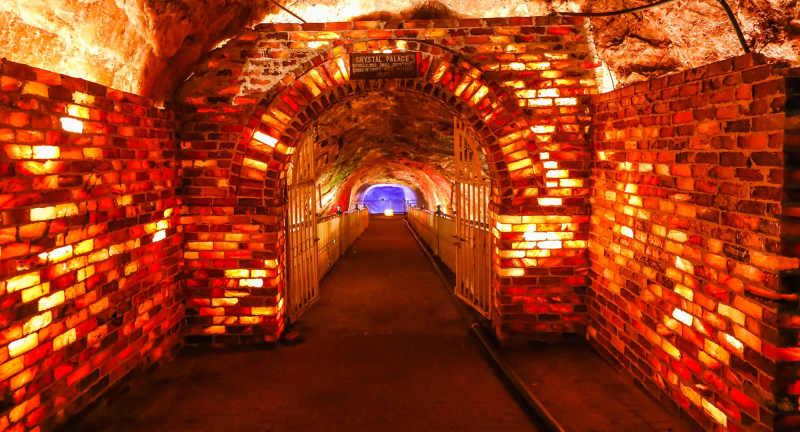
The Khewra Salt Mine (or Mayo Salt Mine) is located in Khewra, Punjab Region, Pakistan, north of Pind Dadan Khan, an administrative subdivision of Jhelum District. The mine is located on the Potohar plateau in the Salt Range, which rises from the Indo-Gangetic Plain and is the world's second largest.
The mine is well-known for producing pink Khewra salt, sometimes known as Himalayan salt, and it is a popular tourist destination, attracting up to 250,000 tourists each year. It was discovered by Alexander's forces in 320 BC, although it did not begin trading until the Mughal era.
The Khewra Salt Mine is a popular tourist destination, attracting over 250,000 tourists each year and generating significant money. The Khewra Salt Mines Railway takes visitors into the mine. About fifty years ago, the Badshahi Masjid was erected in the mine tunnels with multi-colored salt bricks. A replica of the Minar-e-Pakistan, a statue of Allama Iqbal, an accumulation of crystals that form the name of Muhammad in Urdu script, a model of the Great Wall of China, and another of the Mall Road of Murree are among the various artistic carvings in the mine.
Location: Khewra, Punjab Region, Pakistan
Source: Dawn 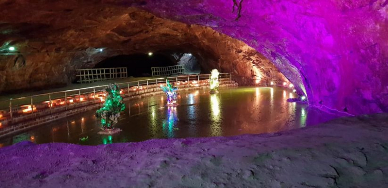
Source: Nature Adventure Club