Top 7 Most Beautiful Lakes inTajikistan

Tajikistan is a breathtakingly gorgeous country with a landscape dotted with majestic mountains and numerous lakes surrounded by snow-capped peaks. Whatever ... read more...color you choose, they are comfortably positioned among hiking trails and motorways. Every visitor to Tajikistan should make an effort to visit the most stunning lakes, which we have selected.
-
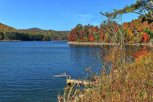
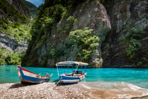
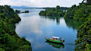
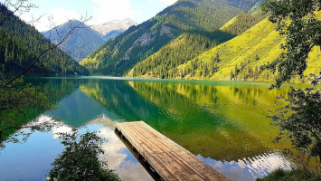
The most frequented lake in Tajikistan is Lake Iskanderkul, which is nestled amid barren yet magnificent mountains and is named after Alexander the Great, who is said to have passed by it on his journey to India.
Indeed, its blue seas provide stunning vistas from all angles and contrast marvelously with its rocky surrounds. The lake is 4 km across, 70 m deep, and always cold since it is fed by the melting snow of the neighboring glaciers at 2000 m above sea level.
A waterfall known locally as Fann Niagara and a snake lake with a magnificent forest behind are only a 30-minute walk from the lake. The ride from Dushanbe to the lake takes 3-4 hours (140 km), making it an ideal day trip from the city.
For those who want to stay longer, there is a Soviet-era resort beside the lake with modest cabins and minimal comforts or a great place to pitch a tent for outdoor enthusiasts. It is also possible to stay at a local homestay in the village of Sarytag, which is 9 kilometers from the lake and provides the opportunity for additional hiking in the Fann highlands.
Location: Gissar Range, Fann Mountains
Surface area: 3.4 square kilometres (1.3 sq mi)
Max. depth: 72 metres (236 ft)
Surface elevation: 2,195 metres (7,201 ft)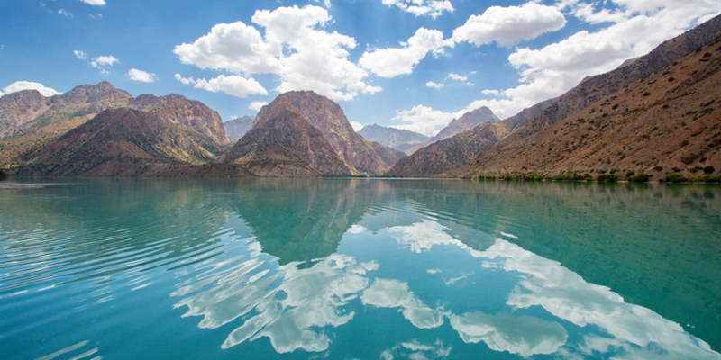
Advantour 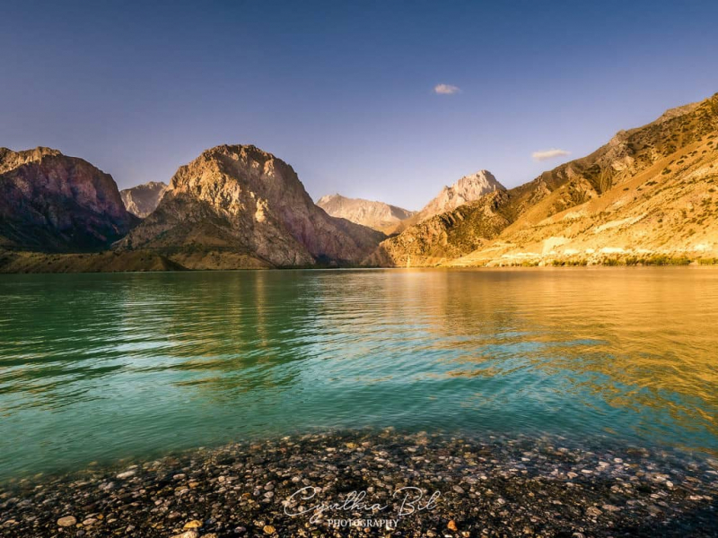
Journal Of Nomads -
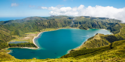
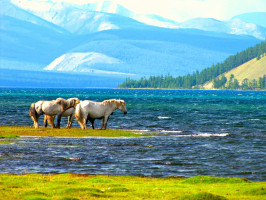
Karakul Lake adorns the highest point of the Pamir Highway. Its name translates to "The Black Lake" and it is situated at an elevation of 3914 m. The Pamir Highway is only a few hundred meters from the lake's shoreline, and one can see the lake for 40 kilometers. Another community bearing the same name, Karakul, stands out for having a grim outlook.
The Karakul Lake covers an area of 380 square kilometers and runs 33 kilometers north to south and 24 kilometers east to west. A large island in the middle divides Karakul into two parts: the eastern half has a depth of 22 meters and a gentle drop to the waters, while the western part is steeper and has a depth of 236 meters. Despite the fact that this drainless lake is fed by nearby mountain glaciers, the water in Karakul is salty. In the summer, the water temperature reaches 12 degrees Celsius, while in the winter, it drops to zero and the lake is covered in 1 meter of ice.
The gorgeous landscape of the Pamir Mountains, which are mirrored in the waters of Karakul Lake, is another aspect of the lake's beauty in addition to its vivid blue hue. The Peaks of Lenin and Avicenna stand out among the array of 7,000-meter mountains that surround the lake. Additionally, the sky appears closer and has a deeper hue because of its great height. You may appreciate the Milky Way's brilliant brilliance at night.
Karakul hamlet, located on the lake's eastern shore, resembles a post-apocalyptic community. The one-story clay dwellings are painted white, and the lack of planning has resulted in a little labyrinth. The Kyrgyz live there primarily because the border with Kyrgyzstan is only 50 kilometers away. There is no infrastructure; merely a small school and a few guesthouses for overnight stays. Aside from that, power is only available in the morning and evening.
Location: Pamir Mountains
Max. width: 52 km (32 mi)
Surface area: 380 km2 (150 sq mi)
Max. depth: 230 m (750 ft)
Surface elevation: 3,900 m (12,800 ft)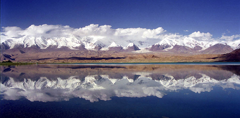
Wikipedia 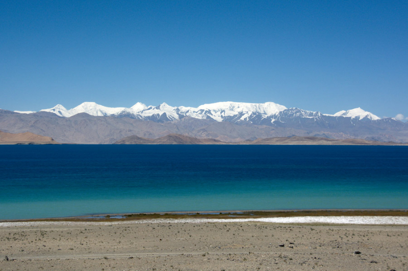
Advantour -
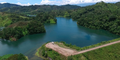
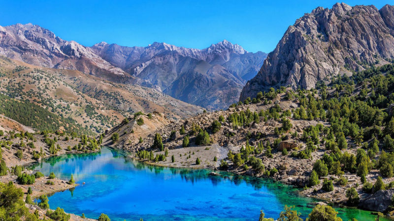
A chain of magnificent and interconnected mountain lakes in western Tajikistan, near the city of Penjikent, astound visitors with their bright colors that continually vary. The lakes are known as the Haftkul (Tajik for "Seven Lakes"), but they are also known as the Marguzor Lakes (the largest lake in the group). Each lake has its own name and story. Nezhigon, Soya, Gushor, Nofin, Khurdak, Marguzor (the largest), and Hazorchashma are the lakes in order of decreasing depth (the highest).
In the gorge of the Shing River, in the Fan Mountains, lie The Seven Lakes. The Marguzor lakes are believed to be exceedingly old based on ancient petroglyphs that were found there. The highest lake is 2,400 meters above sea level, while the lowest lake is 1,640 meters. Over a distance of more than 14 km, there is a 760 m height difference between them. With the exception of the tallest lake, Hazorchashma, all of the lakes were actually created over time by rock falls and landslides damming up the narrow ravine.
The lakes are easily accessible by a serpentine route that passes past all seven lakes and various communities. The travel between the first and last lakes takes roughly an hour. However, due to the difficult terrain on the last leg, between lakes six and seven, many visitors choose to climb this section (which takes around 30 minutes). It is also feasible to climb the distance between the lakes in two days, with the option of continuing to other lakes and valleys and seeing the pristine scenery of the Fan highlands.
The lakes are easily accessible by a serpentine route that passes past all seven lakes and various communities. The travel between the first and last lakes takes roughly an hour. However, due to the difficult terrain on the last leg, between lakes six and seven, many visitors choose to climb this section (which takes around 30 minutes). It is also feasible to climb the distance between the lakes in two days, with the option of continuing to other lakes and valleys and seeing the pristine scenery of the Fan highlands.
Several small towns have started community-based tourism (CBT) programs recently to build lodging and other necessities for visitors, especially in the area of Nofin Lake. Even though they are basic, these guest houses let tourists experience the local culture and way of life. Camping is also very common in plenty of lovely locations near rivers and lakes.
Small fish that cannot be caught and eaten are found in four of the lakes. The lakes also receive water from numerous smaller mountain rivers, which delays their filling until mid-July. The water level may be low in other seasons.
The only way to get to this Fan Mountain spectacle is by car, departing from Penjikent. You turn onto a smaller, paved road that eventually turns into a dirt road after a few kilometers on the major Dushanbe road. About an hour is needed for this trip. Additionally, it is possible to get to the Seven Lakes via Penjikent due to the proximity of the Uzbek border, but doing so will add travel time to the 100 km journey from Samarkand to Jartepa-Sarazm.
To explore the Seven Lakes from Penjikent or Samarkand, allow at least a full day. Although the distance to the lakes is modest, you will most likely want to spend at least 10-20 minutes, and up to an hour in certain locations, at each lake. If you have more time, local community-based tourism projects provide excellent value and insight into the local way of life. Staying overnight also allows you to go on wonderful hikes in the mountains with breathtaking views of the Seven Lakes amidst the Fan mountains.
Location: Fan Mountains, in the Shing River gorge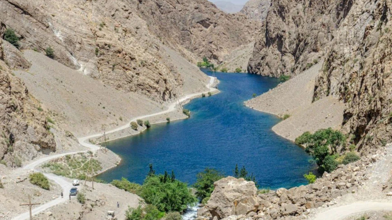
Time Travel Turtle 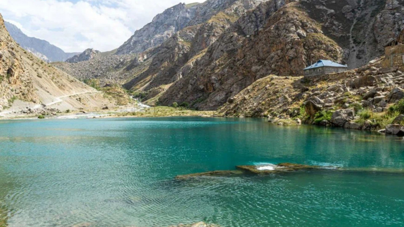
Time Travel Turtle -
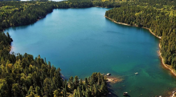
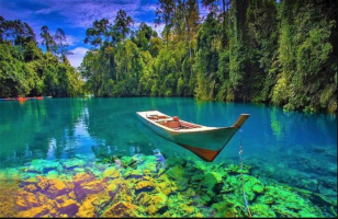
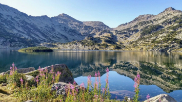
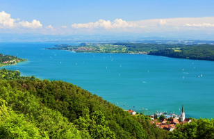
At a height of 3700 meters in the Central Pamir, Yashilkul is a stunning blue freshwater lake that is 19 km long, 1-4 km wide, and covers an area of 3600 hectares. Its highest depth is 52 meters. The lake's clear, clean water seldom rises over +14 degrees Celsius. The glass-like surface of the lake, surrounded by the untamed Pamir Mountains, provides stunning beauty, especially from the west end where it serves as the starting point for the Ghund river, which finally flows to Panj. Since the lake's water is so clean and clear, it is possible to see the aquatic life below and go trout fishing.
Local Kyrgyz shepherds think the lake is home to a magical creature known as Tuya Suu, a water camel. Yashikul is reached through a 16-kilometer diversion off the Pamir Highway, passing via the nearby town of Bulunkul, which has approximately 32 dwellings and a beautiful homestay lodge with a sauna.
A hydrogen sulfide hot spring known as Issyk Bulak springs from the base of the granite mountain that the people regard as sacred further east and north from the lake.
Location: Gorno-Badakhshan Autonomous Province, Tajikistan
Surface area: 3,600 hectares (8,900 acres)
Max. depth: 52 metres (171 ft)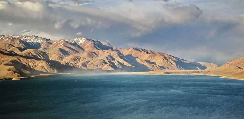
Remote Lands 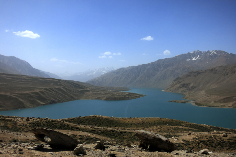
Wikipedia -
A large landslide that erected a dam on the Murgab river and gave birth to lake Sarez in 1911 was caused by a powerful earthquake deep in the Pamir mountains. Since then, the 28-kilometer lake has expanded to a length of 75.8 km.
Currently, Sarez is a stunning lake at the height of 3340 meters, encircled by mountains that climb more than 2300 m above lake level. The name of the settlement that sank to the lake's bottom gave rise to its moniker. From Barchadiff village in the Bartang valley, where a hiking route leads to Bachor village or Yashilkul lake in 4-5 days, a well-built 16 km steep path leads to the lake with 800 meters height difference.
A special permit must be obtained before visiting the lake, and it can be reached with a 4-wheel drive from either Vomar town in the western part of the Pamir Highway (130 km) or from the route that begins on the eastern section of the Pamir Highway at Karakul Lake (150 km).
Location: Rushon District of Gorno-Badakhshan province, Tajikistan
Max. length: 75.8 kilometres (47.1 mi)
Max. width: 3.3 kilometres (2.1 mi)
Surface area: 79.7 square kilometres (30.8 sq mi)
Average depth: 201.8 metres (662 ft)
Max. depth: 505 metres (1,657 ft)
Water volume: 16.074 cubic kilometres (3.856 cu mi)
Shore length: 1162 kilometres (101 mi)
Surface elevation: 3,263 metres (10,705 ft)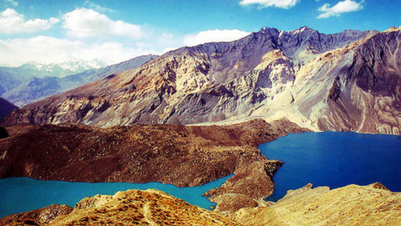
Wikipedia 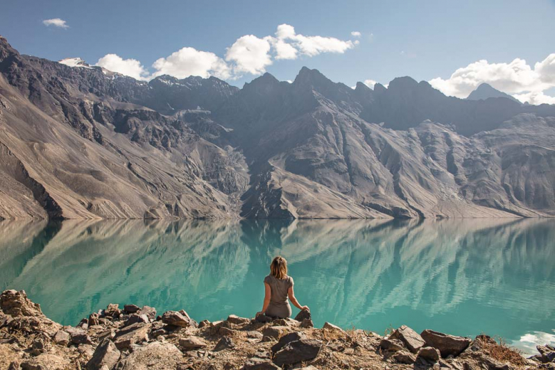
The Adventures of Nicole -
In the center of the Fann mountains, The Kuli Kalon lakes are a collection of glacial lakes located in the Kulikalon cirque. The lakes are linked by cascading streams and are bordered by remnants of Juniper trees, which are regarded a symbol of the Fann mountains. The largest of the lakes is Kulikalon lake, which translates from Tajik as "a large lake" and is the second largest in the Fann mountains after Iskanderkul.
The glacier-fed Kuli Kalon lakes, which are located at the base of Chimtarga, the highest point in the Fann Mountains, are the ideal location for observing wildlife while taking in the spectacular scenery. Eagles, Lammergeiers, Black Vultures, and Himalayan Vultures can all be found in this area, which has been designated as a significant bird area.
Due to the lack of a road leading to the lakes, hikers are the main visitors, and they view the area as a hiking paradise. The trail to the lakes begins at the Artuch tourist camp and is an easy three to four-hour climb. It then continues through the Alauddin pass (3860 m) to the Alauddin lake, from which a breathtakingly gorgeous vista of the surrounding mountains and lakes emerges.Location: Zeravshan Mountains of south-western Sughd Province in western Tajikistan
Pamir Trips 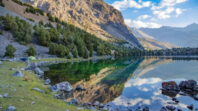
INDY GUIDE -
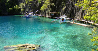
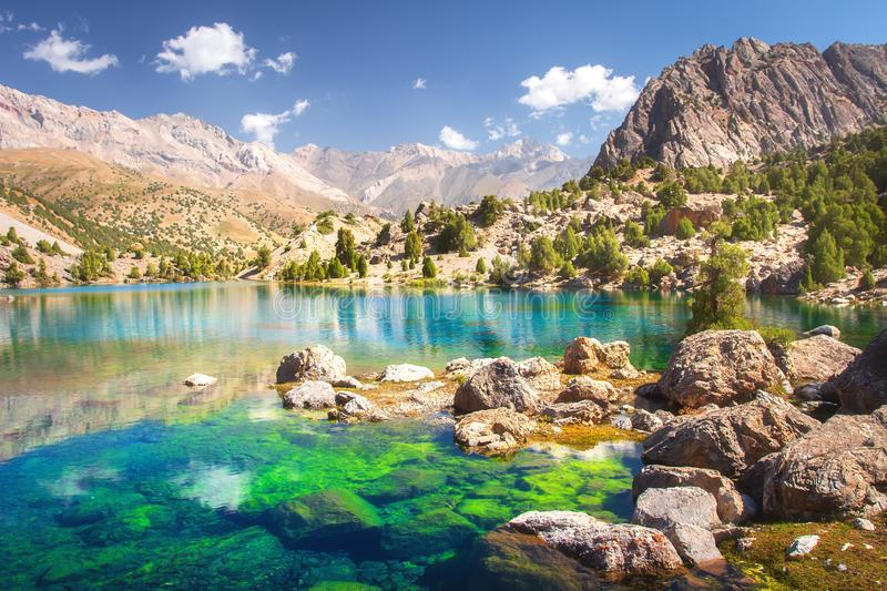
Alaudin lakes, surrounded by lofty peaks, are another jewel in the Fann highlands. The lakes are only accessible by foot and are located 3 kilometers from the Vertical base camp in a rocky bowl surrounded by stands of pine trees. Every tourist is captivated by the lakes' crystal brilliant blue water.
The vertical base camp, which serves as the starting point for the climb to the lakes, is located at the confluence of two valleys, one leading to Alaudin lakes and the other to Kulikalon lakes via Laudan pass (3630 m), and features a house with a couple of rooms and a shower.
On the major route from Dushanbe to Aini, the base camp is accessible from Saravoda village. The trail that leads from the base camp to the lakes provides breathtaking views of the surrounding alpine mountains. The region around lakes is a wonderful location for camping and could serve as a starting point for longer hikes through the Fann Mountains. From the lakes, one can take a well-liked day trek to Mutniy (Mudy) lake. Weekend excursions from Dushanbe are ideal for visiting the Alaudin and Iskanderkul lakes.
Location: Fann mountains of Tajikistan
Dreamstime.com 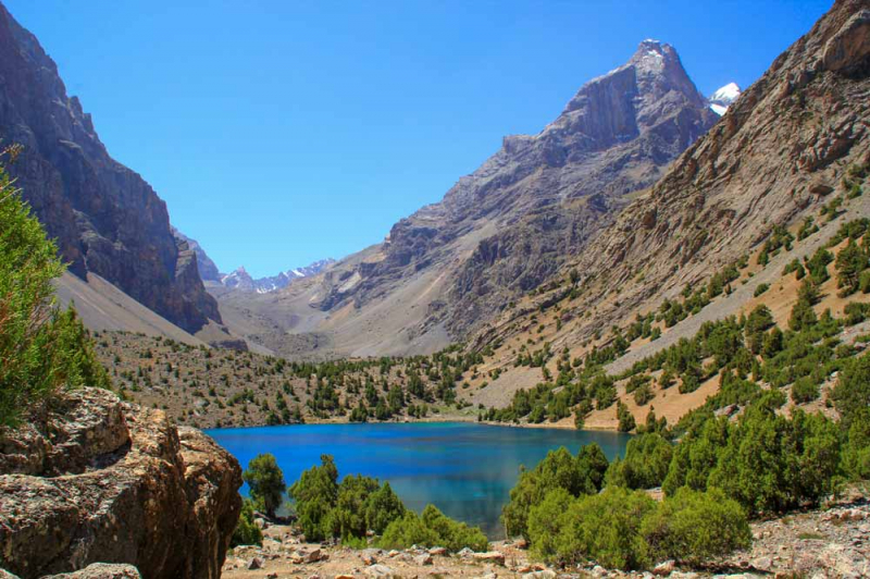
Go Travel Tajikistan