Top 10 Most Spectacular Caves in Brazil
Massive caverns, sunken depressions, and unexplained underground spaces abound in Brazil. The country's caves continue to pique interest with their intriguing ... read more...mysteries; so far, incredible natural beauty, cathedral-like halls, and subterranean woods have been uncovered. Here are some of the Most Spectacular Caves in Brazil.
-
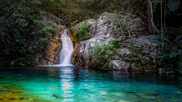
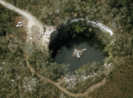
Buraco das Araras, a massive sandstone crater formed by boulder fall, is one of the Most Spectacular Caves in Brazil. It is located in the heart of the cerrado in the Brazilian state of Mato Grosso do Sul, with a circle of 500 meters and a depth of 100 meters. The cave's name comes from the fact that it is home to a vast variety of birds, particularly araçari toucans and red-and-green macaws.
According to an IBAMA order dated April 11, 2007, the crater is part of the Buraco das Araras Private Natural Heritage Reserve (RPPN), which spans 29 hectares, and is connected to the RPPN Rio da Prata, which spans 307 hectares.
It is 53 kilometers from Bonito, in the cerrado of Mato Grosso do Sul, Brazil, around the settlement of Jardim. It has walls that go up to 127 meters in depth and a cave mouth that is about 500 meters in diameter, with a pond of green water, lush forest, and broad-snouted caimans whose survival is unknown. Mammals such as armadillos, anteaters, coatis, and other 120 species of birds, including toucans and ibises, picked the location to dwell with them and the macaws.
Location: Jardim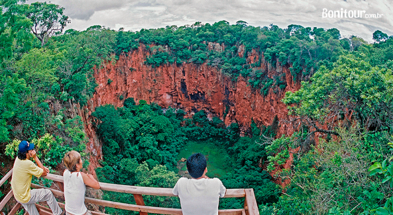
http://blog.bonitour.com.br/ 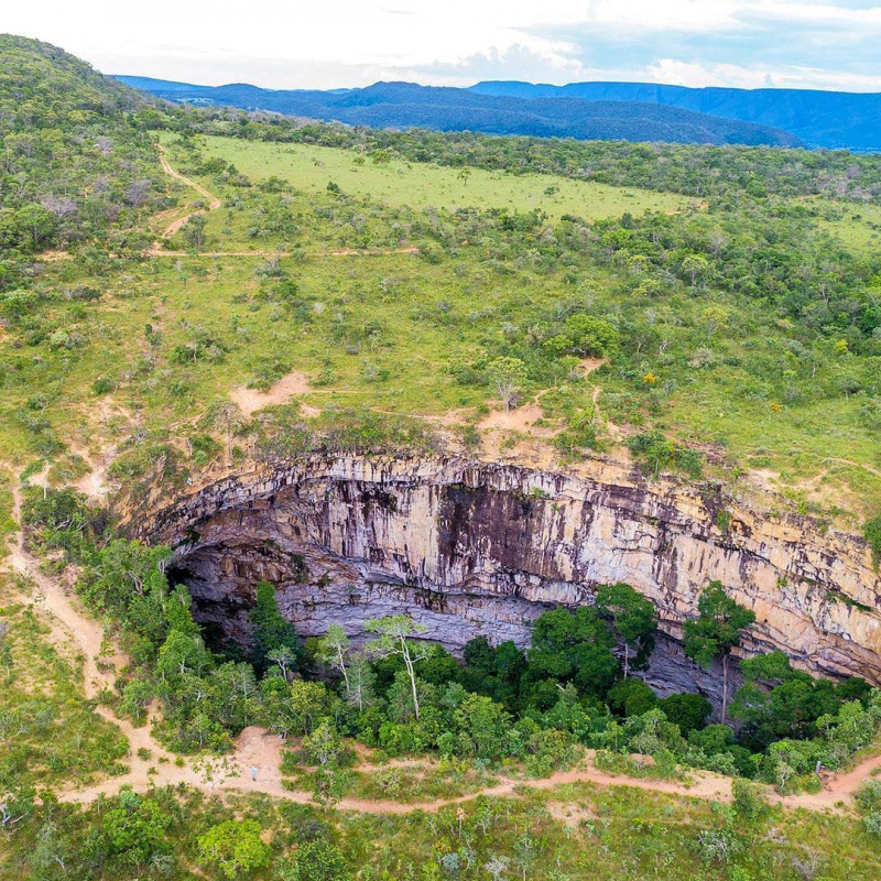
https://www.viajali.com.br/ -
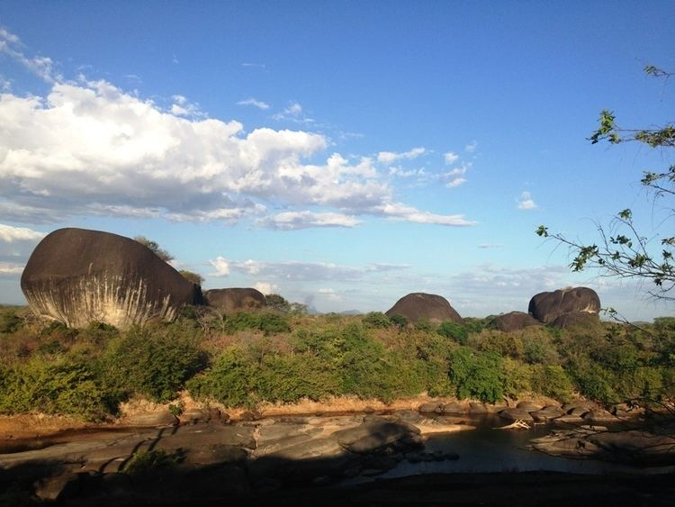
Caverna da Pedra Pintada (Painted Rock Cave in Portuguese) is an archaeological site in northern Brazil that dates back to around 11,200 years. This discovery has cast doubt on earlier assumptions regarding human settlement patterns in South America. Findings from the cave, according to Anna C. Roosevelt, an American archaeologist who has been a key researcher here since 1990, prove that Paleoindians lived thus far south and had an independent society at the same time as other early Native Americans on the Great Plains of North America.
Previously, academics assumed that Amazonian communities arose later than those in the Andes, and that they were founded by highlander migrants. This discovery has cast doubt on earlier assumptions regarding human settlement patterns in South America. Findings from the cave, according to Anna C. Roosevelt, an American archaeologist who has been a key researcher here since 1990, prove that Paleoindians lived thus far south and had an independent society at the same time as other early Native Americans on the Great Plains of North America. Previously, academics assumed that Amazonian communities arose later than those in the Andes, and that they were founded by highlander migrants.
Location: Pará State
https://alchetron.com/ 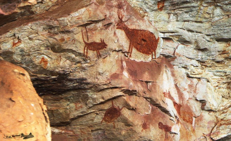
https://www.pinterest.es/ -
Caverna da Tapagemis is a cave in the Caverna do Diabo State Park, near the Alto Ribeira Tourist State Park, in the municipality of Eldorado, Iporanga, Brazil, about 280 kilometers from So Paulo. It is the second longest cave in the state of So Paulo, as well as the highlight of "Circuit Disneyland," a series of family attractions that people of all ages can enjoy, according to local guides.
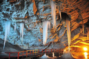
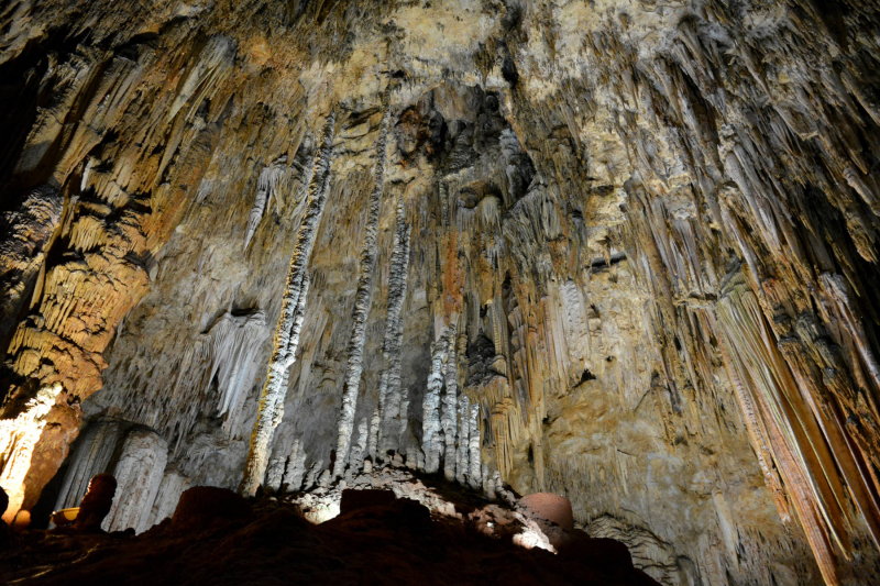
Researchers estimate that the cave's development began some 600 million years ago, during the Precambrian epoch. Almost ten kilometers of galleries and halls have been surveyed so far, all of which are rich in speleothems. Only 700 meters of the 6.237-meter cave, whose entrance is around 40 meters high, have been inspected, leaving only 3.200 meters open to guests. From one side of the cave to the other, it is 152 feet deep.
This space is equipped with a sound system, lights, pathways, steps, and railings for added safety. The cave has several stone curtains, columns, towers, travertine, stalactites, stalagmites, and calcite cascades that fascinate experts and tourists alike as they strive to decipher the cave's mysteries. To go around obstructions, it's often important to utilize ropes to ensure that you're standing on solid ground. Only the waters gliding across the rocks break the silence inside the cave.
Location: São Paulo
https://showcaves.com/ 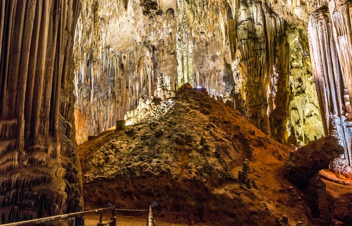
https://www.momondo.com/ -
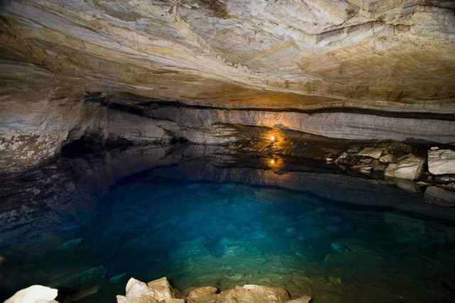
Caverna dos Ecos, one of the Most Spectacular Caves in Brazil, is a mica schist cavern in central Goiás, Brazil, also known as "Gruta dos Ecos" (English: Echo Cave). It is located 134 kilometers from Goiânia, between Cocalzinho de Goiás and Braslia. It is located near the Girassol community, just after the Federal District's border. It is 1,380 meters long and descends 142 meters deep.
It was discovered in March 1975. At a height of 1050 meters, the entrance is placed. It houses Lago dos Ecos, South America's largest subterranean lake, which is roughly 300 meters long, 50 meters broad, and between 10 and 15 meters deep, making it one of the world's longest lakes. Caverna dos Ecos is a unique subterranean karstic feature because no other Brazilian cave of comparable size is known from similar lithologies, mica schist, quartzite, and marble, with schists and quartzite accounting for 70% of the cave's volume.
This cave, a geological wonder, was formed in limestone but traveled to mica-schists underlying it due to disintegration. Only an experienced guide is permitted to accompany visitors. Mica and schist make up the rock, which explains why there are no speleothems.
Location: between Cocalzinho de Goiás and Brasília
https://alchetron.com/Caverna-dos-Ecos 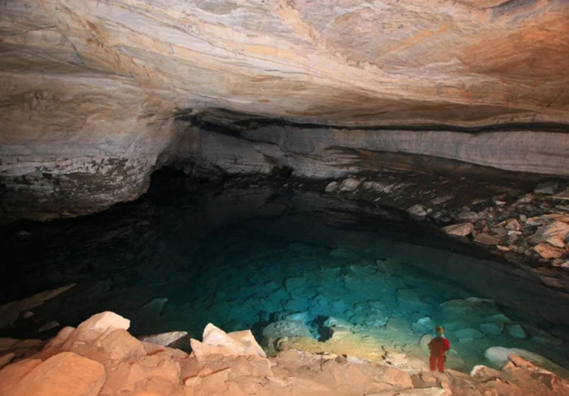
https://melhoresdestinosdobrasil.com.br -
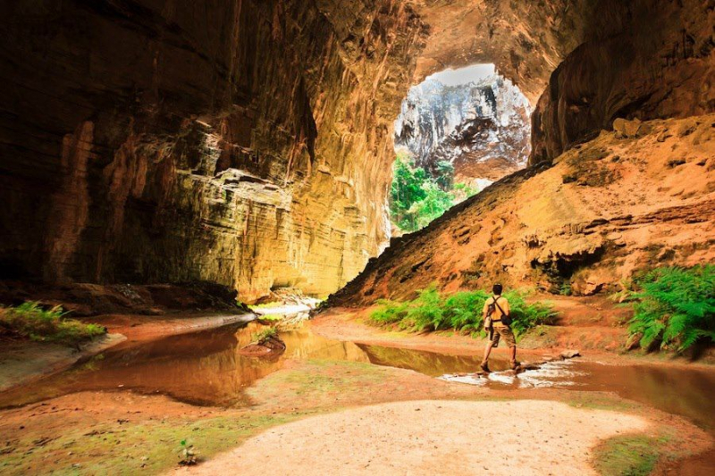
Cavernas do Peruaçu National Park is located in the Brazilian state of Minas Gerais. Large limestone caves are a feature of the area. The Cavernas do Peruaçu National Park, which covers 56,448 hectares (139,490 acres) and is managed by the Chico Mendes Institute for Biodiversity Conservation, was established on September 21, 1999. Parts of the towns of Januária, Itacarambi, and So Joo das Misses in the state of Minas Gerais are included in the park. The State Forestry Institute runs the Veredas do Peruaçu State Park, which is close by, as well as the Xakriabá Indian Reserve.
The Peruaçu River flows through the park from north west to south east, eventually merging with the So Francisco River, which runs along the park's south eastern border. On September 26, 1989, the Cavernas do Peruaçu Environmental Protection Area (EPA) was established, covering 143,866 hectares (355,500 acres). The EPA encompasses the Peruaçu River basin and overlaps both the National Park and the State Park, however both parks expand beyond the EPA's boundaries. Temperatures average around 18 °C (64 °F) in the winter and are slightly higher in the summer due to more cloud cover.
The average annual rainfall is less than 1,200 millimetres (47 in), with the majority of it falling during the summer. The relative humidity is around 70%. Seasonal montane deciduous forest, semi-deciduous forest, savannah with trees, and transitional zones are found in the park, which is located between the Cerrado and Caatinga areas. A large variety of animals thrives in the various habitats. The rock art in the Gruta do Janelo and nearby caves dates back over 10,000 years.
Location: near Januária
https://www.pinterest.com/ 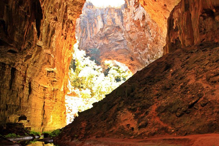
https://www.pinterest.com -
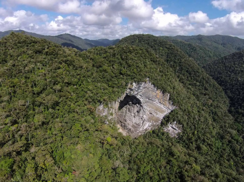
Gruta Casa de Pedra is a cave in the karstic region of the Alto Ribeira Tourist State Park, in the state of Sao Paulo, Brazil, between the towns of Apia and Iporanga. It is 2,930 meters long and has the world's largest cave mouth, which is 172 meters high. It's in the cave's penultimate hydrographic sub-basin, where the Maximiano stream enters for about 800 meters before flowing into the Iporanga River. Its name comes from the size of its portico, which is the largest in the world.
Gruta Casa de Pedra is part of a technical survey containing more details on the Ribeira valley cave system, which will be published as soon as data from other Brazilian caves is finalized, according to measurements taken in the 1960s, but contrary to the allegation that the actual size of the cave's entrance is 215 meters high. [2] Other measurements were taken in the cave using a range finder and a cyclometer in order to create a detailed cross-sectional profile of the cave entrance, which revealed that Gruta Casa de Pedra's cave mouth is 172 meters high, with a recalto on the roof of the entrance causing the height to rise to 175 meters,[2] making it the largest cave mouth in the world.
Location: inside Alto Ribeira Tourist State Park
http://unusualplaces.org/ 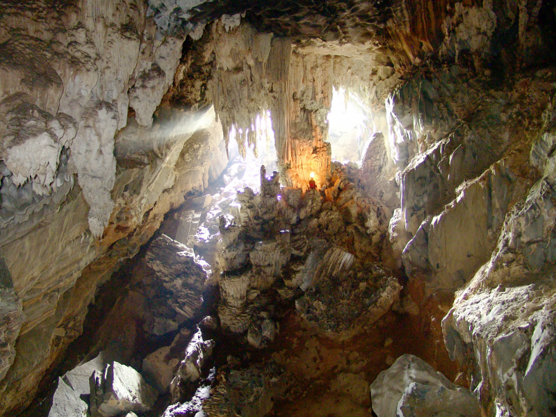
http://unusualplaces.org/ -
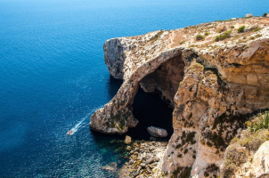
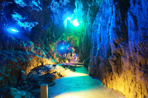
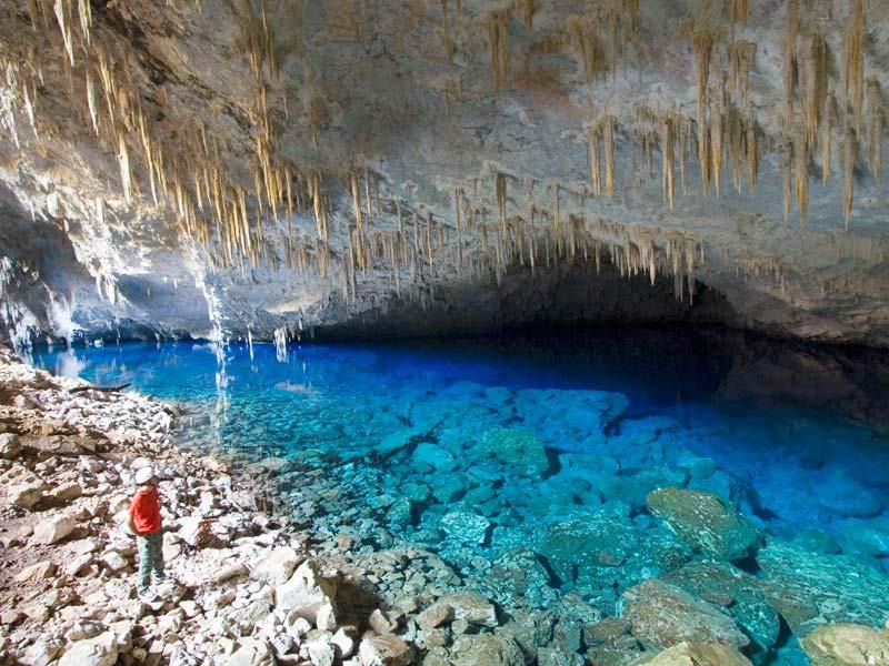
The Blue Lake Cave (Gruta do Lago Azul Natural Monument) is a natural monument near Bonito, Mato Grosso do Sul, Brazil. It has been designated as a protected area since 1978 and contains two caverns with remarkable but fragile calcareous structures. The main chamber of the Gruta do Lago Azul has a floor that falls down to an underground lake that is 50 meters (160 feet) long.
The entrance is circular, about 40 meters (130 feet) in diameter, and it shines brightly on the lake. The waters of the lake take on a striking blue tint between September and February, for which it is named. Large mammals that lived in the area for more than 12,000 years during the Pleistocene epoch have been discovered in the form of fossil bones. Giant sloths, armadillos and sabre-toothed tigers are among them.
The National Institute of Historic and Artistic Heritage designated the Gruta do Lago Azul and the Grutas de Nossa Senhora Aparecida, both near Bonito, Mato Grosso do Sul, as natural monuments in 1978. (IPHAN). The goal is to protect the cave's extremely delicate calcareous structures, the lake and its aquatic life, and the surrounding terrain. Visitors are welcome, as long as they are escorted by guides from the Bonito municipality. Regulations are in place to ensure that the cave is not harmed.
Location: near Bonito, Mato Grosso do Sul
https://www.pinterest.com 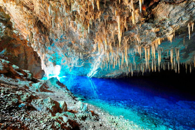
http://cynthiamadonnita.wordpress.com/ -
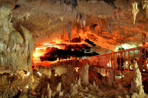
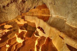
The oldest and one of the most commercially visited caves in Brazil is Gruta de Maquiné (MG-0243), also known as Lapa Nova de Maquiné. It is located in the state of Minas Gerais, about 5 kilometers (3.1 miles) northwest of Cordisburgo and 143 kilometers (88.9 miles) northwest of Belo Horizonte. Seven massive chambers have been discovered in the cave, with a total length of 650 meters (2,130 feet) and an unevenness of only 18 meters (59 ft).
Lighting, paths, and handrails ensure that a large number of visitors may safely appreciate the grotto's delights, which are accompanied by an experienced local guide throughout the tour. Maquiné faces north and has a shallow arch-shaped portico with a width of 18 m (59 ft) and a height of only 8 m. (26 ft). Calcium carbonate is the principal component of its creation, however it also contains other minerals such as silica, gypsum, quartz, and iron. Its galleries and halls, which are truly architectural curiosities, are the consequence of water's tenacious work over millennia.
Location: Minas Gerais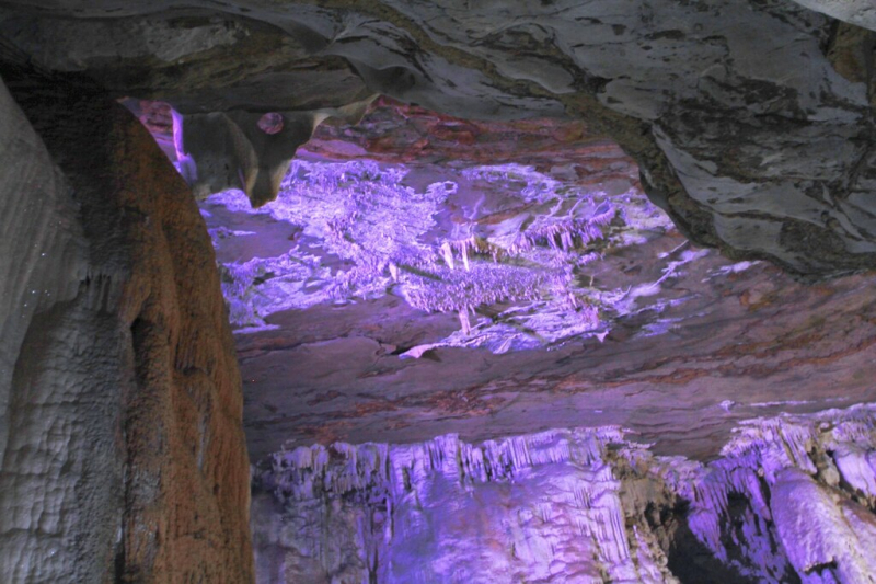
https://www.flickr.com/ 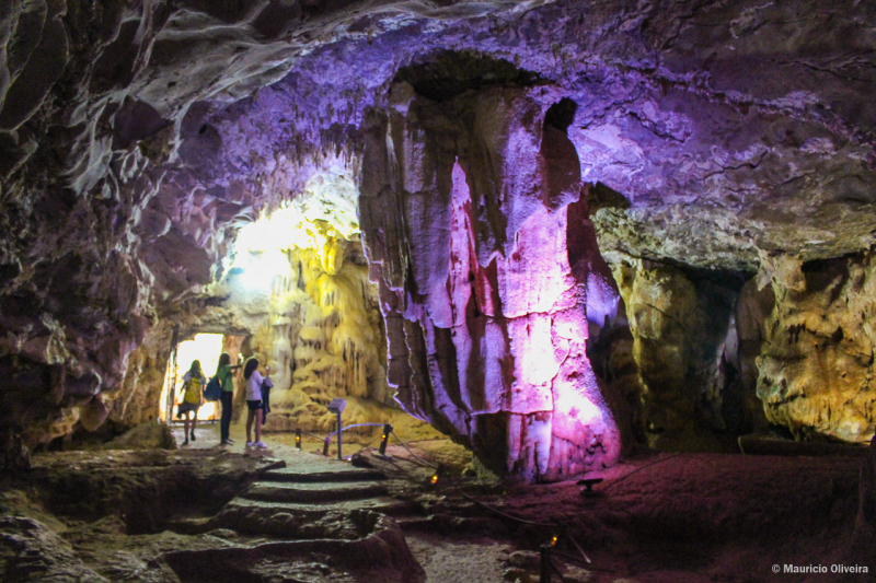
https://www.viagenspossiveis.com.br/ -
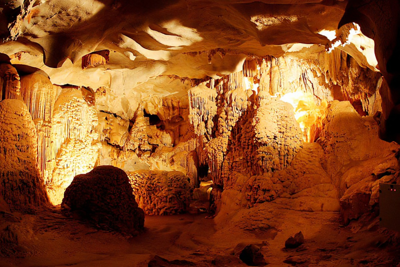
The Gruta de Ubajara is a limestone cave in the Ubajara National Park near Ubajara, Ceará, Brazil, on the foothills of the Serra de Ibiapaba. Its nine halls span 1,120 meters (3,674.54 feet), including 420 meters (1,377.95 feet) of illuminated paths.
The site may be reached by cable car or on foot along the 4 km (2.49 mi) long Cafundós trail, which falls over a 535 m (1,755.25 ft) deep depression. The Ubajara grotto has been known since the early eighteenth century, when Portuguese colonists ventured into the region in quest of minerals, particularly silver, but with little success.
Other caves have been discovered, however they are not accessible to the public. The Gruta do Urso Fóssil, which is of significant paleontological interest, as well as the Gruta do Morcego Branco, Gruta de Cima, and Gruta do Pendurado, are among them.
The name Ubajara is of indigenous origin, and the most common translation is "Lord of the Canoe." The name comes from a narrative about a tribe chief who arrived from the shore and lived in the cave for many years. The name has also been translated as "Lord of the Arrows." Some people believe that the cave was formed as a result of digs for silver, as well as nearly 200 years of climate change.Location: Ubajara National Park, city of Ubajara, Serra de Ibiapaba, Ceará state
https://www.pinterest.com/ 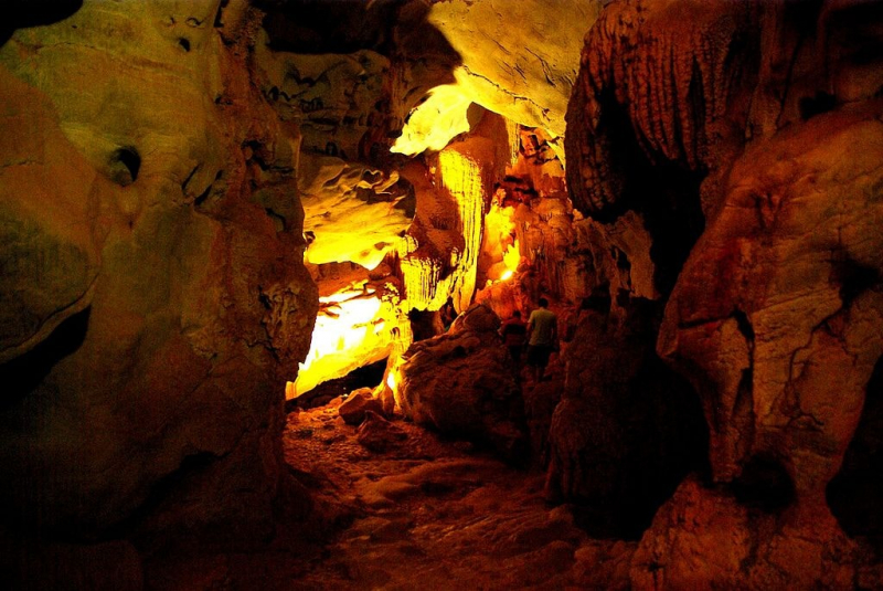
https://theculturetrip.com -
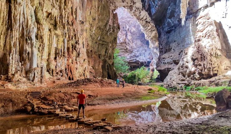
Gruta do Janelo is a limestone cave in Minas Gerais, Brazil, that is part of the Cavernas do Peruaçu National Park. It is located in the town of Januária. This cave is the largest in the valley, with a horizontal extension of 4,740 meters and a height of 176 meters. Because the grotto has multiple skylights that let the sun in, miniature forests resembling Japanese gardens in terms of delicacy and harmony spring up all along the Peruaçu River, which runs through the Janelo grotto. It already contains the world's longest stalactite, spanning 28 meters in length.
The left bank of the Rio Sao Francisco in Minas Gerais shows a set of caves and archaeological sites with cave paintings scattered on a ten-foot wall wnd its first two of many skylights that would spread over the next 3.5 kilometers of the path with interesting stalagmite and stalactite formations appearing along the way, with the largest stalagmite ever recorded measuring 28 meters long.
The Peruaçu River runs through the cave's interior and is a popular tourist attraction. Outside the cave, the environment is rich, with trees reaching heights of up to 60 meters.Location: inside the Cavernas do Peruaçu National Park
https://viagenscinematograficas.com.br/


