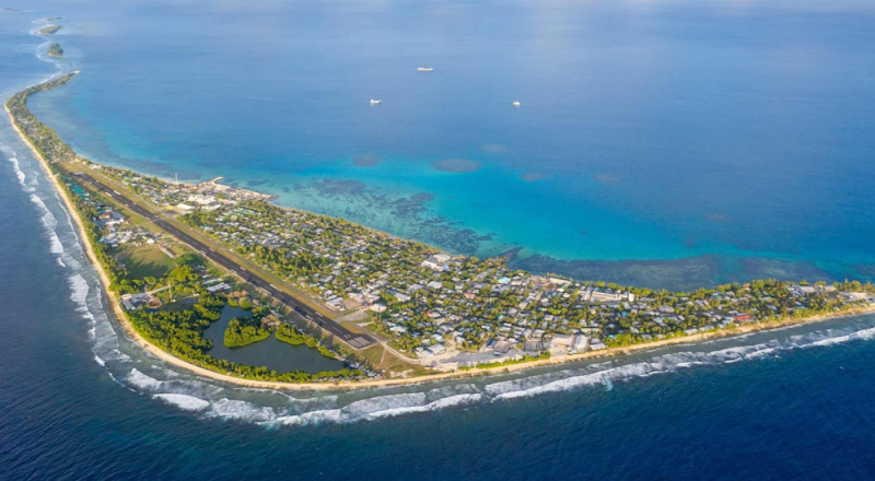
Top 9 Most Beautiful Islands In Tuvalu

Tuvalu is made up of nine distinct islands: six atolls and three reef islands. An atoll is often made up of multiple islets: Tuvalu has 124 islands and islets ... read more...in total. These islands feature the most gorgeous beaches, a rich history and tradition, kind people, wonderful animal and plant species, a calm environment, and everything else you need to have the greatest holiday possible. Here are some of the most beautiful islands in the Tuvalu.
-
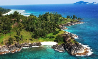
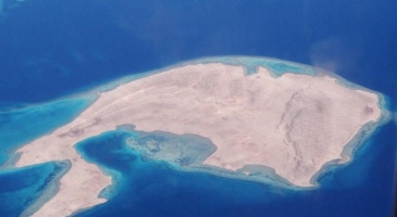
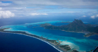
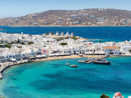
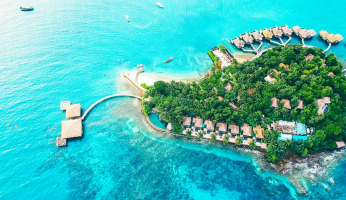
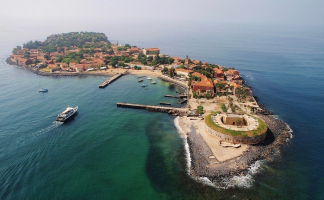
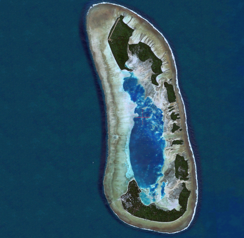
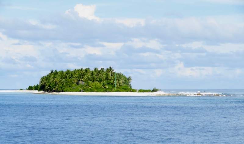
Funafuti ranks 1st on the list of the most beautiful islands in Tuvalu. This island is an atoll and the capital of the Tuvaluan island nation. It has a population of 6,320 people (as of the 2017 census), making it the country's most populous atoll, accounting for around 60% of Tuvalu's total population. It consists of a thin swath of land 20 to 400 meters (66 to 1,312 feet) wide that encircles a big lagoon (Te Namo) 18 km (11 miles) long and 14 km (9 miles) wide. The Funafuti lagoon has an average depth of roughly 20 fathoms (36.5 meters or 120 feet). It is Tuvalu's largest lagoon, covering 275 square kilometers (106.2 square miles). The land area of the 33 islets surrounding Funafuti atoll totals 2.4 square kilometers (0.9 square miles); taken combined, they account for less than 1% of the atoll's total area. Cargo ships can enter Funafuti's lagoon and dock at Fongafale's port facilities.
Tuvalu's capital is commonly referred to as Fongafale or Vaiaku, but it is legally the entire atoll of Funafuti, as it has a single administration that is accountable for the entire atoll.Location: Tuvalu
cruisemapper.com -
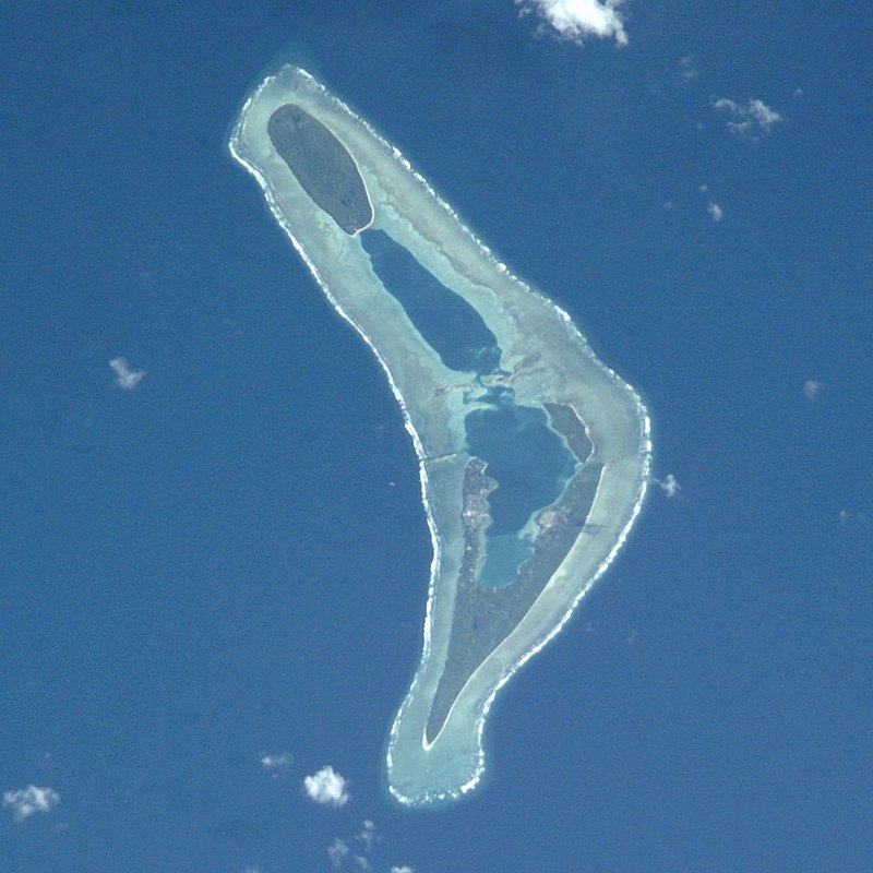
Ranks in 2nd place on the list of the most beautiful islands in Tuvalu is Nanumea. This island is the most northwestern atoll of Tuvalu, a Polynesian republic comprised of nine coral atolls and islands scattered across approximately 400 miles (640 km) of Pacific Ocean roughly south of the equator and west of the International Date Line. Nanumea has a population of 512 people and a land area of 4 km2 (1.5 sq mi) (2017 census).
Nanumea is located along one edge of the Polynesian triangle, close south of the Gilbert Islands, which are Micronesian in language and culture. Nanumea is a conventional atoll, consisting of a series of low islets perched on a coral reef shelf and encircling a lagoon. The dry land area is approximately 3.9 square kilometers and measures approximately 12 kilometers (7.5 miles) long by 2.5 kilometers (1.6 miles) broad (1.5 sq mi). The two largest islets, Nanumea and Lakena, account for 90 percent of the atoll's dry land area.
Location: northwestern Tuvalu
wikipedia.org 
pinterest.com -
Nui is ranked 3rd on the list of the most beautiful islands in Tuvalu. This is an atoll and one of Tuvalu's nine districts in the Pacific Ocean. It has a population of 610 people and a land area of 3.37 km2 (2017 Census). The island was discovered by Spanish navigator lvaro de Mendaa on 16 January 1568, and he named it Isla de Jess (Spanish for "Island of Jesus") since it was discovered on the day after the feast of the Holy Name. Fenua Tapu (area 1.38 km2) is the largest, most southern, and most eastern island, followed by Telikiai (the most western islet), Tokinivae, Pongalei, Talalolae, Pakantou, Unimai, Piliaieve, and Motupuakaka.
Nuian culture is traditionally organized into three family circles: Tekaubaonga, Tekaunimala, and Tekaunibiti. The majority of people dwell on Fenua Tapu's western end. According to the 2012 census, Alamoni – Maiaki has 321 residents, and Manutalake – Meang has 221 residents (Tanrake). Vaipuna Primary School is a junior school.
Location: Tuvalu
cindyoninteresting.wordpress.com 
mapio.net -
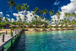
Nukufetau is an atoll that is part of the Tuvaluan nation. The atoll was claimed by the United States under the Guano Islands Act somewhere in the nineteenth century and was transferred in a friendship treaty signed in 1979 and entered into force in 1983. Savave islet has a population of 597 people (2017 Census). The school on Motumua islet was relocated to Savave in 1951 and became the government primary school for Nukufetau. In honor of its predecessor, it was renamed the Tutasi Memorial School.
According to local legend, the first individuals to settle on Nukufetau were a group of Tongans. When they arrived, they discovered only one fetau (or fetau in Tongan) tree flourishing on the atoll, therefore they named it Nukufetau - the fetau's island. They cultivated coconut trees and settled on Fale on the atoll's western edge. Motulalo is Nukufetau's largest islet. After the arrival of the missionaries in the late nineteenth century, the residents of Nukufetau lived on Fale islet until relocating to Savave, which is located on the lagoon side of the Fale community. On Savave islet, Aulotu has 331 residents and Maneapa has 191. (2012 census).
Location: Tuvalu
hallcontracting.com 
hallcontracting.com -
Nukulaelae is an atoll in the country of Tuvalu with a population of 300 people (2017 census). Pepesala, the main settlement on Fangaua islet, has a population of 300 people (2017 Census). It is oval in shape and consists of at least 15 islets. Fangaua, the populated islet, is 1.5 kilometers (0.93 miles) long and 50 to 200 meters (160 to 660 feet) wide. Niuoko islet is Tuvalu's easternmost point. The Nukulaelae Conservation Area encompasses the lagoon's eastern end. In 2010, a baseline survey of marine species in the protection zone was done.
According to the island's traditional history, a white-skinned guy was the first to see it, but he did not settle because there were no trees. Nukulaelae is Hawaiian for "country of sands." Later, on a fishing trip, Valoa from Vaitupu discovered Nukulaelae, according to legend. He returned to Nukulaelae and cultivated coconut trees before settling there with his family. Fagafale, a malae on the islet of Tumuiloto, performed religious rights honoring ancestor spirits. On the islet of Niuoka, there is a massive stone known as Te Faleatua, which translates as "the abode of the gods."
Location: Tuvalu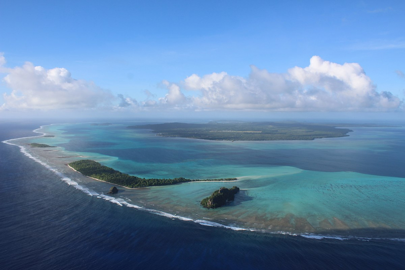
wikidata.org -
Vaitupu is the largest atoll in the Tuvaluan archipelago. It's at 7.48 degrees south and 178.83 degrees west. There are 1,061 inhabitants (2017 Census) residing on 5.6 square kilometers (2.2 square miles), with Asau serving as the principal village. Between 1860 and 1900, the population of Vaitupu was estimated to be 400 persons. Vaitupu has the second-largest population in Tuvalu, with 1,576 people (2002 Census) and 1,555 people (2010 Census) (2012 census). Despite its size, Vaitupu grew so overcrowded in the 1940s that a number of families relocated to Fiji to settle on Kioa Island.
It is unknown when Vaitupu's first settlement took place. According to oral history, the Vaitupuan village was founded by Telematua, a Samoan who arrived in the 16th or 17th century. Tongans may have arrived on the atoll for the first time in the mid-13th century. Throughout its history, Vaitupu has maintained ties with Tonga, both amicable (alliances through marriage) and hostile (visits by Tongan slave-seekers). Vaitupu was also visited by I-Kiribati, indicating that it was not isolated. Vaitupu is a Hawaiian word that means "the fountain of water."
Location: Tuvalu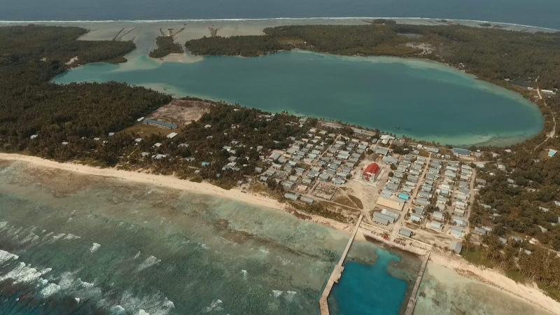
facebook.com -
Nanumanga, sometimes known as Nanumaga, is a reef island in the Oceanian island nation of Tuvalu. It has a population of 491 people and a surface area of around 3 km2 (2017 Census). The Nanumaga landscape includes the main village settlements of Tonga and Tokelau, the two main pits for swamp taro (Cyrtosperma merkusii) (known as Pulaka in Tuvalu), the mangrove forest surrounding the internal lagoons, and areas of general vegetation that include coconuts, pandanus trees, and other vegetation types.
The island is shaped like an oval, with the longer axis orientated north-south. The entire island is surrounded by a fringing reef, making local fishing and transportation into and out of the island difficult. There are two brackish-water lagoons, the largest of which is Vaiatoa, which has four islands. Vaiatoa Lagoon lies in the north of the island, while Ha'apai Lagoon is in the south. To the south of Vaiatoa Lagoon, a causeway has been built, connecting the villages of Tonga and Matematefaga.
Mangrove trees, native broadleaf forest, and coconut palms can be found. Tuvalu has two mangrove species: the common Togo (Rhizophora stylosa) and the red-flowered mangrove Sagale (Lumnitzera littorea). The mangrove forest of the northern Vaiatoa lagoon is approximately 20 hectares in size. The entire island of Nanumaga is covered by a Locally Managed Marine Area. Spear fishing is likewise prohibited on the reef, and no fishing is permitted on the reef on the western side of the island other than handlining. Spear fishing is also prohibited on the island. A sea mound right off the island's northern tip is an essential critical fishing area that has been designated as a "no anchor zone."Location: Tuvalu
wondermondo.com 
bigseventravel.com -
Niulakita is Tuvalu's southernmost island, as well as the name of the island's lone community. The town of Niulakita has a population of 34 people. Niulakita inhabitants have relocated to the island from Niutao. Niulakita is represented in Tuvalu's Parliament by members of the Niutao constituency. The discovery of Niulakita is attributed to travellers from Nui, headed by Kaunatu, who was returning people to Vaitupu when their canoe veered off course to the south and landed in Niulakita. On the islands, the only plants were saltbush (Atriplex) and pukavai trees (Pisonia grandis). One of the passengers, Kaeula, passed away and was buried with the last of their coconuts planted at the head of his grave. Kaunatu named the island after a place on Nui with the same name.
Niulakita is a coral reef. Tuvalu has four ponds or lakes, as well as a maneapa (community hall) that serves as a meeting and recreational facility. The island is shaped like an oval, with the longer axis running east-west (about 1 km long). This island has Tuvalu's highest peak (4.6 meters (15 feet) above sea level). The entire island is surrounded by a fringing reef, making local fishing and transportation into and out of the island difficult.
Location: Tuvalu
she-san.ch -
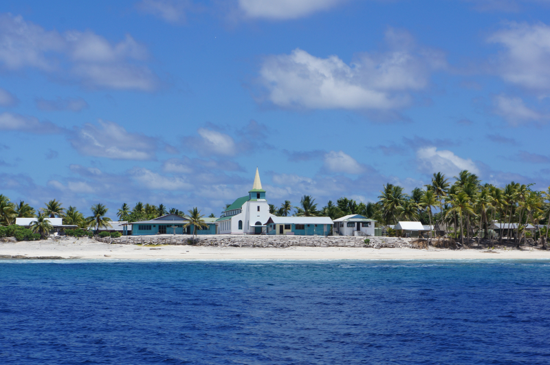
Niutao is the last island on the list of the most beautiful islands in Tuvalu. Niutao is a reef island in Tuvalu's northwestern region. It is one of Tuvalu's nine districts (islands). It is also one of three districts with only one island, excluding the three islets inside the confined lagoon. Niutao has a population of 582 people (2017 census).
There are two brackish to saline lakes (ponds or lagoons). The larger one features three islands as well as a dam. Fresher water from three wells rests in a "lens" above the salt water that leeches in through the coral. Older maps identify Tuapa as the lone village (with the neighbourhood of Angafoulua). Kulia is the main village, and Teava is another. There has a maneapa (community hall), Uepele Primary School, the Church of Tuvalu's Tineifale, a post office, and three wells. A gravel road circles the island, connecting the graveyard, half a mile (800 m) counterclockwise from the settlement, and a quarter mile (400 m) clockwise to the hospital. The island is roughly one mile long and shaped like a horizontal oval (1.6 km). There is a lot of vegetation, yet it's all the same. Pulaka (Cyrtosperma merkusii), or swamp taro grown in pits, is the main food source; breadfruit, coconut, and pandanus are also farmed. The entire island is surrounded by a fringing reef, making local fishing and transportation into and out of the island difficult.
Location: Tuvalu
pacificvoices4globaloceanchallenge.files.wordpress.com