Top 12 Most Beautiful Lakes in New Zealand

The lakes are the ideal summer destination for those who want a place to relax and cool off without descending to cramped beach destinations. In a beautiful ... read more...country like New Zealand, there is no shortage of beautiful lakes. Let's join Toplist to discover the most beautiful lakes in New Zealand!
-
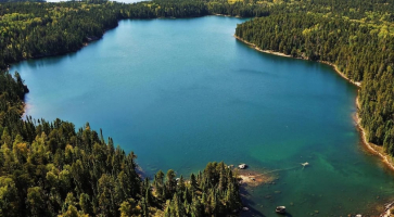
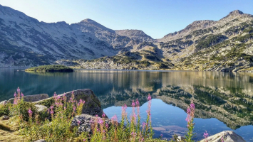
In the South Island of New Zealand, Lake Tekapo is the second-largest of three roughly parallel lakes that run north-south along the northern edge of the Mackenzie Basin (the others are Lake Pukaki and Lake Ohau). It is located at a height of 710 meters above sea level and has an area of 83 square kilometers. Lake Tekapo is one of the most beautiful lakes in New Zealand.
One of three parallel lakes running from north to south in the Mackenzie Basin on the South Island is Lake Tekapo. The Godley River, which originates in the Southern Alps, feeds the lake from the north, providing the high-altitude lake with cool, clear water all year round.
One of the most well-liked tourist locations in the nation, it features a few resorts in adjacent towns and a regional park that provides guests with a range of recreational opportunities. A popular day travel destination for individuals on a strict schedule is Lake Tekapo, which is situated just over 100 kilometers west of Christchurch.
The spectacular snow-capped mountains that tower in the distance, the rocky and craggy beach, and the purple wildflowers that bloom in the spring are some of its most well-known features.
Location: Mackenzie District, Canterbury region, South Island
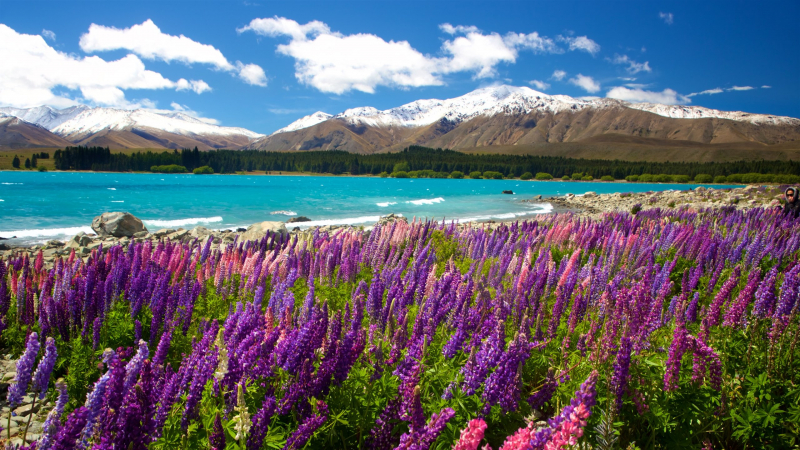
Photo: expedia.com.vn 
Photo: booking.com -
On New Zealand's lower South Island, Lake Wanaka is located in the center of the Otago Lakes. Village by Lake Wanaka is the entryway to Mt Aspiring National Park and is located in a glacier-carved basin on the lake's shoreline. On the road to the frontier settlement of Makarora, the penultimate halt before the West Coast Glacier region, Lake Hwea is a 15-minute drive away. The storied Cardrona Valley, a well-liked picturesque alpine route to neighboring Queenstown, is to the south.
It's a terrific option for those who want to enjoy the great outdoors away from the crowds, and since Mount Aspiring National Park is nearby, visiting multiple places can be done swiftly and effectively.
After a day in the heat, the surrounding town provides a welcome contrast and is full of hip restaurants, galleries, and stores that are fantastic locations to spend some time in the afternoon. There are four distinct seasons in the region surrounding Lake Wanaka, so finding things to do to pass the time won't be a problem whenever you visit.
Location: Queenstown-Lakes District, Otago, South Island
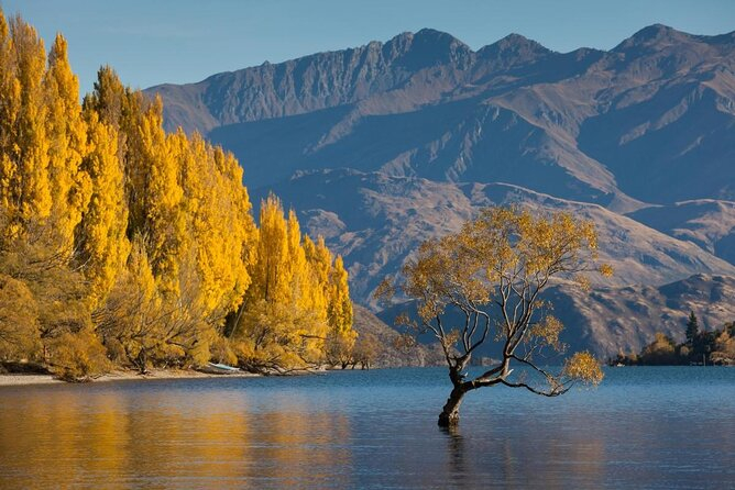
Photo: viator.com 
Photo: tripadvisor.com.vn -
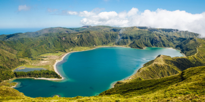
On the South Island of New Zealand, three fairly parallel alpine lakes run roughly north-south along the northern edge of the Mackenzie Basin. Lake Pukaki is the largest of these lakes. Lakes Tekapo and Ohau make up the other two. The terminal moraines of retreating glaciers obstructed the valleys where the three lakes were created, creating moraine-dammed lakes. For a portion of its length, the Alps2Ocean mountain bike track skirts the edge of Lake Pukaki.
The lakes, which are bordered by some of the most beautiful alpine vistas in the nation, were created by glacier action thousands of years ago. The glacial feed, which consists of glacial flour, or the incredibly finely crushed rock from the glaciers, gives the lakes their characteristic blue color. The surface elevation of Lake Pukaki, which has a surface size of 178.7 km2, typically varies between 518.2 to 532 meters above sea level.
The lake's waters frequently have a hazy but brilliant aquamarine tint, which makes for excellent images and appears to be an unnatural phenomenon. Mount Cook is the area's most magnificent peak and is covered in snow for much of the year.
Location: Mackenzie District, Canterbury region, South Island
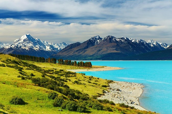
Photo: viator.com 
Photo: hotelscombined.vn -
Lake Wakatipu is a finger lake located on New Zealand's South Island. It is located in the southwest part of the Otago area, close to the Southland border. Additionally, it is the longest lake in the nation, measuring nearly 80 km from end to end. The lake has a maximum depth of 380 meters and a floor that is below sea level. It is located near the southernmost point of the Southern Alps, or K Tiritiri o te Moana, at an elevation of 310 meters.
Given that it is encircled by mountains, Lake Wakatipu is well known for its beautiful splendor. Along its southeasterly edge, there are two mountain ranges: the Remarkables and the Tapuae-o-Uenuku/Hector Mountains. It is a well-known destination for adventure tourism since it is convenient for ski slopes, paragliding, bungee jumping, and hiking trails. The TSS Earnslaw, a vintage riverboat, frequently cruises the area's waters. In Gibbston, there are numerous vineyards close by.
There are designated swimming areas with white sandy beaches that are fantastic places to catch some rays and enjoy a little swimming. Boat trips are one of the most popular methods to visit the lake and give vistas that won't be visible from shore.
Location: Queenstown-Lakes District, Otago Region, South Island
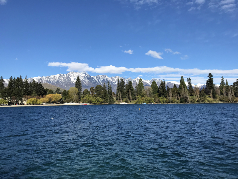
Photo: wikipedia 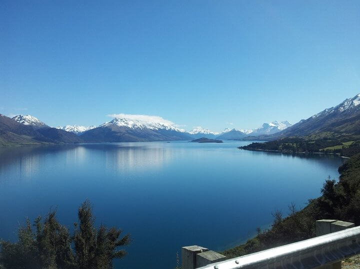
Photo: queenstownexpeditions.com -
The Tongariro Alpine Crossing, a full-day trip that ranks high among outdoor enthusiasts visiting New Zealand, passes via The Emerald Lakes, which are also located in Tongariro National Park.
The lakes have a uniquely lunar vibe to them because they are surrounded by some of New Zealand's most spectacular volcanic rocks. The Blue Lake is the same color as the sky on a bright summer day, and the Emerald Lakes are both startlingly green. You will be left wondering how the lakes obtained their vivid colors due to the color's intensity.
Expect to share the lakes with others during busy periods; nonetheless, the lakes' vibrant contrast to the adjacent, angular mountains more than makes up for this. Numerous of the Emerald Lakes acquire various hues, such as aquamarine, jade, and turquoise, which give them all their own distinctive beauty. In Tongariro, the Emerald and Blue Lakes are also byproducts of previous volcanic activity. As a result of a combination of mineral deposits and melted snow and ice, the lakes developed inside the craters.
Location: Tongariro, New Zealand
Photo: tripadvisor.com.vn 
Photo: airbnb.ae -
The Taup Volcano's caldera contains Lake Taupo, a sizable crater lake on New Zealand's North Island. The town of Taupo, which is located on a cove near the lake's northeastern side, takes its name from the lake. With a surface area of 616 km2, it is the largest lake by surface area in New Zealand and, behind Lake Murray in Papua New Guinea, the second largest freshwater lake by surface area in geographic Oceania. In the lake's southeast corner is Motutaiko Island.
It is the largest lake in the nation by surface area, which is not unexpected given that it was formed volcanically. It also has year-round geysers, steam vents, and gurgling mud pools. Lake Taupo is one of the most beautiful lakes in New Zealand.
There are designated beach areas that are perfect for swimmers, sunbathers, and paddle boarders in several locations of the lake where the water is warmed by geothermal forces below the surface.
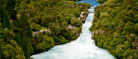
Additionally, you might want to look into the Mine Bay Maori carvings for a fascinating cultural experience. The thunderous Huka Falls, one of the most amazing and popular tourist destinations in the nation, is conveniently adjacent to Lake Taupo.
Location: Taupō District, Waikato Region, North Island
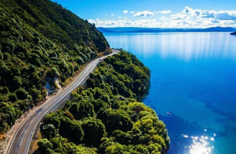
Photo: hakatours.com 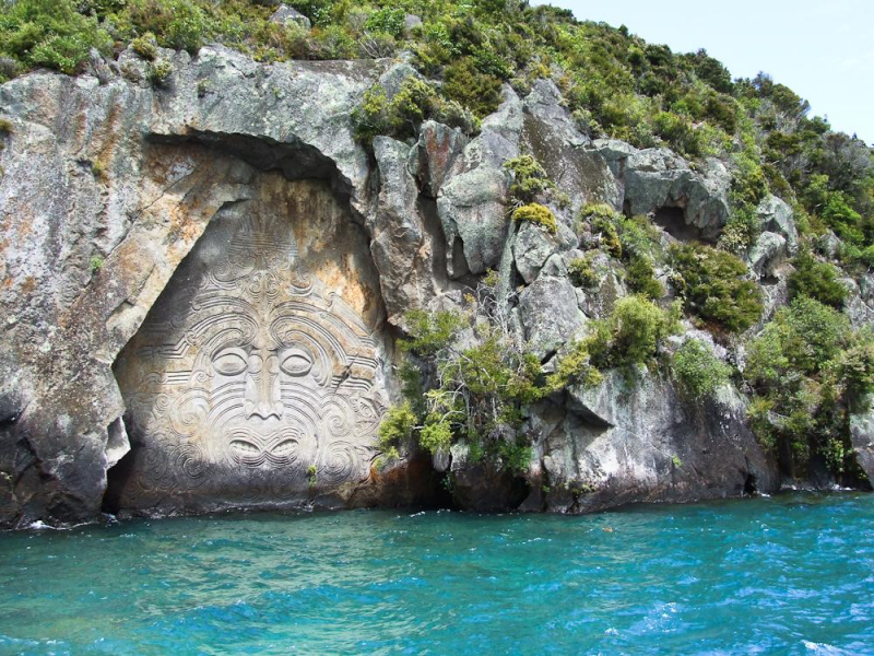
Photo: misswood.eu -
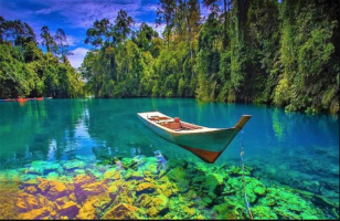
A small glacial lake called Lake Matheson can be found in South Westland, New Zealand, not far from the community of Fox Glacier. For the local Mori, it served as a traditional location to gather food. The lake, which is renowned for its mirrored vistas of Aoraki/Mount Cook and Mount Tasman, is surrounded by an easy walking path. In addition to being surrounded by old-growth forests and famous for its waters that reflect a tea-colored light, Lake Matheson is also the location of the Clearwater Suspension Bridge, which offers visitors breathtaking views that blend aspects of the natural and man-made worlds as if they were meant to be together.
Large types of eels, which live in the lake's less-than-clear water and are frequently spotted feeding there when there is little wind and low light, such as in the morning and afternoon, are another feature that makes it well-known. There are numerous trails that lead to various vantage points with unrestricted views of the lake and the surrounding landscape, and Mount Cook and Mount Aoraki give spectacular backdrops to the lake.
The adjacent Fox Glacier Hotel began offering early-morning excursions to the lake in the 1950s; customers would be transported by bus to the current trailhead and set out on a 15-minute trek through the bush without the convenience of today's bridges and pathways. They were then transported to Reflection Island in a rowboat where they waited for the waves to calm down and the renowned view to materialize. The picture of the famous view across the lake was frequently duplicated and appeared on candy boxes, beer bottles, calendars, and mementos. One of the most photographed lakes in New Zealand right now is Lake Matheson.
Location: Fox Glacier, West Coast, South Island
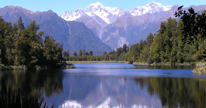
Photo: newzealand.com 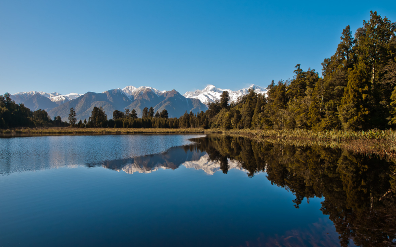
Photo: wikimedia commons -
The ninth-largest lake in New Zealand is Lake Hwea. At a height of 348 meters, the lake is located in the Otago Region. It is 141 km2 in size and 392 meters deep. A Mori tribe that lived in the region before the Waitaha people is honored with the name Lake Hwea. The length of Lake Hwea is 35 kilometers from north to south. It is nourished by the Hunter River and is situated in a glacier valley created during the last ice age. The distance between the lakes at their closest point, a rocky ridge known as The Neck, is only 1000 meters.
A popular summer holiday place for individuals who like to be active while enjoying the great outdoors, Lake Hawea is only a short drive from Lake Wanaka. It is especially popular with kayaks, wind and kite surfers, and fishermen. The mountains that surround Lake Hawea are larger and steeper than those that surround most lakes in New Zealand, and they plunge directly into the lake's depths, creating a harsh and beautiful landscape. The Timaru River, which also offers fantastic hiking routes, picnic spaces, and campsites, feeds the lake and is home to some of the region's most breathtaking scenery. The water is still cold and inviting even during the hot summer months.
Location: Queenstown-Lakes District, Otago Region, South Island
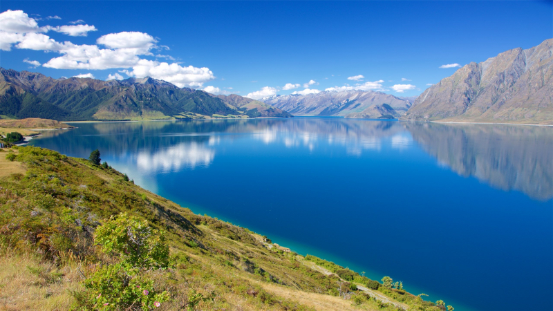
Photo: expedia.com 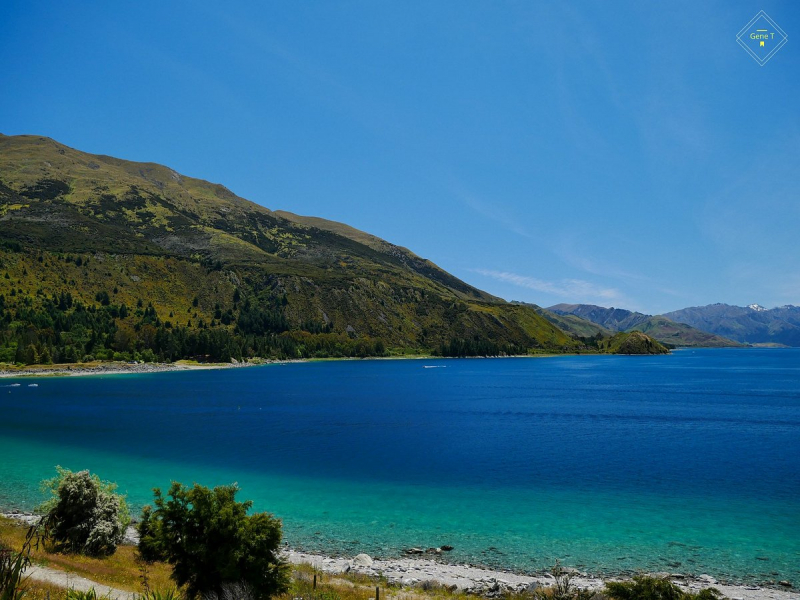
Photo: tripadvisor.com.vn -
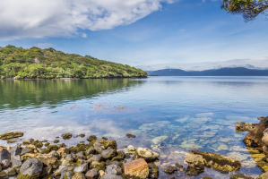
On New Zealand's South Island, in the southwest, is Lake Te Anau. With a surface size of 344 km2, the lake is the largest in the South Island and the second-largest lake in New Zealand (after Lake Taupo). By freshwater volume, it is Australasia's biggest lake. One of the most beautiful lakes in New Zealand is Lake Te Anau.
The South Island's extreme southwest corner is home to Lake Te Anau and the neighboring town of the same name, both of which are conveniently situated near the renowned Fiordland National Park and are excellent places to stay when touring the area's attractions. For the outdoorsy and budget-conscious, there are several lodging options, including full-service lodges, resort-style hotels, and campgrounds.
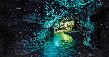
The lake can get crowded during the busiest months of January to March due to its magnificent beauty and proximity to other well-liked tourist destinations, but with so much to see and do, you'll quickly forget that you don't have the place to yourself. A nearby bird refuge and the seasonal glowworm caverns are both excellent side trips.
Location: Southland District, Southland Region, South Island
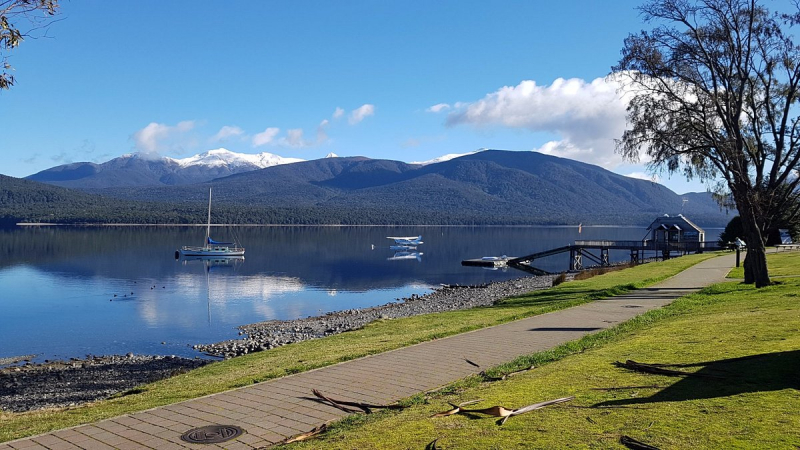
Photo: tripadvisor.com.vn 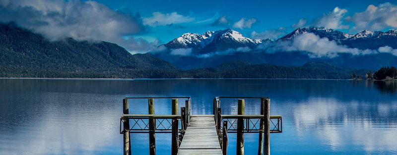
Photo: southlandnz.com -
New Zealand's South Island is home to Lake Manapouri. The lake is located within the boundaries of Te Wahipounamu South West New Zealand World Heritage Area and the Fiordland National Park. During the most recent Holocene, glaciers created Lake Manapouri. The lake, which is 444 meters deep, is the second-deepest lake in New Zealand.
Lake Manapouri is one of the deepest lakes in the nation and is surrounded by majestic mountains. The town of Manapouri, which is close to the lake, makes a great base of operations and serves as the departure point for many guided tours of New Zealand's distinctive glacial region.
A sizable dam and power plant are located at the western end of the lake, and tours are offered for those interested in learning more about how these man-made structures operate. The dramatic and scenic Doubtful Sound, which many visitors recall as the most appealing site they witnessed while visiting New Zealand, is also nearby. The region is widely known for its excellent fishing and clean water. On the trophic state index, Lake Manapouri and Lake Te Anau both fall under the ultra-oligotrophic index, with clear, highly oxygenated waters and very low biological productivity.
Location: Southland District, Southland Region, South Island
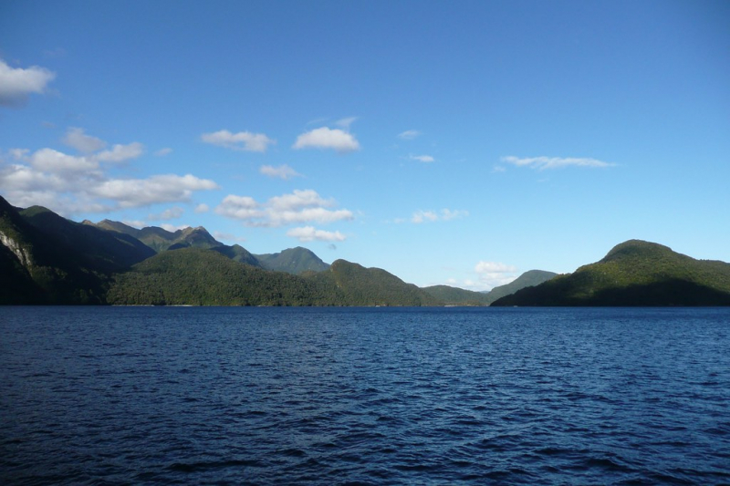
Photo: flickr.com 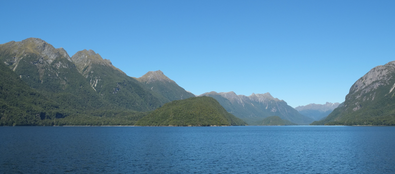
Photo: wikipedia -
A lake named Lake Ohau is located in New Zealand's South Island's Mackenzie Basin. Lake 'hau's northern end received water from the Hopkins and Dobson rivers. Long ago, glacial movements helped to create this lake. This lake is one of the most beautiful lakes New Zealand. It is one of three identical lakes that are located north-south and share the same border. The Hopkins and Dobson Rivers, which originate in the Southern Alps, provide the water for these lakes.
The Lake Ohau Snow Fields, one of the nation's top destinations for winter enjoyment, boasts some very outstanding height, annual snowfall, and a number of available paths for hikers of all skill levels. The ski season normally lasts from early August to the end of October, but this might vary depending on the actual weather. Fishing, hiking, and kayaking are common pastimes for tourists that come during the warmer months.
With its unobstructed clear skies and little population, Lake Ohau is renowned for the quality of its stargazing. The Aoraki Mackenzie Dark Sky Reserve, with a 4300 square kilometer boundary that follows the eastern shore of Lake Hau, was established in 2012. Only eight of these exist globally.
Location: Mackenzie Basin, Waitaki District, Canterbury region, South Island
Photo: queenstownmotorhomerentals.com 
Photo: artist.com -
Previously known as Lake Arthur, Lake Rotoiti is a lake in New Zealand's Tasman region. Within the boundaries of Nelson Lakes National Park, there is a sizable mountain lake. The Buller River receives water from the lake that is fed by the Travers River. The lake is 82 meters deep and encircled by beech trees. A little town called Saint Arnaud is located near the lake's northernmost point.
Lake Rotoiti, which is in New Zealand's Tasman Region and is a well-liked recreation destination because of its location inside the Nelson Lakes National Park, has been known for much of its existence as Lake Arthur after the English Army captain who was among the first Europeans to see it in 1843.
The largest peaks of the Saint Arnaud Mountain Range surround Lake Rotoiti on its northern, eastern, and western coasts as it is located high in the range. Due to their altitude, the peaks are always covered in snow for a large portion of the year, giving the lake and surrounding area a European alpine appearance that many tourists are unprepared for.
Location: Nelson Lakes National Park, Tasman Region, South Island
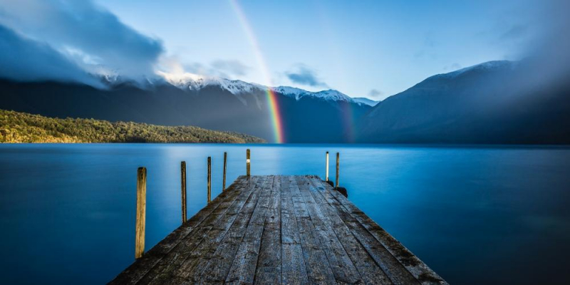
Photo: nelsontasman.nz 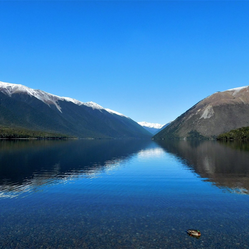
Photo: tripadvisor.com