Top 10 Most Beautiful Islands in New Zealand

New Zealand is a small island nation mainly known for its two main islands - the North and South Islands. Many people don't realize that hundreds of other ... read more...spots scattered around the coast wait to be discovered. It is believed that there are around 600 islands dotted around New Zealand's coastline, and many of them are perfect places to explore. If you want to get out and explore some of these beautiful islands, Toplist will make your island adventures easier with the following list of 10 most beautiful Islands in New Zealand.
-
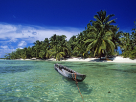
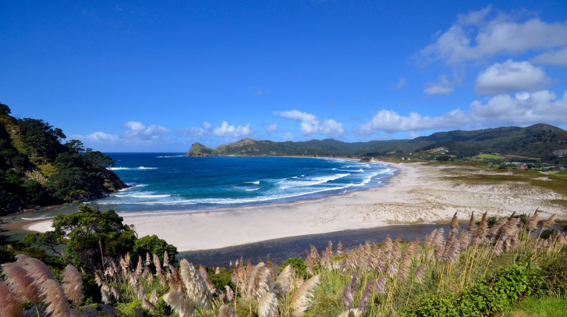
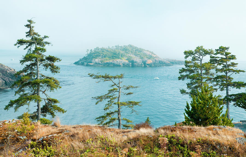
If you want to visit one of the most beautiful islands in New Zealand, do not overlook Stewart Island. It is New Zealand's third-largest island, located 30 kilometers south of the South Island, across the Foveaux Strait. It is called Rakiura in the Maori language, which means 'land of the shining sky.' You will understand why when you see the aurora Australis often appear in this southern sky.
More than 85% of the island is a National Park, and most people come here for hiking and birdwatching. The island has only 28 km of roads, but the 280 km of hiking trails are suitable for short hikes, day hikes, and multi-day hikes. Hike the Rakiura Trail for three days, and you'll get the full experience of the unspoiled beauty of Stewart Island.
Stewart Island is home to the brown kiwi or Tokoeka, which outnumber humans on the island and is active day and night. Blue penguins and rare yellow-eyed penguins waddle among the rocks. Off the coast on Ulva Island, you'll find a predator-free bird sanctuary with dozens of native species.
The approximately 400 Stewart Islanders are a proud and independent group, but they are also very friendly. There is only one large and small settlement on the island - Halfmoon Bay, sometimes called Oban, which offers a wide variety of accommodation.
Location: 30 kilometers south of the South Island, across the Foveaux Strait
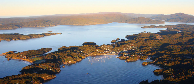
Stewart Island. Photo: newzealand.com 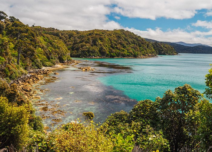
Stewart Island. Photo: tripadvisor.co.nz -
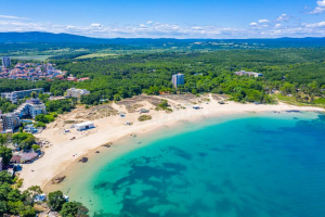
Waiheke is a paradise of vineyards, olive groves, and beautiful beaches, all just a 40-minute ferry ride from Auckland city center. In terms of landscapes, lifestyles, and experiences, Waiheke is a world apart.
The white sand beaches of Oneroa, Palm Beach, and Onetangi slope gently down to Hauraki Bay and are ideal for swimming, kayaking, or picnicking.
If you're more of a hiker, explore the island trails that wind along cliff tops, down beaches, and into cool native forests. At the eastern end of the island, the Stony Batter footpath leads you to a system of World War II gun emplacements and underground tunnels.
For an overnight stay, rent a beach house and wake up to the sound of the ocean waves. If you've got the money, so head to a backpacker-friendly hostel. Commuting is also easy. Catch one of the regular ferries that run to Waiheke from downtown Auckland. When you get to the island, there are public buses and taxis, or you can rent a mountain bike, motorbike, or car. And if you already have a car or a bike, you can bring it across the car ferry.
Location: Hauraki Gulf, New Zealand
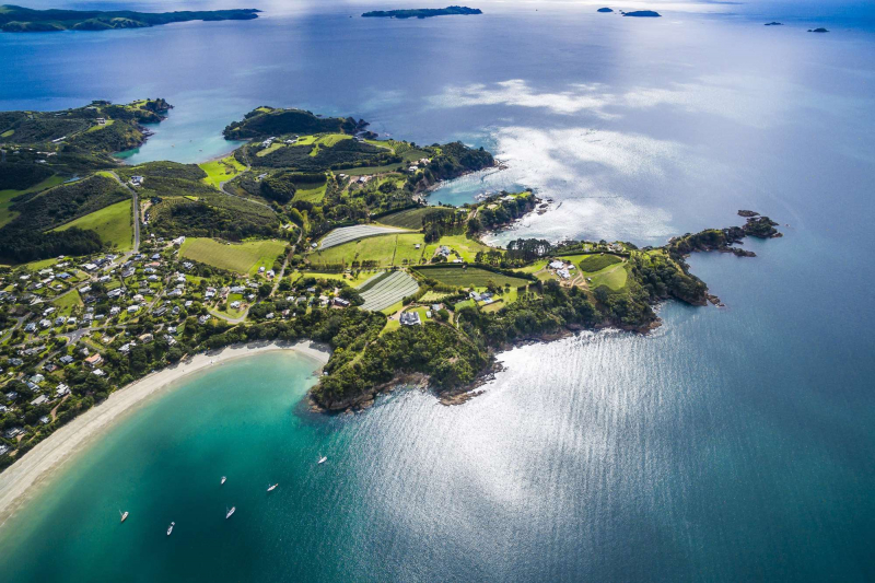
Waiheke Island. Photo: discover-the-world.com 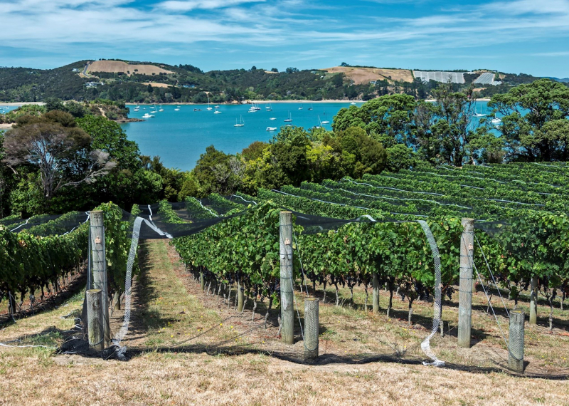
Waiheke Island Wine. Photo: audleytravel.com -
Matakana Island is a long and thin strip of land about 20 km long, the largest of the coastal islands in the Bay of Plenty. The land is split between sheltered orchards, farmland, and thick pine forests on the Pacific side. Home to a small number of locals, the island has a mix of pine forests, orchards, and farmland. The northern region is popular with keen surfers who travel by boat or jetski to get the perfect wave.
The area is a site of national significance for biodiversity with many native species of birds, plants, and wildlife. More than 100 species of plants native to New Zealand are said to grow on the small space of land.
You can get there on your own by boat or board the Kewpie on one of their scheduled 1-hour scenic excursions, and they'll drop you off and pick you up later in the day. A ride on Kewpie is a must when you're in the Bay!
Location: Western Bay of Plenty, New Zealand's North Island
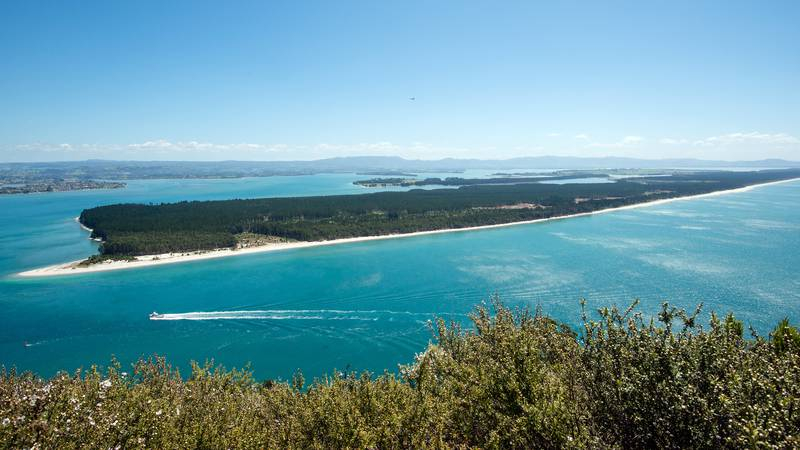
Matakana Island. Photo: 1news.co.nz 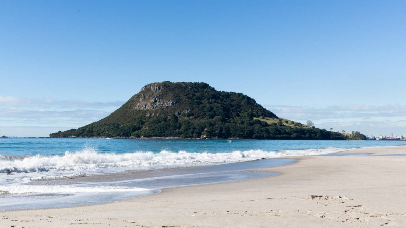
Matakana Island. Photo: stuff.co.nz -
Rangitoto is the youngest and largest of Auckland's 48 dormant volcanic cones and is home to the world's largest pohutukawa forest. It deserves to be one of the most beautiful islands in New Zealand for your vacation.
Rangitoto is Auckland's most iconic island, with its distinctive symmetrical cone and a great location just off the coast. Just a short scenic ferry ride across the harbor from Auckland city center, the island is a favorite destination for hikers and day-trippers. Rising unexpectedly from the sea about 600 years ago, it is the youngest and largest volcano in the Auckland volcanic field.
Take the option of a guided tour on a 4WD train or hike to the top (approximately 1 hour each way). See caves of black lava on your way up, and bring a torch to explore them with the kids. The views from the top are breathtaking - you'll be able to see everything from the emerald islands of Hauraki Bay to the rugged skylines of the Waitakere Ranges to the west and the Hunua Ranges to the east.
Patriots can take a guided sea kayaking trip to Rangitoto – the adventurous can even try night kayaking, heading out in the evening to watch the spectacular sunset from the summit mountains before sailing back in the dark under the stars toward the bright city lights.
Location: Hauraki Gulf near Auckland, New Zealand
Rangitoto Island. Photo: istockphoto.com 
Rangitoto Island. Photo: flickr.com -
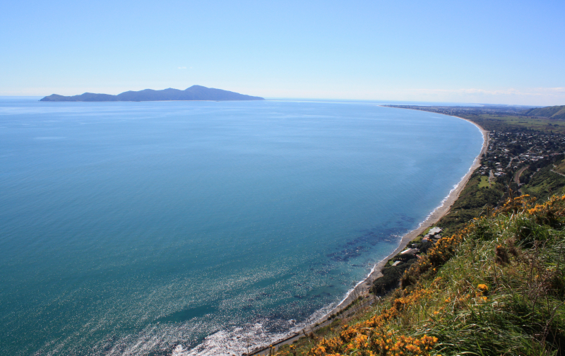
Kapiti Island is a nature reserve that hosts some of New Zealand's most endangered bird species. Its protected waters are home to countless marine life.
Creating a place where endangered species can flourish once again has also created a rare experience for the few people allowed to visit Kapiti Island each day.
Kapiti Island Nature Reserve is 10 km long and 2 km wide. The number of visitors is strictly limited - access is only possible with a departure permit, and a landing permit from your tour operator is required. Licensed tour operators are shown below. A trip to Kapiti Island depends on weather and sea conditions. The Kapiti Island Nature Tours operate from September 1 to May 30. Sailing trips usually take place daily from October to May and from Friday to Sunday in September, depending on visitor demand.
Location: About 5 km off the west coast of the lower North Island, New Zealand
Kapiti Island. Photo: geographic.media 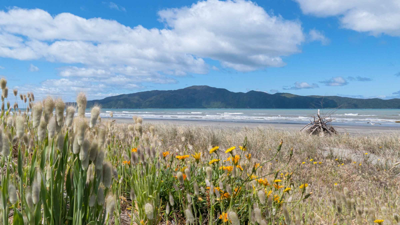
Kapiti Island. Photo: getyourguide.fr -
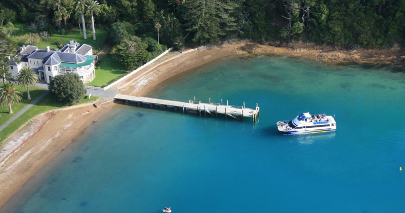
Kawau Island, or Te Kawau Tumaro o Toi, is one of the largest islands that make up Hauraki Bay in the north of New Zealand. A popular day trip to Kawau Island is the Mansion House Historic Reserve and Royal Mail Run Cruise. Visitors should check Mansion House opening hours to get a glimpse of this historic home inside. With plenty of walking around, large grounds, and a beautiful bay for swimming, it's the perfect spot for a day out with family and friends.
Kawau Island is a popular destination for cruises on Hauraki Bay, who are looking for a relaxing escape in nature; and bird enthusiasts. Kawau Island is known to have no access. Accommodation and attractions are accessible by the sea!
The excellent walking trails from Mansion House Bay are open to the public and are a great way to see part of the island's landscape and coastline. There are other walking paths on the island, but they are mostly unmarked and privately owned - as is the coast on a large part of the island.
Location: Hauraki Gulf, close to the north-eastern coast of the North Island, New Zealand
Kawau Island. Photo: newzealand.com 
Kawau Island. Photo: junctionmag.co.nz -
Great Barrier Island is the largest and most ocean-facing of the Hauraki Bay islands in the Auckland region. It has sheltered Auckland's harbor from the ever-changing Pacific Ocean for thousands of years, creating a boating paradise.
The eastern shore of Great Barrier Island faces the ocean with high cliffs and long white surf beaches. The West offers sheltered deep harbors and tranquil sandy coves. The native forest is covered by scenic walking paths that lead to secluded natural hot springs and a historic Kauri dam. These wilderness, jungle, and estuary areas are home to several unique species of plants and birds.
Great Barrier Island is a popular destination for diving, fishing, surfing, kayaking, mountain biking, hiking, camping, and stargazing. There are many accommodation options ranging from tent camps to luxury eco-lodges. Tryphena is the largest settlement on the island and is located on the west coast, home to many picturesque family-friendly beaches.
Enjoy the island's emerging dining culture and sample locally produced fresh Mānuka honey, beer, and gin. Enjoy natural, homemade skincare products from the locals.
Location: Hauraki Gulf, New Zealand
Great Barrier Island. Photo: theculturetrip.com 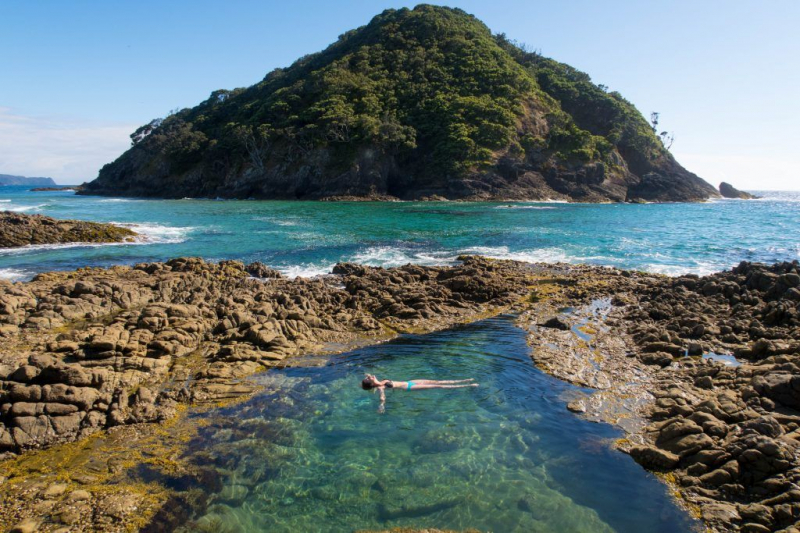
Great Barrier Island. Photo: pinterest.com -
Just 30 kilometers from central Auckland, you'll find the island of Tiritiri Matangi, as it's known by locals, one of the most successful conservation projects in the country.
As you explore the island, native bellbirds perch and sing just a few meters away. Once thought to be extinct, large flightless takahē hovered around humans. Tiny, happy native stitching blissfully unaware of their dangerously low numbers, dart from branch to branch along the edge of the track. Other rare species include the kōkako, brown teal, and small spotted kiwi.
The romantic 1864 lighthouse and old keeper's house mark the highest point on the island. It is a great place to stop for a snack while you soak up the view. Well-maintained trails pass through wooded areas and along surf cliffs to quiet sheltered beaches. Nesting boxes mark the habitat of little blue penguins that breed atop the beach.
The visitor center on the island only offers tea and coffee, so bring plenty of food. And bring a camera, as you will rarely get close to endangered birds in the wild. Binoculars and good walking shoes are also recommended.
Location: Hauraki Gulf, New Zealand
Tiritiri Matangi Island. Photo: trip.com 
Tiritiri Matangi Island. Photo: kkday.com -
Secretary Island is an island in southwestern New Zealand, located entirely within Fiordland National Park. Almost triangular, it sits between the Doubtful Sound to the south and the Thompson Sound to the north, with the west coast facing the Tasman Sea. To the east of the island, Pendulo Reach connects Thompson Sound with Doubtful Sound. With a steep slope, the entirely bush-clad island rises to a chain of several peaks more than 1000 meters high. The island also has three lakes. The largest, Clerk Lake, more than 600 meters long, is located below Mount Grono at an altitude of 550 meters.
The mostly sloping terrain is almost entirely covered by dense native beech-podocarp forest, consisting of plants such as mistletoe and mountain lance, which have been devastated elsewhere by foraging by marsupials. Its isolation and size make Secretary Island one of the most important islands in New Zealand for conservation efforts of vulnerable native species. The island was never inhabited by marsupials or rodents. By 2007 deer and stoat were also exterminated, making it the largest completely pest-free island in New Zealand.
Location: Fiordland coast at the entrance to Doubtful Sound
Secretary Island. Photo: fineartamerica.com 
Secretary Island. Photo: southernalpsphotography.com -
The Chatham Islands are a remote wilderness bordering the sea and are best known for their abundance of fresh seafood and fascinating marine and wildlife species. With outstanding scenery and welcoming hosts, Chatham Islands will leave an indelible impression on you.
When you visit the Chatham Islands, you're on New Zealand's furthest east point and the furthest domestic flight possible. Since most goods, including fuel, must be transported to the island by ship or plane, your visit will cost more than on land. Accommodation and transportation are limited on the islands, and with much of the land privately owned, you must book tours in advance.
Descendants of Moriori still live in the Chatham Islands, and visiting Kopinga Marae will give you cultural insights. The overall shape of the marae is uniquely designed to represent an albatross in flight, a bird of great cultural significance to Moriori. Visitors will hear stories about the Moriori people and their ancient covenant of peace and view intricate works of art and carvings. A trip to see the statue of Tommy Solomon (Tame Horomona Rehe), the last bloody Moriori, at Manukau east of Owenga, is well worth it.
Location: Pacific Ocean off the eastern coast of New Zealand's South Island
Chatham Island. Photo: cic.govt.nz 
Chatham Island. Photo: neilrawlins.blogspot.com