Top 10 Nicest Hiking Spots Near Boston

Boston is a historic city known for its culture, attractions, and harbor. Despite being densely populated, there are many opportunities to enjoy nature outside ... read more...the city. In fact, this great city has adopted the title “The Walking City” because it offers numerous walking trails, parks, and activities perfect for tourists. But with so much variety available, it can be hard to know where to start. So here is a list of the 10 nicest hiking spots near Boston that are perfect for day hikes and offer beautiful forest views.
-
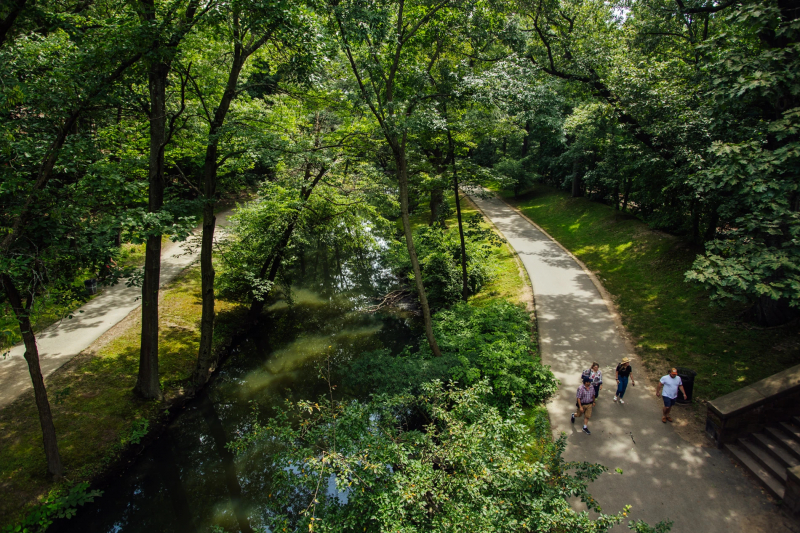
Great Blue Hill, with its 635-foot summit, is the tallest of the 22 Blue Hills within the 7,000 acres of the reservation south of Boston that straddles portions of Milton, Quincy, Braintree, Canton, Randolph, and Dedham.
From its rocky summit, climbers are rewarded with expansive views of the entire metropolis, but this is just one of the park's 125 miles of trails. Some lead past the remains of early farms and quarries, while others go by places where there is evidence of Native American presence in the area.
The park preserves natural habitats that visitors can explore on trails that pass by ponds, marshes, and swamps as well as high and lowland forests, meadows, and an Atlantic white cedar bog. The Blue Hills Trailside Museum and the Blue Hill Observatory and Science Center, located atop Great Blue Hill, are additional attractions in the park. Public transportation is available to get you to the park. This is unquestionable one of the nicest hiking spots near Boston.
Address: 695 Hillside Street, Milton, Massachusettes
pixels.com 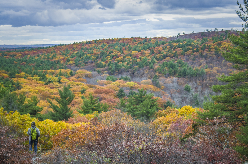
pinterest.com -
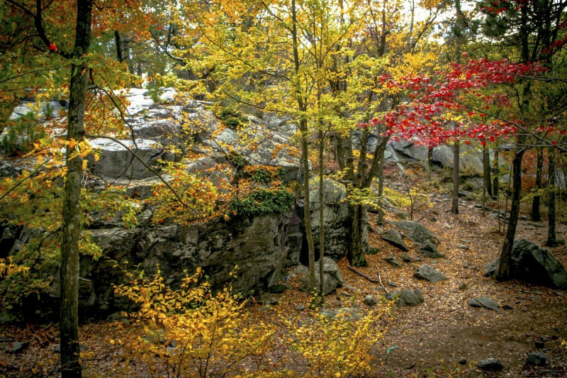
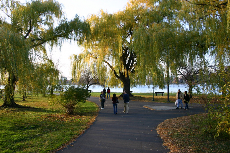
The Middlesex Fells, with their 2,575 acres of rocky, hilly terrain, draw both serious hikers and walkers out for a stroll in the woods. While the reservation has hikes for all levels, the Skyline Trail is both the most challenging and the most popular. It includes seven miles of rough terrain passing over hills, through wooded forests and around stunning lakes. Climb the observation tower along the trail for gorgeous views.
Following white blazes up Pine Hill, which is topped by an observation tower offering expansive views of the reservation and Boston, the main trail departs from Bellevue Pond. From the tower, follow the blazes on the rocks as you travel north.
Through the reservation's more than 100 miles of trails, you can see meadows, ponds, Wright's Tower, and Virginia Wood, the location of the long-gone mill village of Haywardville. A historical interpretive trail that winds through the hemlock forest can be found here. The park provides a wealth of information about the past of the area, including timbering, quarries, ice harvesting, and water that powered nearby mills.
The Rock Circuit and Crystal Springs loops in the eastern Fells, as well as the Cross Fells Trail, which circles the entire property, are all marked on a trail map that is available at the visitors center. One of the hardest hikes in the park, the 3.7-mile Rock Circuit, should take more than four hours.
Address: 4 Woodland Road, Stoneham, Massachusetts
peakvisor.com 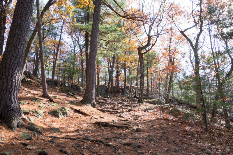
flickr.com -
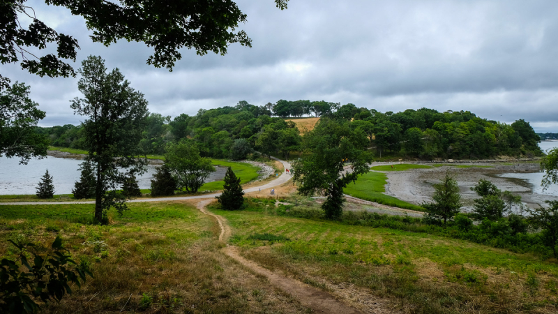
The 251-acre World's End, which is 15 miles south of the city and has gentle hills and rocky shorelines, offers activities for everyone, including hiking, cross-country skiing, snowshoeing, kayaking, canoeing, birding, horseback riding, and mountain biking. The glaciers that left the harbor islands and the granite ledges that are now covered in blueberry bushes and cedar also left behind the drumlins that make up the hills of World's End.
Trails pass through woodlands and meadows that are significant bird and native plant habitats, as well as saltwater marshes, which are forested areas. Views of the Boston skyline are visible from the park's hills and shore, and carriage roads created by landscape designer Frederick Law Olmsted wind through the area while being shaded by trees. Wander along the shoreline, past saltwater marshes, and through rolling hills while catching glimpses of the Boston skyline. Return to the forest to observe the vast variety of bird species that call this preserve their home.
These carriage paths and walking trails combine to create 4.5 miles of moderate hiking. Although World's End is managed by the Trustees of Reservations, it is part of the Boston Harbor Islands National Park area.
Address: Martins Lane, Hingham, Massachusetts
thetrustees.com 
fineartamerica.com -
The 640-acre Breakheart, located north of Boston along a wild section of the Saugus River, is practically unknown to everyone except those who live nearby. Two lakes and seven hills, each just over 200 feet tall and rising above the forest to provide views of Boston and southern New Hampshire, are located inside the hardwood forest. Both lakes are encircled by hiking trails, which also border the river and make loops throughout the park.
This state park offers a variety of trails through dense hardwood forests that range in difficulty from easy to challenging, making it great for both mountain biking and hiking. The park, which spans Saugus and Wakefield, has seven hills that provide views of Boston, New Hampshire, and central Massachusetts.
The park is traversed by the Saugus River, and trails encircle its banks. The riverbanks are popular with birders. In the summer, the park may be crowded with swimmers at the lake beaches, but even then you're likely to have its trails to yourself.
Address: 177 Forest Street, Saugus, Massachusetts
pixels.com 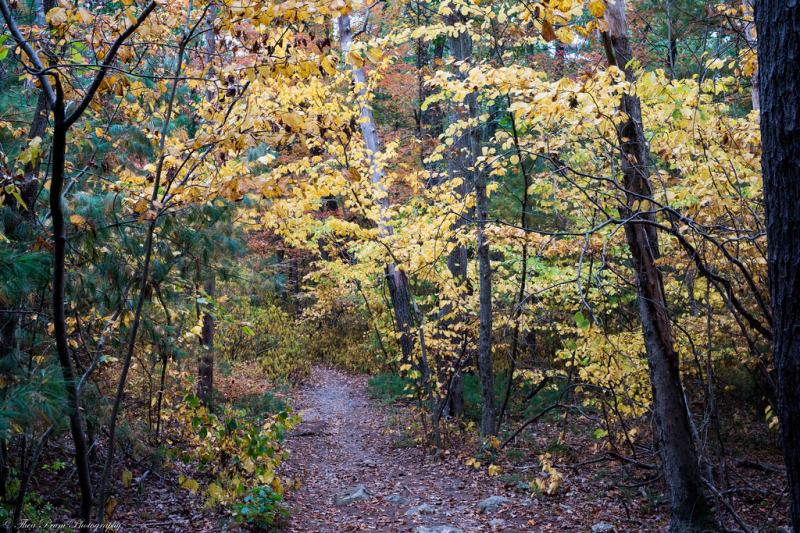
flickr.com -
Everyone all knows that Mount Misery is a popular winter destination for skiers, thanks to those catchy commercials—but the tallest mountain near Boston also offers hiking throughout the rest of the year. On clear days, the view extends to Mt. Monadnock in New Hampshire, the Berkshires in western Massachusetts, and the Boston skyline.
The 17 miles of hiking and walking trails in the 3,000-acre Wachusett Mountain State Reservation allow you to explore the forests, mountain meadows, ponds, streams, fields, and raised bog that are all protected around the summit. The Midstate Trail, which spans the state from the Rhode Island border to the New Hampshire border, includes 3.9 miles within the reservation.
The park's interior contains the largest patch of old growth forest in eastern Massachusetts, which contains trees that are over 350 years old. The force of moving glaciers at the end of the Ice Age is demonstrated by Balance Rock, where two sizable boulders are stacked one on top of the other.
Address: Lincoln Conservation, MA

commons.wikimedia.org 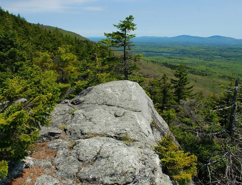
orbitz.com -
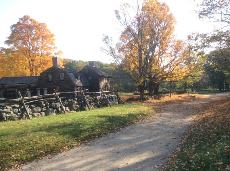
The picturesque level path that passes through forests and riverside wetlands seems to be in a completely different historical setting than Paul Revere's famous ride and the opening salvos of the American Revolution. The trail follows the Minutemen's path as they moved from their initial skirmish with the British troops on Lexington Green to the battle at Concord Bridge, including portions of the Battle Road where they harassed the British troops by firing from behind stone walls.
Here, the British were repelled by a small group of poorly armed farmers, and they fled back to Boston without seizing the Colonists' Concord-based arsenal of weapons and ammunition as they had planned. You should make stops along the five-mile route to read the historical markers, check out the exhibits and multimedia presentation in the visitors center, take a few side paths, go to Hartwell Tavern, and explore Concord Bridge.
Although the visitor center is only open from April through October, the trail is accessible all year. Staying at the Hawthorne Inn, a gracious 1860s house close to Concord's Historic Center, the Old North Bridge, and the homes of Louisa May Alcott, Nathaniel Hawthorne, and other illustrious Concord authors, will allow you to fully immerse yourself in Concord's history.
Address: 250 North Great Road, Lincoln, Massachusetts
onlyinyourstate.com 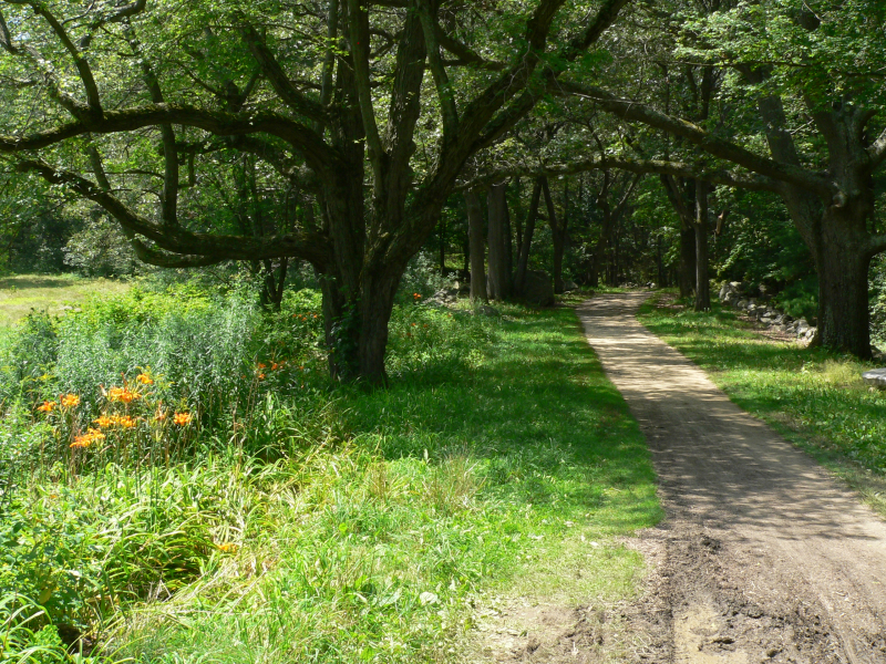
wikimedia.org -
A lengthy green space connecting Boston's downtown to the suburbs was Frederick Law Olmsted's vision more than a century ago. His creation, the Emerald Necklace, which connects more than 1,000 acres in six different parks from Franklin Park to the Boston Common, has endured unaltered.
You can take public transportation or walk the entire seven miles, or any portion of it (nearby stops are marked on the excellent Emerald Necklace map). The route passes the Boston Swan Boats, two significant art museums, the historic Fenway Victory Gardens, a beautiful rose garden, three ponds, a wildflower meadow, the Arnold Arboretum, and a zoo on the way to Dorchester.
The Boston Common and Public Garden mark the start of the Emerald Necklace, which continues along Commonwealth Avenue's center park bordered on either side by elegant brownstone and brick townhouses that served as residences for the "Boston Brahmins."
A 2.5-mile round-trip can be covered by walking the distance between Charles Street and Commonwealth Avenue, through the Public Garden, and the length of Commonwealth Avenue; an additional 1.6 miles can be added by strolling through the rose garden and community gardens in Fenway. While the main trail follows Jamaica Pond's south side, where there is a picturesque overlook, a well-traveled side trail on the Emerald Necklace circles the pond.
Address: Shattuck Visitor Center, 125 The Fenway, Boston, Massachusetts
theculturetrip.com 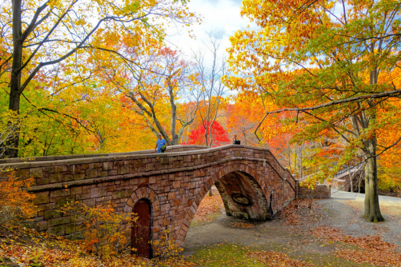
bluebikes.com -
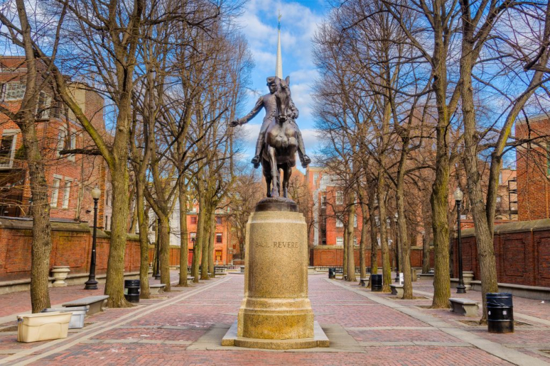
The Freedom Trail, one of the nation's most popular city strolls, includes the locations of many of the crucial pre-American Revolutionary War events. The visitor center in Boston Common serves as the starting point for the three-mile tour, which visits 16 historic monuments and sites and is denoted by a line of red bricks in the sidewalk. Among them are the scene of the infamous Boston Massacre and Old South Meeting House, where the Boston Tea Party was inspired by the patriots' speeches.
The trail starts at Boston Common, where you can see the monument honoring one of the pivotal early battles of the Revolutionary War. The trail passes Faneuil Hall and the Paul Revere House in Boston's North End on its way to the Old Granary Burying Ground, where Paul Revere, Samuel Adams, and John Hancock are interred. Old North Church, where the lanterns used to announce his illustrious ride were hung, is not far away.
It was such an inspiring visit because it’s where you can appreciate those brave men and women who fought for America. You can actually download a free audio tour that you can play on your phone as you walk along the trail. But if you don’t want to do this, there are also many historical signs along the way where you can stop and read about the history of the landmarks.
Address: Boston, Massachusetts
activities.marriott.com 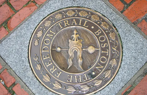
minube.co.uk -
The Charles River, which flows in a broad band between Boston and Cambridge, is shared by both cities. Due to the evenly spaced bridges, there is a green strip on each side with walking and cycling paths that are excellent loops. 20 miles upriver from Boston Harbor, there is a linear park called the Charles River Reservation. It includes the expansive Esplanade on the Boston shore, and on the Cambridge side, it runs past the beautiful campuses of Harvard and MIT. The MIT shore offers the best view of the Boston skyline, with the river and sailboat-dotted foreground.
The trails along the river are joined, split apart, and intersected by numerous neighborhood trail networks. The Charles River Link is a 16-mile trail that connects parks in Newton, Wellesley, Needham, Natick, Dover, and Medfield along one of the most beautiful stretches of the river.
It is a part of the Wellesley Trails network, which follows the Charles River past Longfellow Pond through the Town Forest. The riverside paths near Boston are heavily used by runners, rollerbladers, and cyclists; as a result, walkers must be cautious and keep to the side to avoid bothersome encounters.
Head for the suburban riverside paths if you want to see more nature and less traffic. The Royal Sonesta Boston overlooks the Charles River in Cambridge and is close to the Museum of Science. From there, you have immediate access to the riverside path. Guests are welcome to use the hotel's free bicycles to travel along the river.
Address: 1175A Soldiers Field Rd, Boston, MA 02116
flickr.com 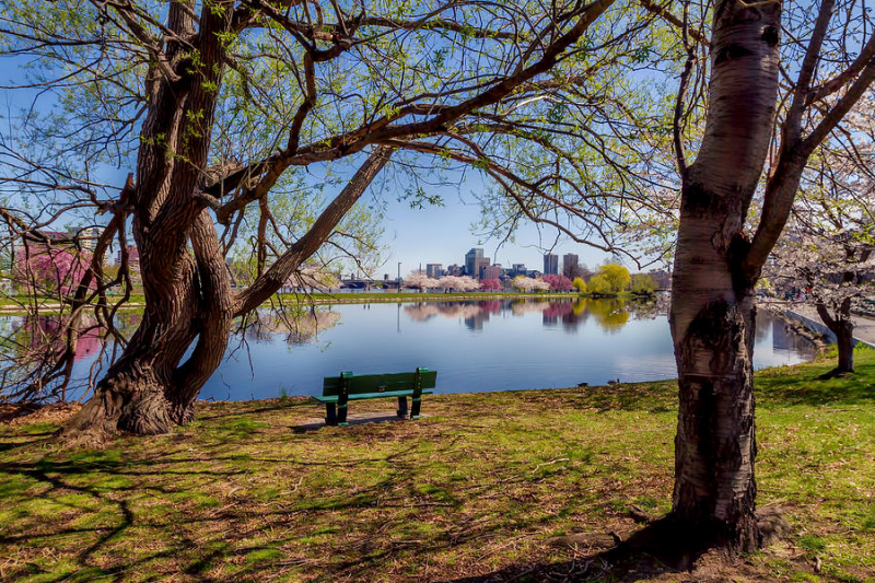
pixels.com -
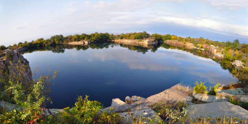
Starting just past The Emerson Inn, a stunning old hotel overlooking the sea on Cathedral Avenue in Rockport, a scenic two-mile walk along the shore, over rock ledges that slope to the sea, and continues to Halibut Point State Park. Here, you'll find 2.5 miles of trails that wind around a granite quarry that springs have filled with water and along an even more rocky shore. It is one of the nicest hiking spots near Boston you shouldn't miss.
The operation of the quarry and the fascinating history of this location are both explained on an interpretive trail. Boston's Custom House Tower was constructed using local granite that was quarried and cut for paving stones. The visitor center and museum offer more information about the natural history and granite quarrying of Halibut Point and Cape Ann.
This beautiful hike will take you along through the woods to a deep, water-filled quarry, then you’ll loop over to the shoreline where you can relax to the metronome of the crashing waves. The views along the coast reach across Ipswich Bay as far as New Hampshire and Maine. Birders will like this park, with its rocky coast covered in bayberry and shad, good habitats for small birds. The Atlantic Path continues from the far side of the park.
Address: Gott Ave, Rockport, MA 01966
marleenvandenneste.com 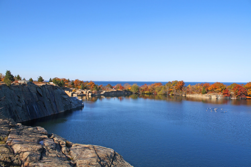
flickr.com