Top 10 Highest Mountains in El Salvador

El Salvador is a Central American country on the western coast of the continent. El Salvador has a lengthy history of earthquakes and volcanic eruptions that ... read more...have caused widespread devastation. In today's article, Toplist will tell you about the 10 highest mountains in El Salvador.
-
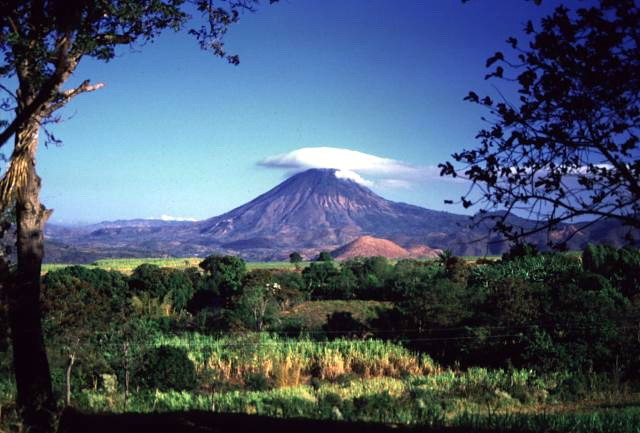
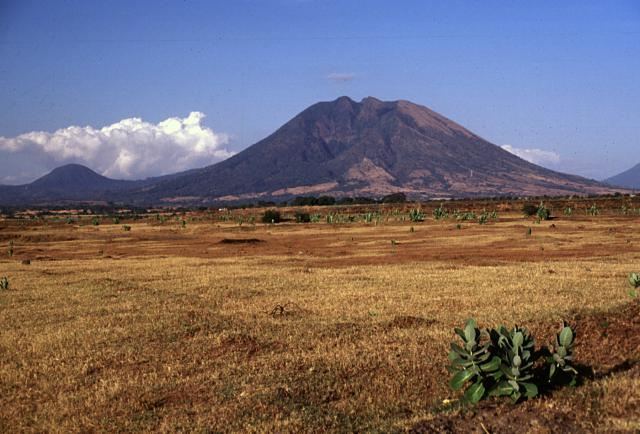
The first one in Top 10 Highest Mountains in El Salvador that Toplist would like to introduce to you is Santa Ana Volcano. The Santa Ana Volcano, also known as Ilamatepec (Spanish: volcán de Santa Ana), is a huge stratovolcano in El Salvador's Santa Ana province. It is the country's highest volcano, rising 2,381 meters (7,812 feet) above sea level. It is situated to the west of the Coatepeque Caldera.
The volcano served as inspiration for one of the active volcanoes in Antoine de Saint-famous Exupéry's French book (The Little Prince), which was based on his life with his Salvadoran wife Consuelo de Saint-Exupéry, who played the role of The Rose in the story.
Santa Ana's summit has four nested calderas and volcanic craters, the innermost of which contains a small crater lake. The collapse of the peak during the late Pleistocene (the highest age limit is estimated to be no more than 57,000 years ago based on underlying soil samples) resulted in a major debris avalanche that reached the Pacific Ocean, establishing the Acajutla Peninsula. The edifice has been largely reconstructed by subsequent eruptions.
Since the 16th century, there have been numerous historical eruptions, both at the summit and from cinder cones on the lower flanks, as well as the flank vents of San Marcelino east of Santa Ana. In 1722, the San Marcelino vents erupted and flowed for 11 kilometers eastward, demolishing the town of San Juan Tecpan.
The volcano erupted in October 2005, killing at least two people and injuring seven more, forcing many others to abandon their homes. The volcano spewed rocks the size of vehicles for almost 1.5 kilometers (0.93 miles). Hurricane Stan caused further damage as a result of the eruption. The last prior eruption occurred in 1904.
Location: in the Santa Ana department of El Salvador
Elevation: 2,381 m (7,812 ft)
volcanohotspot.wordpress.com 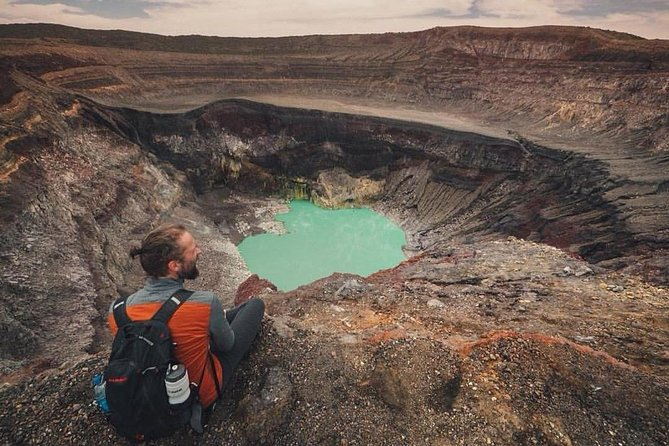
viator.com -
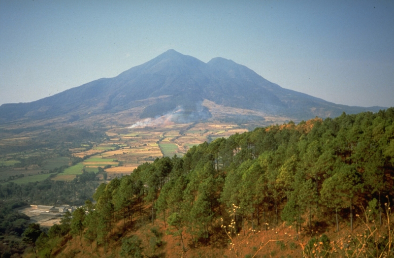
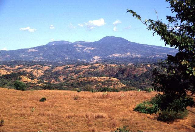
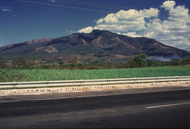
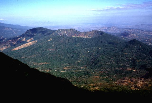
The second one in Top 10 Highest Mountains in El Salvador that Toplist would like to introduce to you is San Vicente. San Vicente is a stratovolcano in central El Salvador that is also known as Chichontepec or Las Chiches. It is the second highest volcano in El Salvador and is located near the town of San Vicente (thus the name). Chichontepec means "mountain of the two breasts'' in the Nahuat language, because its twin top resembles a woman's bosom. There are two craters on the volcano, one on each summit, though not exactly at the top. Both summits are covered in dense forest. On the volcano's northern and western flanks, there are several hot springs and fumaroles. Fumaroles—fountains of clear and murky water or miniature mud volcanoes—can be found to the northeast at 820 meters in a ravine of 180 meters longitude.
More than 1,700 years have passed since the last major eruption. The volcano may have a lengthy history of eruptions, some of which were destructive, and at least once a substantial chunk of the volcano collapsed in a catastrophic landslide.
Aviateca Flight 901 crashed into the volcano on August 9, 1995, killing all 65 people on board.
Location: in central El Salvador
Elevation: 2,182 m (7,159 ft)
volcano.si.edu 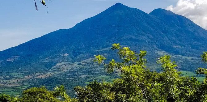
elsalvadorinfo.net -
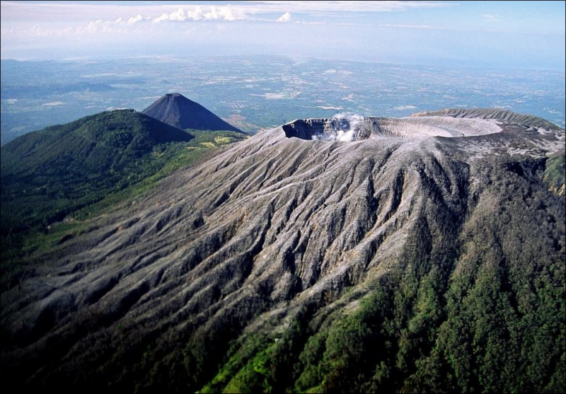
The third one in Top 10 Highest Mountains in El Salvador that Toplist would like to introduce to you is San Miguel. San Miguel or Volcán de San Miguel (also known as Volcán Chaparrastique) is a stratovolcano located in central-eastern El Salvador, 15 kilometers (9.3 miles) southwest of San Miguel. Volcán de San Miguel's coordinates are 13°25′54′′N 88°16′17′′W. A brief eruption of steam, gas, and ash from the summit crater occurred on January 16, 2002, lasting 3 hours but inflicting no major damage to life or property. Carbon dioxide emissions had been tracked since November 2001, and they had been steadily increasing until the eruption.
On December 29, 2013, at 10:30 a.m. local time, Volcán de San Miguel erupted, spewing ash and smoke into the sky and forcing the evacuation of thousands of people living within a 3 km (1.9 mi) radius of the volcano. This volcanic eroption began at 06:30 local time and it was preceded and triggered by heightened seismic activity.
Location: San Miguel Department, El Salvador
Elevation: 2,130 m (6,990 ft)
en.wikipedia.org 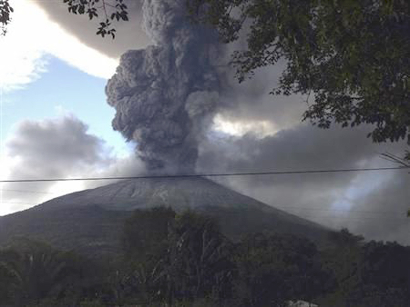
volcano.si.edu -
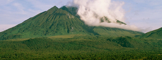
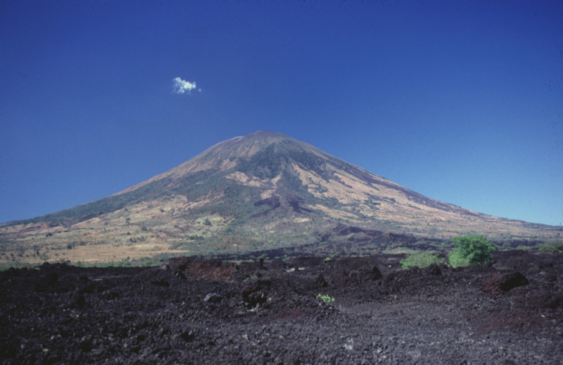
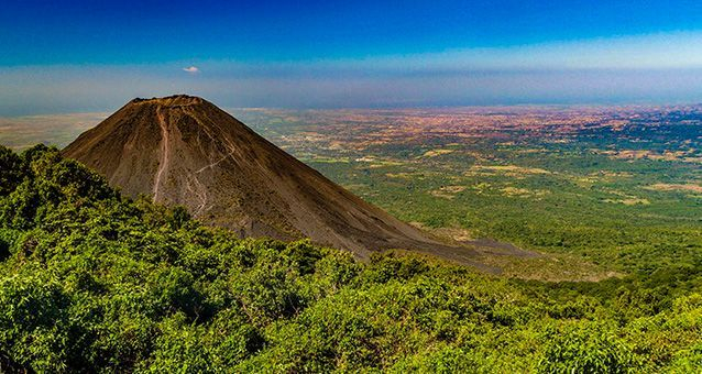
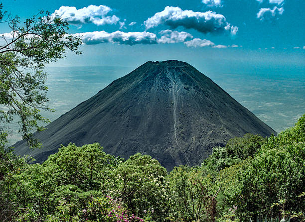
The fourth one in Top 10 Highest Mountains in El Salvador that Toplist would like to introduce to you is Izalco. In western El Salvador, Izalco is an active stratovolcano on the slope of the Santa Ana Volcano. It is located on the Santa Ana volcano's southern flank. From 1770 (when it first erupted) through 1958, Izalco erupted practically continuously, earning it the nickname "Lighthouse of the Pacific." It also had a flank eruption in 1966. The settlement of Matazano was buried and 56 people were killed during an eruption in 1926. The volcano erupted on fertile ground that had been used to grow coffee, chocolate, and sugar cane.
Izalco's lava has traditionally consisted of vesicular vitrophyric olivine basalts. Izalco was formed in 1658, before Izalco was born in 1770, as a result of fumorolic activity. Rather than steam emissions from subterranean gases, Izalco now has fumarolic activity in the form of precipitation seeping into the volcano and touching heated rocks. Several unusual minerals have been discovered in the volcano's fumarole deposits. Bannermanite, blossite, fingerite, howardevansite, lyonsite, mcbirneyite, stoiberite, and ziesite are all type localities for copper vanadium minerals.
The volcano is a national icon of El Salvador, and is featured on the 10 colón bank note. It is regularly visited and climbed by tourists to El Salvador via the Cerro Verde National Park (US dollars replaced the colon in 2001, so the bank note is no longer in circulation). The volcano is currently dormant, but it could erupt again at any time.
A hotel was erected atop adjacent Cerro Verde to provide lodging with a view of the erupting volcano, however the volcano stopped erupting shortly after the hotel was finished.
Location: in western El Salvador
Elevation: 1,950 m (6,400 ft)
ecotourspetate.com 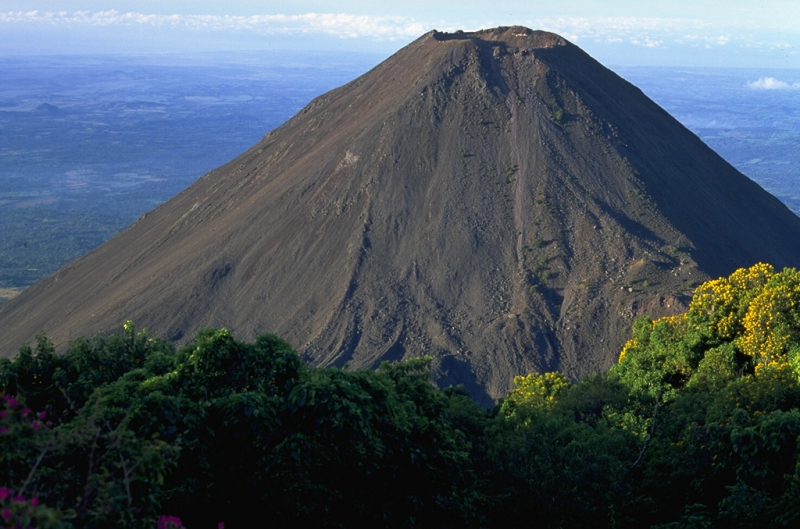
volcano.si.edu -
The fifth one in Top 10 Highest Mountains in El Salvador that Toplist would like to introduce to you is San Salvador. The San Salvador Volcano (also known as Quezaltepeque or El Boquerón) is a stratovolcano located northwest of San Salvador's city limits. The Boquerón volcano, a comparatively recent construction, has nearly filled the crater. San Salvador is located next to the volcano, and the city's western half is built on its slopes. Because of the city's proximity to the volcano, any geological activity, whether eruptive or not, has the potential to cause catastrophic destruction and death. Despite this, the volcano is a symbol of the city, with multiple television and radio towers atop the El Picacho peaks and the Boqueron crater. The towering mountain, El Picacho, is the highest point in the area (1,960 meters altitude).
The main edifice, known as the Boquerón edifice, was built to fill a former caldera between 700 and 1,000 years ago. The caldera rim is visible on the northeast side of the volcano as a crescent-shaped ridge. The Boquerón edifice's lavas contain more alkali elements and iron oxide than the earlier edifice's lavas. The present-day crater was created by a massive explosion around 800 years ago. The crater, which is 1.5 km in diameter and 500 meters deep, lends it its current name (Boquerón means "large mouth" in Spanish). Crops are grown by the residents who live on the volcano within the crater's higher walls.
The magma chamber on which the volcano sits has a number of fissures that protrude along the volcano's flanks and sides. The northwest (N40W) fissure has recently been the most active, with major eruptions such as the Loma Caldera eruption, which destroyed the ancient community of Ceren, and the El Playon eruption (1658–71), which buried the town of Nexapa. The residents moved to Nejapa, and the eruption is now commemorated every year.
The volcano's most recent eruption, in 1917, resulted in a flank eruption along the N40W fissure. During this eruption, the crater lake inside the Boquerón vanished, leaving only a cinder cone known as 'Boqueróncito.'
Location: northwest to the city of San Salvador, El Salvador
Elevation: 1,893 m (6,211 ft)
istockphoto.com 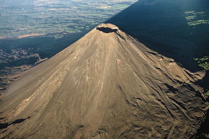
viator.com -
Volcán Chingo is a stratovolcano on the Guatemala-El Salvador border. Volcán Chingo, at 5,823 feet, is the highest peak on the Guatemala/El Salvador border. It is also the second tallest volcano among a group of volcanoes in Guatemala's southeast region. Within 30 kilometers of Volcán Chingo, the population is estimated to be roughly 867,678 people. This volcano has no recorded historical eruptions, however it is currently active. When looking for it on the Smithsonian website, the precise volcano number is 342170.
This symmetrical stratovolcano has a number of characteristics that distinguish it as the highest point on the Guatemala-El Salvador boundary. On the summit, there is a small, oval-shaped crater that has been breached towards the volcano's west side. Many young lava flows may be observed west and north of the volcano, fed by various flank fissures. Cerro Laguneta, a light brown hill located below the volcano on the right center side, is named after it.
Andesite/ Basaltic Andesite and Basalt/ Picro-Basalt are two rock types that can be encountered.
On the south flank of the volcano, across the Salvadorian border, is Cerro la Olla, a young cone. Volcan las Viboras, a cinder cone that crowns the basalt shield to the north, is the most notable of numerous controlled cones in the area.
Location: on the border between Guatemala and El Salvador
Elevation: 1,775 m (5,823 ft)
en.wikipedia.org 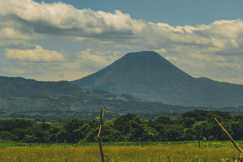
pixels.com -
El Salvador's Tecapa volcano is located in the town of Alegra, in the department of Usulutan. It is part of the Sierra Tecapa-Chinameca and has a height of 1,593 meters above sea level.
Laguna de Alegria is a crater lake surrounded by hot springs and fumaroles. The poet Gabriela Mistral baptized this spot as the "Emerald of America," and it is now a tourist magnet. In addition, the ausoles or fumaroles known as "El Bufadero," "Tronador," "Tronadorcito," "Loma China," and "El Pinar'' are located on the volcano's northern slopes.
President Po Romero Bosque inaugurated the road that connects the city of Alegra to the Alegra lagoon on December 29, 1928, at 10 a.m. On the banks of the lagoon, residents and local authorities of Alegra created an artistic bower in which many residents from the east gathered to accompany the president and his entourage to express gratitude to the government, the board in charge of the works, and the local authorities for the new road's construction.
Location: Usulután Department, El Salvador
Elevation: 1,593 m (5,226 ft)
en.wikipedia.org 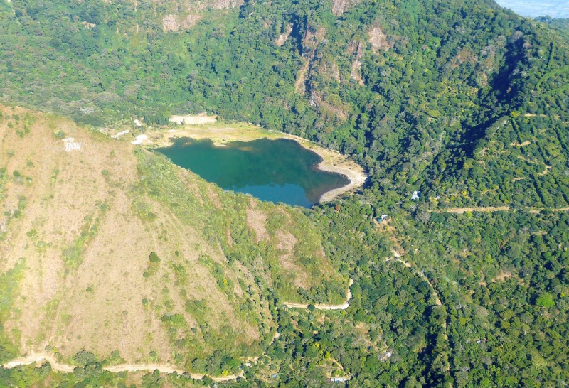
Lake of Joy in the crater of Tecapa Volcano, El Salvador (Photo: flickr.com) -
Usulután is a stratovolcano in central El Salvador that rises above the coastal plain between two volcanoes: the San Vicente- a stratovolcano in central El Salvador is the second highest volcano in El Salvador, is located next to the town of San Vicente and has two craters, one on each summit, though not exactly at the top, both summits are densely forested; and San Miguel volcano- a stratovolcano in central-eastern El Salvador, about 15 kilometers (9.3 miles) southwest of San Miguel. Usulután is slightly east of Taburete. The volcano's summit crater is 1.3 kilometers (0.8 miles) broad and is breached to the east. The coordinates of the mountain are 13.419°N 88.471°W
The Usulután volcano lies in El Salvador's Usulután department, near the Sierra Tecapa-Chinameca. It is part of the coastal plain that includes the same-named city. It is made up of two summits and is made up of a rock formation.
Location: Usulután Department, El Salvador
Elevation: 1,449 m (4,754 ft)
en.wikipedia.org 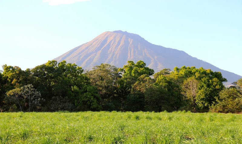
flickr.com -
Guazapa is a stratovolcano in El Salvador's central region. Guazapa volcano is a degraded basaltic stratovolcano located 23 kilometers northeast of San Salvador. The coordinates of the mountain are 13°54′N 89°07′W. It's unclear if the Pleistocene volcano is still active. It has extensive valleys cut into its flanks from strong erosion, indicating a very extended hibernation period, and no crater form remains.
Guazapa was one of the primary strongholds of the FMLN guerillas during the 1980s civil conflict. The Salvadoran Civil War was a twelve-year civil war in El Salvador fought between the Salvadoran government and the Farabundo Mart National Liberation Front (FMLN), a coalition or "umbrella organization" of left-wing groups. The war did not officially end until the signing of the Chapultepec Peace Accords in Mexico City on January 16, 1992. Today, there are secret cemeteries, bomb shelters, guerilla camps, and temporary hospitals in the Guazapa mountains.
Location: in central El Salvador
Elevation: 1,438 m (4,718 ft)
en.wikipedia.org 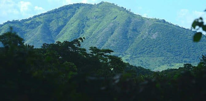
elsalvadorinfo.net -
El Pacayal or Cerro El Pacayal (sometimes spelled Chinameca) is a stratovolcano in El Salvador's central-eastern region. Cerro El Pacayal rises over the village of Chinameca to the north of the San Miguel volcano. The coordinates of the mountain are 13°28′41″N 88°19′48″W. The volcano is crowned by Laguna Seca el Pacayal, a 2 km (1.2 mi) broad caldera, and Cerro el Limbo, a satellite cone on the west side that rises higher than the caldera lip. On the north side, there is Fumaroles, which has been the subject of a geothermal exploration operation.
The earthquakes of El Salvador 1951 are linked to the volcano's activity: on May 6 and 7, 1951, three large shallow earthquakes with magnitudes of 5.9, 5.5, and 6.2 struck near the city of Jucuapa, at the volcano's base northwest. The earthquakes killed 400-1000 people and displaced 25,000 people.
Location: San Miguel Department, El Salvador
Elevation: 1,300 m (4,300 ft)
en.wikipedia.org 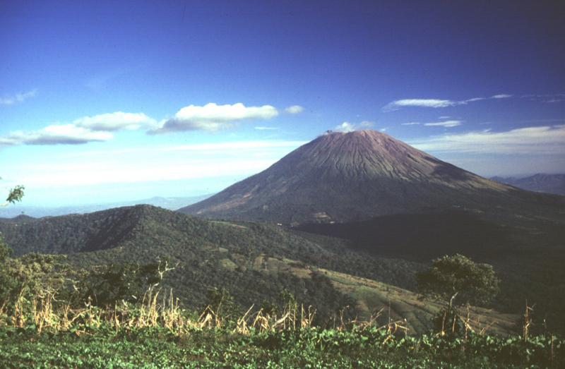
volcano.si.edu