Top 9 Highest Mountains in New Zealand

The home of legendary explorers and a source of inspiration for countless artists, poets, and storytellers, New Zealand's vast peaks and snow-capped pinnacles ... read more...define an extreme landscape. The New Zealand mountains, which rise sharply from the earth and sea, run like a majestic backbone down the country, their rugged beauty never failing to impress. Toplist has compiled the highest mountains in New Zealand.
-
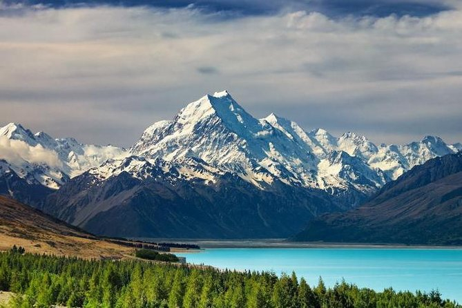
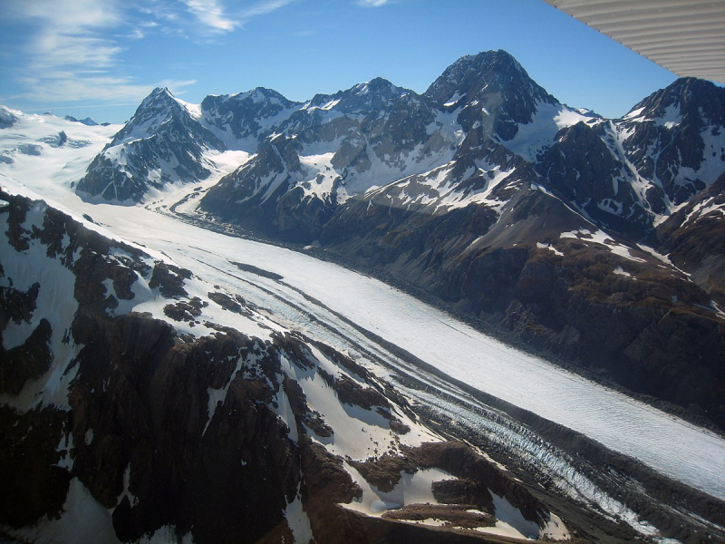
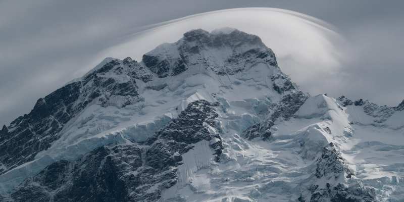
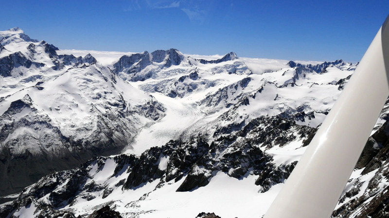
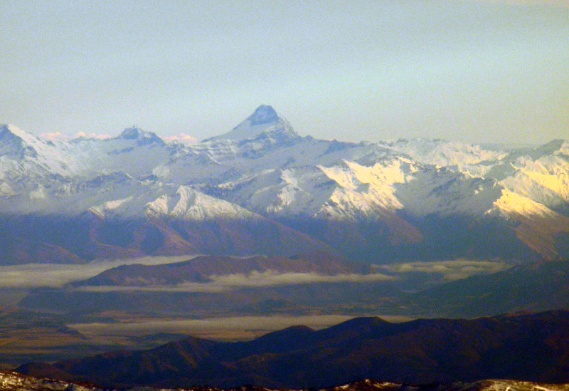
The first one in Top 9 Highest Mountains in New Zealand that Toplist would like to introduce to you is Aoraki. The tallest mountain in New Zealand, Aoraki/Mount Cook, is known as the 'cloud-piercer,' and when its snowy heights are revealed behind the white mist, you'll understand why. Aoraki was formed when the Pacific and Indo-Australian tectonic plates collided, and it is part of the Southern Alps mountain chain. It is located at the center of the 650km long active Alpine Fault. Even today, the mountain is still growing, rising an average of 7mm (0.28in) per year.
Aoraki is the most sacred of peaks to the Ngi Tahu people, connecting the natural and supernatural worlds. According to Māori legend, Aoraki was the son of Rakinui, the Sky Father. During a voyage, Aoraki's canoe became stranded on a reef and tilted up. Aoraki and his three brothers climbed to the top of the canoe, where the south wind froze them, turning them to stone and forming the Southern Alps.
Aoraki/Mount Cook and the surrounding area are widely regarded as the best mountaineering in Australasia, having served as a training ground for none other than Sir Edmund Hillary, who went on to summit Mount Everest in 1953. Fortunately, there is also plenty for non-mountaineers to enjoy. Beautiful lower-level hikes take walkers through stunning alpine scenery, with views normally reserved for serious mountaineers only. Glaciers, lakes with icebergs, herb fields, and cheeky local wildlife such as the Kea (the world's only alpine parrot!) ensure that visitors are not disappointed.
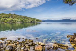
Location: South Island, New Zealand
Height: 3,724 m (12,218 ft)
viator.com 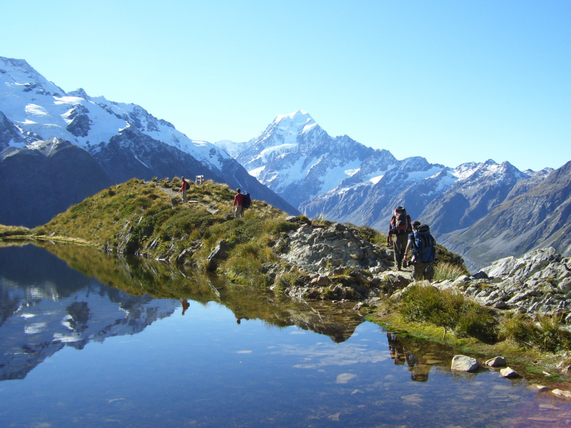
commons.wikimedia.org -
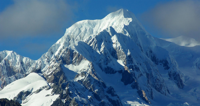
The second one in Top 9 Highest Mountains in New Zealand that Toplist would like to introduce to you is Mount Tasman. Mount Tasman is New Zealand's second tallest mountain, after Aoraki/Mount Cook, and is crowned with a glittering snowy crown. Many consider it to be New Zealand's most beautiful peak, and it is a popular but extremely difficult climb for mountaineers.
Horokoau is a Māori word that refers to the swelling in the neck of a shag bird after swallowing a fish. It's also known by another Māori name, Rarakiroa, the brother of Aoraki/Mount Cook, who stood atop their upturned waka (canoe) of the South Island, turned to stone by the icy winds and forming the mountainous landscape we see today.
Mount Tasman is located in the Aoraki/Mount Cook National Park, four kilometers north of its taller sibling. The Southern Alps contain all of New Zealand's peaks higher than 3000 meters, making it one of the world's most impressive mountainous landscapes.
The towering peak of Mount Tasman is covered in snow and ice, posing a challenge to even the most technically experienced climber. On a clear day, incredible views can be had from the West Coast of New Zealand's South Island for those who are understandably unwilling to summit.
Location: South Island, New Zealand
Height: 3,497 m (11,473 ft)
en.wikipedia.org 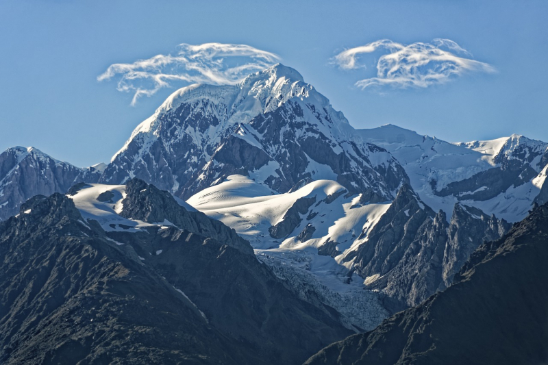
pixabay.com -
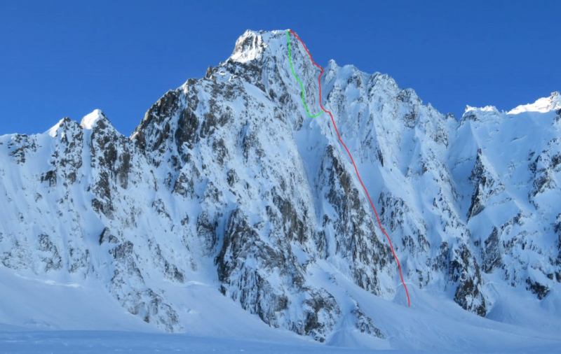
The third one in Top 9 Highest Mountains in New Zealand that Toplist would like to introduce to you is Malte Brun. Malte Brun is the highest peak in the Malte Brun Range, which is located in New Zealand's Southern Alps between the Tasman and Murchison Glaciers. It rises to a height of 3,199 metres (10,495 feet), according to Land Information New Zealand,, though other sources give heights ranging from 3155 to 3199 m. According to the New Zealand Alpine Club, Malte Brun is the third highest mountain in New Zealand.
Julius von Haast named it after the French geographer Victor Adolphe Malte-Brun. Tom Fyfe (solo climb) was the first to reach the summit of Malte Brun via the North Face in March 1894. On the mountain today, there are numerous climbing routes, all of which necessitate technical experience and equipment. The West Ridge, which includes the "Cheval," a knife-edge ridge traversed by straddling, is the classic route. The following are some of the major climbing routes on Malte Brun:
- West Ridge
- South Ridge
- South Face
The Beetham Hut in the Beetham Valley and the Malte Brun Hut on moraine terraces above the Tasman Glacier used to serve climbers on the lower slopes. Avalanche destroyed the Beetham hut in the early 1990s.
Location: South Island, New Zealand
Height: 3,199 m (10,495 ft)
en.wikipedia.org 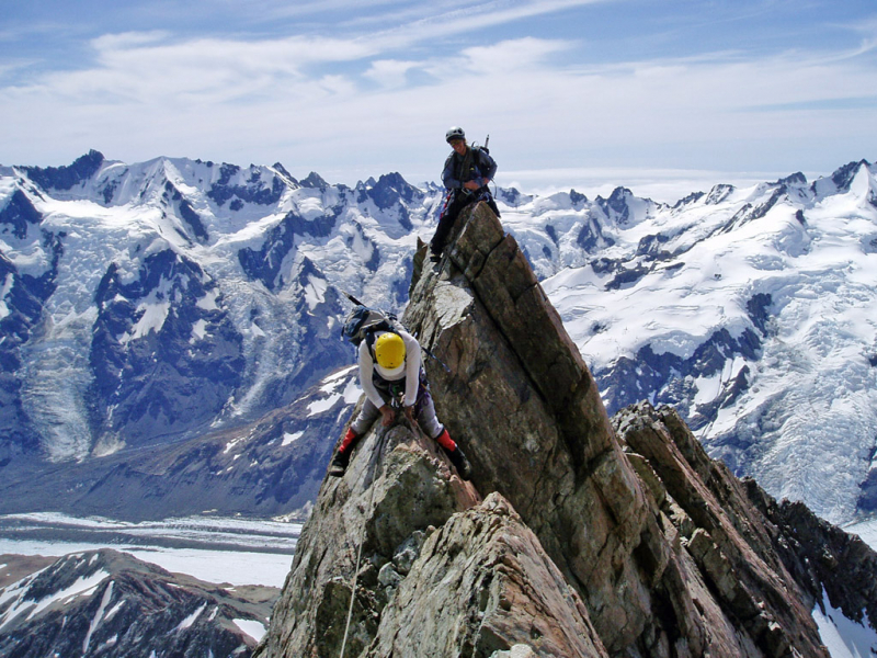
alpineguides.rezdy.com -
The fourth one in Top 9 Highest Mountains in New Zealand that Toplist would like to introduce to you is Mount Sefton. Mount Sefton is a mountain in the Aroarokaehe Range of New Zealand's Southern Alps, about 12 kilometers (7.5 miles) south of Aoraki / Mount Cook. Mount Brunner is to the south, and The Footstool is to the north, both of which are more than 400 metres (1,300 ft) shorter.
The mountain can be seen from Mount Cook Village in the Hooker Valley, with Tuckett Glacier flowing down the mountain's south-eastern side and Mueller Glacier in the valley below it. Mount Sefton, at 3,151 metres (10,338 feet), is the 13th-highest peak in the Southern Alps and the 4th-highest mountain in New Zealand when peaks of little prominence that are closer than a kilometer to a higher peak are excluded.
Mount Sefton is where the Douglas River (formerly known as the Twain River) begins.
Charles French Pemberton, an early resident, named the area, while geologist Julius von Haast named the mountain after William Sefton Moorhouse, the second Superintendent of Canterbury Province. The mountain's Māori name is Maukatua, which translates as "mountain of the gods."
Shortly after Christmas 1894, Edward FitzGerald, accompanied by Matthias Zurbriggen, made the first recorded ascent to the summit.
Location: South Island, New Zealand
Height: 3,151 m (10,338 ft)
alchetron.com 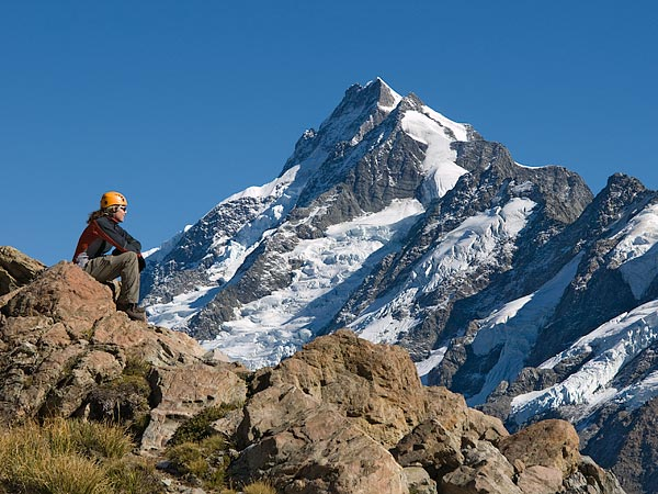
alpinerecreation.com -
The fifth one in Top 9 Highest Mountains in New Zealand that Toplist would like to introduce to you is Mount Elie de Beaumont. Mount Elie de Beaumont is a 3,109-metre (10,200-foot) high mountain in New Zealand's Southern Alps on the South Island, and the country's northernmost Three-thousander. It is surrounded by glaciers such as Johannes Glacier in the north, Burton Glacier in the east, Times Glacier in the west, and Anna Glacier, a tributary of the Tasman Glacier in the south.
Head up the glacier (which can be cut off by crevasses later in the season), usually staying close to Mt Walter. Then climb the slopes to the col between Mts Walter and Elie de Beaumont. Up to the summit, follow an easy snow ridge (but watch out for hard ice just above the col). This is the typical descent path. In good snow conditions, routes can be pushed directly up the Anna Glacier to the summit. If the Anna Glacier is badly crevassed and the col between Mts Walter and Elie de Beaumont is closed, traverse from Divers Col to Elie de Beaumont via Mt Walter.
Location: South Island, New Zealand
Height: 3,109 m (10,200 ft)
en.wikipedia.org 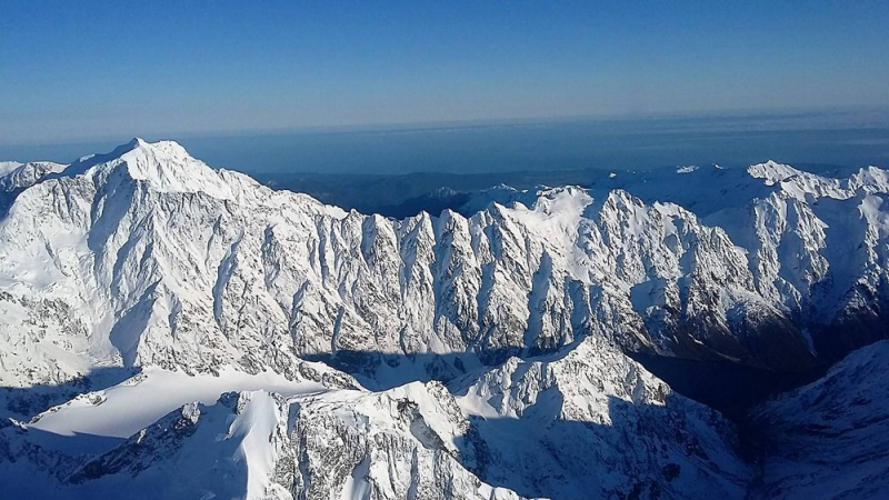
westcoast.recollect.co.nz -
La Perouse, formerly known as Mount Stokes, is a mountain in New Zealand's Southern Alps that rises to a height of 3,078 meters (10,098 ft).
La Perouse is located in the South Island's Southern Alps, four kilometers southwest of Aoraki / Mount Cook. La Perouse, unlike Aoraki/Mount Cook, is located on the South Island's Main Divide, on the border between Aoraki/Mount Cook National Park and Westland Tai Poutini National Park. The La Perouse Glacier on the northern side feeds the Cook River, which flows into the Tasman Sea.
Mount Stokes was named after John Lort Stokes, who was assistant surveyor on HMS Beagle's second voyage (1831–1836) and captain of the survey ship HMS Acheron (1848–1851). Because Mount Stokes had previously been named in Nelson, the mountain was renamed La Perouse in honor of the French explorer Jean-François de Galaup, comte de Lapérouse (also spelled comte de La Pérouse), whose expedition perished on Vanikoro in the Solomon Islands' Santa Cruz Islands in 1788.
Location: South Island, New Zealand
Height: 3,078 m (10,098 ft)
en.wikipedia.org 
en.wikipedia.org -
Douglas Peak is a 3,077-metre (10,095-foot) mountain in New Zealand's Southern Alps on the South Island. It is a few kilometers northeast of Mount Tasman, the country's second highest peak at 3,497 meters (11,473 feet). The mountain is located between Mount Haidinger in the south and Glacier Peak in the northeast. To the west are Fox Glacier tributaries, and to the east are Tasman Glacier tributaries.
The peak of the mountain forms part of the border between the West Coast- a New Zealand region on the west coast of the South Island administered by the West Coast Regional Council and known colloquially as Te Tai Poutini; and Canterbury regions- a New Zealand region in the central-eastern South Island that covers 44,503.88 square kilometers (17,183.04 square miles) and has a population of 649,800 people (June 2021).
Location: South Island, New Zealand
Height: 3,077 m (10,095 ft)
cameronbowker.com 
Photo: Vincent Zintzen's Youtube Channel -
The Minarets are two Southern Alps peaks located in Westland Tai Poutini National Park on New Zealand's South Island, approximately 180 meters (590 feet) apart. Westland Tai Poutini National Park is located on New Zealand's South Island's western coast. It was established in 1960, on the centennial of the European settlement of Westland District, and it covers 1,320 square kilometers (330,000 acres), extending from the highest peaks of the Southern Alps to a wild and remote coastline. Along the Main Divide, it borders the Aoraki/Mount Cook National Park.
Its southeastern and northwestern peaks are 3,040 meters (9,970 feet) and 3,031 meters (9,944 feet), respectively. They are the northernmost three-thousand-metre peaks in the country, following Mount Elie de Beaumont, and are only a few kilometers from New Zealand's highest mountains. The majority of the country's other three-thousand-metre peaks are in the immediate vicinity.
Tom Fyfe and Malcolm Ross made the first ascent in 1895.
Location: South Island, New Zealand
Height: 3,040 m (9,970 ft)
Photo: Minaret Station, New Zealand's Youtube Channel 
peakery.com -
Mount Aspiring / Tititea is the 23rd highest mountain in New Zealand. Outside of the Aoraki/Mount Cook region, it is the highest point in the country.
It is located in Otago's Mount Aspiring National Park and has a height of 3,033 meters (9,951 ft). Māori named it Tititea, which means "Glistening Peak" in Greek. The Chief Surveyor for the Otago Province, John Turnbull Thomson, named it Aspiring in December 1857. It is also known as the "Matterhorn of the South" because of its pyramidal peak as seen from the Matukituki River. Major Bernard Head and guides Jack Clarke and Alec Graham made the first ascent on November 23, 1909. Head's party used the west face from the Bonar Glacier to reach the summit ridge, a route that was not used again until 1965.
Mount Aspiring / Tititea is located 30 kilometers west of Lake Wānaka, slightly west of the main divide. It is located at the confluence of three major glacial systems: the Bonar Glacier, which flows into the Waipara River, and the Volta and Therma Glaciers, which both flow into the Waiatoto River. The Waipara River is a tributary of the Arawhata River, and both rivers flow out to the west coast between Haast and Jackson Bay.
Location: South Island, New Zealand
Height: 3,033 m (9,951 ft)
en.wikipedia.org 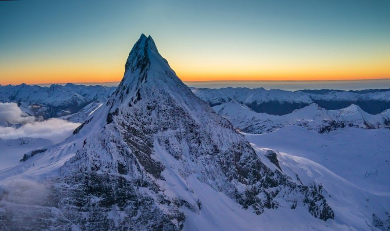
pinterest.ch