Top 4 Highest Mountains in Saint Lucia

Saint Lucia is a West Indian island republic located in the eastern Caribbean Sea, close to the Atlantic Ocean. An area with many dormant volcanoes, it has ... read more...created high mountains, making it a great climbing site for climbers. Let's find out with Toplist some high mountains in Saint Lucia.
-
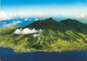
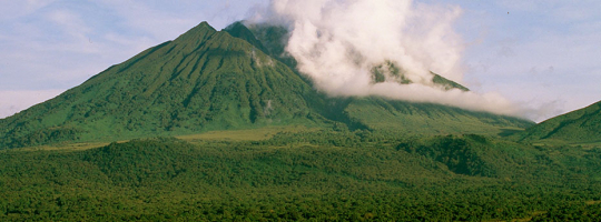
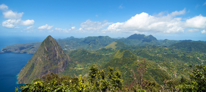
Mount Gimie is the highest mountain in Saint Lucia's island. It's in the Canries District on the island of Saint Lucia's west coast. The mountain's highest point is 950 meters above sea level (3,120 ft). It was formed 200,000 to 300,000 years ago as a consequence of strong volcanic activity and is covered by beautiful tropical rainforest. Many of the Pitons, including Mount Gimie, are still active volcanoes (a couple of volcanic plugs in which Mount Gimie belongs).
The peak may be reached by a path. Mount Gimie is one of the Mount Gimie Trail's three summits. The walk to Mount Gimie normally begins on the main road in Migny. Alternatively, if you have steel nerves and a car with adequate ground clearance, you may drive up the rugged secondary road. You may cut the overall hiking time in half by driving part of the way up the path / road. The East and South coasts, including Vieux Fort and the Maria Islands, may be seen well from the summit of Mount Gimie. When you look to the north across the island, you can appreciate St. Lucia's rocky topography. Because you'll be inland and in a rain forest, it's typical for the top of the mountain to be obscured by clouds; maybe you'll get lucky and catch a glimpse of the breathtaking vista - your prize for reaching the summit!
Elevation: (950m)
Source: PeakVisor 
Source: Tripadvisor -
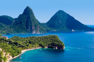
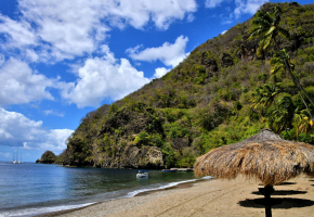
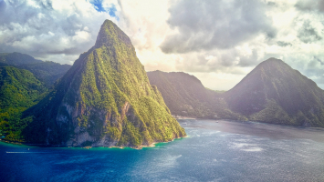
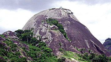
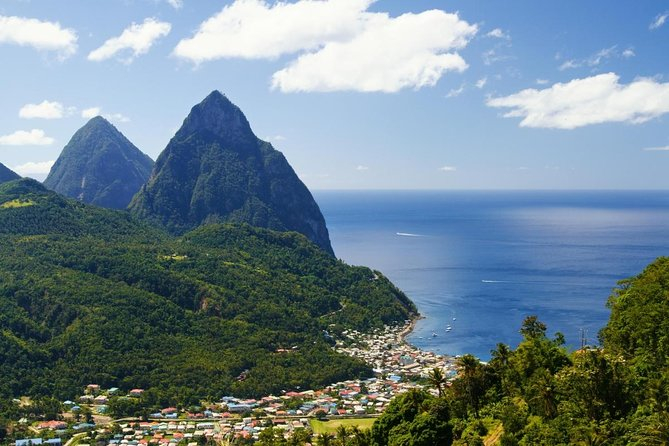
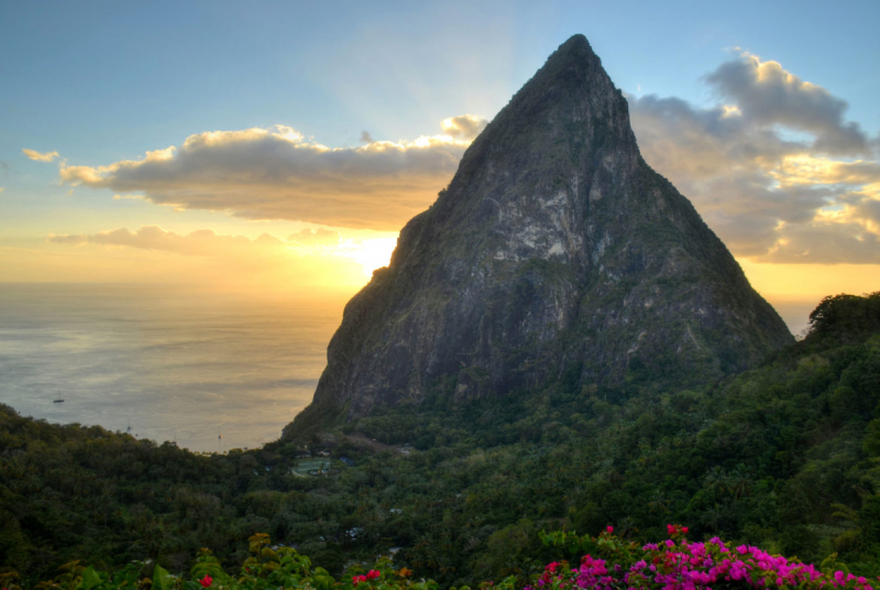
The Pitons, St Lucia's two volcanic mountains, are undoubtedly some of the island's most beautiful characteristics, and hiking the Gros Piton is a once-in-a-lifetime adventure. Gros Piton rises to a height of 2530 feet above sea level, and it is the symbol of St Lucia's western coast, together with Petit Piton. Not only can you see the beautiful Caribbean waters from the top, but you can also see a large chunk of the island.
The only opportunity to see the island from this vantage point is on a Gros Piton hiking trip, and the experience you'll have standing at the summit makes it well worth it. If you choose to climb Gros Piton, you will be immersed in the true meaning of high adventure. While both Gros Piton and Petit Piton are climbable, only the former is officially sanctioned by the government of St Lucia. Petit Piton is significantly steeper and more perilous, but Gros Piton provides a safer hike with a far more spectacular perspective. The trek is not too challenging for most tourists, however the ascent might be a little steep at times.
You can see Soufriere, Vieux Fort, and the island of Saint Vincent from the summit of your Gros Piton trek, while Choiseul and the Maria Islands are visible below. The various colors of the rooftops in the local fishing villages, as well as the many coconut groves on the island, blend together seamlessly.
Elevation: (771m)
Source: Viator 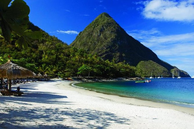
Source: Viator -
Petit Piton is Saint Lucia's most famous mountain, featured on innumerable tourism posters and website banners, the setting for thousands of destination weddings each year, and the focal point of the country's flag. However, few people to the island make the trip up it. Many islanders would inform you that the mountain is blocked since access is limited. It's also a lot tougher climb than its more well-known (and equally gorgeous) sibling, Gros Piton.
On Saint Lucia's west (Caribbean) coast, Petit Piton sits two kilometers south of the charming village of Soufrière. It's about 45 minutes north of the main airport at Vieux Fort via rental vehicle or taxi, and an hour and a half from Castries, the city, via the tortuous but gorgeous route. This map of the island shows it, and this plan of the Soufrière District shows it more locally.
There's just one possible path, and it begins on private property that you don't have permission to enter. The guides maintain the path to the top peak. You'll almost probably utilize the fixed ropes at the summit, if only for safety. The guides are in charge of placing and maintaining these. The majority of guests seem to love their guides, who appear to be rather genuine on this island. Guiding is valuable job that has contributed to the creation of an economic foundation and an incentive for the preservation of natural places.
Elevation: (739m)
Source: Feel Good and Travel 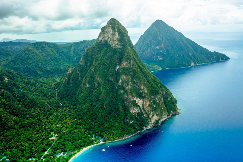
SANDALS® Resorts -
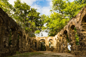
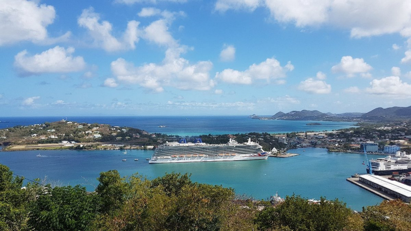
From the point La Toc - the southern arm of the Castries Harbour - Morne Fortuné is the peak of a ridge that climbs to a height of 852 feet. The name Morne Fortuné translates to "Hill of Good Luck," although this is far from the reality, since this location has seen numerous deadly battles between the French and the English. After a war win, it was renamed Fort Charlotte 1794 by the father of Queen Victoria of Great Britain.
When the French transferred their military headquarters and government administrative buildings from Vigie Height to Morne Fortuné in 1765, it was renamed Morne Dubuc. The French built a fort here, Citadelle du Morne Fortuné, which was finished in 1784. The British took the fort on April 1, 1794, but the French recovered it in June 1795. On May 24, 1796, the British recaptured it once more. The fight is commemorated with a memorial to the 27th (Inniskilling) Regiment of Foot. The Treaty of Amiens restored French control in 1802; however, Commodore Samuel Hood defeated French Governor Brig. Gen. Antoine Noguès in June 1803, and the fort remained British until 1979.
Elevation: (212m)
Source: TripAdvisor 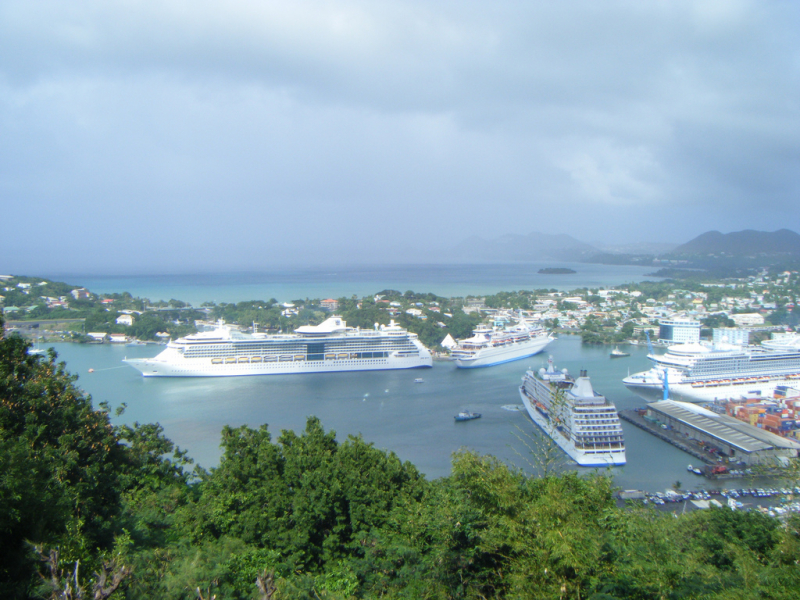
Source: Wikimedia Commons