Top 11 Most Beautiful Islands in Bangladesh

Bangladesh is a country located in South Asia, which shares a border with India on all sides, leaving a small portion, which it shares with Myanmar. Bangladesh ... read more...is known for its wetlands, dense forests, mangroves, and other recognized places. As a country rich in natural resources, the climate is harmonious and the natural landscape is extremely rich. Let's take a look at "Beautiful Islands in Bangladesh" to discover the ideal destinations for your upcoming trip.
-
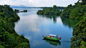
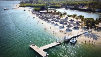
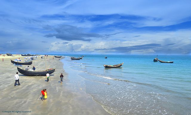
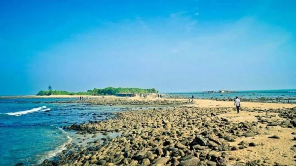
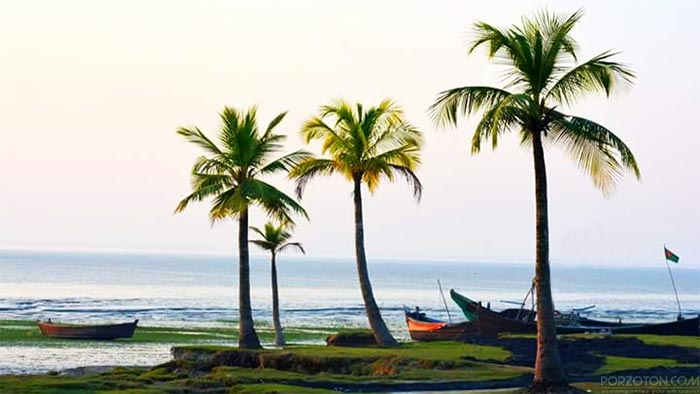
Saint. Martin's is Bangladesh's sole coral island. It is situated south of Bangladesh's mainland. Saint Martin is a small island with a surface area of 17 square kilometers, located 120 kilometers from Cox's Bazar. The Naf river estuary is about 9 kilometers south of Teknaf in Cox's Bazar district and 8 kilometers west of Myanmar's shore. St. Martin is also known as "Narikel Jinzira" or "Daruchini Dwip" in the local community. "Daruchini Dip," a popular Tauquir Ahmed film based on the story of Humayun Ahmed, was filmed here. This island's stunning natural beauty has earned it the title of one of Bangladesh's top tourist destinations. The endless blue sky, azure blue water, and rows of coconut trees have contributed to the island's uniqueness.
The island of Saint. Martin is a renowned tourist attraction. During the tourist season, two-thirds of the launches depart from Bangladesh's mainland every day. The moonlit night on St. Martins Island is the most beautiful in Bangladesh, and it is impossible to forget it in your lifetime. Only from November to March is it possible to visit St. Martin's Island. Hopefully, hotels, resorts, and restaurants will not be affected. In general, it is one of Bangladesh's most tourist-friendly islands.
Location: Caribbean Sea
Area: 95.83 km²
Max length: 13.4 km
Source: Pinterest Source: TravelWithShishirDeb -
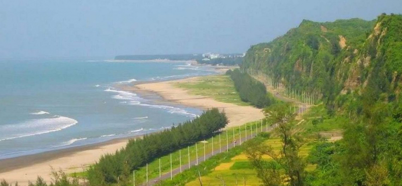
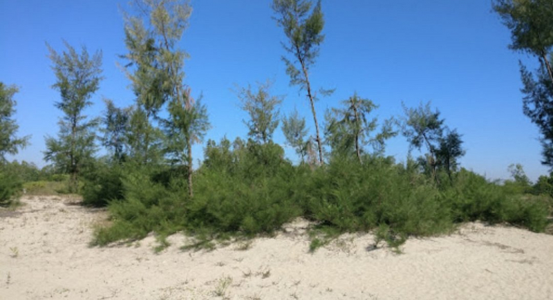
Maheshkhali is a Cox's Bazar district island. The distance between Cox's Bazar and this location is only 12 kilometers. The island is said to have developed after a violent cyclonic storm and tidal surge detached it from the mainland in 1559. Around 200 years ago, it was named after the Buddhist monk Maheshwar. Maheshkhali Island is another name for it. Maheshkhali Island is Bangladesh's only hilly island, covering 362.18 square kilometers. Sonadia, Matarbari, and Dholghata are three small islands in Maheshkhali Upazila. Chakaria Upazila, located in the north-east of the Upazila, is accessible via Maheshkhali Island. Maheshkhali Island is the second name on our list of the most beautiful islands in Bangladesh.
It's a lovely island off the coast of Bangladesh. Adinath Temple is located in the Moinak hills of this island. Visitors are drawn to this island's artwork, and the Adinath fair is held here in the Bengali month of Falgun. There are multiple Buddhist monasteries, as well as a water forest and a variety of animal species. Maheshkhali also has Adinath Mandir, Rakhain Para, and the Golden Temple.
Location: Moheshkhali Upazila, Cox's Bazar District, Bangladesh
Source: Travel Mate 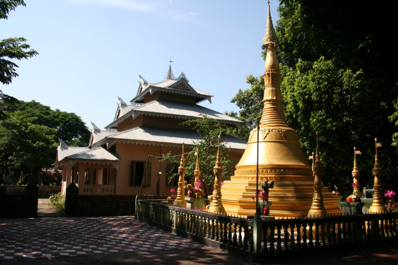
Source: Wikipedia -
Chhera Dwip (Chhera Island) is Bangladesh's southernmost land. It's roughly 5 kilometers south of the coral island of St. Martin. The island is also known as 'Chheradia' or 'Syradiya' among the natives. Natural stone, coral, and coconut trees abound on Chera Island. One-third of the island is submerged under the sea during high tide. When the sea's blue wave slaps against the stone, it forms a lovely scene on Chhera Island. The island was discovered in the late 2000s. Thousands of people visit the island of Chhera every year to see the Blue Sea, the sky, and the sunset. It produces a fantastic appeal when combined with the moonlight.
On the night of this most beautiful island, a large number of people come to camp. Because Chhera Dwip is located on the other side of St. Martins Island, it must first visit St. Martins Island. There are numerous buses to Teknaf from Dhaka. You can also travel to Teknaf from Cox's Bazar. Then you must travel to St. Martins by ship. Then you can walk to Chhera Dwip at low tide or use a speed boat or an engine boat during high tide.
Location: Naf River, Bay of Bengal, Chittagong Division, Bangladesh
Source: Daily Bangladesh 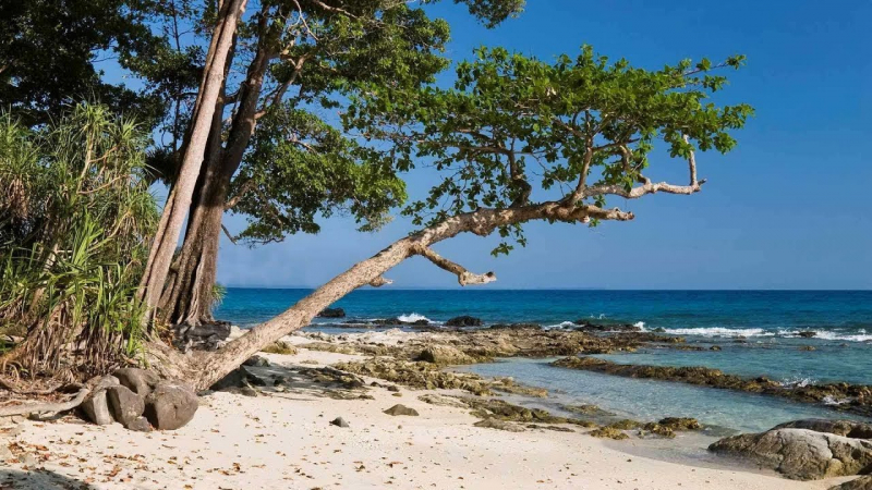
Source: Reddit -
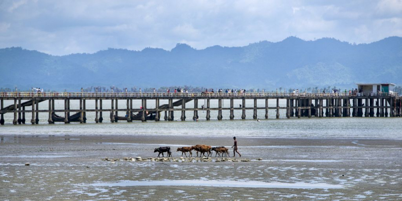
Kutubdia is an island in the Cox's Bazar district's Upazila. With a surface size of 216 square kilometers, this island is rich in diversity. The island is home to Bangladesh's largest wind power station, as well as a beach, salt agriculture, a lighthouse, and the Qutub Auliya shrine. Kutubdia island is thought to have awoken on the water at the end of the fourteenth century. In the late fifteenth century, individuals began to arrive on the island. Kutubuddin, a devout Muslim, was the first to settle on these islands. Kutubuddin afterwards gave shelter to the evicted Muslims from Arakan who arrived on the island.
The Kutubdia Channel, Kutubdia Sea Beach, Wind Power Plant, Lighthouse, Qutb Awali Darbar, and Salt Cultivation are just a few of the interesting attractions in Kutubdia. If you want to visit Kutubdia Island, you must first go to Chakaria in Cox's Bazar and then to Mognama Bus Stand. Kutubdia is also accessible from Chittagong and Cox's Bazar.
Location: Cox's Bazar District
Area: 215.8 km²
Source: Bangladesh Post Source: Mehedi Hasan -
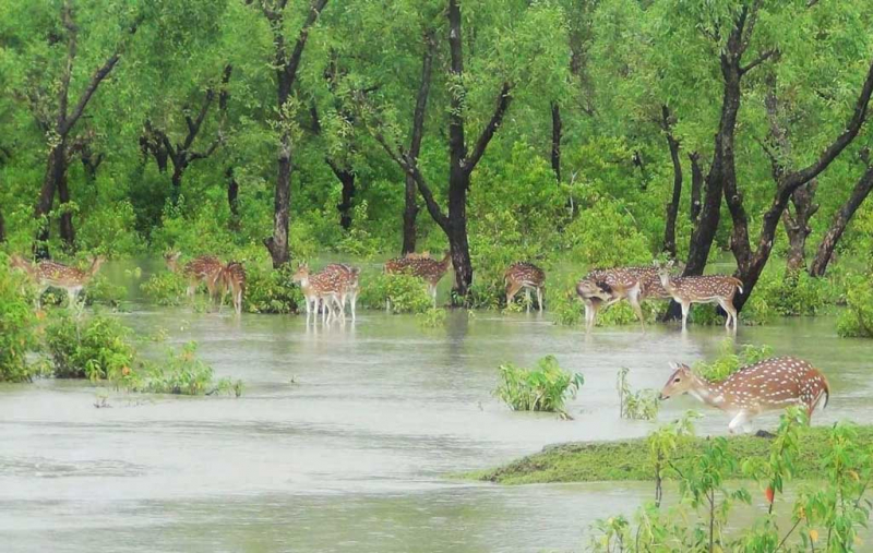
Nijhum Dwip, located in Hatia Upazila in Noakhali district, is one of the most picturesque islands on the Bay of Bengal. This island, which spans 14,050 acres, is made up of four islands: Kamlar Char, Ballar Char, Char Osman, and Char Muri, as well as a few additional chars. Thousands of birds can be found, including Sarali, Ziriya, Lenja, Pyong, and others. Local birds such as the sea eagle, egret, and seagull will be visible at the same time. On the other hand, the island is home to deer, wild pigs, foxes, monkeys, and a variety of snakes. On Nijhum Island, there are approximately 40 thousand deer. Nijhum Island is the only area in the country where you can view thousands of Chitra deer.
The Kabirajer Char and Duma Char are the greatest places to watch the birds. Nijhum Island is home to around 35 different bird species. On the Noakhali route, you can travel to Nijhum Dwip. You must travel to Chairman Ghat from Noakhali's Sonapur. Then you can get to Nijhum Dwip with a Speed Boat or an Engine Boat. At the same time, you can go from Dhaka Sadarghat to Nijhum Dwip. It's also worth noting that you can go to Nijhum Island from Chittagong Sadarghat to Hatia.
Location: Hatiya Upazila, Noakhali District, Bangladesh
Area: 163.4 km²
Source: Dhaka Tribune Source: Around the Bangladesh -
Sonadia Island is a 9-square-kilometer island in Cox's Bazar's Maheshkhali Upazila. Sonadia Island and Maheshkhali are divided by a waterway. Sea beaches, a complete rain forest with biodiversity, little waterways, and a variety of varied species may be found on all three sides of the island. People began to live on this small island between 100 and 120 years ago. Every year, thousands of people flock to the Sonadia Islands to witness the incredible biodiversity. The island is separated into two sections, one on the east and one on the west.
Because the island is surrounded by salt ocean, it is impossible to grow many food grains or green crops on it. The people of the Sonadia Islands make their living by fishing and curing fish. On the other hand, other people work to transport people from the island to various locations. For this, they employ an engine boat or a wooden boat. Other members of the community aid them as well. There is a lot of salt water on the island. As a result, there are no crops or vegetables that can be grown here. With this in mind, everyone travels to Maheshkhali to purchase their necessities.
Location: Cox's Bazar, Chittagong Division, Bangladesh
Area: 9 km²
Source: TripAdvisor 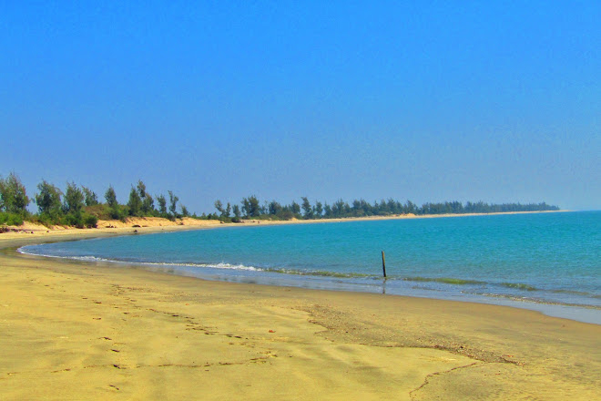
Source: Cox Gazette -
Manpura is a small island in Bhola district, but still is one of the most beautiful islands in Bangladesh. The island is surrounded on three sides by the Meghna River, with the Bay of Bengal to the south. It is one among the natural wonders of the world and a beautiful island in Bangladesh. If you do not come here, you will not be able to appreciate the splendor that awaits you.
On this island, you can witness the dawn and sunset. Manpura landing stations, Deer Sports, and the Chowdhury Project are among the more appealing locations. Motorcycles are the primary mode of transportation on this island. Since Giasuddin Selim's film 'Monpura' was shot in Bangladesh, the island's popularity has skyrocketed. Visiting Manpura Island during the rainy season is not ideal.
In light of this, the winter season is an ideal time to visit Manpura. In general, the road is clear, and you can go wherever you want on the spur of the moment. In any case, riding a motorcycle is the greatest way to go around the island. On the other hand, you can also take a boat ride to see the Dwip's natural beauty.
Location: Bay of Bengal, Bangladesh
Area: 373 km²
Source: Travel Mate 
Source: Travel Mate -
Sandwip Island is a Chittagong district Upazila on the southeast coast of the Bay of Bengal, at the mouth of the Meghna river. The island is 50 kilometers long and 5 to 15 kilometers wide, with a population of around 4 million people. The skyline, the lush fields, and the simple people make this a fantastic location. On the island, there are also a number of traditional places to visit. Traveling on this island surrounded by water will be a once-in-a-lifetime experience. In the winter, the river on the west side of Sandwip (Rahmatpur) is an excellent spot for camping.
The area surrounding the skyline will undoubtedly wow you. Sandwip's Dub (Green Coconut) has a distinct flavor. It is incredibly healthful and well-liked in this area. Someone coined the term "gold-island" to describe the island's bountiful soil. It was also known as Sand Island or Sand Dwip due to the abundance of sand on the island. With the passage of time, the name Sandwip has become more well-known.
Location: Bay of Bengal, Chittagong District, Bangladesh
Area: 762.4 km²
Source: Porzoton Source: Rahi's diary -
Shahpuree Island is one of the closest islands in Teknaf, Bangladesh's southernmost province. Shahpori, Shah Parir, Shapura, and Shinmabyu Island are some of the other names for the island. The island is on the left side of Teknaf and on the right side of Myanmar's border.
The name Shahpuree Island is the subject of numerous legends. Some say it was named for Shah Shuja's wife Parivanu and Shah Shuja himself. Another source claims that the island was named after Shah Farid Awaliya. Shaifir, on the other hand, is a figure in Saifid Khan's Hanifa and Koirrapi poetry from the eighteenth century. Many people make jokes about the name of the island, which is named after Shahpori, the daughter of Rokham's monarch. Their major source of income is fishing and salt cultivation.
Location: Teknaf Upazila, Bay of Bengal, Chittagong District, Bangladesh
Source: Pinterest 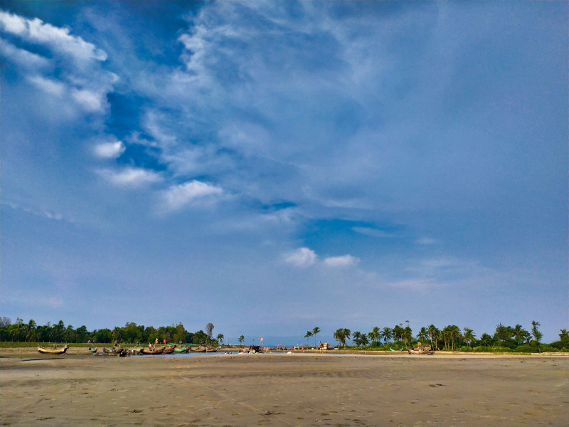
Source: Wikipedia Commons -
Bhola Island, also known as South Shahbazpur, is Bangladesh's largest island, measuring 1221 square kilometers. It is found in the majority of Bhola district, which is part of the Barisal Division. In Bangladesh, Bhola is known as the "Queen of Islands." As a result, it is also known as Bangladesh's Queen Island.
Bhola Island is situated at the mouth of the Meghna River. From Dhaka to Bhola via Barisal, ferries and launches are available. This 130-kilometer-long (81-mile-long) island has a population of 1.7 million people. Bhola is depicted on a map from 1776 as having an oval shape, but due to the erosion of the Meghna river, it now has a more broad appearance.
Bhola Island is famous for its buffalo curd/yogurt, which is unique to Bangladesh and has helped it become a lovely island. Bhola has a lot of interesting locations to visit.
Location: Bay of Bengal, Chittagong District, Bangladesh
Area: 1,441 km²
Source: Vromonkari Source: BD Explorer -
Hatiya is a fully isolated island off the coast of Bangladesh, situated at the mouth of the Meghna River, north of the Bay of Bengal. In the Noakhali district, it is an Upazila having 19 Chor. This island has a surface area of 2100 square kilometers and a population of 6 million people.
The Meghna river, which flows on the north and west sides of the island, and the Bay of Bengal, which flows on the east and south sides, appeared in the middle of the eighteenth century. Hatia Upazila currently has one municipality and eleven unions. Hatiya Police Station is in charge of the administrative functions of the entire Upazila. Hatia Yogurt is well-known throughout Bangladesh.
Location: Noakhali District, Chittagong Division, Bangladesh
Area: 480 km²
Source: Wikipedia Source: TravelWithShishirDeb