Top 10 Most Beautiful Islands in Norway

While most of you are already familiar with Norway's lively landscape, history-rich cities, magnificent fjords, and spectacular Northern lights, Norway is also ... read more...a classic destination for admiring breathtakingly beautiful islands. If you want to know which islands are best for you, here is a list of the "10 Most Beautiful Islands In Norway" to help you plan your holiday.
-
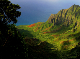
Moskenesya is an island in Norway's Nordland county at the southern extremity of the Lofoten archipelago. Moskenes Municipality and Flakstad Municipality share the 186-square-kilometer (72-square-mile) island. It is considered one of the most beautiful islands in Norway.
The island is made up of a collection of glaciated hills, the highest of which is the Hermannsdalstinden mountain, which stands at 1,029 meters (3,376 feet). It is 40 kilometers (25 miles) long and 10 kilometers (6 miles) wide, and it stretches from southwest to northeast. The shoreline is likewise fairly uneven. The Kkern Bridge connects the island to the neighbouring island of Flakstadya, and is part of the European road E10, which finishes in the settlement of the Moskenesya island.
On the island, there are numerous communities. Fredvang, Selfjord, and Krystad are among the tiny communities of the Flakstad municipality, which is located in the northern half of the island Moskenesya. The settlements of Hamny, Moskenes, Reine, Sakrisy, Srvgen, and Tind are all located on the eastern side of the island and are part of the Moskenes municipality in the southern portion of the island. On the western coast, there were communities, but the last ones were abandoned in the 1950s due to strong storms.
Tourists frequent most villages, therefore they've created modest exhibitions showcasing local characteristics. As a result, Sakrisy now houses a museum with 2,500 dolls from all around Europe. Norsk Telemuseum (Norwegian Telecom Museum) has a local department in Srvgen that reflects the local history of telegraphy. The island joined the 170-kilometer-long (110-mile) Lofoten telegraph line in 1861, with a station at Srvgen (which later became the Srvgen museum in 1914), and the line was connected to Europe in 1867. In 1906, a wireless telegraph system connecting Srvgen and Rst island was established in Srvgen - the second in Europe after Italy.
The 150-year-old Norwegian Fishing Village Museum, which comprises the Lofoten Stockfish Museum, a forge, a bakery, and a cod liver oil factory, is located in the village of, which is a traditional fishing town.
Location: Nordland, Norway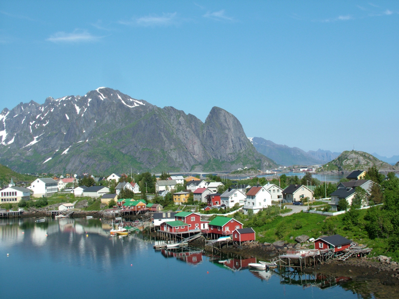
Photo: wikipedia 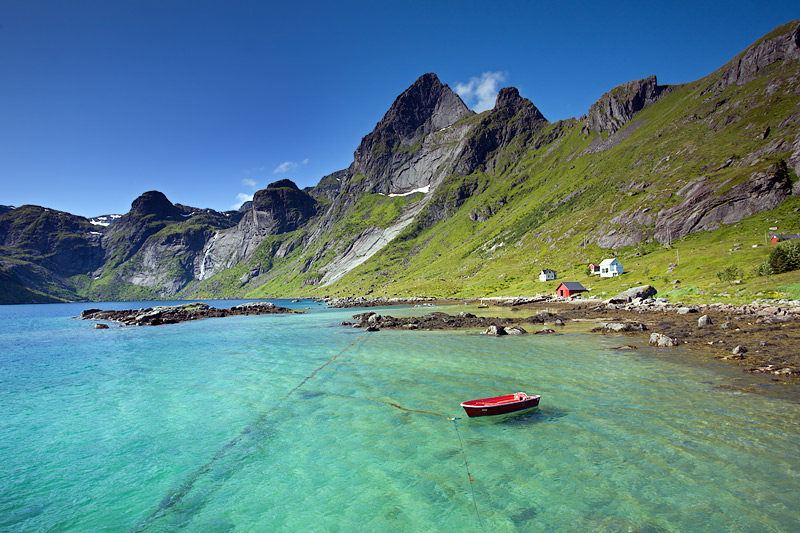
Photo: pbase -
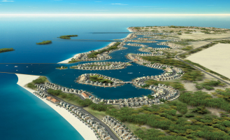
Hidra is the largest island in Norway's Agder county. The 20.8-square-kilometer (8.0-square-mile) island is located south of the mainland coast in Flekkefjord municipality, divided by the 350-meter (1,150-foot) wide Hidrasund strait and the Listafjorden. In 2015, the island's population was estimated to be around 500 people, with the majority of them living on the west side in Kirkehavn, where Hidra Church is located. The town of Rasvg is another important settlement on the island's south side. The Norwegian government considered building an underground tunnel to connect the island to the mainland without using a boat in 2007, but it was deemed too expensive for the tiny advantage. The island served as the administrative capital of Hidra, which lasted from 1893 to 1965.
The island is almost entirely made up of granite, with some moraine deposits thrown in for good measure. The interior of the island, which is covered in oak and other deciduous trees, is much more inviting. The Rasvgfjorden divides the island nearly in half, and the Eie Canal was created through the remaining isthmus to allow small boats to sail all the way through.
Location: Agder, Norway
Photo: visitsorlandet 
Photo: marinas -
Vågsøy is a Norwegian island located in the Kinn Municipality in Vestland County. The 59.1-square-kilometer island is located on the northern side of the Nordfjorden, Norway's sixth-longest fjord. The Stadlandet peninsula is located to the north of the island, the islands of Silda and Barmya, as well as the mainland, are located to the east, Husevgy is located to the south (in the midst of the Nordfjorden mouth), and the open ocean is located to the west. There are multiple lighthouses along the island's shoreline, including Hendanes Lighthouse, Krkenes Lighthouse, and Skongenes Lighthouse, because the island lies along the open ocean, which can be rough. Veten, at 613 meters, is the highest point on the island.
The island is connected to the mainland by the Måløy Bridge. The main population center on the island is the town of Måløy, which is also the administrative centre for the municipality. Other population centers are the villages of Raudeberg, Kvalheim, Langenes, Refvik, Vågsvåg, and Vedvik. The population (2001) of the whole island was 4,207. There are 2 churches on the Vågsøy: Nord-Vågsøy Church in Raudeberg and Sør-Vågsøy Church in Måløy.
Location: Vestland, Norway
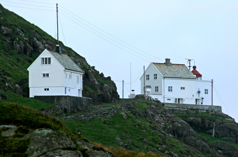
Photo: flickr 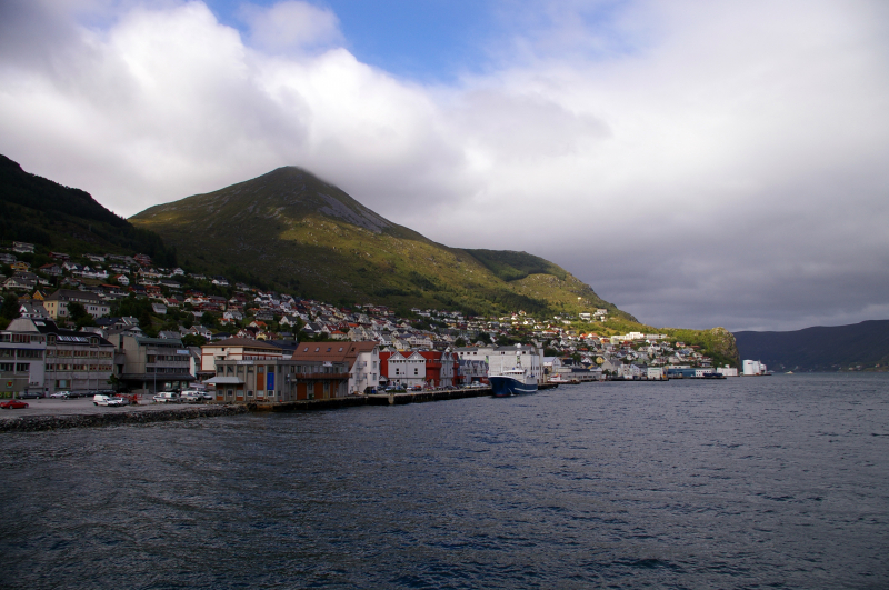
Photo: wikipedia -
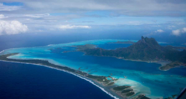
Svalbard is a Norwegian archipelago in the Arctic Ocean, also known as Spitsbergen or Spitzbergen. It is located north of continental Europe, almost halfway between Norway's northern shore and the North Pole. The group's islands are located between 74° and 81° north latitude and 10° and 35° east longitude. Spitsbergen is the largest island, followed by Nordaustlandet and Edgeya. Longyearbyen is the largest settlement. It is belongs to top of the most beautiful islands in Norway.
Glaciers comprise over 60% of the archipelago, and the Svalbard islands include several mountains and fjords. The archipelago has an Arctic climate, with temperatures that are much higher than other locations at the same latitude. To compensate for the polar night, the vegetation has evolved to take advantage of the lengthy duration of midnight sun. Svalbard is home to polar bears, reindeer, the Arctic fox, and a variety of marine mammals, as well as a breeding habitat for numerous seabirds. Two-thirds of the archipelago is protected by seven national parks and 23 nature reserves, which conserve the island's mostly pristine but endangered natural ecosystem.
In its untamed snows cape, you can engage in a variety of activities, from hiking to dog-sledding. Shiny glaciers, mountains, and fjords surround this lonely island in the Arctic circle. Even if the island's cold weather and inaccessibility make it unpleasant, you can still take a guided tour to see its beautiful national parks. Taking a solo excursion here is not recommended because there are many wild polar bears, seals, and walruses roaming around.
Location: Arctic Ocean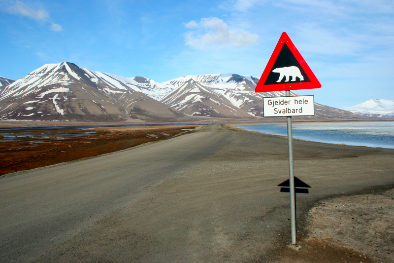
Photo: wikipedia 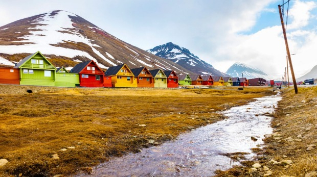
Photo: traveller -
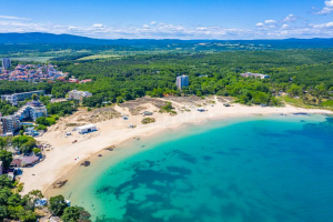
The locals' favorite summer island is Sommaroy. From the minute you glimpse it from your cruise or boat, you can feel its rising beauty. Its pure blue beaches with sandy shoreline scattered with wooden cabins are so beautiful that you won't be able to stop yourself from filling your phone and camera album with magnificent photos of Sommaroy.
Sommary is one of the busiest fishing settlements in the county of Troms, with 300 residents. Herring is the major product, which is processed and packed in a state-of-the-art processing factory before being frozen for international export. As a result, this fishing community is a significant contributor to the national economy, with a high export value per capita.
To say the least, the views from Sommaroy Island are breathtaking. All the little islands of the Troms County can be seen to the north. Hja is the highest of the three islands, rising 486 meters above sea level. It is shaped similarly to the Arctic Cathedral in Troms. On that one, the jury is still out! To the south, past Senja's rugged shoreline, you can see all the way to the Kjlva headland. The view of the Kvalya mountains faces inland and to the east, while Storhavet itself is to the west. If you manage to be here at midnight in the height of summer, the midnight sun shines on the horizon that lies due west of Håja Island.
Location: Troms og Finnmark, Norway
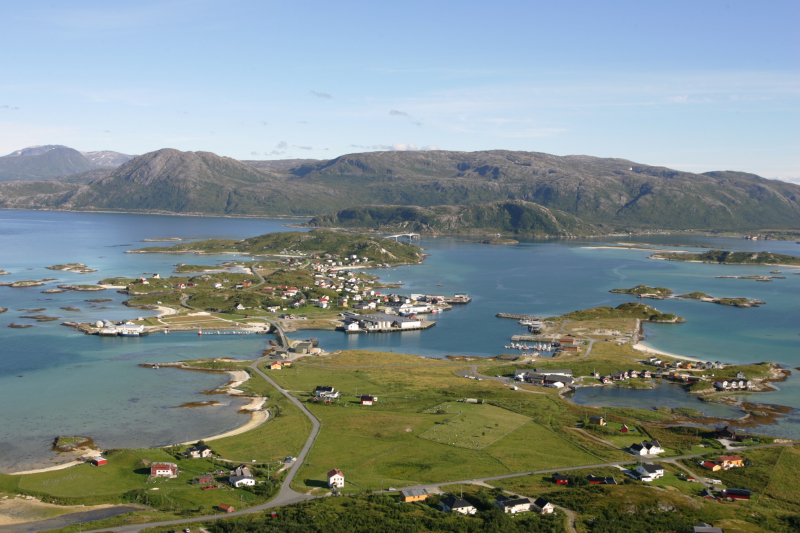
Photo: outdooractive 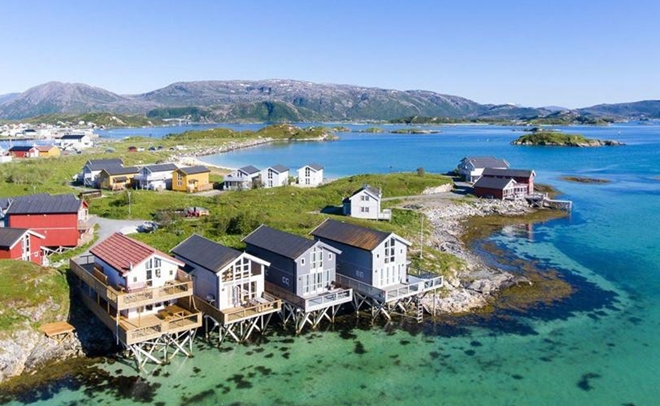
Photo: congannhandan -
Senja is a Norwegian island in the county of Troms og Finnmark. It is Norway's second-largest island, covering 1,586.3 square kilometers (612.5 square miles) (outside the Svalbard archipelago). It has a rugged, mountainous western (Atlantic) side and a calm, verdant inner (Eastern) side. Senja Municipality, which was founded on January 1, 2020, includes the island. As of January 1, 2017, the island of Senja had 7,864 residents. The majority of the population lives on the island's eastern shore, with Silsand being the largest city. The Andenes–Gryllefjord Ferry connects the fishing community of Gryllefjord on the West Coast with the neighbouring island of Andya during the summer months.
Senja's northern coast confronts the open sea, its western coast faces the Andya and Krttya islands, and its southern coast faces the Andrja and Dyrya islands. On the western coast, steep and Rocky Mountains rise directly from the sea, with some fishing settlements (such as Gryllefjord and Husy) nestled between the mountains and the sea. With rounded mountains, forests, rivers, and agricultural area, the island's eastern and southern regions are milder.
Senja is sometimes described to as "Norway in miniature" since the island's varied scenery depicts nearly the complete range of Norwegian natural topography. Arguably one of the most beautiful islands in Norway, Senja is touted as a tourist attraction in the United States because of its surroundings.
Anderdalen National Park, with coastal pine forests and mountains, traditional fishing towns, and the Senja Troll, the world's largest troll monument, are among the island's attractions (which burned down on 28 March 2019). The Halibut Museum ("Kveitmuseet") in Skrolsvik is one of several tiny museums chronicling local history in Trany's southernmost municipality.
Location: Troms og Finnmark, Norway
Photo: dangerous-business 
Photo: kimkim -
Tromsøya is a Norwegian island located in the municipality of Troms in the county of Troms og Finnmark. It is located between the mainland and the bigger island of Kvalya in the Tromsysundet strait. Troms is a city on the 21.7-square-kilometer (8.4-square-mile) island of Troms, which has a population of 39,882. The Troms Bridge and Tromsysund Tunnel connect the island to the Tromsdalen area on the mainland to the east, and the Sandnessund Bridge connects the island to the village of Kvalysletta on Kvalya island to the west.
Tromsøya Island is the greatest place on the planet to experience the wonders of the Northern Lights. This island is a typical ice realm in the quiet strait, backed up by magnificent mountain peaks crowned with fluffy snow due to its location in the Arctic circle. This island city is amazing to stay in, with visually beautiful wooden dwellings, Arctic Cathedrals, and museums with a grandeur vibe. To get the most out of your visit to Tromsya, take a stroll around the city, ride the cable car to Mount Storsteinen, or relax in Prestvannet Lake.
Troms Airport is located on the island's western edge. Prestvannet Lake is in the middle of the island, and the surrounding region has been designated as a nature reserve. On the eastern side of the island, you'll find the University of Troms, the Troms police station, the Troms fire station, the University Hospital of North Norway, and the Troms Museum.
Location: Troms og Finnmark, Norway
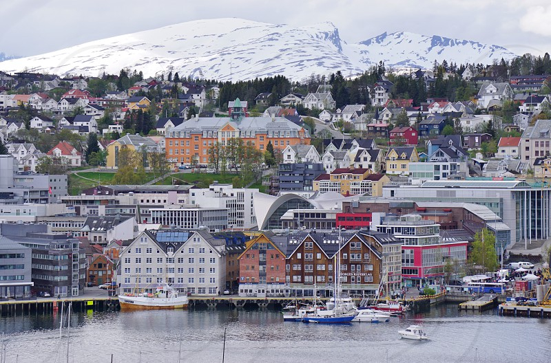
Photo: community.snapwire 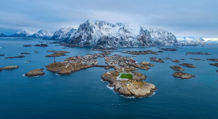
Photo: indiaa2z -
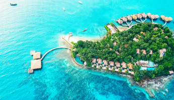
Kvaløya is an island in the municipality of Troms, in the county of Troms og Finnmark, Norway. It is the fifth-largest island in mainland Norway, covering 737 square kilometers (285 square miles). The Sandnessund Bridge connects it to the neighboring island of Tromsya on the east, the sub-sea Kvalsund Tunnel to the island of Ringvassya on the north, the Sommary Bridge to the small island of Sommarya on the west, and the Rya Tunnel to the mainland on the south. On the southwest coast, the island of Sommary is a popular vacation location with beautiful coastal scenery.
Approximately 13,000 people live on Kvaløya, the majority of them dwell on the eastern side in Kvalysletta (a suburb of Troms) near the Sandnessund Bridge. Because it is the country's oldest town, you can spend a lot of time touring the Struve Geodetic Arc and chocolate box houses. Make a point of climbing Mount Salen for a breathtaking panoramic view of the town. Also, visit Mikkelgammn Sami Camp to learn about the indigenous Sami tribe and their traditional history.
Location: Troms og Finnmark, Norway
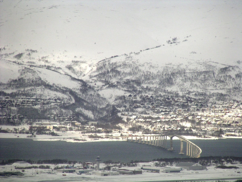
Photo: wikipedia 
Photo: readytotrip -
Vesterålen is a municipality and archipelago in the county of Nordland, Norway. It is situated between Lofoten and Harstad, just north of the latter. It is located in the far northwestern region of the county of Nordland. Sortland is the archipelago's largest town, located near the archipelago's center. The municipalities of Andy, B, Hadsel, Sortland, and ksnes make up Vesterlen.
Its enticing beauty stems from its towering mountains and rugged coasts, making it an ideal wellness retreat for relaxation and rejuvenation. The atmosphere in the neighborhood is always upbeat and calm. Walking tours are good because of the huge fjords, fishing communities, and lonely woodlands. Aside from that, visit the beaches or go on a boat ride to see the gorgeous whales. The towns and settlements are located between the mountains and the fjords on the coastal brim (Strandflaten). There are also a number of lakes, including Alsvgvatnet. Vesterålen is home to part of Mysalen National Park (website). Vesterlen has a maritime climate, with moderate winters despite its being well north of the arctic circle. B is Norway's northernmost location, with daily average temperatures above 0 °C (32 °F) throughout the winter months.
Location: Nordland, Norway
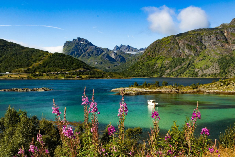
Photo: matadornetwork 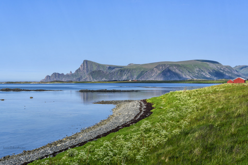
Photo: flickr -
Stangholmen, part of the Risr archipelago, is one of Norway's must-see islands. It is known as the "wooden house town" and boasts a plethora of beautiful sights to explore. Nothing goes off the beaten path at Stangholmen, from the magnificent lighthouse built in 1855 to the bathing areas and old taverns to the classy gourmet restaurants. If you travel in the summer, you may enjoy some lively concerts and summer festivals.
Concerts and festivals, such as the Risr International Chamber Music Festival, are held on the outdoor stage. This is also where the "FyrJam" music festival takes place. This is an event that features both local and international musicians. During the summer, the ferry "Agnes" departs from Risr's main harbor every 30 minutes. There is a pier, toilets, and washing facilities if you arrive by boat. Around the island, there are additional hiking opportunities.
Location: Arendal, Agder, Norway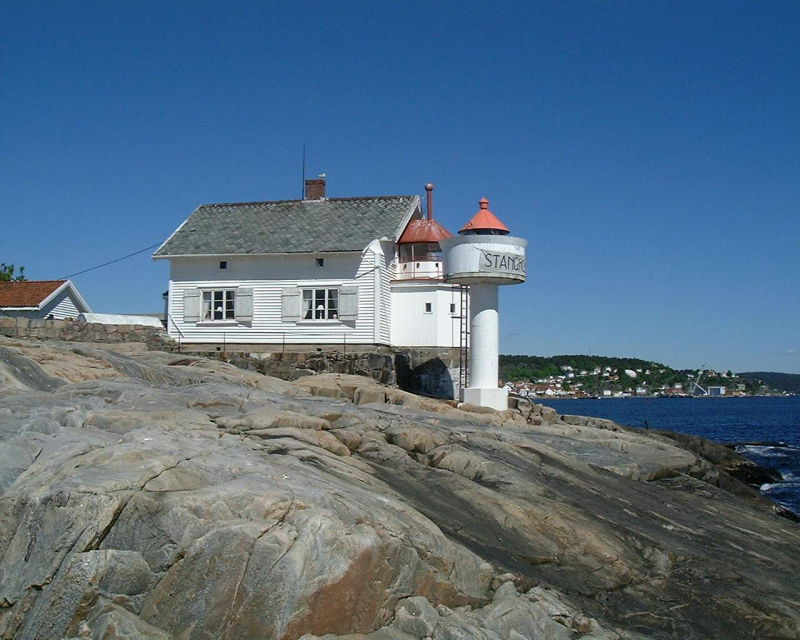
Photo: wikipedia 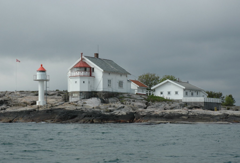
Photo: flickr