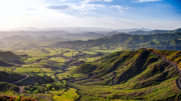
Top 10 Longest Rivers in Ethiopia

A landlocked country in the Horn of Africa, Ethiopia is known for being home to twelve lakes and nine large rivers with many tributaries. Here are the longest ... read more...rivers of Ethiopia that Toplist has compiled.
-
The Blue Nile is an Ethiopian river that flows from Lake Tana. It travels 1,450 kilometers (900 miles) through Ethiopia and Sudan. It is one of the Nile's two major tributaries, along with the White Nile, and supplies approximately 80% of the Nile's water during the rainy season.
The river's length from its headwaters to its confluence has been estimated to be between 1,460 km (910 mi) and 1,600 km (1,600 mi) (990 mi). This uncertainty may be due to the fact that the river flows through a series of nearly impenetrable gorges cut into the Ethiopian Highlands to a depth of approximately 1,500 metres (4,900 ft)—a depth comparable to the Grand Canyon of the Colorado River in the United States. According to Central Statistical Agency materials, the Blue Nile has a total length of 1,450 kilometers (900 miles), of which 800 kilometers (500 miles) are within Ethiopia.
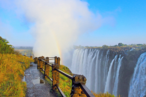
The Blue Nile originates in Ethiopia at Lake Tana (where it is called the Abay River). The river flows generally south before entering a canyon about 400 kilometers (250 miles) long, about 30 kilometers (19 miles) from Lake Tana, which is a major barrier to travel and communication between north and south Ethiopia. The canyon was first referred to as the "Grand Canyon" by a British team in 1968 after they completed the first descent of the river from Lake Tana to the canyon's end; subsequent river rafting parties referred to it as the "Grand Canyon of the Nile." One of Ethiopia's most popular tourist attractions, the Blue Nile Falls (Amharic: Tis Abay, literally "great smoke"), is located at the canyon's entrance.
The river winds its way through northwest Ethiopia before being fed by a slew of tributaries between Lake Tana and the Ethiopia–Sudan border. The Wanqa River, the Bashilo River, the Walaqa River, the Wanchet River, the Jamma River, the Muger River, the Guder River, the Agwel River, the Nedi River, the Didessa River, and the Dabus River are all on its left bank. The Handassa, Tul, Abaya, Sade, Tammi, Cha, Shita, Suha, Muga, Gulla, Temcha, Bachat, Katlan, Jiba, Chamoga, Weter, and Beles are among those on the right side, also in downstream order.
Length: 1,450 km (900 mi)
Photo: Wikipedia 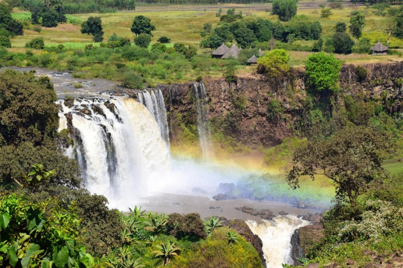
Photo: Doanh nghiệp -
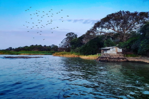
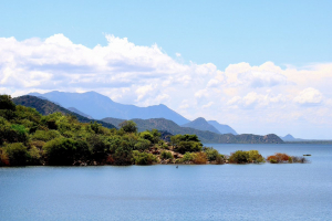
The Awash is a major Ethiopian river. It flows entirely within Ethiopian territory and empties into a chain of interconnected lakes beginning with Lake Gargori and ending with Lake Abbe (or Abhe Bad) on the border with Djibouti, about 100 kilometers (60 or 70 miles) from the mouth of the Gulf of Tadjoura. It is the main stream of an endorheic drainage basin that encompasses parts of the Amhara, Oromia, and Somali Regions, as well as the southern half of the Afar Region. According to Huntingford, the Awash River was known as the Great Dir River in the 16th century and flowed through Muslim territory.
The Awash Valley (particularly the Middle Awash) is internationally renowned for its abundance of hominin fossils, which provide unparalleled insight into the early evolution of humans. One of the most well-known early hominin fossils, "Lucy," was discovered in the lower Awash Valley. The lower valley of the Awash was inscribed on the UNESCO World Heritage List in 1980 for its paleontological and anthropological significance.
Length: 1200 km (746 mi)
Video: ornithopia tours 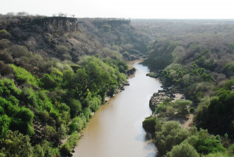
Photo: Journeys by Design -
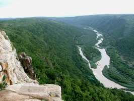
The Ganale Doria River is a perennial river that flows through southeastern Ethiopia. The Ganale rises in the mountains east of Aleta Wendo and flows south and east to join the Dawa at the Somali border to form the Jubba. The Welmel, Weyib (also known as Gestro), Dumale, Doya, Hawas, and Hambala are among the river's tributaries. The Del Verme Falls are a prominent feature of the middle course.
The Ganale has a total length of 858 km (533 mi) according to materials published by the Ethiopian Central Statistical Agency, of which 480 km (300 mi) are within Ethiopia. According to the Ethiopian Ministry of Water Resources, the Ganale Dorya-Dawa river basin has a catchment area of 171,050 km2 (66,040 sq mi), an annual runoff of 5.80 billion cubic metres (205109 cu ft), and a specific discharge of 1.2 litres per second (0.042 cu ft/s) per square kilometre. The catchment area has the potential to irrigate 1,070 km2 (410 sq mi) and generate 9270 gigatonne-hours per year.
The Italian explorer Vittorio Bottego renamed the river Ganale Doria after the Italian biologist Giacomo Doria.
The Genale Doria is historically significant because it served as the border between the provinces of Sidamo and Bale. The confluence of the Ganale Doria and the Dawa is significant because it marks the beginning of the boundary between Ethiopia and Kenya to the west, and the beginning of the boundary between Ethiopia and Somalia to the east. The Battle of Genale Doria took place to the south of the river's course.
Length: 858 km (533 mi)
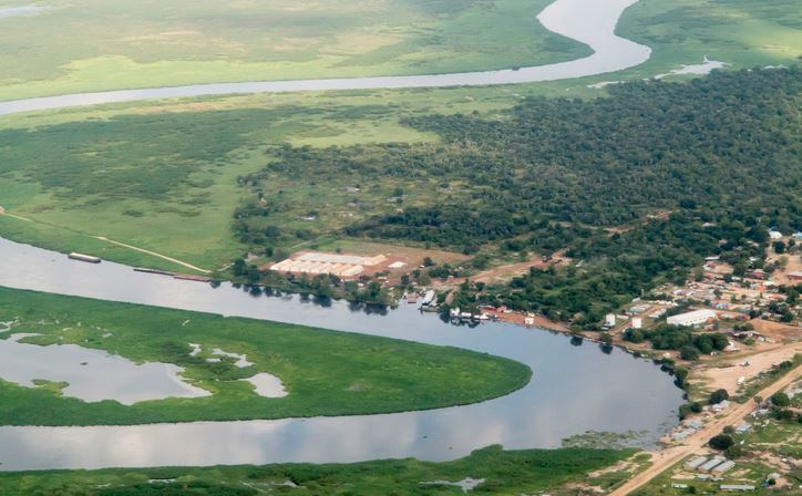
Photo: Alchetron 
Photo: Alchetron -
The Black Nile, also known as the Atbarah River, is a river in northeast Africa. It rises in northwest Ethiopia, about 50 kilometers north of Lake Tana and 30 kilometers west of Gondar. It then flows for about 805 kilometers (500 miles) to the Nile in north-central Sudan, where it joins it at Atbarah (17.677°N 33.970°E). The Tekezé (Setit) River, a tributary of the Atbarah, may be the true upper course of the river, as it follows the longer course prior to the confluence of the two rivers (at 14° 10' N, 36° E) in northeastern Sudan. The Atbarah is the Nile's final tributary before it enters the Mediterranean.
For the majority of the year, it is nothing more than a stream. During the rainy season (generally from June to October), the Atbarah rises 18 feet (5 meters) above its normal level. At the moment, it forms a formidable barrier between the northern and central districts of Ethiopia's Amhara Region. Aside from the Tekezé, other significant tributaries of the Atbarah include the Shinfa River, which rises west of Lake Tana, and the Greater Angereb, which rises north of Gondar.
Length: 805 km (500 mi)
Photo: britannica 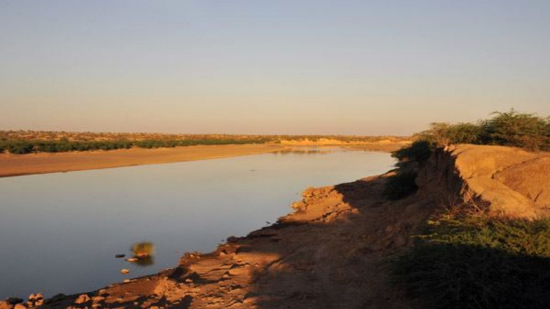
Photo: Alchetron -
The Omo River (also known as the Omo-Bottego) in southern Ethiopia is the largest river in Ethiopia outside of the Nile Basin. Its entire course is within the borders of Ethiopia, and it empties into Lake Turkana on the Kenyan border. The river is the main stream of the Turkana Basin, an endorheic drainage basin.
The river basin is well-known for its abundance of early hominid fossils and archeological discoveries, such as early stone tools, which led to its inclusion on the UNESCO World Heritage List in 1980.
The Omo River is formed by the confluence of the Gibe River, the Omo River's largest total tributary, and the Wabe River, the Omo River's largest left-bank tributary, at 8°19′N 37°28′E. Given their sizes, lengths, and courses, one might mistake the Omo and Gibe rivers for the same river with different names. As a result, the entire river basin is sometimes referred to as the Omo-Gibe River Basin. This river basin encompasses a portion of the western Oromia Region as well as the heart of the Southern Nations, Nationalities, and People's Region.
Its general direction is south, with a major bend to the west at about 7° N 37° 30' E to about 36° E, where it turns south until 5° 30' N, where it makes a large S- bend and resumes its southerly course to Lake Turkana. The Omo-Bottego River is 760 kilometers long, according to materials published by the Ethiopian Central Statistical Agency.
The Omo-Bottego has a total fall of about 700 m in its course, from the confluence of the Gibe and Wabe rivers at 1060 m to 360 m at lake level, and is thus a rapid stream in its upper reaches, broken by the Kokobi and other falls, and navigable only for a short distance above where it empties into Lake Turkana, one of the Gregory Rift's lakes. According to the Spectrum Guide to Ethiopia, it is a popular white-water rafting destination in September and October, when the river is still high from the rainy season. The Gibe River is its most important tributary; smaller tributaries include the Wabi, Denchya, Gojeb, Mui, and Usno rivers.
The Omo-Bottego River defined the eastern borders of the Janjero and Garo kingdoms. The Omo also runs through the Mago and Omo National Parks, which are well-known for their wildlife. Many animals, including hippopotamuses, crocodiles, and puff adders, live near and on the river.
Length: 760 km (472 mi)
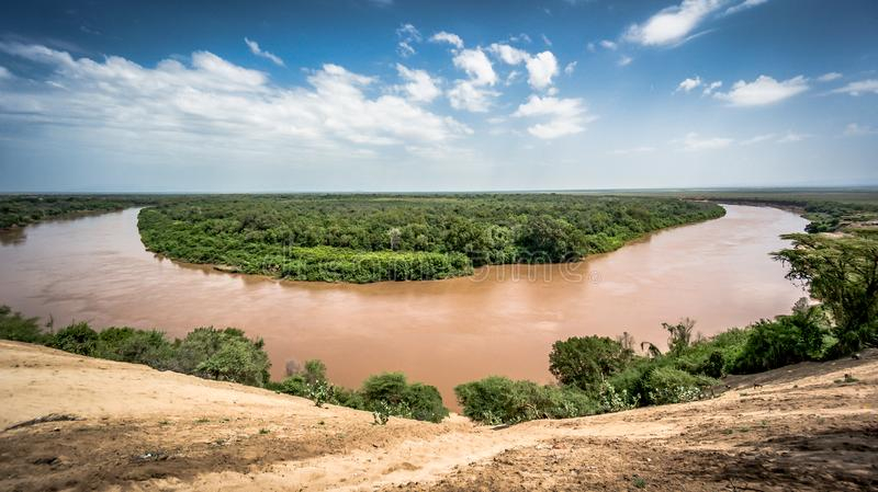
Photo: Dreamstime.com 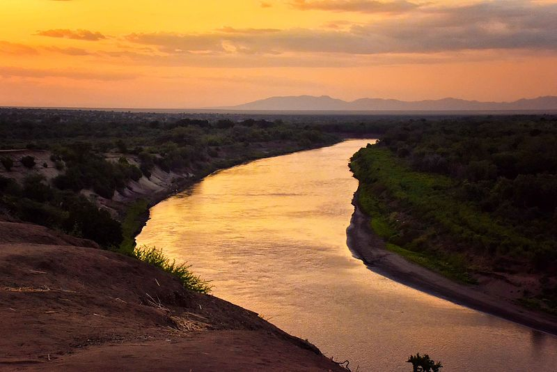
Photo: Wikimedia Commons -
The Tekezé or Täkkäze River (Amharic:, Tigrinya:; originally meaning "river" in Ge'ez, Arabic: ), also spelled Takkaze,, is a major Ethiopian river. It forms a section of Ethiopia's and Eritrea's westernmost border for a portion of its length. In Eritrea, western Ethiopia, and eastern Sudan, the river is also known as the Setit (Arabic: ). The Tekezé River is 608 kilometers (378 miles) long, according to materials published by the Ethiopian Central Statistical Agency. The canyon it has formed is the deepest in Africa and one of the deepest in the world, reaching depths of over 2000 meters at some points (6,562 feet).
The Tekezé River rises in the central Ethiopian Highlands near Mount Qachen within Lasta and flows west, north, and then west again, forming the westernmost border of Ethiopia and Eritrea from the confluence of the Tomsa with the Tekezé at 14°11′N 37°31.7′E to the tripoint between the two countries and Sudan at 14°15′27′′N 36°33′37′′E. It joins the Atbarah River, a tributary of the Nile, after entering northeastern Sudan at the tripoint. The Tekezé is possibly the true upper course of the Atbarah, as the latter follows the longer course prior to the two rivers' confluence.
The names of its main tributaries in Ethiopia from its source are: Tahali, Meri, Tellare, Sullo, Arekwa, Gheoa, Wari, Firafira, Tocoro, and Gumalo Rivers on the right bank; and Nili, Balagas, Saha, Bembea, Ataba, Zarima, and Kwalema Rivers on the left bank.
Length: 608 km (378 mi)
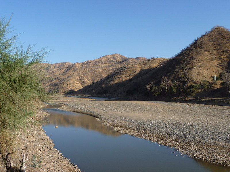
Photo: Wikipedia Video: Namaste World -
The Dinder River (Arabic: نهر الدندر Nahr-ud-dindir, also spelled Dindar; Amharic: ዲንደር ወንዝ, romanized: dīnideri wenizi) is a Blue Nile tributary. It runs for 480 kilometers through Ethiopia and Sudan (300 mi).
The Dinder River originates in the Ethiopian Highlands west of Lake Tana in the Ethiopian woreda of Alefa. It flows northwest from the highlands into the Sudanese state of Sennar's plains. It flows across the plains before joining the Blue Nile near Sennar.
Sudan's Dinder National Park, which extends south from the Dinder, is named after the river. This watershed was previously home to the endangered painted hunting dog, Lycaon pictus; however, this canid is now thought to be extinct in the region due to human population growth and a lack of conservation attention.
Length: 480 km (300 mi)
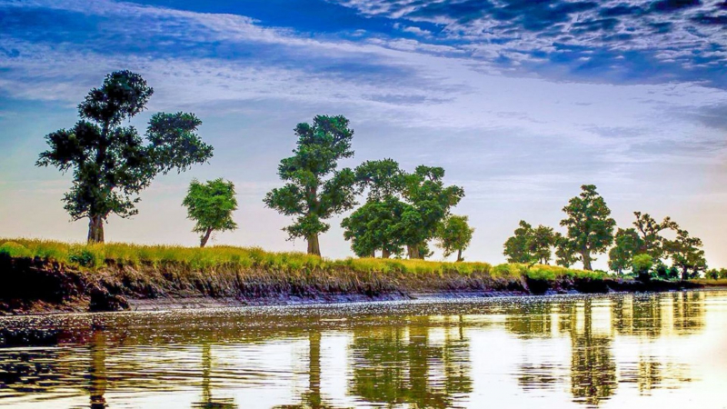
Photo: Sharaf Magzoub 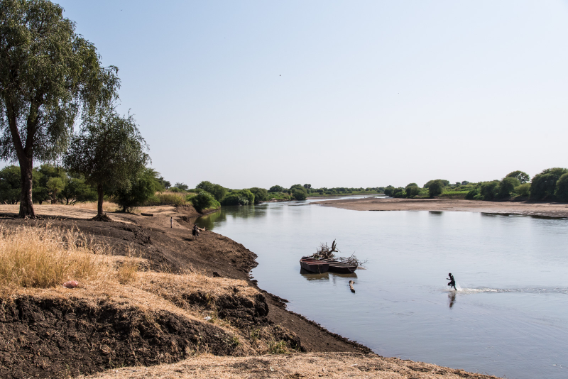
Photo: photoneer.de -
The Dawa River flows through East Africa and covers an area of 58,961 km2. It flows through three major countries: Kenya, Ethiopia, and Somalia, with Ethiopia receiving 81% of the flow. The river's proximity to multiple volcanic-tectonic events has resulted in a complex geological environment, as evidenced by its diverse lithology and structural framework. The broad river has gentle slopes on both sides of its exposed bedrock. The Dawa river flows south-east, forming part of the Ethiopia-Somalia border as well as part of the Ethiopia-Kenya border. The only significant off-flowing rivers to Dawa are the Awata, Digati, and Mormora.
The Dawa River is home to thousands of animals and plants, as it is fed by a number of seasonal rivers and streams. The riverine forest's largest trees can be found along the lower section of the Dawa River. Diospyros Mespliformis, Ficus sycamorus, Mimusops kummel, Tamarindus indica, and African mahogany Trichilia emetica are among them. Ficus capreaefolia shrubs cover the majority of the river bank, while bushland and thickets cover the majority of the wachile plain. During the long dry season, most wildlife is scarce, making plants like Acokanthera schimperi, Dobera glabra, Euclea racemosa schimperi, and Salvadora persica abundant and visible. Borena people have developed cattle and sheep farming skills as a result of crops being too dry to grow during the extended dry season.
Length: 450 km (280 mi)
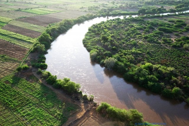
Photo: East African Adventures's FB 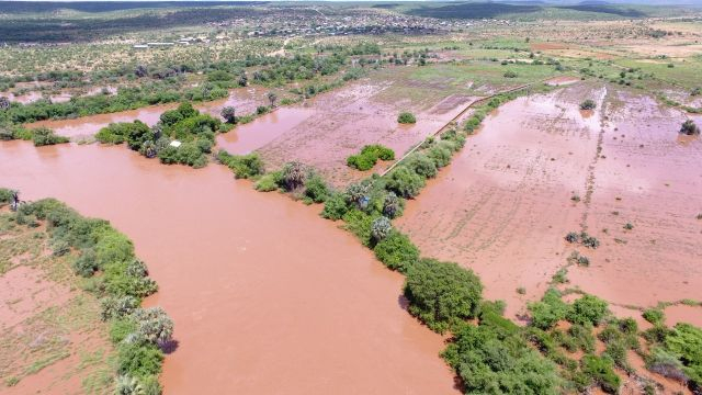
Photo: The Star -
The Weyib River (also known as the Webi Gestro, Wab Gestro, or Web River) is a river in eastern Ethiopia. It begins in the Bale Mountains east of Goba in the Oromia Region. The Bale Mountains (also known as the Urgoma Mountains) are mountain ranges in southeast Ethiopia's Oromia Region, south of the Awash River, that are part of the Ethiopian Highlands.
Tullu Demtu, Ethiopia's second-highest mountain (4377 meters), and Mount Batu are among them (4307 meters). Then, it flows east to pass through the Sof Omar Caves- Ethiopia's longest cave, stretching 15.1 kilometers (9.4 miles). It was the longest cave in Africa when it was discovered in 1972.before joining the Ganale Dorya River in the Somali Region.
Length: 450 km (280 mi)
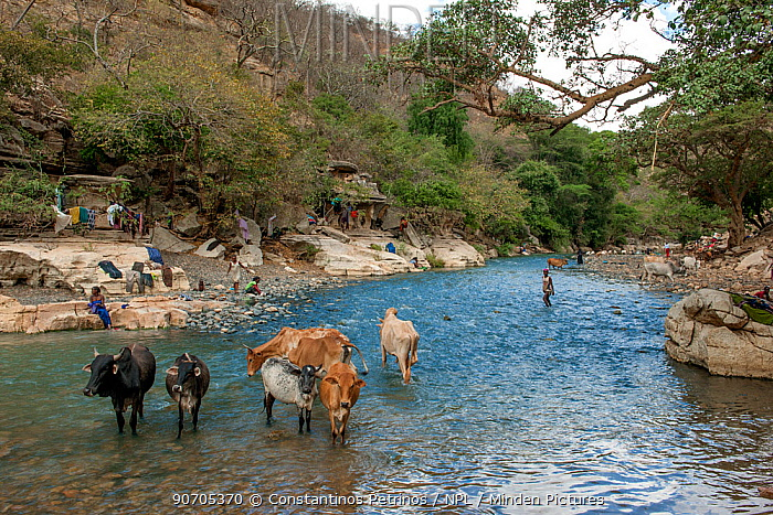
Photo: Minden Pictures 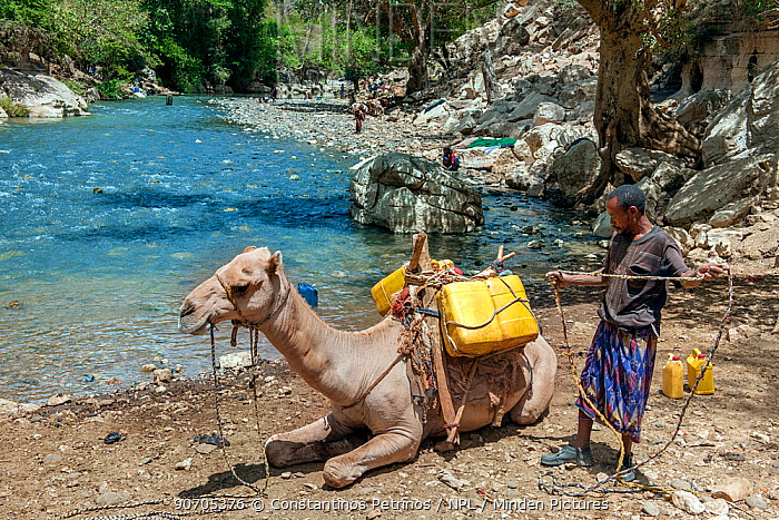
Photo: Minden Pictures -
The Akobo River is a river that runs through South Sudan and Ethiopia. It flows west for 434 kilometers (270 miles) from its source in the Ethiopian Highlands near Mizan Teferi to join the Pibor River. The Pibor River empties into the Sobat River, which empties into the White Nile.
The Akobo river's tributaries include the Cechi, Chiarini, and Owag on the Ethiopian side, and the Neubari, Ajuba, and Kaia on the South Sudanese side.
Several mining surveys have been conducted on the Akobo. Engineers from COMINA explored the Akobo and its tributaries in 1939. North-flowing tributaries seemed to be more promising than south-flowing tributaries. Gold values of up to 10 grams per cubic meter have been discovered in Chama Creek, with an average value of 0.7 g per cubic meter possible. Between 1952 and 1954, the Ministry of Mines employed up to 120 miners at a time. They produced 1.66 grams of gold per day on average.
Length: 434 km (270 mi)
Photo: Nile Basin - Nile Basin Initiative 
Photo: Nile Basin - Nile Basin Initiative