Top 10 Longest Rivers in South Africa

South Africa is home to some of the continent's most beautiful and longest rivers. These rivers have a significant role in the ecosystem of the country. Rivers ... read more...are the primary supply of water for irrigation and industrial processes for the majority of farms and industry. Most of the crops along the river banks and in the coastal zones get their nutrients from the rivers. Rivers also facilitate transportation and recreational activities such as canoeing and rafting. The following are some of South Africa's longest rivers.
-
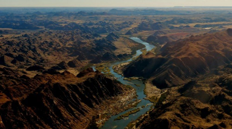
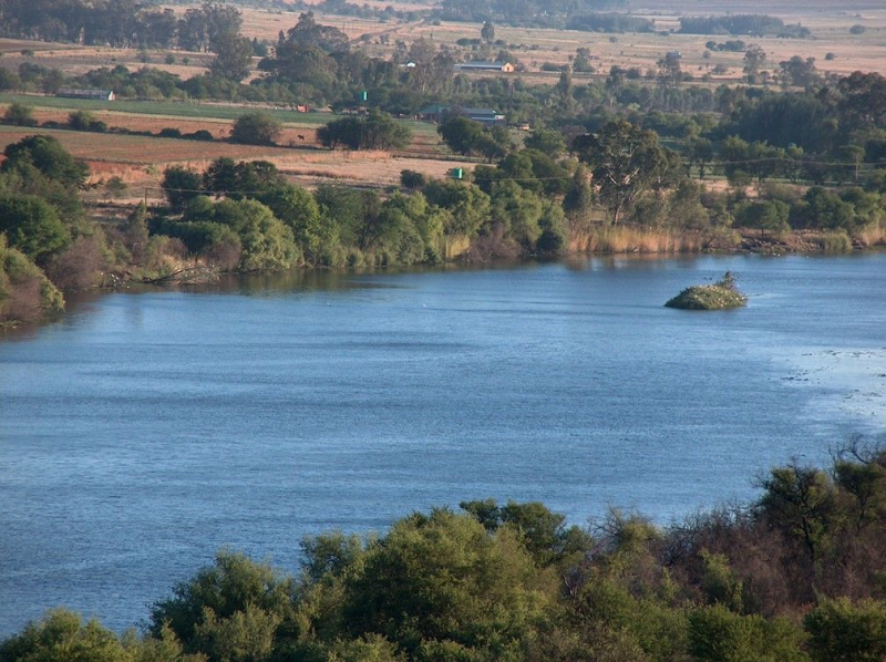
The Orange River, sometimes called isAngqu in isiZulu, is a river in Southern Africa. It is South Africa's longest river. The Orange River Basin stretches 2,432 kilometers (1,511 miles) from Lesotho to South Africa, with Namibia to the north. It begins in Lesotho's Drakensberg highlands and flows west through South Africa to the Atlantic Ocean. The river runs through various international borders, including those between South Africa and Lesotho and South Africa and Namibia, as well as several provincial borders within South Africa. It does not travel through any significant cities except Upington. The Orange River, which provides water for agricultural and hydroelectric generation, is vital to the South African economy. The river was dubbed the Orange River by Dutch explorer Robert Jacob Gordon in honor of the Dutch reigning dynasty, the House of Orange.
At an elevation of almost 3,000 meters, the Orange rises in the Drakensberg highlands on the boundary between South Africa and Lesotho, some 193 kilometers (120 miles) west of the Indian Ocean. The Senqu is located at the mouth of the Orange River in Lesotho. Because of the high altitude, parts of the Senqu River freeze in the winter. Droughts result downstream, affecting goat and cattle output in particular.
The Orange River then flows westward into South Africa, establishing the province of the Free State's southern border. The river flows first into the Gariep Dam (the country's largest) and then into the Vanderkloof Dam in this portion. The riverbed is steeply incised from Lesotho's border to below the Vanderkloof Dam. The land is flatter further downstream, and the river is heavily used for irrigation.
The Orange River meets its main tributary, the Vaal River, at the westernmost point of the Free State, southwest of Kimberley. The Vaal River forms much of the province's northern border. The river travels westward from here, through the dry wilderness of the southern Kalahari and Namaqualand in the Northern Cape Province, until it reaches Namibia at 20°E longitude. It flows west for 550 kilometers from here, marking the international border between the province and Namibia's Karas Region. The river flows through the town of Vioolsdrif, which serves as the principal border crossing between South Africa and Namibia.
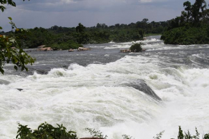
The Orange gets many intermittent streams and several huge wadis in the last 800 kilometers (500 miles) of its journey. Because the Namib Desert ends on the river's north bank in this segment, the volume of water contributed by these tributaries is insignificant under normal conditions. The riverbed has been deeply incised once again here. The Augrabies Falls are found on this portion of the Orange River, where the river drops 122 meters (400 feet) during a 26-kilometer journey (16 mi).
Between the small settlements of Oranjemund (literally "Orange mouth") in Namibia and Alexander Bay in South Africa, about halfway between Walvis Bay and Cape Town, the Orange flows into the Atlantic Ocean. It is totally obstructed by rapids and sandbars 33 kilometers (21 miles) from its mouth, and is generally not navigable for extended lengths.
Length: 2,432 km (1,511 mi- shared with Lesotho and Namibia )
kalahari-adventures.co.za 
vi.wikipedia.org -
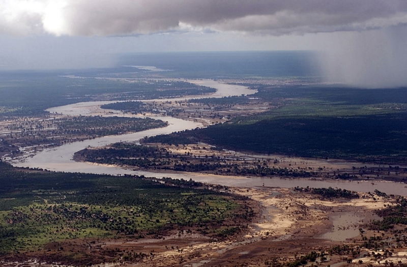
The Limpopo River rises in South Africa and runs eastward to the Indian Ocean through Mozambique. The name Limpopo comes from Rivombo (Livombo/Lebombo), a group of Tsonga settlers led by Hosi Rivombo who arrived in the mountainous terrain and named it after him. The river runs for around 1,750 kilometers (1,087 miles) and has a drainage basin of 415,000 square kilometers (160,200 square miles). At its mouth, the average discharge over a year is 170 m3 (6,000 cu ft; 170,000 l; 44,900 US gal). After the Zambezi River, the Limpopo is Africa's second largest river that flows into the Indian Ocean.
Vasco da Gama was the first European to see the river, anchoring outside its mouth in 1498 and naming it Espirito Santo River. St Vincent Whitshed Erskine examined the lower river in 1868–69, while Captain J F Elton traveled along the middle route in 1870.
Over geological time, the Limpopo River's drainage area has shrunk. The upper stream of the Zambezi River poured into the Limpopo River until the Late Pliocene or Pleistocene. The epeirogenic movement that rose the surface north of the present-day Limpopo River, diverting fluids into the Zambezi River, caused the drainage divide to shift.
Length: 1,750 km (1,090 mi- shared with Mozambique, Zimbabwe, and Botswana)
en.wikipedia.org 
istockphoto.com -
The Vaal River is South Africa's greatest tributary of the Orange River. The river originates near Breyten in the Mpumalanga province, around 30 kilometers (19 miles) north of Ermelo and barely 240 kilometers (150 miles) from the Indian Ocean. It then runs west, merging with the Orange River southwest of Kimberley in the Northern Cape. It runs for 1,458 kilometers (906 miles) between Mpumalanga, Gauteng, and the North West Province on the north bank and the Free State on the south bank.
It is South Africa's third largest river, behind the Orange River (2432 km) and the Limpopo River (1750 km), and it was established as the main source of water for the huge Witswatersrand area following the gold rush in the nineteenth century. The Vaal Dam is located on the Vaal River in Deneysville, just south of the Gauteng-Free State boundary. It's also worth noting that the Vaal River is the world's longest river entirely within South Africa's borders.
Rain and underground water collect in pans, vleis, and streams, which join to form the Vaal River, which flows westward. Near Standerton, Mpumalanga, the river runs west into the Grootdraai Dam. The river is joined by a number of tributaries on its way to the Vaal Dam near Vereeniging. The Little Vaal River begins near Ermelo in an escarpment. The Klip River begins near Memel, in the Free State. In Secunda, Mpumalanga, the Watervals River begins. Before the Vaal Dam was erected in 1938, the Wilge River met the Vaal River; now the water runs straight into the dam.
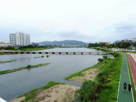
The Vaal River is 50 kilometers long and has 50 kilometers of navigable water. As a result, the river basin provides a variety of enjoyable water sports that draw both local and foreign visitors throughout the year. Boating, yachting, and water skiing are some of the activities available.
Deneysville is a prominent water-sports destination on the Free State side of the Vaal River, with visitors enjoying swimming, kiteboarding, yachting, boating, catamaran cruise, jet skiing, windsurfing, snorkeling, and fishing.
Length: 1,458 km (906 mi)
pinterest.pt 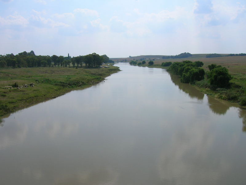
en.wikipedia.org -
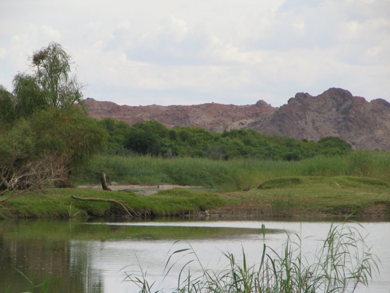
The Molopo River is one of Southern Africa's most important rivers. It stretches for around 970 kilometers and has a catchment area of 367,201 square kilometers, with Botswana, Namibia, and South Africa each owning almost a third of the basin.
The river's source is between Groot Marico and Lichtenburg, and it runs west first, then southwest from there. The Molopo River constitutes a substantial stretch of the border between Botswana and South Africa in its middle course.
The river flows infrequently, and when it does, the water moves at an extremely slow pace due to a gradient of only 0.76 m/km. Floods are uncommon since the Kalahari Desert's enormous sandveld areas on the Namibian side of the basin absorb all of the water from the seasonal rainfall. The flow empties into the Orange River, which it joins downstream of Augrabies Falls National Park at 28°31′02′′S 20°12′46′′E, in the event of unusually heavy and sustained precipitation. It is thought that the last time this happened was almost a century ago.
Length: 970 km (600 mi- shared with Botswana and Namibia)
mapio.net 
za.pinterest.com -
The Nossob River (also spelled Nossob or Nossop) is a dry riverbed in eastern Namibia, South Africa, and Botswana. It stretches over 740 km and was last inundated in 1989. Nossob camp, located at 25°25′18′′S 20°35′47′′E in the Kgalagadi Transfrontier Park, is named after the river.
The Swart-Nossob and Wit-Nossob, which mean black and white respectively, are the two main tributaries of the Nossob. The eastern slopes of the Otjihavera mountain range, east of Windhoek, are the source of both tributaries. Their respective sources are located at 1,800 m and above 2,000 m above sea level. The two riverbeds meet around 80 kilometers south of Gobabis, which is located on the Swart-bank. Nossob's
The river runs through the villages of Leonardville and Aranos on its way to Union's End, South Africa, from this junction. From Union's End, the river bed that forms the Botswana boundary meanders for over 200 kilometers across the Kgalagadi Transfrontier Park. It reaches the game reserve's southern limit slightly north of Twee Rivieren Camp, near the Auob River's junction.
The Nossob River in the Kalahari is supposed to flow once every century. Water does, however, run deep underground to sustain the grass and camelthorn trees that grow in the riverbed. After big thunderstorms, the Nossob may flow briefly, attracting species to the river.
The Nossob River joins the Molopo River 50 kilometers south of Twee Rivieren. The confluence is still 890 meters above sea level at 26°54′15′′S 20°41′24′′E. The Orange River, which it meets downstream of Augrabies Falls, is a tributary of the Molopo.
Length: 740 km (460 miles- shared with Botswana and Namibia)
en.wikipedia.org 
africawild-forum.com -
The Great Fish River flows through Cradock, starting east of Graaff-Reinet. The Tarka River meets its left bank further south. Then it makes a zig-zag turn to Cookhouse, before meandering down the escarpment east of Grahamstown and into the Indian Ocean at its estuary 8 kilometers northeast of Seafield.
Although the river's headwaters are in an arid region, and the natural flow can be sluggish in the dry season beyond the ebb and flow of the tidal sections, water from the Orange River system can now be used to keep the river flowing during dry periods. The river is tidal for about 20 kilometers.
The Groot Brak River, the Tarka River, and the Kap River are its primary tributaries on the left, and the Little Fish River on the right. The Fish to Tsitsikama Water Management Area includes the Great Fish River.
Rio do Infante was the name given to the Great Fish River after Joo Infante, the captain of one of Bartolomeu Dias' caravels. In the late 1480s, Infante paid a visit to the river.
Length: 730 km (450 mi)
visiteasterncape.co.za 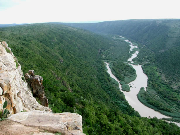
safarinow.com -
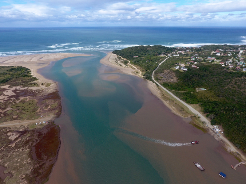
The Gamtoos River, sometimes known as the Gamptoos River, is a river in South Africa's Eastern Cape Province. It is formed by the confluence of the Kouga River and the Groot River, and it is approximately 645 kilometers long (401 miles) with a catchment area of 34,635 square kilometers (13,373 sq mi).
The Groot, Kouga, and Baviaanskloof rivers make up the Gamtoos river system. The Kouga's tributary is the latter.
Despite the low rainfall in the catchment area, commercial irrigated agriculture in the lower catchment supports the production of oranges, tobacco, citrus fruit, and vegetables. The Gamtoos River enters the Indian Ocean through an estuary. It's halfway between Jeffreys Bay and Port Elizabeth, and it's close to the Gamtoos River Mouth Nature Reserve. The lower catchment includes the settlements of Hankey, the oldest town in the Gamtoos river valley, and Patensie. The settlements of Steytlerville, Joubertina, Uniondale, Willowmore, and Murraysburg are located further inland.
The Loerie River, Klein River, and Hol River are tributaries of the Gamtoos, as are the Groot and Kouga rivers.
Length: 645 km (401 mi)
en.wikipedia.org 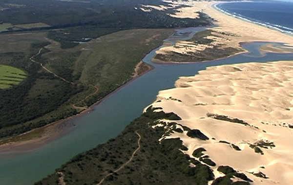
kougatourism.com -
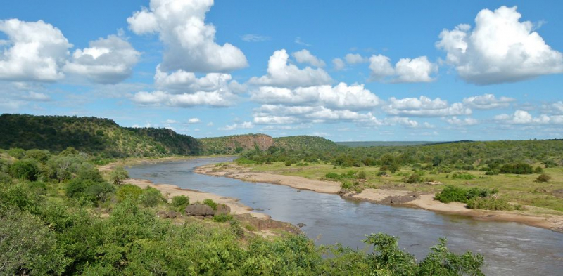
The Olifants River, also known as Lepelle, iBhalule, or Obalule, is a tributary of the Limpopo River in South Africa and Mozambique. It is located in the Drainage Area B of South Africa's Drainage Basins. Between the Olifants River and one of its main tributaries, the Steelpoort River, lies Sekhukhuneland, the Pedi people's ancestral homeland.
The Olifants River originates in Mpumalanga Province, between Breyten and Bethal.
It flows north through Witbank Dam and then Loskop Dam, before being forced east by the Transvaal Drakensberg, cutting through at the Abel Erasmus Pass and then flowing east over the Lowveld to join the Letaba River. It reaches Gaza Province, Mozambique, after cutting through the Lebombo Mountains via the Olifants Gorge, becoming the Rio dos Elefantes, and finally joining the Limpopo River 40 kilometers north of Maputo before entering the Indian Ocean at Xai-Xai.
After heavy rains, the river carries away degraded soil due to overgrazing in areas of its middle course. The Olifants River has become one of South Africa's most extensively contaminated rivers, thanks to growing green algae rather than human or industrial trash. According to a 2013 research conducted in the Kruger Park, the river was mesotrophic, meaning that nutrient levels were relatively low, yet a modest rise in nitrates might cause eutrophication. Coal mining and industry in the upper watershed were blamed for the elevated sulphate levels.
Length: 560 km (348 mi- shared with Mozambique)
letabaherald.co.za 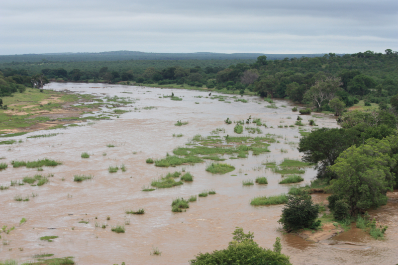
en.wikipedia.org -
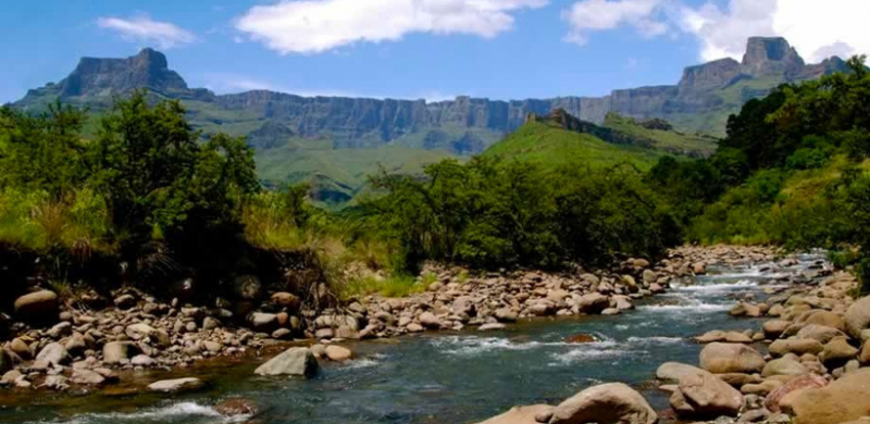
The Tugela River is the largest river in South Africa's KwaZulu-Natal Province. It is one of the country's most important rivers, with a total length of 531 km (330 mi).
The river flows from Mont-aux-Sources in the Drakensberg Mountains at an elevation of nearly 11,000 feet and drops 947 meters to the Tugela Falls. The Mont-aux-Sources also serves as the headwaters for two other major South African rivers, the Orange and the Vaal. The Tugela flows 531 kilometers (330 miles) from the Drakensberg range through the KwaZulu-Natal midlands before entering the Indian Ocean. The total catchment area is about 29,100 km2 (11,200 sq mi). The catchment's land uses are primarily rural subsistence farming and commercial forestry.
The Tugela River System is home to the scaly yellowfish (Labeobarbus natalensis). It is a common endemic fish in KwaZulu-Natal Province, where it can be found in a variety of habitats ranging from the Drakensberg foothills to the coastal lowlands, including rivers like the Umkomazi.
Length: 531 km (330 mi)
embark.org 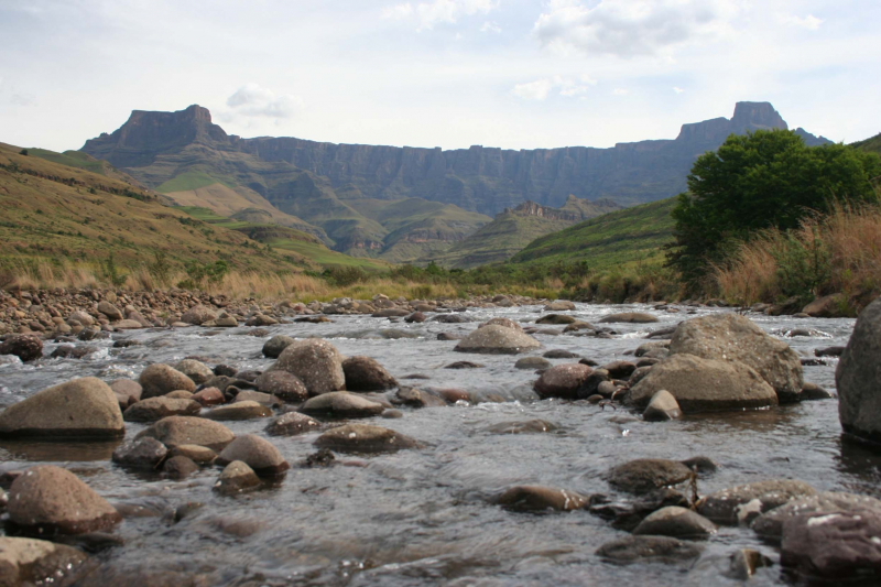
en.wikipedia.org -
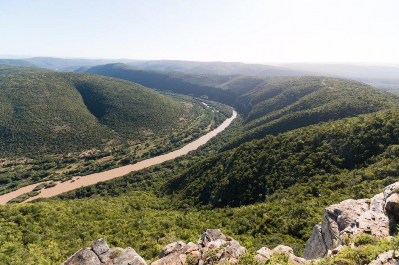
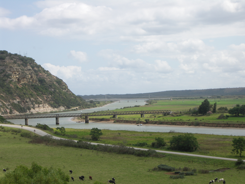
The Great Kei River is a river in South Africa's Eastern Cape province. Northeast of Cathcart, it is formed by the confluence of the Black and White Kei Rivers. It flows about 320 kilometers (199 miles) before ending in the Indian Ocean's Great Kei Estuary, with the little hamlet of Kei Mouth on the west bank. The Great Kei River, originally known as the Nciba River, formed the southwestern border of the Transkei region in the past.
The Great Kei River is a flowing river in Enoch Mgijima Local Municipality, north-east of Cathcart and southeast of Queenstown, formed by the confluence of the Black and White Kei Rivers. The Great Kei river flows southeast for about 225 kilometers (140 miles) from the confluence of the Black and White Kei rivers, meandering its way to the Indian Ocean. It ends at Kei Mouth, a beach vacation town, at the Great Kei estuary. In the north, the Tsomo is its longest tributary. The name dates back to 1752 and is derived from a Khoisan term for the river that means 'sand.'
The Great Kei used to be the southern border of the Transkei region, which may now be reached by the 'Pont,' one of South Africa's only two car-transporting river ferries.
The pont is currently operating, and automobiles are often transported into the Wild Coast from the southwestern side to the northeastern bank.
Length: 320 km (199 mi)
en.wikipedia.org 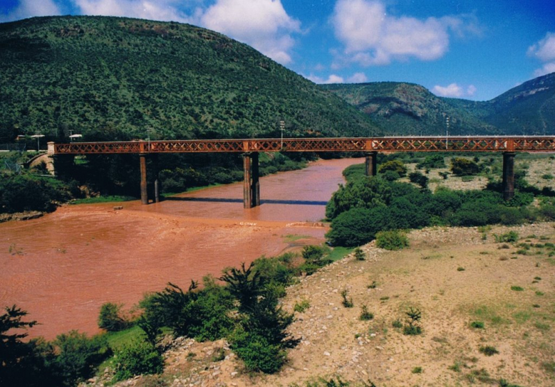
Great Kei River Bridge (Photo: mapio.net)