


Top 6 Longest Rivers in Zimbabwe

Zimbabwe is a landlocked country in southern Africa, famous for the largest and most spectacular waterfalls in the world associated with the name of great ... read more...rivers. The following article mentions the top 6 longest rivers in Zimbabwe that many readers probably do not know.
-
The Zambezi River (also written Zambeze and Zambesi) is Africa's fourth-longest river, its longest east-flowing river, and its biggest river flowing into the Indian Ocean from Africa. Its basin measures 1,390,000 square kilometers (540,000 square miles), somewhat less than half the size of the Nile's. The river begins in Zambia and travels through eastern Angola, along Namibia's north-eastern border and Botswana's northern border, then through Zambia and Zimbabwe to Mozambique, where it traverses the nation to empty into the Indian Ocean.
Victoria Falls is the most well-known feature of the Zambezi. Other prominent falls are the Chavuma Falls on the Zambia-Angola border and the Ngonye Falls at Sioma in Western Zambia.
The river has two major hydroelectric power sources: the Kariba Dam in Zambia and Zimbabwe, and the Cahora Bassa Dam in Mozambique, which supplies power to Mozambique and South Africa. In Zambia, there are two minor power stations along the Zambezi River, one at Victoria Falls and the other at Kalene Hill in Ikelenge District.
Length: 2,200 miles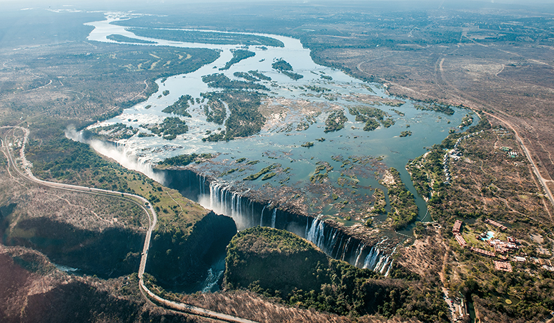
perspectives-cblacp.eu 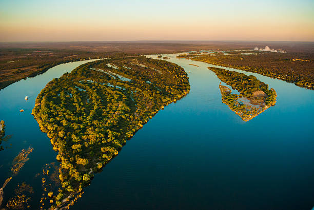
itstockphoto.com -
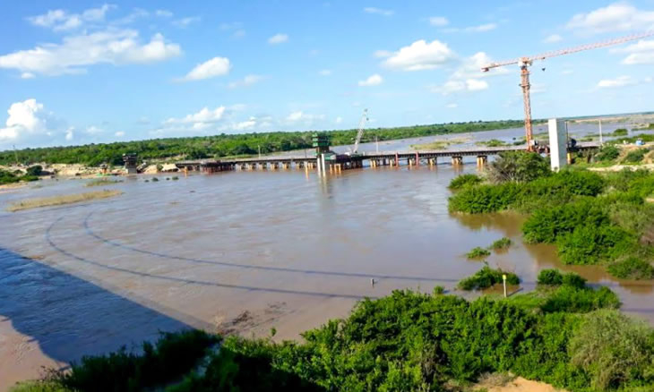
When it comes to the longest rivers in Zimbabwe people often mention The Limpopo River. It originated in South Africa and runs mainly eastward to the Indian Ocean through Mozambique. The name Limpopo comes from Rivombo (Livombo/Lebombo), a tribe of Tsonga immigrants commanded by Hosi Rivombo who settled in the surrounding mountains and called the area after their commander. The river is about 1,750 kilometers (1,087 miles) long, having a drainage basin that is 415,000 square kilometers (160,200 square miles). At its mouth, the average discharge throughout a year is 170 m3 (6,000 cu ft; 170,000 l; 44,900 US gal). After the Zambezi, the Limpopo River is Africa's second-biggest river that flows into the Indian Ocean.
Vasco da Gama was the first European to see the river, anchoring outside its mouth in 1498 and naming it the Espirito Santo River. St Vincent Whitshed Erskine examined its lower channel in 1868–69, and Captain J F Elton traveled along its middle course in 1870.
The Limpopo River's drainage area has shrunk throughout geological time. The upper stream of the Zambezi River poured into the Limpopo River until the Late Pliocene or Pleistocene. The drainage split shifted due to epeirogenic activity that rose the surface north of the present-day Limpopo River, diverting water into the Zambezi River.
Length: 1,100 miles
en.wikipedia.org 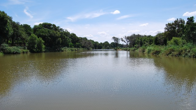
nehandaradio.com -
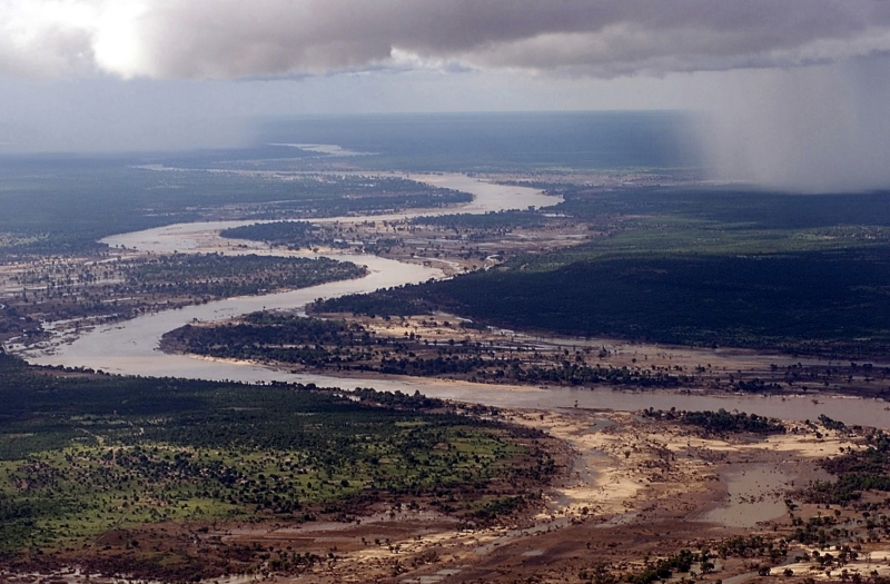
One of the longest rivers in Zimbabwe is Save River, sometimes known as the Sabi River (Portuguese: Río Save), is a 400-mile-long (640-kilometer) river in southern Africa that flows between Zimbabwe and Mozambique. The river originates in Zimbabwe, approximately 80 kilometers (50 miles) south of Harare, and runs south and then east from the Zimbabwean highveld to its confluence with the Odzi River. It then runs south, over the Chivirira ("Place of Boiling") Falls, and down the western side of Zimbabwe's Eastern Highlands, producing a dry river valley in the rain shadow of these mountains. At the Mozambique border, it is joined by the Runde River or Lundi, making a spectacular confluence at Mahenya. It then flows across Mozambique before entering the Indian Ocean at roughly 21° South.
The Save River was originally used to irrigate sugar plantations, but it is currently used to grow citrus, cotton, rice, and wheat. It also serves as a source of small-scale fishing for the locals.
Mozambique is divided administratively, politically, ethnically, and ecologically:
- The administrative units of the territory south of the Save varied over time throughout the colonial era, but the districts of Gaza and Inhambane lasted the longest; now, the Save separates the provinces of Gaza and Inhambane to the south from those of Manica and Sofala to the north.
- Politically, the "south-of-the-Save" might be regarded as Frelimo's heartland, whilst the territory immediately to the north is more supportive of Renamo;
- The Save divides ethnic groups that speak Shangaan (or Xi-Tsonga) in the south from those that speak Shona languages in the north.
- Ecologically, as the Save flows into the Indian Ocean, its mouth corresponds to the separation of tropical marine ecosystems to the north from subtropical; terrestrial ecosystems show less variation along the coastal plain north and south of the river, but inland, where the Chimanimani Mountains begin, a montane forest develops that is completely different from the forests found in the south.
The Save River delta contains mangrove trees that stretch for around 100 kilometers (62 miles) along the Indian Ocean coast. The mangrove woods are used by villagers in the delta basin for timber and as a venue for small-scale fishing. Cyclones, floods, erosion, and sea-level rise have all had an impact on the ecosystem of the lower Save River basin.
Length: 249 miles
clubofmozambique.com 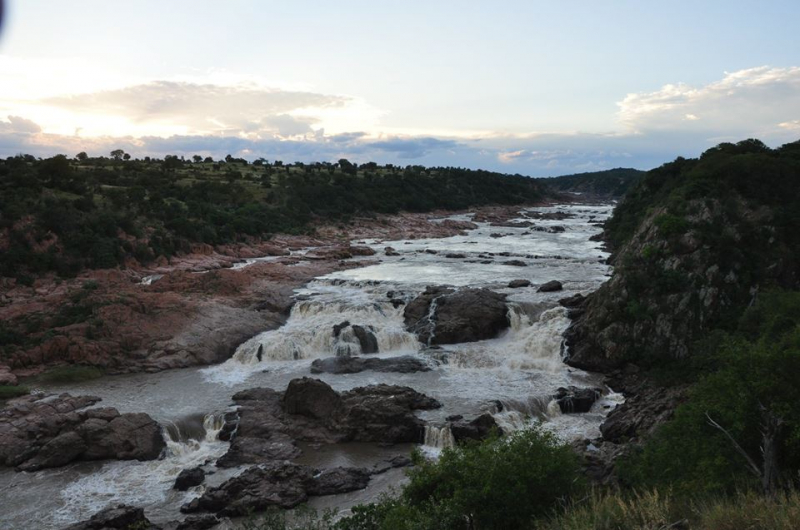
pindula.co.zw -
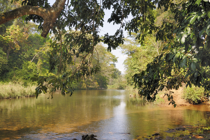
Pungwe River (Portuguese: Rio Púngoè or Rio Púnguè) is a 400 km (240 mi) long river in Zimbabwe and Mozambique. It rises below Mount Nyangani in the Eastern Highlands of Zimbabwe and then flows through the Manica and Sofala provinces of Mozambique. the Pungwe enters the Urema Valley, the southernmost portion of the Great Rift Valley, where it forms the southern boundary of Gorongosa National Park. The Urema River joins it, and the river follows the rift valley southward. Large seasonal wetlands from around the Pungwe and Urema rivers in the rift valley section. It empties into the Mozambique Channel at Beira, forming a large estuary. It is one of the major rivers of Mozambique and often causes floods.
As one of the longest rivers in Zimbabwe, Pungwe from upstream to downstream, the main left tributaries are the Nhazonia, Txatola, Vinduzi, and Nhandugue-Urema. The Honde and Muda are the appropriate tributaries.
Administratively, the Pungwe Basin encompasses sections of Mozambique's Sofala and Manica provinces, as well as a substantial portion of Zimbabwe's Mutasa District. In Zimbabwe, a minor fraction of the basin is located in the Nyanga District. Mozambique's population in the basin was projected to be at 1,104,000 people in 2003, while Zimbabwe's population was predicted to be 96,000 people.
Length: 240 miles
flickr.com 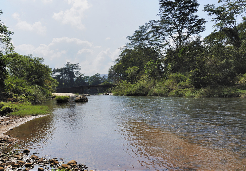
newzimbabwe.com -
The Thuli River, formerly known as the Tuli River, is a significant tributary of Zimbabwe's Shashe River. It drains into the Shashe River near Tuli hamlet after rising near Matopo Mission in Matobo District.
The Thuli is a transient river with decreasing annual unit discharge. The Thuli River's major tributaries are the Mtshabezi, Mtshelele, Sengezane, and Mwewe Rivers. The Thuli River below the Thuli-Makwe Dam is a sand-filled watercourse with alluvial aquifers.
Thuli Makwe Dam, west of Gwanda, is a huge dam on the Thuli River, in addition to a number of lesser weirs. It lies at the confluence with the Mtshelele River and provides irrigation water. The primary left-bank tributary, the Mtshabezi River, is dammed at Mtshabezi, Sheet, and Blanket. Once a connecting pipeline is finished, the Mtshabezi Dam will increase Bulawayo's water supply. The Sheet and Blanket Dams supply water to Gwanda as well as the Blanket and Vubachikwe mines. Two more dam sites were chosen further downstream: Thuli–Moswa, where no construction has occurred. Thuli-Manyange, upstream of Elliot Bridge, where building began briefly in 2007 but has since been discontinued. From which it can be seen that the Thuli is one of the longest rivers in Zimbabwe
Length: 210 miles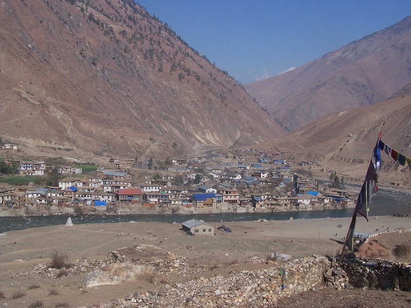
wikidata.org 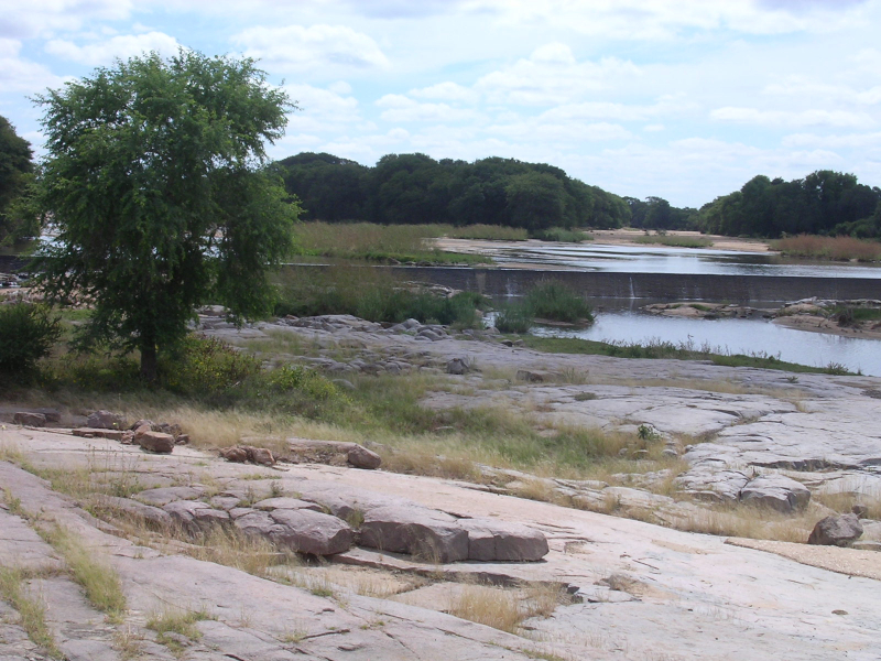
commons.wikimedia.org -
The Mzingwane River - one of the longest rivers in Zimbabwe, historically known as the Umzingwane River or the Umzingwani River, is a large left-bank tributary of Zimbabwe's Limpopo River. It begins near Fort Usher in Matobo District, south of Bulawayo, and flows into the Limpopo River near Beitbridge, downstream of the Shashe River's mouth and upstream of the Bubye River's mouth.
The Mzingwane River is an ephemeral river, with flow mainly constrained to the months of rain (November to March), with the highest flow observed between December and February, except where dam activities have affected it. The river produces 9.3 percent of the Limpopo Basin's mean annual discharge, making it the basin's third greatest tributary.
The Insiza, Inyankuni, Ncema, Umchabezi (not to be confused with Mtshabezi), and Mtetengwe Rivers are major tributaries of the Mzingwane River. The lower Mzingwane River is a sand-filled waterway with huge alluvial aquifers under the alluvial plains. The estimated water resource potential of these aquifers ranges from 175,000 m3 to 5,430,000 m3 in the channels and from 80,000 m3 to 6,920,0003 on the plains. Some of these aquifers are now being exploited to supply water for residential consumption, livestock watering and dip tanks, commercial irrigation, and market gardening.
Length: 205 miles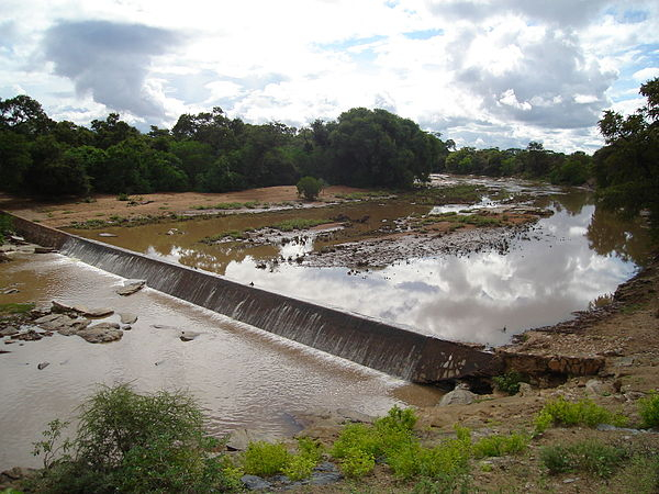
wikiwand.com 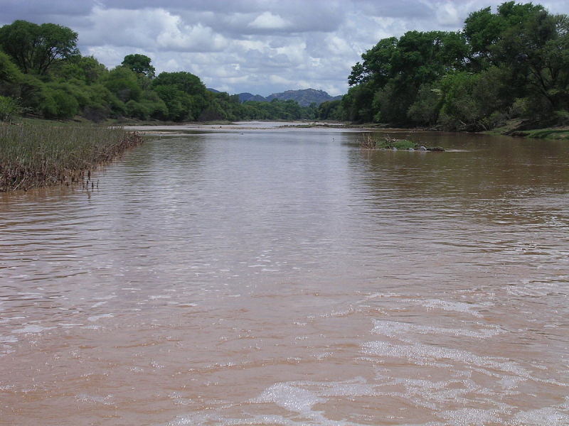
commons.wikimedia.org


