


Top 10 Longest Rivers in Malaysia

The Rajang River, which flows through Sarawak on Borneo's island, is Malaysia's longest river at 350 miles. Malaysia's rivers have played an important role in ... read more...the country's culture and economic growth over time. Rivers are important to indigenous peoples, who consider rivers to be a part of their culture. In Malaysia, rivers and streams provide 98 percent of the country's water, with the rest coming from groundwater. Toplist has compiled the top 10 longest rivers in Malaysia.
-
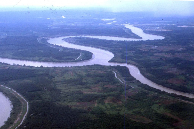
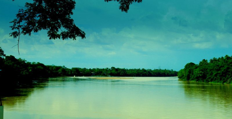
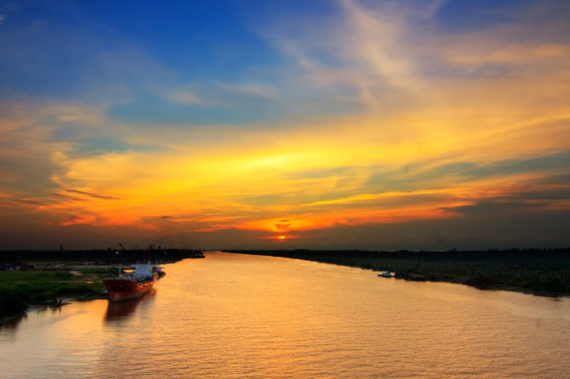
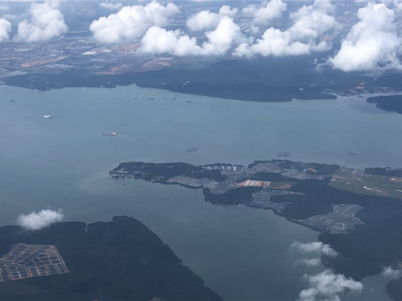
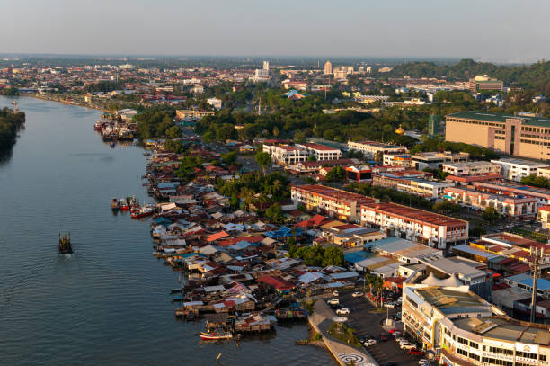
The first one in Top 10 Longest Rivers in Malaysia that Toplist would like to introduce to you is Rajang River. The Rajang River is a river in the Malaysian state of Sarawak. The river is found in Borneo's northwest corner. The river rises in the Iran Mountains and flows through Kapit before reaching the South China Sea. It is the 4th longest river in Borneo and the longest river in Malaysia, with a total length of around 565 kilometers (351 miles).
The Balui River, Katibas River, Ngemah River, Iran River, Pila River, Balleh River, Bangkit River, and Kanowit River are some of the major tributaries. Bakun Hydro Electric Dam Plant, Malaysia's largest and tallest (160m) hydroelectric project, is situated on the Balui River's narrow Bakun Fall.
The Rajang basin is home to 30 animal species (2004), 122 bird species (2004), and 164 fish species (2005).
Logging is the main source of income along the Rajang River's higher reaches. Ramin, plywood, Kapur, Meranti, Keruing, and Belian are among the woods that are harvested for export. Rice is the most common crop in the Rajang river's middle reaches. In the 1970s, Engkabang fruit was widely traded. Rubber and pepper production, poultry domestication, and vegetable planting are some of the other agricultural activities in the Rajang basin. The Rajang Port Authority (RPA) is the major regulatory agency in charge of coordinating the trade activities of the Rajang River's five river ports.
Pandaw River Cruises began on July 1, 2009, with the goal of increasing tourism along the Rajang River. It was a nine-day cruise from Sibu's Express Wharf Terminal to Kapit's Pelagus Rapids Resort. During the ride, guests can go hiking and explore long houses and communities. However, due to logistical and operational issues, this experiment was canceled in March 2012. Longhouse tours along the Rajang River were promoted as an ecotourism product during the 2017 Visit Sibu Year. Crocodiles that live along the riverbanks were chosen as the event's mascot.
Length: 563 km (350 mi)
web.colby.edu 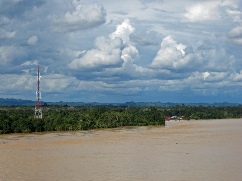
en.wikipedia.org -
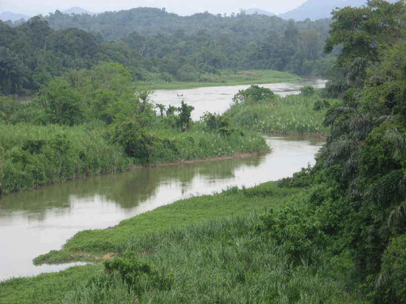
The second one in Top 10 Longest Rivers in Malaysia that Toplist would like to introduce to you is Kinabatangan River. The Kinabatangan River flows through Sandakan Division in Malaysia's northern state of Sabah. With a length of 560 kilometers (350 miles) from its headwaters in the mountains of southwest Sabah to its mouth in the Sulu Sea, east of Sandakan, it is Malaysia's second longest river. The limestone caverns at Gomantong Hill, dryland dipterocarp forests, riverine forest, freshwater swamp forest, oxbow lakes, and salty mangrove swamps near the coast are among the area's high-biodiversity habitats.
The river area, which includes Labang and Kuamut, dates back to the Early and Middle Miocene, while the Maliau Basin's river system dates back to the Early and Late Miocene.
The area around the river mouth is made up of Middle Miocene chaotic deposits. Excessive logging and land clearing for plantations have severely disrupted the ecology of the upper reaches of the river, but the original lowland forests and mangrove swamps near the coast have largely survived, providing a haven for a population of saltwater crocodiles (Crocodylus porosus) and containing some of Borneo's highest wildlife concentrations. The demand for freshwater fish is always high in many settlements along the river, where the residents' livelihoods are heavily reliant on the money from their catches. The northeast monsoon's drenching rains lead the river to swell rapidly every year. The river exceeds its banks and stretches across the flat ground of its lower sections, forming a massive floodplain, as it is unable to disgorge into the sea quickly enough.
Length: 560 km (350 mi)
en.wikipedia.org 
commons.wikimedia.org -
The third one in Top 10 Longest Rivers in Malaysia that Toplist would like to introduce to you is Pahang River. The Pahang River is a Malaysian river that runs through the state of Pahang. It is the Malay Peninsula's longest river, measuring 459 kilometers in length. The river rises in the Titiwangsa Mountains and flows into the South China Sea at the confluence of the Jelai and Tembeling rivers.
Warriors and mariners from all across Maritime Southeast Asia, including Aceh, Riau, Palembang, and Sulawesi, landed on the banks of the Pahang River as early as 1400. The Malay Annals and Hikayat Munshi Abdullah include the earliest historical records of the Pahang River, riverine populations, and Pahang people.
At Jempol in Negeri Sembilan, where the Serting River flows into the Bera River, a tributary of the Pahang River, the Pahang and Muar Rivers were practically connected. The Jempol River empties into the Muar River. Trading boats from the Muar could continue their journey until they reached Pekan's Kuala Pahang or Kuala Lipis, from which they could travel to Terengganu, Kelantan, or Perak.
Across the river, seven bridges have been constructed. Abu Bakar Bridge in Pekan, Tun Razak Highway's Paloh Hinai Bridge in Paloh Hinai, Chenor Bridge in Chenor, new Temerloh Bridge in Temerloh, East Coast Expressway's Semantan Bridge in Sanggang, Sultan Ahmad Shah Bridge in Kuala Krau, and Sultan Abdullah Bridge in Jerantut Feri are the bridges.
Length: 459 km (285 mi)
sites.google.com 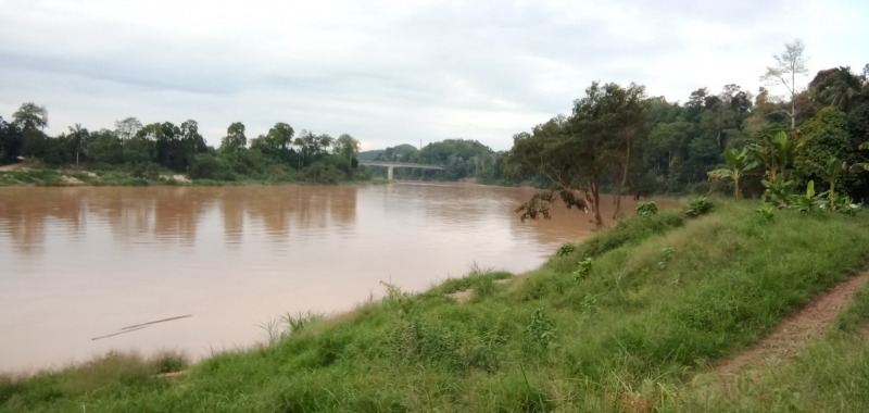
commons.wikimedia.org -
The fourth one in Top 10 Longest Rivers in Malaysia that Toplist would like to introduce to you is Perak River. After the Pahang River in Pahang, Malaysia, Perak River is Malaysia's fourth longest river. The river's banks are home to a variety of towns, notably the royal town of Kuala Kangsar. Until the 19th century, when tin reserves were discovered elsewhere, most notably at Ipoh, most of the villages in what is now Perak were located along the river. The Perak River originates in the Belum Forest Reserve's hilly Perak–Kelantan–Thailand boundary. The junction of the Machang and Merah rivers, deep in the Royal Belum State Park's isolated section. The Machang River comes from the Titiwangsa Range on the Perak-Terengganu border, while the Merah River comes from the upper stream of Thailand's Bang Lang National Park. The headwaters of the Perak River were formed by the confluence of several rivers. The Bidor River and the Kinta River are two of the river's branches. At Banding, near Grik, the Temenggor Dam has created a massive man-made lake.
The Perak River is Peninsular Malaysia's fourth-longest river. The river originates in the highlands of Upper Perak, close to the Thai border. It then flows past the two main cities in the region, Gerik and Lenggong, before joining the Kangsar River at Kuala Kangsar, the royal seat. It then flows past the cities of Parit, Pasir Salak, and Kampung Gajah in Perak Tengah before emptying into the Malacca Straits just outside Teluk Intan in the Hilir Perak (Lower Perak) region.
Length: 400 km (250 mi)
en.wikipedia.org 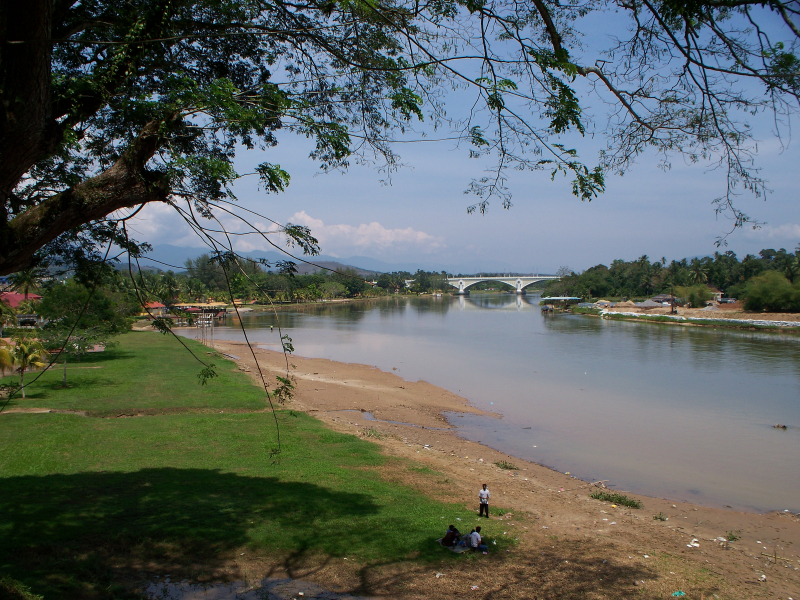
commons.wikimedia.org -
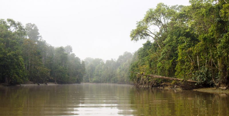
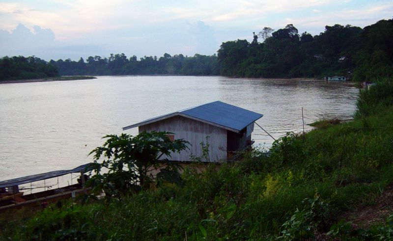
The fifth one in Top 10 Longest Rivers in Malaysia that Toplist would like to introduce to you is Baram River. The Baram River is a river on the island of Borneo that flows through Sarawak. The river rises in the Kelabit Highlands, a watershed separated from Sarawak by the Iran Mountains of East Kalimantan. The river travels westward to the South China Sea, passing through tropical rainforest. The Baram River empties into a delta, which is separated into two sections: the Middle-Late Miocene East Barma Delta and the Late Miocene-Quaternary West Barma Delta. The western unit is made up of organic-rich mudstones (with a total organic carbon content of more than 1.0 wt%) that contain significant oil and gas potential.
Since 1882, when the then-Sultan of Brunei gave the White Rajah of Sarawak an area of 10,000 square miles (30,000 km2) in exchange for a perpetual annual payment of 6000 dollars, the Baram river basin has been part of Sarawak.
The Miri-Baram Highway, Federal Route, crosses the river not far from its mouth on the Batang Baram Bridge, was opened in 2003. The settlement of Marudi is about 100 kilometers upstream.
Length: 400 km (250 mi)
pinterest.com 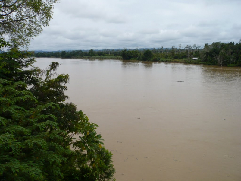
mapio.net -
The Kelantan River is the main river in the Malaysian state of Kelantan. It flows northwards into the South China Sea after draining a catchment area of around 11900 km2 in north-east Malaysia, including part of the Taman Negara National Park. The area receives 0 mm of rain during the dry season (March–May) and 1750 mm during the monsoon season (November–January). The area's typical discharge is around 500 m3/s.
Many Orang Asli tribes live in the Gua Musang region of southern Kelantan, where the river tributaries spring in the forested mountains. The limestone outcrops and caverns in the area are well-known. Some cave systems around the River Nenggeri area, such as Gua Cha near Kuala Betis, reveal signs of habitation dating back to 9000 years ago.
Lower down, Malay settlements dot the banks of the river, which runs through one of the Malay Peninsula's most heavily populated flood plains, with padi farms that provide roughly 12% of Malaysia's rice production.
From south to north, the river passes through seven key towns: Kuala Krai, Tanah Merah, Machang, Pasir Mas, Tumpat, the state capital Kota Bharu, and Pengkalan Chepa, which is at the river's mouth. There are various islands in the river near the estuary.
The Kuala Besar area around the real estuary is filled with lovely fishing towns that are particularly widely renowned for the manufacturing of batik (a local patterned textile made by waxing and dyeing cloth), for which Kelantan is recognized. The mouth of the Kelantan River is also significant for being the location of the initial landing of Japanese troops in Malaya in December 1941.
Length: 248 km (154 mi)
en.wikipedia.org 
mapio.net -
The Johor River is the most important river in Johor, Malaysia. The river, which originates from Mount Gemuruh and empties into the Strait of Johor, is 122.7 km long and has a catchment area of 2,636 km2. It flows roughly north–south. Sayong, Linggiu, Tiram, and Lebam Rivers are its primary tributaries. Its banks have also served as the site of past Johor capitals, the Johor Lama. The Sungai Johor Bridge, which opened in June 2011 and is now Malaysia's longest river bridge, was the first to span the river.
The Johor River basin covers around 14 percent of Peninsular Malaysia's Johor State. The river and its tributaries are vital water sources not just for the state but also for Singapore. The Public Utilities Board of Singapore (PUB), Syarikat Air Johor, and SAJ (or Johor Water Company) each pull roughly 250,000 cubic metres of water each day from the Johor River near Kota Tinggi. Since the mid-1960s, both water supply schemes have been functioning. Furthermore, the Linggui Dam, which was built and impounded in 1993, provides additional water to both Johor and Singapore.
Between 1974 and 1989, researchers obtained evidence of a robust breeding population of dugongs in the waters of the Johor River estuary.
Length: 122.7 km (76.2 mi)
commons.wikimedia.org 
en.wikipedia.org -
The Klang River is a Malaysian river that passes through Kuala Lumpur and Selangor before entering the Malacca Straits. It stretches for around 120 kilometers (75 miles) and drains a 1,288-square-kilometer basin (497 sq mi). There are 11 significant tributaries of the Klang River.
Because the river flows through the Klang Valley, a densely populated area with a population of more than four million people, it is heavily polluted due to deep siltation caused by human waste from riverbank squatters and even some businesses without septic tanks or sewage treatment plants, as well as soil carried by mudflows from the mountains. The river has been narrowed by heavy construction to the point where it resembles a gigantic storm drain in certain parts. In Kuala Lumpur, this contributes to flash floods, especially after heavy rain.
The river begins in Ampang Jaya, Selangor, and flows through the city center along the Ampang–Kuala Lumpur Elevated Highway.
Kuala Lumpur is located at the confluence of the Gombak and Klang rivers. Behind Masjid Jamek, the confluence can be found. It then runs south-west via Brickfields, Bangsar, Lembah Pantai, Old Klang Road, and Jalan Puchong, before becoming the Petaling Jaya-Subang Jaya border till PJS7, crossing UEP Subang Jaya, and finally making a U-turn at Puchong and Putra Heights.
The river passes through Shah Alam, the state capital of Selangor, further downstream. The city of Klang is located on the river's lower reaches. The Klang River's estuary is also home to Malaysia's largest sea port, Port Klang.
Upstream of the river are two important dams: Batu Dam and Klang Gates Dam, which give water to the residents of Klang Valley and help to moderate floods.
Length: 120 km (75 mi)
malaymail.com 
tripadvisor.com.vn -
The Sarawak River is a river in the Malaysian state of Sarawak. For the people of southwestern Sarawak, it is a significant source of water and transportation. The river is also used for water-related sports like the yearly Sarawak Regatta, which draws visitors from all over the world.
On the north bank of the river stands the Astana, the official residence of the Yang di-Pertua Negeri Sarawak (Governor of Sarawak), as well as the New Sarawak State Legislative Assembly Building and Fort Margherita.
It circles the Holiday Inn Kuching (formerly known as the Grand Margherita Hotel) and the Riverbank Suites apartment complex on the river's edge. It is surrounded by the Sarawak River Cruise.
Length: 120 km (75 mi)
istockphoto.com 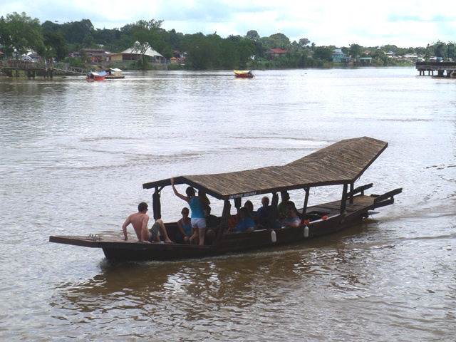
commons.wikimedia.org -
The Kinta River is a river in the Malaysian state of Perak. The Kinta Valley, which surrounds Ipoh, Perak's capital, gave it its name. This river runs through Ipoh. In the area surrounding the river, there are numerous limestone hills, as well as numerous tin mines. In the Kinta Valley, the world's largest tin field was discovered in 1876.
The river was also recognized for its diverse freshwater fish population. From the Intake Dam to Tasek, and from a remote fish pool 0.75 miles (1.21 km) down from Tanjung Rambutan, the fisheries department recorded a greater amount of fish. Until the fisheries gradually closed down, fishing was a key local occupation in this area.
The Kinta River is one of the Perak River's main streams.
The following are the major settlements along the river:
- Sungai Siput
- Ipoh
- Pusing
- Batu Gajah
- Gopeng
- Teronoh
- Kampar
- Tanjung Tualang
Length: 100 km (62 mi)
en.wikipedia.org 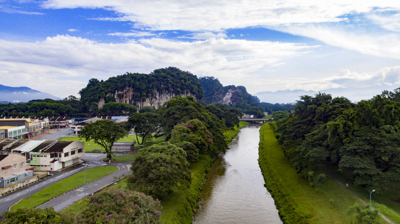
flickr.com


