Top 10 Most Beautiful Waterfalls in California

It should come as no surprise that California is home to numerous spectacular waterfalls. Water runs in every direction across the state, with towering ... read more...mountain peaks, rushing rivers, and a rugged coastline. From famous waterfalls in Northern California to a few favorites in Southern California, gravity is on display across the state. Let's find out about some of the Most Beautiful Waterfalls in California through this article!
-
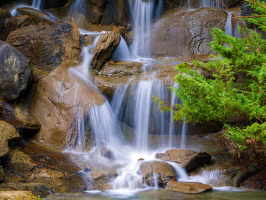
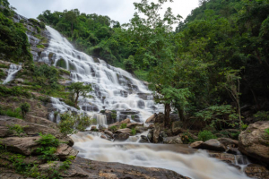
McArthur-Burney Falls Memorial State Park is in Shasta County, near the town of Burney. It is most known for Burney Falls, which is 129 feet in height and is one of the state's most beautiful waterfalls. Visitors may enjoy a variety of leisure activities almost all year.
From the parking area, an ADA accessible path leads to Burney Falls. There are several ADA-compliant restrooms, and some of the campsites and cabins are also accessible. There is also a 3/4-mile accessible trail that runs beside Burney Creek and includes an accessible fishing pier. President Teddy Roosevelt once called Burney Falls the "eighth wonder of the world," and they are definitely worth a visit. Water is supplied by underground springs at the top of the falls, which give a nearly continuous flow of water throughout the year. The outcome is a wall of water that seems to erupt from the mountain's side before plunging over a hundred feet into a pool at the base.
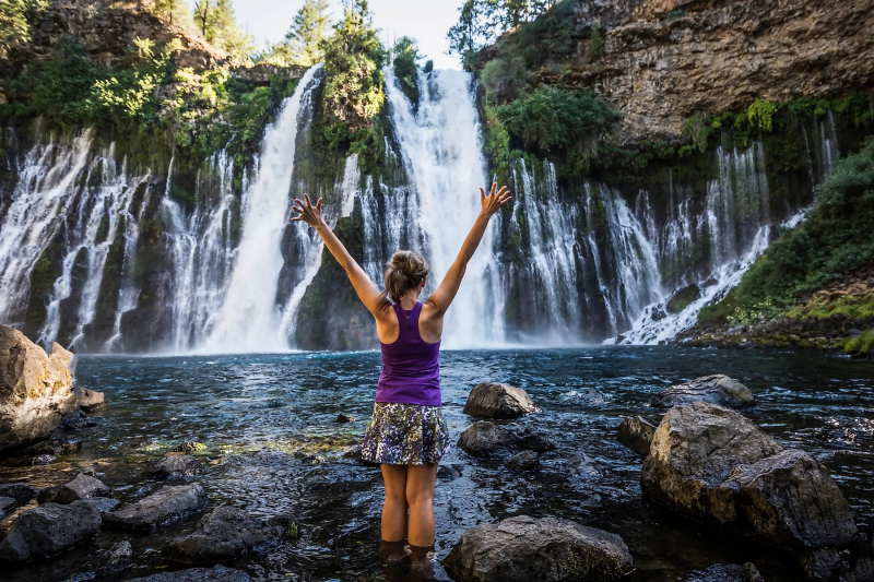
Burney Falls, McArthur-Burney Falls Memorial State Park 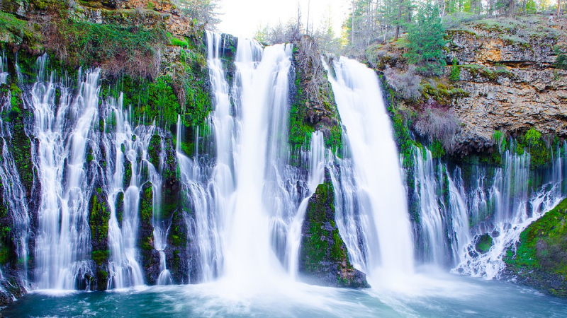
Burney Falls, McArthur-Burney Falls Memorial State Park -
It's a good idea to visit Yosemite National Park in the Sierra Nevada Mountains for a series of breathtaking California waterfalls. Nearly all waterfalls in the Yosemite Valley run at their peak in the spring. Water falls powerfully from prominent granite peaks here, making a lasting impression on visitors.
Yosemite Valley offers views of many of Yosemite's famous waterfalls. Bridalveil Falls, Sentinel Falls, and Yosemite Falls, one of the park's highest at 2,425 feet, are just a few of the picture-perfect waterfalls. Yosemite Falls is made up of three different falls: Upper Yosemite Fall (1,430 feet), the middle cascades (675 feet), and Lower Yosemite Fall (675 feet) (320 feet). Yosemite Falls may be seen from a variety of locations across Yosemite Valley, particularly at Yosemite Village and Yosemite Valley Lodge. Visitors who want to get a closer look may hike the 7.2-mile round trip to the top of Yosemite Falls.
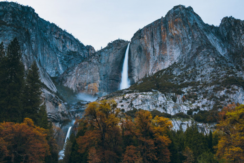
Yosemite Falls, Yosemite Valley 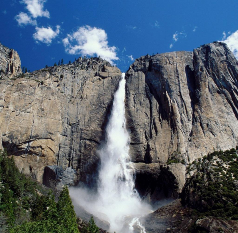
Yosemite Falls, Yosemite Valley -
McWay Falls, located in Big Sur, is an 80-foot waterfall that looks like a postcard. McWay Falls is a must-see year-round ribbon of water along the famous Pacific Coast Highway in a state-recognized for its numerous stunning waterfalls.
McWay Falls is part of Julia Pfeiffer Burns State Park in Big Sur. Unlike many other well-known California waterfalls, McWay Falls flows year-round. McWay Falls either falls directly into the Pacific Ocean or into a gorgeous small cove, depending on the tide. It's a stunning sight and one of California's most photographed landmarks. The McWay Falls overlook trail is a must-see for anybody driving along Highway One along the Big Sur Coast. A viewpoint for McWay Falls is a short 0.6-mile round trip hike that may be accessible directly from Highway One or from Julia Pfieffer Burns State Park parking areas.
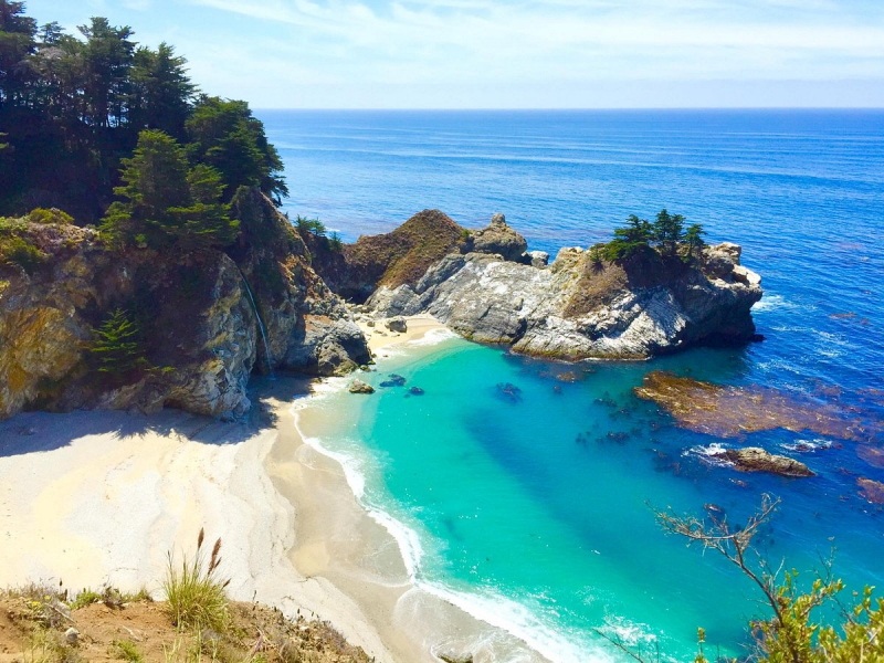
McWay Falls, Julia Pfeiffer Burns State Park 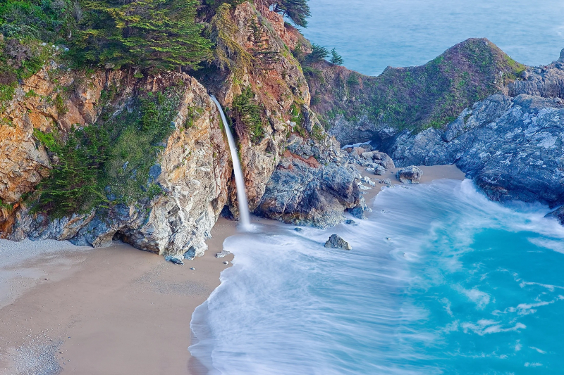
McWay Falls, Julia Pfeiffer Burns State Park -
Rainbow Falls near Mammoth Lakes is one of California's most magnificent waterfalls. The Sierra Nevada Mountains and the Inyo National Forest surround Rainbow Falls, which is located inside Devils Postpile National Monument. It's famous for the colorful rainbow that its mist creates making the perfect picture postcard.
The San Joaquin River's mist acts as a giant prism, refracting the sun's rays into a spectrum of color. Although it is the hottest time to go, midday is undoubtedly the best time to see Rainbow Falls' colorful effect. Starting from the trailhead at the end of Reds Meadow Road, it's about a five-mile round trip to see the falls. The 5.4-mile round-trip hike is rated as moderately challenging and relatively exposed and vulnerable to sunburn.
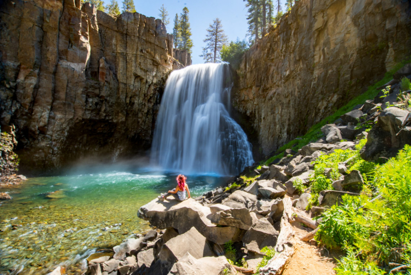
Rainbow Falls, Devils Postpile National Monument 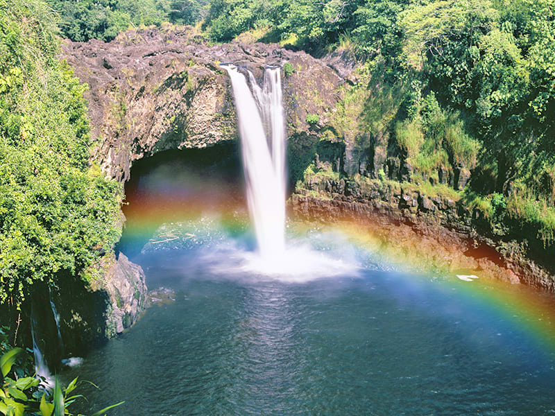
Rainbow Falls, Devils Postpile National Monument -
Alamere Falls is a stunning waterfall located in the Phillip Burton Wilderness. Water rushes down a 40-foot (12-meter) cliff onto the south end of Wildcat Beach, creating a stunning spectacle.
Alamere Falls is a beautiful coastal waterfall in Point Reyes National Seashore that can be seen from Wildcat Beach. It is, however, a difficult waterfall to access, requiring a 13-mile round trip if you want to see it in a day. Alternatively, Point Reyes features a network of backcountry campsites where you may break up the hike over many days. To go to Alamere Falls, you must follow the trail guide issued by the National Park Service. Visitors sometimes come to the top of the falls by a few unmarked and unauthorized pathways, and several search and rescue missions have had to save people from the cliffs.
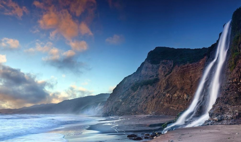
Alamere Falls, Point Reyes National Seashore 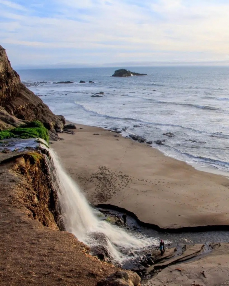
Alamere Falls, Point Reyes National Seashore -
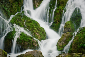
Within the Shasta-Trinity National Forest in Northern California, three beautiful waterfalls line the McCloud River: Lower Falls, Middle Falls, and Upper Falls. Summer swimming, fall foliage, and an early spring thaw make this beautiful, well-maintained trail exciting and accessible all year. All three waterfalls are easily accessible along the Volcanic Legacy Scenic Byway and have parking sites. This magnificent byway connects numerous other ancient landscapes, including Burney Falls, which is a 40-mile drive to the east.
The three McCloud River waterfalls are connected by a moderate four-mile hiking trail. The road between Lower and Middle Falls is partially paved and passes alongside the popular Fowler Campground. The Lower Falls was more of large swimming and play waterfall, with a 12-15 foot plunge into a deep, emerald green pool. The trail going to the Upper Falls quickly gains elevation and is the most difficult part of the hike.
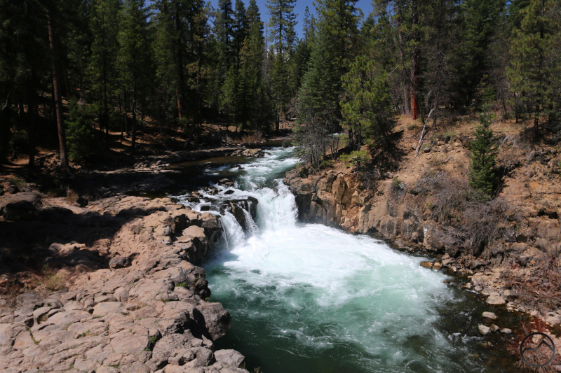
McCloud Falls, Shasta-Trinity National Forest 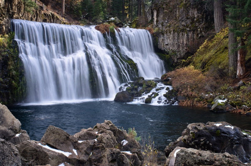
McCloud Falls, Shasta-Trinity National Forest -
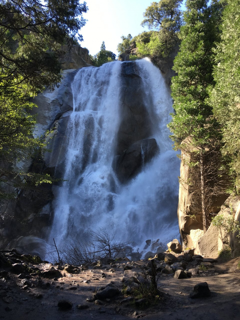
In Yosemite National Park, Vernal Falls is a beautiful example of gravity. Vernal, however, is not visible from Yosemite Valley, unlike other major falls in the park. The most popular trailhead departs from near the Happy Isles Nature Center, and it takes a bit of hiking to see this magnificent 317-foot waterfall.
Although Vernal Fall is just 317 ft (96 meters) tall, it is one of Yosemite's most powerful waterfalls. Unlike Yosemite and Bridalveil Falls, Vernal is not accessible by car from the valley floor. You must go on the trail to see it. You have a lot of alternatives. The simplest walk begins at the Happy Isles Nature Center and follows a well-marked path. You may take a free shuttle bus or walk from Curry Village to Happy Isles Nature Center. From there, either continue to the top of the waterfall or follow the trailhead to the Vernal Fall footbridge (approximately 1 mile). If you want to walk through the mist of this huge waterfall, this is a great option.
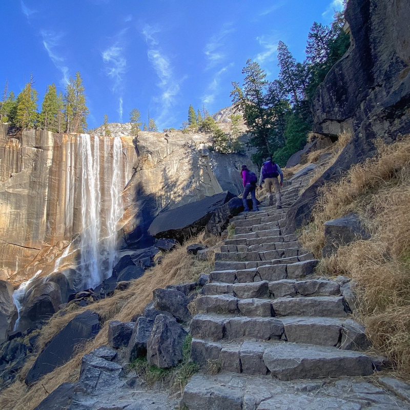
Vernal Falls, Yosemite National Park 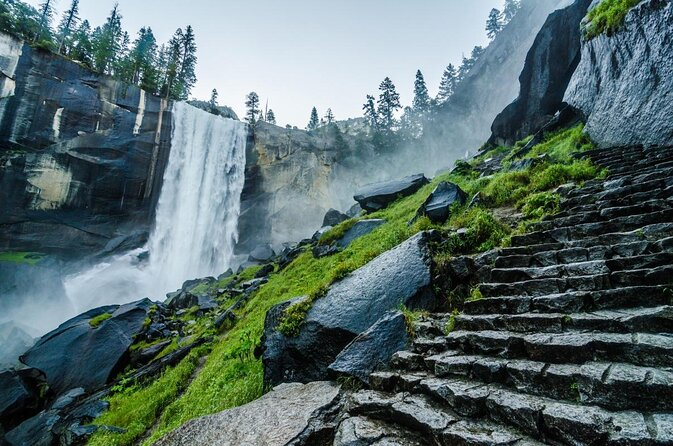
Vernal Falls, Yosemite National Park -
The Kings Canyon Scenic Byway leads into Kings Canyon National Park, and Grizzly Falls is a scenic stop along the way. If you don't chance to get a glimpse of the falls while driving, look for signs directing you to the Grizzly Falls Picnic Area. The partially obscured view of the 80-foot waterfall from the road should be enough to convince you to pull over, and the hike to the base of Grizzly Falls is only a 0.1-mile round trip.
Grizzly Falls is a short and easy walk from the picnic spot. The falls are a favorite family waterfall because of the simple access and without having to hike far. The size of the waterfall changes depending on the quantity of snowmelt on the south side of the Monarch Divide. Grizzly Creek swells after a snowy winter, and the waterfall widens to a frothing wall of white water. Because the falls themselves are reliant on snowmelt, so the ideal time to go is when the road reopens in early spring. Outside, the picnic area is a great location to have a packed lunch. There are restrooms available.
Grizzly Falls, Sequoia National Forest 
Grizzly Falls, Sequoia National Forest -
The most well-known waterfall in San Diego is Cedar Creek. The falls are located in Cleveland National Forest, which is situated in the city's eastern foothills and is about an hour's drive from downtown. Permits are necessary to visit the falls since they have become such a famous adventure destination.
This San Diego landmark location offers much in the way of beautiful scenery, great exercise and a natural watering hole. But to get to the falls, you'll need a permit and a 6.6-mile round-trip hike that's moderate to challenging. The trail rises 1,000 feet in height and passes through exposed and hot terrain. Prepare for a lengthy and hot hike, but the stunning 80-foot Cedar Creek Falls plunging into a great swimming pool will be well worth it. During the summer, the falls are usually not in use, it's totally dry, and the highest flow falls in the winter and spring.
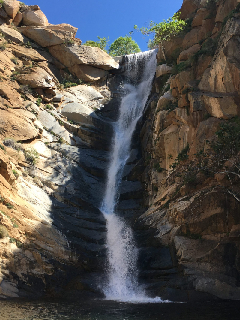
Cedar Creek Falls, Cleveland National Forest 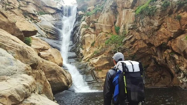
Cedar Creek Falls, Cleveland National Forest -
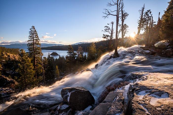
Lower Eagle Falls is the last of a series of beautiful waterfalls that drop down the hillside and into Emerald Bay. Because this lower waterfall is so easily accessible, be prepared for challenging street parking and a large crowd. Still, it's worth waiting for a parking spot to enjoy being so near to such a powerful waterfall with such a gorgeous view.
Lower Eagle Falls is the most accessible waterfall. It's reachable through a 0.6-mile round trip hike with a few elevation changes on the way back to the trailhead. It's one of South Lake Tahoe's most popular hikes. A roughly three-mile roundtrip provides a more comprehensive view of both falls. The waterfall is spectacular, especially in the spring, with two large drops. When the snow in the mountains melts in the summer, the waterfall becomes a trickle. Spring is unquestionably the best time to go.
Lower Eagle Falls, Lake Tahoe 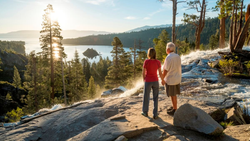
Lower Eagle Falls, Lake Tahoe