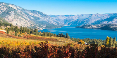
Top 10 Most Beautiful Waterfalls in Washington

It should come as no surprise that Washington has several beautiful waterfalls. The state has a diverse assortment of stunning waterfalls that make an ... read more...indelible impression. Gravity is on show throughout the state, from waterfalls in Northern Washington to a few favorites in Southern Washington. Let's find out some of the Most Beautiful Waterfalls in Washington through this article!
-
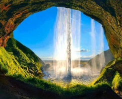
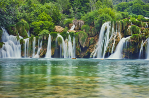
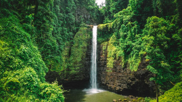
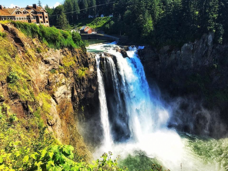
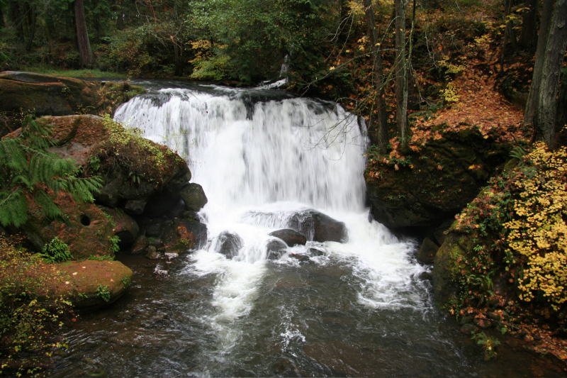
Snoqualmie Falls is a 268-foot (82-meter) waterfall located east of Seattle on the Snoqualmie River between Snoqualmie and Fall City, Washington. It is one of Washington's most notable picturesque areas, and it is well-known worldwide for its appearance in the cult television series Twin Peaks. Approximately 1.5 million people visit the Falls each year, which include a two-acre (0.8-hectare) park, an observation deck, and a gift shop. The majority of the river flows into the power facilities, but it can also overflow across the entire cliff, generating a blinding spray. Heavy rain or snow, followed by warm wet conditions, causes high water.
Snoqualmie Falls is essential to the Snoqualmie People's culture, beliefs, and spirituality, who have lived in the Snoqualmie Valley in western Washington since time immemorial. According to the Snoqualmie, the falls are "the area where Moon the Transformer formed First Woman and First Man" and "where prayers were taken up to the Creator by vast mists that rise from the tremendous flow". The mists coming from the waterfall's base are thought to unite Heaven and Earth.
via: TripAdvisor 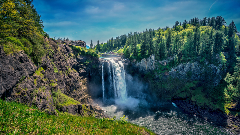
via: Small Town Washington -
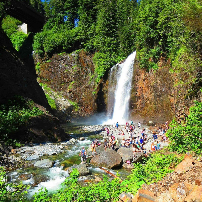
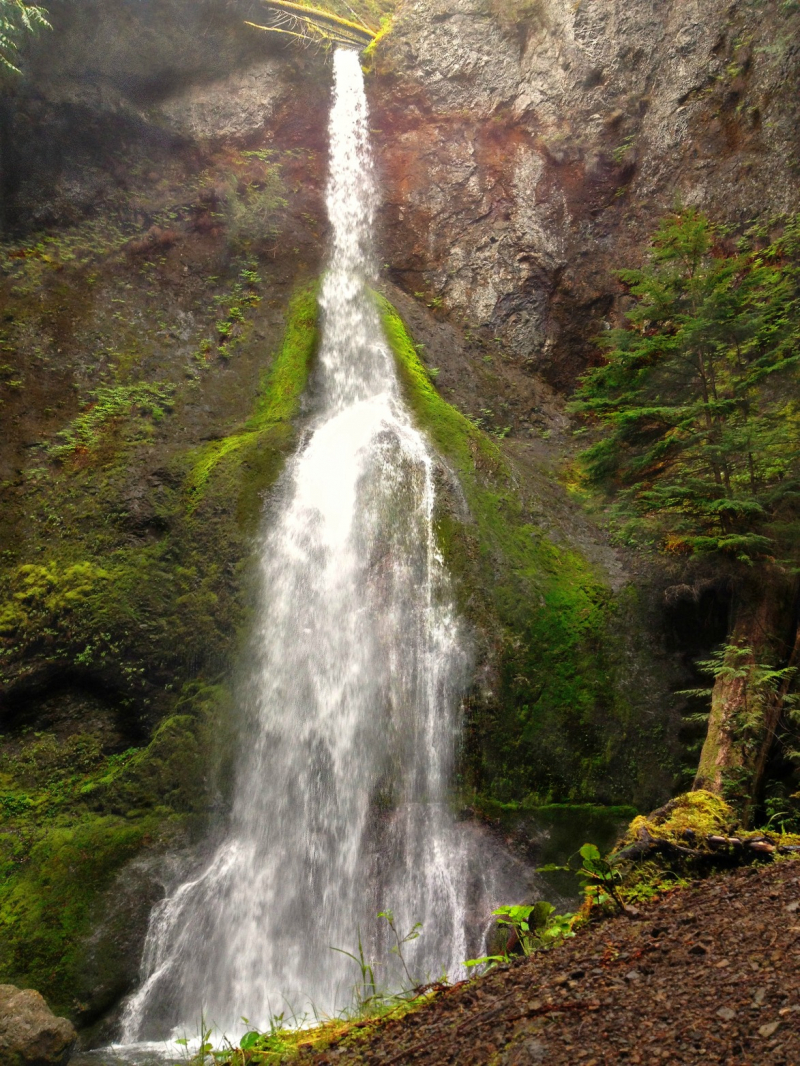
Spray Falls is one of several wonderful walks in Mount Rainier National Park, located in the park's northwest Mowich Lake region. This 350-foot waterfall cascading down the edge of a cliff is accessible via a 2.25-mile journey. Hikers begin their journey by taking a short section of the Wonderland Trail, the park's sole hiking trail that encircles Mount Rainier. The trail undulates as it leads to Spray Falls and passes by the Eagle's Cliff overlook, which provides a spectacular vista. The cloud of mist from Spray Falls lends credence to its name after a short spur walk to approach the falls. Visitors can see the falls from a distance or carefully navigate enormous boulders to get a closer look.
Spray Falls and return is a doable day trek. The track continues into the alpine meadows of Spray Park for a more challenging hike. During the summer, the wildflower meadows at Spray Park are in full bloom. Spray Park requires a significant amount of elevation gain, thus tourists should plan on spending the entire day there.
via: National Park Service 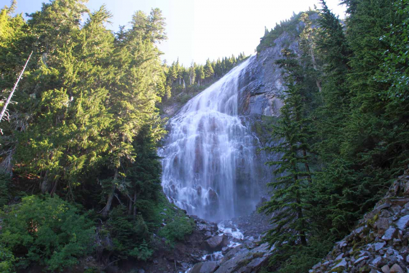
via: World of Waterfalls -
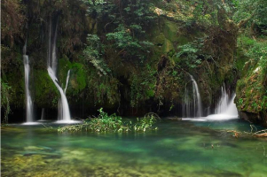
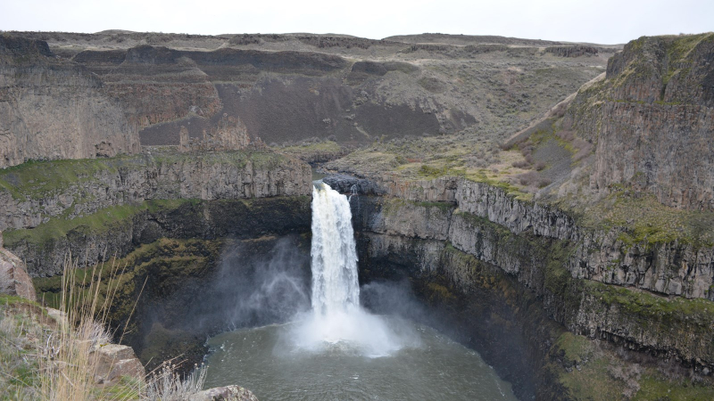
Palouse Falls is a waterfall on the Palouse River in southeast Washington, about 4 miles (6 kilometers) upstream of its confluence with the Snake River. The falls are 200 feet (61 meters) tall. The falls are made up of an upper fall with a drop of roughly 20 feet (6.1 meters), located 1,000 feet (305 meters) north-northwest of the main drop, and a lower fall with a descent of 200 feet (6.1 meters). It is located in the 94-acre (38-hectare) Palouse Falls State Park. These falls and the canyon below are significant features of the channeled scablands formed by the enormous Missoula floods that swept across eastern Washington and the Columbia River Plateau on a regular basis during the Pleistocene epoch.
The original Palouse River flowed to the Columbia River through the now-dry Washtucna Coulee. The Palouse Falls and adjacent canyons were formed when the Missoula floods overtopped the original Palouse River's south valley wall, diverting it to its current path to the Snake River via erosion of a new channel. Interconnected and hanging flood-created coulees, cascades, plunge pools, kolk-created craters, rock benches, buttes, and pinnacles typical of scablands characterize the area. Palouse Falls State Park is located at the falls and protects this unique picturesque location.
via: Wikipedia 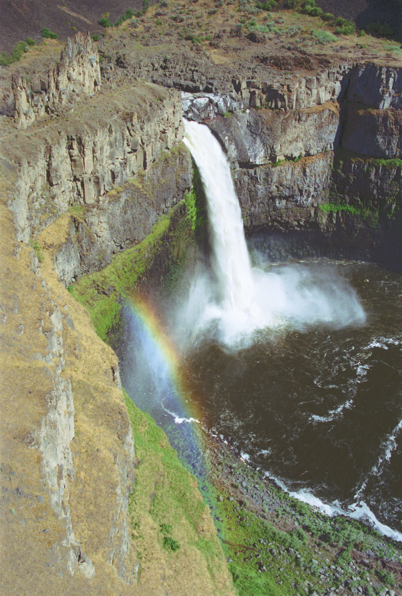
via: National Park Service -
Franklin Falls is a waterfall on the Snoqualmie River's South Fork. It is the first of three significant waterfalls on the Snoqualmie River's South Fork. The falls are in King County, Washington, near Snoqualmie Pass, between the north and south lanes of Interstate 90, approximately east of exit 47. The falls are actually three tiers tall, totaling roughly 135 feet (41 m). The first drop is a 15-foot (4.6-meter) block-shaped fall. The second drop is a fanning cascade of 25 feet (7.6 m). The last drop begins with a 25-foot slide that bends to the right before plunging over the final 70-foot (21 m) drop viewed from the falls' base. The falls are a popular canyoneering spot. The upper two drops are north of the freeway.
This beautiful waterfall in the Mt. Baker-Snoqualmie National Forest is only a short stroll away. The track to the falls has very little elevation increase and is well maintained by trail personnel and hikers. Franklin Falls is also one of the most popular family waterfall hikes in the state due to its short hike and easy trail. The trail follows the Snoqualmie River's south fork. A slick slope goes down to the pool beneath the falls, where the misty atmosphere is ideal for cooling off throughout the heat.
via: TripAdvisor 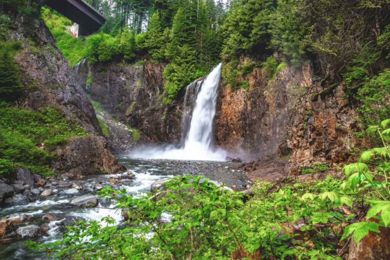
via: Washington is for Adventure -
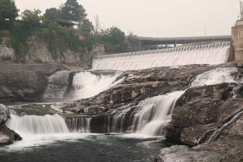
Spokane Falls is the name of a waterfall and dam on the Spokane River in Spokane, Washington's central business district. Spokane was also once known as "Spokane Falls". This series of two waterfalls, a defining feature of Spokane's Riverfront Park, features one of the best urban waterfalls in the country. Lower and Upper Spokane Falls, located in the heart of downtown Spokane, have a lengthy history in the area. The falls, formerly a popular gathering place for local cultures, is now linked with the city and the development of hydroelectric power.
Spokane Falls' natural beauty has been preserved despite the urban expansion. Huntington Park, located near City Hall, is one of the greatest spots to watch Lower Falls from land. Riverfront Park also has a SkyRide, which consists of an enclosed-cabin cable ride above the lower falls. The water that is not diverted by the dam to the south fork pours over the Upper Falls. The river splits again at Salmon People Island, and the north fork goes over the two Upper Falls on either side of the island. The park is mostly on Havermale Island, with the first fork in the river forming the park's eastern boundary. This is the site of the Upper Falls Dam, a diversion dam constructed in 1920 that directs the water into the Upper Falls intake on the south channel of the Spokane River. The Lower Falls is the site of a second diversion dam, the Monroe Street Dam. Completed in 1890, it was the first dam built on the Spokane River and is currently the longest-running hydroelectric generation facility in Washington state. Its Kaplan turbine has a generating capacity of 14.82 MW.
via: World of Waterfalls 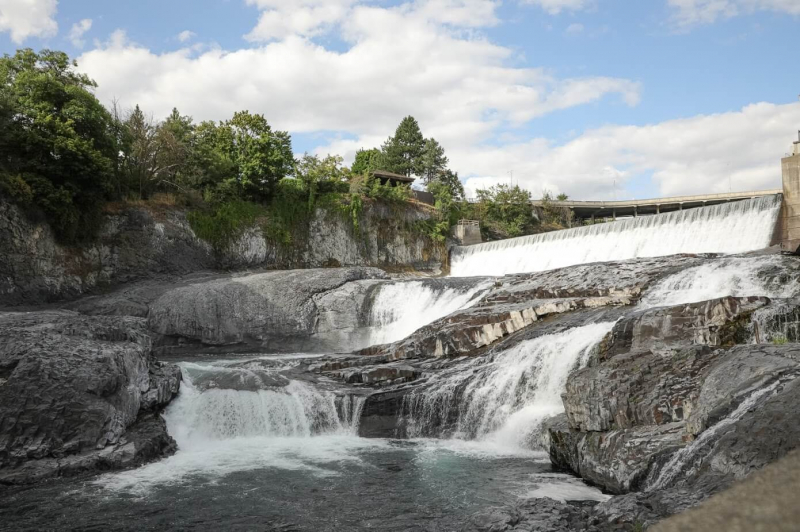
via: Explore Washington State -
Whatcom Falls, one of the greatest attractions in Bellingham, is the centerpiece of its own park. Whatcom Falls Park is a 241-acre (0.98 km2) park in Bellingham, Washington. The falls are located on Whatcom Creek, which connects Lake Whatcom to Bellingham Bay. The park contains four waterfalls and numerous kilometers of well-kept walking pathways. Visitors to Whatcom Falls Park are greeted by a Civilian Conservation Corps-era bridge. The bridge also serves as a fantastic viewing platform for the falls. Whatcom Falls Park has about three miles of paths that lead to other gorgeous water attractions along Whatcom Creek.
Picnic areas, interpretive displays, and a playground are all available at the park. The park also has a fish hatchery and educational resources about the local environment. A popular swimming hole is located further into the park, where large groups assemble during the summer.
via: Wikipedia 
via: TripAdvisor -
A popular waterfall hike in Seattle is Twin Falls. This 165-foot waterfall is located in Olallie State Park, which is less than an hour from the city. Hikers can get an outstanding sight of the falls after a 2.5-mile stroll. The trail begins near the Snoqualmie River's south fork and provides multiple opportunities for a brief plunge if the weather is warm.
Twin Falls, a cluster of cascading waterfalls, isn't the only water feature in Olallie State Park. Visitors to the park can take a shorter walk from the South Fork Picnic Area to the 77-foot Weeks Falls. Mountain biking and hiking trails are also popular in the park. The park is traversed by a segment of the 212-mile Palouse to Cascades State Park Trail.
via: TripAdvisor 
via: West Coast Wayfarers -
Marymere Falls is located near Lake Crescent in Olympic National Park in Washington, United States. A one-mile well-maintained dirt trail leads to the falls through an old-growth lowland forest of fir, cedar, hemlock, and alder trees. Falls Creek flows down from Aurora Ridge, over Marymere Falls, and into Barnes Creek. It stands 90 feet tall (27 m). Because of its ease of access and closeness to U.S. Highway 101, the waterfall is one of the area's most popular attractions.
Marymere Falls, located on the Olympic Peninsula in western Washington, is one of the most popular waterfalls in Olympic National Park. The falls also have one of the better hiking trails in the park. The falls' trailhead is located on the peninsula's north side, 30 minutes west of Port Angeles on Highway 101. Marymere Falls is less than a two-mile round-trip stroll on a flat path through an old-growth forest. Marymere Falls is a popular park attraction, thanks in part to its ease of access. The 90-foot waterfall is a nice place to hike and eat a picnic. It only takes about an hour to make the trip to Marymere Falls and back, but the stunning scenery encourages slower trips.
via: Washington Trails Association 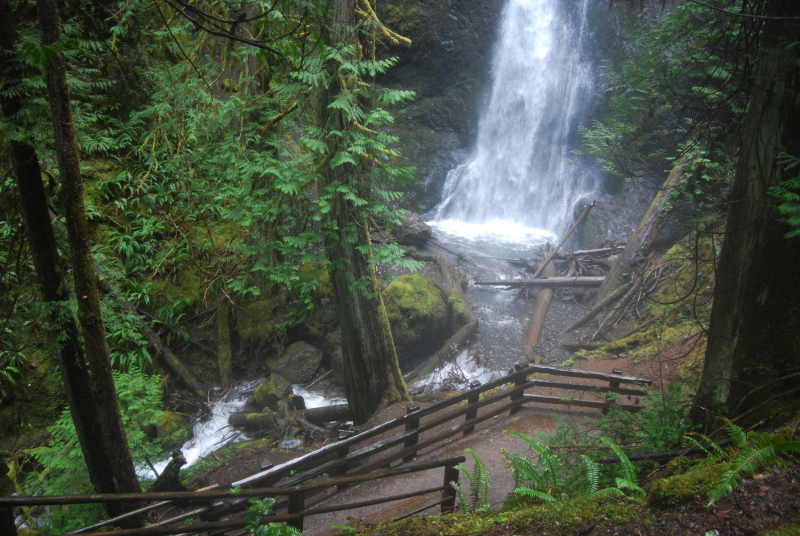
via: Olympic Hiking Co. -
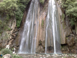
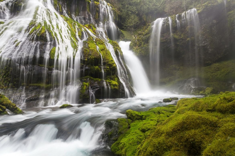
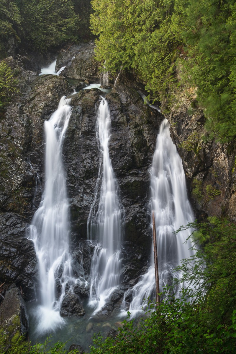
Panther Creek Falls is a 130-foot (40-meter) waterfall on Panther Creek in Skamania County, Washington. The waterfall has two drops, the tallest of which is 102 feet (31 m). The waterfall is everlasting. The Pacific Northwest as a whole is widely recognized for its waterfalls. Another spectacular waterfall nearby is the three-tiered Falls Creek Falls. To the south, the Columbia River Gorge is home to many of Oregon's biggest waterfalls, including the 620-foot-tall Multnomah Falls.
Panther Creek Falls is a family-friendly climb as well as a big cascade. It's about a half-mile stroll from Forest Service Road 65 to an observation platform for the falls. Panther Creek Falls drops over 70 feet into a swirling blue pool. For added aesthetic appeal, a series of much taller rivulets tumble down the same rock face. The Forest Service maintains a trail that leads up to the waterfall and the creek that feeds it. A viewing deck was built to the right at a Y in the route, where you can watch the major, horsetail portion of the waterfall, in addition to the maintained trail. The trail continues down to the left at the Y for those who wish to see the final 30-foot (9.1 m) drop. The waterfall is produced by Panther Creek approaching a cliff and then sharply making a turn. Some of the water rushes too quickly and falls over the side prematurely at the bend, but the majority of the water follows the creek until it reaches a natural trough which then drops off. At the dropoff, the horsetail begins the first tier of the waterfall, which drops 102 feet (31 m). After this, a 30-foot (9.1 m) drop concludes the waterfall and the creek continues.
via: The Gorge Guide 
via: Fototripper -
Wallace Falls is in Wallace Falls State Park, which is a 1,380-acre (560-hectare) public recreation facility located along the Wallace River in Snohomish County, Washington. The state park sits on the west side of the Cascade Mountains, with an entrance one mile (1.6 km) northeast of the Gold Bar town. Three waterfalls, three backcountry lakes, old-growth coniferous woods, rushing mountain rivers and streams, remnants of railroad trestles, unused railroad grades, and springboard cuts in stumps are among the park's highlights.
The name "Wallace" is a misspelling of Joe and Sarah Kwayaylsh, members of the Skykomish tribe who were the area's first homesteaders. Visitors not looking to test their legs will find an excellent view of the middle falls before the trail takes a steep turn. Wallace Falls is a popular hiking trail on summer weekends, though an early start can avoid most of the crowds. Alongside the 5.6-mile round-trip to see the upper falls, Wallace Falls State Park features nearly 10 more miles of hiking trails.
via: Northwest Waterfall Survey 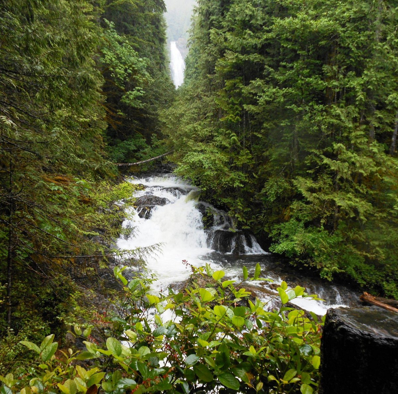
via: TripAdvisor