Top 10 Most Beautiful Waterfalls in Wyoming

Famous for Yellowstone National Park, Wyoming is a land of majestic mountains, oil rigs, and open plains. Coming here, you can watch cowboys round up the bulls ... read more...and breed cattle they did in previous centuries. And an extremely important thing when coming to this place that visitors cannot ignore is admiring the majestic waterfalls and immersing in nature. Here is a list of the Most Beautiful Waterfalls in Wyoming that Toplist would like to introduce to readers.
-
The most impressive and powerful waterfalls in the park may be seen just south of Canyon Junction where the huge Yellowstone River bursts its banks over two enormous rocks. Yellowstone Falls is an integrated area of two large waterfalls on the Yellowstone River in Yellowstone National Park, Wyoming, United States. From Yellowstone Lake, the Yellowstone River flows north, leaves the Hayden Valley, and descends into Upper Yellowstone Falls at 33 meters (109 ft). The cliff edge of the Upper Falls marked the transition between the robust rhyolite lava flows and the more easily eroded vitreous lava.
A quarter mile (400 m) downstream through Lower Yellowstone Falls, the water pours into the vast fissure of Yellowstone Gorge up to 1,000 feet (304 m) deep. Lower Waterfall is considered the highest and most impressive of the two waterfalls of the Yellowstone River. Hikers can get a great view of them from many different angles.
Lower Yellowstone Falls may have water flows ranging from 680 cubic feet per second (19 m3/s) in the autumn to 8,400 cubic feet per second (240 m3/s) at its peak in late April. As the Yellowstone River is just 70 feet (21 meters) broad at the point where it runs through the Lower Falls, the flow rate of Lower Yellowstone Falls is significantly lower than that of Niagara Falls, which is 2,600 feet (790 m) wide.
In sum, Yellowstone Falls:
- An integrated area of two large waterfalls on the Yellowstone River in Yellowstone National Park, Wyoming.
- The lower Yellowstone Falls pour into the vast fissure of Yellowstone Gorge up to 1,000 feet (304 m) deep.
- The amount of water in the waterfall can change depending on the time of year.
El Jay 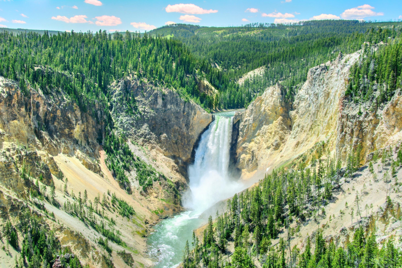
trip.com -
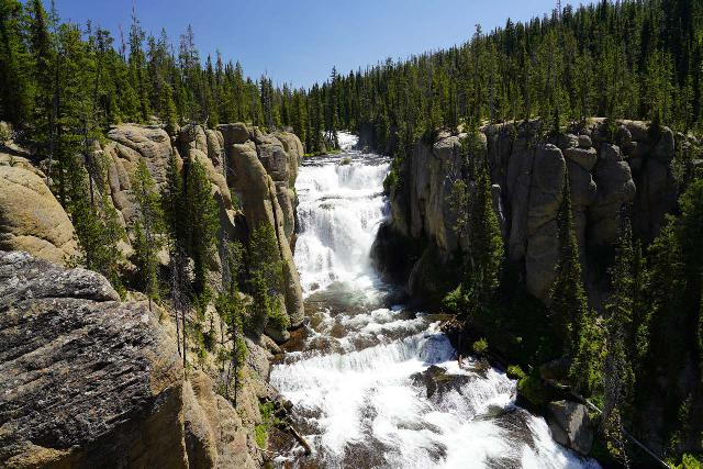
Union Falls, a fan-shaped waterfall in Yellowstone National Park, is renowned as being the second-tallest waterfall in all of Yellowstone. The Union Falls Waterfall is located on Mountain Ash Creek, one of the tributaries of the Fall River in the US state of Wyoming. It is categorized as a fan-type waterfall because of its trapezoidal form and high descent. However, Union Falls' distinctive fanning towards the base produces an overall lesser drop than Horsetail Falls, which also have similarly steep drops.
However, Union Falls is still considered an impressive natural wonder with a vertical drop of about 260 feet. Furthermore, due to its location in the Bechler region southwest of Yellowstone, an unexplored temperate forest region, the area regularly receives large amounts of annual rainfall with numerous streams, creeks, and rivers. Given the 16-mile roundtrip distance needed to get there, Union Falls is regarded as one of Wyoming's undiscovered gems. This is definitely a great destination for those who like to enjoy the majestic river scenery.
According to geologist J.P. Iddings, Mountain Ash Creek's converging branches, which combine to generate this massive cascade, are the source of the waterfall's name. After severe floods in 2004, the long route that leads to Union Falls was severely destroyed. As a result, there was a considerable risk of waterlogging in the region, which put hikers in danger. The National Park Service Trails Crew and the Montana Youth Conservation Corps worked together to build the required erosion and drainage control devices and to reconstruct the trail's damaged portions. Additionally, the partnership restored the most damaged places and stopped the main route to the waterfall from becoming disjointed.
In short, Union Falls:
- Located on Mountain Ash Creek, one of the tributaries of the Fall River in the US state of Wyoming.
- A fan-type waterfall because of its trapezoidal form and high descent.
- An impressive natural wonder with a vertical drop of about 260 feet, and is definitely a great destination for those who like to enjoy the majestic river scenery.
fineartamerican.com - Located on Mountain Ash Creek, one of the tributaries of the Fall River in the US state of Wyoming.
-
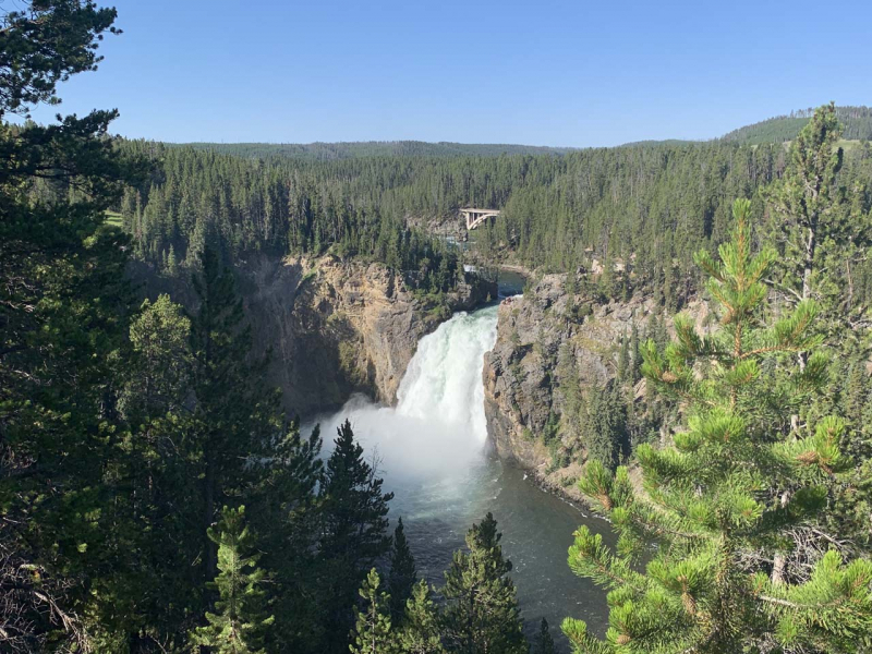
Upper Falls is another large waterfall that visitors can see on the Yellowstone River. Although it is significantly smaller than the falls below and does not sink as deep in the Grand Canyon of the Yellowstone River, this impressive 110-foot-tall waterfall retains its own charm, especially when it comes to its flow power.
In fact, there is an entire state park or reserve dedicated to this waterfall as it is located exclusively outside the boundaries of Yellowstone National Park. Visitors coming here will be able to go down below the waterfall to observe as well as access the trails leading to the waterfall.
Just a few meters from Uncle Tom Trail's parking area, tourists can get a classic view of Upper Falls from the viewpoint next to Uncle Tom Trailhead and Lookout (also known as Uncle Tom's Point). After parking, walk to the west end of the property where you will find a trail that leads further west and offers a clear view of Upper Falls. From this vantage point, one can see the river above the falls where they twist through the black rock before sliding over the ledge into the large pool below.
While Uncle Tom’s Point mentioned above offers a classic view of Upper Falls, the Southern Rim Trail is 0.3 miles upstream of the Yellowstone River is a place that gets little attention. In this walk, the entire path is paved along the river, although the view is obscured by trees. Compared to the main observatory at Uncle Tom's Point, this is actually much quieter because most people don't care to explore the Southern Rim Trail in this direction. But it is also not completely unknown.
To conclude, Upper Falls:
- Located in the Canyons Area of Yellowstone National Park, Upper Falls is the first of two large falls in Yellowstone's Grand Canyon.
- We can access the fall by Uncle Tom's Point and the Southern Rim Trail.
worldwaterfalldatabase.com 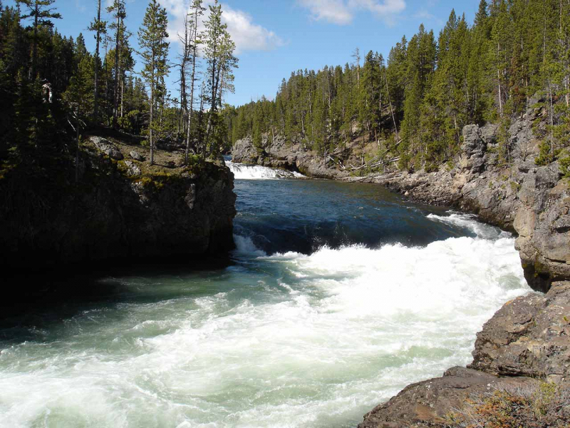
worldwaterfalldatabase.com -
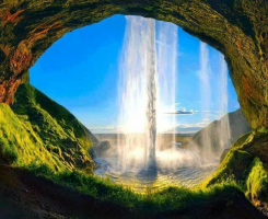
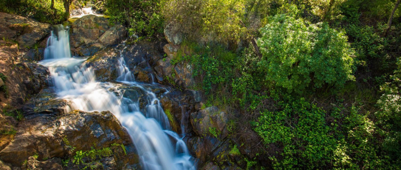
On Cascade Creek in Wyoming's Grand Teton National Park, there is a place called Hidden Falls. The falls, which are located west of Jenny Lake and at the eastern end of Cascade Canyon, are about 100 feet (30 meters) high. Hidden Falls is one of the busiest visitor destinations in Grand Teton National Park throughout the summer.
Taking the Jenny Lake shuttle boat from Hunan Jenny to Cascade Canyon's entrance is the simplest method to reach the falls. The Cascade Canyon Trail extends 1.2 miles (1.9 km) from there to the observation areas for the falls. Another choice is to hike the Jenny Lake Trail, which is an 8.4 km (5.2 mi) roundtrip from South Lake Jenny.
Hidden Falls has over 30 miles of multi-use paths such as walking, running, biking, and horseback riding. It also has two lookouts for viewing waterfalls over 30 feet high, riverine ecosystems along multiple rivers, a picnic area, a swimming area, and a fishing route. At several locations throughout the paths, attractive interpretive boards are mounted that offer useful details about the local flora and wildlife in the Park. The falls provide expansive views of the Sacramento Valley, Sutter Buttes, and beyond. There is also enough space to relax in peace and quiet in a beautiful outdoor setting.
In sum, Hidden Falls:
- Located on Cascade Creek in Wyoming's Grand Teton National Park, west of Jenny Lake and at the eastern end of Cascade Canyon.
- About 100 feet (30 meters) high
- Has over 30 miles of multi-use paths to relax in peace and quiet in a beautiful outdoor setting.
placer.ca.gov 
placer.ca.gov -
Terraced Falls, a 130-foot (40 m) waterfall, is located on the Fall River in Yellowstone National Park. It is also known as the Fall River's highest waterfall and was given this name by the Hague Geological Survey in 1885–1886. In the 1920s, an attempt was made to call it "Totem Falls".
Terraced Falls is a series of drops that create a terrace, and that is the reason for its name. It is not a curtain or a waterfall on the rocks, but a wonderful combination of nature. The 130-foot-deep, six-tiered Terraced Falls is located on the Falls River and is framed by angular volcanic granite columns. The main waterfall pours into a gorge with tall, round columns. At the foot of the waterfall, the water gurgled, then rolled out of sight.
Terraced Falls is conveniently reachable from the Ashton-Flagg Ranch Road at the southern edge of Yellowstone National Park by a little hike. On the way to Terraced Falls, this 3.8-mile round-trip walk meanders through the forest and through a number of waterfalls. This route descends about 300 feet before ascending on the way back. When viewing the falls from one of the many side routes, use caution because some of the steep areas are unfenced. But this is a really gorgeous place in the park.
To conclude, Terraced Falls:
- A 130-foot (40 m) waterfall and the Fall River's highest waterfall.
- Located on the Fall River in Yellowstone National Park.
- Access it on a 3.8-mile round-trip hike that meanders through the woods and past several falls.
utahsadventurefamily.com 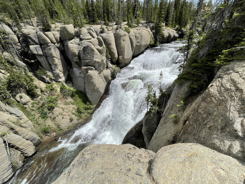
utahsadventurefamily.com - A 130-foot (40 m) waterfall and the Fall River's highest waterfall.
-
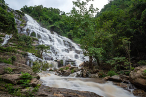
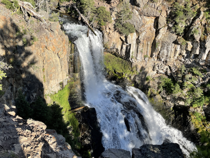
One of the Most Beautiful Waterfalls in Wyoming that Toplist would like to introduce is Undine Falls. It can be seen in the renowned Yellowstone National Park, which plunges around 60 feet from the Lava Creek cliffs, and sheds several tears before reaching the pool below.
This waterfall was once known by a number of names, including East Gardner Falls and Gardiner River Falls, in accordance with their Yellowstone Falls Guide and Discovery. This is odd since, despite being downstream of the Gardner River, Lava Creek is not really on the river. Regardless, it is stated that the waterfall's current name was given by geologist Arnold Hague in 1885 after female water deities from German folklore.
When it comes to how Undine Falls came to be, it is believed that the hard basalt layer that distinguishes tumbling waterfalls like these was created as a consequence of lava flows that occurred some 700,000 years ago. Geologists estimate the last eruption of Yellowstone's Supervolcano, which produced this lava flow, occurred 640,000 years ago.
Tourists must park at the Lava Creek Picnic Area, which is further east of the retreat area, and then trek the Lava Creek Trail in order to get closer to the waterfall.In sum, Undine Falls:
- Located in Yellowstone National Park, descends about 60 feet from the cliffs of Lava Creek.
- The waterfall's current name was given by geologist Arnold Hague in 1885 after the water nymphs in German folklore.
- The hard basalt layer created by volcanic lava flows about 700,000 years ago is the origin of the Undine Falls.
utahsadventurefamily.com 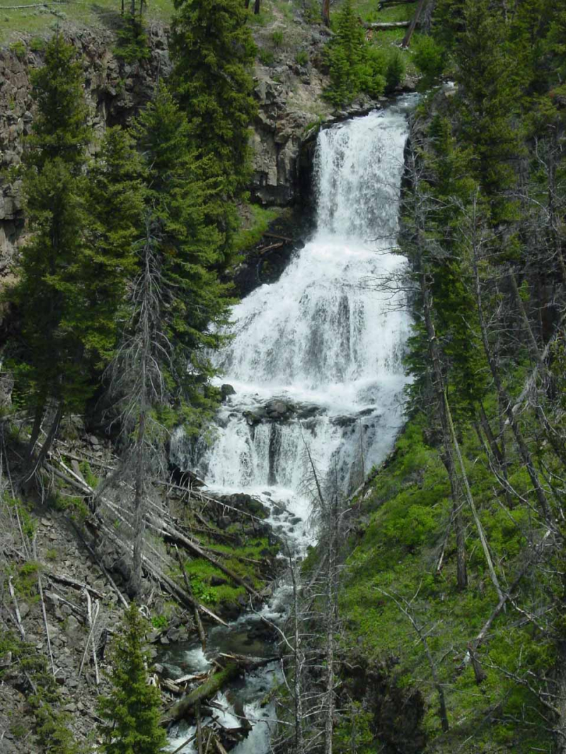
world-of-waterfalls.com -
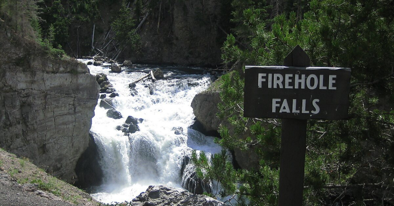
In the southwest of Yellowstone National Park in the United States, there is a waterfall called Firehole Falls on the Firehole River. The falls are about 0.80 kilometers (0.5 miles) upstream of Madison Junction, where the Firehole and Gibbon Rivers converge, and are situated inside Firehole Canyon on Firehole Canyon Drive, a one-way street that runs parallel to the main Madison Junction to Old Faithful route.
The plunge of Firehole Falls is around 40 feet (12 m) that sits amid the 800-foot-thick lava that forms the canyon walls. The Little Firehole Trail is a stunning path through Yellowstone National Park that leads to Firehole Falls. This 16.1 km path has a few steep portions and is somewhat difficult. This trek may be completed in one long day hike or spread out over a few days by sleeping at Firehole Falls. Hikers can come equipped with suitable, comfortable hiking boots as well as enough water and snacks to keep them hydrated and fuel their expedition. With so much to uncover, this path is perhaps the ideal way to spend time taking in Firehole Falls's beauty and wonder.
In sum, Firehole Falls:
- Located on the Firehole River in the southwest of Yellowstone National Park in the United States.
- The slope of Firehole Falls is about 40 feet (12 m) high among 800 feet of thick lava.
- The Little Firehole Trail, 16.1 kilometers long, is a scenic trail that leads to Firehole Falls.
world-of-waterfalls.com 
world-of-waterfalls.com -
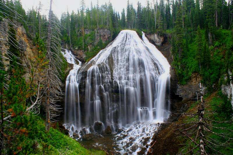
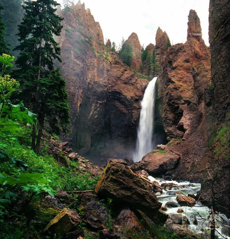
In the northeastern corner of Yellowstone National Park, in the U.S. state of Wyoming, there is a waterfall called Tower Fall that flows into Tower Creek. It is located approximately three miles south of Roosevelt Junction on Tower-Canyon road.
The fall plunges 132 feet around 1,000 yards (910 m) upstream from the creek's confluence with the Yellowstone River (40 m). Hot Spring Creek's Tower Fall, where that stream precipitates in one continuous body from an amygdaloid cliff, drops 115 feet steep into a deep canyon before merging with the Yellowstone a few hundred yards below. The stream has carved its way through amygdaloid masses at the top of the fall, creating tall granite spires that range in height from 50 to 100 feet. There are some of them that stand like sentinels on the verge of collapsing since they are so fragile and crumble easily under minimal pressure.
The view from the top of Tower Fall is breathtaking. A clear, freezing stream flows down the narrow valley, crashing over stones and tree trunks that have fallen into the channel as it descends from a ledge 100 feet below to the bottom of the abyss, almost 200 feet below. A spur from the enormous plateau rises above all, with a perpendicular front of 400 feet, while the walls of the abyss are eroded into caves lined with variously colored mosses that are fed by spray clouds that rise from the waterfall.
A nice view of Tower Fall can be obtained from the cliff at the foot of the falls or from both sides of the canon. Nothing could be more chastely beautiful than this exquisite waterfall, which is concealed in the shadowy light of rocks and trees, its voice muffled to a faint murmur, and undetectable from a few hundred yards away. Once you have seen Tower Fall, its image will be the best memory of your journey.
In short, Tower Fall:
- Located in the northeastern corner of Yellowstone National Park and flows into Tower Creek.
- Plunges 132 feet about 1,000 yards (910 m) upstream.
- You can enjoy a beautiful view of Tower Fall from the cliffs at the base of the falls or from both sides of the gorge.
pixels.com 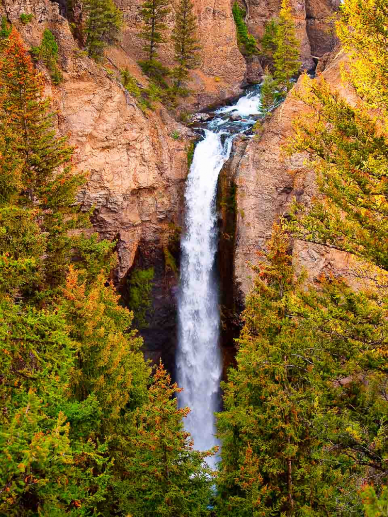
imagesbytk.com -
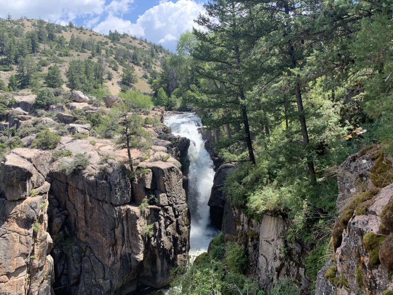
In northeastern Wyoming, on Shell Creek, a few miles upstream from the hamlet of Shell, is a waterfall known as Shell Falls. It is located in the Bighorn National Forest.
Shell Falls, a rushing waterfall that resembles it is situated in an area of aridity, has been cultivated by the presence of Shell Creek into a pretty lovely cascade. This 75-foot waterfall is a little different from most waterfalls we have seen in nature because of its odd geography and contradictory environment. Since streams of water typically accompany waterfalls, streams of soft rock will erode considerably more quickly than streams of harder rock. However, variations in erosion rates are what cause Shell waterfalls to appear the way they do.
Additionally, taller waterfalls may be found in hanging valleys where the strong rock strata supporting the watercourses may have been physically damaged or even sheared by glaciers. Shell Falls, on the other hand, was created by a fault line in which one side descended while the other pushed upward.
Speaking of canyons, the cliffs are said to be home to fossil shells (which is why the waterfall gets its name). This also suggests that the area's surface crust may have once sunk deep under the ocean.
The granite foundation rock that the falls cascade over is at a height of 120 feet (36 meters). From the rest area and interpretive center, one can witness flathead sandstone outcrops that are around 550 million years old and sit on rocks that are 2.9 billion years old, making them some of the oldest rocks on Earth. Additionally, visitors may view "Corman's Tomb," a vast limestone promontory to the north.
To conclude, Shell Falls:
- Located in northeast Wyoming, on Shell Creek, several miles upstream of Shell Village in the Bighorn National Forest.
- This 75-foot waterfall is a little different from most waterfalls we have seen in nature.
- We can witness flat outcrops of sandstone, one of the oldest rocks on Earth from the resting area and interpretation center.
world-of-waterfalls.com 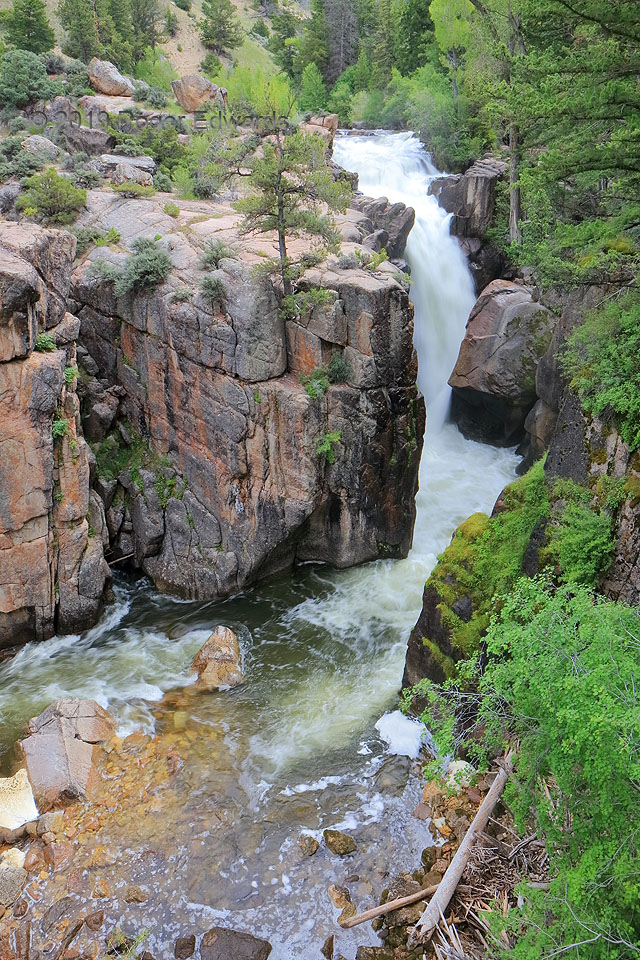
skypix.photography -
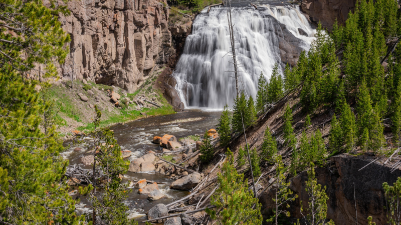
In the northwest of Yellowstone National Park in the United States, Gibbon Falls is a waterfall on the Gibbon River. The falls are situated along the Grand Loop Road, 4.7 miles (7.6 km) upstream from Madison Junction, where the Gibbon and Firehole Rivers converge. The Gibbon River's Gibbon Falls was a charmingly long and broad cascade that was said to drop 84 feet over the crater wall of the Yellowstone Supervolcano. One of the more picturesque waterfalls tourists has seen in the area, with its odd trapezoidal shape and apparently brush-like texture.
The Lava Creek tuff underneath the falls, which is made of ash fused by intense heat as a result of the last Yellowstone Volcano eruption around 640,000 years ago, is responsible for the texture of Gibbon Falls. The enormity of the Lava Creek tuff walls around the waterfall and some of the cliffs farther up the Grand Loop Road gave visitors a sobering impression of the volcano's scale and power.
Four kilometers from the canon's entrance, Gibbon Falls is accessible through a route that runs along the right side of the road. Although the drop is extremely steep, the devoted traveler won't regret the work on his muscles once he sees the spectacular falls. With a depth of 84 feet (26 meters), the water cascades over them in a frothy sheet, creating a lovely scene that contrasts sharply with the surrounding landscape of gloomy rocks and shady woods. After leaving the waterfall and bubbling river, the trail quickly crosses Canon Creek for the next 8 miles through terraces covered with pine and fir. Their captivating beauty will make visitors extremely excited before going to the next attractions.
In sum, Gibbon Falls:
- Located in the northwest of Yellowstone National Park in the United States, along the Grand Loop Road, 4.7 miles upstream where the Gibbon and Firehole rivers converge.
- Drops 84 feet over the crater wall of the Yellowstone Supervolcano.
- Can be accessed through a route that runs along the right side of the road.
a.travel-assets.com 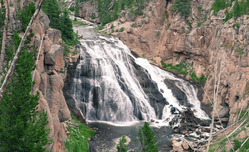
wikipedia.org