Top 6 Highest Mountains In Belgium

Belgium an area of 30,689 km2 (11,849 sq mi) and has a population of more than 11.5 million. It is also home to several mountains, despite being one of the ... read more...smallest countries in Europe. Here are some of the highest mountains in Belgium.
-
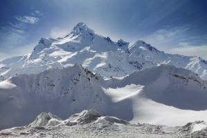
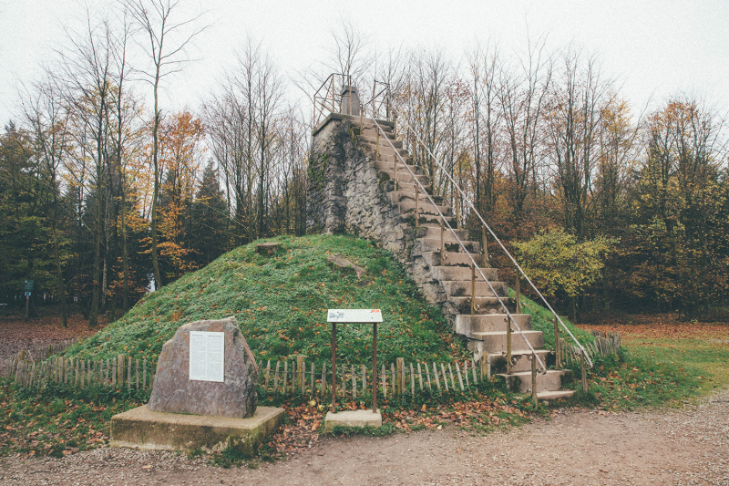
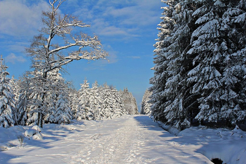
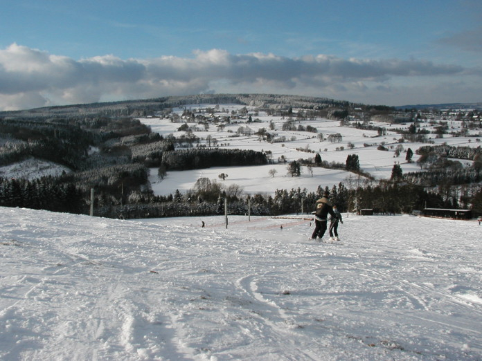
Signal de Botrange is the highest point, and also the highest summit, in Belgium, standing at 2,277 feet (694 meters). The Signal de Botrange is situated on the crest of a large land plateau. Because a road runs through the summit and there is a café across the road at the top, the place attracts some visitors.
At the peak, there are two distinct towers, one erected in 1923 to allow tourists to reach 700 meters (2,296 feet) and the other built in 1934 to allow visitors to reach 781 meters (2,355 feet). For a few decades, there was also a meteorological station on the site, but it was decommissioned in 1999.
During the winter, the Signal de Botrange serves as the starting point for a variety of cross-country skiing routes throughout Belgium. When compared to the rest of Belgium, the plateau features more fluctuating temperatures, winds, and rainfall.
Location: Liège Province, Wallonia, Belgium
Parent range: Hautes Fagnes
Elevation: 694 m (2,277 ft)
https://49peaks.com/ 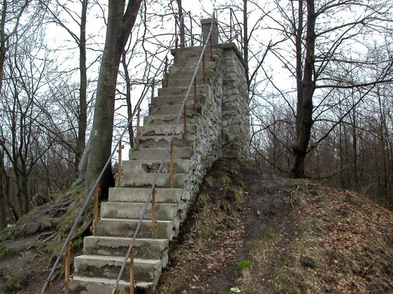
http://targotennisberg.com/ -
Because its vertical reference EGM96 deviates a few meters from the German Normalnull and the Belgian TAW, the altitude meter of Google Earth cast considerable doubt on Signal de Botrange (694 m TAW) as Belgium's highest peak, implying a height of 701 m for the Weißer Stein. The Weißer Stein was measured to be at maximum 693.3 m TAW (=691 m NN) by the Belgian National Geographic Institute in 2010, which is less than 1 m different from Signal de Botrange.
German measurements (the area was German until 1920) revealed an altitude of 689 meters (NN, German standard) at a nearby measuring site, as well as a little higher area encompassed by the 690-meter altitude line.
The University of Liège conducted measurements in 2007 and discovered a height of 692 meters (TAW, Belgian standard). Because its vertical reference EGM96 deviates a little, the altitude meter of Google Earth cast some doubt on Signal de Botrange (694 m TAW) as Belgium's highest peak.Location: Büllingen, East Belgium
Parent range: Eifel
Elevation: 2,274 feet (693 meters)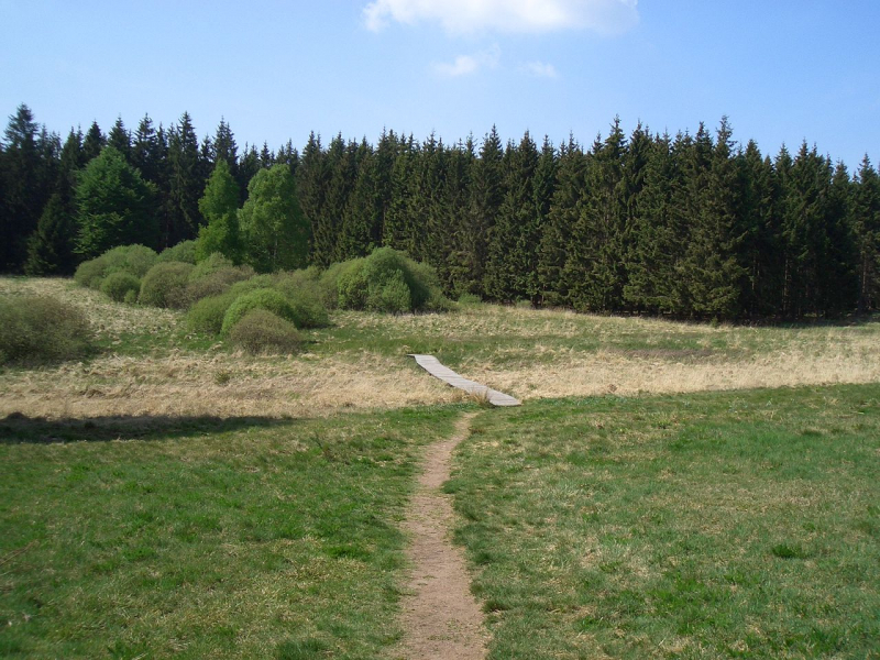
Boardwalk leading to the Weißer Stein rocks in Belgium, Photo by: Macphil -
Mont-Rigi, with an elevation of 2,234 feet, is Belgium's third-highest settlement (680 meters). Near the Belgian municipality of Waimes, in the High Fens natural reserve, the settlement is located. The small village, which has an inn and a coffee shop, is located on the road that connects the Belgian cities of Eupen and Malmedy.
The town also has a timber antenna in the region with an automatic measuring station to collect data for the Hautes Fagnes (High Ferns) scientific station and the Walloon Public Service's Department of Nature and Forests. Tourists flock to the area as a starting point for excursions in the High Fens nature reserve, and it transforms into a famous ski resort in the winter.
Location: Belgium
Elevation:2,234 feet
http://www.discoveringbelgium.com 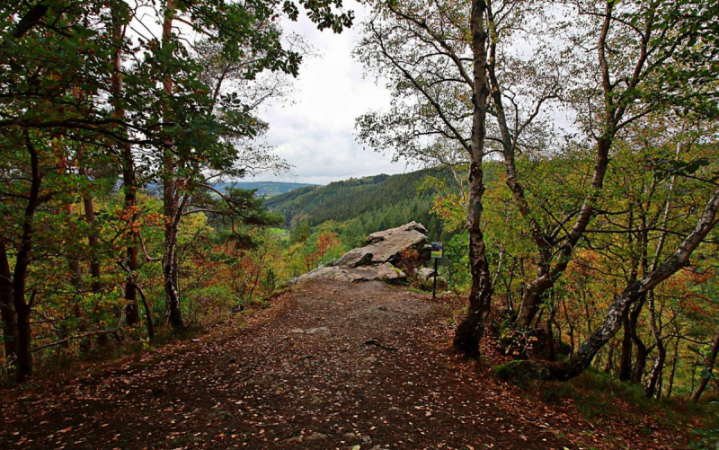
http://www.discoveringbelgium.com/ -
Baraque Michel is a village in the municipality of Jalhay, Wallonia's High Fens. It was Belgium's highest point before the annexation of the Eastern Cantons by Belgium in 1919. After the adjacent Signal de Botrange (694 meters (2,277 feet) and the Weißer Stein (691 meters (2,267 feet), it is now the third highest peak at 674 meters (2,211 feet).
The Baraque is an inn that serves as a jumping off place for a variety of excursions. Michel Schmitz of Herbiester (a hamlet near Jalhay) created the Baraque Michel between 1811 and 1813, not only as an inn, but also as a sanctuary for wandering travellers: a bell was rung there during fog, allowing the rescue of over a hundred persons during the 19th century.The building was also utilized as a relay for postal coaches that ran between the two Prussian towns of Eupen and Malmedy at the time. The direct route passed via Belgian territory and followed the current N68 road.
Several Belgian rivers, all of which are part of the Vesdre basin, have their origins in the area. Gileppe, Hogne, and Helle are the most important.Location: High Fens, Belgium
Elevation: 2,211 feet (673 meters)
https://mapcarta.com/17951064 
https://www.fotocommunity.de -
The Baraque de Fraiture is the highest point in Luxembourg, Belgium's Wallonia province. It stands 652 meters (2,139 feet) tall in the municipality of Vielsalm. It contains a ski area with three pistes (350, 700, and 1,000 meters in length) that are usually accessible for less than 20 days per year. It has recently been open for up to 60 days every year.
La Baraque de Fraiture is located on the hill that separates the Ourthe River Basin from the Amblève River Basin on the Plateau des Tailles, which consists of grassland, rural, and forest.
The Baraque de Fraiture is accessible through the Soleil autoroute (A26 / E25), which may be reached by exiting at junction 50 and going onto the N30 (Liège–Bastogne) and N89 N89 (La Roche-en-Ardenne–Salmchâteau).Location: Wallonia, Belgium
Parent range: Ardennes
Elevation: 652 m (2,139 ft)
http://wintersportgids.be/skigebieden/baraque-fraiture/ -
The plateau of Croix Scaille is Belgium's eighth highest point, standing at 1,657 feet (505 meters) above sea level. Croix Scaille plateau is a forested area in the Ardennes that is bounded to the north by the Semois River and to the east by the Meuse River.
The plateau is situated on the Belgian-French border, with the Belgian portion being within the Namur province. Croix Scaille was a stronghold for the Maquis French Resistance fighters during World War II, because the wooded surroundings provided a superb shelter and set up for guerrilla attacks.
The only other claim to fame for the site came in 2001, when a one-of-a-kind tower known as the Tour du Millénaire was built to provide tourists with a panoramic view of the region. The tower has three platforms, each measuring 15, 30, and 45 meters (49,98, and 147 feet) in height. Unfortunately, due to wood rot, the tower had to be completely demolished in 2008, but it was completely reconstructed in 2012 out of metal.
Location: Province of Namur, Wallonia, Belgium
Parent range: Ardennes
Elevation: 1,657 feet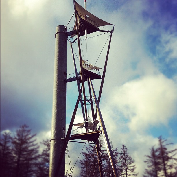
Photo by TheMisterTom - Flickr: La Tour du millénaire à Gedinne