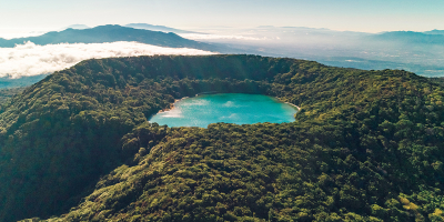
Top 8 Longest Rivers in Costa Rica

Costa Rica is bordered on the north by Nicaragua (309 km/192 mi) and on the south by Panama. Because Costa Rica has such a diversified geography with so many ... read more...mountains, the rivers flow quickly, making it ideal for activities like kayaking and rafting. You won't be able to miss the breathtaking views of the longest rivers in Costa Rica.
-
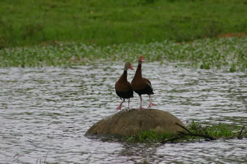
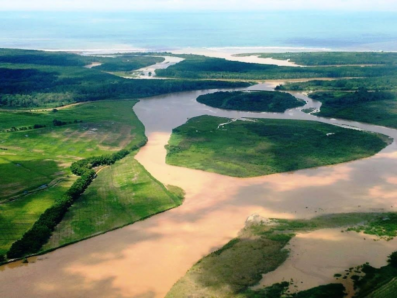
The Sarapiqu River, also known as the Rio Sarapiqu, is a tributary of the San Juan River in Costa Rica, and it forms the eastern border of Sarapiqu Canton. The region surrounding the river is primarily lowland tropical rainforest, with lush foliage and a diverse range of plant, animal, and insect life.
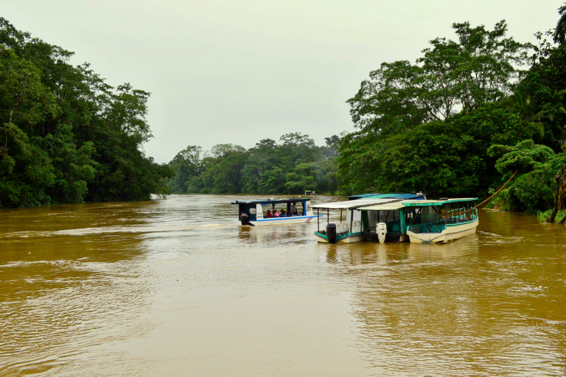
This Sarapiqu River is navigable and serves as a local trade route, as well as providing opportunities for fishing and tourism. The river, once known as the 'Siripiqui,' is prone to floods. Plantations of coffee, sugar cane, bananas, and cocoa plants surround the river. The Sarapiqui River was severely impacted by the 2009 Costa Rica earthquake in Cinchona.
Since the country's privatization of energy generation, a number of hydroelectric dams have been erected along the river's path. Corruption connected to hydropower projects sparked public outcry in 2012. Because of its critical role in delivering guns, commodities, and soldiers during the 1856 struggle against the filibusters, the river is designated as a national monument. This is considered one of the longest rivers in Costa Rica.
Length: 85 km
https://en.wikipedia.org/ 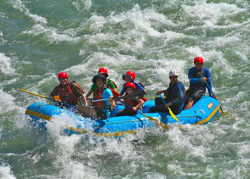
https://en.wikipedia.org/ -
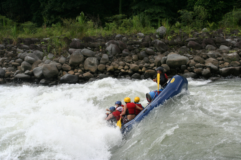
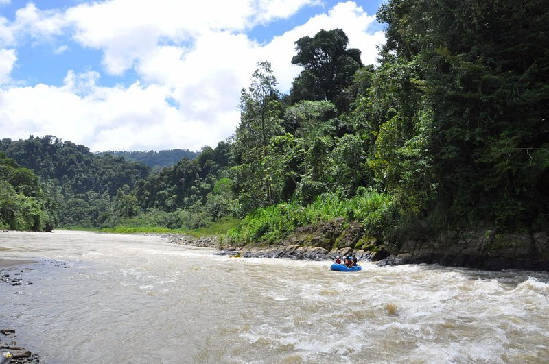
The Pacuare River, sometimes known as the Ro Pacuare, runs to the Caribbean for around 108 kilometers (67 miles). Whitewater rafting, whitewater kayaking, and riverboarding are all popular activities here. Exotic animal species such as jaguars, monkeys, ocelots, and a great variety of birds live in the jungles that surround the river. It was also rated as one of the top five rivers for rafting.
In 1986, the Instituto Costarricense de Electricidad, Costa Rica's state-owned power provider, requested that a hydroelectric dam be built on the river. This concept was eventually rejected in 2005 because to worries about pollution and other negative effects on tourism and the river's environment. Large cats have been seen near the river, although these creatures are notoriously elusive. In 1986, a black panther was observed around 2 kilometers (1.2 miles) from the river. Near the Haucas River Gorge, jaguars have been observed.
Anteaters, raccoons, river otters, iguanas, capuchin monkeys, and sloths are all prevalent. After the Dos Montanas canyon, howler monkeys can be spotted on the lower portions.
In Pacuare River, there are five common snakes. The coral snake, bushmaster, and fer-de-lance are among the poisonous snakes. In the region, the laura and sopy lota (a long black snake that consumes dangerous snakes) are also common.Length: 129 km
https://en.wikipedia.org/wiki/Pacuare_River 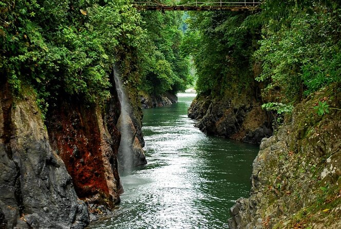
https://en.wikipedia.org/wiki/Pacuare_River -
Sixaola River (Spanish: Ro Sixaola) is a river in Costa Rica's southern Limón Province. It runs northeast of Sixaola from the Cordillera Talamanca to the Caribbean Sea at 9°34′20′′N 82°33′54′′W. The La Amistad International Park encompasses the river's headwaters. The river forms part of the border between Costa Rica's Limón Province and Panama's Bocas del Toro Province.
The Sixaola River between Guabito, Panama, and Sixaola, Costa Rica, was bridged by an ancient railroad bridge that collapsed in 2017. Pedestrians going between Costa Rica and Bocas del Toro utilized this bridge as a border crossing between Costa Rica and Panama. This bridge has been demolished.
A new binational road bridge is being built adjacent to the existing railway bridge and is scheduled to open in 2020. It will be the conclusion of Costa Rica's National Route 36 and Panama's Route 1001.
The Rio Sixaola also serves as a time zone border between UTC 06:00 (Central) and UTC 05:00 (Eastern). Costa Rica is one hour behind Panama in terms of time zone. Sixaola is where Route 36 comes to an end. Guabito, Panama located directly over the river from Sixaola. This is considered one of the longest rivers in Costa Rica.Length: 146 km
https://en.wikipedia.org/wiki/Sixaola_River 
https://en.wikipedia.org/wiki/Sixaola_River -
The Tempisque River, sometimes known as the Ro Tempisque, is a 144-kilometer-long river in Costa Rica that flows from the Guanacaste Cordillera near the Oros Volcano to the Gulf of Nicoya. It runs through Palo Verde National Park. The dry tropical forest along the Tempisque River is home to a variety of monkeys, crocodiles, iguanas, and migratory and aquatic birds, including the roseate spoonbill, white ibis, greets egret, tiny blue heron, tricoled heron, and bare-throated tiger heron. This region has the most diverse bird population in the whole country.
Because the river is extensively silted, only shallow ships capable of crossing the muddy flats may navigate it. The time of crossing the bar at the river mouth is determined by the tides. The Tempisque was formerly utilized to float logs down to the sea. Chira Island was where the logs were collected to be placed onto ships.
The Tempisque River Bridge was erected to connect the Nicoya Peninsula to southern Guanacaste, reducing travel time to San José substantially. It was made possible thanks to a donation from the Taiwanese government.Length: 128 km
https://www.anywhere.com/costa-rica/ 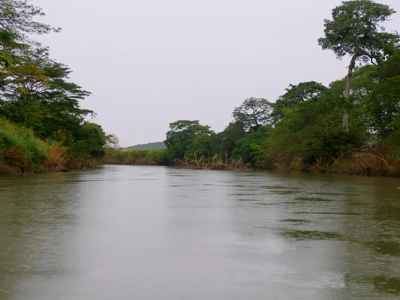
https://www.anywhere.com/costa-rica/ -
The Savegre River (Spanish pronunciation: [saˈβeɣɾe]) runs into the Pacific Ocean from Costa Rica. The source is in Quebrada Providencia in the Cerro de la Muerte, Cordillera de Talamanca, at 3,491 m (11,453 ft) above sea level, and it flows into the Pacific Ocean after receiving the Division River and traveling 41 linear kilometers across severe terrain.
Savegre River flows through four cantons: Dota, Tarraz, Pérez Zeledón, and Quepos, and encompasses 590 km2 (230 sq mi). It is regarded as one of the country's cleanest rivers. Its basin is one of Costa Rica's most ecologically diversified areas, with 47 distinct ecosystems recognized, including 9 natural, 15 semi-natural, and 23 cultural habitats, with the majority of the basin protected by the Los Quetzales National Park and the Manuel Antonio National Park. UNESCO designated the Savegre River Basin as a Biosphere Reserve on June 14, 2017. This is a great river with warm water, tons of beautiful scenery, and great guides.
Length: 41 km
https://en.wikipedia.org/wiki/Savegre_River 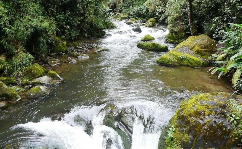
https://en.wikipedia.org/wiki/Savegre_River -
The Térraba River (Spanish: Ro Grande de Térraba) is Costa Rica's largest river, flowing through the southern Brunca area. Diqus is the indigenous Boruca language term for "big river." Its basin covers ten percent of the nation, with a surface area of 5,085 square kilometers (1,963 square miles) and a length of 160 kilometers (99 miles).
Térraba River emerges at the junction of the Ro General and the Ro Coto Brus as a tributary. In the basin, pineapple plantations cover 10,815 hectares (26,720 acres), accounting for 21% of total production. Mangrove cockles (Anadara tuberculosa and Anadara similis) are harvested in the mangrove swamps and mud around the estuary of the Rio Grande de Térraba, and are known locally as piangua.
The Interamerican Highway follows the river's flow for a short while before crossing it on a bridge. The settlements of Palmar Norte, Palmar Sur, and Ciudad Cortés are located along the river. Six outlets of the Térraba empties into the Pacific Ocean: Mala, Brava, Chica, Zacate, Guarumal, and Sierpe. Humedal Nacional Térraba-Sierpe (Térraba-Sierpe National Wetlands) is a nationally protected wetland located among the mangroves along the coast.
El Diqus Hydroelectric Project, a projected renewable energy project for the region, has been canceled. It would have necessitated the relocation of 1,500 people and encompassed 7,000 hectares (17,000 acres). This is considered one of the longest rivers in Costa Rica.
Length: 160 km
https://en.wikipedia.org/wiki/T%C3%A9rraba_River 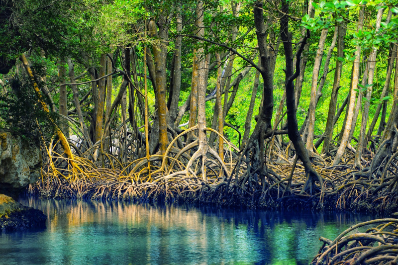
https://en.wikipedia.org/wiki/T%C3%A9rraba_River -
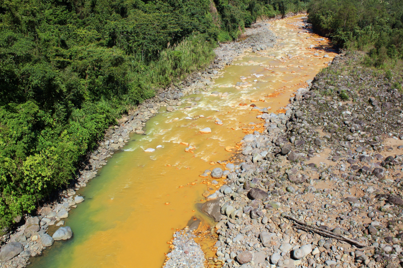
The Sucio River (Spanish: Ro Sucio, meaning "filthy river") is a Costa Rican river. The river's name comes from sulfur deposits on the Iraz Volcano, which give the water a brownish hue. It is a San Juan River tributary. The Sucio River originates half a kilometer from the summit of the Iraz Volcano and flows into the San Juan River, then into the Caribbean Sea, where it meets the Sarapiqu River near Boca Rio Sucio.
The Chirripo Norte River, a tributary of the Colorado River, is formed when one of the Sucio's branches joins the Patria River. The Sucio River is one of the most beautiful and distinctive rivers of Costa Rica. Because of the special color of the river, it has attracted a large number of tourists to visit.
Visitors often take pictures or participate in water sports here. Both sides of the river are large and small rocky beaches, so visitors need to be very careful if they want to move on it. On one side of the river is a forest of tall trees, which is very cool in the hot season. This is considered one of the longest rivers in Costa Rica.Length: 85 km
https://opensea.io/ 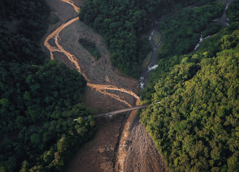
https://opensea.io/ -
The Telire River is a Costa Rican river in the province of Limón, in the country's eastern region. The Sixaola, which is part of the Costa Rica-Panama border, is formed by the confluence of Telire and the Yorkin River. The region has a tropical rainforest climate.
The yearly average temperature is 22 degrees Celsius. The hottest month is October, with an average temperature of 22 °C, while the coldest month is January, with an average temperature of 19 °C. The yearly average rainfall is 2 550 millimeters. July is the wettest month, with an average of 434 mm of rain, while February is the driest, with just 75 mm of rain.
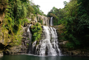
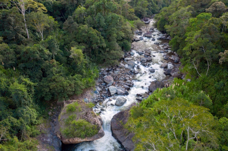
The Telire River is also a Costa Rican wonder to kayak. You must go through various phases in order to select the appropriate place. A massive, house-sized boulder dominated the view from above, and it looked that the entire river had vanished beneath it. To obtain a closer view, let's climb downstream down the left bank. A magnificent waterfall may be found nestled between the bedrock and the boulder. This is considered one of the longest rivers in Costa Rica.
Length: 75 km
https://community.nrs.com/ 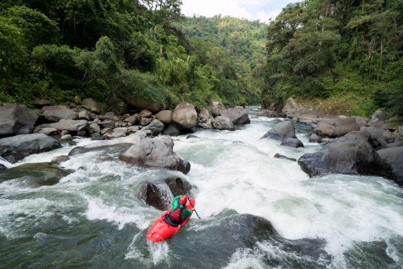
https://community.nrs.com/