Top 8 Longest Rivers in Uganda

Uganda is a landlocked country in East Africa. It is a landlocked country that borders the great Lake Victoria and is home to two additional Great Lakes in ... read more...Africa, Lake Albert, and Lake Edward. Lake Kyoga, the country's largest lake, is also located in the country. Tropical rainforests, snow-capped mountains, and a rich range of species may all be found in Uganda. Uganda's longest rivers are the source of water that feeds and influences all of these distinct parts of the country. In this article, Toplist will list some of the longest rivers in Uganda.
-
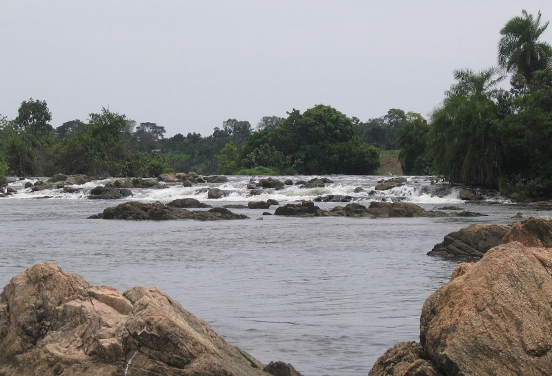
The Nile river, which runs for 4,258 miles through eleven countries, is widely regarded as the world's longest river. It is Sudan's main supply of water. Its two main tributaries, the Blue and White Niles merge in Khartoum and run north to Lake Nubia, also known as Lake Nasser on the Egyptian side of the border. The White Nile, which originates in central Africa and flows 2,299 miles through five nations before reaching Sudan, is significantly longer. The Blue Nile starts in Ethiopia and runs for 901 kilometers before merging with the White Nile. The Nile's tributaries include the 500-mile Atbarah, 398-mile Barka, 300-mile Dinder, and 137-mile Angareb rivers.
The Nile travels across Sudan in a unique route. Between Aswan and Sabaloka, it passes through six groups of cataracts before turning south and heading north toward Egypt. As it reaches the Sudanese border, the river enters Lake Nubia, also known as Lake Nasser in Egypt.
Length: 4,258 miles (shared with 10 other countries)

en.wikipedia.org/wiki/Nile 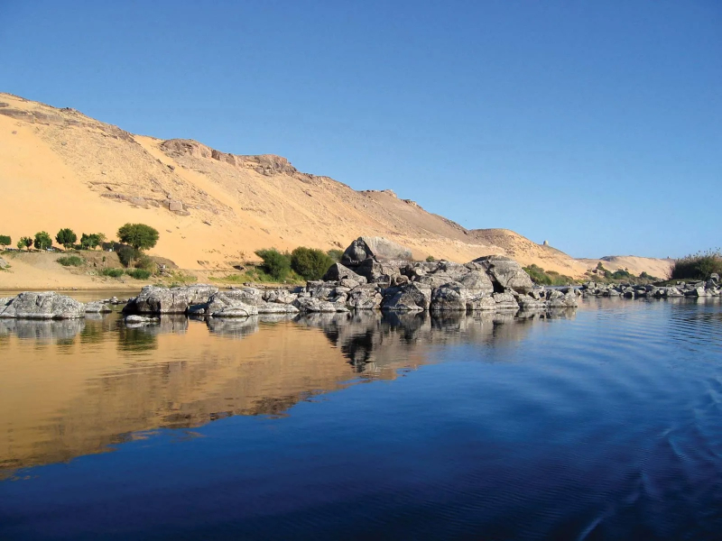
https://www.britannica.com/ -
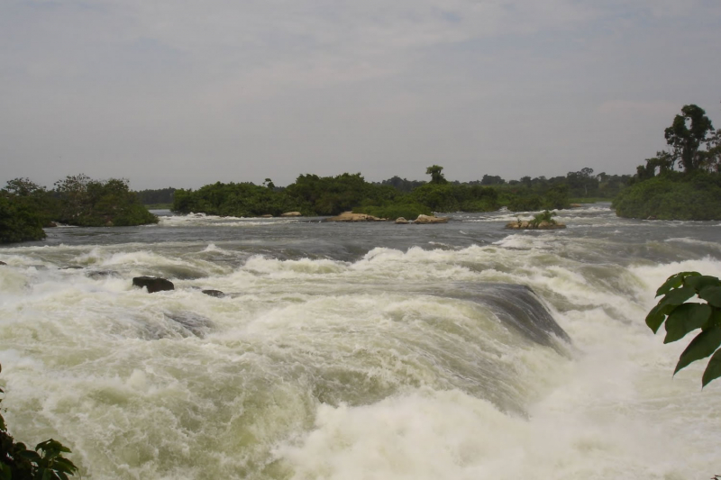
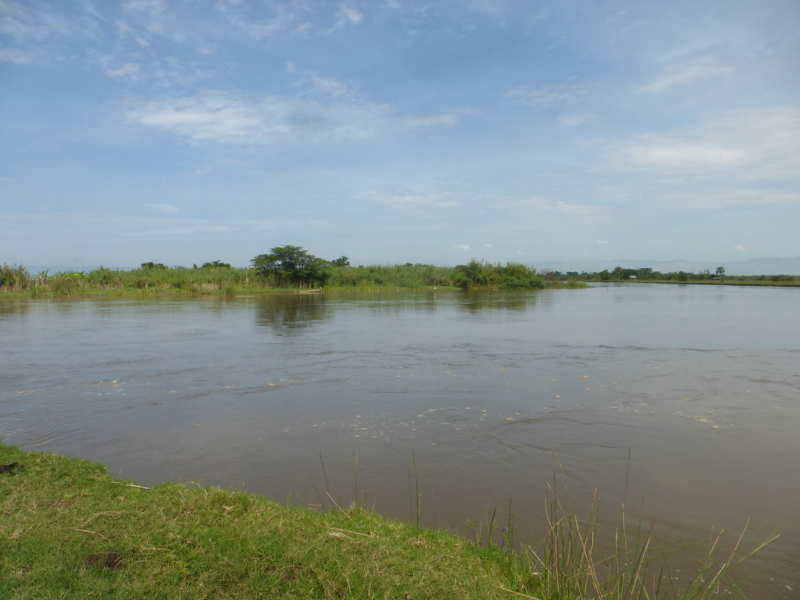
The White Nile ranks second among the longest rivers in Uganda. This river is one of the two primary tributaries of the Nile River in Africa, the other being the Blue Nile. The name stems from the coloration caused by clay in the water. The river generated at Lake No, at the junction of the Bahr al Jabal and Bahr el Ghazal Rivers, is known as the "White Nile". The "White Nile" refers to all segments of the river draining from Lake Victoria to the Blue Nile's merger; the "Victoria Nile" from Lake Victoria to Lake Albert via Lake Kyoga, then the "Albert Nile" to the South Sudan border, and finally the "Mountain Nile" or "Bahr-al-Jabal" down to Lake No. The headwaters of Lake Victoria, the most remote of which is 3,700 kilometers from the Blue Nile, are sometimes referred to as the "White Nile"
The White Nile, which disappeared into the depths of what was then regarded as "Darkest Africa" was the focus of Europeans' hunt for the Nile's source in the nineteenth century.
Length: 2,299 miles (shared with 5 other countries)
https://www.olamspecialtycoffee.com/ 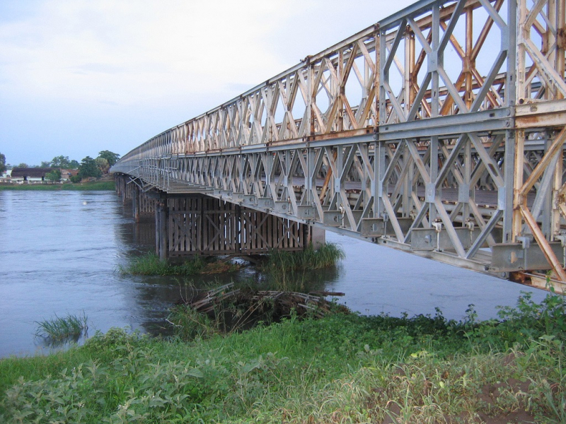
en.wikipedia.org/wiki/White_Nile -
The Kagera river, also known as the Akagera River or the Alexandra Nile, is an East African river that is part of the Nile's upper headwaters and transports water from the Nile's farthest source. The Kagera part of the river starts in Burundi and flows out of Lake Rweru. It runs east from the lake, crossing the Rwanda-Burundi and Rwanda-Tanzania borders before joining the Ruvubu River. Two important tributaries, the Nyabarongo of Rwanda, which feeds Lake Rweru, and the Ruvubu of Burundi, give water for the Kagera. It is unclear which of these two feeder rivers is the longer, and thus the Nile's ultimate source.
The Kagera flows north from the junction along the Rwanda-Tanzania border, past Rusumo Falls, and through Akagera National Park. It then flows east, following the Tanzania-Uganda border and draining into Uganda's Lake Victoria. Richard Kandt found the Kagera's source in 1898.
The river has played a significant role in the histories of the nations through which it flows, particularly Rwanda. The Rwandan colonial era began in 1894 when German Gustav Adolf von Gotzen crossed the Kagera at Rusumo Falls, then the Belgians fought the Germans in 1916 during World War I, entering Rwanda by the same path. In 1994, the river drew international attention for transporting dead from the Rwandan genocide into Lake Victoria, prompting the declaration of a state of emergency in sections of Uganda where the bodies eventually washed up.
Length: 249 miles (shared with Burundi, Rwanda, and Tanzania)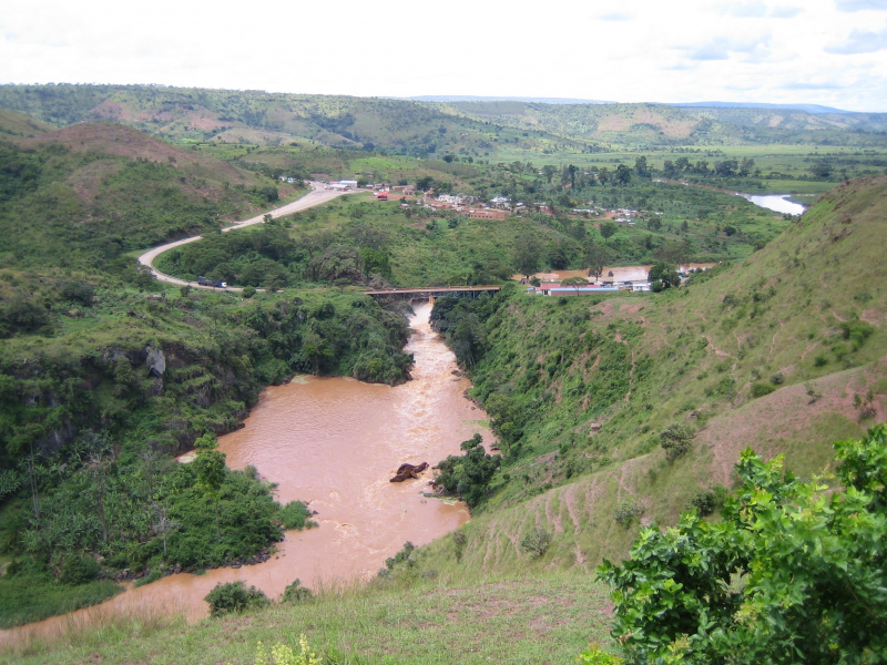
https://mapcarta.com/ 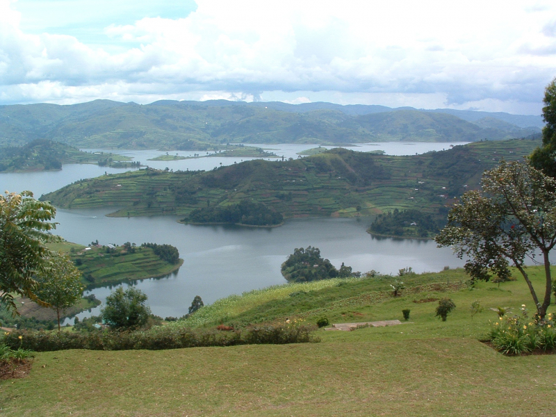
https://www.fao.org/ -
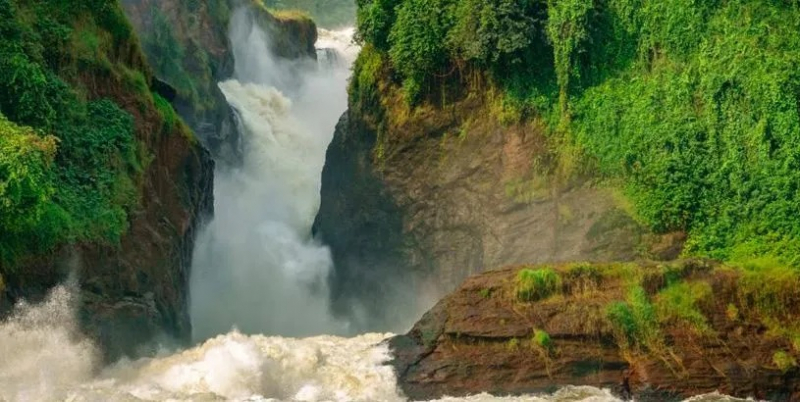
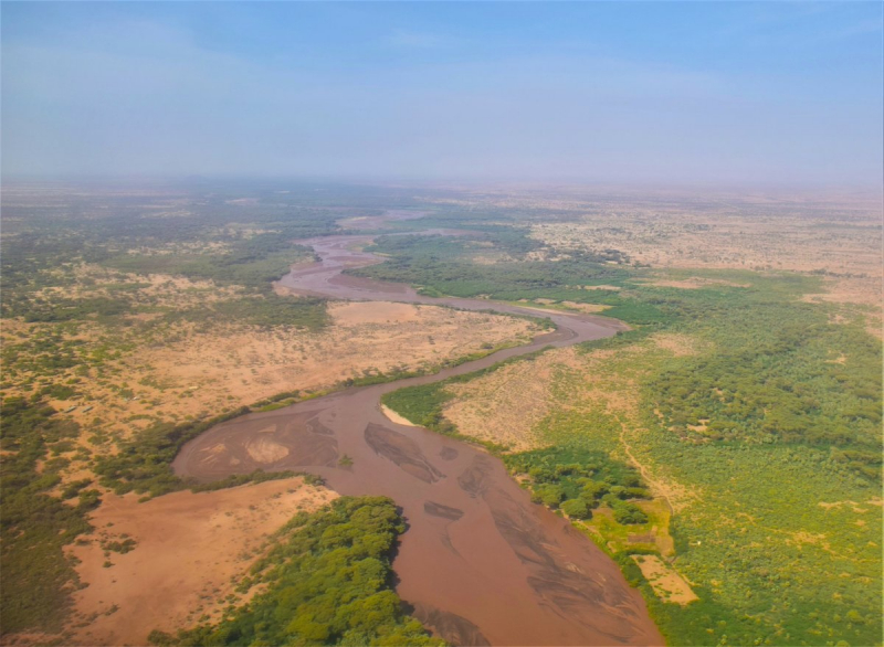
The Turkwel river flows from Mount Elgon, on Kenya's border with Uganda, to Lake Turkana. From its source to the Kenyan border in West Pokot County, the river is known as the Suam River. Turkwel is derived from Tir-kol, the Turkana word for the river, which means "withstands the wilderness" The Turkwel originates on Mount Elgon's lush green slopes and the Cherangani Hills, then passes across the Southern Turkana Plains, crossing the Loturerei Desert near Lodwar, and empties into Lake Turkana, the world's largest desert lake. The river's flow varies annually, and flash floods can occur during the wet season.
The controversial Turkwel Dam was constructed by the Kenyan government with the help of France from 1986 to 1991. The goal was to harness the Turkwel's waters. The project was expected to cost 4 billion Kenyan shillings, but it ended up costing more over 20 billion. The Turkwel Gorge Reservoir was constructed when the dam partially filled the Turkwel Gorge.
Length: 211 miles (shared with Kenya)
twitter.com/kenyangeography/status/1265622098682265602 
https://paukwa.or.ke/ -
The Kagera river travels through Burundi, Rwanda, Tanzania, and Uganda, for a total distance of 249 miles (400 kilometers). The river's source is Lake Rweru in Burundi, and it flows east, crossing the borders of Burundi and Rwanda, as well as Rwanda and Tanzania. The Kagera then joins the Ruvubu River and continues north, passing through Rwanda and Burundi before crossing into Uganda and reaching its mouth at Lake Victoria, where it is the largest intake of water into the lake. During the 1994 Rwandan Genocide, bodies were dumped into a river that eventually flowed into Lake Victoria in Uganda, posing a serious health threat to Ugandans.
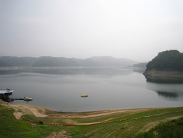
During wet seasons, rising water levels in the swampy watershed cause some water to flow west from this location into the western section of the Katonga River, which feeds Lake George, although the majority of the flow still flows eastwards into Lake Victoria. Along its route to Lake George, the Katonga river is supplied by various tributaries west of its watershed.
Length: 137 miles
https://www.primeugandasafaris.com/ -
The Kafu river is the second-longest river that located completely in Uganda. From source to mouth, the river is around 180 kilometers long.. The river's source is the Kitoma Swamp in the Kibaale District, and it flows east before turning north to reach its mouth near Masindi Port in the Masindi District, where it empties into the Victorian Nile River. Because the river originates in the Kitoma Swamp, it contributes to the survival of wildlife and a variety of creatures in the swamp and along its path.
Another river system, the Nkusi river, runs through the wetland from which Kafu river emerges. The Nkusi river, on the other hand, begins elsewhere and flows through the swamp before emptying into Lake Albert along Uganda's international boundary with the Democratic Republic of Congo. River Kafu rises at an altitude of about 1,100 meters at its source. The altitude at its point of entry into the Nile River is roughly 1,040 meters.
Length: 112 miles
https://www.loveugandasafaris.com/ 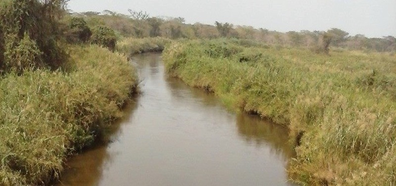
https://www.primeugandasafaris.com/ -
The Sezibwa is one of the longest rivers in Uganda. The Sezibwa River is found in Uganda's southern central region. It rises in the wetlands between Lake Victoria and Lake Kyoga, west of the Victoria Nile, and runs north before emptying into Lake Kyoga. The source of the River Sezibwa is near the town of Ngogwe in Buikwe District. From source to mouth, the River Sezibwa is around 150 kilometers long. The river flows through Mukono District between its source in Buikwe District and its entry into Kayunga District.
The Ssezibwa River, according to myth, is the offspring of a pregnant lady named Nakangu, who lived many hundreds of years ago and was a member of the Achibe clan. She was expecting twins, but instead, a twin river gushed forth from her womb, splitting into two independent streams surrounding an island immediately below the waterfall. Ssezibwa and Mobeya, the spirits of Nakangu's unborn offspring, each inhabit one of these streams, which is why it was once usual for every Muganda passing the river's source at Namukono, some 20 kilometers east, to toss a handful of grass or stones into the river for good luck. Every year, at the river's source, a thanksgiving sacrifice of barkcloth, beer, and a cockerel is made, usually conducted by a Ssalongo (father of twins).
Length: 93 miles
https://ugandatourismcenter.com/ 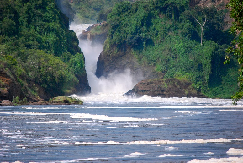
https://mukono.go.ug/ -
Semliki is an important river in Central and East Africa that runs for 140 kilometers across the Democratic Republic of the Congo (DRC) and Uganda. It flows north from Lake Edward in Beni Territory, Nord-Kivu, DRC, avoiding the Rwenzori Mountains on its right, eventually draining into Lake Albert in the Albertine Rift, Irumu Territory, Ituri Province, DRC, overlooking the Blue Mountains to the west. Its mouth lies near Katolingo Village in the Kanara subcounty of Uganda's Ntoroko district. It meanders considerably in its lower reaches, comprising part of the international border between the Democratic Republic of the Congo and the western Ugandan districts of Bundibugyo and Ntoroko, near the Semuliki National Park.
Bank erosion and frequent changes in the course of the meandering lower portions of the river have been caused by increasing snow melt from the Rwenzoris, overgrazing, and other changes to the watershed. Uganda is losing up to 10 meters of land each year due to erosion on its side of the river, while silt from the Semliki is rapidly filling in the southern end of Lake Albert. In some locations, the DRC is losing territory as the course of the river shifts the border's apparent location.
Length: 87 miles (shared with the Democratic Republic of the Congo)
https://www.flickr.com/ 
https://www.instagram.com/virunganationalpark/