Top 8 Highest Mountains In North Korea

In addition to the huge coastal plains bordering the Yellow Sea, the Korean Bay, and the Sea of Japan, North Korea's geography is characterized by hills and ... read more...mountains separated by deep narrow valleys. The stratovolcanic Paektu Mountain, at an elevation of 9,019 feet above sea level, is North Korea's highest point. The Rangrim Mountains in the north-central part of the country and the Hamgyong Ranges in the northeastern region, with their many high peaks, are two other prominent ranges in the country.
-
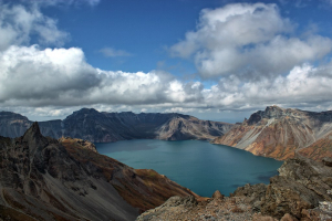
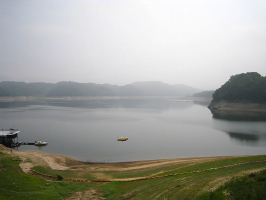
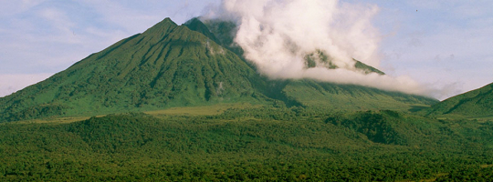
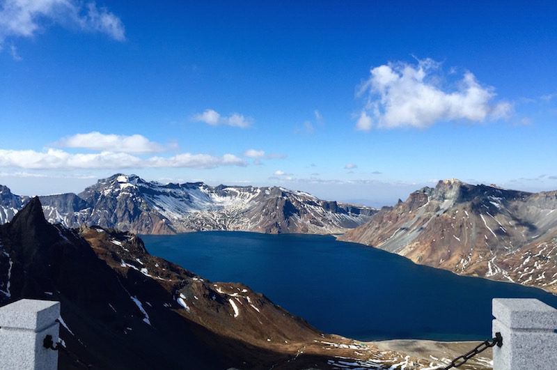
The highest mountain on the Korean Peninsula is Mt. Paektu, also known as Paektusan, Paekdusan, Paektu San, or Changbaishan. It is also the most famous and important North Korean peak, and it has some of the most stunning landscapes in the country. Mt. Paektu, which borders China, attracts a large number of Chinese tourists each year. Changbaishan is the Chinese name for the mountain. The enormous lake crater in the middle of Paektusan's top, also known as Heaven Lake, is its most famous feature.
Mt. Paektu can only be climbed during the summer months due to the freezing temperatures at the peak. During the summer, the temperature can reach up to 18 degrees Celsius at its highest point. It can be as cold as -48 degrees in the winter. For the North Korean people, Mt. Paektu is regarded as the birthplace of Kim Jong Il, as well as the birthplace of the Korean people.
Both Koreans and Manchus think the mountains are their ancient home and continue to worship there. It is a popular tourist attraction for foreign visitors who come to see the mountain's monuments, springs, and ancient secret camps. There are five documented plant species in Heaven Lake, with additional found around its shores. Tree species such as birch and pine can be found in the forest on the Chinese side of the mountain. The woodlands around the mountains are home to Siberian tigers, bears, wolves, and Amur leopards.
It is home to black grouse, woodpeckers, and owls, among other wildlife. The Chinese and Koreans continue to argue over sovereignty of the mountain, which the Koreans consider entire Korean land and object to the Chinese's use and development. Recent Chinese initiatives in economic growth, infrastructure, and cultural festivals have exacerbated tensions between the two populations.
Height: 9,019 feet
Name Meaning: Mountain of 7 TreasuresLocation: Disputed between: Ryanggang, DPRK/South Hamgyeong, ROK & Jilin, PRC/Andong, ROC
uritours.com 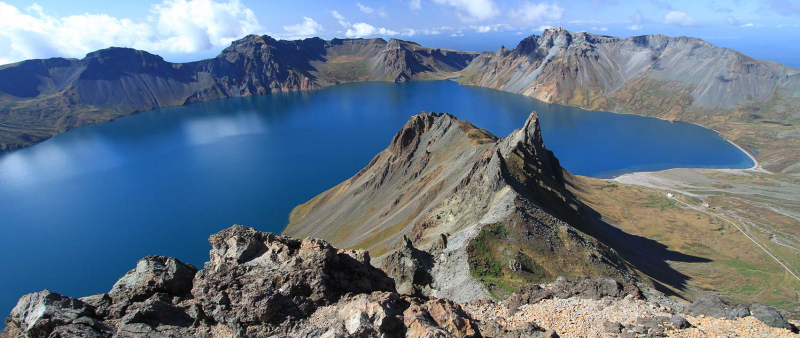
juchetravelservices.com -
The mountain is located on the boundary of North Korea's Kilju, Myongan, and Orang Counties. It has a granite peak that rises to 7,234 feet, making it the country's second tallest mountain. The mountain is a nuclear denotation site, with extensive tunnels constructed by Korean POWs for use in nuclear testing on the eastern side. It was here that nuclear tests were conducted in 2006, 2009, 2013, and 2016. It also houses North Korea's largest concentration camp.
At the nuclear test site in P'unggye-ri, political prisoners were reportedly forced to construct tunnels into the southern side of the mountain. The horizontal tunnels are thought to be two to three meters broad and tall, with hundreds of meters of length. The sixth and largest explosion, believed to be the final, "caused the mountain bulge sideways by about 12 feet and fall vertically by about a foot and a half," according to international analysts, with one seismologist describing the subsequent reaction as the mountain "pancaking." The largest North Korean concentration camp, Hwasong, is located between Mantapsan and Mynggan (Hwasng), covering 549 km2 (212 sq mi).
Height: 7,234 feet
Location: Kilju County, North Hamgyong Province, North Korea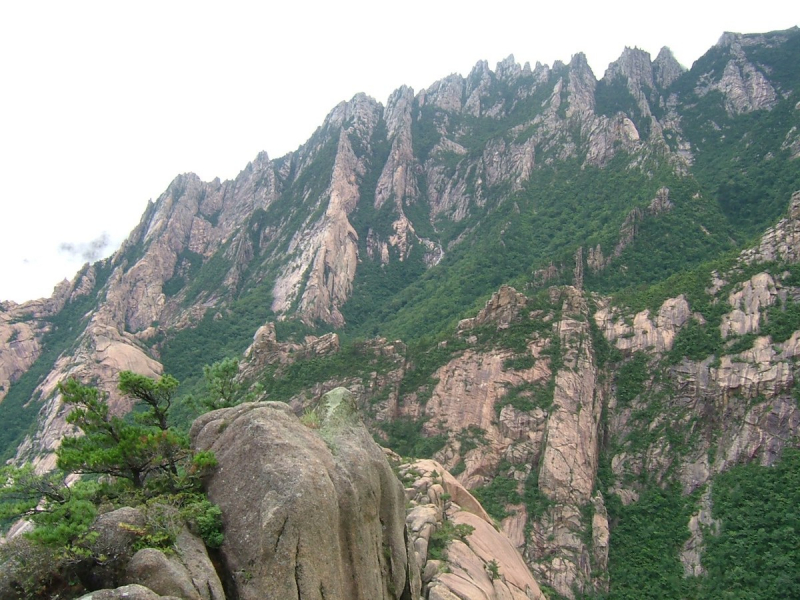
en.wikipedia.org -
Myohyangsan Mountain is North Korea's third tallest peak, standing at 6,263 feet. Because of the mystic shapes and fragrances present in the area, the locals named it Myohyangsan, which means "mystery fragrant mountain." The Koreans regard the mountain as a sacred spot and the residence of the legendary King Tangun, the Korean people's ancestor. Hiking trails, Pohyon Temple, Sangwon Hermitage, Kumgang Hermitage, and Habiro Hermitage are all popular tourist attractions on the mountain. It was designated as a biosphere reserve by UNESCO in 2009 because of its cultural value as a sacred site and birthplace of legends, as well as its beautiful cliff, which is home to 30 endemic plant species, 12 endangered animal species, and 16 globally threatened plant species.
When visiting Mt. Myohyang, be sure to stop at the International Friendship House. This is a mountain-carved structure that keeps all international presents given to North Korean officials, including the famous basketball from Denis Rodman. It's rumored to be home to 220,000 gifts. The Ryongmun cavern system is also open to the public for exploration. These mountains also house a number of remote Buddhist temples. The Pohyon Temple, which is over 1000 years old and was the epicenter of Buddhism during the Koryo period, is a must-see.
Height: 6,263 feet
Name Meaning: Mysterious Fragrant Mountain
Location: North Pyongan Province, North Korea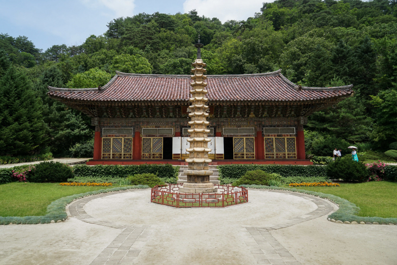
uritours.com 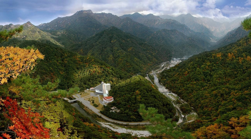
dulichdiaphuong.com -
Mt. Maisan is located in Chollabuk-do province, east of the city of Jeonju and near to the city of Chinan, in the Maisan Provincial Park. The Korean word for "horse" is "mai," and the Korean word for "mountain" is "san." This mountain gets its name from the fact that its two peaks are separated, giving it the appearance of two horse ears from afar. The west peak, Ammai-bong (673m), is known as Ammai-bong (female horse ear peak), whereas the east peak, Sunmai-bong (667m), is known as Sunmai-bong (male horse ear peak).
The mountain is unusual in Korea since it is made of conglomerate rock that looks like gray pebbles solidified in cement and gives the area a sense of lost world. The renowned Tapsa Temple, with its 80 stone pagodas, is located at the foot of the mountain, halfway between the two summits. In the early 1900s, a hermit built the mortar-less pagodas as symbolic personal prayers for peace. These various stone structures (some as tall as 10 meters) are an intriguing sight and contribute to the area's mystical ambiance.
Maisan's inverted icicles are another fascinating feature. When water is left outside in a bowl in the chilly winter months, it freezes into a pole reaching for the sky. No one understands why or how this happens, but it only adds to Maisan's mystique. The only peak that can be hiked to is the west summit. Climbing equipment is required to reach the east peak. The trek up Maisan's west summit is incredibly steep, but it's on a well-marked track that winds its way up stone stairs and through dense forest. The hike is difficult but brief (less than 2km). To get to the top, plan on walking for around 45 minutes.
Height: 5,725 feet
Name meaning: horse ear mountain
Location: Chollabuk-do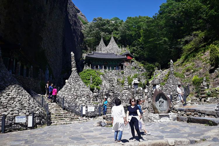
en.trippose.com 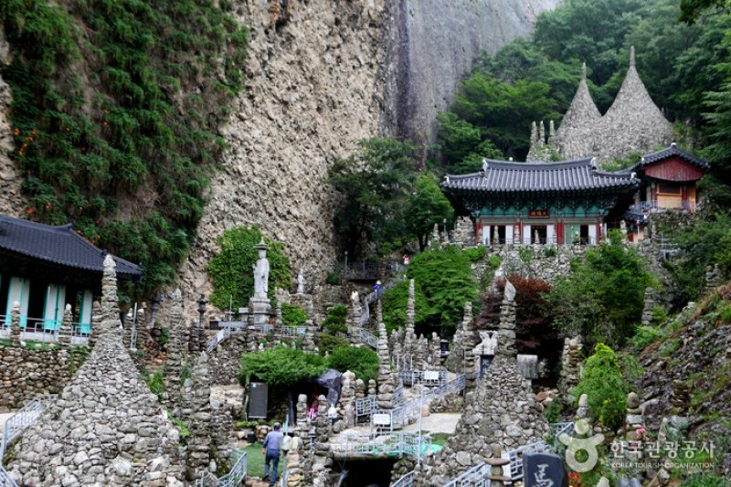
en.trippose.com -
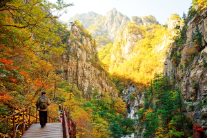
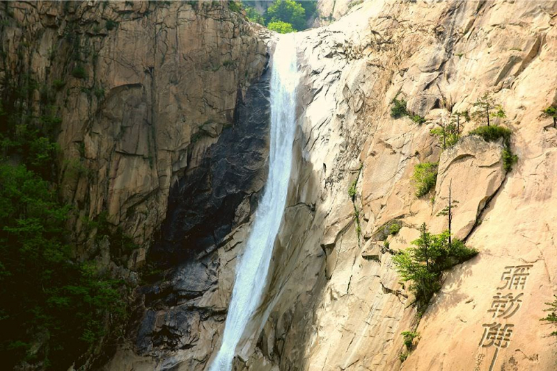
This mountain's name changes with the seasons, although it is most popularly known as Kumgangsan. With a height of 1638 meters, it is known as Korea's diamond and the country's second tallest mountain. Inner Kumgang is recognized for its temples; Outer Kumgang is known for its waterfalls and hot springs; and Sea is known for its lagoons and rock pillars that emerge from them. A national park protects much of the mountain's mixed broad-leaf and coniferous forest. Because of the endangered red-crowned cranes, it is also a key international bird area. The mountain is a tourist destination due to its picturesque beauty, and it attracts visitors from all over the world. During the Joseon Dynasty's reign, the locals paid tribute to the peak.
The hanging Poduk Hermitage, which is held from falling by one copper rod, has historically been popular with artists who require a space to contemplate. Find sanctuary at Pyohon, a zen monastery in inner Kumgang that dates back to 670 and is one of the oldest of its kind. Watch your step because there are a lot of jagged rocks in this area, even the peaks are jagged. Both South and North Korea contributed to the development of this tourism sector.Height: 5,374 feet
Name Meaning: Diamond MountainLocation: South Hwanghae, North Korea.
north-korea-travel.com 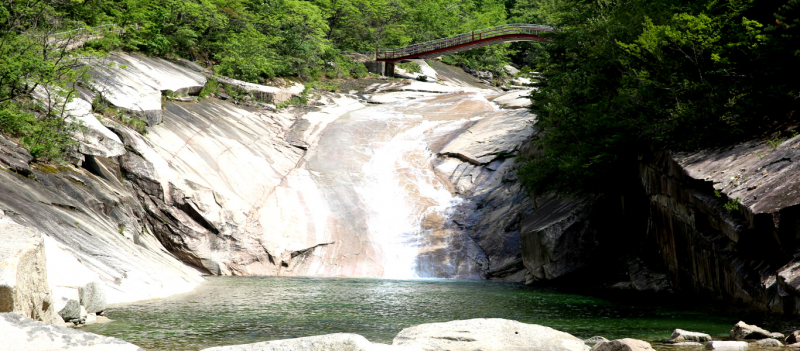
north-korea-travel.com -
Because it is where the Baekdudaegan Mountain Range and the Nakdong Mountain Range diverge, Maebongsan Mountain is also known as 'Cheonwibong.' Maebongsan would be a rather unimportant mountain in Seoul if it weren't for its location. It's fortunate that it's directly near to the World Cup Stadium. On the mountain, there are various walking pathways that start (or end) at World Cup Stadium Park. As a result of its proximity, it attracts a lot of attention.
Maebongsan is a relatively low mountain. It is barely a few inches higher than the nearby World Cup Stadium. Switchbacks, on the other hand, were not considered necessary by the trailblazers who chose the paths up the mountain. Because of the straight-up-the-mountain route, reaching the summit can be a little more challenging than one might imagine. The Maebongsan Mountain meets the sky, with a cabbage field stretching 1,320,000m2 from the mountain's crest. The Gwinemi Village, at 1000 meters above sea level, boasts a 653,000-square-meter cabbage farm. It was also included in the television show 1 Night 2 Days, which has since become a popular tourist destination in Taebaek.
Height: 5,177 feet
Location: Hwanghaenam-do in North Korea
gangwon.to 
photos.com -
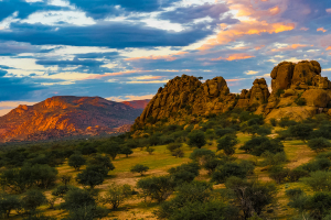
Mt. Chilbo, also known as Chilbosan, is one of North Korea's least visited mountain ranges. This is primarily owing to the fact that it is difficult to access. This stunning piece of North Korean countryside, however, should not be neglected! The only method to go to Mt. Chilbo, which is located in North Korea's northeast, is to take an internal aircraft from Pyongyang to Orang airport.
Legend has it that there are 7 treasures hidden within the "Mountain of 7 Treasures." Sangmae Peak, with slightly over 1100 meters, is the tallest of a range of summits that are generally referred to as a single mountain. Chilbosan, like Kumgangsan, is divided into three areas: Inner, Outer, and Sea, each with its own unique features. There are uncommon rock formations and lovely perspectives all across Chilbosan, especially when there is snow on the ground. Tourists flock to this mountain, eager to learn from native guides who share folklore and adventure stories. While you're here, pay a visit to the Kaesim Buddhist Temple, which is one of the area's primary attractions. This temple is over 1000 years old, founded in 826; And is one of North Korea’s official national treasures.
Height: 3,619 ft
Name Meaning: Mountain of 7 Treasures
Location: North Korea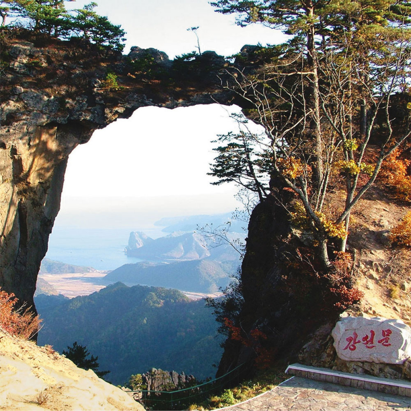
uritours.com 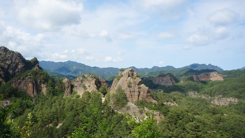
uritours.com -
Kuwlsan, also known as Mount Kuwol, is a peak in North Korea's South Hwanghae province. The mountain gets its name from the ninth month of the lunar calendar, when it is said to be exceptionally beautiful. The mountain is a popular summer destination in North Korea, attracting a large number of domestic visitors. The mountain's highest peak, at 954 meters above sea level, is the highest point in the short Kuwol range.
The Sansong Revolutionary Site, the 9th century Woljong Temple and stupas, as well as the 4th century Anak Tomb No. 3 are all located in Kuwolsan. Rock formations, river falls, and natural pools are among the natural features. There are several picturesque paths that run across the mountains. The mountain's highest peak, 954 meters above sea level, is the highest point in the short Kuwol range. There are various picturesque paths that wind their way across the mountains. Rock formations, waterfalls, and natural pools are among the natural features. An 18,000-hectare national park protects much of the mountain, which is covered in mixed broadleaf and coniferous forest. BirdLife International has designated 1100 hectares as an Important Bird Area (IBA).
Height: 3,130 feet
Location: HwangHae
peakvisor.com 
peakvisor.com