Top 5 Longest Rivers In North Korea

North Korea, also known as the Democratic People's Republic of Korea, is a country in East Asia that is located in the northern half of the Korean Peninsula. ... read more...China, Russia, and South Korea, the latter of which is also known as the Republic of Korea, bordered it. North Korea is 46,541 square miles in size and has a population of 24.9 million people. Mountains, plains, and a large continental and oceanic climate characterize the country's scenery. Summer, winter, autumn, and spring are the four distinct seasons of the country, with June to September seeing the highest precipitation.
-
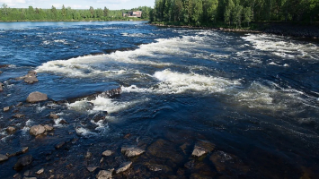
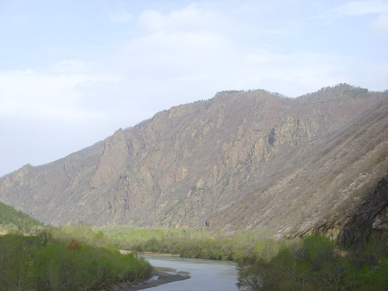
The Yalu River, commonly known as the Amnok River, runs along the North Korean-China border. It rises 8,200 feet above sea level on Mount Paektu and flows south into the Korean Bay. It stretches for 491 miles and is home to more than 200 islands. The river is important to North Korea's economy since it sustains Asia's largest hydroelectric plant, facilitates transportation, and provides fish to the population for food. This is also the longest river in North Korea.
The origin of the river's name is the subject of two theories. One explanation is that the name comes from the Manchu word Yalu ula. Yalu is a Manchu term that signifies "border between two countries." In Mandarin Chinese, ylù is a phonetic equivalent of the original Manchu name, but it actually means "duck green," which was once the river's color. Another idea is that the river was named after the union of its two upper branches, which were known as (Y or Ap) and (Lù or R(or n)ok), respectively.
It was spelled Amnokgang in Revised Romanization of Korean and Aprokgang in Revised Romanization of Hangeul. The river flows south from Paektu Mountain on the China–North Korea border to Hyesan before sweeping 130 kilometers northwest to Linjiang and then returning to a more southerly direction for another 300 kilometers before emptying into the Korea Bay between Dandong (China) and Sinuiju (North Korea) (North Korea). Jilin and Liaoning are two Chinese provinces near the border.
The river runs about 795 kilometers (494 miles) and receives water from 30,000 square kilometers of land. The Changjin, Hochon, and Togro rivers in Korea, and the Ai (or Aihe) and Hun rivers in China, are the Yalu's most important tributaries. For the most part, the river is difficult to navigate. During the winter, the river freezes over and can be traversed on foot.The ancient Korean kingdom of Goguryeo ascended to prominence in the river basin. Many old fortresses may be seen along the river, and the kingdom's previous capital was located in what is now Ji'an, Jilin, beside the Yalu, a place rich in Goguryeo era antiquities. General Yi Songgye (later Taejo of Joseon) decided to send back his troops southward to Kaesong on Wihwa Island on the river in 1388, in the first of a series of revolts that eventually led to the establishment of the House of Yi.
Length: 795 kilometers (494 miles)
https://www.irishtimes.com/ 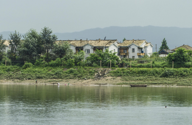
https://www.youngpioneertours.com/ -
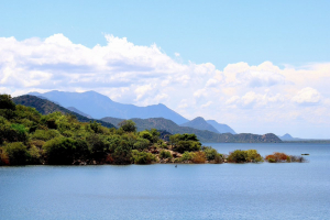
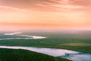
The Tumen River, also known as the Tuman River or the Dooman River, is a 521-kilometer (324-mile) long river that flows through China, North Korea, and Russia, rising on the slopes of Mount Paektu and into the Sea of Japan. The river has a 33,800 km2 drainage basin (13,050 sq mi) and is one of the longest rivers in North Korea.
The river runs through northeast Asia, passing through China and North Korea in its upper reaches and into Russia in its final 17 kilometers (11 miles) before entering the Sea of Japan. The river forms much of Jilin Province's southern border in Northeast China, as well as North Korea's North Hamgyong and Ryanggang provinces' northern borders. The river, as well as the Amnok River, commonly known as the Yalu River, originates on the Chinese-North Korean border in Baekdu Mountain (which forms the western portion of the border of North Korea and China).
The Mongolian term tümen, which means "ten thousand" or "a myriad," is the source of the river's name. This river is heavily polluted by North Korean and Chinese companies nearby, but it is nevertheless a popular tourist destination in the area. A riverfront promenade in Tumen, Jilin, features eateries where patrons can gaze across the river towards North Korea. Tumannaya is the Russian name for the river, which literally means cloudy.Between the villages of Wonjong (Hunchun) and Quanhe, the Japanese erected the Tumen River Bridge in 1938, where the Quan River joins the Tumen River. Hoeryong and Onsong in North Korea, as well as Tumen and Nanping in China's Jilin province, are important cities and towns along the river. Three agreements were signed in 1995 by the People's Republic of China, Mongolia, Russia, North Korea, and South Korea to establish the Tumen River Economic Development Area.
Length: 17 kilometers (11 miles)
https://en.wikipedia.org/ 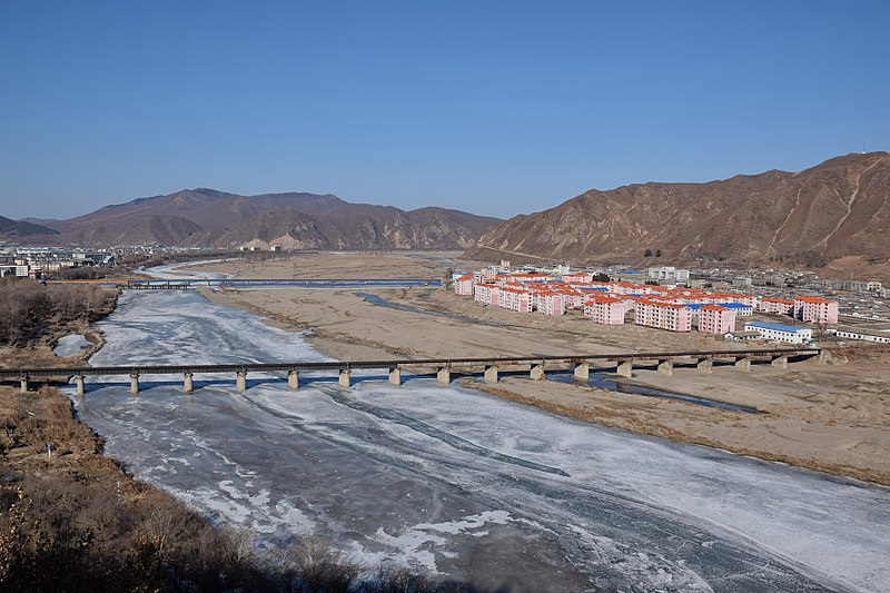
https://en.wikipedia.org/ -
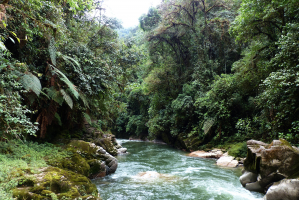
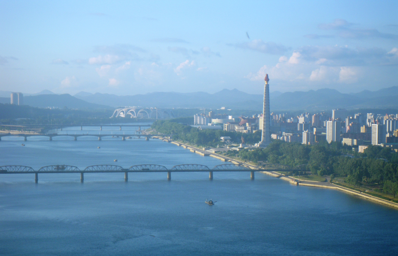
North Korea's Taedong River is a major river. The river springs in the country's northwestern Rangrim Mountains, then runs southwest into Korea Bay near Namp'o. It passes through Pyongyang, the country's capital, in the middle. The Juche Tower and Kim Il-sung Square are both located along the river.
The river runs over 439 kilometers (272.7 miles) and is generally deep. It is the second-longest river in North Korea and the fifth-longest on the Korean Peninsula. Pyongyang is 110 kilometers upstream, Sunchon is 192 kilometers upstream, and Taehng is 414 kilometers upstream. It is commonly used for river transportation due to its depth; huge ships can navigate it up to 65 kilometers inland, though most commercial traffic stops at Songrim.
On its waters, the kingdom of Koguryo was created. Many neolithic and Bronze Age archeological sites, as well as remnants and ruins from Koguryo, have been discovered along the river. It was also known as the Pae River at one time. When the Taedonggang Culture flourished in 3000 BC, the Taedong River basin is thought to have been the location of the Korean nation's historical center.The government completed the 8-kilometer-long West Sea Barrage at the mouth of the Taedong River in Namp'o in 1986, with three locks and 36 sluices. The dam is used to control floodwaters and irrigate land that has recently been recovered from the Korea Gulf. The dam prevents outgoing river water from mingling with ocean, resulting in an increase in pollutant concentrations. Other dams have been erected to give energy to the country, such as the Nyongwon Power Station. The Okryu Bridge, Rungra Bridge, and Taedong Bridge are among the six bridges on the Taedong in Pyongyang.
Length: 439 kilometers (272.7 miles)
https://drbenjaminhabib.com/ 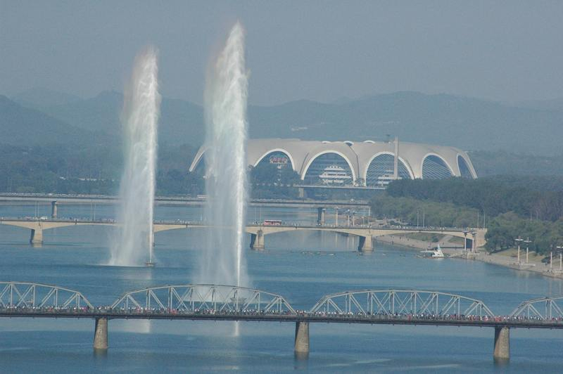
https://koryogroup.com/ -
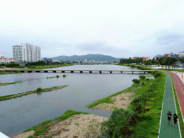
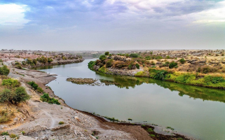
The Bukhan River is a 197-mile-long river that originates in North Korea's Geumgangsan region and flows through both North and South Korea. It ranks 4th among the longest rivers in North Korea. It runs across North Korea's Kangwon Province, as well as South Korea's Gangwon and Gyeonggi provinces. It is sometimes referred to as the North Han River because it is a tributary of the Han River. It joins the Namhan River near Yangyeong to form the Han River.
The Bukhan River's headwaters are near Geumgangsan in North Korea, and this section of the river is known as the Geumgangcheon, or "Geumgang Stream." It enters Hwacheon County after crossing the Korean Demilitarized Zone, flowing south through Chuncheon and then west through Gapyeong. In Yangseo-myeon, Yangpyeong, it joins the Namhan River to form the Han River.
Length: 197-mile-long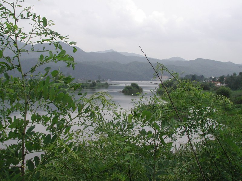
https://vi.wikipedia.org/ 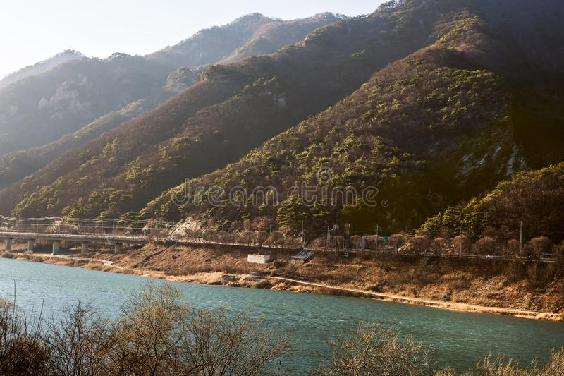
https://www.dreamstime.com/ -
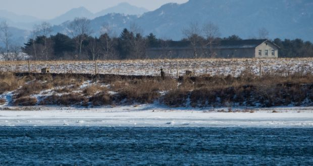
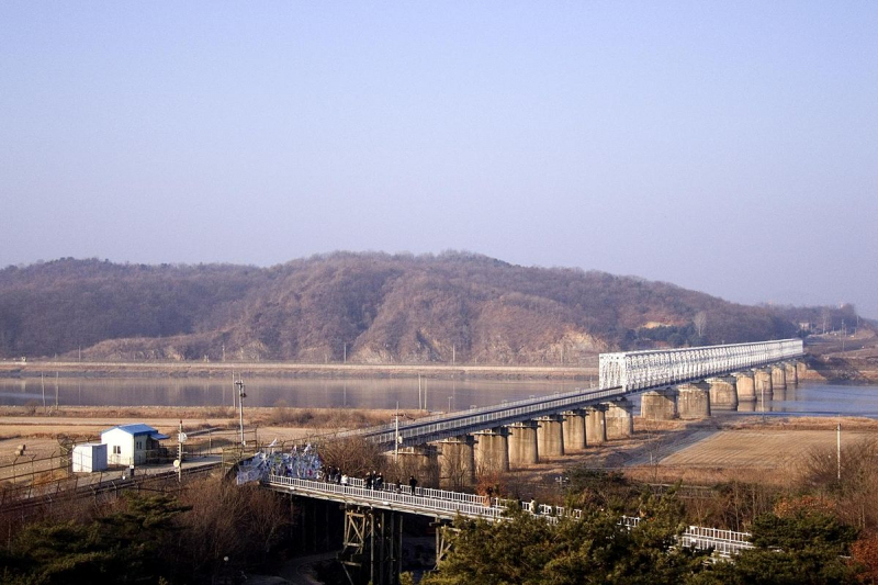
The Imjin River, sometimes known as the Rimjin River, is Korea's seventh largest river. This is one of the longest rivers in North Korea. It flows from north to south, passing through the Demilitarized Zone before joining the Han River near the Yellow Sea, downstream of Seoul. The Imjin War is not named for the river. The Battle of Imjin River, fought during the Seven Years War in 1592, and the Battle of the Imjin River, fought during the Korean War, were both fought on the Imjin River.
On November 4, 2018, a 20-member team made up of ten North Koreans and ten South Koreans began a collaborative inter-Korean survey with the goal of establishing a Joint Utilization Zone along the Imjin River's estuary. Under the protection of troops on both sides of the Korean border, citizens would be able to visit the estuary for tourism, environmental conservation, and the collecting of construction aggregate. The councils of South Korea's Gangwon and Gyeonggi provinces, which share a border with the DMZ, signed a "peace working agreement" at Dorasan Station in Paju on November 5, 2018, approving the Joint Utilization Zone on a local level. On December 9, 2018, the inter-Korean survey of the Imjin River's estuary was finished. By January 25, 2019, the updated map of the river's estuary, which includes newly identified reefs, was to be made public.
The active channel of the Imjin River occupies only about 150 to 200 feet of the dry riverbed's 1,200-foot (370-meter) width, which is surrounded by nearly vertical rock cliffs rising 75 feet (23 meters) above the mean low water level. It reaches flood heights of 48 feet (15 m) above mean water level and a velocity of 15 to 20 feet per second (6 m/s), fed by its major tributaries and many tiny mountain streams. Imjin has risen at a rate of more than six feet per hour on occasion due to the quick runoff of around 95 percent of precipitation during severe general rains.
Imjin is known as the "River of the Dead" in South Korea because large numbers of bodies have floated down the river from the north in the past. The most recent incident occurred during the 1990s famine, when millions of North Koreans were thought to have died of starvation.
Length: 273.50 km (169.95 mi)
https://commons.wikimedia.org/ 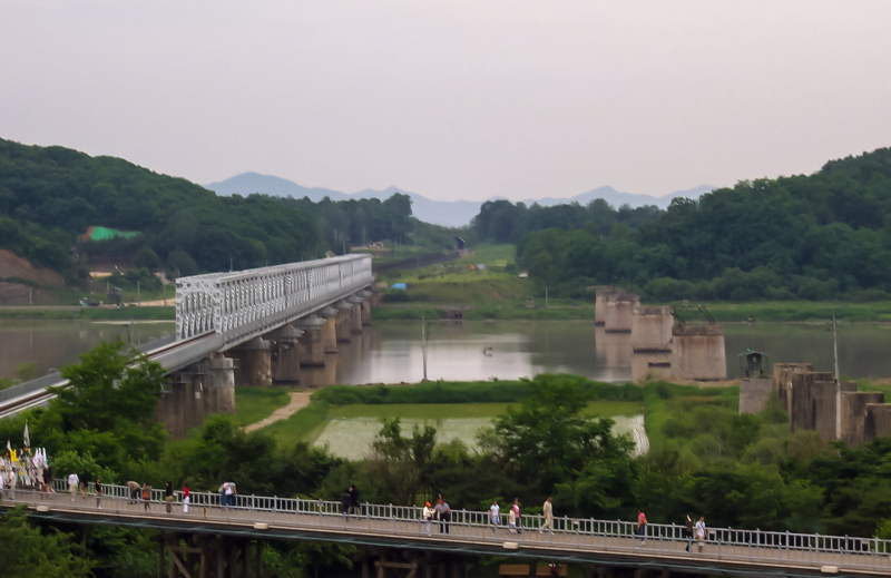
https://en.wikipedia.org/