


Top 8 Longest Rivers in Argentina

Argentina is regarded around the world as a football-mad country, with its soccer players and teams dominating the worldwide sporting scene. Its capital, ... read more...Buenos Aires, is also the country's largest city. There is no official language in the country, but regional languages such as Guarani, Qom, and Mocovi are recognized. President Mauricio Macri leads the country's unitary presidential form of government. With over 92 percent of the population living in cities, the country is highly urbanized. It is a country with a variety of habitats impacted by natural resources like rivers. This article lists some of Argentina's longest rivers.
-
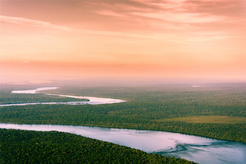
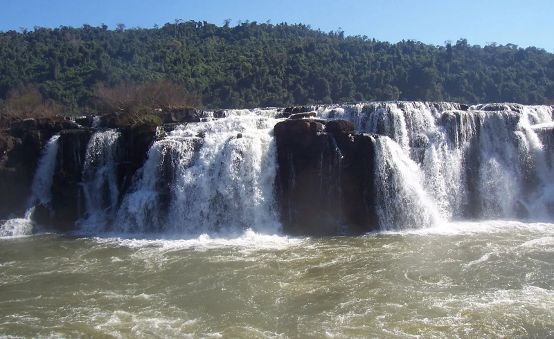
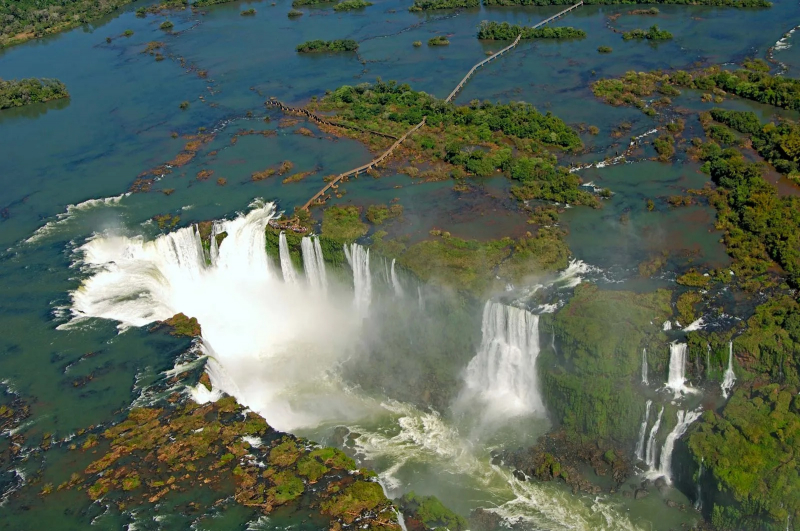
The Parana river is Argentina's longest river. The Paraná River began on a plateau in southern Brazil and was named after a native word, para rehe onáva, which means as big as the sea. The Paraná River travels 3,032 miles (4,880 kilometers) before merging with the Paraguay and Uruguay rivers to form the Ro de la Plata. The Titetê and the Iguazu rivers are two of the most important tributaries of the Paraná River, with the Iguazu Falls, which has a remarkable total fall of around 275 cascades, making it the world's greatest waterfall.
The Paraná River, along with its tributaries, comprises a huge watershed that stretches throughout northern Argentina. The drainage basin of the river encompasses all of Paraguay, as well as considerable areas of Brazil, Argentina, Uruguay, and Bolivia. A substantial chunk of its navigable length connects inland cities in Argentina and Paraguay to the Atlantic. With the construction of Yacyretá Dam and Itaipu Dam, one of the world's largest, on its border, the Parana River has also made Paraguay the world's greatest exporter of electricity.
About 300 kinds of freshwater fish live in this Argentina's longest river. Nearly nine species of Potamotrygonidae freshwater river stingrays have been found in the Parana River, including the popular Motoro stingray and the smooth-back river stingray. The Aphyocharax paraguayensis population accounts for around half of the fish in the river. Otocinclus vittatus, Pseudohemiodon laticeps, and Otocinclus vestitus are only a few of the almost 80 species of loricariids. Other fish species found in the river include approximately 25 species of killifish and cichlids, South American lungfish, and three anostomidae.
Length: 3,032 miles (shared with Brazil and Paraguay)
https://www.ukpandi.com/ 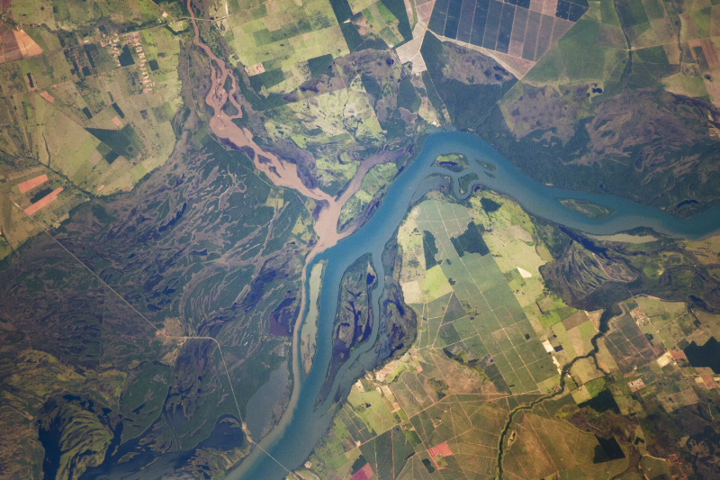
https://earthobservatory.nasa.gov/ -
Paraguay river originates in Paraguay, then runs through Brazil and Argentina before draining into the Parana River in Argentina. The river travels for 1,621 miles till it reaches the Parana River, where it joins it. Unlike other major rivers, the Paraguay River has no single dam, making it navigable for long distances and having the continent's second longest navigable length behind the Amazon. The river's principal uses are fishing and agriculture. Seasonal flooding forces thousands of residents to seek temporary shelter until the floodwaters recede. There are around 350 fish species in the fauna, with 80 of them being indigenous.
The river also serves as a source of commerce through fishing and irrigation for crops along its path. As a result, it sustains a lot of poor fisherman who live along its banks and earn the majority of their money selling fish in local markets, as well as providing a substantial source of food for their families. This has caused problems in large cities like Asunción, where impoverished farmers from the interior of the country have flocked to the river's banks in pursuit of a better life. Seasonal flooding of the river's banks can compel tens of thousands of displaced residents to seek temporary shelter until the floodwaters recede. The Paraguayan military has been compelled to set aside space on one of its reserves in the city for temporary accommodation for the displaced inhabitants. Because of its beauty, the river is a popular tourist destination.
Length: 1,629 miles (shared with Bolivia, Brazil, and Paraguay)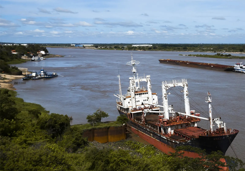
https://www.britannica.com/ 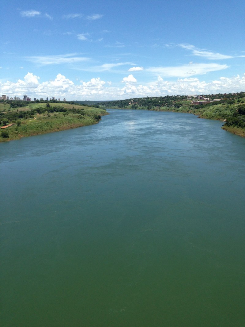
pinterest.com/pin/575194183630315235/ -
Uruguay River rises in Brazil's Serra do Mar, where the Canoas and Pelotas rivers meet and runs a long way before emptying its waters in Rio de la Plata. Below the river channel, the Uruguay River forms a submerged canyon with a depth of over 300 feet. The river also includes five international bridges, two of which connect Argentina and Brazil and the other three which connect Argentina and Uruguay. Argentina and Uruguay were at odds over the development of pulp mills along the river, with Argentina alleging that Uruguay had violated a 1975 deal. All matters concerning the river were intended to be agreed upon by both countries, according to the treaty.
The river's name is believed to be derived from the Spanish settlers' interpretation of the Guaran language word that the locals used to refer to it. "The river of the uru (an indigenous bird)" and "(river of) the uruguá" are two possible interpretations.
Length: 1,142 miles (shared with Brazil and Uruguay)
https://www.britannica.com/ 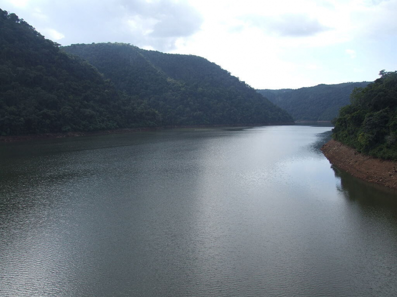
https://lacgeo.com/ -
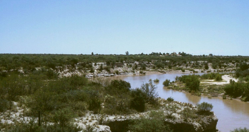
The Desaguadero river is an Argentine river. The river Bermejo or Vinchina originates near the Tipas volcano in La Rioja at an elevation of around 5,500 meters. Its upper stages are known as the Bermejo or Vinchina. It is also known as the Salado in its lower reaches. In La Pampa Province, near Pichi Mahuida, it meets the Colorado River. The Desaguadero River has a total length of 1,498 kilometers and a drainage basin of approximately 260,000 square kilometers.
It is one of the key rivers that supply Cuyo's irrigated lands, and it flows along the region's eastern border. Despite its length, the river is a small, shallow stream for most of the year due to irrigation use, and surface flow only reaches the Colorado on rare occasions. The Jáchal, San Juan, Tunuyán, Diamante, and Atuel Rivers are tributaries. The river served as a traditional boundary between the viceroyalty of Buenos Aires and the viceroyalty of Peru.
Length: 941 miles
en.wikipedia.org/wiki/Desaguadero_River_(Argentina) 
commons.wikimedia.org/wiki/File:Argentina_-_Río_Desaguadero.JPG -
Iguazu river flows through Argentina and Brazil. It is a significant Paraná River tributary. The Iguazu River is 1,320 kilometers long, with a 62,000-square-kilometer drainage basin. The Iguazu River is home to over 100 fish species, including several that have yet to be identified.
Catfish, characiforms, and cichlids make up the majority of the river's fish species. About 70% are endemic, which is mostly due to the falls, which serve as both a home for rheophilic species and a barrier between above and below. Large migratory fish known throughout much of the Paraná River Basin are naturally absent from Iguazu, with the exception of the endangered Steindachneridion melanodermatum in the lower section. In the river, there are about 30 introduced species, with roughly a third coming from other continents and the rest from elsewhere in South America. In the Iguazu River Basin, the unique Aegla crustacean is common.
Length: 820 miles (shared with Brazil)
https://www.britannica.com/ 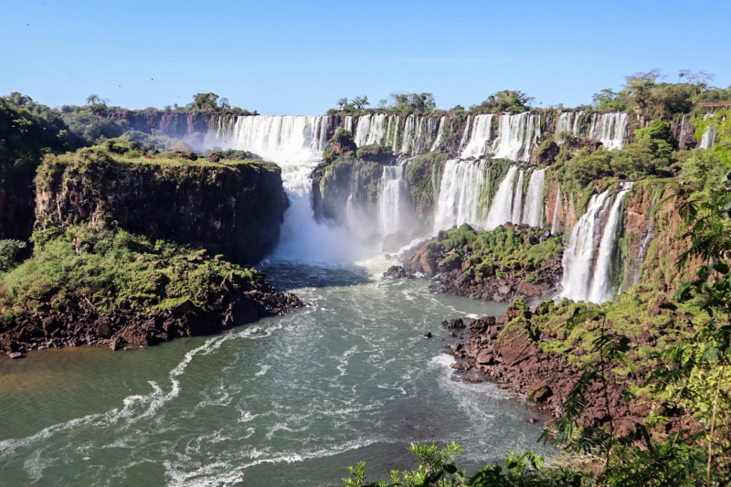
https://www.nothingfamiliar.com/ -
The Salado river is a river in Argentina's northern province of Buenos Aires. It begins at El Chaar Lake, 40 meters above sea level on the border with Santa Fe Province, and runs southeast for 640 kilometers before debouching into Samborombón Bay, part of the Ro de la Plata estuary on the Atlantic Ocean. The mouth of the Salado lies roughly 170 kilometers south of Buenos Aires.
The drainage basin of the Salado is around 170,000 square kilometers in size, covering more than half of the province's land area. The region receives an average of 2,000 mm of rain each year, which frequently causes floods in low-lying areas. The river passes through Junn, Roque Pérez, and General Belgrano, as well as a variety of wetlands and lakes; channelization of the lower course has enhanced the river's 88 cubic meters per second drainage. The basin is home to about a million people.
Length: 715 miles
https://en.wikipedia.org/ 
https://www.bnamericas.com/ -
Pilcomayo river is the longest western tributary of the Paraguay river, with a length of 1,100 kilometers. It has a drainage basin with a surface size of 270,000 square kilometers and a mean discharge of 200 cubic meters per second. The Pilcomayo silts up along its path and separates into two main branches, North and South. These branches come together after a while to form the Lower Pilcomayo.
The Pilcomayo is located in Bolivia's Oruro Department, east of Lake Poopó, in the foothills of the Andes mountain range. The Pilcomayo is thought to have originated in the Jach'a Juqhu River. The Jach'a Juqhu River is given the titles Aguas Calientes and Kachi Mayu as it flows upstream. The river is known as Pilcomayo after its confluence with the Chillawa. From there, it runs southeast through the departments of Chuquisaca and Tarija, through the Argentine province of Formosa and the Paraguayan Gran Chaco plains, forming the majority of the border between the two nations before joining the Paraguay River near Asunción. On the Argentine side of the border is the Ro Pilcomayo National Park. It also forms a short section of the Argentina–Bolivia–Paraguay border, just before the Argentina–Bolivia–Paraguay tripoint.
Length: 684 miles (shared with Bolivia and Paraguay)
https://www.betastudio.eu/ 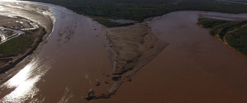
https://inncontext.avina.net/ -
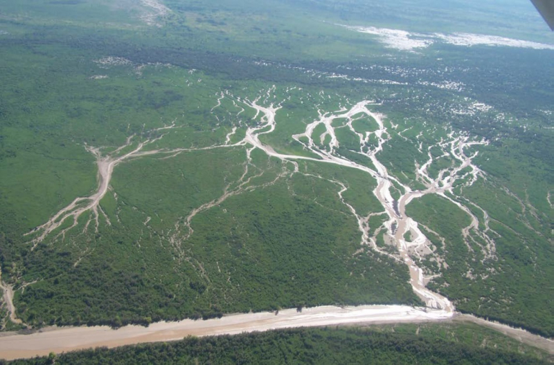
Bermejo is a South American river that runs from Bolivia to Argentina's Paraguay River. Despite its various names along the route, the river is commonly referred to as Bermejo, but it also has its own Native American names: Teuco in Wich and Ypitá in Guaran. The Bermejo forms marshes and separates into two branches in Argentina's Gran Chaco plains. The southern offshoot is the former Bermejo River bed, which is now a seasonal torrent known as Ro Bermejito. The Teuco River, Bermejo Nuevo, or simply the Bermejo River, is the northern offshoot of the Bermejo River, which is currently the main stream.
The river originates in the Sierra de Santa Victoria mountain range near Tarija, Bolivia, a few kilometers southeast of Chaguaya and not far from La Quiaca, Jujuy Province, Argentina. It keeps a southern orientation in general. The Lipeo River is its principal tributary at its highest point, and the Grande de Tarija, the Iruya River, and the San Francisco River are further downstream. It is a component of Argentina's and Bolivia's international border.
Length: 659 miles
https://www.theguardian.com/


