Top 9 Longest Rivers in Sudan

The majority of Sudan's major rivers are shared with other nations. With the exception of the Barka River, which is shared with Eritrea, and the Bahr al-Arab ... read more...River, which is shared with South Sudan, the majority of the rivers are shared with Ethiopia. The massive Nile river, as well as two of its major tributaries, run through the country. Below is a list of the longest rivers in Sudan. Toplist hopes you will find it helpful.
-
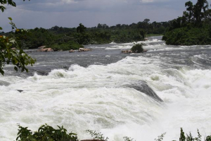
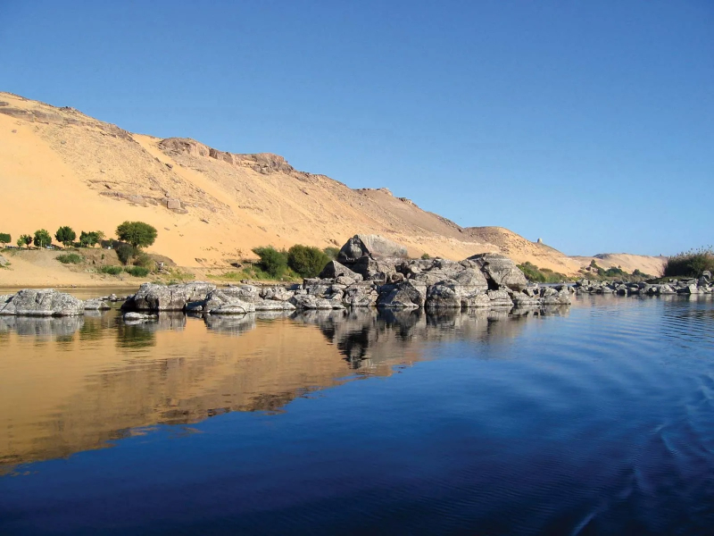
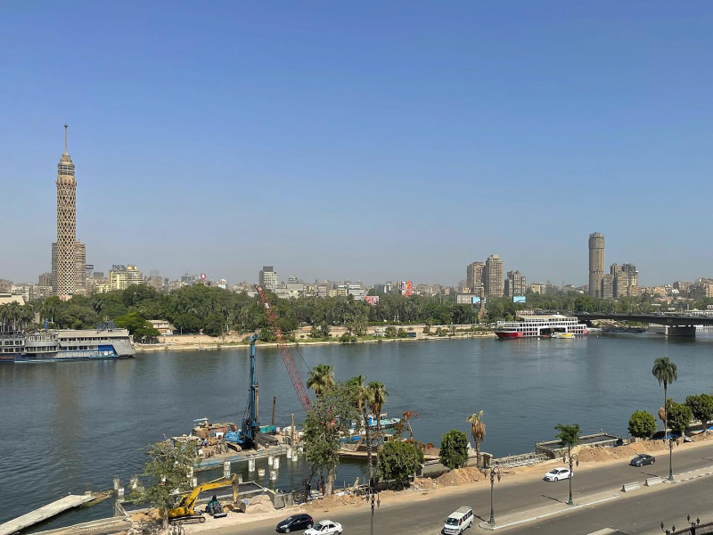
The Nile river, which runs for 4,258 miles through eleven countries, is widely regarded as the world's longest river. It is Sudan's main supply of water. Its two main tributaries, the Blue and White Niles merge in Khartoum and run north to Lake Nubia, also known as Lake Nasser on the Egyptian side of the border. The White Nile, which originates in central Africa and flows 2,299 miles through five nations before reaching Sudan, is significantly longer. The Blue Nile starts in Ethiopia and runs for 901 kilometers before merging with the White Nile. The Nile's tributaries include the 500-mile Atbarah, 398-mile Barka, 300-mile Dinder, and 137-mile Angareb rivers.
The Nile travels across Sudan in a unique route. Between Aswan and Sabaloka, it passes through six groups of cataracts before turning south and heading north toward Egypt. As it reaches the Sudanese border, the river enters Lake Nubia, also known as Lake Nasser in Egypt.
Length: 4,258 miles (shared with 10 other countries)
https://www.britannica.com/ 
en.wikipedia.org/wiki/Nile -
The White Nile is one of the two primary tributaries of the Nile River in Africa, the other being the Blue Nile. The name stems from the coloration caused by clay in the water. The river generated at Lake No, at the junction of the Bahr al Jabal and Bahr el Ghazal Rivers, is known as the "White Nile". The "White Nile" refers to all segments of the river draining from Lake Victoria to the Blue Nile's merger; the "Victoria Nile" from Lake Victoria to Lake Albert via Lake Kyoga, then the "Albert Nile" to the South Sudan border, and finally the "Mountain Nile" or "Bahr-al-Jabal" down to Lake No. The headwaters of Lake Victoria, the most remote of which is 3,700 kilometers from the Blue Nile, are sometimes referred to as the "White Nile"
The White Nile, which disappeared into the depths of what was then regarded as "Darkest Africa" was the focus of Europeans' hunt for the Nile's source in the nineteenth century.Length: 2,299 miles (shared with 5 other countries)
en.wikipedia.org/wiki/White_Nile 
https://www.instagram.com/emmafausholt/ -
The Blue Nile is an Ethiopian river that originates from Lake Tana. It passes across Ethiopia and Sudan for about 1,450 kilometers. It is one of the two major tributaries of the Nile, together with the White Nile, and supplies around 80% of the water in the Nile during the wet season.
The Blue Nile originates in Ethiopia's Lake Tana. The river travels south before entering a 400-kilometer-long canyon around 30 kilometers from Lake Tana, which creates a significant barrier to transit and communication between north and south Ethiopia. The canyon was first dubbed the "Grand Canyon" by a British team in 1968 after they completed the first river descent from Lake Tana to the canyon's end; later river rafting parties dubbed it the "Grand Canyon of the Nile" At the mouth of the canyon are the Blue Nile Falls, one of Ethiopia's most popular tourist destinations.Length: 901 miles (shared with Ethiopia)
https://www.instagram.com/saabbill/ 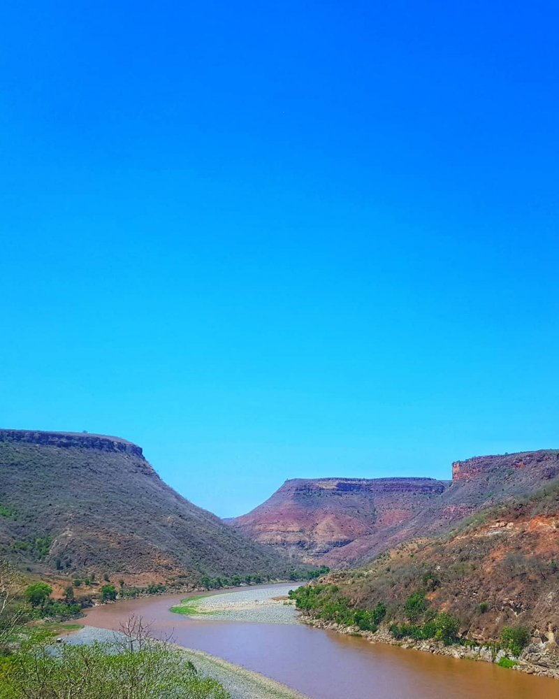
https://www.instagram.com/epic_25_/ -
The Black Nile, commonly known as the Atbarah River, flows through northeast Africa. It springs 50 kilometers north of Lake Tana and 30 kilometers west of Gondar in northwest Ethiopia. It then runs 805 kilometers to the Nile in north-central Sudan, where it joins it at Atbarah. The Tekezé river, a tributary of the Atbarah, maybe the genuine upper course of the Atbarah, as it follows the longer path prior to the two rivers' junction in northeastern Sudan. The Atbarah is the Nile's final tributary before it reaches the Mediterranean Sea.
The Atbarah reaches 5 meters beyond its typical level during the rainy season (normally June to October). It currently acts as a formidable barrier between the northern and center districts of Ethiopia's Amhara Region. Aside from the Tekezé, the Shinfa River, which rises west of Lake Tana, and the Greater Angereb, which rises north of Gondar, are notable tributaries of the Atbarah.
Length: 500 miles (shared with Ethiopia)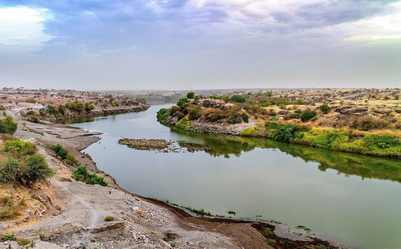
pinterest.com/pin/439663982361613473/ -
Bahr al-Arab is a river in Sudan's southwest that runs for around 800 kilometers and forms part of the country's international border with South Sudan. It is a tributary of Bahr el Ghazal, which is a tributary of the White Nile, and is part of the Nile river system.
The river flows through Sudan's Kurdufan and Darfur areas, and it forms part of the border between Darfur and northeastern South Sudan's Bahr el Ghazal region. The Bahr al-Arab has served as a dividing line between the Dinka and Baggara ethnic groups for millennia. Since the beginning of their oral traditions, the river has acted as a border and a source of conflict between the Baggara and Dinka peoples.
The location of Bahr al-Arab on the border of Northern and Southern Sudan made it a military front and a fighting zone during the Second Sudanese Civil War. Several droughts and crop failures hit western Sudan in the early 1980s. The Baggara went south of the Bahr al-Arab and came into conflict with the Dinka as various peoples shifted southward. In an attempt to gain ground against the Sudan People's Liberation Army, the Sudanese military backed the Baggara. Throughout the 1980s, Baggara militias known as murahileen fought the SPLA. The area near the Bahr al-Arab had been ruined by the end of the decade, and the people had been decimated.
Length: 497 miles (shared with South Sudan)
https://www.flickr.com/ -
The Tekezé or Täkkäze River, sometimes known as the Takkaze river, is a large Ethiopian river. It constitutes a stretch of Ethiopia's westernmost boundary with Eritrea for part of its journey. In Eritrea, western Ethiopia, and eastern Sudan, the river is known as the Setit. The Tekezé River is 608 kilometers long, according to Ethiopian Central Statistical Agency documents. The canyon it has carved out is the deepest in Africa and one of the deepest in the world, with depths of over 2000 meters at some spots.
From the confluence of the Tomsa with the Tekezé to the tripoint between the two countries and Sudan, the Tekezé River rises in the central Ethiopian Highlands near Mount Qachen within Lasta, where it runs west, north, and west again, marking the westernmost border of Ethiopia and Eritrea. It joins the Atbarah River, a tributary of the Nile, after entering northeastern Sudan at the tripoint. The Tekezé may be the genuine upper course of the Atbarah, given the latter takes the lengthier route before the two river's junction.
Length: 378 miles (shared with Ethiopia and Eritrea)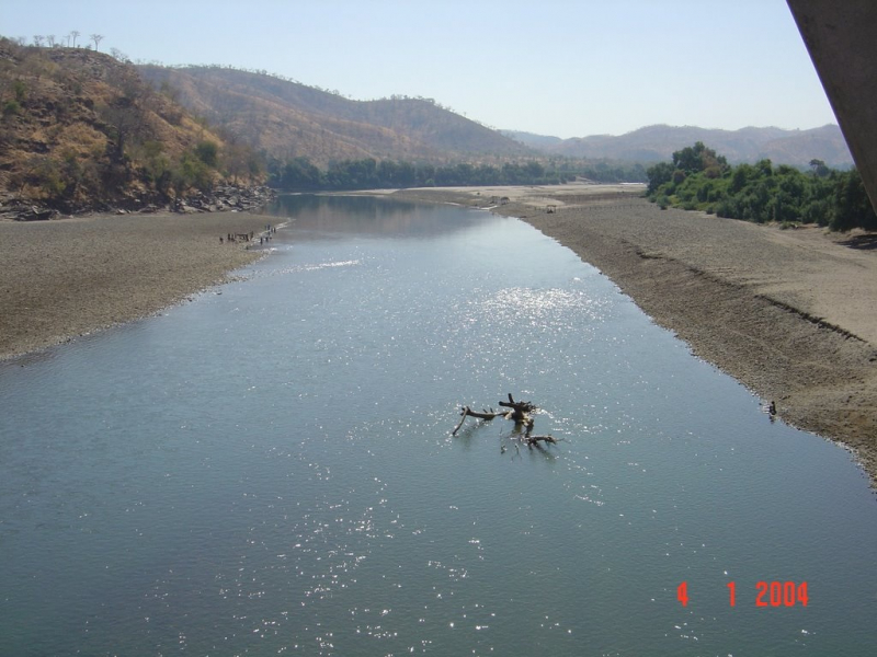
https://mapio.net/ 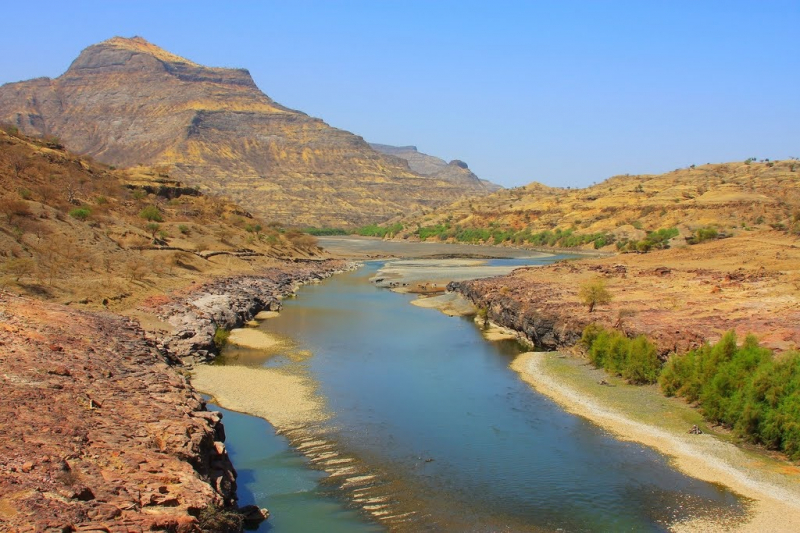
https://mapio.net/ -
The Dinder River is a Blue Nile tributary. It runs for 480 kilometers in Ethiopia and Sudan. The Tekezé or Täkkäze River, also known as the Takkaze River in Ethiopia, is a major river. For portion of its route, it forms part of Ethiopia's westernmost border with Eritrea. The Setit is the name of the river in Eritrea, western Ethiopia, and eastern Sudan. According to Ethiopian Central Statistical Agency data, the Tekezé River is 608 kilometers long. With depths of almost 2000 meters in some places, the canyon it has carved out is the deepest in Africa and one of the deepest in the world.
The Sudanese Dinder National Park, which runs south of the river, is named after it. This watershed was once home to the endangered painted hunting dog, Lycaon pictus; however, the canid is now assumed to be extinct in the area due to human population growth and a lack of conservation attention.
Length: 300 miles (shared with Ethiopia)
https://mapcarta.com/ 
pinterest.com/pin/482800022530151762/ -
The Mareb river is one of the longest rivers in Sudan. It is sometimes known as the Gash river and originates in central Eritrea. Its primary function is to define part of the Eritrean-Ethiopian border, from the point where the Mai Ambassa enters the river to the junction of the Balasa and the Mareb. The Mareb is dry for most of the year, but like the Takazze, it is prone to flash floods during the rainy season; only the left bank of the Mareb's upper course is Ethiopian territory. On the right bank, is the Obel River, and on the left bank, are the Sarana, Balasa, Mai Shawesh, and Engweya Rivers.
The Mareb was historically significant as the dividing line between two separately ruled regions in the area: the Bahr negash territory to the north of the river and the Tigray country to the south. The Bahr negash controlled territory as far north as the Red Sea coast and as far south as the Shire, with the capital in Debarwa, Eritrea, some 20 miles south of Asmara.
Length: 273 miles (shared with Ethiopia and Eritrea)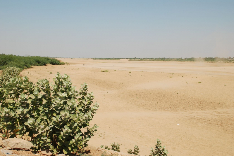
en.wikipedia.org/wiki/Mareb_River -
The Angereb, also known as the Bahr as-Salam, is an Ethiopian and Sudanese river that is one of the Nile's origins. It starts near Daqwa in the Amhara Region, north of Gondar, and flows west to join the Atbarah River. Part of its route runs through Armachiho's historic quarter.
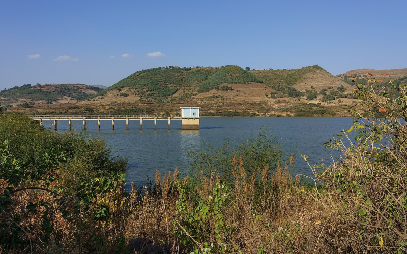
The Angereb Reservoir (supplied by the Angereb River) is Gondar's main supply of drinking water. The reservoir was created in 1986 after an earthen dam was completed. In 1986, a water treatment facility was built to treat the water stored in the reservoir so that Gondar could have a reliable and safe source of potable water. The reservoir was built with a 5 million cubic meter storage capacity. Angereb reservoir and two boreholes have a combined average production capacity of 8,298 m3/day.
The hillsides surrounding the reservoir, as well as the lands near the Angereb river and its tributaries, have been cleared of trees (mostly for firewood). As a result, material from slope erosion enters the waterways.
Length: 137 miles (shared with Ethiopia)
https://www.wikidata.org/