


Top 9 Longest Rivers in Ecuador

Ecuador is divided into four primary geographical regions: La Coste (the coast), La Sierra (the Highlands), La Amazonia, and La Region Insular, which includes ... read more...the Galapagos Islands. The Andean mountains from La Sierra, a watershed that stretches to the east to the Pacific. Ecuador's rivers originate in the La Sierra and run to the Amazon River and the Pacific Ocean. These rivers originate in the upper mountains from snowfall peaks or copious rainfall. Rivers in the La Sierra are tiny and swiftly rush across the mountains. Ecuador's rivers are divided into two water systems: the Esmeraldas River and the Guayas River. The longest rivers in Ecuador listed below will help you better understand the nature and beauty of this country
-
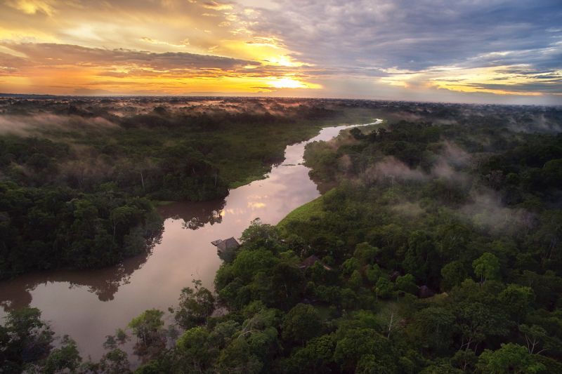
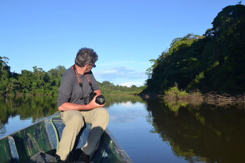
The Amazon River is the world's biggest river in terms of water output and also the world's longest in terms of length. The river is 4,345 miles long and shared by four South American countries: Ecuador, Peru, Brazil, and Colombia. The Amazon River rises in the Rio Mantaro watershed and flows out of the Andean plain, surrounded by floodplains. The river then flows into Brazil and Peru, forming part of the Peruvian-Colombian border. The Amazon River forms various tributaries and separates into numerous lengthy channels throughout its course. The river's water flows into the Atlantic Ocean.
The Amazon River is distinguished by wooded sections that flood during the rainy season. More than 30 percent of the world's known bird species, over 3,000 fish species, reptiles like the Anaconda, and many microorganisms live in the river. The Amazon River provides the main source of income for many Ecuadorian families. Perennial flooding, on the other hand, has resulted in deaths and property devastation.
Length: 4,345 mile
destinationecuador.com 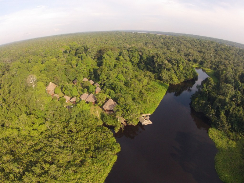
sumak-travel.org -
The Marañón River is the Amazon River's main source. It begins north of Lima, Peru, and runs through the Andean Valley before passing through the rainforest Andes and into the Amazon Basin. The Marañón River flows 1,079 miles from its headwaters in Peru to the Amazon Basin. The river is distinguished by 20 hydroelectric dams built in the Andes, with the majority of the energy generated exported to Brazil or utilized locally in Ecuador and Peru.
Dams on the Marañón River have been fiercely resisted because they interrupt the Amazon River's main source and ruin fish habitat and migration. The majority of the settlements along the Maraón River's banks rely on the river for a living. The river is also a vital transportation corridor that links several villages.
Length: 1,079 miles
amazonwaters.org 
amazonwaters.org -
The Putumayo River constitutes a portion of Colombia's boundary with Ecuador as well as the majority of its border with Peru. In the previous three countries, it is known as the Putumayo, but when it enters Brazil, it is known as the Içá. The Putumayo River rises in the Andes Mountains east of Pasto, Colombia. It flows into the Solimes (upper Amazon) near the Brazilian town of Santo Antônio do Içá. The Guamués, San Miguel, Güepp, Cumpuya, Algodón, Igara-Paraná, Yaguas, Cotuhé, and Paraná de Jacurapá rivers are major tributaries. The river passes through the ecoregion of Solimes-Japurá damp woods.
Putumayo is one of the longest rivers in Ecuador and also is one of the Amazon River's tributaries. It is a section of the Ecuador-Colombia border as well as a border with Peru. Putumayo flows over 1,000 miles from the Andes Mountains in Columbia to the Amazon River in Brazil. During the Amazon rubber boom of the nineteenth century, the terrain near Putumayo was utilized for rubber manufacturing. The Putumayo River is now an important transportation corridor, with boats able to travel the whole length of the river. Cattle farming is another important activity along the Putumayo River's banks.
Length: 1,000 miles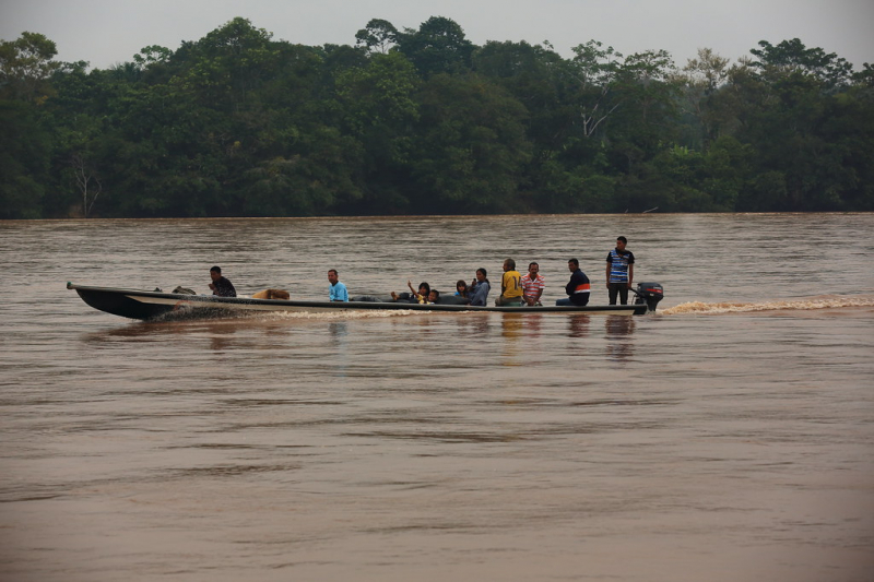
flickr.com 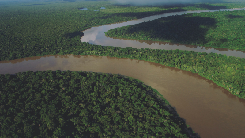
cuencaputumayoica.com -
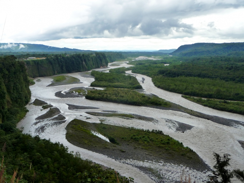
The Napo River (Spanish: Río Napo) is an Amazon River tributary that originates in Ecuador on the sides of the east Andean mountains Antisana, Sincholagua, and Cotopaxi. This river is one of the longest rivers in Ecuador (702 miles).
Before reaching the plains, it gets a large number of tiny streams from impassable, saturated, and heavily fractured mountainous zones where thick and diverse flora appears to struggle for every piece of land. From the north, it is joined by the Coca River, which has its origins in the gorges of Cayambe volcano on the equator, and the Aguarico, a strong river with its headwaters between Cayambe and the Colombia border. It gets a minor tributary, the Curaray, from the Andean slopes between Cotopaxi and the Tungurahua volcano from the west. The Napo River is full of snags and shelving sandbanks from its Coca branch to the mouth of the Curaray, and it casts out innumerable canoes amid jungle-tangled islands that are inundated during the rainy season, giving the river a tremendous breadth. From the Coca to the Amazon, it flows across a wooded plain with no apparent hills, its consistently flat banks broken only by marshes and lagoons.
The Napo is navigable for river craft up to its Curaray branch, a distance of about 216 mi (348 km), and possibly a little further; from there, by painful canoe navigation, its upper waters can be ascended as far as Santa Rosa, the usual point of embarkation for any daring traveler who descends from the Quito tableland. The Coca river may be explored all the way up to its middle course, when it is trapped between two mountainsides in a deep canyon, rushing over tremendous falls and numerous reefs. This is the creek made famous by Gonzalo Pizarro's expedition.
Length: 702 miles
sciencephoto.com 
flickr.com -
The Curaray River (also known as the Ewenguno River or Rio Curaray) is a river that flows through eastern Ecuador and Peru. It is a tributary of the Amazon basin's Napo River. Several indigenous ethnic tribes, including the Kichwa and Huaorani, live on the river's banks. Caimans and piranhas may be found in the river.
During Operation Auca, an attempt to convert the Huaorani, five Christian missionaries were slain by Huaorani tribespeople on a sandbar on the Curaray in 1956. The bodies of the missionaries were then dumped into the river. Four of the victims were eventually found and buried in a mass grave on the riverbank by a rescue squad. The fifth, Ed McCully's, was allegedly unearthed downstream by a group of Indians who manufactured McCully's wristwatch. His corpse, however, was never found and identified.
The missionaries had come by aircraft and decided to land on the sandbar because it was the only land area close that was free of trees. They established a camp on the sandbar, which they dubbed "Palm Beach." They also constructed a treehouse nearby.
The Huaorani stripped the plane of its fabric skin after the attack. The plane was then ditched into the river. It vanished and was not discovered again until 1994. Someone was walking down the sandbar when they discovered a naked metal piece jutting out of the sand. It was eventually determined to be a section of the metal structure of the Nate Saint's Piper airplane. The river had nearly totally covered the river's vestiges in the sand. The plane's structure is presently on exhibit at the Mission Aviation Fellowship's headquarters.
Today, the Huaorani Christian community frequently uses the Curaray River for baptisms. Steve Saint and his children were christened there as well. The region is said to be the origin of criollo cacao, the most uncommon kind.Length: 497 miles
pinterest.com 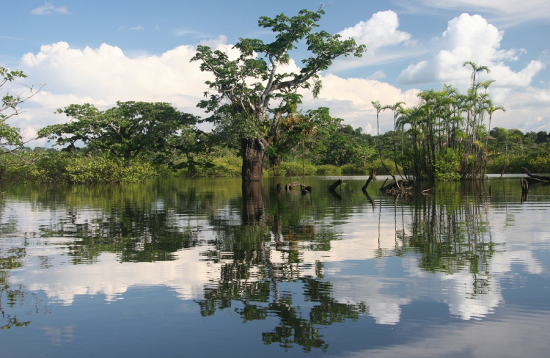
hotcore.info -
The Tigre River (Peruvian pronunciation: [ˈtiɣɾe]) is a tributary of the River located west of the Nanay River. From its confluence with the Marañón, it is navigable for 125 miles (201 kilometers). It is formed at the Peruvian border by the confluence of the Ecuadorian rivers Cunambo and Pintoyacu. It, like the Nanay, runs wholly across the plains. Its mouth lies 42 miles (68 kilometers) west of the confluence of the Ucayali and Maraón rivers. Continuing west from the Tigre to the Marañón River, it finds the Parinari, Chambira, and Nucuray, all small lowland streams with a similar nature to the Nanay. Tigre is Spanish meaning "tiger," the region's colloquial name for the Jaguar.
The Tigre River Delta is one of the world's biggest, covering approximately 5,405 square miles. It is also one of the few major deltas that do not empty into a sea or ocean, instead of flowing into the Rio de la Plata, which separates Argentina and Uruguay. There are no roads linking the residences in the region, thus they are all built on islands.
People travel by water, and services like food and medical care are also provided by the boat. In this regard, the region is comparable to Venice. To see some of the islands and buildings, visitors usually take a boat excursion across the Tigre Delta's various waterways. The mansion of former Argentine President Domingo Sarmiento, who resided there for over three decades, is one of the most well-known sites. To preserve it from the weather, the home is presently contained in a glass cage. The Museo de Arte de Tigre is another prominent attraction on the boat ride.
Tigre derives its name from the jaguars that originally frequented the region before the British arrived and developed it into a prominent wicker and fruit market. The architecture in the neighborhood is still heavily influenced by the British, with some Victorian and half-timbered faux Tudor-style mansions.
Length: 472 miles
riosdelplaneta.com 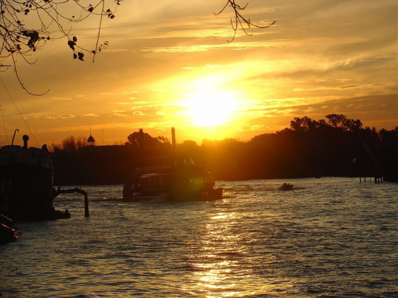
riosdelplaneta.com -
The Pastaza River (Spanish: Río Pastaza, historically known as the Sumatra) is a major tributary of the Marañón River in South America's northeastern Amazon Basin.
Its sources are in the Ecuadorian province of Cotapaxi, where it flows from the northern slopes of the volcano Cotopaxi as the Patate River. The Patate runs south and joins the Chambo River approximately upstream from the village of Banos de Agua Santa, just north of the volcano Mount Tungurahua, to form the Pastaza in Tungurahua Province. It is dammed seven kilometers east of Baos for the Agoyán hydropower project, which has formed a silty lagoon near the community of La Cienega. The Agoyán dam was built in that area primarily to protect the famed Agoyán Falls, which are about 5 kilometers downstream. Following the waterfall, the river enters a valley with very fast whitewater with class-4 rapids; it is frequently used for whitewater rafting, however, it is not considered to be of the same caliber as the Tena River and so less popular for the sport.
The Pastaza runs almost straight east from its confluence with the Chambo for about 275 kilometers (171 miles) until it is joined by the Topo River. The Troncal Amazonas highway borders the river from Baos to Puyo, going through seven tunnels and four significant waterfalls that are important tourist sites for many Ecuadorians (the most popular being Agoyán and Pailón del Diablo). The Pastaza River enters the province of Pastaza just before the town of Santa Inez, where it defines the border between that province and Morona-Santiago. The river departs the mountains around Mera and runs through a large valley, getting wider and shallower as it approaches Puyo. The river gets braided and meanders after Shell, producing oxbows and sloughs along its path over the Amazonian lowlands.
Length: 441 miles
commons.wikimedia.org 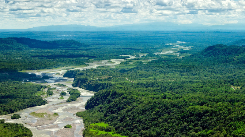
windows10spotlight.com -
One of the longest rivers in Ecuador is the Morona River. This river is a tributary of the Marañón River that flows parallel to and directly to the west of the Pastaza River. It is the final stream of any significance on the northern bank of the Amazon before reaching the Pongo de Manseriche.
It is produced by a slew of watercourses that descend the slopes of the Ecuadorian Andes south of the massive volcano of Sangay; nonetheless, it quickly reaches the plain, where it gets its Cusulima branch. For small ships, the Morona is navigable for about 300 miles above its mouth, although it is highly tortuous. Many of its branches, particularly the Cusuhma and the Miazal, are navigable by canoe, with the latter reaching almost to the foot of Sangay. The Morona has been the site of several rough investigations in the expectation of finding it useful as a trade route between Ecuador's inter-Andean tableland and the Amazon River.
Length: 342 miles
wikiloc.com 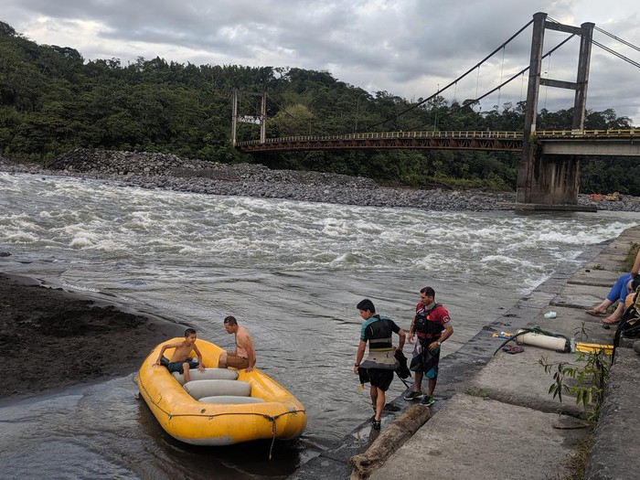
wikiloc.com -
The Aguarico River (Spanish for "rich water") is a river in northern Ecuador. It is the principal river of the province of Sucumbos. It is the Ecuadorian-Peruvian boundary at the end of its path. It discharges into the Napo River. It is 390 kilometers (240 miles) long, with the last 50 kilometers (31 miles) running along the natural border between Ecuador and Peru (in the department of Loreto). According to The Rio de Janeiro Protocol of 1942, the lower course of the Aguarico River was resolved and legally fixed as part of the long-disputed Ecuador-Peru border. Ecuador unilaterally rejected the protocol in 1960, but a new agreement recognizing the pre-existing protocol was signed in 1999.
As one of the longest rivers in Ecuador, the Aguarico River runs almost entirely through the province of Sucumbos in northern Ecuador and is the province's primary river. It flows close to the Reserve of Production Faunstica Cuyabeno on average. It runs along the Ecuadorian-Peruvian border in the final stretch of its journey. Finally, it comes to an end at the Napo River, on the same boundary, a little over the town of Pantoja in Loreto, Peru.
Length: 242 miles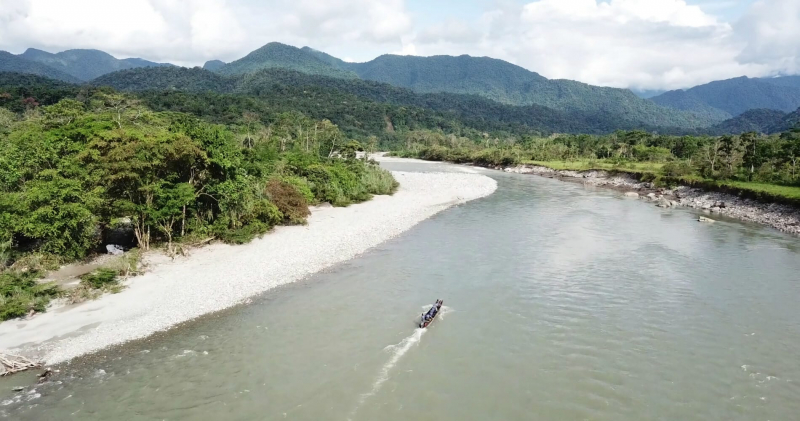
intercontinentalcry.org 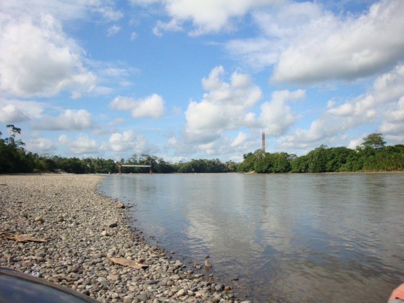
mapio.net


