Top 10 Longest Rivers in United Kingdom

Several important rivers run through the United Kingdom's cities, villages, and rural landscapes. The majority of these rivers drain these territories' ... read more...watersheds and join various estuaries that pour into the North Sea, Irish Sea, Bristol Channel, and the English Channel. Rivers have critical functions in the United Kingdom, including the movement of people and products between cities and towns, a large supply of water for families and enterprises, a source of hydroelectric power, and an essential habitat for some of the country's unique fauna. The rivers are also well-known for athletic activities like canoeing, boat racing, and sailing. The Longest Rivers in the United Kingdom are examined below.
-
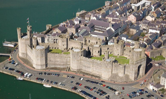
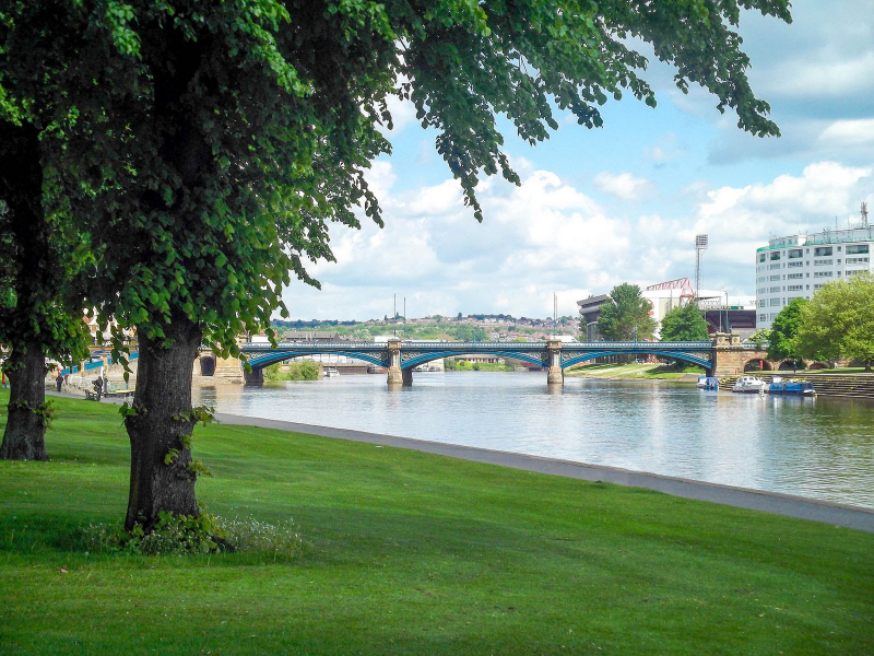
The Severn River is the Longest River in the United Kingdom, stretching 220 miles. The river rises at Plynlimon at 2,000 feet and runs through Shropshire, Powys, and Worcestershire. At Apperley, the river flows at 107 cubic meters per second into the Bristol Channel, which eventually empties into the Celtic Sea. The Severn River has a drainage basin size of 4,400 square miles, and its major tributaries are Vyrnwy, Stour, and Teme. Along its course, the river features various bridges and trains that provide an effective mode of transportation. The Severn River is a vital feeding area for waders and spot ladybirds. The River Severn has claimed up to 300 lives, while floods in Tewkesbury in 2007 ruined buildings worth thousands of dollars.
The current form of the River Severn is the consequence of a multi-million-year history and complicated underlying geology, but it is also the result of glaciation during the last ice age in the Quaternary period's Pleistocene era. The river flows through a terrain built by Ordovician and Silurian rocks in Wales. These lower Palaeozoic rocks are replaced by Permian and Triassic age strata when it approaches the Shropshire Plain, albeit they are mainly hidden behind a thick blanket of Quaternary sediments. Certain portions also traverse Carboniferous layers, as seen at Shrewsbury and over much of the distance between Ironbridge and Bewdley. The Permo-Triassic bedrock then continues until the Severn passes occasionally onto the Jurassic outcrop south of Tewkesbury. Only the SSW-NNE-aligned valley on either side of Welshpool has any visible geological structural link; the valley follows the lines of the Severn Valley Faults. It goes straight over geological features for much of the rest of its route.
Length: 220 miles
ciceroni.co.uk 
ciceroni.co.uk -
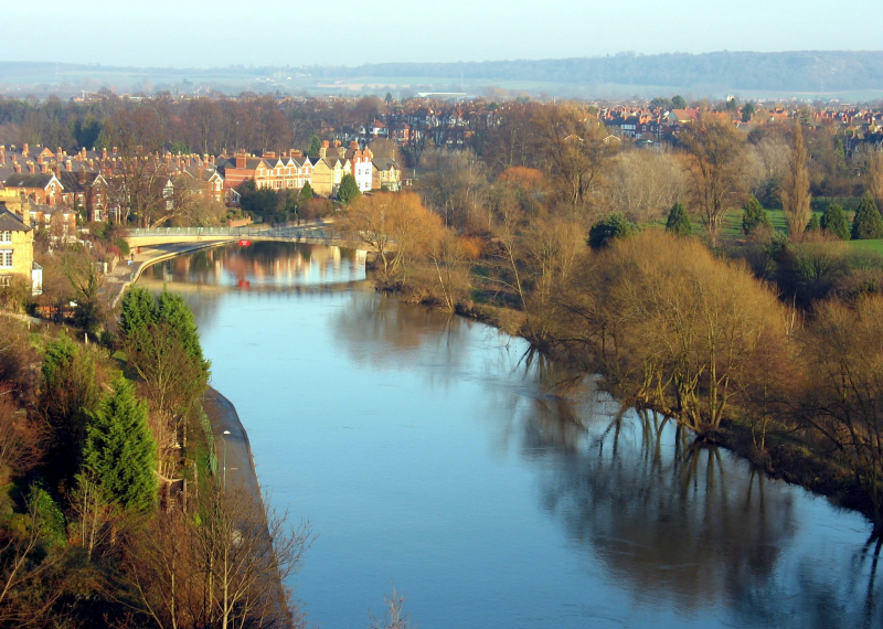
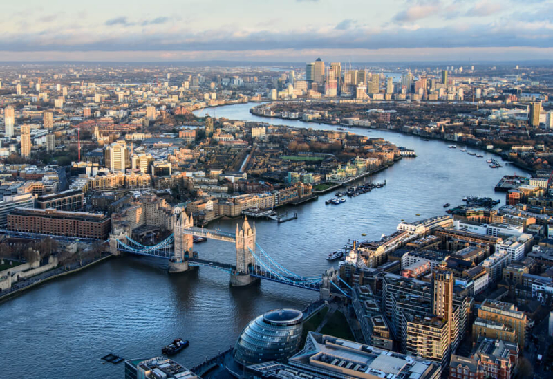
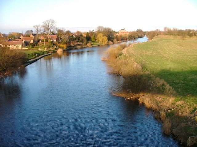
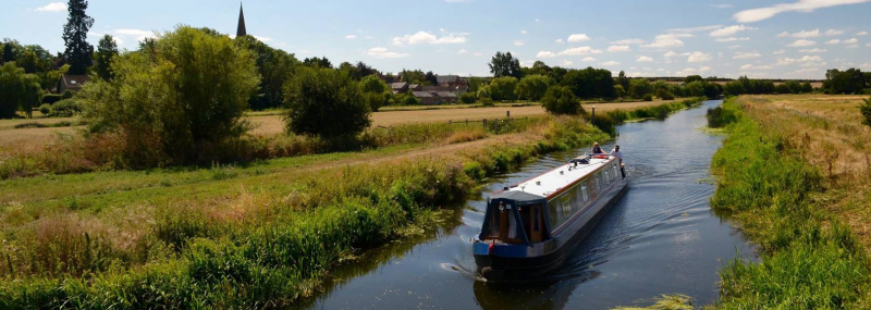
With a length of 215 miles, the Thames River is England's second-longest and the United Kingdom's second-longest river, behind the Severn. It runs through Southern England, passing via London, Reading, Windsor, Oxford, and Henley-on-Thames. The Thames drains all of Greater London and flows into the North Sea through the Thames Estuary. Its origins may be traced back to Themes Head and Seven Spring. The river has roughly 80 islands, including extensive tidal marshlands and little tree-covered islets. The River Themes are home to a variety of animal species, including birds, fish, and water mammals. Tourists throng the river for boat rides and sightseeing trips. The river also includes various bridges, such as the Swinford Bridge, Folly Bridge, and London Bridge, that allow people to pass from one side to the other.
The Tideway refers to the river's lower portions, which are named for the river's lengthy tidal stretch up to Teddington Lock. Its tidal portion comprises the majority of its London stretch and has a 23-foot rise and fall (7 m). The Thames dips 55 meters from Oxford to the Estuary. The Thames has a modest flow given its length and width, running through some of the driest sections of mainland Britain and intensively abstracted for drinking water: the Severn has a discharge almost twice as high on average while having a smaller drainage basin. In Scotland, the Tay produces more than double the average flow of the Thames from a drainage basin that is 60% smaller.
Length: 215 miles
parkgrandlancastergate.co.uk 
parkgrandlancastergate.co.uk -
With a total length of 185 miles, the River Trent is the third-longest river in the United Kingdom. It originates in Staffordshire and drains portions of the Midlands including eastern Birmingham. The river flows through Nottingham, Burton upon Trent, and Stockton-on-Trent before joining the River Ouse at Trent Falls to form the Humber Estuary, which eventually drains into the North Sea. It is notorious for flooding on a regular basis, particularly following storms and snowmelt, which can cause the river's channel to alter. Some bird species, such as wading birds and wildfowl, use the Trent River as a home. The river is utilized for recreation, with a variety of activities available on the water and along the river banks, including rowing, sailing, and canoeing, among others.
The Trent River emerges from a number of sources, including the Trent Head Well, in the Staffordshire Moorlands region, near the settlement of Biddulph Moor. It is subsequently joined by several minor streams to form the Head of Trent, which flows south to Knypersley, the sole reservoir along its route. Downstream of the reservoir, it flows through Stoke-on-Trent before joining the Lyme, Fowler, and other brooks that drain the six cities of the Staffordshire Potteries to form the Trent. It runs through Trentham Gardens, a manicured parkland on the outskirts of Stoke.
Length: 185 miles
istockphoto.com 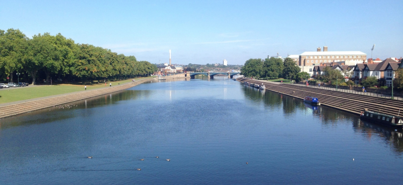
istockphoto.com -
The River Great Ouse is one of the Longest Rivers in the United Kingdom a river in England that is the longest of numerous "Ouse" rivers in the country. The Great Ouse runs from Syresham in Northamptonshire through Buckinghamshire, Bedfordshire, Cambridgeshire, and Norfolk before emptying into Wash and the North Sea at Kings Lynn. It is the fifth-longest river in the United Kingdom, with a length of around 143 miles (230 kilometers) generally running north and east. The Great Ouse has traditionally been vital for commercial navigation and drainage of the low-lying region through which it flows; its most well-known tributary is the Cam, which passes through Cambridge. Its lower course is through drained marshes and fens, and it has been significantly changed or channelized, to alleviate floods and give a better path for barge traffic. After a flood, the unaltered river would have shifted channels on a frequent basis.
The river has various origins in South Northamptonshire, between the villages of Syresham and Wappenham. It runs through Brackley, providing the Oxfordshire/Northamptonshire boundary, then into Buckinghamshire, passing through Buckingham, Milton Keynes (at Stony Stratford), Newport Pagnell, and Olney, before reaching Kempston in Bedfordshire, the current head of navigation.
Length: 143 miles
literarynorfolk.co.uk 
literarynorfolk.co.uk -
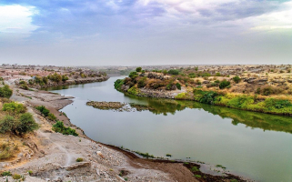
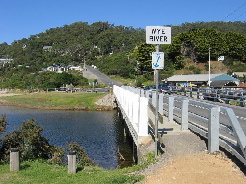
The Wye River is the fourth-longest river in the United Kingdom, running 250 kilometers (155 miles) from its headwaters on Plynlimon in mid-Wales to the Severn estuary. The river forms part of the boundary between England and Wales for most of its course. The Wye Valley's lower section has been classified as an Area of Outstanding Natural Beauty. The Wye is vital for environmental protection and enjoyment, yet it is heavily polluted.
The Wye originates in the Welsh highlands in Plynlimon. It runs through or past Rhayader, Builth Wells, Hay-on-Wye, Hereford (the only city on the River Wye), Ross-on-Wye, Symonds Yat, Monmouth, and Tintern before joining the Severn estuary close beyond Chepstow. The river's bottom 16 miles (26 km) from Redbrook to Chepstow defines the boundary between England and Wales.
The River Wye is protected by two Sites of Special Scientific Interest, one above Hay-on-Wye (Gwy Uchaf) and one downstream to Chepstow (Gwy Isaf). Geology, topography, vegetation, animals, invertebrates, fish, and birds are among the requirements for the river's designation as an SSSI since the river and its tributaries form a huge linear habitat. Natural England has split the Lower Wye SSSI into seven units of assessment, and administrative responsibilities are shared by the councils of Powys, Herefordshire, Gloucestershire, and Monmouthshire. The Wye is bordered by a number of other SSSIs in England and Wales, notably the Upper Wye Gorge and Lower Wye Gorge.
Length: 134 miles
travelvictoria.com.au 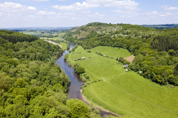
travelvictoria.com.au -
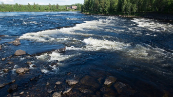
The River Ure in North Yorkshire, England, is one of the Longest Rivers in the United Kingdom and is roughly 74 miles (119 km) long from its headwaters to its confluence with the River Ouse. It is the main river in Wensleydale, the only major dale that is currently called a hamlet rather than its river. Yoredale, named for the river that passes through it, was the valley's previous name. The Ure is one of several rivers and canals that drain the Dales into the Ouse. The River Swale and the River Skell are two of the Ure's tributaries.
The river begins at Ure Head on Abbotside Common and runs west-south-west to the valley level before turning south. When it meets the A684, it heads east down Wensleydale until it reaches Wensley. It runs southeast from here to Jervaulx Abbey, then south to Mickley. It then goes east and then south to return to Ripon. It returns to Boroughbridge a little distance after Ripon. The River Swale joins the Ure to the east of Boroughbridge. The river changes its name to the River Ouse about 6 miles (9.7 km) downstream of this junction, at Cuddy Shaw Reach Linton-on-Ouse.
Length: 129 miles
en.wikipedia.org 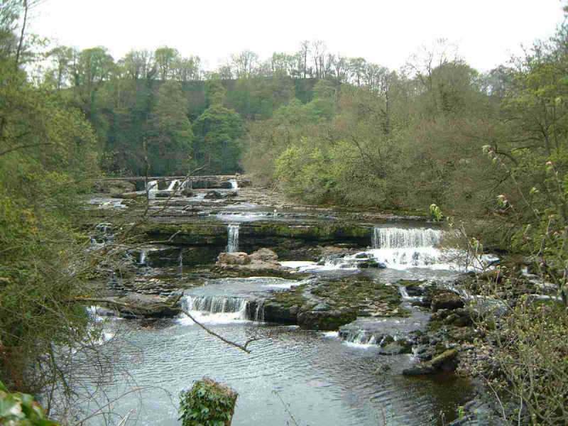
en.wikipedia.org -
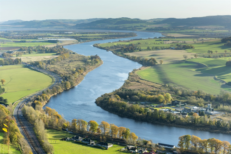
The River Tay is Scotland's longest river and the seventh-longest in the United Kingdom. The Tay begins on the slopes of Ben Lui in western Scotland, then flows east through the Highlands, through Loch Dochart, Loch Iubhair, and Loch Tay, then continues east through Strathtay (see Strath), in the center of Scotland, then southeasterly through Perth, where it becomes tidal, to its mouth at the Firth of Tay, south of Dundee. By measured discharge, it is the biggest river in the British Isles. Its catchment area is roughly 2,000 square miles (5,200 km2), whereas the Tweed's catchment area is 1,500 square miles (3,900 km2) and the Spey's catchment area is 1,097 square miles (2,840 km2).
The River Tay is Scotland's longest river and the seventh-longest in the United Kingdom. The Tay begins on the slopes of Ben Lui (Scottish Gaelic: Beinn Laoigh) in western Scotland, then flows east through the Highlands, through Loch Dochart, Loch Iubhair, and Loch Tay, then continues east through Strathtay (see Strath), in the center of Scotland, then southeasterly through Perth, where it becomes tidal, to its mouth at the Firth of Tay, south of Dundee. By measured discharge, it is the biggest river in the British Isles. Its catchment area is roughly 2,000 square miles (5,200 km2), whereas the Tweed's catchment area is 1,500 square miles (3,900 km2) and the Spey's catchment area is 1,097 square miles (2,840 km2).
Length: 117 miles
visitscotland.com 
visitscotland.com -
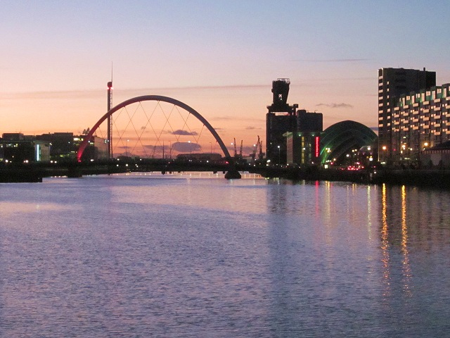
The River Clyde is a Scottish river that feeds into the Firth of Clyde and is the Longest Rivers in the United Kingdom. It is the ninth-longest river in the United Kingdom and Scotland's third-longest. It goes through Glasgow, Scotland's largest metropolis. It was historically significant to the British Empire because of its significance in shipbuilding and trade. Clota was the name given to it by the Romans, while Clud or Clut was the name given to it in the early medieval Cumbric language. It was the capital of the Kingdom of Strathclyde (Teyrnas Ystrad Clut).
The precise derivation of the river's name is unknown, although it is known that it is ancient: the Britons named it Clut or Clud, and the Romans called it Clota. As a result, the name is most likely derived from a Celtic language, most likely Old British. However, the river's name might be derived from more than one old Celtic term. The Common Brittonic Clywwd, which means 'loud' or 'loudly,' is one probable root. Clta, a native Celtic goddess, is more likely to have inspired the river's name. The goddess' name, in turn, is derived from an ancient, Proto-Celtic phrase that means "the vigorously flowing one" or "the holy cleaner."
The Clyde is produced by the confluence of two streams, the Daer Water and the Potrail Water (the headwaters of which are dammed to form the Daer Reservoir). The Southern Upland Way crosses both streams before they join to form the River Clyde at Watermeetings. The Clyde is just 10 kilometers (6 miles) from Tweed's Well, the source of the River Tweed, and roughly the same distance from Annanhead Hill, the source of the River Annan, at this point. It then meanders northeastward until turning west, where its flood plain serves as the location of numerous key roadways in the area, before reaching the town of Lanark.
Length: 109 miles
en.wikipedia.org 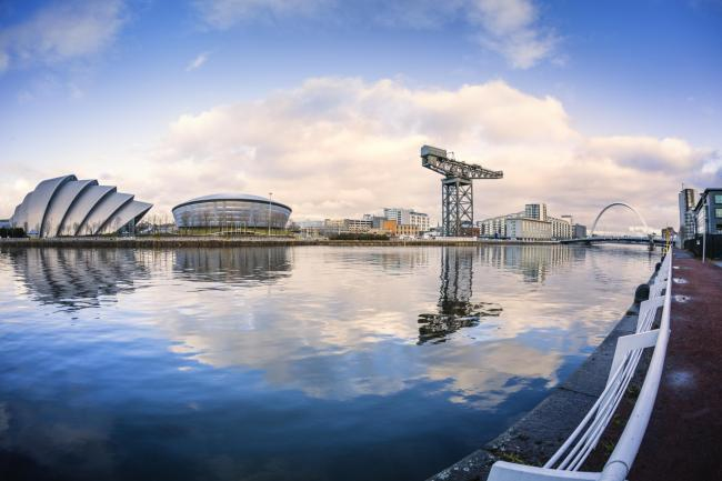
en.wikipedia.org -
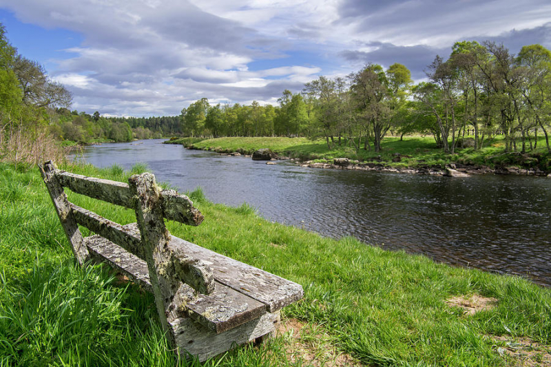
The Spey is a river in northeastern Scotland. It is the eighth-longest river in the United Kingdom and Scotland's second-longest and fastest-flowing river. It's critical for salmon fishing and whiskey manufacturing.
The Spey runs for 107 miles (172 kilometers). It reaches a height of nearly 1,000 feet (300 meters) in Loch Spey in Corrieyairack Forest in the Scottish Highlands, about ten miles (16 kilometers) south of Fort Augustus. Some miles downstream from its headwaters, it is dammed by Spey Dam before continuing its journey via Newtonmore and Kingussie, crossing Loch Insh before reaching Aviemore and giving Strathspey its name. It runs the last 60 miles (97 kilometers) northeast to the Moray Firth, hitting the sea 5 miles (8 kilometers) west of Buckie.
The river acquires multiple fires in the Corrieyarack, Sherramore, and Glenshirra Forests after leaving Loch Spey. The first significant tributary is the Markie Burn, which flows north from Glen Markie to join the Spey River, which is held back by the Spey Dam. The River Mashie enters from Strath Mashie to the south a further mile downstream.
Length: 107 miles
en.wikipedia.org 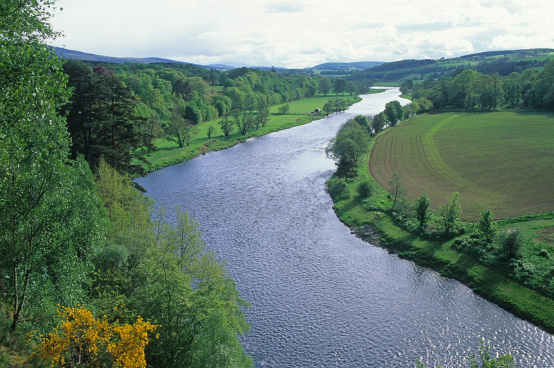
en.wikipedia.org -
The River Nene is one of the Longest Rivers in the east of England that originates from three different locations in Northamptonshire. The river is approximately 100 miles (160 km) long, with 3.7 miles (6.0 km) forming the border between Cambridgeshire and Norfolk. It is the tenth-longest river in the United Kingdom, running 88 miles (142 kilometers) from Northampton to Wash.
The River Nene is the United Kingdom's tenth-longest river. The river descends 300 feet (91 meters) in 17 miles from one of its headwaters near Arbury Hill to Northampton (27 km). The Nene drops less than 200 feet over the rest of its journey (61 m). It covers 631 square miles (1,630 km2) and has a mean flow of 328 cubic feet per second (9.3 m3/s). The last 88 miles (142 kilometers) from Northampton to Wash are navigable.
The river's westernmost source is in the settlement of Badby, near Daventry. Two streams meet at Dodford Mill to produce the upper stages of the Daventry Nene on the eastern slopes of Arbury Hill and in ponds between Arbury Hill and Sharmans Hill. The northern stream goes to the confluence through the towns of Badby and Newnham, while the southern stream flows through Fawsley Park and past the village of Everdon before the confluence. The river flows from Dodford through the village of Weedon, where it runs beneath the major west coast railway line, the Grand Union Canal, and Watling Street. The river meets a further northerly tributary originating at Nenmoor Spring to the northwest of West Haddon a little west of Weedon. The river then runs towards Northampton, passing through Flore and Nether Heyford, where tiny streams on either bank join it. The Nene flows under the M1 motorway just beyond Bugbrooke Mill and falls through a weir near Kislingbury.
Length: 100 miles
nenevalley.ne 
nenevalley.ne