Top 10 Longest Rivers in the Philippines

The Republic of the Philippines is made up of 7,641 islands in the western Pacific Ocean surrounded by numerous large rivers. In this article, Toplist has ... read more...compiled the longest rivers in the Philippines that many readers probably do not know yet. These rivers not only provide water but are also considered tourist attractions worth visiting. So, if you have a chance to visit this oasis country, you can experience and enjoy the beauty of these longest rivers.
-
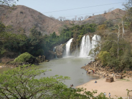
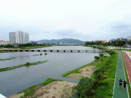
The Cagayan River, also known as the Río Grande de Cagayán, is the Philippines' longest river and largest river by discharge volume of water. It has a total length of about 505 kilometers (314 miles) and a drainage basin of 27,753 square kilometers (10,715 sq mi). It runs through the provinces of Nueva Vizcaya, Quirino, Isabela, and Cagayan in the Cagayan Valley region of northeastern Luzon Island.
The river runs through four different provinces: Nueva Vizcaya, Quirino, Isabela, and Cagayan. These provinces have a population of about two million people, the majority of whom are farmers and indigenous tribesmen. The Ibanag people take their name from the ancient name of the Cagayan River, Bannag. The Gaddang tribe lived along the Cagayan River and its tributaries.
The river drains a fertile valley rich in crops such as rice, corn, bananas, coconut, citrus, and tobacco. Dams have been built on two of the river's tributaries, the Magat and Chico Rivers, and several mining concessions have been granted in the mineral-rich Cordillera Mountains near the headwaters of the two tributary rivers. The provincial governments along the river have also created tourism programs that provide river activities, particularly whitewater rafting.
Length: 505 km (314 mi)
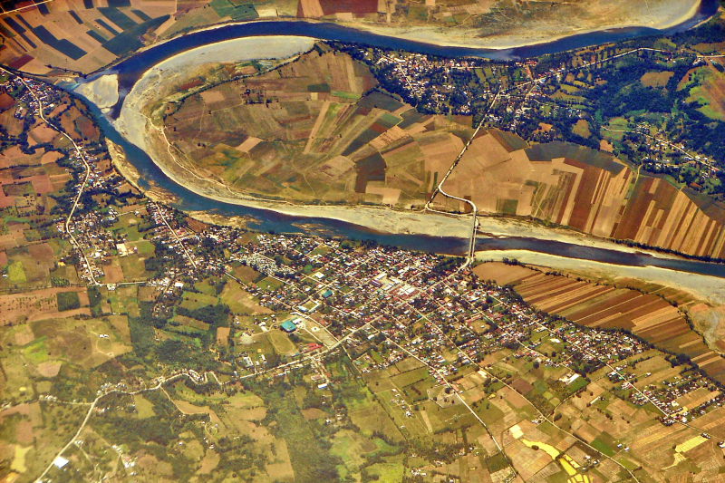
Photo: Wikipedia 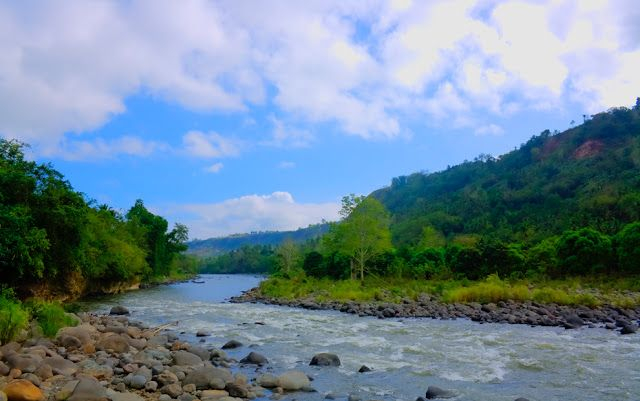
Photo: Pinterest -
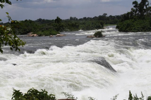
The Rio Grande de Mindanao, also known as the Mindanao River, is the Philippines' second-largest river system. Located on Mindanao's southern island, with a total drainage area of 23,169 km2 (8,946 sq mi), draining the majority of the island's central and eastern portions, and a total length of approximately 373 km (232 mi). It is a vital transportation artery, primarily used to transport agricultural products and, formerly, timber.
Its source is in the mountains of Impasugong, Bukidnon, south of Gingoog City, Misamis Oriental, where it is known as the Pulangi River. It merges with the Kabacan River to form the Mindanao River. Flowing from the mountains, it forms the heart of a broad, fertile plain in the island's southcentral region. It divides into two parallel sections before its mouth in Illana Bay, the Cotabato and Tamontaka, separated by a 180 m (590 ft) hill.
Cotabato City, Datu Piang, and Midsayap are among the population centers along the river.
Length: 373 km (232 mi)
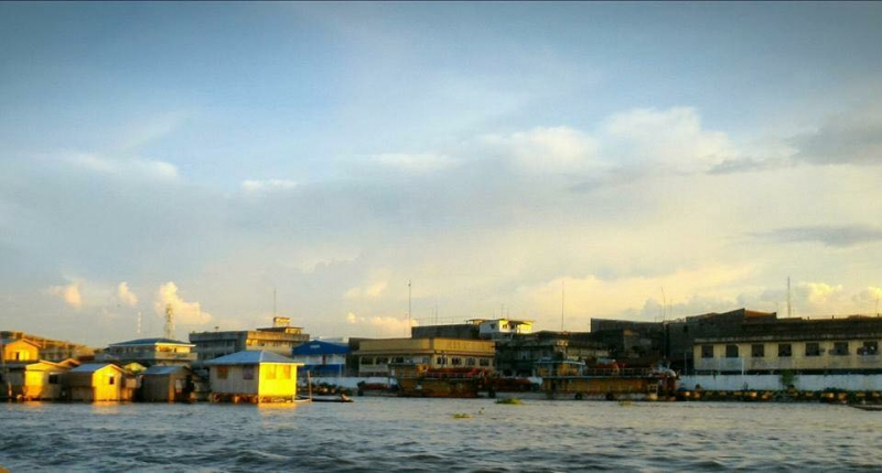
Photo: Wikipedia 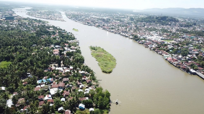
Photo: Rio Grande de Mindanao Boatbuilders and Fishers -
The Agusan River, located in the north-eastern part of Mindanao island, is the third longest river in the Philippines, draining the majority of the Caraga region and some parts of Davao de Oro. It is the country's third-largest river (after the Cagayan River and the Rio Grande de Mindanao), with a total drainage area of 11,937 square kilometers (4,609 square miles) and an estimated length of 349 kilometers (217 miles) from its headwaters.
The river's headwaters are located in the mountains of Davao de Oro, near the border with Davao Oriental and east of Tagum. It flows through the broad Agusan River valley, which stretches 177 kilometers (110 miles) from south to north and varies in width from 32 to 48 kilometers (20–30 miles). It eventually empties into Butuan Bay at its mouth in Butuan.
The presence of the Agusan Marsh, which covers a total area of 19,197 hectares, is one of the most notable features of the Agusan River basin (47,440 acres). The marsh acts as a flood retention basin for the Agusan River, reducing the high discharge of water that causes flash floods in the river's lower reaches. Aside from that, the marsh is home to endangered and endemic flora and fauna, as well as unique and pristine habitats such as sago and peat swamp forests. As a result, it was designated a wildlife sanctuary in 1996 by then-President Fidel V. Ramos.
Length: 349 km (217 mi)
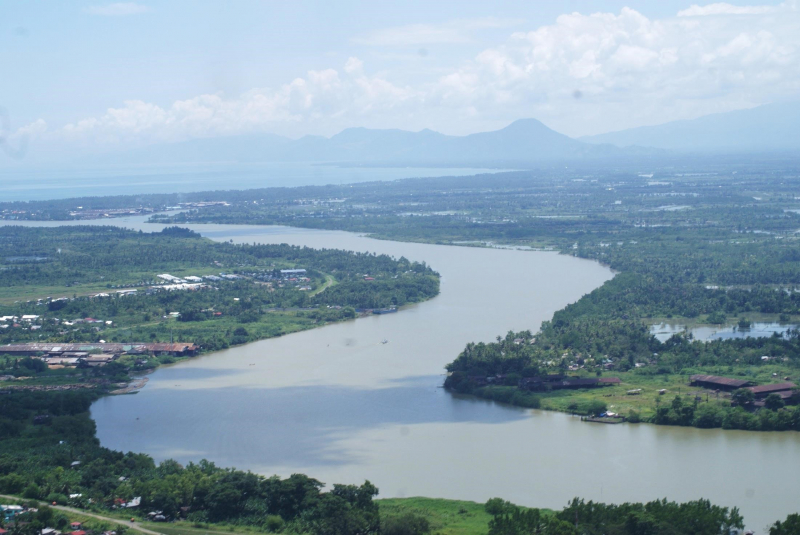
Photo: MindaNOW 
Photo: River Basin Control Office -
The Pulangi River, also known as the Pulangui River, is a major tributary of the Rio Grande de Mindanao, a vast river system in Mindanao, Philippines. It is the longest river in Bukidnon and the fourth longest river in the Philippines, with a length of 320 kilometers (199 miles). From its source in Barangay Kalabugao, Impasugong, Bukidnon, it flows through the majority of the province's cities and municipalities.
The Manupali River, a major tributary of the Pulangi River, begins in the mountains of Lantapan, Bukidnon, and picks up tributaries from the Kalatungan and Kitanglad Mountain Ranges along the way. It is a natural boundary between Valencia City and Lantapan. It flows eastward towards Malaybalay City before connecting with the Pulangi River in Valencia City.
The Muleta River runs through the municipalities of Pangantucan, Don Carlos, Kitaotao, Dangcagan, Kibawe, Kadingilan, and Damulog in the province's south. It is a major tributary of the Pulangi River that flows southward. It will connect with the Pulangi River near the border of Bukidnon and Cotabato provinces.
Another tributary of the Pulangi River is the Bobonawan River, which flows through the municipality of Cabanglasan. It runs through the majority of the municipality, flowing southward towards the Pulangi River.
The Tigwa River of San Fernando, Bukidnon, and the Maradugao River are also tributaries. Impasugong's Kalabugao River, Bukidnon's Sawaga River, and Malaybalay City's Sawaga River. Managok, Malaybalay City's Abuhan and Balongkot rivers. Kabacan River in Cotabato, Dampilasan River in Impasugong, and Valencia's Maapag River
Length: 320 km (199 mi)
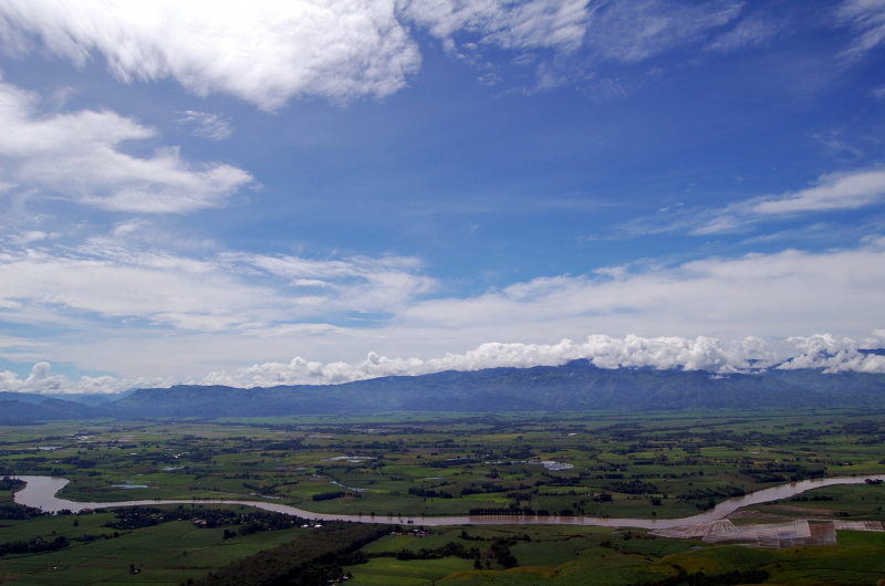
Photo: Wikipedia 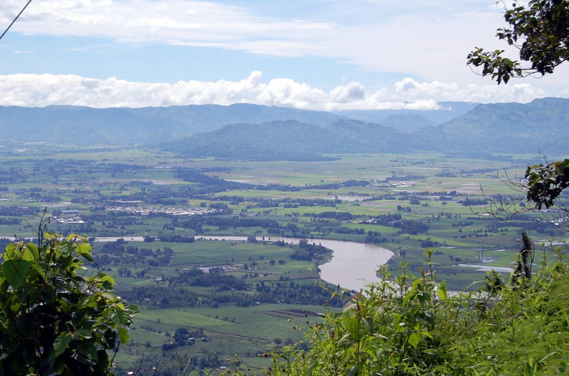
Photo: Flickr -
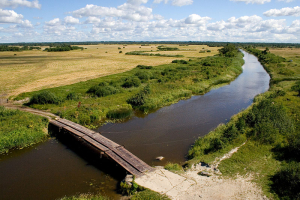
The Pampanga River is the second largest river on the Philippine island of Luzon (after the Cagayan River) and the country's fifth longest river. It runs through the provinces of Pampanga, Bulacan, and Nueva Ecija in Central Luzon.
Its headwaters are in the Sierra Madre, and it flows south and southwest for about 261 kilometers (162 miles) before draining into Manila Bay.
The basin of the river is 10,434 square kilometers (4,029 square miles), including the allied basin of the Guagua River. The basin drains into Manila Bay via the Pampanga River and the Labangan Channel. Its main tributaries are the Pearanda and Coronel-Santor rivers on the basin's eastern side, and the Rio Chico River on the basin's northwest side. The Bagbag River connects the Angat River to the Pampanga River at Calumpit, Bulacan. Mount Arayat (elevation: 1,026 metres (3,366 feet)) dominates the basin.
The Candaba Swamp, located southeast of Mount Arayat and the Pampanga River, absorbs the majority of the flood flows from the western slopes of a portion of the Sierra Madre and the overflowing of the Pampanga River via the Cabiao Floodway. During the rainy season, this area is submerged, but it is relatively dry during the summer.
Length: 270 km (170 mi)
Photo: River Basin Control Office 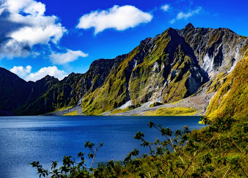
Photo: Dreamstime.com -
The Agno River, also known as the Pangasinan River, is a river on the Philippine island of Luzon. With a drainage area of 5,952 square kilometers and running through the provinces of Benguet and Pangasinan, it is one of the country's largest river systems (2,298 sq mi).
The river flows from the Cordillera Mountains to the South China Sea via the Lingayen Gulf. The river is 248 kilometers (154 miles) long, making it the country's sixth longest. The Agno River Valley is home to approximately two million people and is one of the Philippines' most populous areas.
Three hydroelectric power plants dam the river: the Ambuklao Dam in Bokod, the Binga Dam in Itogon, and the San Roque Dam in San Manuel. The Agno River is the area's main drainage system, with a catchment area of 5,952 square kilometers (2,298 sq mi). It is the third largest river in Luzon (after the Cagayan and Pampanga rivers) and the Philippines' fifth largest river.
In terms of water discharge, the Agno is the largest Philippine river, draining approximately 6.6 cubic kilometers of fresh water into Lingayen Gulf, accounting for nearly 70% of the total fresh water input into the gulf.
Length: 248 km (154 mi)
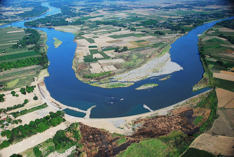
Photo: River Basin Control Office 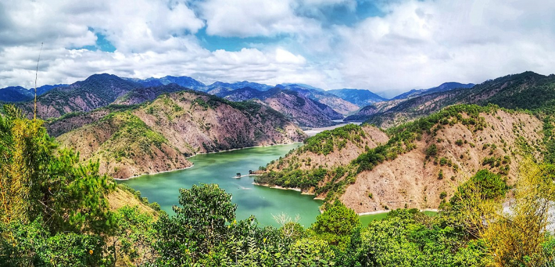
Photo: Wikipedia -
The Chico River is a river system in the Philippines on the island of Luzon that connects the Cordillera and Cagayan Valley regions. With a total length of 233 kilometers, it is the Cagayan River's longest tributary (145 mi).
It is the longest river in the Cordillera region, spanning the provinces of Mountain Province, Kalinga, and Cagayan. It is known among development workers as a "river of life" for the Kalinga people who live on its banks, and it is well known among development workers because of the Chico River Dam Project, an electric power generation project that local residents fought for three decades before it was finally shelved in the 1980s - a landmark case study concerning ancestral domain issues in the Philippines.
The Chico River is the longest tributary of the Cagayan River, stretching 233 kilometers (145 miles). The highest headwaters start along the slopes of Mount Data in the Cordillera mountains, near Bauko in Mountain Province. The river then flows northeast through Bontoc, Sabangan, Sadanga, Tinglayan, Lubuagan, Tabuk City, Pinukpuk, Tuao, Piat, Rizal, and finally to Santo Nio, where it joins the Cagayan River. The Bunog River to the south, the Tanudan and Biga Rivers to the east, the Mabaca and Saltan Rivers to the north, and the Pasil River further downstream are its tributaries.
Length: 233 km (145 mi)
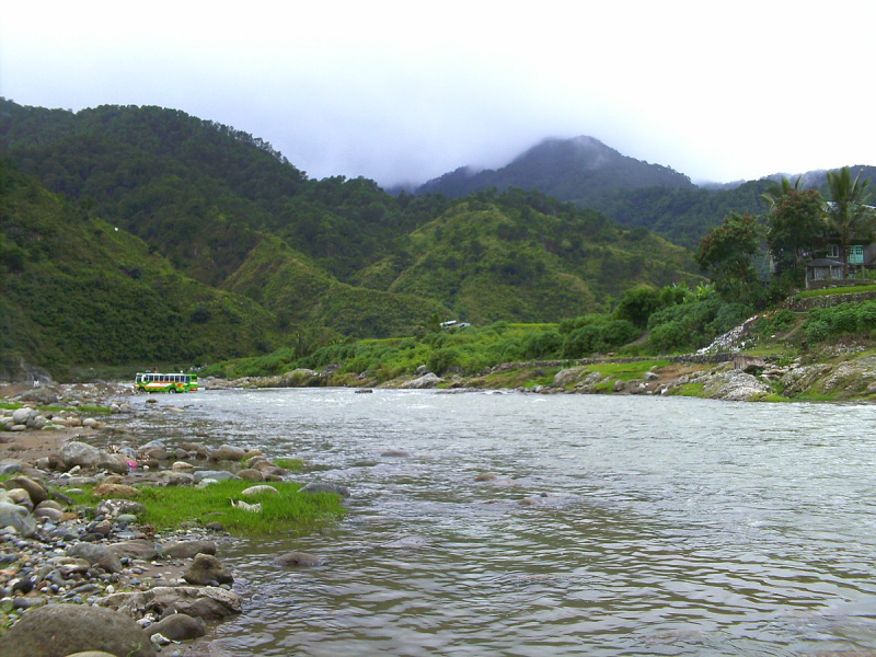
Photo: Wikipedia 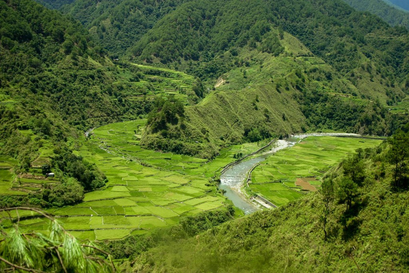
Photo: Flickr -
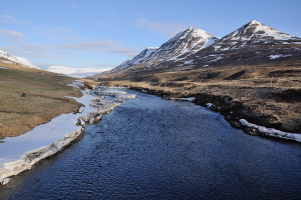
The Abra River, commonly known as the Lagben River, is the Philippines' eighth biggest river system in terms of watershed size. Its headwaters are near Mount Data in Benguet province, and it has a drainage area of 5,125 square kilometers (1,979 square miles) and a length of 206 kilometers (128 miles).
The Abra is a river that originates on Mount Data's southern crest. After descending to Cervantes, Ilocos Sur, it flows into Abra. The Tineg River, which originates in the Abra uplands near the town of Dolores, connects the two.
It is famous for being the home of the Abra River eel, a rare species. During the rainy season, the river runs rapidly, supplying a multitude of tributaries throughout Abra's plains and valleys. The riverbed, on the other hand, dries up in the summer, revealing its exceedingly harsh and stony gravel bottom.
The country's widest river, which originates in the Cordillera Mountains and flows down to Ilocos Sur, is a great area to swim and fish. The river is one of the biggest in the area, serving as the confluence point for all of the rivers and streams in the surrounding province.
Length: 206 km (128 mi)
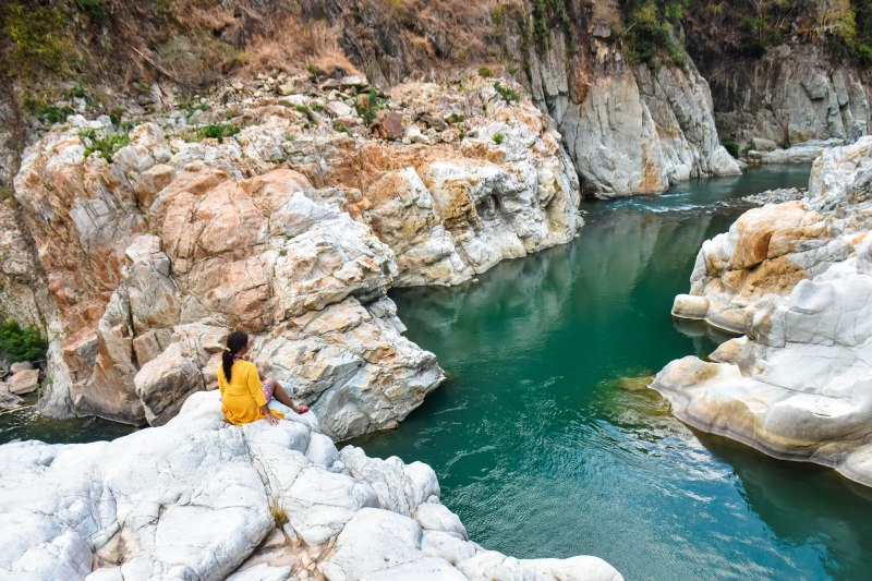
Photo: The Pinay Solo Backpacker Itinerary Blog 
Photo: Flickr -
In terms of watershed size, the Abulog River, also known as the Abulug River, is the Philippines' ninth longest river system. It has a drainage area of 3,372 square kilometers (1,302 square miles) and a length of 196 kilometers (122 miles) from its headwaters in the mountains of Apayao in the Cordillera Administrative Region. More than 90% of the river's drainage area is in Apayao province, with the remainder, including the river's mouth, in Cagayan province.
The upper reaches of the Abulug River, particularly upstream from Kabugao, are known colloquially as the Apayao River. The DENR's River Basin Control Office (RBCO) has recognized the Apayao-Abulug River Basin as one of 18 main river basins across the country as priority regions for sustainable resource management and development. Following the watershed to coastal area resource management framework, it was the topic of an integrated area development study.
The Apayao-Abulug River Basin spans the Cordillera provinces of Apayao and Cagayan in Region II.
Length: 196 km (122 mi)
Photo: yomaps.net Video: Will2Wander -
The Davao River is the third largest river in the southern Philippines, located on the island of Mindanao. It drains an area of more than 1,700 square kilometers (660 square miles) and has a total length of 170 kilometers (110 mi). The majority of the land is upland. Average river flows near the mouth are estimated to be 70 to 80 cubic metres per second (2,500 to 2,800 cu ft/s). Throughout the year, the climate is relatively uniform, with evenly distributed rainfall, temperatures, and humidity (rainfall = 2600mm, Actual Evap 1028mm). Typhoons are uncommon in the area.
River discharge measurements taken between 1984 and 1990 revealed an average river flow of about 78 cubic meters per second. Davao City's primary drinking water sources are in the Talomo watershed. These sources are under stress, and water abstraction from the Davao River Basin is likely in the near future.
The Environmental Management Bureau collects samples from eight different locations along the Tamugan River, from its confluence to its mouth. The water is classified as Class A – Public Water Supply Class II from the Tamugan River confluence with the Davao River downstream to DDF Subdivision, Mandug. From this point to the sea, the water is classified as Class B or recreational water class I. Analyses of dissolved oxygen over the last four years have revealed no discernible change in quality. The current water quality monitoring is insufficient for monitoring and evaluating pollution levels and trends in the river.
Length: 170 km (110 mi)
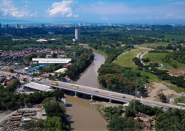
Photo: Wikipedia 
Photo: River Basin Control Office