


Top 5 Longest Rivers In Belize

Belize is located in northern Central America on the Caribbean coast. It shares a border with the Mexican state of Quintana Roo on the north, the Guatemalan ... read more...department of Petén on the west, and the Guatemalan department of Izabal on the south. To the east, in the Caribbean Sea, the world's second-longest barrier reef surrounds much of the 386 kilometers (240 miles) of mostly swampy shoreline. The country has a total size of 22,960 square kilometers (8,865 square miles), which is somewhat larger than El Salvador, Israel, New Jersey, or Wales. This country's river system is also well developed. Toplist has compiled a list of the top five longest rivers in Belize.
-
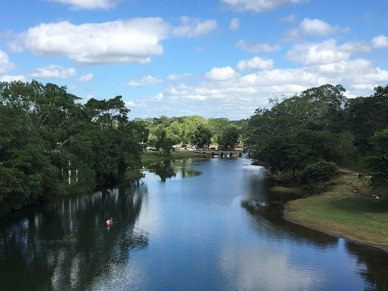
The Macal River ranks in 1st place on the list of the longest rivers in Belize. It flows through Cayo District in western Belize. The historic Mayan settlement of Cahal Pech and the Belize Botanic Gardens are both located along the river. The Macal River flows into the Belize River. The Macal River has multiple tributaries, including the streams Privassion, Rio On, Rio Frio, Mollejon, and Cacao Camp.
The watershed basin of the Macal River is approximately 1492 square kilometers in size. The Macal River begins in a steep section of the Maya Mountains and runs north to join the Mopan River to form the Belize River. The Cockscomb Basin Wildlife Refuge, located to the east of the Macal River Basin, is the main sanctuary constructed particularly for jaguar conservation.
The Macal River is vulnerable to rapid stage height rise because to the steep terrain of the headwaters region and the considerable rainfall of the upper Macal Basin, contributing significantly to downstream flooding of the Belize River. According to mythology, the river is named after a beautiful young lady named Macall, which is a rare name. [Citation required] Canoes are used to navigate the lower river all year.Length: 320 km (200 mi)
wikipedia.org 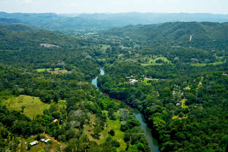
belize-travel-blog.chaacreek.com -
The Belize River ranks in 2nd place on the list of the longest rivers in Belize. This river flows through the middle of Belize for 290 kilometers (180 miles). It drains over a quarter of the country as it winds along the northern border of the Maya Mountains to the sea just north of Belize City (17°32′N 88°14′W). The Belize river valley is mostly covered in the tropical rainforest.
The Belize River, sometimes known as the Old River, begins where the Mopan and Macal rivers meet slightly east of San Ignacio, Belize (17°11′N 89°04′W). The Belize River – Mopan River Catchment area is home to more than 45 percent of Belize's population. Despite having 78 runs or rapids, the Belize River is navigable from the Mopan to the Guatemalan border. It was the principal artery of commerce and communication between the interior and the coast until the early twentieth century, and it has long been connected with the forestry, logwood (for dye), and mahogany, which continues in small stands.
Early on, loggers who used the river encountered the Maya and clashed with them as well as the Spaniards. A request for "weapons and ammunition" for loggers was made in 1807. In the late 1820s, Methodist minister Thomas Wilkinson discovered that three to four thousand men worked at camps for most of the year. By the late 1800s, there were more than 130 small communities along the river. Burrell Boom, located just above Belize City, serves as a log catchment area.
The Belize River is now a vital source of drinking water and other domestic use for the locals who live along with it; unfortunately, water quality has deteriorated due to sediment, fertilizer loading, pesticides, and other contaminants. The main cause of deterioration is significant deforestation in the upper sections of the Mopan River, as well as non-sustainable agriculture. Traditional slash and burn agricultural methods also contribute to the degradation of watersheds.
Length: 290 km (180 mi)
belizehub.com 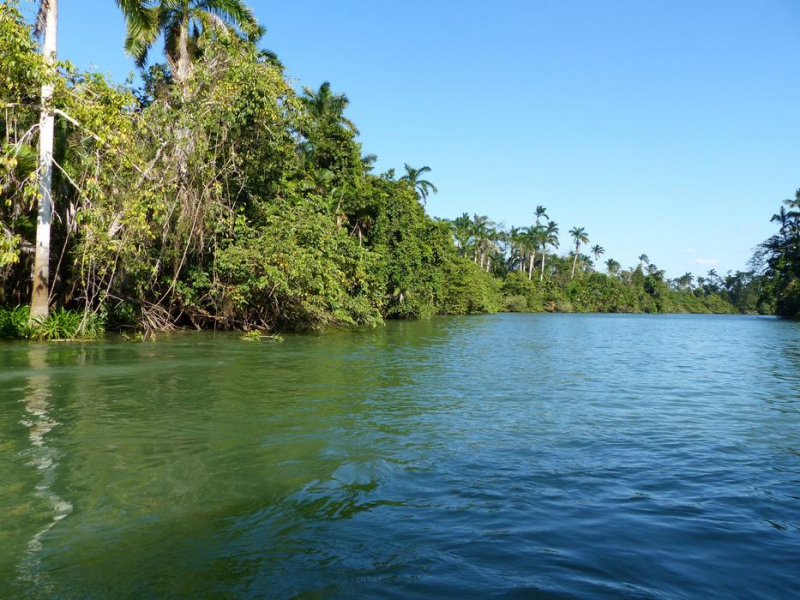
pixy.org -
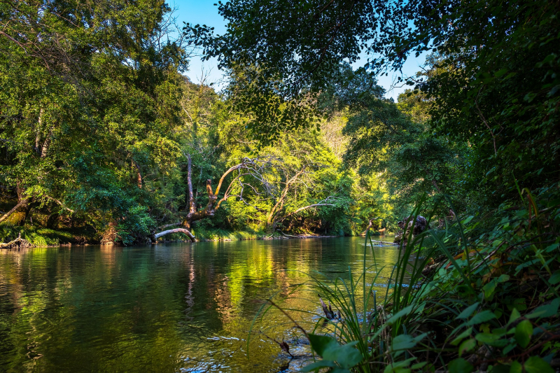
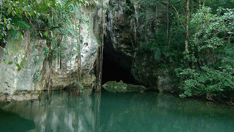
The Sibun River (Xibun River, originally Sheboon River) is a river in Belize that drains a considerable amount of the country's central region. The Sibun (Xibun) was an ancient Maya people who lived in the area.
The Sibun River's headwaters are in the Maya Mountains, around 800 meters above sea level, and are known as the Caves Branch River. The river then flows through a gorge before arriving at an alluvial floodplain with citrus and cacao plantations. The river valley is surrounded by karst geology, which includes Maya cave sites. River figs and spiny bamboo (Guadua longifolia) are prevalent along the river's banks before it reaches the community of Freetown Sibun; mangroves predominate along the stretch of river between the shore and the village. South of Belize City, it flows into the Caribbean Sea.
The Sibun River Watershed contains a variety of flora types, such as tropical evergreen seasonal mixed needle forest, broadleaf forest, mangroves, and agricultural. The Sibun Watershed Association is a local group concerned with environmental issues in the watershed. Guatemala has claimed all of the Belizean territories south of the Sibun River since 1999, yet the claim is not officially recognized.
The Sarstoon River is the current internationally recognized southern Belizean–Guatemalan border. The claim is fundamental to the ongoing territorial dispute between Belize and Guatemala. Mexico originally claimed the area north of the Sibun River in Belize but renounced the claim in a treaty with Britain in 1893. Since then, Mexico has said that it will resurrect the claim only if Guatemala is successful in acquiring all or a portion of the country.
Length: 161 km (100 mi)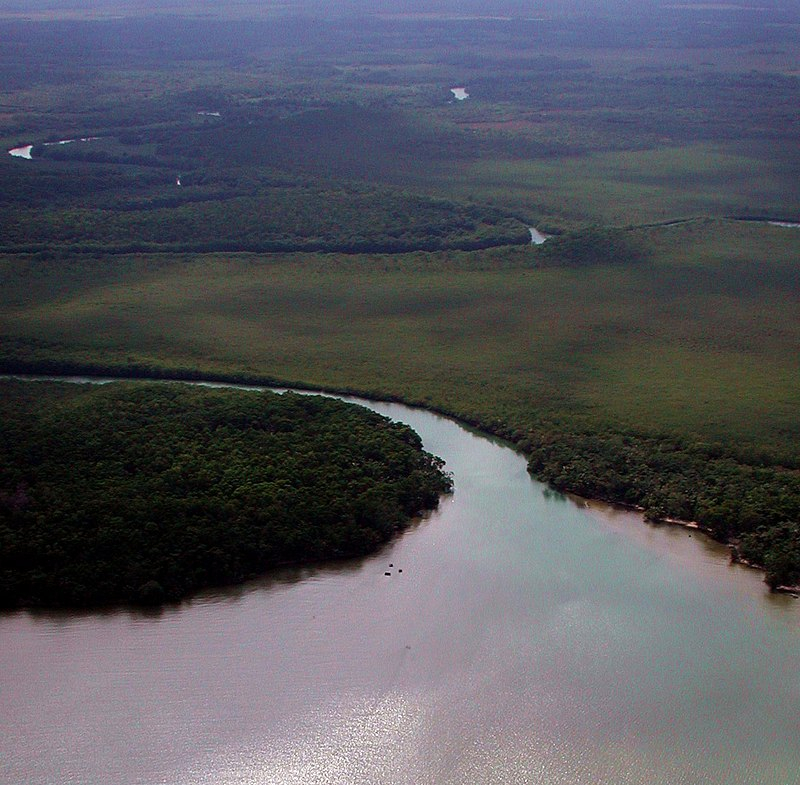
wikipedia.org -
Barton Creek is the name of a tiny river and the area through which it flows in Belize's Cayo District. This river is a tributary of the Belize River. There are two Mennonite villages in this area: Lower and Upper Barton Creek. Both are relatively conservative Mennonite villages in Belize. Barton Creek Cave is also nearby.
Upper Barton Creek is a one-of-a-kind settlement of reformers from various Anabaptist backgrounds who desired to establish a Mennonite community free of modernistic trends and living a simple Christian life in nonconformity to the world. Plautdietsch-speaking "Russian" Mennonites founded it in 1969. Upper Barton Creek Mennonites, in accordance with their Ordnung, do not own any motorized equipment, including automobiles, and do not utilize electricity. They farm with horses, and both men and women dress simply, comparable to Old Order Mennonites and Amish, with males sporting beards. Upper Barton Creek Mennonites are part of the Noah Hoover group, which originated in central Pennsylvania. It has a population of 380 people in 2010.
Lower Barton Creek is a small town in Belize created in 1970 by Shipyard Mennonites. It is home to Belize's most conservative German-speaking "Russian Mennonites." It resembles conservative Mennonite villages in Bolivia. It had a population of roughly 150 in 1980, 200 in 1985, and only about 100 in 1989, when many residents moved to Mennonite colonies in Paraguay, Bolivia, and other places. In 2010, its population was 193.
Length: 64 km (40 mi)
belize.com 
thefamilywithoutborders.com -
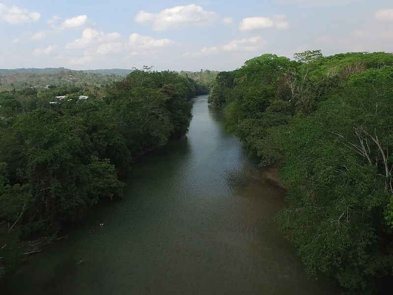
The Mopan River is a river in Central America that runs through Guatemala's Petén Department and Belize's Cayo District. It joins the Macal River at Branch Mouth, Belize, to form the Belize River, which eventually empties into the Caribbean Sea. The combined watershed has a drainage area of 9,434.2 km2 (3,642.6 sq mi). Chiquibul Branch, Ceiba Grande, Salisipuedes, and Delores are Mopan tributaries.
Since 1981, the Mopan River's discharge rate has been measured on a regular basis at the river gauge station in Benque Viejo, Belize. According to these measurements, the annual mean discharge of the river is between 20 and 40 m3/s. In November 1990, the highest rate ever recorded was 404 m3/s.
Although the Mopan may contribute to downstream flooding during the rainy season, it responds to rainstorms slower than the Belize River's other major tributary, the Macal. On average, both rivers produce similar quantities, but the Mopan watershed is less hilly than the Macal watershed, resulting in less severe flood waves.
Length: 50 km (30 mi)
wikipedia.org 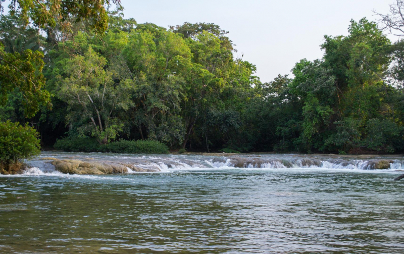
belizing.com


