


Top 5 Highest Mountains in Austria

Austria contains several mountains, the majority of which are part of the Alps. These mountains feature glaciated magnificent vistas that provide an ... read more...awe-inspiring environment. Austrian highlands are a famous tourist destination, and some of them are ideal for skiing and trekking. If you are interested in any recreational activity, such as hiking or mountain climbing, the local tourist board will have all of the information you need to decide where to go. These are Austria's highest mountains.
-
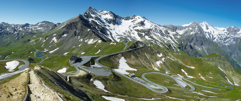
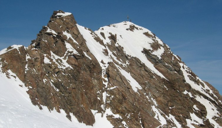
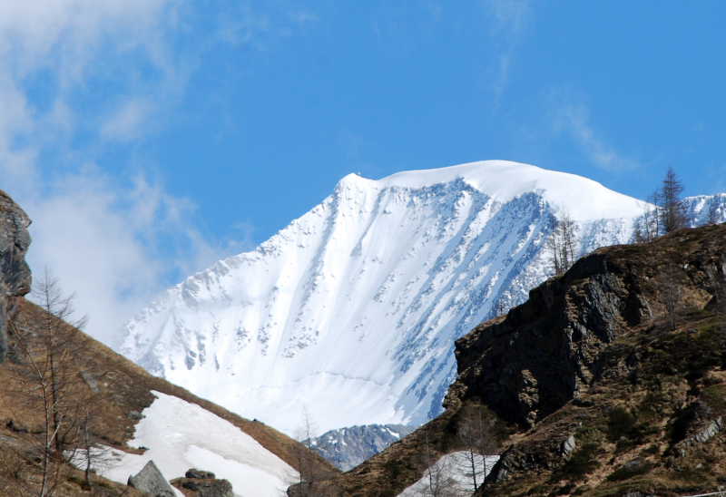
Grossglockner, at 3,798 meters, is Austria's highest and most renowned peak. It is located near the Brenner Pass, which connects Italy and Austria, on the boundary between the Austrian states of Carinthia and Tyrol (East Tyrol). The name Grossglockner comes from the German word glocke, which means bell, and refers to the mountain's distinctive form. The development of the High Alpine Road, which runs near the peak, has resulted in a surge in visitor traffic to the area. The construction of the road in the 1930s alleviated the unemployment issue and aided in the growth of Salzburg's Alpine areas. Today, after Schönbrunn Palace in Vienna, the route is Austria's second most popular tourist site. Museums and display centers along the route educate visitors about the National Park's flora and wildlife, the hard labor involved in building the road, and the influence it had on the local economy.
The road widened, grew safer, and more comfortable. In the heart of the Hohe Tauern National Park, exhibitions and museums, huts and mountain inns, tourist centers and information stations highlight the unique alpine world with its species and plants. The mountain road merges into the scenery, provides a one-of-a-kind mountain experience, and has delivered 48 kilometers of unequaled driving enjoyment for more than 80 years.
Height: 3,798 meters
Location: on the boundary between the Austrian states of Carinthia and Tyrol (East Tyrol)
salzburg.info 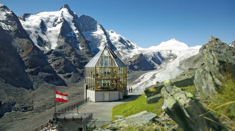
salzburg.info -
Wildspitze, located on the white ridge, is Austria's second tallest (3,770 meters) peak and the highest mountain in the tztal Alps and North Tyrol. The mountain features twin glaciated summits, making it popular for ice climbers. The North Face is 55 degrees and ideal for climbing in July, August, and September.
The north and south peaks of Wildspitze are separate. The summit cross is located on the south peak, which is 3768 meters high. The North peak is dominated by a massive snowcap that is melting as a result of global warming. The North peak used to be the highest point on Wildspitze, however owing to global warming, the northern summit has been significantly losing height ("Bergsteiger" issue 1/02, page15). Most guides and maps gave the altitude of Wildspitze as 3772 meters, although the most recent statistics offer 3765 meters for the Northern peak and 3768 meters for the Southern summit. As a result of global warming, the southern peak is now the highest point on Wildpsitze, at 3768 meters (other sources say 3770m though). Because the south top is made of rocks, the elevation is unlikely to alter very soon.
Height: 3,770 meters
Location: Weißkamm, Austria
summitpost.org 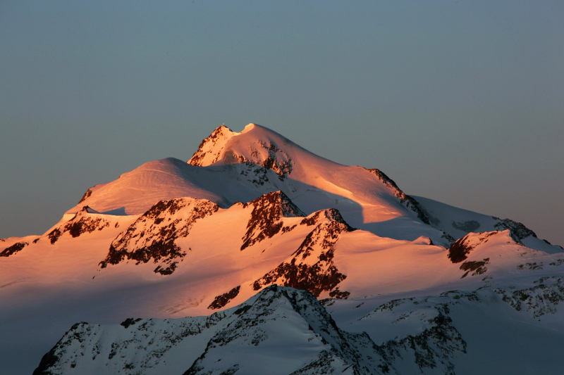
summitpost.org -
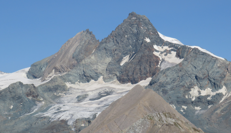
The Palla Bianca is Austria's third highest peak and the second highest in the tztal Alps. It reaches a height of 3,739 meters. It is situated on the Austrian-Italian border. Palla Bianca is strategically positioned in the tztal Alps and offers one of the nicest views in the Alps. The summit of Palla Bianca may be seen from Venice. On September 30, 1861, Joseph Anton Specht of Vienna led the first climb from Vent, accompanied by Leander and Nicodem Klotz.
It is bordered by glaciers such as the Hintereisferner, Val di Mazia Glacier, and Vallelunga Glacier. Melago, in the Vallelunga valley, is about 7 kilometers distant (beeline). Mt. Palla Bianca was first ascended in the mid-nineteenth century by Johann Gurschler and Josef Weitthalm, both of whom came from the Val Senales valley. Archduke John of Austria was so taken with the mountain that he documented his experience in writing after hiking to the Hochjoch saddle in 1846.
Height: 3,739 meters
Location: the border between South Tyrol and North Tyrol, the Austrian-Italian border
peakvisor.com 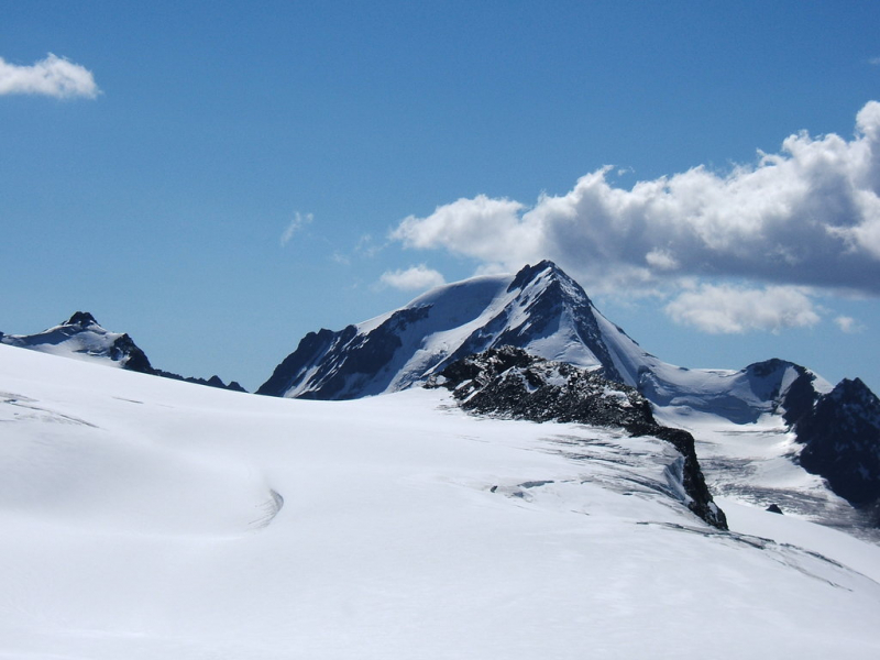
peakvisor.com -
The Glocknerwand mountain is located in Austria's Central Alps, near the border between East Tyrol and Carinthia. With a height of 3,721 meters, it is Austria's fourth highest peak. Because of its sheer granite sides, this mountain is one of the most challenging to climb. The Glocknerwand's top area includes high snowdrifts that can be unexpected at times. It is not one of the most dangerous mountains to climb.
The Glocknerwand is a large, fan-shaped mountain with over 400-meter-high (1,300-foot) granite sides to the southwest and northeast. The summit location is surrounded by deep snowdrifts, making the ascent perilous and unexpected. As a result, the towers of the Glocknerwand are regarded as the most challenging peaks to reach in the whole Glockner Group.
Height: 3,721 meters
Location: Austria's Central Alps, the border between East Tyrol and Carinthia
myholidays.com 
myholidays.com -
Großvenediger is the major summit of the Venediger Group within the Hohe Tauern mountain range, located on the boundary of Austria's Tyrol (East Tyrol) and Salzburg. It is often regarded as Austria's fourth highest peak (although it can be up to sixteenth if every subsidiary summit is counted). The glacier-covered mountaintop is part of the Hohe Tauern National Park.
Großvenediger is the major summit of the Venediger Group within the Hohe Tauern mountain range, located on the boundary of Austria's Tyrol (East Tyrol) and Salzburg. It is often regarded as Austria's fourth highest peak (although it can be up to sixteenth if every subsidiary summit is counted). The glacier-covered mountaintop is part of the Hohe Tauern National Park.
It wasn't until September 3, 1841, forty years after the first ascent of the Großglockner, that a team led by Josef Schwab made the first successful attempt on the Großvenediger summit, beginning at the northern foot in Neukirchen in the Salzach Valley and climbing southwards along the Obersulzbach tributary valley and over the Stierlahnerwand. Ignaz von Kürsinger, Paul Rohregger, Anton von Ruthner, and Franz Spitaler were also on the squad. Only 26 of the 40 athletes made it to the top, with the remainder dropping out due to exhaustion. Several mountain huts now serve as the starting point for summit ascents, while mountaineering at the naval level can be difficult due to numerous crevasses.
Height: 3,666 meters.
Location: the boundary of Austria's Tyrol (East Tyrol) and Salzburg
myholidays.com 
myholidays.com


