Top 5 Highest Mountains in Armenia

Armenia is a mountainous country with a lot of potential for mountaineering and extreme tourism development. This article aims to pique your interest in ... read more...Armenia's highest mountains by presenting the country's highest mountains. The top 5 highest mountains in Armenia are as follows:
-
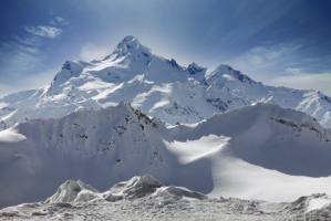
The Aragats Mountains are located in western Armenia, between the Ararat and Shirak valleys, and the Akhuryan and Kasagh rivers. It is a regular cone with jagged summits and slopes that are slightly oblique. Historians attribute the name's origins to an Armenian god named Ara. Ara's throne or Ara's throne is the name's etymology. The mountain is known for its magnificent cultural heritage, which includes dozens of Paleolithic era testimonies and artifacts, ancient irrigation networks, massive vishaps (dragon stones) placed near several water sources, and incredible Medieval era architecture samples.
Aragats is Armenia's highest mountain and the fourth highest in the Armenian Highlands. It has four main peaks, the highest of which is 4090,1 meters. A massive crater with a depth of 350 meters and a width of 3 kilometers lies between the rocky peaks of Aragats. Firm fields and snowfields were found on the sides of the crated cirque, as well as moraines and glaciers inside the crater, according to observations. The top part has alpine-style relief that is strictly fragmented.
There are also numerous cold-water tributaries that originate from the mountain's volcanic stones. Many picturesque lakes were formed as a result of glacial debris and moraine dams: Kari, Amberd, Umroy, Lesing, and so on. Tourists are drawn to nature because it is breathtakingly beautiful. The Byurakan Observatory is on the mountain's southeastern slope, meteorological stations for cosmic ray explosion studies are on Aragats' sub-summit plateau, and the Mantash valley has a large water reservoir.
Aragats is Armenia's most popular tourist destination. Many historians, poets, painters, and composers praised Aragats in their works, including Gh. Alishan, Komitas, H. Tumanyan, Charents, and M. Saryan.Elevation: 4090 m
Location: Shirak Province, Armenia
https://www.wikiloc.com/ 
https://nomadjoseph.com/ -
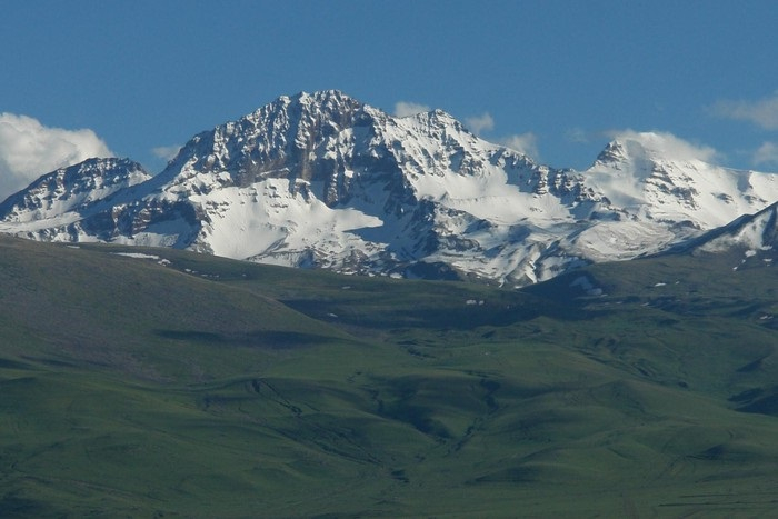
The Kaputjugh is one of the highest mountains in Armenia. It is a mountain in the south of Zanguezour near the Armenian - Azerbaijani border that rises to a height of 3904 meters. More precisely, the Kaputjugh lies on the border between Armenia's Syunik region and Azerbaijan's Nakhitchevan region. The Kaputjugh is the highest mountain in Nakhitchevan and the second highest mountain in Armenia, after the Aragats Volcano (4095 m).
It is located 9 kilometers west of the village of Kajarants and is the highest point in the Zangezur mountain range. The mountain's height is not well expressed in comparison to its surroundings due to its low relative altitude, despite the fact that it is Armenia's second-highest summit. The mountain's steep slopes are covered in alpine or subalpine vegetation. Kaputjugh is a mountain on the outskirts of town. Ascents to the mountain are not permitted and are still prohibited as a result of the Armenian-Azerbaijani conflict.Elevation: 3904 m
Location: The south of Zanguezour, Armenian-Azerbaijani border
https://peakvisor.com/ 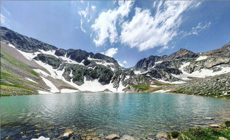
https://www.armgeo.am/ -
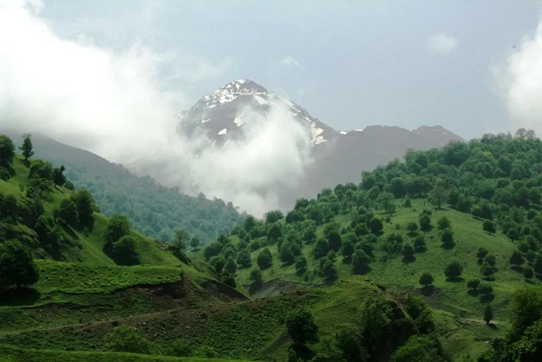
In the Lesser Caucasus, the Murovda or Mrav is the highest mountain range. Gomshasar Mountain, at 3,724 meters, is the highest peak in the range, which stretches for about 70 kilometers. Ariutyan (valiancy) mountain is another name for Gomshasar. Jurassic, Cretaceous, and Paleogene rocks dominate the landscape. It is made up of volcanic rocks, has a rocky peak, and has well-defined landscapes ranging from mountain steppes to snowy zones. The mountain's slopes are steep, with alpine and subalpine flora covering them.
From Hinaldag Peak to Gomshasar Mountain, the Mrav range stretches north. A group of scenic lakes, including Goygol near the northern slope, can be found on the northeastern slope.
There are signs of ancient frosting on the mountain's summit, and some snowlines can still be seen in the mountain's former glacier. Due to the fact that Gomshasar is a borderline mountain with several Armenian military outposts, climbing it without special permission is prohibited.
Elevation: 3724 m
Location: Lesser Caucasus, Armenia
https://www.armgeo.am/ 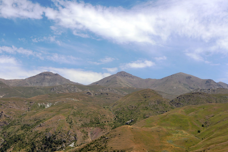
https://wikimapia.org/ -
Tsrasar mountain, with a height of 3616 meters, is located on the border of the Shahumyan and Kashatagh regions. It is one of the highest mountains in Armenia. In terms of elevation, it is Armenia's fourth highest peak. Tsrasar information, particularly about its ascents, is almost non-existent.
On August 13, 2011, members of the Russian tourist club "Abris", led by Armen Harutyunyan, climbed Mount Tsrasar for the first time. The Tsrasar mountain range traverse was used for the ascent. The ascent is described in detail on the mountain.ru website. For the second time, other members of the Russian tourist club "Abris" and six Armenians from Artsakh, led by Armen Harutyunyan, climbed Mount Tsrasar.
Despite the fact that Tsrasar is Armenia's fourth highest mountain, there is virtually no information about it. Tsrasar is a small town in Artsakh's Shahumian region, south of Jermajur. Drinkable water can be found in rivers and mountain streams. When you return, you can enjoy the geysers, which will make you forget about your tiredness.
Evelation: 3616 m
Location: Shahumyan province, Armenia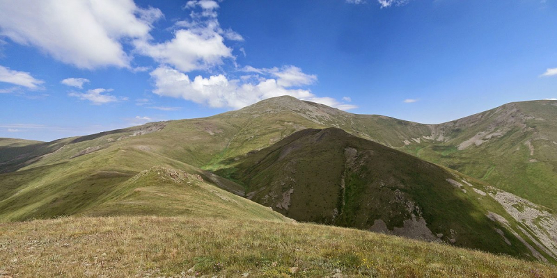
https://commons.wikimedia.org/ 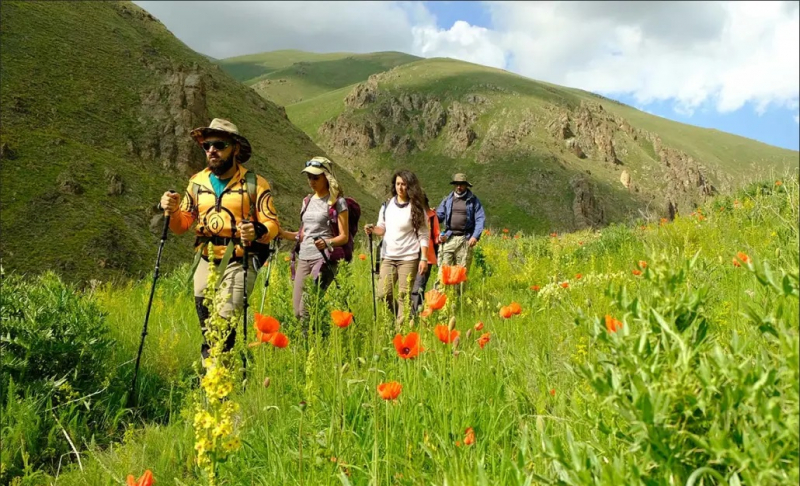
https://www.armgeo.am/ -
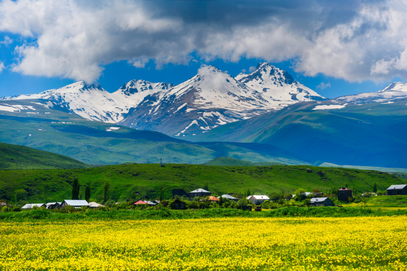
Azhdahak is the fifth peak of Armenia. On the border of the Kotayk and Gegharkunik regions, Azhdahak is the highest mountain in the Geghama mountain range. Azhdahak is a volcanic cone that no longer exists. The crater has a depth of 50 meters and a diameter of 500 meters, and its floor is completely filled with water. Azhdahak has an absolute height of 3596 meters and a relative altitude of 600 meters. Volcanic eruptions and explosions formed the mountain in the upper anthropogenic period. Volcanic bombs and gray slags make up the structure.
Azhdahak's compound slag cone is a large strewn structure with a diameter of 1600m and a height of about 370m. Around 8 square kilometers of volcano lavas have been partially eroded and overlapped by Tar streams. Slags, lapilli, sands, ashes, debris, lava boulders, slag, twisting, composite, and spindle-shaped volcanic bombs make up the cone.
Tourists have long been drawn to the Azhdahak area because of its natural beauty. The chances of running into each other's hiking groups, on the other hand, are negligible. It depends on the distance from civilization, as well as navigational difficulties, which are exacerbated by weather conditions such as thunder and lightning, hail and snow, and fog with visibility as low as 2-3 meters.
Elevation: 3597 m
Location: Gegharkunik Province, Armenia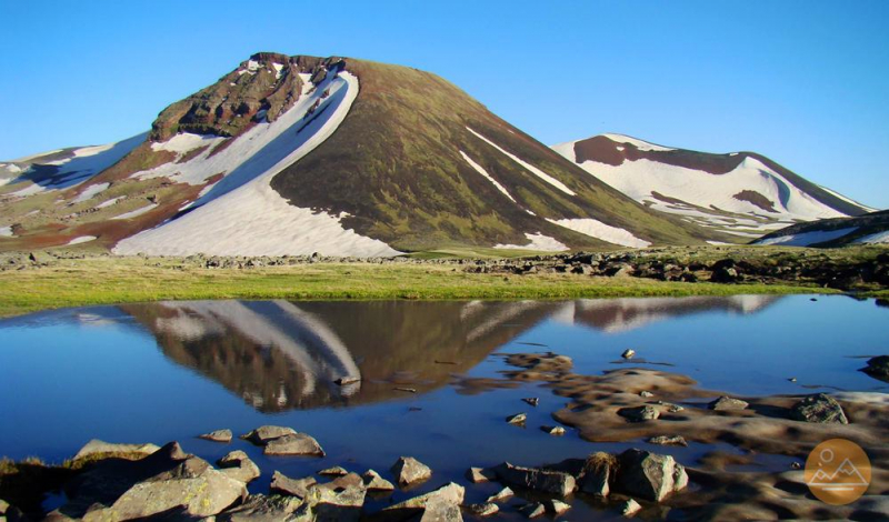
https://www.ecokayan.com/ 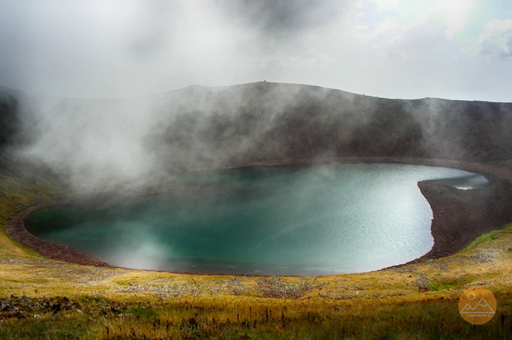
https://www.ecokayan.com/