


Top 11 Highest Mountains In Canada

Whether you're a seasoned mountain climber or simply enjoy taking in the scenery, Canada has something for everyone. With over a hundred mountains spread ... read more...across the country, deciding which one to visit first may be difficult. Toplist has whittled down the list to the top eleven tallest mountains in one of the world's most gorgeous countries. The mountains on this list are all located on the west coast of the United States, in British Columbia or Yukon Territory. Many people associate Yukon Territory with the gold rush, although the territory encompasses much more. Over 80% of the Yukon's territory is covered by mountains and glaciers, including many of the mountains in the Saint Elias range. This list has you covered if you're looking for some cool weather and stunning scenery. Keep exploring, as they say in Canada.
-
Mount Logan is the tallest mountain in Canada and the second tallest in North America, and it is located in Kluane National Park. It is also the world's largest non-volcanic peak in terms of circumference. While anybody may admire the breathtaking grandeur of this mountain, climbing it is best left to the specialists. Even in the summer, the temperature on the mountain, which is near 20,000 feet, remains below 0 degrees. Climbers took 65 days from start to finish to reach the summit and return to their starting place when the mountain was first climbed in 1925. If you hiked Mount Logan today, it would probably take you two weeks. The cost of going on the hike with guides is almost $10,000 per person, and that's just for the climbing portion.
Airfare to and from Whitehorse (where your tour begins), motels, meals, insurance, and your gear are all additional expenses to consider when embarking on a journey like this. If none of that deters you, Mount Logan is supposed to be a once-in-a-lifetime experience. Mount Logan is similar in size to Denali, although it is considerably less visited and yet pure.
Elevation: 19,551 feet (5,959 m)
Location: Kluane National Park Reserve, Yukon
Range: Saint Elias Mountains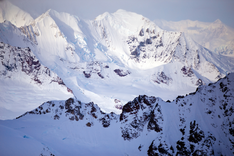
Photo source: Journeyz 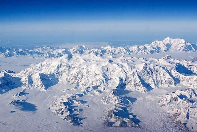
Photo source: Artheclipse -
Mount Saint Elias, also known as Boundary Peak 186, is located on the Alaska-Canada border. Because of its high rise, which reaches over 18,000 feet in under 10 miles, this peak is rarely ascended. Only a few teams have finished this difficult climb, but the majority of them abandon the mountain. In 1897, Prince Luigi Amedeo headed the first team to achieve so. They are one of the first ascents on this list, and it's remarkable since the climbers had to deal with constant terrible weather on the peak.
Yaséitaa Shaa, which loosely translates to "mountain behind icy bay," is the name given to the peak by native Tlingit people. According to folklore, Mount Saint Elias and Mount Fairweather used to be neighbors, but after a disagreement, they split apart. Their children are considered to be the smaller mountains between them.
Elevation: 18,009 feet (5,489 m)
Location: Alaska and the Yukon Territory
Range: Saint Elias Mountains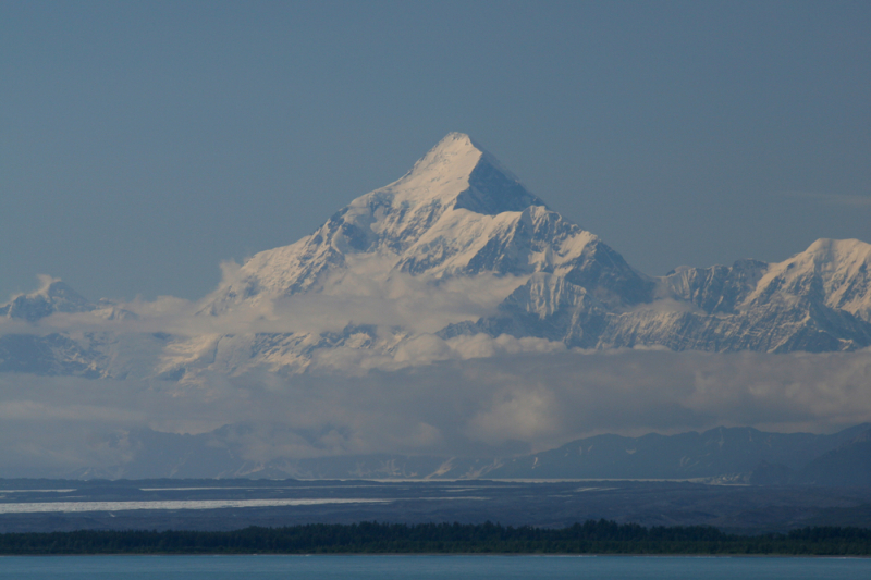
Photo source: Journeys 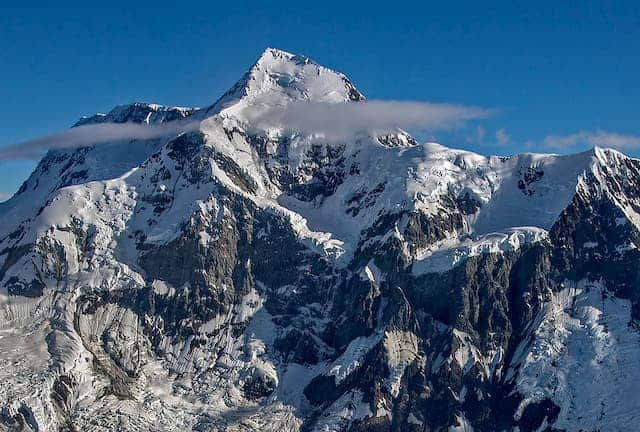
Photo source: Artheclipse -
The Duke of the Abruzzi named the peak he could see in the distance Mount Lucania, after his expedition ship, the RMS Lucania, while he stood on Mount Saint Elias. It's a true beast of a mountain, occupying third place among Canada's highest summits. A succession of overlapping mountain ridges make up the northern summit of the St. Elias range. Lucania, like Mt. Logan and Mt. St. Elias, lies near to the Pacific coast and is rarely visited; Bradford Washburn and Robert Bates completed the first ascent on Lucania in 1937. A steep snow saddle connects Lucania to its north-eastern neighbor Mount Steele.
This magnificent peak has been climbed three times, the most recent by an all-female team just this year, 84 years after the first ascent. Robert Hicks Bates and Bradford Washburn were the first to summit Mount Lucania. They had to hike approximately 150 miles to the nearest town to go home after their journey up and down the mountain.
Elevation: 17,260 feet (5,260 m)
Location: Yukon
Range: Saint Elias Mountains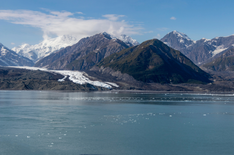
Photo source: Journeyz 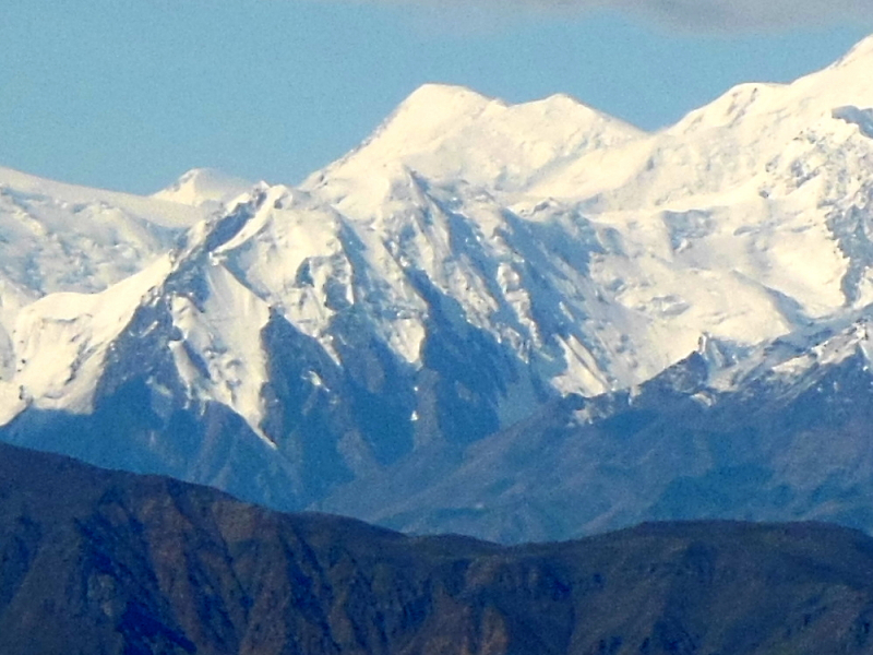
Photo source: Wikimedia Commons -
This behemoth is North America's ninth highest peak and Canada's fourth highest. William King, a commissioner of the International Boundary Commission and director of the Dominion Observatory, is the mountain's name. This mountain, which is located in Yukon Territory, is extremely frigid and unfriendly, which is likely one of the reasons it has only been climbed three times.
In 1952, four University of Alaska students became the first to summit Kings Peak. Their supplies were airdropped near the Ogilvie glacier, which was the starting point for their ascent of the peak. Their journey was hampered by a two-day snowstorm, which tragically resulted in one of the climbers sustaining a knee injury. He was unable to reach the top as a result of this, but his friends were able to complete the expedition while he remained in camp.
Elevation: 16,972 ft (5,173 m)
Location: Yukon
Range: Saint Elias Mountains
Photo source: Utah.com 
Photo source: Journeyz -
This mountain, named after Sam Steele, a police officer during the Yukon Gold Rush, is notorious for being exceptionally harsh and difficult to reach. Those conditions, however, did not deter Walter Wood and his team from ascending the summit in 1935. The weather delayed their progress, with their initial effort being thwarted and their successful attempt requiring them to travel on all fours for much of the trek.
One of the largest landslides in Yukon Territory history occurred on this peak. A tremendous amount of rock, ice, and snow careened down the slope of the mountain at an estimated 157 mph on July 24, 2007. Fortunately, no one was hurt as a result of the unlivable conditions around the mountain.
Mount Steele climbs to #5 on the list of Canada's tallest peaks. It is the tenth highest peak in North America and is located in the center of Yukon. Steele, along with Lucania, constitutes a massive ice massif that covers over 90 square kilometers and is home to numerous glaciers, including Walsh and Chitina. Mt. Steele, like the rest of the St. Elias Mountains, is very young, severely glaciated, and highly dynamic, making it more prone to avalanche. The rock and ice avalanches on Mt. Steele in July 2007 are thought to be one of the greatest in Western Canada.
Elevation: 16,644 ft (5,073 m)
Location: Kluane National Park, Yukon
Range: Saint Elias Mountains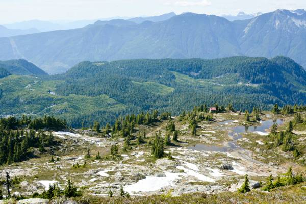
Photo source: Georgia Straight 
Photo source: Journeyz -
This Yukon Territory peak is not to be confused with Mount Wood in the United States. This mountain has had no major climbs and very little is known about it.
The mountain was named after Zachary Taylor, which is a nice fact. The first to ascend this highly glaciated summit were Walter Wood, Anderson Blakewell, and Albert Jackman. Mt. Wood, on the other hand, is named after a Canadian geographer, not Walter Wood. Wood was the commissioner of the North West Mountain Police Department. James McArthur, the first to climb numerous peaks in the Yukon Territory, gave it this name.
Mount Wood, Canada's seventh highest mountain, can be seen all the way from Donjek River Bridge on the Alaska Highway. It is located on the northern boundary of Kluane National Park and is also known as Wood Peak. Only planes have access.
Elevation: 15886 feet (4,842 m)
Location: Kluane National Park and Reserve
Range: Saint Elias Mountains
Photo source: Journeyz 
Photo source: Peakbagger -
Mount Vancouver is the eighth highest Canadian mountain and the fifteenth tallest in North America, straddling Glacier Bay National Park and Preserve in Alaska and Kluane National Park and Reserve in Yukon.
This peak is massive, rising nearly 3000 meters above the icefield. It was first climbed in 1949 and has only had 5-6 major ascents since then. On a north-south sloping crest, Mt. Vancouver has three summits, one of which, Good Neighbor Peak, is located on the international border.
Captain George Vancouver, a British Royal Navy officer who explored the southeast coast of Alaska from 1792 to 1794, was named after it by H. Dall in 1874. Walter Wood and his group became the first to reach the summit of Mount Vancouver. During the 1967 centennial expedition, where several summits were climbed and named for the first time, Good Neighbor Peak was given its name.
Elevation: 15,979 feet (4,870 m)
Location: Alaska and the Yukon Territory
Range: Saint Elias Mountains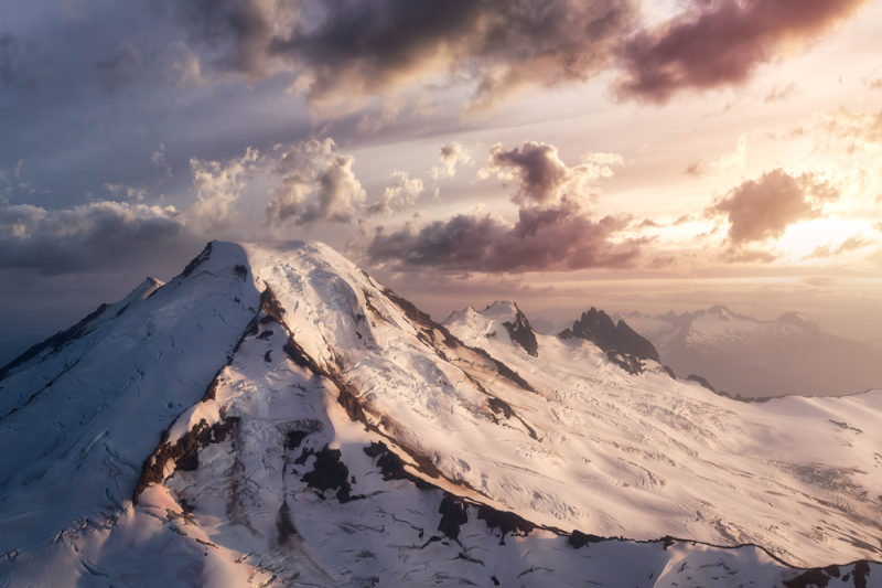
Photo source: Journeyz 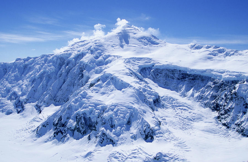
Photo source: Fine Art America -
Mount Slaggard is a distant, severely glaciated peak buried deep inside the Icefield Range, some 40 kilometers north-west of Mt. Lucania. In terms of scale and scope of the expedition, it pales in contrast to other St. Elias peaks because it is contained within Kluane National Park and Reserve. That could explain why one of its sub peaks, South Slaggard (4370m), was not ascended until 1997.
On the western side of Mt. Slaggard, there are two more sub summits: West Slaggard I (4,290m) and West Slaggard II (4,210m), both of which are notorious for having the worst snowstorms.
This peak, which is part of the Icefield Range, is one of the lesser-known mountains in the area. Prepare to pay around $10,000 per person on gear, guides, and transportation if you decide to ascend this peak. This type of expedition necessitates months of planning and preparation. While reaching the peak is doable, you must be prepared, as this location is infamous for its bad weather and violent storms.
Elevation: 15, 557 feet (4,742 m)
Location: Kluane National Park and Reserve
Range: Saint Elias Mountains
Photo source: Journeyz 
Photo source: Eartheclipse -
Alaska owns two-thirds of Mount Fairweather in the Saint Elias Mountains. Its peak is located within Canada's Tatshenshini-Alsek Wilderness Provincial Park, which is a UNESCO World Heritage Site. Mount Fairweather is the highest point in British Columbia as a result of this.
While James Cook named the peak Fairweather because of the exceptionally fine weather they were experiencing at the time, good weather is not something you should expect if you decide to visit this mountain. It, like the rest of the Saint Elias range, is plagued by severe weather and freezing temperatures.
Although it was named by Captain James Cook during his mission in 1931, this border mountain defies its name. Because of the devastating snowstorms and inadequate precipitation, it is the least favorite summit among climbers.
Elevation: 15,300 feet (4,671 m)
States: Alaska and British Columbia
Range: Saint Elias Mountains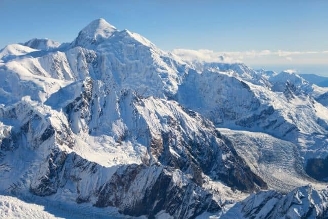
Photo source: Eartheclipse 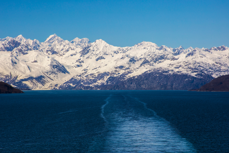
Photo source: Journeyz -
Mount Hubbard, the eighth tallest mountain in the United States and the tenth in Canada, is shared by both countries. While being ranked 19th in North America. The top is separated from the rest of the world by about 21 kilometers.
Mount Hubbard is a significant feature in the area. A non-technical approach to the summit is available on Mount Hubbard's eastern side. Climbing the mountain can be difficult because it is 25 miles from Disenchantment Bay, an inlet straight north of the Gulf of Alaska.Mount Hubbard is a mountain in the St. Elias Mountains about 60 miles north of Yakutat, named for Gardiner G. Hubbard, the founder and first president of the National Geographic Society. On the Canadian side, Kluane National Park and Reserve, and on the American side, Wrangell-St. Elias National Park, it crosses two national parks. Walter Wood and his team conquered Mount Alverstone and accomplished the first ascent of Mount Hubbard in 1951.
Elevation: 14,950 feet (4,557 m)
States: Alaska and the Yukon Territory
Range: Saint Elias Mountains
Photo source: Journeyz 
Photo source: Eartheclipse -
There isn't a lot of information about Mount Walsh available. This peak, like the most of the others we've discussed thus far, is located in the Saint Elias mountain range in Yukon Territory. It was named after James Morrow Walsh, a Royal Canadian Mountain Police superintendent. James Morrow Walsh was born in Prescott, Canada, in 1840, and is best known for his work with the Sioux Indians who crossed the border into Canada following the Battle of Little Big Horn.
Walsh was able to work with the tribe and became friends with Sitting Bull, the group's leader. Unfortunately, the Canadian government did not appreciate his friendship and placed him under house arrest in 1880. They thought Walsh was the reason Sitting Bull and his people refused to leave Canada, but it was the horrible treatment they received from Americans that kept them from returning to their homeland.
Elevation: 14,786.75 feet (4,507 m)
Location: Yukon
Range: Saint Elias Mountains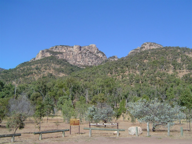
Photo source: ExploOz 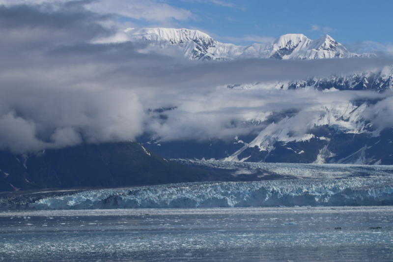
Photo source: Journeyz


