


Top 4 Highest Mountains In Haiti

Haiti is a Caribbean island off the coast of the Dominican Republic on the western side of Hispaniola. The island was a French colony until 1804 when the ... read more...Haitian people won the Haitian Revolution (1791-1804), becoming the New World's second independent republic. Haiti is currently recuperating from the devastating earthquake that struck the country in 2010. In this article, Toplist will bring you useful information about the 4 highest mountains of Haiti.
-
Pic la Selle is Haiti's tallest mountain, towering at 8,793 feet (2,240 meters). Mount Pic la Selle is part of Haiti's Chaîne de la Selle mountain range and is located in the department of Ouest. In the northwest, the land around the mountain is hilly, while in the southeast, it becomes more mountainous, with primarily savanna forest. Fond Parisien, which is around 10.06 miles (16.2 kilometers) distant and has a population of around 18,000 people, is also the nearest town to the peak.
It takes between 8 and 12 hours to travel round trip. If you've booked your guides the night before, you may leave Gros Cheval at 5 a.m., drive an hour into the forest, park the car, and begin your climb. Although the trail will be difficult in spots, there will be no rock climbing required. Using a guide is still strongly advised because the trail is frequently obscure or invisible.
The climb takes 3-6 hours, depending on your fitness level, and passes across a ridge and four smaller summits before reaching Pic la Selle proper. Those brave enough to take on the challenge will be rewarded with breathtaking views of the dramatic scenery of Hispaniola, including both Haiti and the Dominican Republic's Bahoruco mountain range.Location: Quest
Elevation: 2,240 m
Range: Haiti's Chaîne de la Selle mountain
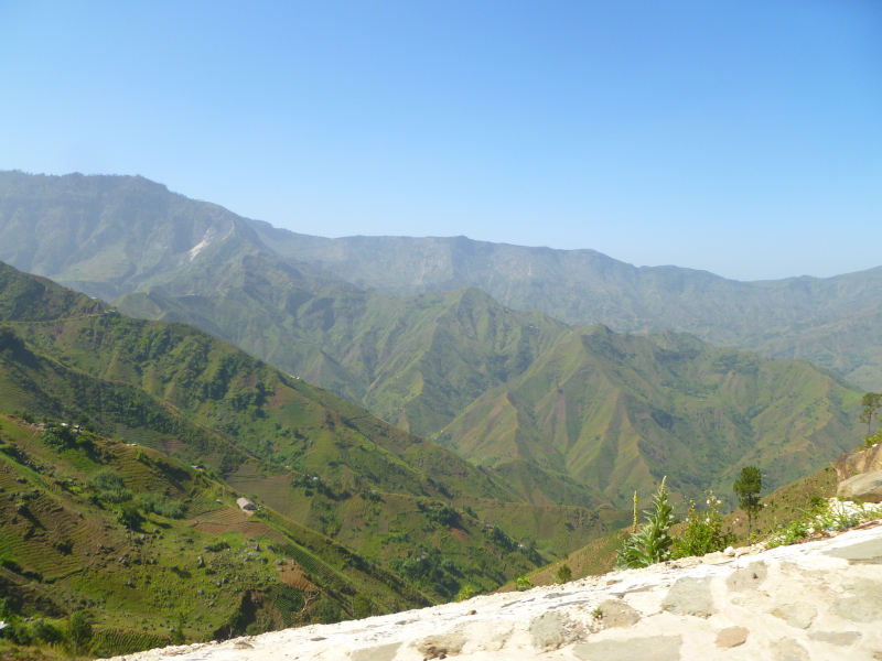
Photo source: Wikimedia Commons 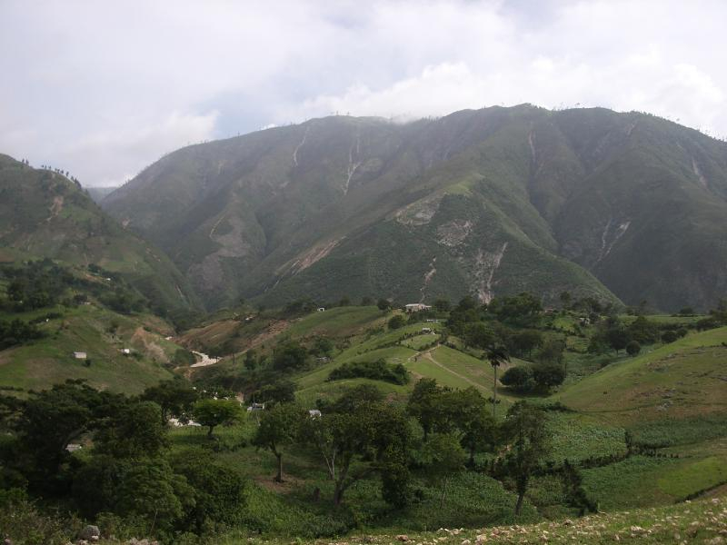
Photo source: wildernessphotographs -
With a height of 7,700 feet (2,347 meters), Macaya is Haiti's second tallest mountain. Mount Bois Pin lies 36 kilometers (22 miles) northwest of Les Cayes and 195 kilometers (121 miles) west of Port-au-Prince in Haiti's Sud department. It is part of the Massif de la Hotte mountain range. It's also part of the Pic Macaya National Park, which is one of Haiti's only five national parks.
The rich soil around the mountain supports extensive pine trees, serves as a source of water, and is home to a variety of rare species. It boasts a lot of biodiversity, including a lot of endemic species, and it's also where the endangered Black-capped Petrel breeds. Les Cayes, which is 22 miles (36 kilometers) distant and has a population of around 86,000 people, is the nearest town to the peak.
Location: Pic Macaya National Park
Elevation: 2,347 m
Range: the Massif de la Hotte mountain
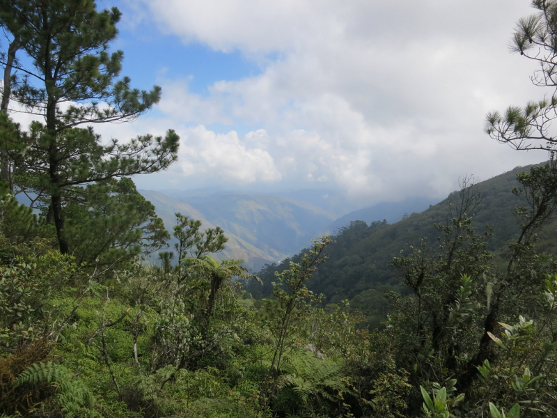
Photo source: flickr 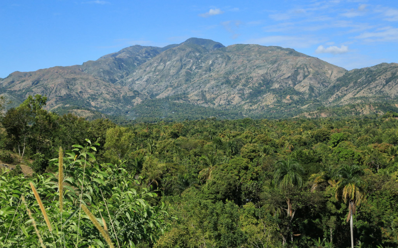
Photo source: flickr -
Morne Kadeneau (Morne Kadeneau) is a peak (class T - Hypsographic) in Haiti's Departement du Sud-Est (Sud-Est) with the Americas/Western Europe region font code. At 2,019 meters above sea level, it is the highest point in the area. With a height of 7,036 feet (2,144 meters), Mount Kadeneau is Haiti's fourth highest peak. Mount Kadeneau is part of the Massif de la Selle and is found in the Sud-Est department of France. The terrain surrounding the mountain is hilly in the northwest but mountainous in the southeast, with meadows growing near the mountain's base. Pétionville, roughly 12.36 miles (19.9 kilometers) distant, is the nearest settlement to the peak.
In DMS (Degrees Minutes Seconds), its coordinates are 18°21'0" N and 72°12'0" W, or 18.35 and -72.2. (in decimal degrees). YF93 is its UTM position, and NE18-08 is its Joint Operation Graphics reference. Morne Kadeneau's conventional time zone is UTC/GMT-5, but due to Daylight Saving Time (DST), the actual time zone is UTC/GMT-4.
Location: Haiti's Departement du Sud-Est
Elevation: 2,144 m
Range: the Massif de la Selle
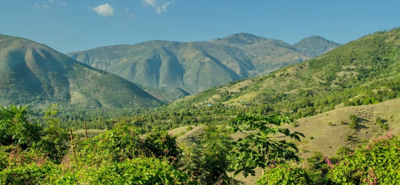
Photo source: PeakVisor 
Photo source: PeakVisor -
Morne Cabaio (Morne Cabao) is a mountain (class T - Hypsographic) in Haiti's Departement du Sud-Est (Sud-Est), with the Americas/Western Europe region font code. It stands at a height of 2,005 meters above sea level. Cabaio is Haiti's seventh tallest peak, towering at 6,768 feet (2,062 meters) above sea level. Mount Cabaio is part of the Massif de la Selle mountain range and is found in the Sud-Est department. In the northeast, the region surrounding the mountain is hilly, but more mountainous in the southwest, with savanna forest growing nearby. Pétionville, which is roughly 10.81 miles (17.4 kilometers) distant and has a population of around 376,000 people, is the nearest town to the peak.
In DMS (Degrees Minutes Seconds), its coordinates are 18°21'0" N and 72°16'0" W, or 18.35 and -72.2667. (in decimal degrees). YF83 is its UTM position, and NE18-08 is its Joint Operation Graphics reference.
Location: Haiti's Departement du Sud-Est
Elevation: 2,062 m
Range: the Massif de la Selle mountain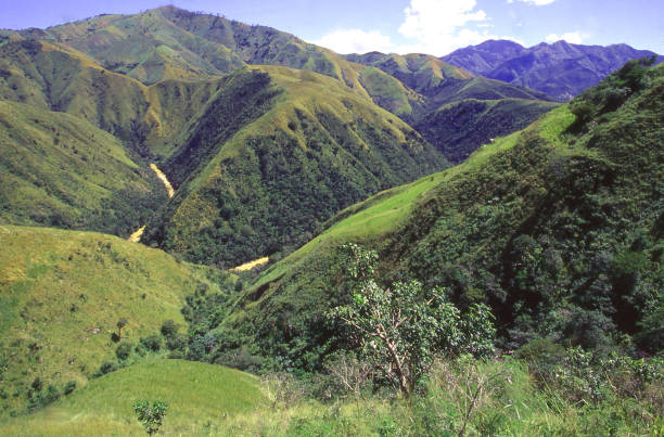
Photo source: iStock 
Photo source: PeakVisor


