


Top 10 Highest Mountains in Iceland

Iceland (Icelandic: sland) is a mountainous island country in the north Atlantic Ocean between Europe and North America. Despite not being a part of the ... read more...continental landmass, the nation is classified as European. Although glaciers occupy 10% of Iceland, the island enjoys a surprisingly moderate climate and a plethora of geothermal hotspots and hot springs. The native spelling ("sland") is also correct in English. Tipping is not practiced in Iceland, because driving off-road is forbidden and harmful to the environment.
-
The southern half of Vatnajökull is known as rfajökull, and it is here that you will discover Iceland's tallest peak, Hvannadalshnjkur, a pyramidal peak that stands 2,110 meters (6,920 feet) above sea level. rfajökull is an active volcano that has erupted twice in recorded history, in 1362 and 1727.
The first eruption was an explosive one that turned the surrounding area into a wasteland, from which the glacier got its name. The later eruption lasted a whole year and filled the air with ash, so there was no way to tell night from the day at the beginning stages of the eruption. Standing on top of Iceland’s highest peak is understandably an experience that many dreams of and luckily it does not require mountaineering experience. The hike does take 10-15 hours and is quite strenuous, so it does require potential climbers to be in the decent shape of mind and body. Several tour operators offer regular guided hikes to the peak.
Height: 2,110 meters (6,920 ft)
Location: Vatnajökull National Park, Iceland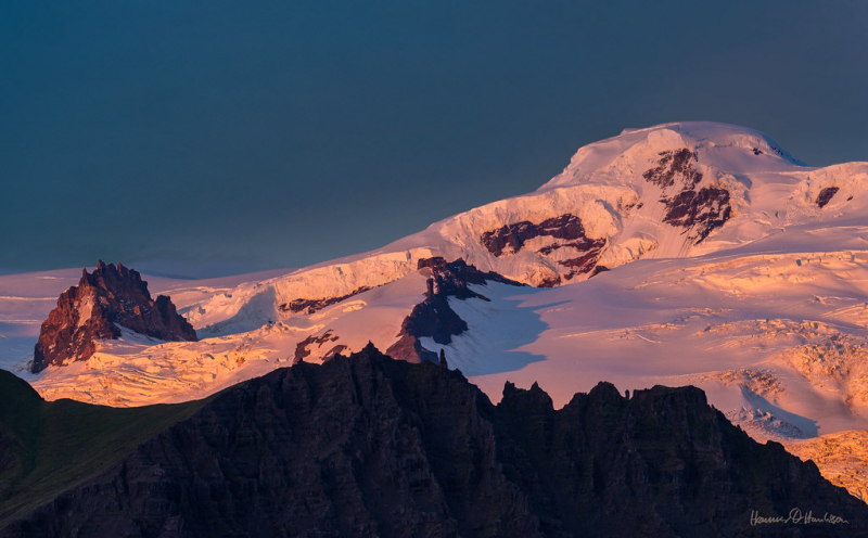
flickr.com 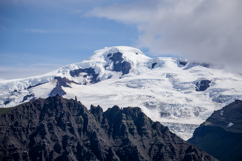
flickr.com -
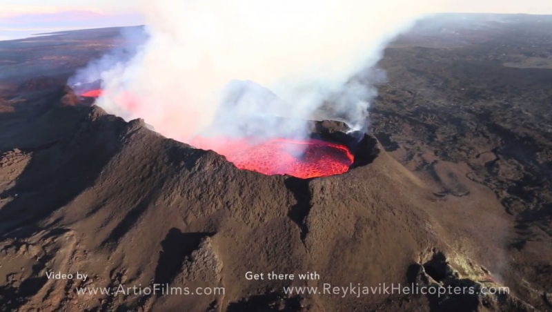
Last year, as word of volcanic activity spread over the world, you may have seen the name of Iceland's second-highest mountain in the headlines. Bárarbunga is a stratovolcano that stands 2,009 meters tall and is located beneath the northwestern section of the Vatnajökull glacier (6,591 feet).
The eruption began in August 2014 and lasted until February 2015, resulting in a lava field measuring 82 square kilometers (20 square miles). The region north of Bárarbunga has just reopened, however, the new lava field is restricted; seek information in Vatnajökul National Park for ideal viewing sites of the brand-new lava field.
Height: 2,009 meters (6,591 ft)
Location: Vatnajökull, Iceland
volcanodiscovery.com 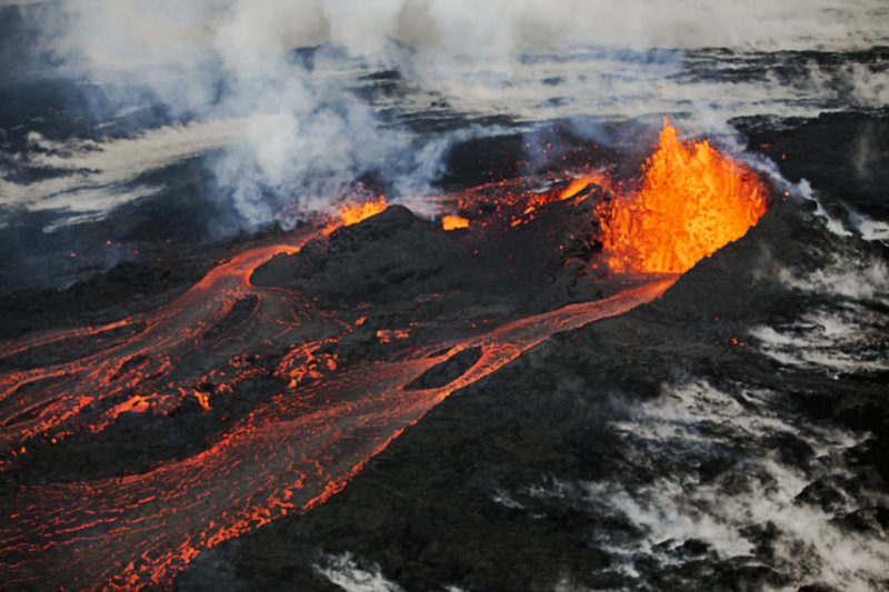
flickr.com -
The spectacular Kverkfjöll mountain range, located on the north-eastern boundary of Vatnajökull, reaches 1,920 meters (6,300 feet) at its highest point. A big hot lava chamber beneath the mountain has developed amazing glacier caves, but only enjoy them from the outside as they can collapse at any time and inflict catastrophic harm. There are various hiking trails in the distant Kverkfjöll region, which are only accessible from the north through a 4x4 vehicle and hence rather inaccessible, so once there, you actually feel as if you've discovered uncharted terrain. The surrounding region is one of the most active geothermal zones in Iceland.
Height: 1,920 meters (6,300 ft)
Location: Iceland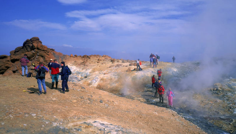
northiceland.is 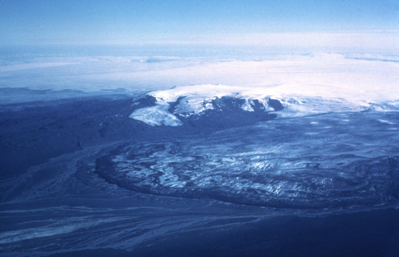
volcano.si.edu -
Snfellsjökull (Icelandic pronunciation: [stnaiflsjktl], snow-fell glacier) is a glacier-capped stratovolcano in western Iceland that is 700,000 years old. It is located on the western tip of Iceland's Snfellsnes peninsula. It may sometimes be visible from Reykjavik, 120 kilometers away, over Faxa Bay.
The mountain is one of Iceland's most renowned places, according to Jules Verne's novel Journey to the Core of the Earth (1864), in which the characters discover the opening to a passage heading to the center of the earth atop Snfellsjökull. Snfellsjökull National Park (Icelandic: jógarurinn Snfellsjökull) includes the peak.
On July 17, 1939, Snfellsjökull was visible from a great distance owing to an arctic mirage. Captain Robert Bartlett of the Effie M. Morrissey saw Snfellsjökull from a distance of 536 to 560 kilometers (335 to 350 miles). For the first time in recorded history, the summit was ice-free in August 2012.
Height: 1,833 meters (6,013 ft)
Location: Snæfellsnes peninsula, western Iceland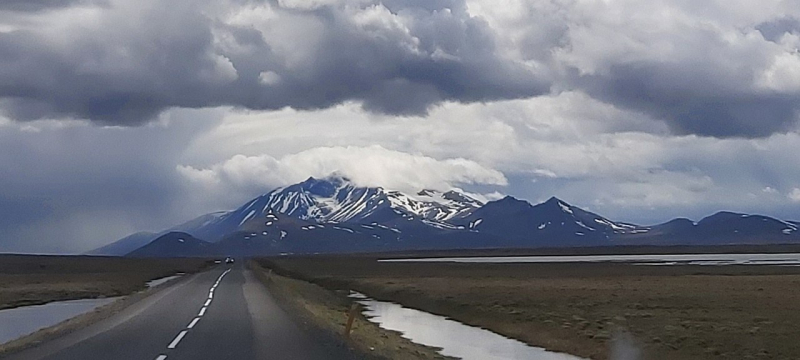
commons.wikimedia.org 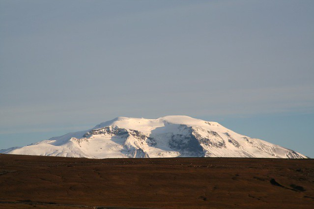
flickr.com -
Hofsjökull (Icelandic: "temple glacier," [hfsjktl]) is Iceland's third-biggest ice cap after Vatnajökull and Langjökull, as well as the country's greatest active volcano. It is located between Iceland's two major glaciers, west of the Highlands and north of the mountain range Kerlingarfjöll. It has a total size of 925 km2 and a peak elevation of 1,765 m (5,791 ft). A subglacial volcano is a shield volcano with a caldera.
Hofsjökull is the source of numerous rivers, including Iceland's longest, the Jórsá. In the southeast of Iceland, between Vatnajökull's easternmost glacier tongue (Axajökull) and rándarjökull, there is a smaller glacier (approximately 4 km2) known as Hofsjökull. In 2015, Hofsjökull rose in size for the first time in 20 years.
Height; 1,765 meters (5,791 ft)
Location: Southwestern Iceland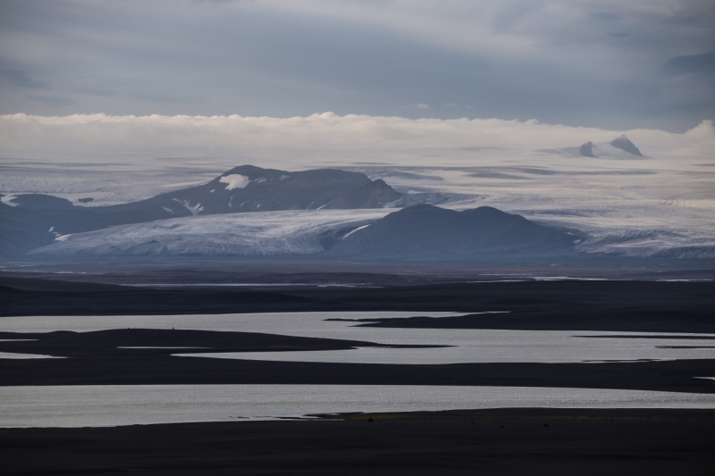
icelandmag.is 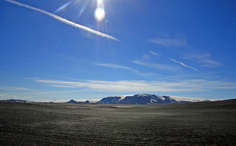
flickr.com -
The famous Herubrei, which rises 1,682 meters into the sky in the middle of an apparently desolate desert, is a notable flat-topped peak in the northeast highlands. On a clear day, the views from the summit are unrivaled, and you can see all the way to the ocean. Herubrei is a difficult climb due to the loose dirt, and the only entrance is from the northwest side, which is also quite steep. Herubreiarlindir, a green oasis in the desert, may be found at the roots. Many consider it a highland jewel, demonstrating that Iceland genuinely lives up to its moniker "country of extremes." Herubreiarlindir is said to have been home to one of Iceland's most renowned outlaws.
Height: 1,682 meters
Location: Eastern Iceland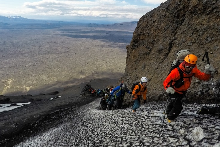
icelandmag.is 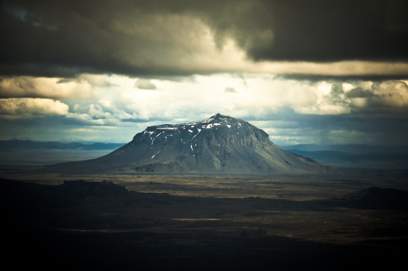
flickr.com -
Eirksjökull (Icelandic for "Eirk's glacier," [eiriksjktl]) is a glacier in Iceland with an extent of 22 km2 (8.5 sq mi) and a height of 1,675 m (5,495 ft), making it Iceland's largest table mountain. The lowest 350 m (1,150 ft) of a hyaloclastite (móberg) tuya created likely by a single subglacial volcanic activity is topped by a 750 m (2,460 ft) thick lava shield, rising almost 1,000 m (3,300 ft) above its surroundings. In terms of volcanic activity, it is presently inactive or extinct.
Until around 1700, the glacier was known as Baldjökull, and the present name was most likely influenced by the adjacent peak Eirksgnpa. Nothing is clear about Erik, but a story talks of an outlaw named Eirkur or Eirekur who escaped arrest by fleeing into the mountain.
Height: 1,675 metres (5,495 ft)
Location: Northwest of Langjökull in Iceland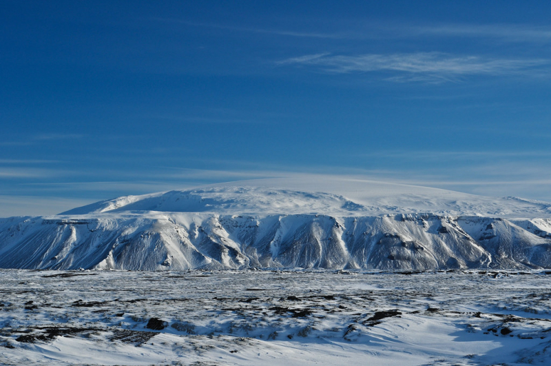
flickr.com 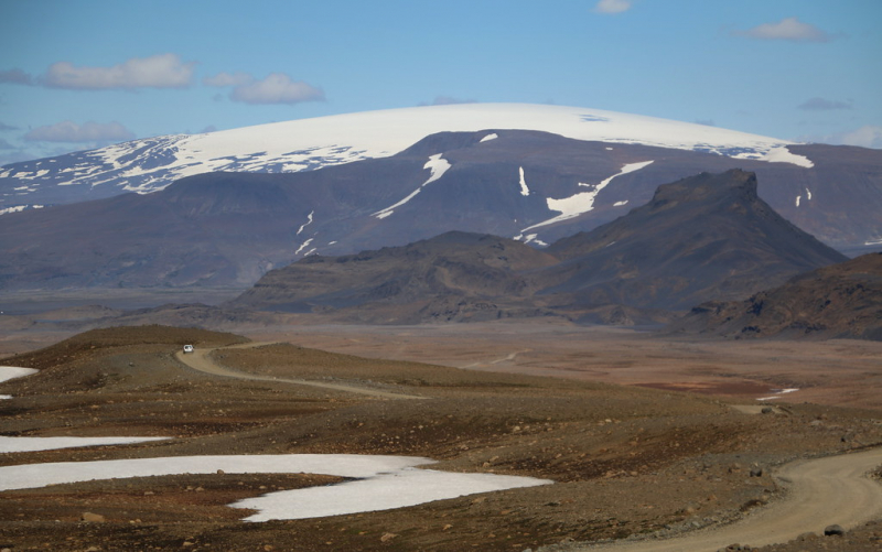
flickr.com -
Probably Iceland's most renowned glacier, whose name no one seems to be able to say right (and understandably so. Eyjafjallajökull gained international news in 2010 when a volcanic eruption sprayed a massive cloud of ash into the atmosphere, covering significant regions of Northern Europe and causing commercial aircraft to be grounded, affecting around ten million passengers. Eyjafjallajökull sits 1,666 meters tall and is readily visible from Iceland's ring road, a reminder of mankind's incapacity to forecast or manage nature's immense capabilities.
Height: 1,666 meters
Location: Suðurland, Iceland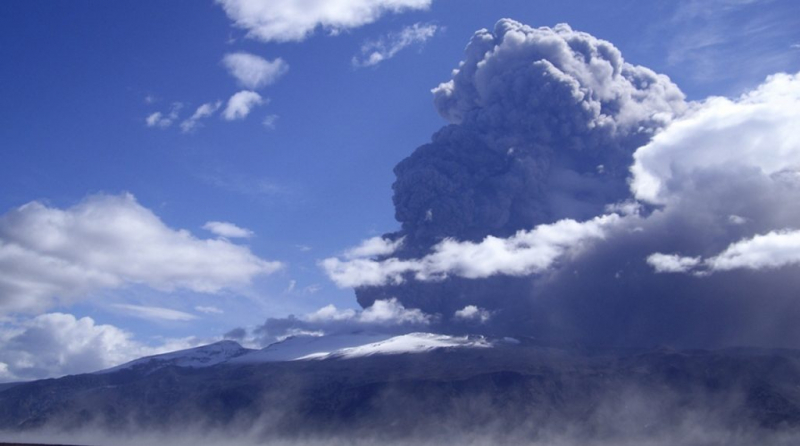
ncas.ac.uk 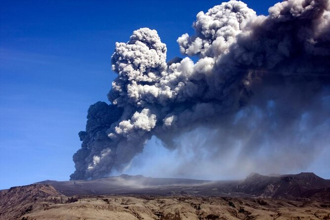
viator.com -
Tungnafellsjökull, Iceland's tenth highest mountain, is located northwest of the Vatnajökull glacier and rises 1,540 meters (5,036 feet). The trek to the peak, known as Háhyrna, is reasonably straightforward and offers spectacular views. The central volcano of Tungnafellsjökull has two calderas, one of which is filled with glaciers and the other with rhyolitic lava.
Two calderas may be found on the major volcano Tungnafellsjökull, which is located immediately northwest of the huge Vatnajökull icecap. The Tungnafellsjökull glacier fills one, while Pleistocene rhyolitic lavas are found in the second ice-free caldera to the southeast. The volcano is mostly Pleistocene in age, although postglacial flank cracks on the NE side have generated youthful basalts. This volcanic system includes the major volcano Hágöngur to the SW.
Height: 1,540 meters (5,036 ft)
Location: Northwest of Vatnajökull glacier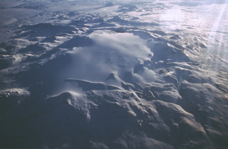
volcano.si.edu 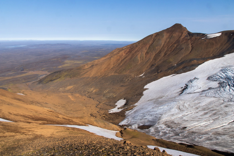
flickr.com -
Mount Kerling (Icelandic pronunciation: [ch(r)tlik], "Old Hag") is the tallest mountain (1538 m) in Iceland's District of Eyjafjararsveit. Its structure is primarily basaltic rock, although the topmost section is rhyolite, and it reaches all the way to the lower slopes of Mt. Vindheimajökull to the north of the valley Glerárdalur. On a clear day, it is considered an easy climb with spectacular panoramic views.
Kerling, the tallest peak in northern Iceland, is a mostly basalt rock mountain that rises to 1,538 meters (5,030 feet) at its top. There is no documented route to the summit, although it is not a tough trek. However, as always, make sure to dress appropriately. On a clear day, the view from the summit provides breathtaking panoramic vistas.
Height: 1,538 meters (5,030 ft)
Location: Northeast, Iceland
flickr.com 
gettyimages.ae


