


Top 3 Highest Mountains in Iowa

Within the state of Iowa, there are numerous mountains, peaks, and hills. Toplist will expose you to the tallest mountains in Iowa in this post. Now, without ... read more...further ado, have a look at our list!
-
Hawkeye Point, at 1,670 feet, is Iowa's highest natural point (510 m). It is located on the eastern side of SR 60, roughly 4.5 miles (7.2 kilometers) north of Sibley and 3.5 miles (5.6 kilometers) south of the Iowa-Minnesota state line. An ancient silo is 100 feet (30 meters) south of the high ground.
The area that comprises the highpoint was granted to Osceola County by the Sterler family, who had managed the site for decades and had stipulated that it be made into a park. The ancient hog feed bunker at the highpoint site, as well as a few small barns, were dismantled by Osceola County's Economic Development Commission and Hawkeye Point Committee because they were judged harmful to public safety. They've built an information kiosk that showcases the family and the county, as well as a display of license plates from all 50 states that have been handed in to the Sterlers over the years.
The county bought around 6 acres (2.4 ha) of neighboring land, which includes the original family farm home, which is now utilized as office space for the county. A flagpole, picnic seat, tile mosaic, many granite monuments, and five tall poles with placards pointing to the other 49 state highpoints, each with the precise distance stated, are among the amenities. This project benefited greatly from the efforts of the local 4-H club and high school students. The Hawkeye Point Commission also recently bought a 7-acre (28,000-m2) forested tract of land on the north side of the county road that runs beside the property with the intention of turning it into a campsite.
The Hawkeye Point restorations were funded in part by the Highpointers Foundation, a non-profit organization dedicated to preserving privately held state highpoints.
County: Osceola
Elevation: 1670 ft
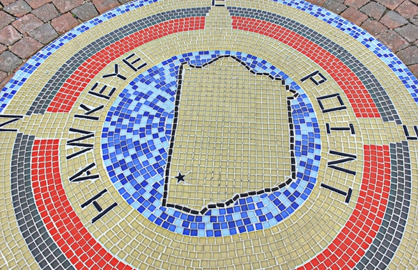
Photo: All-free-download.com 
Photo: The Mountaineers -
Few natural objects in Iowa have sparked as much interest as the Ocheyedan Mound in northwest Iowa's lakes region. The Mound, located about southeast of the village of Ocheyedan, rises 170 feet above the surrounding flood plain. It is one of Iowa's highest points, standing at 1655 feet above sea level, only 15 feet lower than Hawkeye Point, the state's highest point. The Mound is about two miles south of Highway 9 and is easily accessible to visitors through a concrete and blacktop road.
The Ocheyedan Mound is one of the most picturesque hills in the state's northwest, with its form visible for kilometers in all directions. Rolling hills characterize the region around the Ocheyedan River flood valley. Some are in groups, each with a unique layout. Others are fairly isolated, with the Mound being the most obvious example.
The Mound's general trend is northeast and southwest. It is barely about a third of a mile long at its longest. Its small top is only a few yards broad at places.The Mound was long assumed to be an Indian burial place. When geologists examined, they discovered that it was a kame of glacial origin. Kames are stratified drift hills and ridges deposited by glaciers near the mouths of ice tunnels or ice channels, as well as at ice angles. The Mound was constructed roughly 13,000 years ago with the retreat of the Wisconsin ice sheet, the last glacier to enter Iowa. The Mound's composition is primarily sand and gravel, with tiny boulders of varying sizes and rocks of diverse sorts. Granites, Sioux quartzite, and limestone are all available.
Local people should cherish the esthetic worth of such beautiful and intriguing geological occurrences as the Ocheyedan Mound, and every effort should be taken to avoid their destruction. Already, the Ocheyedan Mound has been tainted by the removal of sand and stones from its peak for commercial uses. To be sure, the Mound is important for the many tons of material that could be extracted from it, but it is far more valuable to the state as a beauty place, a monument that should be preserved for future generations with the same enthusiasm that they should preserve their material treasures.
It's unclear where the name Ocheyedan comes from. Acheya and Akicheya, both meaning to weep for a deceased relative, appeared in an early Dacotah (Sioux) dictionary produced in 1852. The Indians of the region used them to honor two Indian lads who were slain here by a group of tribe foes. Acheya (called Ocheyedan by European settlers) is a place of grief. Nobles County's (Minnesota) biggest lake was known as Ocheyeda. The town in Osceola County was renamed "Ocheyedan" when a "n" was added.
According to legend, the Indians utilized the Mound as an observation point and a place of grief. It was utilized as a guide through the plains by white men, and it is now popular for picnics, steak fries, fireworks displays, and winter sliding, toboggan parties, and skiing.
The Burlington, Cedar Rapids and Northern Railroad, today known as the Chicago, Rock Island and Pacific, passed through Osceola County in the summer of 1884. The arrival of the railroad was a big deal on the prairie and in this sparsely inhabited region—one of the last in Iowa to be colonized.In the fall of 1884, construction efforts began, and the prairie town of Ocheyedan was a hive of activity, with every available person engaged in some form of labor. The first structure built on the town site was a shanty, also known as a shack. That year, the post office was relocated to the town site from Rush Lake, where it had resided since 1875. Rush Lake, located a mile northeast of town, is well-known for its superb waterfowl hunting.
Ocheyedan, like many tiny Iowa communities, has seen its population decline over the years. It today has a population of just 545 people, but it has been recognized by the state betterment committee for several initiatives of improvement in business, housing, retirement, recreation, churches, schools, and other fields.
The Tracy House Museum, also in Ocheyedan, houses objects contributed by the community that predate 1902. Dishes, a table, and a Bible from the Congregational Church are among the goods. The Osceola County Historical Society got interested in saving the home in 1976. Aside from the home, there is a steel structure that houses vintage farming instruments, ancient office machinery, county documents, books, pictures, and trophies.The Ocheyedan Pits Recreation Area is two miles south of Ocheyedan and has a picnic shelter, bathrooms, water, camping, fishing, swimming, and nature paths on its 33-acre property. Electricity, drinking water, pit toilets, picnics, hiking, fishing, and swimming are all available at the park.
The Willow Creek Wildlife Management Area, located 5 miles west of Ocheyedan on Highway 9, is home to the Osceola County Conservation office. There's a resort, a nature center, and a classroom here. A 3.5-acre lake, natural and restored grassland, and chances for fishing, hunting, hiking, birdwatching, nature research, and photography are all available in the vicinity. For varied events, the lodge can accommodate up to 55 persons.
County: Osceola
Elevation: 1,655 ft
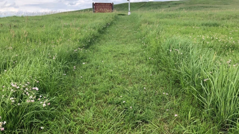
Photo: www.iowaadventurer.com 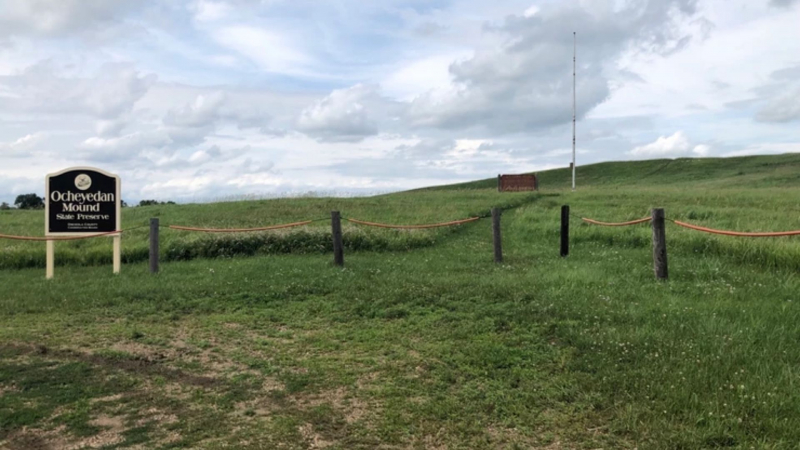
Photo: www.iowaadventurer.com -
With an elevation of 1469.82 feet, Pikes Point is one of Iowa's tallest mountains. Zebulon Pike, an American adventurer, is commemorated by the mountain's name (though he was unable to reach the summit). The summit is higher than any point east of its longitude in the United States.
Pikes Peak or Pikes Point is thought to have formed around 50 million years ago. The mountain was produced by years of molten rock erosion; yet, it is not classified as a volcano.The mountain has its own weather at all times, and honestly, when you're the biggest thing for kilometers, you can do whatever you want! It will occasionally snow in July, or it will be gorgeous and sunny when it is snowing in town.
Pikes Point State Park was established in 1931. By March 17, 1934, Civilian Conservation Corps (CCC) Company 778 had completed the shelter, steps, paths, plantings, and footings for the latrine. Gull Point State Park took over management of the park in 1936. It's a little park on a spit of land jutting out into West Okoboji Lake. It has picnic areas, a National Register of Historic Places-listed shelter, a playground, a swimming beach, boating, and fishing on the lake.
County: Dickinson
Elevation: 1469.82 ft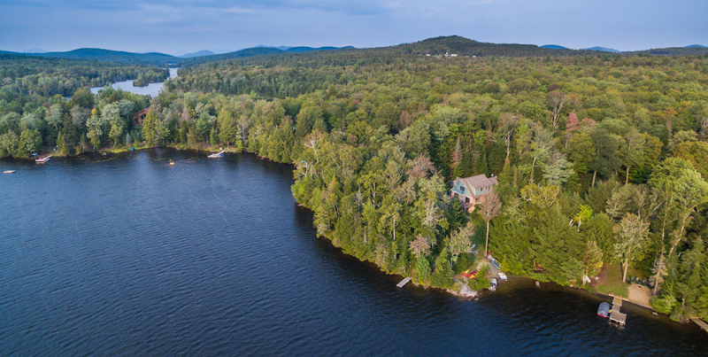
Photo: vacationadirondacks.com 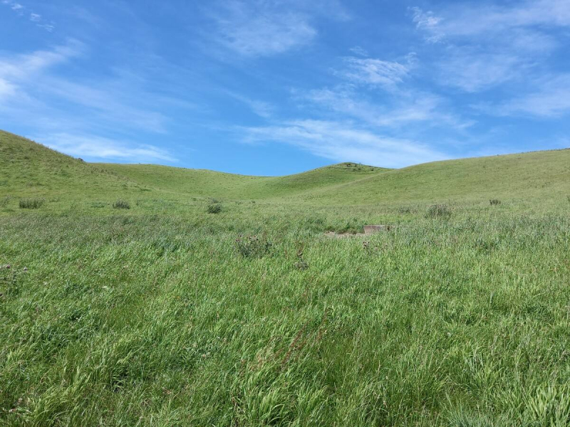
Photo: OneRoof


