


Top 7 Highest Mountains In Italy

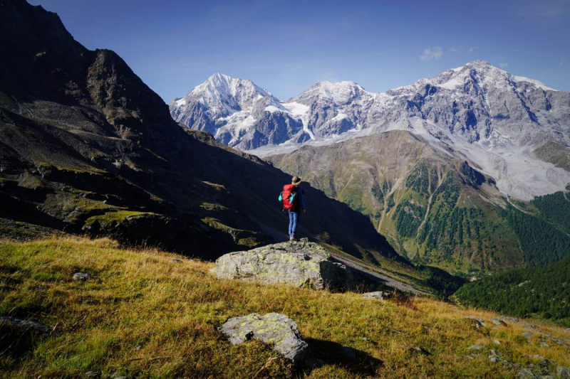
Many of the Italian Alps' highest peaks are found in well-known mountain massifs like the Mont Blanc and the Monte Rosa. They are not the highest peaks in the ... read more...massifs because the main summits are located across the border in Switzerland or France, but they are only slightly smaller and reach impressive heights of over 4,000 meters. The 4,748-meter-high Monte Bianco di Courmayeur would thus be Italy's highest peak. The following list will focus on the seven highest independent mountains or main summits in Italy.
-
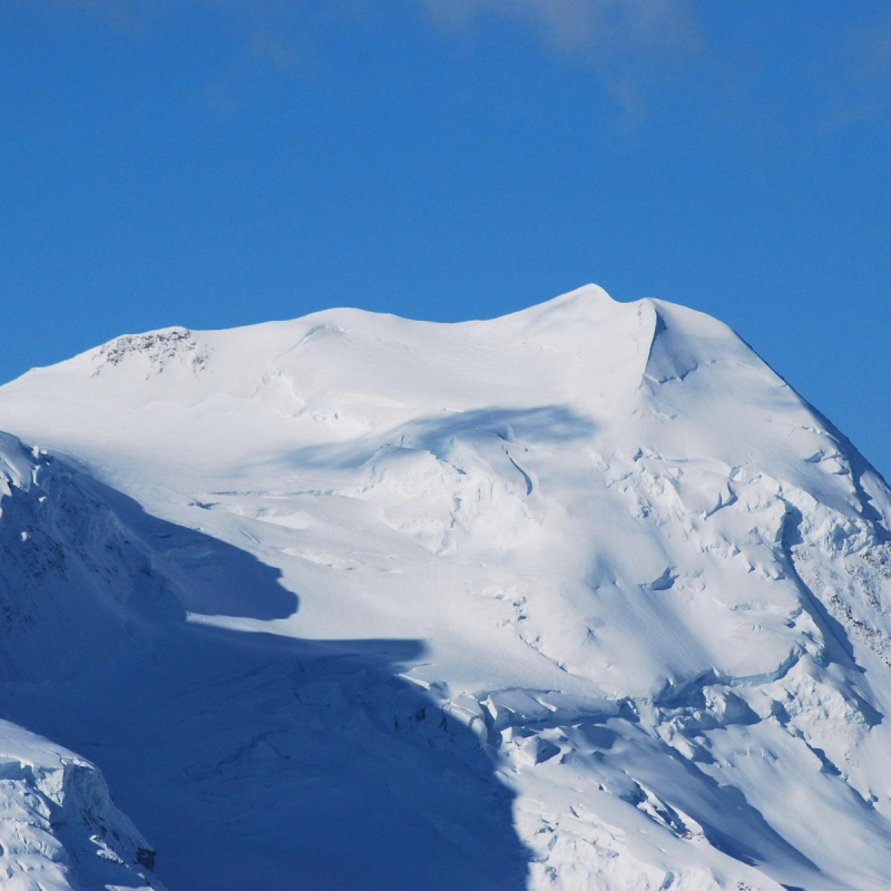
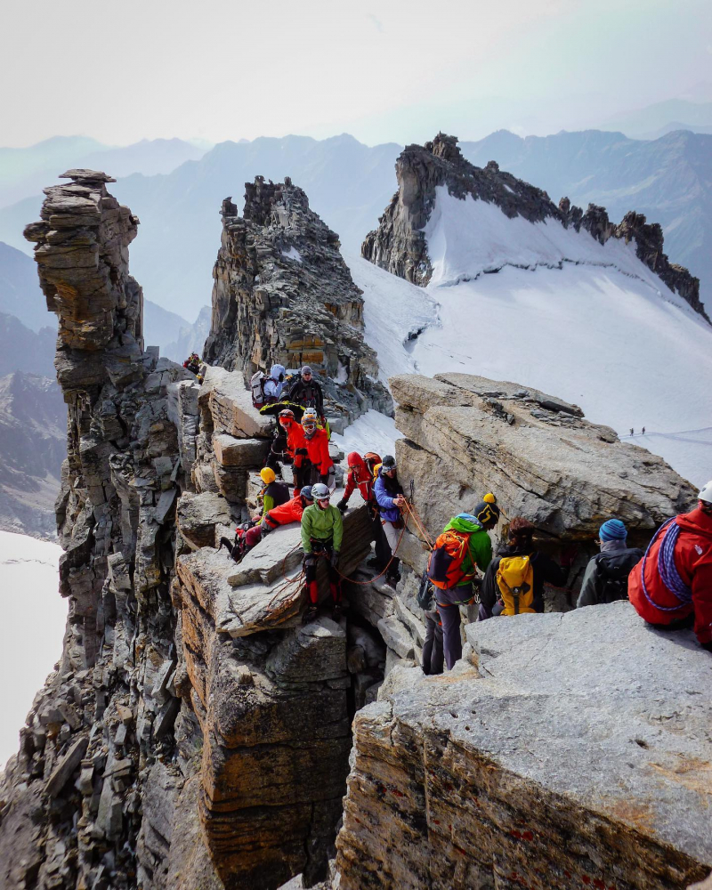
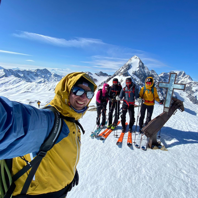
With a height of 4,223 meters, Castor is one of the highest mountains in the world. The highest mountain in Italy is Castor, which is located in the Valais Alps. Pollux, its slightly lower twin peak, lies to the west but is already in Swiss territory. The names are inspired by Greek mythology, and they refer to Zeus' twins and sons. The Zwillingsjoch pass connects the two mountains. The long and narrow south-eastern ridge defines the snow-covered, triangular mountain. The Breithorn to the west and the Lyskamm to the east surround Castor.
The Felikjoch and the long and narrow southeast ridge are used to ascend from the alpine hut Capanna Quintino Sella on the Italian side. Ascents begin on the Swiss side at Klein Matterhorn and continue through the Italian glacier Grand Glacier of Verra and the mountain's west flank. On August 23, 1861, the first ascent was made.
Elevation: 4,223 mLocation: Pennine Alps, border between Valais, Switzerland and the Aosta Valley in Italy
https://www.tripadvisor.com/ 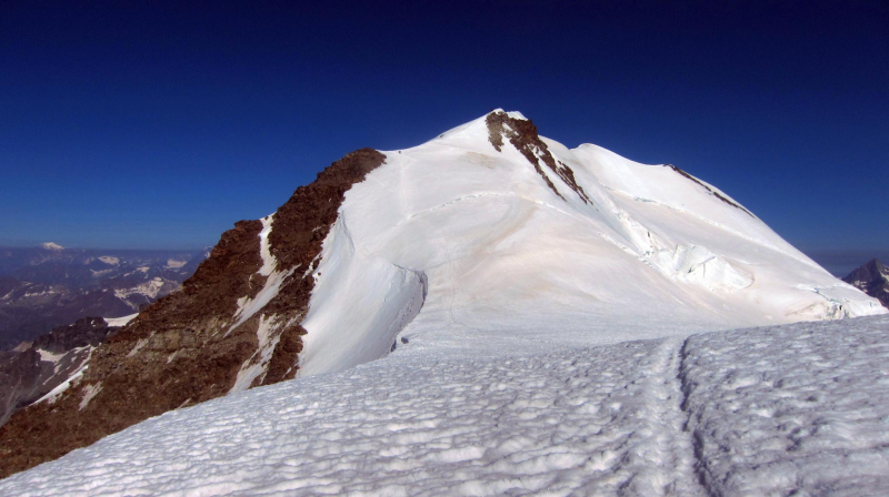
https://www.outdooractive.com/ -
The 4,171 meters high Dent d'Hérens, which lies in the shadow of the Matterhorn in the Valais Alps, has a narrow, snow-covered peak. Its summit is bisected by the Italian-Swiss border. The Dent d'Hérens offers difficult ascent routes with rock climbing passages, but due to its difficult access location, it is relatively unvisited. The Tiefmatten glacier is located on the northern side of the mountain, while the south side is characterized by rocky ridges, with the east ridge being one of the longest in the Alps.
On August 12, 1863, Florence Crauford Grove, William Edward Hall, Reginald Somerled Macdonald, Montagu Woodmass, Melchior Anderegg, Jean-Pierre Cachat, and Peter Perren made the first ascent of the mountain.
The name of the mountain comes from the Val d'Hérens, a valley to the north. The Dent Blanche was most likely the original name, which is now shared by the nearby Dent Blanche, which overlooks the Val d'Hérens. The Dent d'Hérens was given the name because cartographers usually made their observations far away from the more remote areas, and also because the Dent Blanche is sometimes hidden behind the Dent d'Hérens, making it less visible. The Dent d'Hérens was known as the Dent Blanche by residents of the lower Val d'Hérens, but the Dent de Rong or the Dent d'Erins by residents of the upper Val d'Hérens, adding to the confusion. Since the completion of the Dufour map in 1862, the names used today have been the official ones.Elevation: 4,171 m
Location: Pennine Alps, border between Italy and Switzerland
https://www.instagram.com/ale_sesa/ 
https://www.instagram.com/withthebets/ -
The Gran Paradiso, at 4,061 meters, is the highest mountain in the Graian Alps, located eight kilometers south of the Grivola. It is also the highest mountain in Italy that is entirely on Italian soil. Sharp peaks, narrow ridges, and deep valleys characterize the mountain range. The view from the top is unrivaled. You can see as far as Mont Blanc, Grand Combin, and Monte Viso on a clear day.
Gran Paradiso is part of the Gran Paradiso National Park in Italy, which is named after the mountain. The Vanoise National Park continues the park on the French side of the border. Almost the entire route to the ridge is graded F+, with the last few dozen meters to the Virgin Mary summit requiring grade I UIAA rock climbing with significant exposure, while access to the proper main summit requires 15 minutes of grade II UIAA climbing. Novice alpinists flock to the Gran Paradiso, and many of them only make it to the Madonna summit. Gran Paradiso has a steep snow/ice North West Face that can be climbed at AD+ from the Refuge Frédéric Chabod, in addition to the main summit routes.Elevation: 4,061 m
Location: Piedmont (Metropolitan City of Turin) and Aosta Valley, Italy
https://www.instagram.com/nadiaclimbs/ 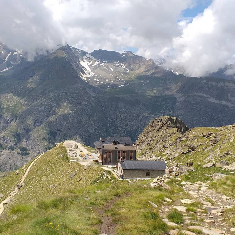
https://www.instagram.com/adventure.dreamers/ -
Grivola, a perfectly shaped stone pyramid, is the second-highest mountain in the Graian Alps and the fourth highest in Italy, standing at 3,969 meters. The Grivola, in the Aosta Valley, is surrounded by glaciers and is part of the Gran Paradiso National Park.
The Valsavarenche valley is to the west, and the Cogne valley is to the northeast, so the Grivola's distinctive peak can be seen from many directions. Alpine tours are popular in the area surrounding the mountain. Because it is made up of orthogneiss, the north face of the mountain is ideal for friction climbing. Pic de Cogne, Grivolet, Bec de Grivola, and Aiguille de Grivola were all names given to Grivola in the past.
The first appearance of "Grivola" was in 1845. It comes from Valdôtain Griva, which means song thrush, according to Giuseppe Giacosa. As for Jungfrau, Joseph-Marie Henry suggested Grivoline, a lovely young lady. According to Paul-Louis Rousset, the origin is Gri in Valgrisenche Valdôtain, which means "loose stones".
Elevation: 3,969 m
Location: Graian Alps, between the Valsavarenche and the Cogne Valley, Italy
https://www.instagram.com/alfmajo/ 
https://www.instagram.com/giorgio.pia/ -
Ortler, at 3,905 meters, is South Tyrol's highest mountain and the Ortler Alps' main peak. It is also known as "King Ortler" because of its majestic appearance. It was the first mountain to be climbed in 1804 and is considered to be one of the most significant mountains in alpine history. The mountain is distinguished by three prominent ridges. The ascent to the heavily glaciated mountain's summit is a strenuous high-altitude trek. The north face of Ortler is also well-known for having the Eastern Alps' longest ice route, which is considered extremely difficult to climb. The view from the summit reaches as far as the Bernina Range and the Dolomites on a clear day. During World War I, the Ortler also played a significant role. The Ortler Front was the highest gun emplacement in the Alps at the time.
The massive mountain has a long north ridge that ends at the village of Gomagoi and separates the Trafoi and Sulden valleys. It is capped by a glacier on the northwest flank and has a long north ridge that ends at the village of Gomagoi. The Hochjoch is located on the main ridge of the Ortler Alps, which forms the border between the provinces of Sondrio and South Tyrol. The Thurwieserspitze and Trafoier Wall are to the west of this main ridge, while the Monte Zebrù and the majestic Königspitze are to the southeast. The impressive lineup of Königspitze, Zebru, and Ortler is known as "das Dreigestirn" from nearby mountains in the northeast (the three heavenly bodies).
Elevation: 3,905 m
Location: South Tyrol, Italy
https://www.moonhoneytravel.com/ 
https://www.moonhoneytravel.com/ -
The three even peaks of the elegantly looking, glaciated Piz Palü rise to a height of 3,900 meters on the border between Italy and Switzerland. The mountain is part of the Bernina Range in the Central Eastern Alps and is located to the east of Piz Bernina. Many alpinists are captivated by Piz Palü's three pillars and imposing north face. Not only are alpine tours to Piz Palü's summit popular, but the great view of the mountain from the Diavolezza ski resort is as well. Many people may be familiar with the mountain's name even if they have never visited it because it was the setting for Arnold Fanck's famous 1929 mountain film "The White Hell of Pitz Palu," starring Leni Riefenstahl.
Oswald Heer, Peter, and M. Flury, and Johann Madutz and Gian Marchet Colani, with guides Johann Madutz and Gian Marchet Colani, climbed the 3,882 m east peak on August 12, 1835, believing it to be the highest summit of the mountain. This is still the most common route from Switzerland, with an easy traverse to the central peak as a bonus. On July 24, 1864, Edward N. Buxton, W.F. Digby, William Edward Hall, J. Johnston, and Montagu Woodmass made a second ascent of the east summit with Pontresina guides Peter Jenny, Alexander Flury, and J. B. Walther. This group had no knowledge of the ascent nearly 30 years prior and thought they had reached the highest peak.
Elevation: 3,900
Location: Graubünden, Switzerland - Lombardy, Italy
https://www.instagram.com/michaelbuechi/ 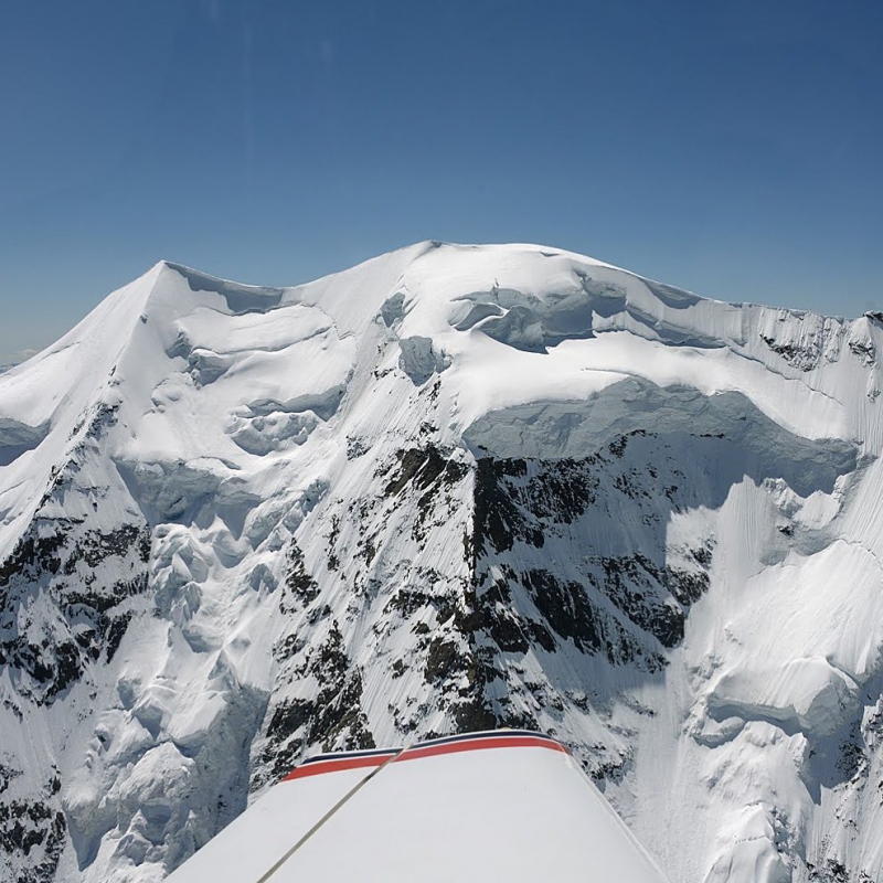
https://www.instagram.com/hopffpaul/ -
The Königspitze, or Gran Zebrù in Italian, stands at 3,851 meters and is Italy's second-highest peak in the Ortler Alps and seventh-highest overall. The mountain is located on the border of Lombardy and South Tyrol. Because of its distinctive shape, the Königspitze is particularly striking. It is heavily glaciated and made up of dolomite rock.
It is well-known among alpinists for its north face, but it was also strategically important during World War I. Barracks were discovered just below the summit in 2015.
On August 3, 1854, the mountain was first climbed. In warm weather, when the snow and ice become unstable, the mountain can be dangerous. On August 5, 1997, the mountain's worst day for climbing fatalities occurred, when seven people were killed in two separate incidents. Six people were killed on June 23, 2013, in two separate incidents. In March of this year, three skiers were killed in an avalanche.
Elevation: 3,851 m
Location: Province of Sondrio, Ortler Alps, Italy
https://www.instagram.com/hdominik09/ 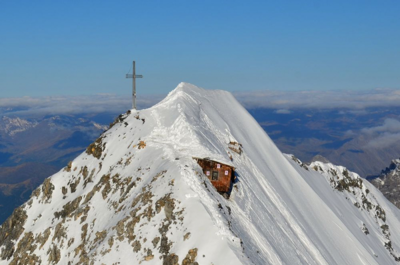
https://www.ortlerfront.org/


