


Top 5 Highest Mountains in Norway
Norway's spectacular glaciers and fjords attract visitors from all over the world. The true stars, though, are the mountains. The spectacular chain known as ... read more...the Scandinavian mountains serves as Norway's spine. Much of Norway's stunning landscape can be attributed to the Scandinavian mountains. The tallest mountains in Norway are listed below.
-
Galdhøpiggen is not just Norway's tallest peak, but also the highest in Scandinavia. Despite reaching a height of 2,469 meters (8,100 feet) above sea level, it is considerably more approachable than you might think.
The view from the summit of Jotunheimen over glaciers and hundreds of other rocky peaks is simply breathtaking. Due to geographical oddities, travelers can reach the mountain lodge Juvasshytta in Jotunheimen National Park by road. That implies the hike's starting point is 1,850 meters above sea level.The climb from Juvasshytta takes only three hours. This includes a glacier crossing, which must be done with the assistance of an expert guide. A glacier-free alternate trail takes around four hours to the summit, but it's faster on the way down! This trip begins in the Visdalen mountain lodge Spiterstulen.
A modest lodge has been constructed on the peak. During the summer, soft drinks, chocolate bars, postcards, and other products are sold here. Previously, the Norwegian Postal Authority had a tiny post office here, which was the tallest in Northern Europe.
MORE INFORMATION:
Elevation: 2,469 m
Location: Galdhøpiggen, Norway
Galdhøpiggen (photo: https://jotunheimen.com/) 
Galdhøpiggen (photo: ut.no) -
Glittertind is ranked second, just below its neighbor Galdhøpiggen. Glittertind's summit is 2,452 meters (8,045 feet) above sea level, which means it loses out on the award by only four meters!
For a long time, the mountain was thought to be Norway's highest since the glacier atop it raised it over Galdhøpiggen. The glacier was the subject of heated debate. However, in recent decades, the glacier has receded to the point that there is no longer any dispute.
Glittertind is easily accessible from Spiterstulen lodge in the west by a 1300 m climb, and from Glitterheim lodge in the east via a 1000 m ascent. The hike from Glitterheim is the easiest of the two, however, Glitterheim is located within the National Park and can only be reached on foot.
The route across the glacier that crowns the top is free of crevasses, however, it may be a soggy climb across the melting snow that covers the ice on a hot summer day. The vista is breathtaking. Because there are few high peaks east and southeast of Glittertind, most of the northern and eastern sections of the province of Oppland may be seen. All of Glittertind's renowned images were taken on the eastern edge, slightly below the peak.MORE INFORMATION:
Elevation: 2,452 m
Location: Glittertind, Norway
Glittertind (photo: http://matsolsson.net/) 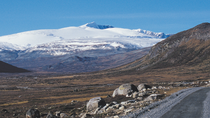
Glittertind (photo: https://www.randsverk.no/) -
Store Skagasølstind, Norway's third-highest peak, is located at the westernmost end of Jotunheimen. The 2,405-meter (7,890-foot) peak is part of Jotunheimen's Hurrungane range. Sir William Cecil Slingsby, a British adventurer and climber, was the first to scale it in 1876. It is also the highest peak in the Hurrungane group, Norway's highest alpine mountains, which offer several other beautiful climbs.
While the summit is a popular mountaineering challenge, it is a pretty demanding ascent. It's undeniably more difficult than the country's two highest peaks.
The trailhead, Turtagro Hotel, is located 12 kilometers east of the northeast end of Norway's longest fjord, Sognefjorden.
Sogndal Airport is 70 kilometers west of Turtagro. Alternatively, you can drive or take a bus from Oslo, which is approximately 400 kilometers away.July, August, and the first few weeks of September. The difficult part of the climb Store Skagasølstind is hidden by snow and ice for the remainder of the year.
MORE INFORMATION:
Elevation: 2,452 m
Location: 2,405, Norway
Store Skagasølstind (photo: https://blog.norrona.com/) 
Store Skagasølstind (photo: https://www.tinderangel.no/) -
Store Styggedalstind is Norway's fourth-highest peak, located within the Hurrungane mountains, which are part of the Jotunheimen mountain range. It is 2,387 meters (7,831 ft) above sea level. The mountain is located in the municipality of Luster in the county of Vestland, Norway. This peak is located right between Sentraltind and Jervvasstind.
The first element of the name Store Styggedalstind is the genitive form of Styggedalen, while the last element is tind, which means "mountain top." The valley's name is a combination of stygg, which means "ugly" or "bad," and the finite form of dal, which means "dale" or "valley."
The ascent is moderately difficult. In descending order of complexity, there are three options:
- Climb up Jervvasstind (Norway's 12th highest peak) from Skogadalsben
- Cross the Jervvassbreen glacier and begin climbing from there
- Climb all of the summits from Store Skagasølstind to the summit—the Styggedal traverse
MORE INFORMATION:
Elevation: 2,387 m
Location: Store Styggedalstind, Norway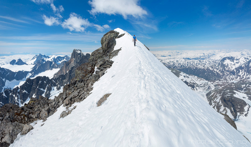
Store Styggedalstind (photo: https://www.frittfallfoto.no/) 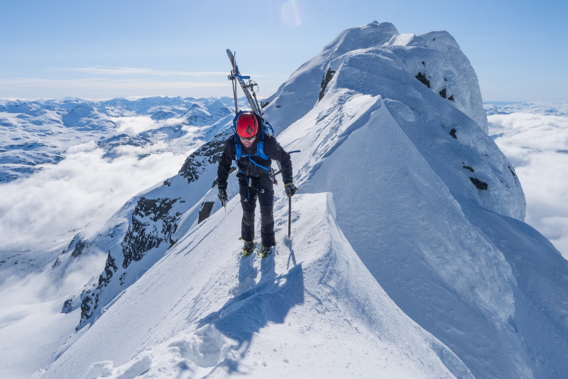
Store Styggedalstind (photo: http://joikapride.blogspot.com/) -
Skarstind is a significant portion of the Galdhpiggen mountain range in northeastern Jotunheimen, Norway, and the country's fifth-highest summit. The mountain has three summits and the main summit is 2,373 meters above sea level. It is located on the eastern side of the Leirdalen valley in the municipality of Lom (in Innlandet), and the peak can be seen from the road that runs along the valley floor.
If conditions are favorable and there is little snow on the talus slopes on the southwest face, the summit can be reached without using any equipment. The usual ascent begins at Leirdalen and ascends to Dummhe, a short but strong 1000-meter climb. There is a trail formed by sheep and goats that are utilized by mountaineers up to around 1500 meters, but from there, one must follow the ridge up to Dummhe, which is more of a little plain than a mountain. The plain is followed up to the peak of Western Skarstind, from whence the rugged west wall of the main summit can be seen.
Given the mountain's high ranking among Norwegian summits, Skarstind is extremely popular; peak baggers climb the mountain on most days during the short summer season, but the summit is rarely crowded. A winter ascent is only for the most experienced climbers.
MORE INFORMATION:
Elevation: 2,387 m
Location: Store Styggedalstind, Norway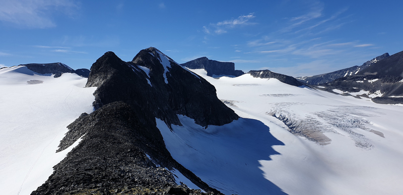
Skarstind (photo: https://peakbook.org/) 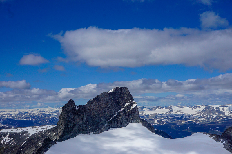
Skarstind (photo: https://peakbook.org/)


