


Top 7 Highest Mountains in Russia

Russia has approximately 20 mountain ranges. According to some sources, it has about 1,000 mountain peaks on its vast territory, but according to others, the ... read more...total number of mountain peaks exceeds 2,000. In fact, providing precise figures is extremely difficult. In today's article, Toplist will tell you about the 7 highest mountains in Russia.
-
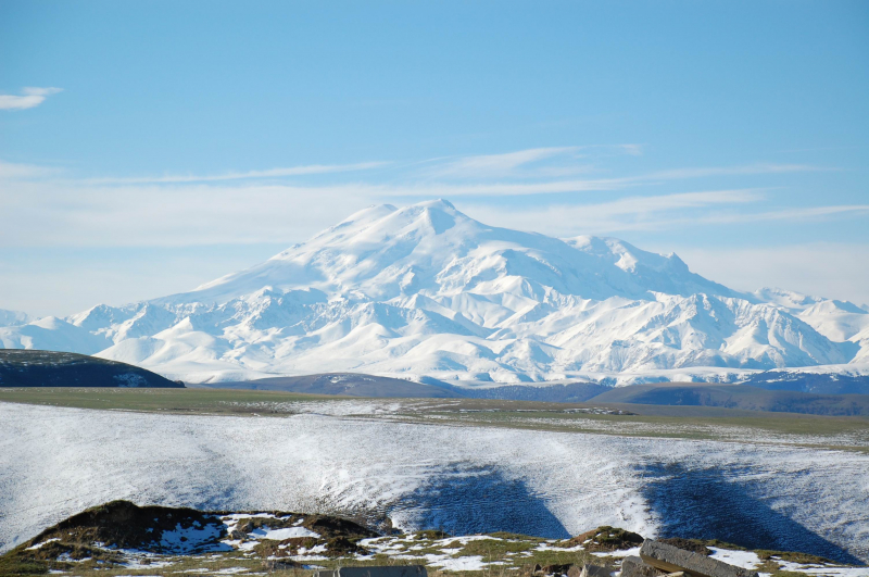
The first one in Top 7 Highest Mountains in Russia that Toplist would like to introduce to you is Mount Elbrus. Mount Elbrus is Russia's and Europe's highest and most visible peak. It is the highest peak in the Caucasus Mountains and is located in the western part of the Caucasus. The dormant volcano rises 5,642 m (18,510 ft) above sea level, making it Eurasia's highest stratovolcano and the world's tenth-most prominent peak. The mountain is located in the Russian republic of Kabardino-Balkaria in southern Russia.
Elbrus has two summits that are both dormant volcanic domes. The western summit is 5,642 metres (18,510 feet) taller than the eastern summit, which is 5,621 metres (18,442 ft). Khillar Khachirov first ascended the eastern summit on July 10, 1829, and a British expedition led by F. Crauford Grove and including Frederick Gardner, Horace Walker, and the Swiss guide Peter Knubel ascended the western summit in 1874.
Elbrus is located in the Caucasus, 100 kilometers from the Black Sea and 370 kilometers from the Caspian Sea, from which it can be seen in exceptionally clear weather. It is located eleven kilometers north of the Greater Caucasus Watershed, which marks the border with Georgia, and is shared by the Russian republics of Kabardino-Balkaria and Karachay-Cherkessia. It is Russia's and Europe's highest peak, surpassing Mont Blanc in the Alps, which rises 4,809 meters above sea level.
Elbrus is about 65 kilometers southwest of Kislovodsk and about 80 kilometers west-southwest of Nalchik. It is reachable by road from European route E50, also known as the M29 or R217 highway in Russia. Elbrus National Park, accessible via the A158 road from Baksan, is located on the mountain's southeastern flank. Because of border controls, access permits are required south of Baksan.
Location: in the Russian republic of Kabardino-Balkaria.
Elevation: 5,642 m (18,510 ft)
en.wikipedia.org 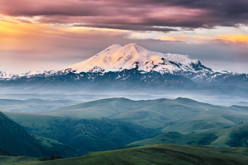
peakvisor.com -
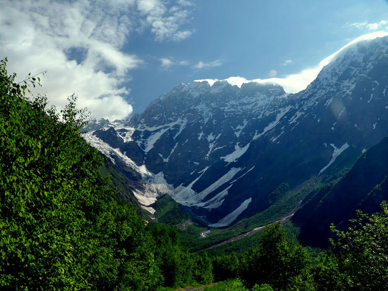
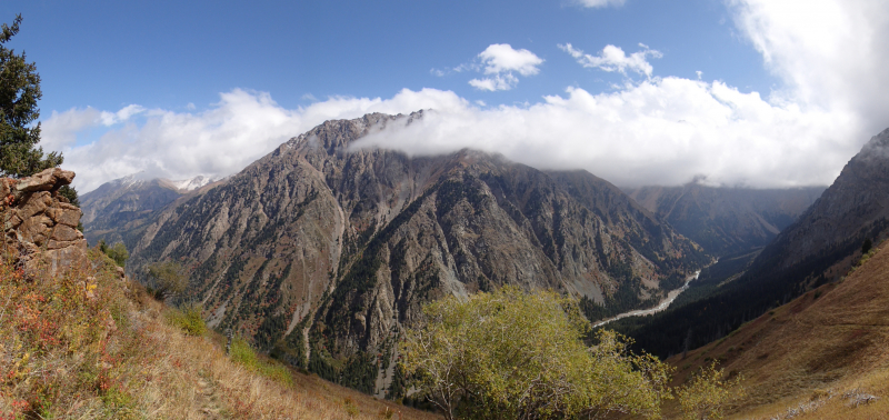
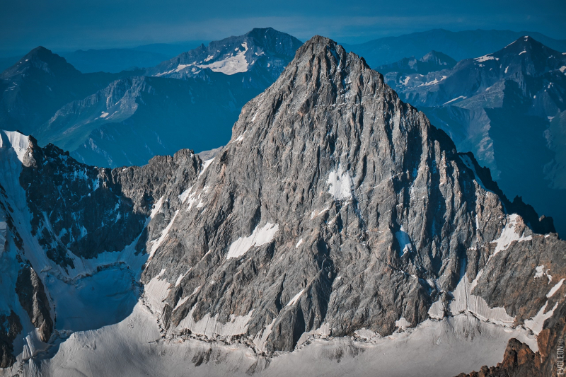
The second one in Top 7 Highest Mountains in Russia that Toplist would like to introduce to you is Dykh-Tau. Dykh-Tau, also known as Dykhtau, is a mountain in Kabardino-Balkaria, Russia, with a peak about 5 kilometers (3 miles) north of the border with Georgia. Dykh-Tau is the second highest mountain in Europe and the second highest mountain in the Caucasus Mountains, after Mount Elbrus.
The best way to get to Dykh-Tau is from the north (Russia). Bezingi village is accessible by public transportation from Nalchik in Kabardino-Balkaria, but a 4WD vehicle is required. Thus, at 2,180 meters, the Bezingi Alpine Camp is reached (7,150 ft). It takes another two days to get to the base of the climb from here.
This is one of the great Caucasian peaks, looking across the Bezingi Glacier at the magnificent Bezingi Wall. Albert Mummery and Heinrich Zurfluh of Meiringen made the first ascent in 1888, which was a significant achievement at the time. Their route up the SW Ridge is no longer used as the standard route, which is now the graded 4B North Ridge (Russian Grading).
Starting from Misses Kosh, the ridge is reached by crossing the Misses-Tau West Ridge and continuing to the Russian Bivouac, which is reached by a hanging glacier descending from the North Ridge of Dykhtau, 4 hours from Misses-Kosh. The North Ridge leads to the summit after passing through a notch between Misses-Tau and Dykhtau. Allow two and a half days from the Russian Bivouac; the North Ridge has several good bivouac sites.
Location: Kabardino-Balkaria, Russia
Elevation: 5,205 m (17,077 ft)
mountainguides.pro 
madisonmountaineering.com -
The third one in Top 7 Highest Mountains in Russia that Toplist would like to introduce to you is Pushkin. Pushkin, also known as Pushkin Peak, is Russia's third tallest mountain, standing 5,108 meters (16,758 feet) tall. Pushkin is located on the border of Georgia and Russia. The Pushkin Peak is located in the mountain massif of Dykh-Tau in the Bezengi Region of the Caucasus Mountain Range's central area. Pushkin Peak was first summited in 1961 by a Russian Spartak club team led by B. Kletsko.
Pushkin peak is located in the Dykh-Tau mountain massif which is between East Dykh-Tau and Borovikov peak. A subtle ridge runs north from the summit of Borovikov Peak. It was climbed by the "Spartak" team, led by Kletsko, in 1961. (3rd place in the championship of the USSR). From Borovikov peak to West Mizhirgi, the Kletsko route descended to the left. Climb the ridge up to the cofferdam beneath Borovikov peak and then traverse up to Pushkin peak via the Dykh-Tau massif's ridge. Another route on Pushkin 5B-graded paved by Kudinov in 1972 (4th place in the USSR championship) takes place more to the right. It travels on an avalanche-prone hanging glacier and is perilous due to ice collapses from the top hanging glacier.
Location: in the Dykh-Tau mountain massif in the Bezengi region of the Caucasus Mountain Range's central area
Elevation: 5,108 m (16,758 ft)
indyguide.com 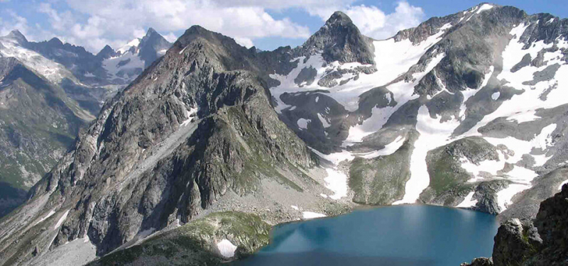
https://www.learnrussianineu.com/ -
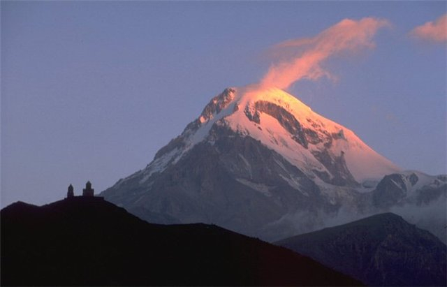
The fourth one in Top 7 Highest Mountains in Russia that Toplist would like to introduce to you is Mount Kazbek. Mount Kazbek, also known as Mount Kazbegi, is a dormant stratovolcano on the Russian-Georgian border, located in Russia's North Ossetia region and Georgia's Kazbegi District.
Mount Kazbek is one of Russia's ten highest peaks, the third highest in Georgia (after Mount Shkhara and Janga), and the seventh highest peak in the Caucasus Mountains. Kazbegi is also the Caucasus' second-highest volcanic peak, after Mount Elbrus. The summit is the most prominent geographical feature of the area, located directly to the west of the town of Stepantsminda. The name Kazbeg first appeared at the end of the 18th century, when local nobleman Dimitri Chopikashvili (grandfather of Georgian writer Aleksandre Kazbegi) was bestowed with the title "Kazgeb" by Georgian King Erekle II. The term "Kazbeg" translates as "religious leader." The title first appeared in the 17th century under Georgian king Rostom. Mqinvartsveri, the mountain's Georgian name, translates to "Glacier Peak" or "Freezing Cold Peak." Bashlam is a Vainakh name that translates as "Molten Mount."
The Soviet government designated the area around Mount Kazbegi as a nature reserve in 1979, and it includes beech forests, subalpine forests, and alpine meadows. Many of the plants and animals in the reserve are only found in the Caucasus.
Location: Georgia, Russia
Elevation: 5,054 m (16,581 ft)
en.wikipedia.org 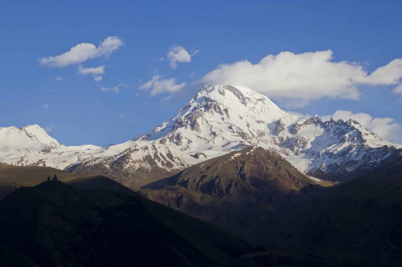
tetra-travel.com -
The fifth one in Top 7 Highest Mountains in Russia that Toplist would like to introduce to you is Shota Rustaveli. Shota Rustaveli (officially Shota Rustaveli Peak) is a mountain in the Greater Caucasus Mountain Range that straddles the borders of Svaneti (Georgia) and Kabardino-Balkaria (Russia). The mountain's elevation is 4,960 meters (16,270 feet). Shota Rustaveli is widely regarded as the Caucasus' ninth highest peak. The Shota Rustaveli Peak's slopes are glaciated, and some glaciers extend well into the adjacent valleys. Shota Rustaveli, a famous Georgian poet, inspired the name.
Shota Rustaveli Peak is Russia's fifth tallest mountain, standing at 4,859 meters (15,941 feet). The Shota Rustaveli Peak is part of the Greater Caucasus Mountain Range and has glaciated slopes as well as valleys with glaciers in the surrounding area. Despite being named after Shota Rustaveli, a famous Georgian poet, the mountain is claimed by both countries because it extends its border into Russia's Kabardino-Balkaria federal subject and Georgia's Svaneti province.
Location: Georgia and Kabardino-Balkaria
Elevation: 4,859 m (15,941 ft)
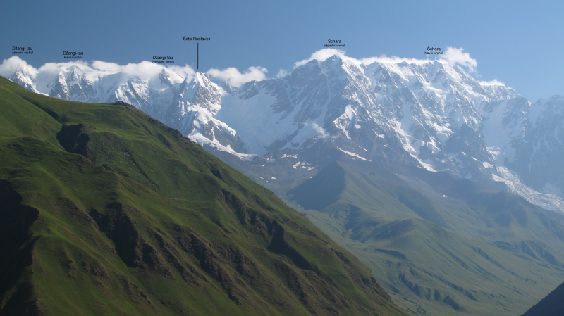
en.wikipedia.org 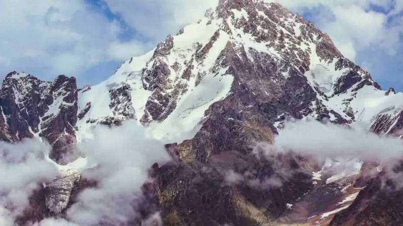
Photo: Explore The World's Youtube Channel -
Mount Dzhimara, also known as Jimara, is the second highest point in North Ossetia–Alania, a Russian republic, at 4,780 meters (15,680 ft). It is situated on the Russian-Georgian border. The mountain is located on the Khokh Range, 9 kilometers (5.5 miles) west of Mount Kazbek. The Khokh Range is a mountain range in Georgia's Caucasus Mountains. The mountain range runs north of the Greater Caucasus Range, which is pierced by the Ardon and Terek gorges and the Truso Pass (3150 meters above sea level). The Khokh Range is home to the Kazbek volcano.
Mount Dzhimara is Russia's sixth tallest mountain, standing at 4,780 meters (15,680 feet). The mountain is part of the Greater Caucasus Mountain Range and is located on the Khokh Mountain Range. Jimara is located in the Russian republic of North Ossetia-Alania, despite being right on Russia's border with Georgia.
Location: North Ossetia–Alania, Russia
Elevation: 4,780 m (15,680 ft)
wikidata.org 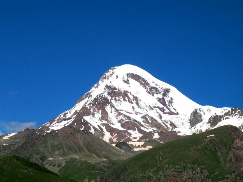
peakvisor.com -
Uilpata is Russia's seventh tallest mountain, standing at 4,646 meters (15,242 feet). The Uilpata mountain is located in Russia's North Ossetia-Alania federal subject by the city of Verkhniy Tsey in the Caucasus Mountain Range. The Caucasus Mountains are a mountain range that connects Asia and Europe. It stretches between the Black Sea and the Caspian Sea and is surrounded by the Caucasus region, which is home to Mount Elbrus, Europe's highest peak at 5,642 metres (18,510 ft) above sea level. The Caucasus Mountains are divided into two sections: the Greater Caucasus in the north and the Lesser Caucasus in the south. The Greater Caucasus runs west-northwest to east-southeast, from the Caucasian Natural Reserve near Sochi, Russia on the Black Sea's northeastern shore to Baku, Azerbaijan on the Caspian Sea.
The coordinates of the mountain are 42°46′33″N 43°48′12″E. There is not much known about this mountain, and it's never been climbed.
Location: North Ossetia-Alania, Russia
Elevation: 4,649 m (15,253 ft)
mapcarta.com 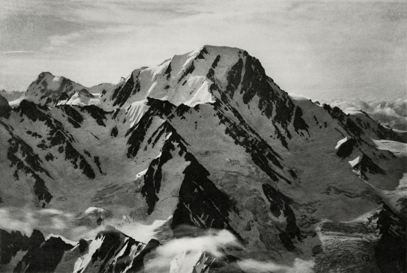
whympr.com


