


Top 11 Highest Mountains in Switzerland

Switzerland is a country in Western Europe's Central region. Many of Switzerland's highest mountains are found in the Pennine Alps, with 14 of the country's 20 ... read more...highest peaks being in Valais canton. There are 20 peaks that are over 4,000 meters high. The cantons of Valais and Bern contain the majority of Switzerland's mountains. Here is the list of the 11 highest mountains in Switzerland.
-
The highest summit of Monte Rosa, an ice-covered mountain massif in the Alps, is the Dufourspitze. Dufourspitze is the highest mountain peak in both Switzerland and the Pennine Alps, as well as the Alps' and Western Europe's second-highest peak after Mont Blanc. It lies between Switzerland (Valais Canton) and Italy (Piedmont and Aosta Valley).
Monte Rosa's summit, then known as Höchste Spitze (English: Highest Peak), was first reached in 1855 from Zermatt by a party of eight climbers led by three guides: Matthäus and Johannes Zumtaugwald, Ulrich Lauener, Christopher and James Smyth, Charles Hudson, John Birkbeck, and Edward Stephenson, after a long series of attempts dating back to the early nineteenth century.
The route to the peak for alpinists normally begins at a low height near Monte Rosa hut, which implies that the climb and descent take a long time. The toughest obstacles on the climb to the summit are crevasses and icy ridges.
Elevation: 4,634 m
Location: Valais, Switzerland
Parent peak: Punta Nordend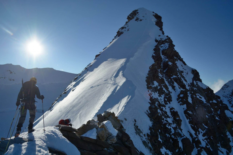
Photo: explore-share 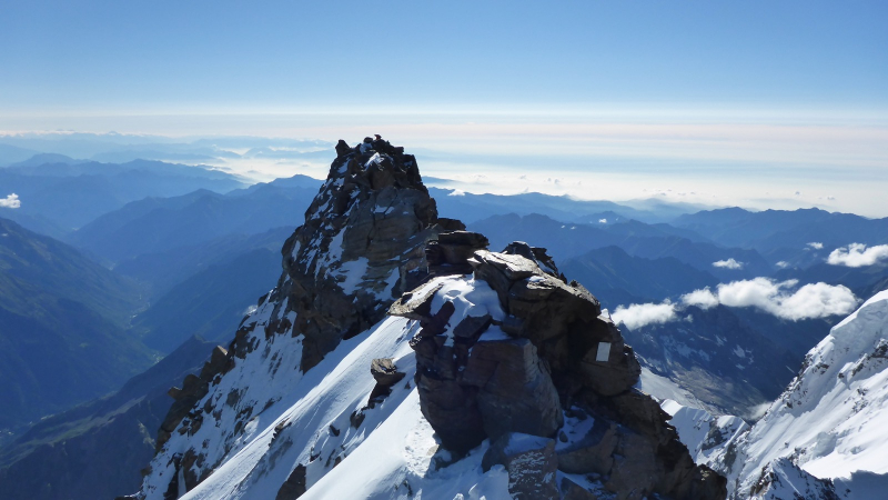
Photo: reflector.sota.org.uk -
Punta Nordend, 4609 m, is located on the Swiss-Italian border and is part of the Monte Rosa group. It is the massif's northernmost peak. The toponym Nordend (Nord End) simply refers to the group's northernmost point and the Piedmont Region's tallest. After Mont Blanc 4810 m, Monte Bianco di Courmayeur 4748 m, and Punta Dufour 4634 m, all of which are part of the Monte Rosa group, Nordend 4609 m is the fourth-highest mountain in the entire Alpin chain. In addition, it is the tallest peak in the Piedmont region and one of the highest mountains in Switzerland. Nordend is separated from Punta Dufour by the Sella d'Argento - Silbersattel. See Monte Rosa for a panoramic view of the entire massif. The beautiful East wall connects Punta Nordend to the other Monte Rosa summit peaks. A thin rocky point is the showpiece. Punta Nordend also has a large rocky bulwark facing NW that is coated in ice. The Cresta di Santa Caterina breaks off from this bastion to the northeast.
Despite having excellent ascents on snow and mixed terrain, among the most severe and longest in the Alps, Punta Nordend is the wildest and least frequented of Monte Rosa's four highest summits (Dufour, Nordend, Zumstein, and Gnifetti). Nordend is a secluded mountain that is significantly less busy than Punta Dufour, which sits nearby. Given the altitude to be attained and the disparity in height to overcome, the acclimatization and physical effort required to climb this mountain are extraordinary, regardless of which side you approach it from.
Elevation: 4,609 m
Location: Switzerland and Italy
Parent peak: Dufourspitze of Monte Rosa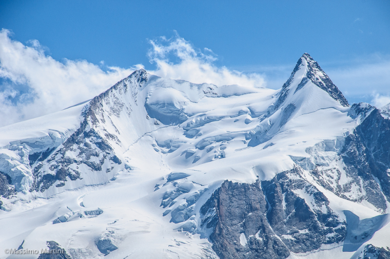
Photo: flickr 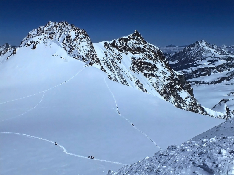
Photo: flickr -
Zumsteinspitze is the fifth-highest mountain in the Alps is one of the highest mountains in Switzerland. Joseph Zumstein and his team climbed Zumsteinspitze for the first time on August 1, 1820. Zumsteinspitze is one of the four Monte Rosa peaks that rise above the Macugnagna valley, producing the famed Monte Rosa East wall, the Alps' largest and tallest rock face. Zumsteinspitze is a popular climbing destination, owing to the relative simplicity of the ascent (the standard route is rated PD) and the fact that it is one of the 82 mountains in the Alps above the mystical 4000-meter barrier (UIAA-list).
Zumsteinspitze can be reached by a number of different paths. The standard route begins in either the Gnifetti or Mantova Huts on the Italian side of the mountain. The trail follows the Lys glacier up to the Lys Col and then along the mountain's western flank to the summit. The standard route is technically straightforward and consists of 95 percent glaciated terrain. Only the final section of the SE-ridge to the top offers some modest first-grade climbing (UIAA I). Overall, the grade is PD. The path from the Swiss side of the mountain, commencing at the Monte Rosa Hut, is an alternative to the conventional approach from the Italian side. After the Lys col, this route joins the Italian normal route, which is likewise classed PD. Many climbers use the Grenzsattel to traverse Zumsteinspitze to its higher neighbor Dufourspitze. However, this path is more difficult: UIAA III, AD.
Elevation: 4,563 m
Location: Valais, Switzerland
Parent peak: Dufourspitze of Monte Rosa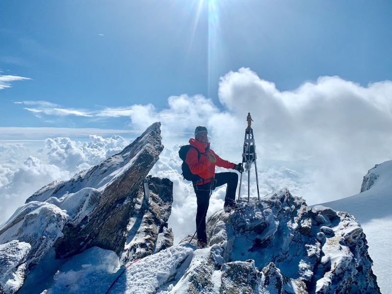
Photo: flickr 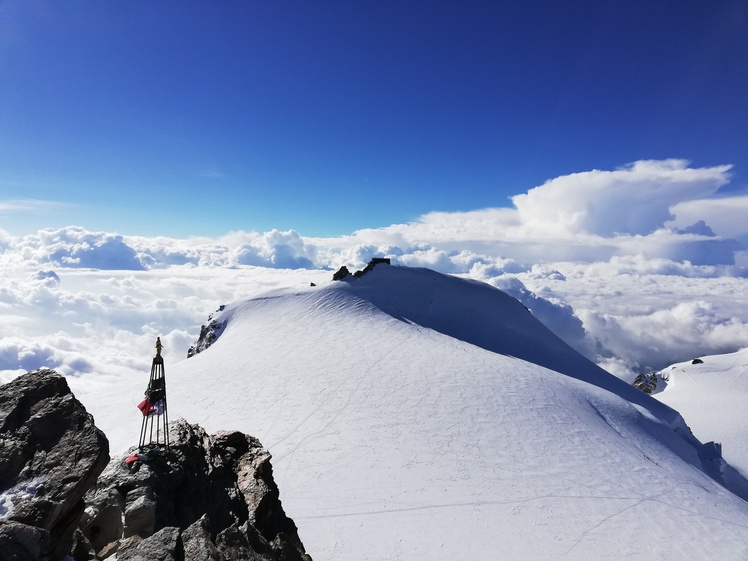
Photo: mountain-forecast -
The Signalkuppe (4,554 m), also known as Punta Gnifetti (in Italian), is a peak in the Pennine Alps on the Italian-Swiss border. It is a Monte Rosa subpeak. The mountain is called after 'the Signal,' a notable gendarme named Cresta Signal who sat atop the east ridge.
On the 9th of August 1842, Giovanni Gnifetti, a parish priest from Alagna Valsesia, performed the first climb alongside J. Farinetti, C. Ferraris, C. Grober, J. and G. Giordiano, and their porters. On the summit of the mountain, the Margherita Hut (named for Italy's Queen consort Margherita of Savoy) is Europe's highest hut. The construction began in 1890 with the help of the Italian crown, and Queen Margherita inaugurated it in 1893. The new hut is covered with sheet copper to defend against unwanted electrical fields, thereby making it a high-altitude Faraday cage.
The peak of Signalkuppe can be reached via a variety of ways. The standard route begins in either the Gnifetti or Mantova Huts on the Italian side of the mountain. The trail follows the Lys glacier up to the Lys Col and then along the mountain's western flank to the summit. The standard route is technically straightforward and entirely on glaciated terrain. Overall, the grade is PD. The path from the Swiss side of the mountain, commencing at the Monte Rosa Hut, is an alternative to the conventional approach from the Italian side. After the Lys col, this route joins the Italian normal route, which is likewise classed PD. A classic route on the mountain is the Cresta Signal (East ridge), 800 meters high and graded D (Difficile). Other routes are the SW-ridge (D+), the SE-wall (700 m,D+) and the NE-wall left spur (2500 m(!), ED)
Elevation: 4,554 m
Location: Valais, Switzerland
Parent peak: Dufourspitze of Monte Rosa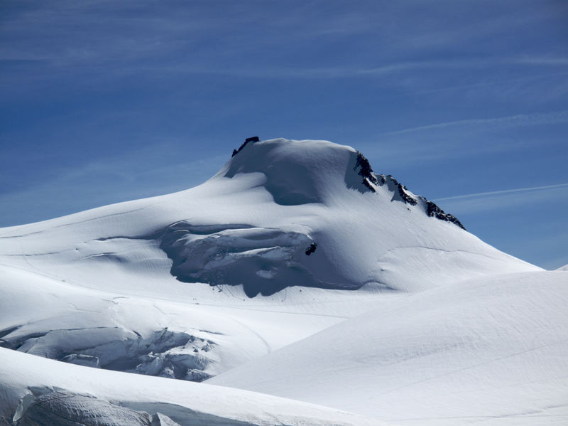
Photo: zermatt 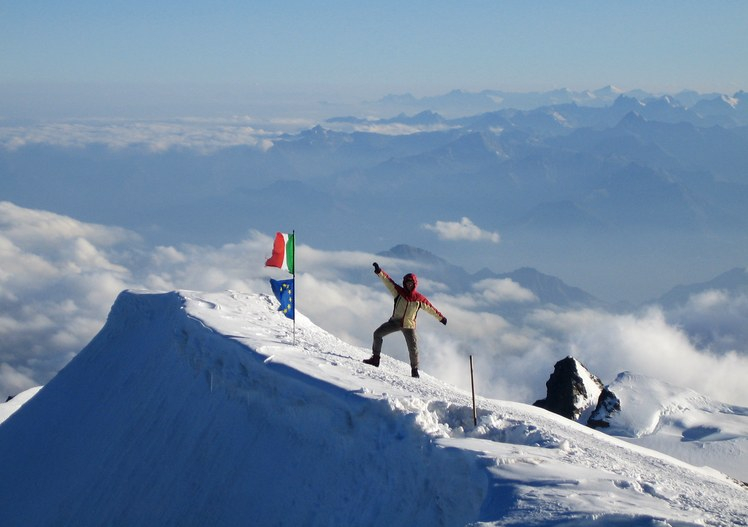
Photo: danielarndt -
The Dom is a Pennine Alps peak located between Randa and Saas-Fee in the Swiss canton of Valais. It is the sixth highest summit in the Alps, standing at 4,545 meters (14,911 feet). The Dom is the tallest peak of the Mischabel group, which is Switzerland's highest mountain range. The Dom is notable for having the largest vertical height rise of the alpine 4000 meter summits, and none of that route's 3,100 meters of height can be reached via mechanical means.
Despite the fact that Dom is a German cognate for 'dome,' it can also mean 'cathedral,' and the mountain is called for Canon Berchtold of Sitten cathedral, who was the first to explore the area. The Dom is named for canon Joseph Anton Bechthold, who inspected the peak for the first time in 1833. Because the path to the summit passes parallel to crevasses and across strongly corniced terrain, it is only suggested for experienced alpinists. The first successful climb of Dom occurred in 1858, while the mountain was first scaled on skis in 1917.
Elevation: 4,545 m
Location: Valais, Switzerland
Parent peak: Monte Rosa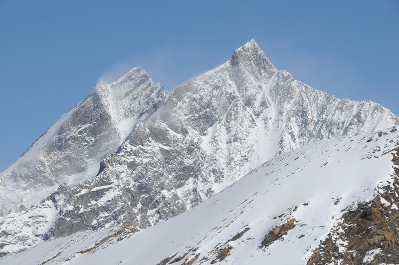
Photo: zermatt 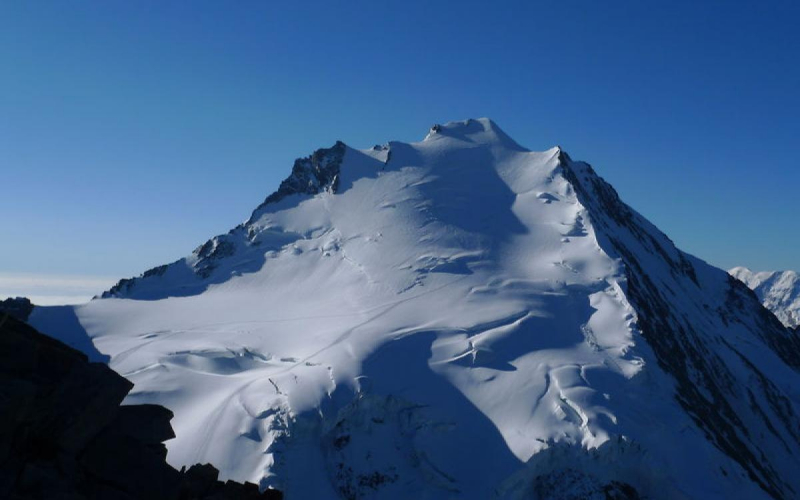
Photo: zermatters.ch -
Lyskamm is a peak in the Pennine Alps that lies on the Swiss-Italian border at 4,533 meters (14,872 feet). A five-kilometer-long ridge with two separate peaks makes up the ridge. Because of the numerous cornices on the ridge and the frequent avalanches, the mountain has earned the moniker Menschenfresser (meaning "serious mountain") ("people eater"). The eastern summit, at 4,527 meters above sea level, is the highest point in the mountain range. At an elevation of 4,479 meters, the western summit is around one kilometer away. A 1,000-meter-high cold rock face slides from the north-east side of the ridge. The highly jagged Lys Glacier dominates the landscape to the south.
The Lyskamm can be climbed in a variety of ways. The east ridge or the south ridge can be used to reach the eastern summit. If you want to summit both peaks in one trip, however, you should start by ascending the southwest ridge to the west summit and then continue to the east summit. The crossing from top to peak, in particular, is highly cornice, posing a significant risk to mountaineers.
Elevation: 4,533 m
Location: between Italy and Switzerland
Parent peak: Monte Rosa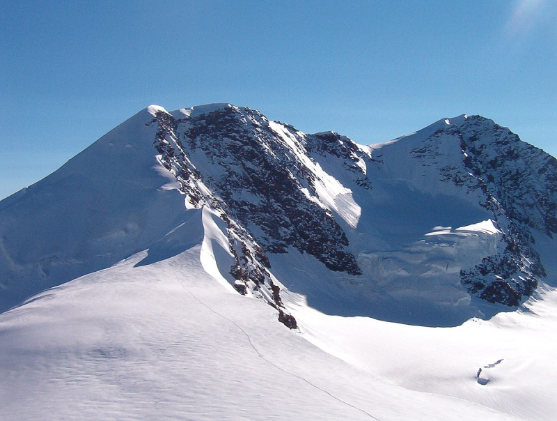
Photo: wikipedia 
Photo: explore-share -
The Weisshorn is a notable Swiss and Alps summit that rises to 4,506 meters (14,783 feet) above sea level. It is located in the canton of Valais, between the valleys of Anniviers and Zermatt, and is part of the Pennine Alps. The Weisshorn, along with Monte Rosa and the Matterhorn, is one of the several 4000ers that surround Zermatt.
The Irish physicist John Tyndall, assisted by guides J.J. Bennen and Ulrich Wenger, first climbed the Weisshorn from Randa in 1861. The Weisshorn Hut is now utilized on the standard route. Because of its pyramidal shape and pure white slopes, many mountaineers consider the Weisshorn to be the most beautiful mountain in the Alps and Switzerland.
One must gain 3,000 meters of altitude while climbing to the summit. For alpinists, this is a fantastic challenge. The east ridge is the most common path today, but the south-west ridge is the most challenging. In April and May 1991, two consecutive rock slides took place from a cliff above the town of Randa on the east side of the massif, below the Bis Glacier.
Elevation: 4,506 m
Location: Valais, Switzerland
Parent peak: Monte Rosa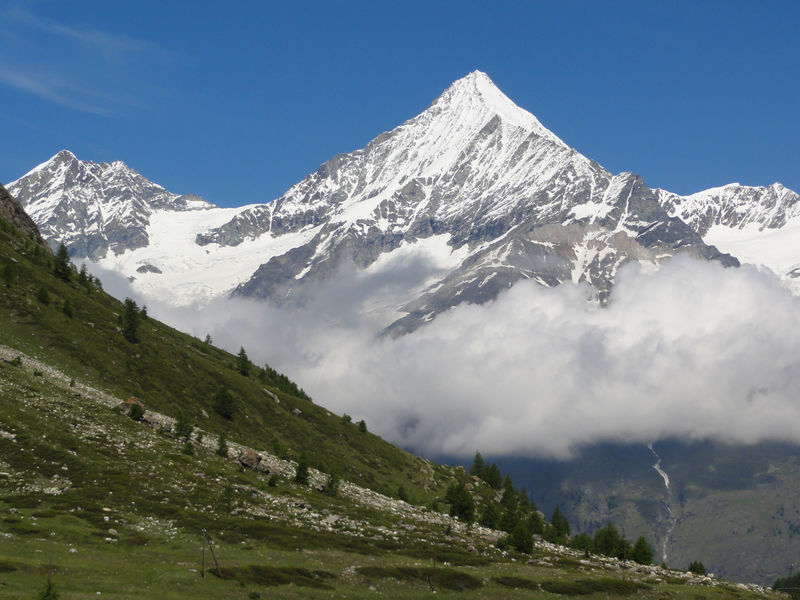
Photo: zermatt.ch 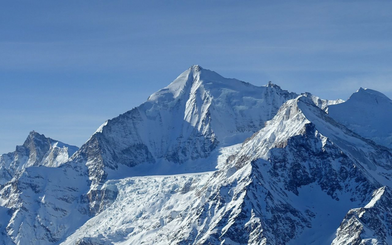
Photo: sac-cas.ch -
The Täschhorn (4,491 m) is a mountain in the Pennine Alps in Switzerland, lying south of the Dom within the Mischabel range. Täschorn is a little lower than Dom, but it's more difficult to get to because rock climbing is required. Täschorn is a pyramid with three sides. The East face is higher than Saas Fee, the W face is higher than Täsch (the last settlement before Zermatt), and the massive South face is higher than Täschalp (Ottavan). Each side has its own glacier: Kingletscher on the Täsch side, Weingartengletscher on the Ottavan side, and Feegletscher on the Saas side.
Summer is the best climbing season: July, August, and September. Starting at Mischabeljoch, the typical route follows the SE ridge. You can enter the Mischabel pass from either the Saas Fee side or the Täsch side, which is more common. On July 30, 1862, John Llewelyn Davies and J. W. Hayward, with guides Stefan and Johann Zumtaugwald and Peter-Josef Summermatter, made the first climb of the mountain.Elevation: 4,491 m
Location: Valais, Switzerland
Parent peak: Dom
Photo: outdooractive 
Photo: zermatters.ch -
The Matterhorn is an Alps mountain that straddles Switzerland's and Italy's primary watershed and border. It is a massive, nearly-symmetric pyramidal peak in the extended Monte Rosa area of the Pennine Alps, with a top elevation of 4,478 meters (14,692 feet), making it one of Europe's highest summits. The Hörnli, Furggen, Leone/Lion, and Zmutt ridges divide the four steep sides that rise above the surrounding glaciers and face the four compass points. To the north, the summit offers views of the Swiss town of Zermatt in the canton of Valais, and to the south, the Italian town of Breuil-Cervinia in the Aosta Valley. Theodul Pass, located just east of the Matterhorn, is the principal path between the two valleys on the Matterhorn's north and south flanks, and has been a trading route since the Roman Era.
The Matterhorn mountain is made up primarily of two different layers of rock placed diagonally on top of one other. It has a section of its south face that is partially on Italian land. The neighboring grassy valley, known as the "matte," is most likely the source of the Matterhorn's name. The four ridges can be used to reach the summit, with the route across the northeast ridge, also known as Hörnligrat, being the most popular. Climbing the Matterhorn is always dangerous. There have been nearly 500 tragic accidents since the first ascent in 1865. Many climbers misjudge the dangers, particularly on the descent.
Elevation: 4,478 m
LocationAosta: Valais, SwitzerlandParent peak: Weisshorn
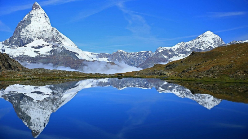
Photo: tripadvisor 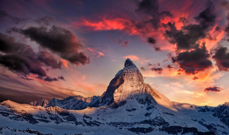
Photo: airbooking -
The Parrotspitze (Punta Parrot in Italian) (4,432 m) is a peak in the Italian and Swiss Pennine Alps. It's in the Monte Rosa Massif, south of Dufourspitze. The peak is named after a German doctor called Johann Jakob Friedrich Wilhelm Parrot, who attempted to climb the Piramide Vincent with Joseph Zumstein in 1816. Reginald S. Macdonald, Florence Crauford Grove, Montagu Woodmass, and William Edward Hall completed the first ascent on August 16, 1863, with guides Melchior Anderegg and Peter Perren, four days after the same party (with an extra guide) accomplished the first ascent of the adjacent Dent d'Hérens.
On July 8, 1862, a party led by A. W. Moore and Hereford Brooke George (the first editor of the Alpine Journal) with guides Christian Almer and Matthias Zumtaugwald climbed the east spur of the Parrotspitze (the British Route) but did not bother to climb the final 60 meters to the summit, instead of crossing the Swiss border.
Elevation: 4,432 m
Location: Valais, Switzerland
Parent peak: Monte Rosa
Photo: mountain-forecast 
Photo: peakbagger -
The Dent Blanche is an isolated, spectacular, pyramid-shaped mountain summit located about 10 kilometers west of Zermatt in the Valais Alps. It is the sixteenth highest peak in the Alps, standing at 4,356 meters.
The four mountain ridges run in a straight line in each of the four cardinal directions. The most glaciated area is on the northeast flank. The south flank has a more gentle slope than the others, making it ideal for ascents. Mountaineers can have a panoramic view of Mont Blanc, Grand Combin, Monte Rosa, Matterhorn, and Weisshorn, as well as the Mischabel range, from the top. The mountain's name, which means "white teeth" in German, is most likely the result of a map translation error. Originally, the name probably referred to the nearby, significantly more snow-covered Dent d’Hérens.
Elevation: 4,358 m
Location: Valais, Switzerland
Parent peak: Matterhorn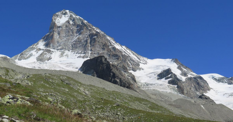
Photo: sac-cas.ch 
Photo: discoverimages


