


Top 5 Highest Mountains In Uzbekistan

Uzbekistan is a Central Asian country whose capital is Tashkent, which is also the country's largest city. The country is governed by a president and a prime ... read more...minister in a unitary semi-presidential system. Toplist will look at some of Uzbekistan's tallest mountains in this article.
-
The main peak in Uzbekistan is Khazret-Sultan Peak (4,643m). It is part of the Pamir-Alay mountain chain, and is part of the Hissar Range. The first ascent is thought to have occurred in 1961, and the peak was dubbed Peak of the XXII Party Congress during Soviet times, but this name was dropped when Uzbekistan gained independence, and there is no documentary evidence of the conquest, nor is there any guarantee that this is the same peak.
In 2010, a party of Uzbek climbers made the first official ascent to the unnamed summit. They discovered the remains of two more climbers, an Englishman and his Tajik guide. The climbers classified the route as 3A in the conditions of the ascent, but it is probable that it would be more difficult in another season, when there is less snow.
Following the ascent, the mountain was given the name Khazret-Sultan, after Khoja Ahmed Yasawi, a Sufi poet, philosopher, Islamic saint, and founder of the Yasawiya Sufi school. The life of Khazret-Sultan has nothing to do with modern-day Uzbekistan; he was born, lived, and died in Kazakhstan in the 12th century. But he lived in the Karhanid state, which had Samarkand as its capital.Location: Tajikistan, Central Asia, Asia
Elevation: 4,643m
Range: Central Asia Ranges
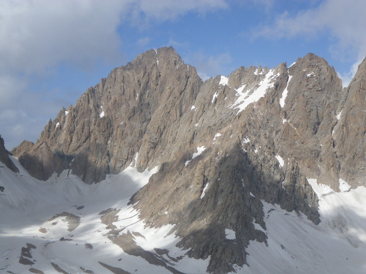
Photo source: Mountain Forecast 
Photo source: Mapio.net -
Mount Adelung (Russian: ора дeлуна) is the tallest mountain in the Pskem Range (Russian: скемски реет), located in Uzbekistan's Tashkent Province. Mount Adelung, at 4,301 meters, is the highest peak in Tashkent Province, just 2 meters higher than neighbouring Mount Beshtor, which is located a little farther south-west in the same range, and it is frequently misidentified as the "highest point in Uzbekistan" by numerous web sources. In actuality, the Khazret Sultan, a peak with an elevation of 4,643 meters in Surkhandarya Province, in the Uzbek part of the Gissar Range, near the Tajikistan border, was originally known as Peak of the Communist Party's 22nd Congress. The ranges were generated by tectonic earth power, which created folds that subsequently expanded into large mountain ranges. There is no record of the mountain's first ascent. Several consulting organizations have specialized in assisting visitors in climbing Adelung.
Some web sources use the name Adelunga Toghi, where Adelunga is the Russian possessive form of Adelung and Toghi (tog' in Latin script, тo in Cyrillic script) is apparently the Uzbek word for mountain. At the time of writing, it is unknown who Adelung the mountain is named after.
Location: the extreme north-east of the Tashkent Region, Uzbekistan.
Elevation: 4,301 m
Range: Pskem Mountains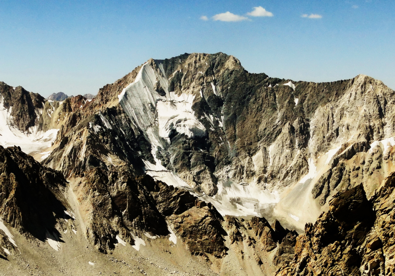
Photo source: Wikipedia 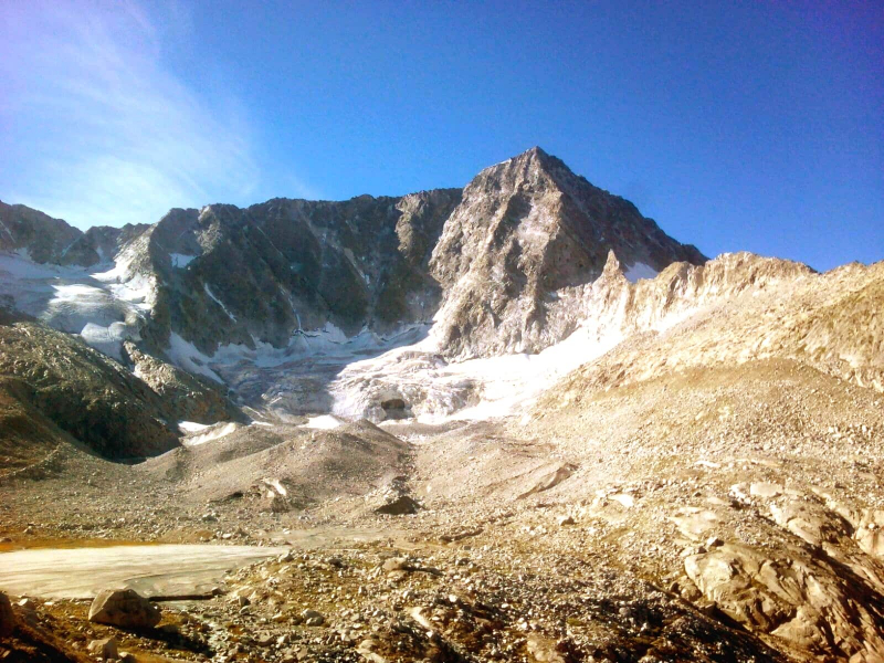
Photo source: Explore-Share.com -
Mount Beshtor (Russian: оpа етор, also е-р) rises to 4,299 meters in the Pskem Range in Uzbekistan's Tashkent Province's north-eastern corner. Mount Adelung is a high mountain in the Pskem Range that is located on the southern border with Kyrgyzstan, just a short distance to the south-west of another towering peak in the Pskem Range (Adelunga Toghi, 4,301 m). In both Tashkent Province and the Pskem Range, Beshtor is the second highest peak.
Mount Beshtor / Beshtar (4,299m) is the second highest mountain in the Pskem Range, just 2 meters behind Adelunga. Beshtor was thought to be the range's main peak before Adelunga was discovered. The mountains are not far apart, yet the altitude difference was insufficient to induce the error. The difficulty level is 3B, which necessitates much preparation on the part of the climbers.
Location: the southern border with Kyrgyzstan
Elevation: 4,299 m
Range: Pskem Mountains
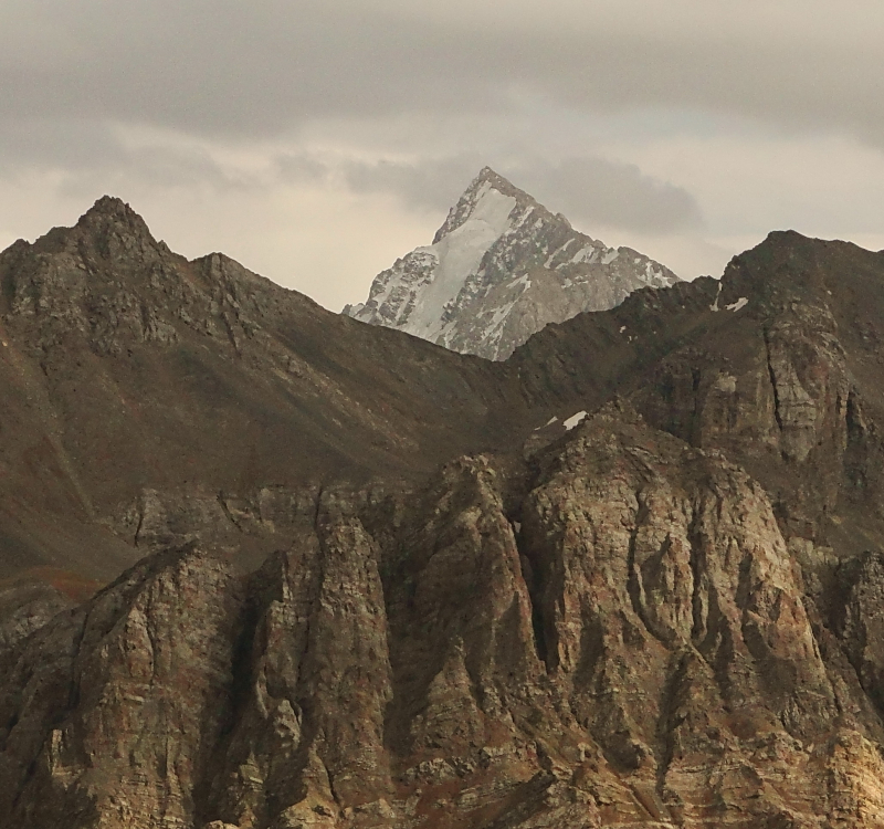
Photo source: Wikipedia 
Photo source: PeakVisor -
Chimgan is part of the Chatkal Mountains range, with a prominence of 5,541 feet and an elevation of 10,856 feet above mean sea level. Although it is not officially recorded, it is believed that the first ascent occurred in 1909. It is located in Tashkent Province, within the Ugam-Chatkal National Park. The weather in the mountains varies from day to day and season to season. The weather is mild during the day, but it is frigid at night. Heavy snowfall occurs during the winter, with the snow cover lasting five months and the frost period lasting roughly 120 days.
Hiking, adventure, skiing, snowboarding, and mountain climbing are all popular activities on the Greater Chimgan. There are numerous ways of varying degrees of difficulty. Beginners usually stick to the straightforward western ridge. For more experienced climbers, there are more difficult routes. The mountain is only 80 miles away from a railway station, and travelers can easily get there by bus. Helicopter services are also available, however they are relatively restricted.
Location: Tashkent Province
Elevation: 3,309 m
Range: Chatkal Mountains
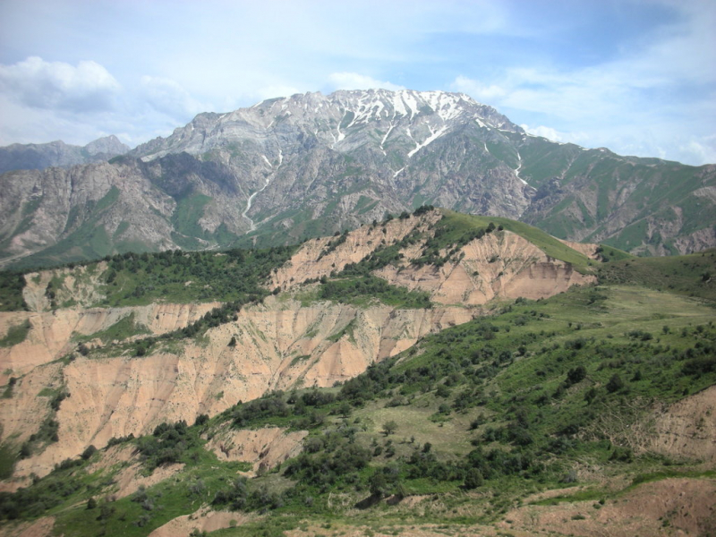
Photo source: Wikipedia 
Photo source: Advantour -
The Chatkal Range's second highest peak, Kyzylnura / Kyzyl Nura, is located to the south-southwest of Big Chimgan (3,267 m). Gora Kyzylnura is a mountain in the Uzbekistan city of Toshkent. The peak's name translates to "Red Ray" in Uzbek, owing to the peak's unique geological characteristics. It is made of red granite, and when the stone isn't covered in snow, which happens most often in August and September, the peak turns a bright red at sunset, making it stand out against the background of neighboring mountains. If you look east from Tashkent's city center, you can see this phenomenon right away.
On the southwestern slopes, the Chatkal State Biosphere Reserve is located. When climbing Kyzylnura, the town of Yangiabad, where the road to Babaytag begins, is likely to be your final destination.
Location: the south-southwest of Big Chimgan
Elevation: 3,267 m
Range: The Chatkal
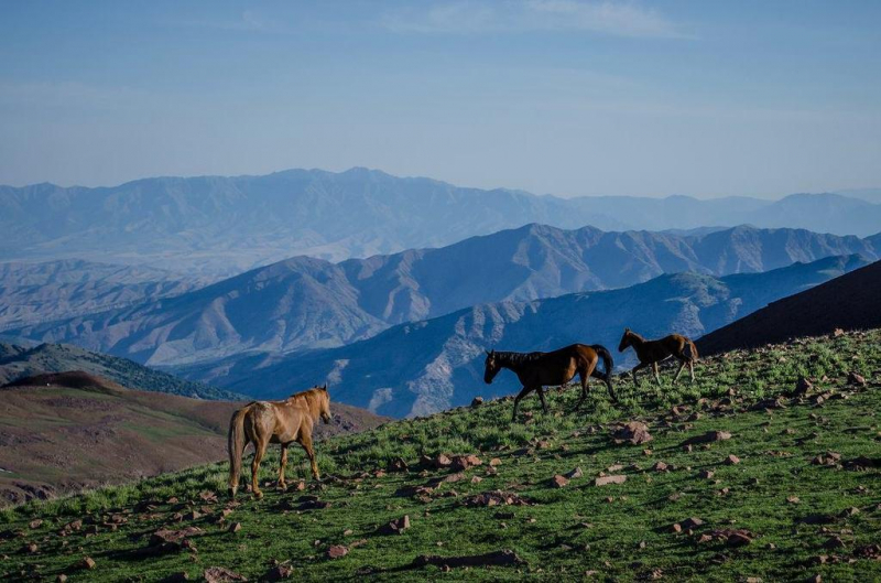
Photo source: Twitter 
Photo source: Journey To The East


