


Top 6 Highest Mountains in Andorra

Andorra is a place that can be enjoyed at any time of year. With the approach of spring, the snow melts, revealing the Andorran mountains. This allows you to ... read more...hike, trail run, climb, or even via ferrata to experience them. The highest mountains in Andorra, as measured by elevation, are shown below.
-
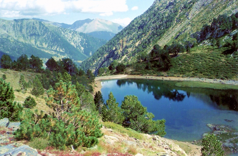
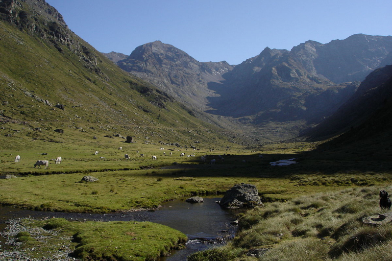
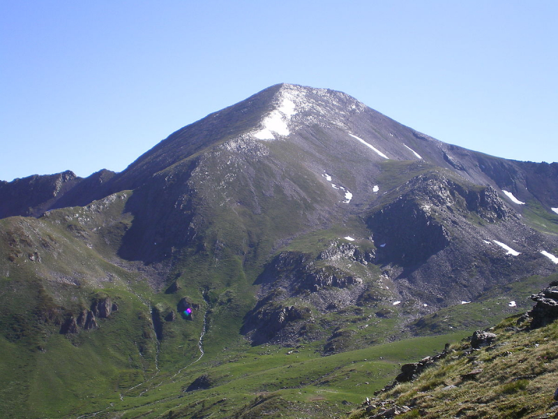
The tallest peak in the principality of Andorra, Coma Pedrosa, is popular among mountain climbers due to its technical simplicity, albeit strenuous ascent. The ascent from Arinsal to Camp de Refuge (650 meters) is rated moderate, while the following 862 meters are regarded as challenging. On the slopes, there are several mountain lakes and tarns, including Estanys de Baiau, which is located on the western slopes, just across the Spanish border.
Arinsal, La Massana is the closest town. Historically, the mountain protected Andorra against invasions. Today, the peak is part of the national park Parc Natural Comunal de les Valls del Comapedrosa.
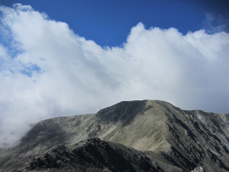
The pyramid-shaped Coma Pedrosa is located on the northwestern border of France and SpaiW,,n. It has served as a border between Andorra and France in the past. Andorra's hilly landscape, which is landlocked, features 65 peaks that climb to an elevation of more than 2,000 meters (6,562 feet), with Coma Pedrosa being the highest at 2,943 meters (9,656 ft).
Its increased tourism exposure has attracted millions of visitors who come to appreciate the unique visual splendor of its hills and valleys.
The mountain's highest slopes are forested, while the lower reaches include some arable fields. During the winter months, the mountain is completely covered in snow, providing chances for skiing, mountaineering, ice climbing, and scrambling. After passing the mountain pass Baiau in the summer, the mountain provides various simple trekking routes along the Arinsal valley, covering neighboring areas of Vall Ferrera in Spain.
Pines, birch, and firs make up the forest vegetation atop the mountain and in its valleys. Many glacier lakes and extensive meadows have formed within the valley created by the mountains. The pure ambiance of the valley has been swamped with tourist resorts, hotels, restaurants, and business operations catering to tourists as a result of the popularity of skiing in and around this mountain valley near Arinsal and adjacent to the Andorra la Vella and other valleys in Andorra. This has raised awareness about the importance of preserving virgin mountains and forests, as well as putting limits on the expansion of ski resorts and urban activities, by establishing a nationwide network of parks as preserves.
Location: in Northwestern Andorra.
Elevation: 2,942 m (9,652 ft)
outdooractive.com 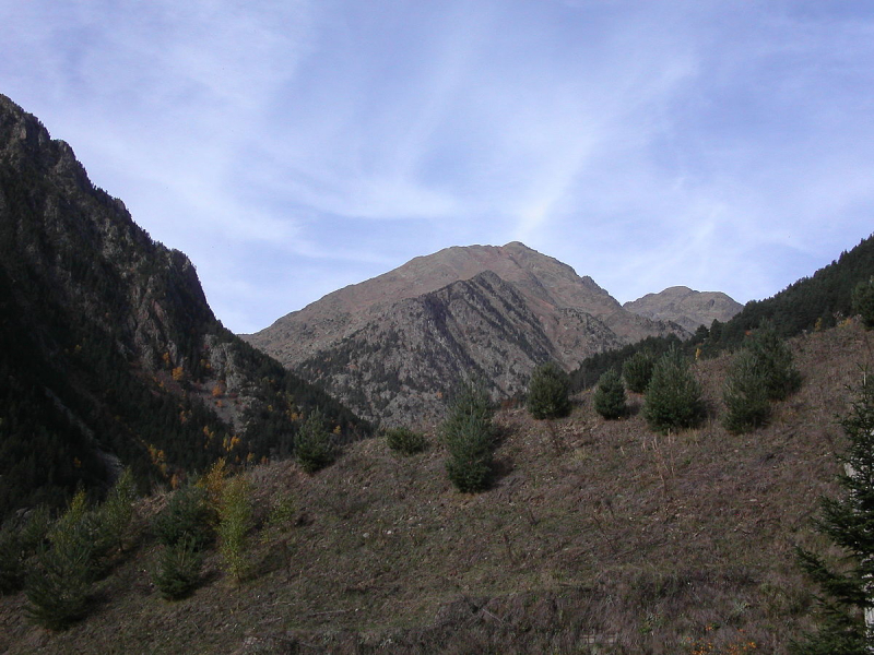
en.wikipedia.org -
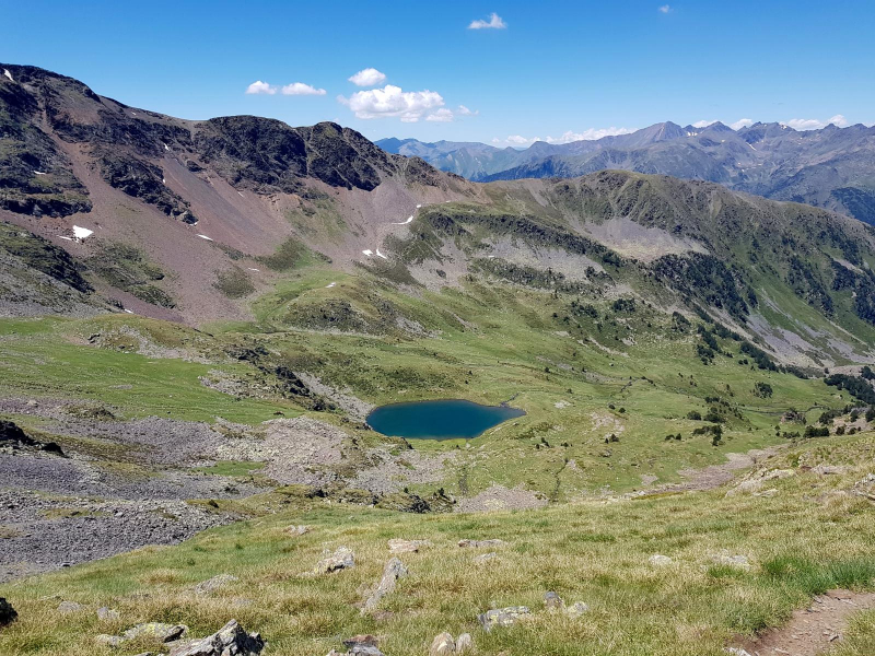
With a height of 2,915 meters, the mountain of l'Estanyó is Andorra's second highest peak. On this mountain, you can also see glacier lakes and learn about the many different species of flora and wildlife that thrive at such a high height.
The little lake (Estany de l'Estanyó or Estanyó de Sorteny) at the foot of the northern slope inspired the name Pic de l'Estanyó. The mountain separates the Valira d'Encamp (also known as Oriente, Canillo, or Soldeu) and the Valira d'Ordino (also known as La Massana, del Nord, or Ribera d'Ordino), which join at the Escaldes-highest Engordany's point to form the Gran Valira. Many mountaineers believe it to be the best sight in Andorra because of its placement between the two big valleys.
El Serrat is the nearest settlement to l'Estanyó's summit and lake. There is free parking in Canya de la Rabassa, as well as a picnic area with barbecues and picnic tables where you may enjoy an outdoor lunch.
As a highlight, you will locate a Botanical Garden on any of the hiking routes where you can explore and learn about over 700 types of plants and flowers found only in the Pyrenees!
Location: in Northern Andorra
Elevation: 2,915 m (9,564 ft)
wikiloc.com 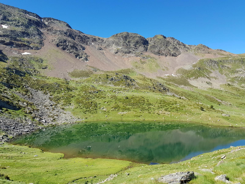
wikiloc.com -
Pic de Médécourbe is a European mountain located on the western tripoint of Andorra, France, and Spain. It stands at a height of 2,914 meters (9,560 feet). It has a view of the Vicdessos valley and the Étang de Soulcem, a vast manmade lake used for hydroelectricity. About 6 kilometers south of Pas de la Casa, there is also an eastern tripoint of Andorra, France, and Spain.
It is one of the Pyrenees' most beautiful summits. You will have spectacular panoramic views from the highest point, and you can even see the Pica d'Estats.
Because of its proximity to the Comapedrosa summit, more ambitious hikers can perform a circular Medacorba – Comapedrosa hike and see two of Andorra's most iconic mountains with the best views on the same day. This trip may be completed in one day, but if you have more time, you shoud stay overnight at the Estanys Forcats hut to extend your enjoyment of the journey. The nearest town, like Comapedrosa, is Arinsal, where you can park for free in the same parking lot stated in the first part.
Location: Andorra – France – Spain border
Elevation: 2,914 m (9,560 ft)
en.wikipedia.org 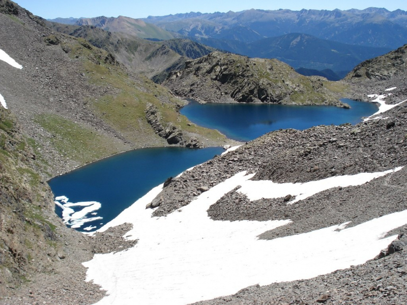
mapcarta.com -
The Pic de la Serrera, at 2,914 meters, is the fourth highest peak in the Principality of Andorra, and one of the mountains in Andorra that exceed 2,900 meters (Comapedrosa, Estanyó, Medacorba, Roca Entravessada, La Portelleta, and Font Blanca). It has become a good observatory on all the Andorran summits, highlighting the view of the Coma Pedrosa and, already outside the Andorran boundaries, the Pica d'Estats and the Maladeta massif, thanks to its strategic placement. The Serrera is accessible from the Ransol and Sorteny valleys, and is famed for its stunning southern slope.
If you travel up the Ransol valley by car, you may reach a picnic place at 1,900 meters above sea level through a track that exits the settlement of Ransol and enters the valley. There is already a sign pointing to the start of the walk. The path is always well signposted and passes through various lakes before joining the path that comes from the Sorteny valley at the Coll de la Mina. All you have to do now is turn right and follow the 200-meter drop along the broad ridge to the peak's summit.
Location: Ordino, Andorra
Elevation: 2,914 m (9,560 ft)
ca.wikipedia.org 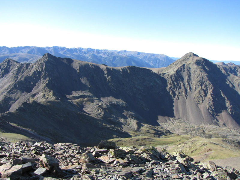
wikiloc.com -
Pic de la Portelleta, also known as Tossa Plana de Lles, is a 2,905-meter-high peak in Andorra that lies between the parish of Escaldes-Engordany and the municipality of Lles de Cerdanya. It is one of only five summits in Andorra that rise beyond 2,900 meters. In massifs of a given size with geographically very distinct slopes, toponymic duplications are relatively prevalent. This is the case of La Cerdanya's Tossa Plana de Lles, also known as Pic de la Portelleta by the Andorran band.
On clear days, the Maladeta, Pica d'Estats, and most of the Pallars and Andorra reliefs, including those of the Conflent and Canigó, can be seen.
This mountain is listed as Tossa Plana de Lles on the FEEC's list of 100 peaks (Pic de la Portelleta).
Location: on the Andorra-Baixa Cerdanya border
Elevation: 2,905 m (9,530 ft)
mapcarta.com 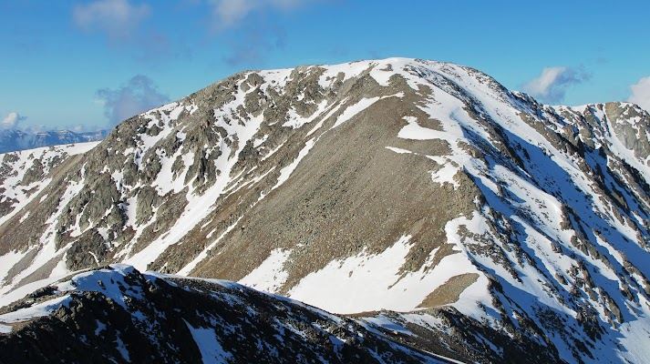
reptesmuntanyencs.cat -
The Agulla de Baiau is a peak on the Andorran-Spanish boundary that rises to 2,860 or 2,863 meters between the parish of La Massana and Catalonia. Between the Pic de Sanfonts (2,889 m) to the south and the Pic de Baiau (2,885 m) to the north, the Agulla de Baiau lies on the boundary between Andorra and Spain. On the Andorran side, it overlooks the Estany Negre, while on the Spanish side, it overlooks the estanys of Baiau.
Baiau's agulla is part of the Pyrenees' primary axial chain, which was produced by Paleozoic rocks. The majority of the rocks of the Natural Park of the Coma Pedrosa Valleys are Cambrian and Ordovician in age, as they are throughout North-West Andorra. With shale in the foreground, they are fundamentally metamorphic in character.
The Natural Park of the Coma Pedrosa Valleys, where the top is located, has a mountain climate. The park's highest areas, including the Agulla de Baiau, are influenced by the Atlantic.
Location: on the Andorran-Spanish border
Elevation: 2,863 m (9,393 ft)

mapcarta.com 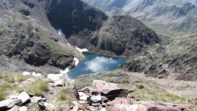
wikiloc.com


