


Top 8 Highest Mountains in Bulgaria

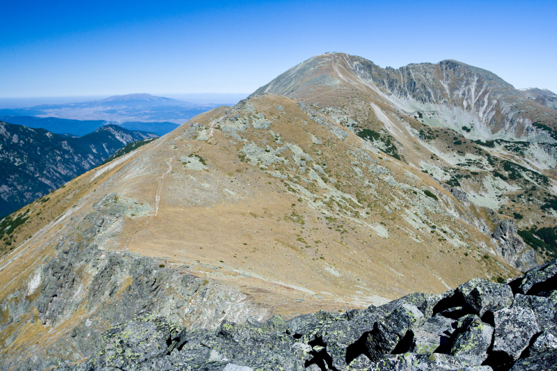
Mountains cover a large portion of Bulgaria, dominating in the southwest and central regions. The highest mountains in Bulgaria are Rila (highest peak Musala, ... read more...2925 m; the highest in the Balkans) and Pirin (highest peak Vihren, 2914 m). Toplist has compiled a list of the Highest Mountains in Bulgaria for you.
-
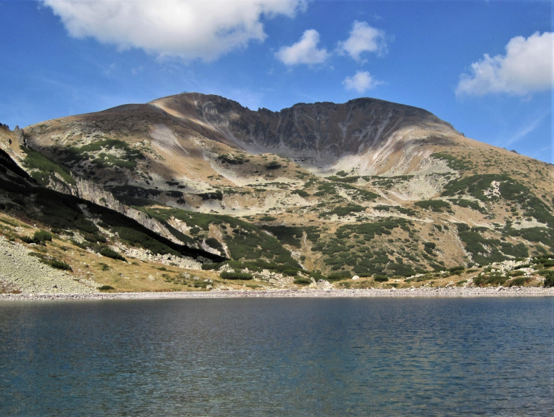
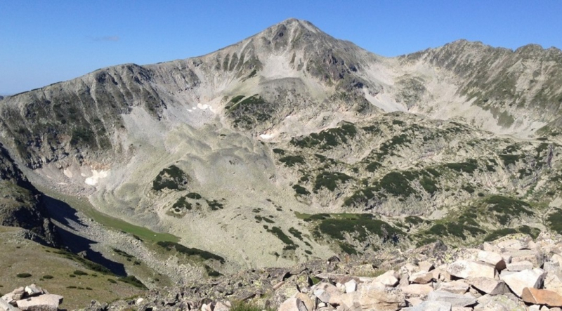
Musala, at 2,925 meters, is the highest peak in the Rila Mountains, as well as in Bulgaria and the entire Balkan Peninsula (9,596 ft). Musala is also the sixth highest peak in mainland Europe by topographic prominence, with a topographic prominence of 2,473 metres (8,114 ft). Musala is also Continental Europe's third most topographically isolated major peak.
Musala is located within the Rila National Park, which is known for its diverse flora and fauna, including Macedonian Pine and Bulgarian Fir in the forests on its middle slopes, and is one of the best places in Europe to see the wallcreeper. From the top, you can see all of Bulgaria's major mountain ranges, including Vitosha to the northwest, Sredna Gora to the northeast, the Balkan Mountains along most of the northern horizon behind Vitosha and Sredna Gora, the Rhodope Mountains to the southeast, Pirin to the south, Osogovo and Ruy Mountain to the west, and, of course, the rest of Rila.
In 1960, with the assistance of the Hungarian Academy of Science, a cosmic ray station was built on the peak. The station used a muon telescope to conduct scientific experiments. On October 29, 1983, an electrical fire destroyed the station.
Musala is the coldest place in Bulgaria and the Balkan Peninsula, with an average annual temperature of -2.3 °C. Temperatures remain below 0 °C for approximately 8 months of the year. As a result, snow accounts for approximately 45 percent of Musala's annual precipitation, and snow cover lasts for approximately 200 days (more than six months). Three of Bulgaria's major rivers, the Iskar, Maritsa, and Mesta, have their origins near Musala.
Location: Sofia Region, Bulgaria
Elevation: 2,925.4 m (9,598 ft)
en.wikipedia.org 
bulgariahiking.com -
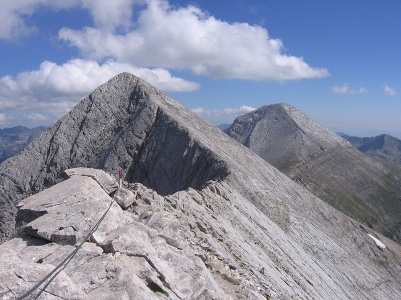
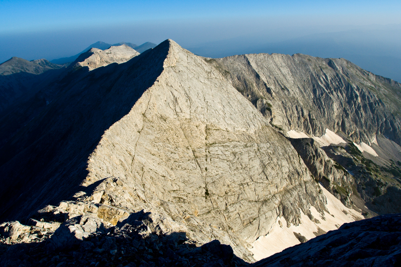
Vihren is the highest peak in the Pirin Mountains of Bulgaria. With a height of 2,914 meters (9,560 feet), it is Bulgaria's second highest peak and the Balkans' third highest, after Musala and Mount Olympus. Although Vihren lacks lakes and streams due to its karst topography, a number of Pirin's lakes, as well as Europe's southernmost glacial mass, the Snezhnika glacieret, are located around the peak. Until 1942, Vihren was known as Eltepe (storm peak); it was also known as Buren (stormy) and Malnienosets (lightning-bringer). The Pirin National Park, a UNESCO World Heritage Site, was originally known as the Vihren National Park. Vihren is listed as No. 2 in Bulgaria's Top 100 Tourist Attractions.
Vihren is located in Pirin's northern subdivision on the main ridge between the summits of Kutelo (2,908 m) to the north-west and Hvoynati Vrah (2,635 m) to the south-east.
T.Atanasov, D.Stoykov, V.Baynov, and N.Bozhinov climbed Vihren for the first time in winter on January 9, 1925. The classic route to the peak is from the Vihren refuge (1,950 m) to the south via the Kabata saddle; this route takes three to four hours in summer and is steep, gaining nearly 1,000 m in a short time. Alternative routes include those from the Banderitsa refuge (1,810 m) or from the north across the knife-edge crest Koncheto. From the Kazanite cirques in the north, there is a 400-meter-high steep wall with several alpine climbing tracks. The German alpinists W.Mosel and F.Auer were the first to climb this wall in 1934, and Al.Belkovski and Vl.Lobodin were the first to climb it in winter in 1949.
From the summit, you can see almost the entire northern Pirin, as well as the mountain ranges of Rila, Rhodope, Maleshevo, Ograzhden, Belasica, and Slavyanka.
Location: Blagoevgrad Province, Bulgaria
Elevation: 2,914 m (9,560 ft)
en.wikipedia.org 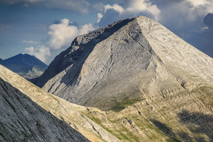
mountain-forecast.com -
Kutelo is a mountain peak in southwestern Bulgaria's Pirin mountain range. It is the second highest peak in Pirin after Vihren (2,914 m) and the third highest peak in Bulgaria, after Musala (2,925 m) in Rila and Vihren. Kutelo is a double peak separated by a small saddle, with the lower peak only one meter lower than the upper one, at 2,907 m. From Bansko, it appears to be higher than Vihren.
Kutelo, like Vihren to the south, is made of marble, but its slopes, while sheer, are not as rocky, and it is not difficult to climb. There are alpine climbing tracks of category II "b" on the north-eastern slopes. To the south, the Premkata saddle leads to Vihren, while to the north, the narrow karst edge Koncheto connects Kutelo to the summit of Banski Suhodol. There are no marked trails to the summit of Kutelo, but the track between the Vihren and Yavorov refuges is nestled among the rocks on the slanting western slope. This path also follows Koncheto. Snow drifts can be found all year in the eponymous waterless cirque to the north-east. To the south-east is the Golemiya Kazan cirque, which contains Europe's southernmost glacier, Snezhnika. Pirin's second glacierlet, Banski Suhodol Glacier, is located beneath Kutelo's northern face.
Chamois live on Kutelo's slopes, as do edelweiss (Leontopodium nivale) and a variety of other rare herbaceous plants.
Location: Blagoevgrad Province, Bulgaria
Elevation: 2,908 m (9540 ft)
en.wikipedia.org 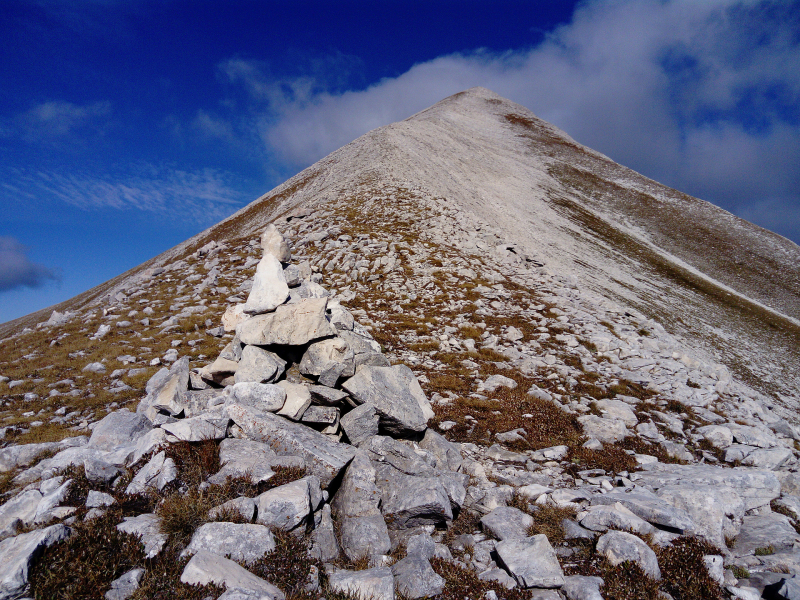
peakery.com -
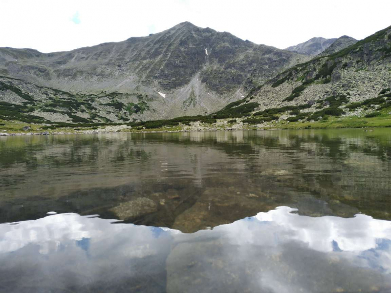
Malka Musala is a summit in southwestern Bulgaria's Rila Mountain. With an elevation of 2,902 meters, it is the second highest peak in Rila after Musala (2,925 meters), the fourth highest peak in Bulgaria after Vihren (2,914 meters) and Kutelo (2,908 meters) in the Pirin Mountain, and the seventh highest peak in the Balkan Peninsula.
The summit is located to the north-east of Musala and is separated from it by a rocky ridge. The ridge extends north-easterly to the summits of Irechek (2,852 m) and Deno (2,852 m) (2,790 m). The Musala Cirque and the highest of the seven Musala Lakes are located to the north-west. The slopes of Malka Musala form two cirques to the south and east, descending to the deep valley of the Maritsa River. The cirque between Malka Musala and Musala is devoid of water, whereas the one between Malka Musala and Irechek contains a glacial lake that serves as the source of a stream that flows into the Maritsa.
Malka Musala was officially named Dimitov between 1950 and 1989, after Bulgarian communist leader Georgi Dimitrov.
Location: in southwestern Bulgaria
Elevation: 2,902 m (9,521 ft)
en.wikipedia.org 
View from Musala to Malka Musala (Photo: commons.wikimedia.org) -
Banski Suhodol is a summit in Bulgaria's Pirin mountain range in the south-western part of the country. It is situated on the major ridge in the northern section of Pirin. It is the third highest peak in Pirin, behind Vihren (2,914 m) and Kutelo (2,884 m) (2,908 m).
The summit of Kutelo is located to the south-east of Banski Suhodol on the main ridge, and the two summits are connected by the Koncheto ridge – a dizzy karst slope that is only 70 cm wide in some places.
A nameless peak is located on the main ridge to the north-west, from which the secondary karst ridge Koteshki Chal deviates to the north-east. The main ridge from there continues west-northwest to the neighboring Bayuvi Dupki summit (2,820 m).
Banski Suhodol's north-eastern slope is a vertical 300-meter marble cliff that descends to the same-named cirque. There are various locations in the cirque where snow lingers all year, and several karst caves have been discovered there.
At 70 degrees, the south-western slope descends to the Vlahina reka river basin. Despite the fact that the slope is not as steep as the one to the north-east, the distance between the peak and the valley below is roughly 1,000 meters, creating a stunning perspective. The main summit Vihren and the second in rank — Kutelo, the granite Hvoynati Vrah (2,635 m) and Muratov Vrah (2,669 m), the subsidiary Sinanishki ridge with its cirques and ridges, and the Vlahini Lakes with the marble peak Sinanitsa (2,516 m) in the distance can all be seen from that direction.
Location: Blagoevgrad Province, Bulgaria
Elevation: 2,884 m (9,462 ft)
en.wikipedia.org 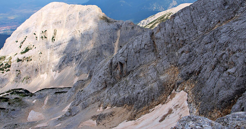
travel.sygic.com -
The peak of Irechek is located in the eastern portion of the Rila Mountain in southwestern Bulgaria. Rila is Bulgaria's, the Balkan Peninsula's, and Southeast Europe's highest mountain range. It is in southwestern Bulgaria and is part of the Rila–Rhodope Massif. The highest summit is Musala at 2,925 m, making Rila the sixth highest mountain range in Europe after the Caucasus, the Alps, Sierra Nevada, the Pyrenees, and Mount Etna. Irechek (2,852 m) is the third highest peak in Rila, behind Musala (2,925 m) and Malka Musala (2,902 m). It is located in the eastern portion of the Musala Cirque, which encompasses the Musala Lakes, near the summits of Musala and Deno (2,790 m). The coordinates of Irechek mountain are 42°11′9.7″N 23°35′31.6″E.
It is named for the Czech historian Konstantin Jireek, who conducted considerable research on Bulgarian history and was engaged by the Bulgarian government following the reestablishment of the Bulgarian state in 1878.
Location: in southwestern Bulgaria
Elevation: 2,852 m (9,357 ft)
en.wikipedia.org 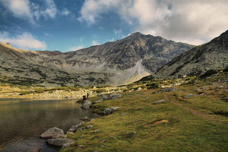
hotelmap.bg -
Polezhan is the highest granite summit in the Pirin Mountains and the fourth tallest after Vihren, Kutelo, and Banski Suhodol (all three are marble peaks). The Pirin Mountains are a mountain range in southwestern Bulgaria, with Vihren being the highest peak at 2,914 m. The range stretches about 80 kilometers from north to south and is about 40 kilometers wide, encompassing a 2,585-square-kilometer area (998 sq mi). Pirin is home to Europe's southernmost glaciers, Snezhnika and Banski Suhodol, as well as over a hundred glacial lakes. Polezhan is the Pirin range's fifth highest peak. The coordinates of the mountain are 41°43′N 23°29′E
Hizha Bezbog, named after the nearby village of Bezbog, is the closest mountain hut. The mountain hut is roughly 2-3 hours from Polezhan, depending on the weather. The Upper Polezhan Lake (2,706 m), Bulgaria's second highest lake, and the Upper Gazei Lake, both located near Polezhan, are the highest lakes in Pirin.
Location: Blagoevgrad Region, Bulgaria
Elevation: 2,851 m (9,354 ft)
bg-guide.org 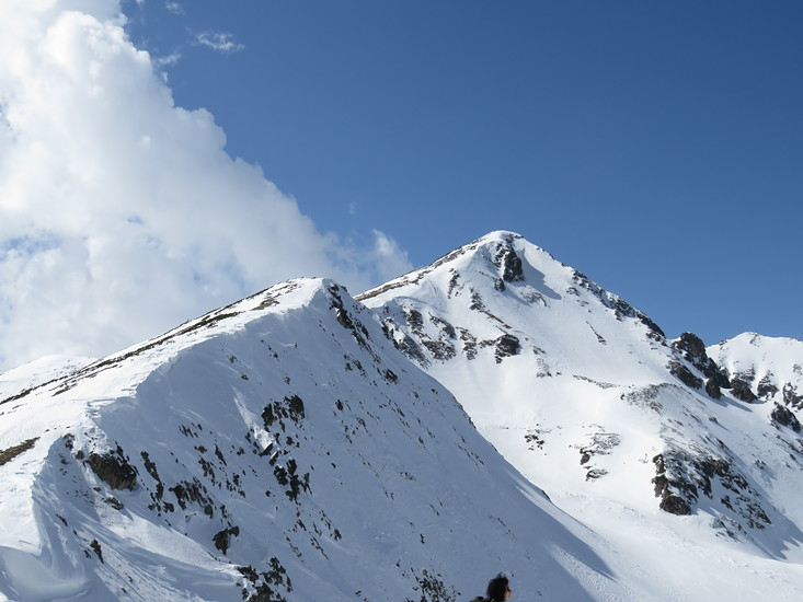
mountain-forecast.com -
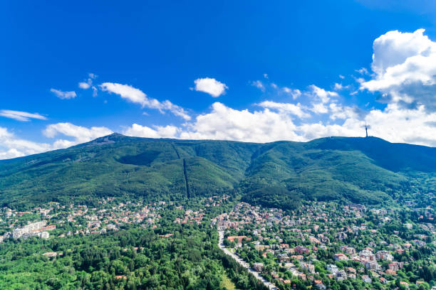
The ancient Scomius or Scombrus, Vitosha, is a mountain massif on the outskirts of Sofia, Bulgaria's capital. Vitosha is one of Sofia's icons and the nearest location for trekking, alpinism, and skiing. The mountain is easily accessible thanks to convenient transport lines and ropeways.
The silhouette of a gigantic dome may be seen at Vitosha. The mountain's territory contains Vitosha Nature Park, which includes the most well-known and often visited areas. Sofia's resort neighborhoods are nestled in the Vitosha slopes, and Knyazhevo boasts mineral springs. Vitosha is the Balkans' oldest nature park. The mountain was formed by the slow folding of granite rock layers and a series of progressive uplifts of the surrounding area as a result of volcanic activity.
The mountain, which is 19 km long and 17 km wide, appears dome-shaped at first glance, but it is actually made up of concentric denudational plateaus that rise in layers one above the other. Vitosha is divided into four sections, with the major ridges converging at Cherni Vrah. This is the mountain's highest point, at 2290 meters, and one of Vitosha's 12 peaks exceeding 2000 meters. Together with Sredna gora, Plana (mountain), Lyulin Mountain, Greben Mountain, Viskyar Mountain, and others, it is the highest massif of the Srednogorie mountain chain system.
They're all the product of the Mesozoic's bending of the earth's strata, which resulted in a magma sheet-like intrusion (or concordant pluton) injected between sedimentary rock layers. Vitosha's laccolithic domed form is a good illustration of gradual uplifts in the area.
Location: Sofia City Province, Sofia Province, Pernik Province
Elevation: 2,292 m (7,520 ft)
istockphoto.com 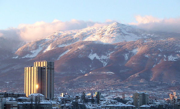
greatruns.com


