


Top 10 Highest Mountains in Ecuador
Ecuador's tallest mountains are mostly located inside the Andean range, and they are home to a diverse range of alpine flora and animals that are unique to the ... read more...Ecuadorian mountains. Through volcanoes and glacial activity, these mountains play a significant influence in sculpting the surrounding terrain. In this post, we will discover the highest mountains in Ecuador.
-
With a height of 20702 feet, Chimborazo is Ecuador's highest peak and the tallest peak close to the equator. The stratovolcano is located in the Cordillera Occidental of the Andes. Since around 550 C.E., the mountain has been inactive.
Chimborazo's top is covered by glaciers, which flow to lower elevations and provide water to the provinces. These glaciers have been shrinking as a result of climate change and human excavation for cooling purposes. Mountaineering activities draw people to the peak, particularly between December and January and July and August.
The most difficult challenge at these altitudes is allowing enough time to acclimate. Begin an hour by road from Riobamba at the Whimper Refuge at 16,400 feet, named after British Edward Whimper, who first summited in 1880. It is a strenuous 6- to 9-hour ascent that normally takes place along the southern route.
It is best done between December and January or June and July and should be avoided between February and May. Even if you don't intend to try the summit, a day trip to the national park to explore its otherworldly scenery is worthwhile.
MORE INFORMATION:
Elevation: 20702 ft
Location: Chimborazo, Ecuador
Chimborazo (photo: https://peakvisor.com/) 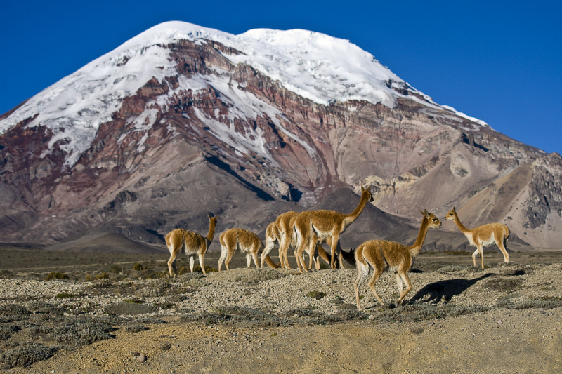
Chimborazo (photo: Alejandro Cock-Peláez) -
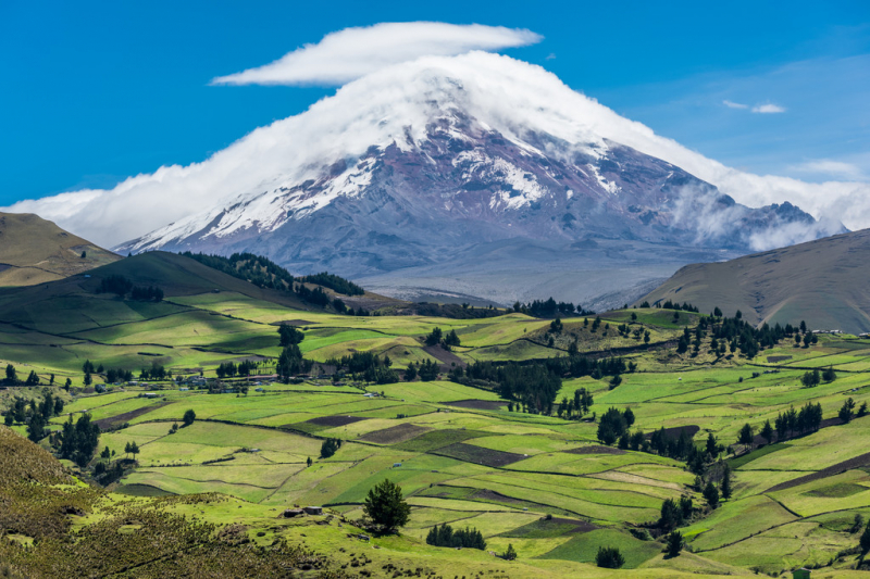
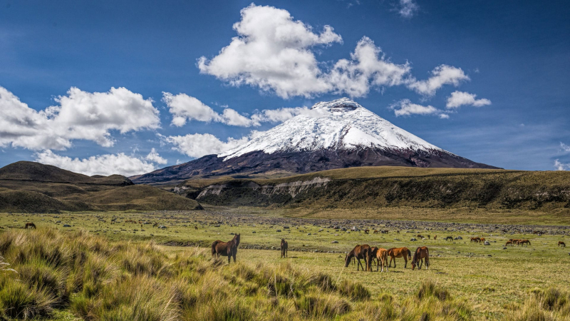
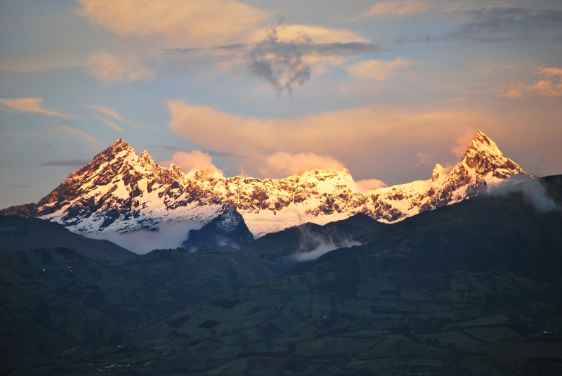
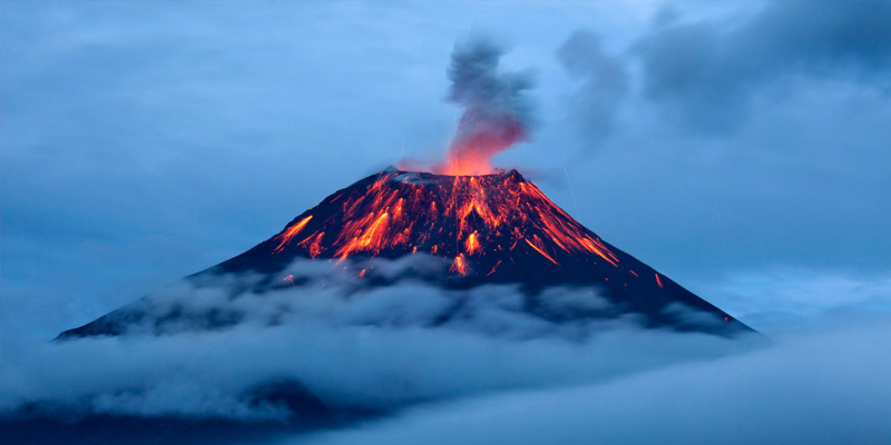
Cotopaxi, Ecuador's second tallest peak, has an elevation of 19347 feet and is located in the North Volcanic Zone and the Andean range. The active stratovolcano last erupted in 2015, lasting about six months from August to January 2016.
Cotopaxi is an almost symmetrical cone with snow at the top. The volcano is situated within the Cotopaxi Volcano National Park, which is home to humid mountain forests and pine trees at lower elevations. Deforestation is a major issue threatening the volcano's forests, as it results in the extinction of indigenous tree species. Andean wolves, llamas, pumas, deer, and a variety of bird species are among the animals that benefit from the alpine habitat.
Because of altitude sickness and inadequate acclimatization, only about half of the climbers reach the summit, but those eager for the challenge should arrange a trip ahead of time. If you don't want to hike to the summit, the hike around Laguna de Limpiopungo is significantly less strenuous and provides spectacular views of the volcano on clear days.
MORE INFORMATION:
Elevation: 19347 ft
Location: Cotopaxi, Ecuador
Cotopaxi (photo: https://www.andbeyond.com/) 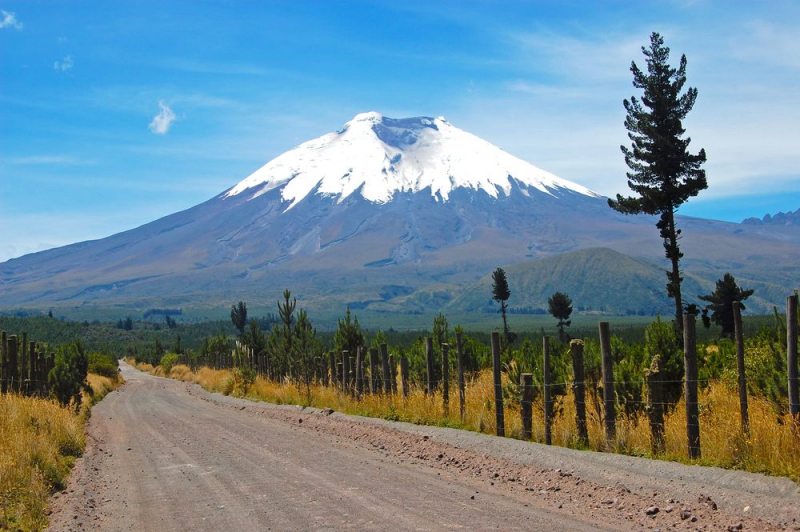
Cotopaxi (photo: https://national-parks.org/) -
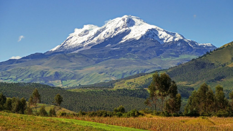
Cayambe, Ecuador's third highest peak, stands at an elevation of 18996 feet. The compound volcano is located near Pichincha, on the Andean range's Cordillera Central. The mountain is permanently snow-capped, making it the only one on the equator with snow. Since the 18th century, the volcano has remained dormant.
The mountain draws visitors for mountain climbing as well as for the biodiversity found along the slopes of the Cyambe-Coca Ecological Reserve. The mountain is home to jungles, rivers, lakes, and hot springs, as well as species including Andean condors, turkeys, and monkeys. Within the mountains, there are over 900 bird species, 200 animal species, and approximately 100 amphibian species.
Cayambe and Cotopaxi can be visible from Quito and the valleys on clear days. Cayambe is famed for its stunning glaciers, which can be seen while climbing up to the Oleas Ruales reserve. Experienced climbers can go to the top quite easily, but it's advisable to hire a guide because the routes aren't well-signposted for visitors who want to see the glaciers and Laguna Solitaria – and there have been a few accidents in the past.
MORE INFORMATION:
Elevation: 18996 ft
Location: Cayambe, Ecuador
Cayambe (photo: Andreas Kay) 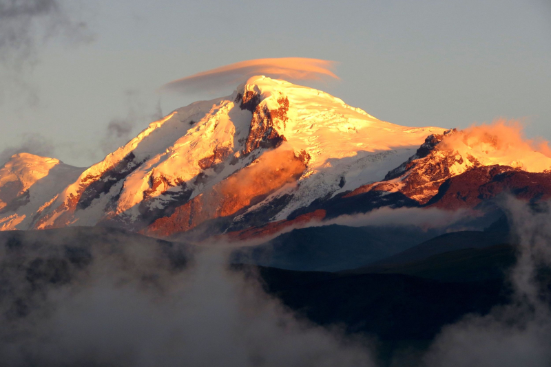
Cayambe (photo: https://gentiantrails.com/) -
Antisana is a stratovolcano located on the Andean range's Cordillera Real, and it is the fourth tallest volcano in Ecuador, standing at 18891 ft. The peak is covered with glaciers, which cause glacial erosion on the mountain slopes. The volcano has remained dormant since the nineteenth century, with the latest eruption taking place in 1801-1802. The peak is rarely climbed due to the difficulties posed by glaciers and the restrictions imposed to safeguard the species supported by the alpine environment. Condors, hummingbirds, and curiquingue falcons can be seen in Antisana.
Antisana is a popular climb among expert climbers, owing to the mountain's beauty and abundance of Ecuadorian fauna. Climbing to the summit is difficult and technical, making it an ideal challenge for experienced climbers. Because of its remoteness, infamously low visibility, and unpredictable weather, glacier climbing skills and a guide are required—but the above-cloud vistas from the top are well worth the effort.
There will also be no permanent shelter, so you will need to establish a base camp. Antisana is best climbed between December and February, making it an ideal winter retreat.
MORE INFORMATION:
Elevation: 18891 ft
Location: Antisana, Ecuador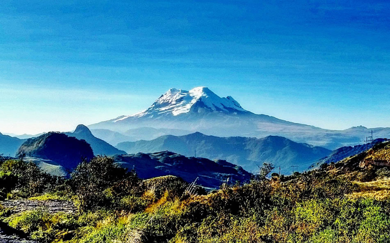
Antisana (photo: https://ecuadormitierra.com/) 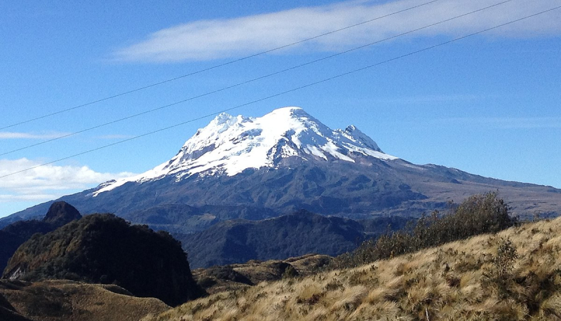
Antisana (photo: https://commons.wikimedia.org/) -
El Altar or Capac Urcu is an extinct volcano in Ecuador, 170 kilometers (110 miles) south of Quito, with a peak height of 5,319 meters (17,451 feet). Spaniards gave it that name because it resembled two nuns and four friars listening to a bishop around a church altar. It is also known as The Altar in ancient English sources.
El Altar is made up of nine prominent summits that form a reverse C shape. The names of the summits are as follows, starting with the tallest in the south and working counterclockwise: Canónigo; Obispo; Monja Grande; Monja Chica; Tabernaculo; the three Frailes, Oriental, Central, and Grande; and Canónigo.
Whatever angle you look at it from, this ancient and extinct volcano is the most spectacular in Ecuador's Andes. It is the most technical mountain in Ecuador, ranking fifth in height. El Altar offers the most difficult climbing in Ecuador. El Obispo 5.319m / 17,451 ft is El Altar's most popular peak because it is the simplest to reach and the highest. The months of December through February are ideal for attempting an ascent.
MORE INFORMATION:
Elevation: 17451 ft
Location: El Altar, Ecuador
El Altar (photo: https://en.wikipedia.org/) 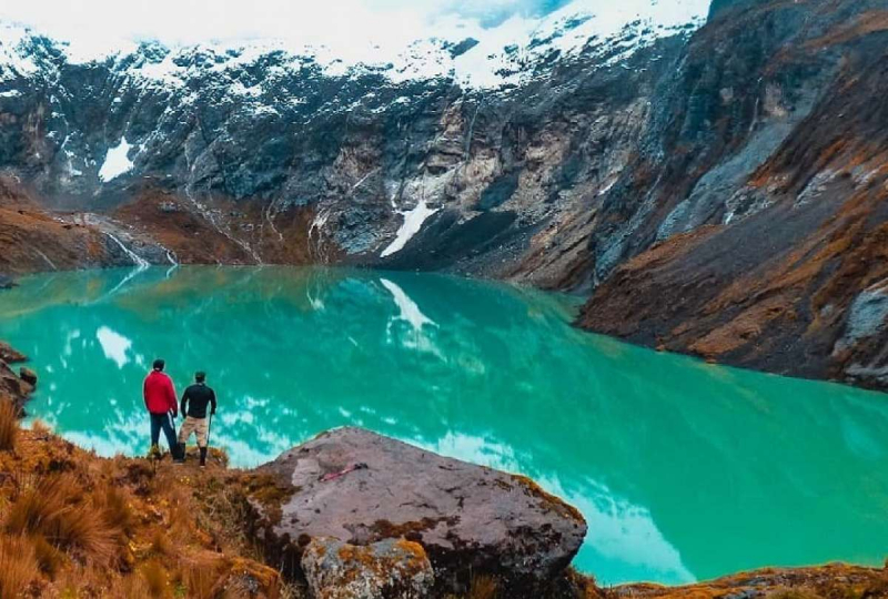
El Altar (photo: https://www.eltelegrafo.com.ec/) -
Illiniza has two summits that provide very different climbing experiences. The northern peak (Illiniza Norte, 16,785 ft) lies two hours southwest of Quito and is mostly trekking and scrambling. It is frequently used as a warm-up climb before attempting Cotopaxi or Chimborazo.
The more glacial Illiniza Sur (17,267 ft) is a more difficult climb that even outwitted the legendary British climber Edward Whimper, who failed twice. The refuge, located at 15,090 feet, can be used to reach either peak. Both summits are best hiked with a mountain guide to avoid risky terrain and gain access to specific equipment.
Unfortunately, Illiniza Sur has lost the majority of its surviving glaciers, and it may lose all of them by the end of the next decade. Aside from that, Illiniza Sur is a lovely steep peak with superb difficult ice/snow climbing routes and stunning views of the surrounding Ecuadorian Andes mountains and valleys.
MORE INFORMATION:
Elevation: 17267 ft
Location: Iliniza Sur, Ecuador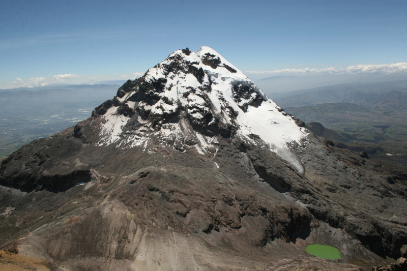
Iliniza Sur (photo: https://es.wikipedia.org/) 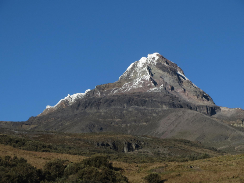
Iliniza Sur (photo: https://www.peakbagger.com/) -
Sangay is an active stratovolcano in central Ecuador. It primarily exhibits strombolian activity. Sangay represents the southern edge of the Northern Volcanic Zone, and its location straddling two main chunks of crust explains its high degree of activity. Sangay's roughly 500,000-year history is one of instability; two prior forms of the mountain were destroyed in huge flank collapses, the remnants of which may still be found today.
Sangay has a significant ecological community due to its isolation, with wildlife such as the mountain tapir, gigantic otter, Andean cock-of-the-rock, and king vulture. Its biological community has been protected as part of the Sangay National Park since 1983. Despite its remoteness, severe weather conditions, river flooding, and the danger of falling ejecta, the volcano is regularly climbed, a feat first accomplished by Robert T. Moore in 1929.
To reach the summit, it might take up to a week of trekking through the rainforest, thus guided trips are required. It's important to remember that the peak – at a height of 17,159 ft above sea level – is not guaranteed to be reached owing to weather conditions.
MORE INFORMATION:
Elevation: 17159 ft
Location: Sangay, Ecuador
Sangay (photo: https://www.volcanodiscovery.com/) 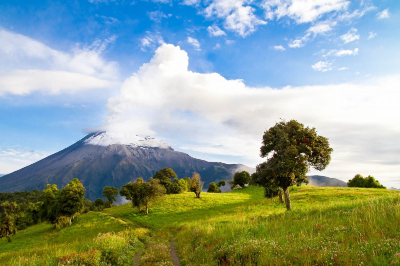
Sangay (photo: https://franks-travelbox.com/) -
The Illinizas are two mountains in Ecuador that rank sixth and eighth in terms of elevation, with Illiniza Sur (17,267 feet) and Illiniza Norte (16,785 feet) respectively. They used to be a single volcano with a crater, but they gradually separated in two. These peaks are located in the Occidental Andean range, 55 kilometers south of Quito, Ecuador's capital city.
It is said that Illiniza Norte (North) is easier to climb than its neighbor summit Illiniza Sur (South). Indeed, Illiniza Sur is recommended for experienced climbers who are familiar with the technical gear and its application on steep snow/ice ramps, whilst for the latter, the deal is solid trekking and scrambling skills.
Illiniza Norte, on the other hand, might face snow/ice conditions from time to time, making this rocky summit tricky and a genuine challenge even for experienced climbers. Climbers may require an ice axe, crampons, and a rope in this situation. It is mandatory to wear a helmet at all times.MORE INFORMATION:
Elevation: 16785 ft
Location: Iliniza Norte, Ecuador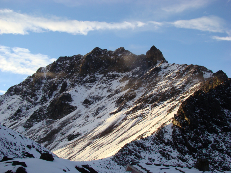
Iliniza Norte (photo: https://commons.wikimedia.org/) 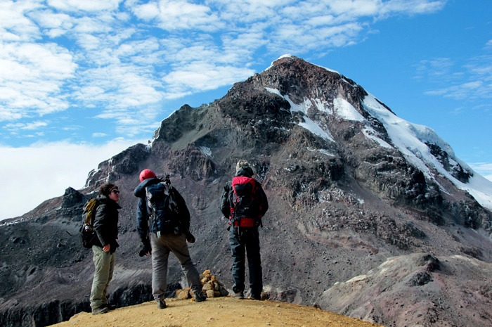
Iliniza Norte (photo: https://www.travelsauro.com/) -
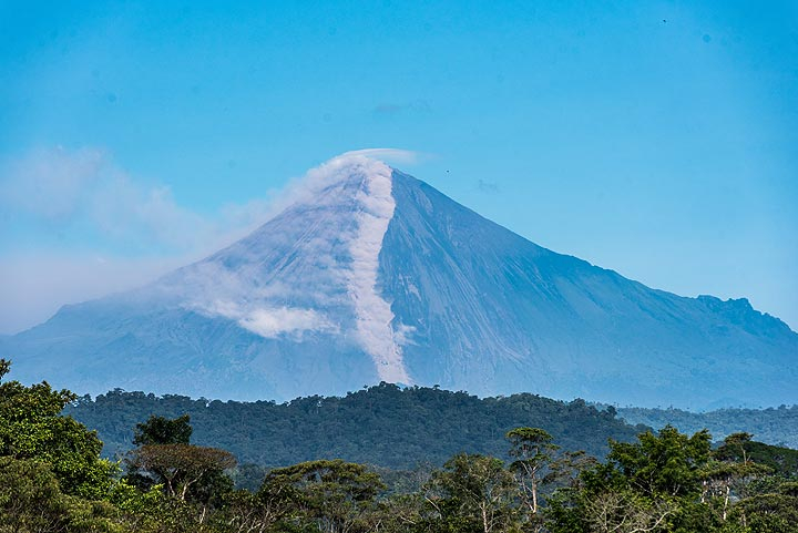
Tungurahua, often known as "The Black Giant," is an active stratovolcano. One of Ecuador's most active volcanoes, it is a steep-sided andesitic-dacitic stratovolcano that towers more than 3 km above its northern base. The summit crater, which is 600 feet (183 meters) broad, has been the source of all historical eruptions. They have been accompanied by powerful explosions and, on occasion, pyroclastic flows.
Tungurahua, visible from the Swing at the End of the World, has fully earned its Kichwa (Quechua) appellation of 'Throat of Fire.' The population of Baños has been subjected to repeated eruptions and ash devastation since 1999, and the volcano is still active today.
Tungurahua, fortunately, is not too tough nor too tricky to climb. The first shelter, at 12,475 feet (3,800 meters) above sea level, takes around four hours to reach, but the top, at 16,480 feet (5,023 meters), may only be reached on guided trips during periods of low volcanic activity.
MORE INFORMATION:
Elevation: 16480 ft
Location: Tungurahua, Ecuador
Tungurahua (photo: https://naturegalapagos.com/) 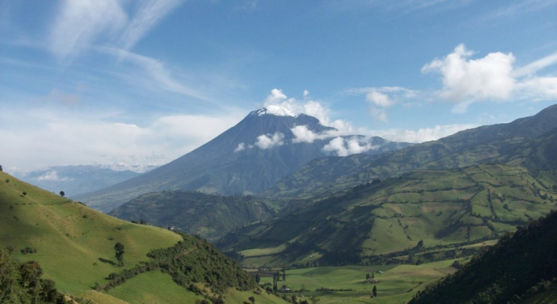
Tungurahua (photo: https://www.sapiens.org/) -
Carihuairazo is located in central Ecuador's Cordillera Occidental in the Andes, 150 kilometers (93 miles) south-southwest of Quito. Mount Carihuairazo is an eroded stratovolcano that is located next to Ecuador's tallest peak, Chimborazo. The Carihuairazo is part of the "Reserva de Produccion Faunistica Chimborazo," a protected ecosystem dedicated to preserving the habitat of the andens native camelids Vicua, Llama, and Alpaca.
Carihuairazo's glacier has lost nearly all of its mass in the last decade due to global warming and ash covering induced by Tungurahua's recent volcanic activity. Carihuairazo's glacier is likely to vanish entirely by 2020 and 2030 if continues at this rate.
Carihuairazo may be climbed all year, but the best months are December–January, and July–August. A decent level of acclimatization is strongly advised for this climb. The standard approach to Carihuairazo Maxima (5,018m) begins from a camping place around 4,600m and proceeds to the main ridge via the SW-ridge or the glacier, followed by a steep technical ascent to the summit tower.
MORE INFORMATION:
Elevation: 16463 ft
Location: Carihuairazo, Ecuador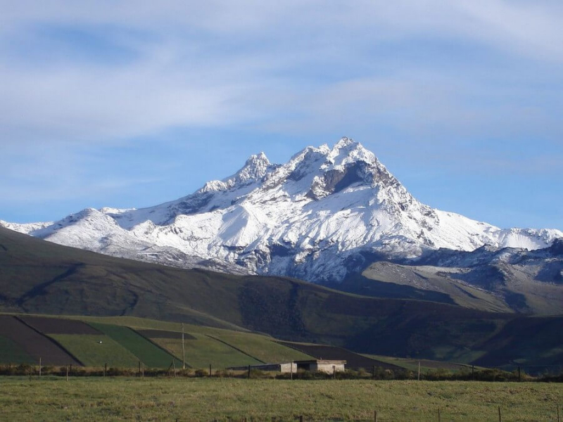
Carihuairazo (photo: https://www.fairtravel4u.org/) 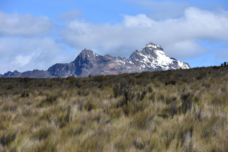
Carihuairazo (photo: https://www.reddit.com/)


