


Top 11 Highest Mountains In Greece

Greece may be the 15th largest country in Europe, yet it ranks third among the continent's hilly countries. It offers breathtaking views and wonderful hiking ... read more...options, ranging from the fabled and heavenly mountain of Olympus to extended mountain ranges and lone peaks. The Greek mountains are covered in rich pine forests, with alpine vegetation of thick fir trees closer to the peaks at higher elevations. Here's a list of Greece's tallest peaks and how to get to them!
-
Mount Olympus, which is known as the home of the Ancient Greek Gods, has Mytikas as its tallest peak, which is also the highest in Greece, looming over the Thessalian countryside at an altitude of 2,917 meters, intimidating and spectacular. Rain and wind shaped Olympus, which resulted in an isolated tower about 3,000 meters (9,800 feet) above the sea, approximately 18 kilometers (11 miles) distant at Litochoro. Olympus is a mountain range with several summits and an almost round shape. The climate in the lower elevations (Litochoro and the foothills) is typically Mediterranean, with hot and dry summers and humid and cold winters. It is more humid and harsh higher up, with more powerful occurrences; it frequently snows all winter in these regions, and raining and snowing are common even in the summer.
The mountain is located between Macedonia and Thessaly, making it an ideal destination for mountaineers and hikers interested in visiting the Pantheon's famous abode. It's a National Park as well as a World Biosphere Reserve. A total of 50 peaks and deep gorges can be found along steep slopes with amazing vistas.There are numerous paths and trails to take, with varied degrees of difficulty, the most popular of which begins in Litochoro's E4 town. It passes through the breathtaking Enipea Canyon and the Prionia Waterfalls before arriving at the Spilios Agapitos Refuge at 2100 meters. You need consult a local guide to get to the summit or leave the designated areas. The greatest time to visit Mount Olympus is from June through September, as snowfall begins early in the summer.
Location: Greece
Elevation: 2,917 m
Range: Thessaly and Macedonia, near the Gulf of Salonika
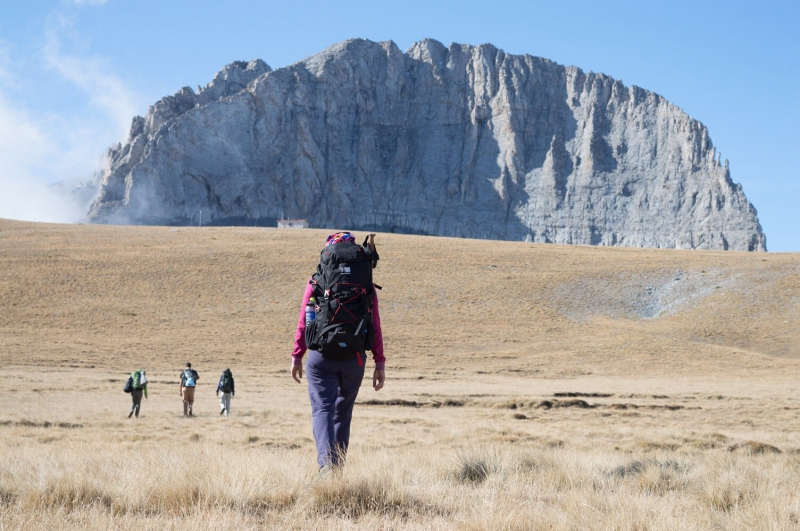
Photo source: greecehighdefinition 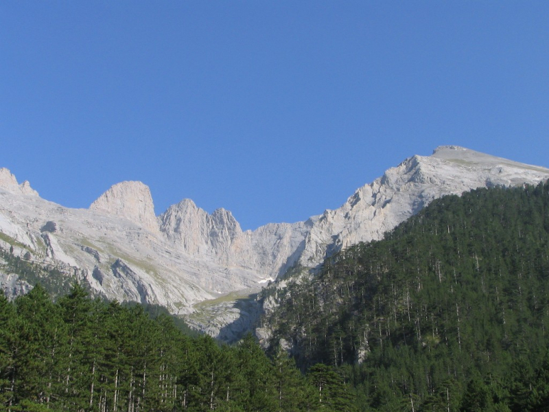
Photo source: Wikipedia -
Mount Smolikas, Greece's second tallest peak, is located in the Ioannina regional unit in the northwestern section of the country. The peak, at 2,637 meters above sea level, is the highest point in the Pindus Mountain Range. Ophiolite rocks make up the mountain. The northern and eastern cirques and valleys were glaciated multiple times throughout the Pleistocene. Around 11,500 years ago, the last glaciers in this area disappeared. It is drained on the south by the river Vjosa, and on the north by the river Vourkopotamo (a tributary of the Sarantaporos). Grasslands and rocks can be found at higher elevations above 2,000 meters, while deciduous and conifer woods can be found at lower levels. The mountain is entirely inside the municipality of Konitsa, with Agia Paraskevi to the north and Palaioselli, Pades, and Armata to the south being the main villages around it. Konitsa is 15 kilometers southwest of Smolikas. The mountain is crossed by the Greek National Road 20 (Kozani - Siatista - Konitsa - Ioannina).
At 2,200 meters, Smolikas is also home to the stunning Dragon Lake, popularly known as the blue lake because of its vivid blue waters. The fact that it is heart-shaped further adds to its uniqueness! According to legend, the lake was named after a real dragon that sought refuge in the lake and was constantly at odds with another dragon atop Mount Tymfi, who was also a resident of Tymfi's Dragon Lake.Climbing, mountaineering, and hiking are all possible on the mountain. There are numerous routes to choose from, but the most well-traveled begins in Agia Paraskevi. There is no need for a guide because it is well signposted and designated. The trek to the top is also very straightforward, with views of lush trees and precipitous cliffs. The trek can take up to 5 hours to complete, and the gorgeous lake is located one hour before the peak.
Location: Northwest central Greece
Elevation: 2,637 mParent range: Pindus Mountains
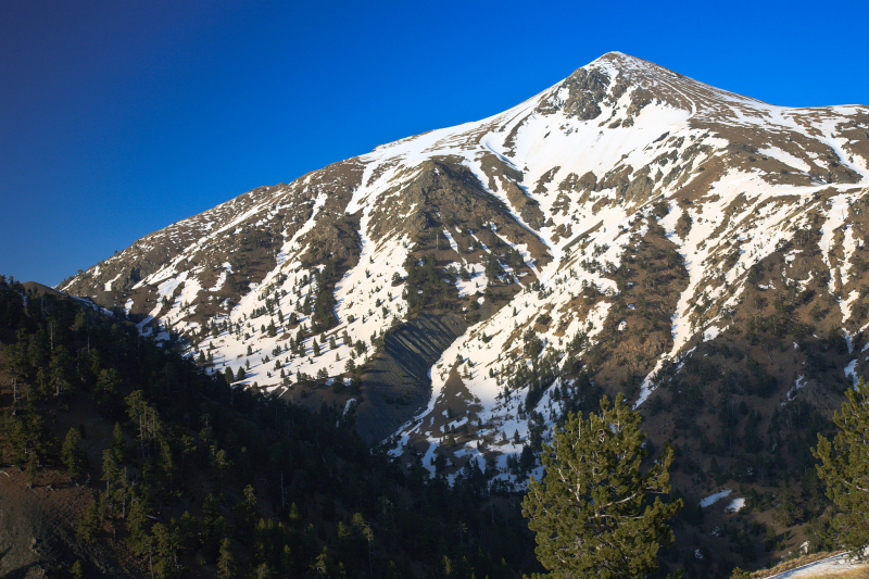
Photo source: Wikipedia 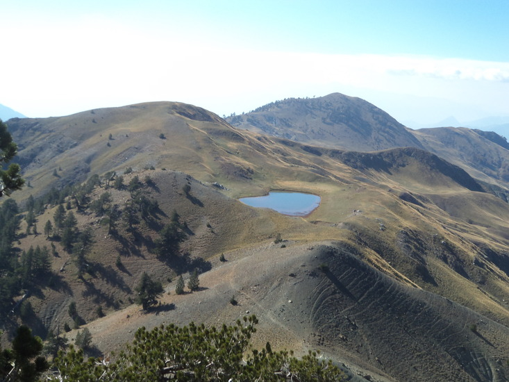
Photo source: Mountain forecast -
Kaimaktsalan is the third highest peak in Macedonia, located north of Pella on the Republic of Macedonia's border. Locals call it "white top" because of the heavy snowfall. It is the southernmost and highest mountain of a range known in Greek as the Voras Mountains and in Macedonian as Nide, with a height of 2,521 meters (8,271 feet). The border between the two countries runs right through the peak. After Mytikas and Smolikas, it is Greece's third highest peak, and North Macedonia's fifth highest.
The highest point, Voras Kaimaktsalan, is 2.524 meters above sea level. Jenna, at 2.182 meters, and Pinovo, at 2.156 meters, are among the other summits. Hiking, climbing, and skiing are all popular activities on the mountain, with the ski center being the most popular among winter sports aficionados. Forests of pine trees, oaks, and other unusual flora abound in the mountainous region.
Hiking paths frequently pass through the Orma, Pozar, and Pinovo districts. The Church of Profitis Elias and a Serbian war memorial can also be found on the peak of Voras. Small traditional villages such as Agios Athanasios and Karidia, both quite lovely and snug, are nearby. If you have time, you should also go to the Pella archaeological site and Ancient Edessa.
Location: Greece–North Macedonia border
Elevation: 2,521 m
Mountain range: Nidže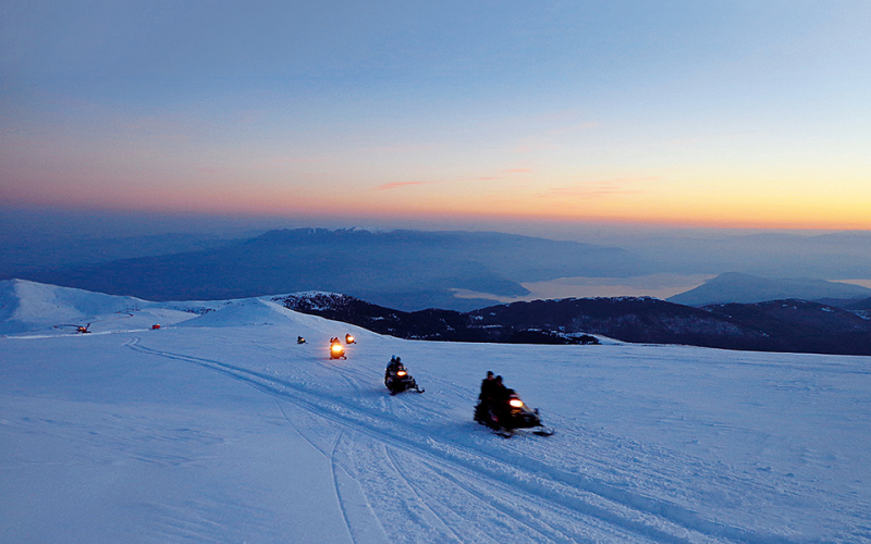
Photo source: Greece is 
Photo source: MyGreekHeart -
Gramos mountain is located in West Macedonia, near the Greek and Albanian borders. Its highest peak is 2.520 meters. It is also part of the northern Pindus Mountain Range, which runs between the Greek cities of Kastoria and Ioannina and the Albanian city of Kolonj.
The Gramos is located on the boundary of Albania's Kolonj district and Greece's Ioannina and Kastoria regional units. At its highest point, three ridges meet and run north, southwest, and east. The river Osum empties into the Gramos in the west, the Devoll empties into the northwest, the Aliakmonas empties into the northeast, and the Sarantaporos empties into the south. The Gramos is sparsely populated, with Ersek (Albania) at its western foot serving as the only significant town. Gramos (northeast), Aetomilitsa (southeast), Starje (west), and Plikati (east) are other mountain communities (south). The Smolikas to the south, Voio to the east, and Ostrovic to the northwest are nearby mountain ranges.
At an altitude of 2.350 meters, this mountain has an alpine lake, which is the largest in Greece. Low temperatures cause the lake to freeze in the winter. According to folklore, a dragon used to live in Gramos village, but when the inhabitants hunted it down, it released a small tear, which formed the small dragon lake, and then a larger tear, which formed the main lake. The mountain was a major communist stronghold in the Greek Civil War. The provisional democratic government had its headquarters in the vicinity. It fell to the national government only in 1949, bringing the near conclusion of the Greek Civil war since after its fall only isolated pockets were left in communist control. The mountain still has live minefields from the civil war despite decades of demining and access to parts of the mountain is perilous. In the wider region, you can also visit the Museum dedicated to the Greek Civil War.Location: the border of Albania and Greece
Elevation: 2,520 m
Range: the northern Pindus Mountain
Photo source: Wikipedia 
Photo source: MountainsGreece -
The awe-inspiring Mt. Giona lies at 2.510 meters in the Phocis region of central Greece, with Pyramida as its highest summit. It is located between Mt. Parnassus and Mt. Vardousia, separated by the river Mornos and the "51" tunnel. It is the tallest peak south of Olympus and Greece's fifth highest altogether. It was known in classical antiquity as the Aselinon Oros. At 2,510 meters, Pyramida is the highest point on the mountain (8,235 ft). It is drained to the west by the Mornos River.
The many gorges in the area are most famous, particularly the northern gorge of Reka and the western ravine of Lazorema.
In the area, you'll also find the magnificent 1000-meter-high Sykia cliff, which is one of the destination's highlights. This side of the mountain, which faces down over Sykia village, is the most natural and undisturbed. Wild horses, foxes, griffon vultures, and eagles, as well as wolves, are among the many varieties of flora and animals that reside there.
The Sykia-Lazorema- Vatheia Laka- Pyramida trail leads to the top and takes around 5 hours to complete. It is only advised for experienced mountaineers. The path begins steeply but gradually eases as it passes through a dense fir forest. The path in the Vatheia Laka region is flat, and the summit can be seen. The view of Olympus from Giona's top is breathtaking.Elevation: 2,510 m
Location: Phocis, Greece
Parent range: Pindus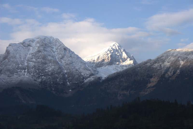
Photo source: Wikipedia 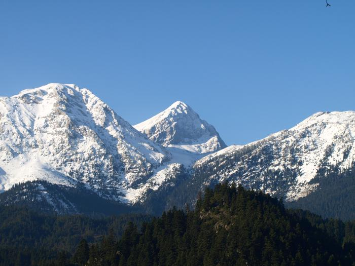
Photo source: Wikimapia -
Tymfi is another mountain in the northern Pindus Mountain Range, with the highest summit, Gamila, standing at 2.497 meters. It's in Zagori's Ioannina region, near the lovely mountain villages of Zagorochoria, which are known for their traditional beauty and architecture. The Vikos Gorge is located in the southern portion of the Tymfi massif, and they are both part of the Vikos–Aoös National Park, which receives over 100,000 tourists each year. The mountain gave its name to the old municipality of the same name. It also gave its name to the ancient country of Tymphaea, as well as the Tymphaeans, one of Ancient Epirus' tribes.
The entire mountain of Tymfi, which includes the Vikos-Aoos Natural Park, is a valuable natural home for numerous species and is protected by Natura 2000. The stunning alpine Drakolimni of Tymfi, another dragon lake buried between the peaks, may be found in the western section of the mountain. The view from up there is magnificent! The Greek dragon lakes are actually glacier remnants, but legend has it that there was a dragon there fighting with the one in Smolikas Dragon Lake, as previously described.
The most popular route to get there starts at the village of Mikro Papigko, where you can stay in a variety of hotels and resorts. The path is 8.4 kilometers long and takes about 3 hours to complete, depending on your pace.
Location: Greece
Elevation: 2,497 m
Mountain range: Pindus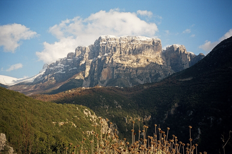
Photo source: Wikimedia Commons 
Photo source: Wikipedia -
Vardousia is a mountain in Greece's northwest Phocis and southwest Phthiotis. Korakas is the second-highest peak in Central Greece after Giona, reaching 2,495 meters (8,186 feet) above sea level. The Pindus mountains have a southern extension. Northern Vardousia has the highest peak, Sinani, at 2,059 meters (6,755 feet), the very steep Western Vardousia has the highest peak, Soufles, at 2,300 meters (7,500 feet), and Southern Vardousia has the highest peak, Korakas, at 2,300 meters (7,500 feet). From north to south, the entire range is around 25 kilometers (16 miles).
Despite its height, the morphology of Korakas Peak lends itself to trekking pathways that all lead to the summit. The E4 trail runs through the Artotina and Athanasios Diakos districts, providing breathtaking views of the mountains and wildlife. The ascent from the Pitimaliko plateau is another popular route. Mountaineering and trekking are popular on the mountain, and two refuges, EOS Amfissas and POA, are available for those activities (Athens Hiking Club).
The Vardousia is drained to the north by tributaries of the river Spercheios, to the east and south by the Mornos, and to the west by the Evinos. To the west are the Panaitoliko mountains, to the northwest are Tymfristos, to the east are Oeta, and to the southeast are Giona. Vardousia, named after the mountain, is a municipal unit that spans the western portion of the mountain and contains the settlements of Artotina and Dichori. Athanasios Diakos is located in the east, while Anatoli and Dafni are located in the north.Location: Greece
Elevation: 2,495 m
Parent range: Pindus
Photo source: Wikipedia 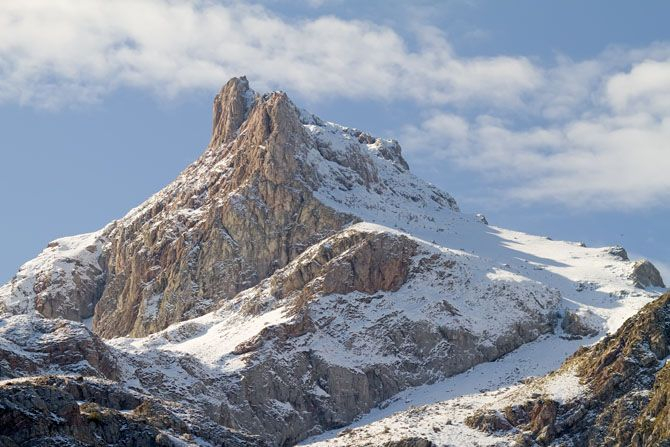
Photo source: Pinterest -
Mount Parnassus is a mountain in central Greece that runs across three municipalities: Boeotia, Phocis, and Phthiotis; its parent is also Pindus. Liakouras, the tallest peak in the area, stands at 2,457 meters. Parnassus is connected to Giona on the northeastern side. Mount Parnassus is a mountain range in central Greece that is and has been historically significant to the Greek nation and, prior to that, to Greek city-states for a variety of reasons. It is a major worldwide recreational location with views of highland landscapes and gives picturesque vistas of the countryside in solitude. In terms of economics, its undulating hillsides and valleys are home to vast olive orchards, a cash crop that has been traded all over the world since antiquity. Delphi, positioned on the southern slopes of the mountain in a rift valley north of the Gulf of Corinth, is one of the mountain's historical, archaeological, and other cultural sites.
According to legend, it was named after Parnassos, a muse's son, and the mountain was home to the Muses, who were noted for poetry and other arts. Experts declared the Parnassus as a National Park in 1938 to protect the area's remarkable biodiversity. The mountain has endemic species and wildlife that must be protected. In early Greek literature, Parnassus is mentioned. Homer's Iliad mentions many of its ancient villages. In terms of linguistics, it was home to Dorians states such as the Phokians, who spoke a Doric dialect known as Phokian. This mountain was dedicated to Dionysus and the Dionysian mysteries, as well as Apollo and the Corycian nymphs, and it was the abode of the Muses, according to Greek mythology.
The park encompasses the greater territory of Delphi, a culturally significant archaeological site, as well as the traditional town of Arachova. Quality amenities are available, including elegant resorts and a well-known ski facility that is well-equipped and busy during the winter months.Elevation: 2,457 m
Mountain range: Pindus
Location: Greece
Photo source: Wikipedia 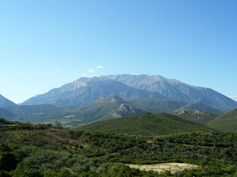
Photo source: Wikipedia -
Mount Ida or Idi, also known as Psiloritis (Greek for "High Mountain"), is located on Crete, Greece's largest island. It is situated in the Rethymno region, with views of the Aegean Sea to the north and the Libyan Sea to the south. Its highest summit, standing boldly at 2,456 meters, also possesses the highest topographic prominence in Greece. The area is also a UNESCO-protected natural park.
Many caves can be found in the vicinity, the most famous of which is Idaean Cave, which is said to be the birthplace of God Zeus. According to the Theogony, the Mt. Idi was dedicated to the Titaness Rea, mother of Zeus and Poseidon, among other Gods.
Because the mountain is devoid of trees and water, especially over 2.000 meters, climbing during the summer months is hard. The mountain may be explored via 4 to 5 trekking paths, the easiest of which begins at the Nida plateau at 1.412m. Depending on the pace, the trip could take up to 6 hours to ascend and 2 to 4 hours to descend. The Aegean Sea and the Libyan Sea, as well as Lefka Ori and the settlements below, are all visible from the summit. Plan to climb the mountain when the weather is clear and there are no clouds in the sky.
Elevation: 2,456 m
Location: Crete, Greece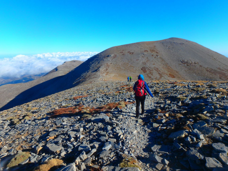
Photo source: Zorbas.nl 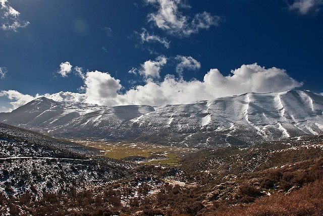
Photo source: karatarakisgroup -
The White Mountains, also known as Lefka Ori, are a mountain range in Crete's central and western regions, in the Chania region. Pachnes (2.453m) is the highest peak, however the mountain complex has around 30 summits that are higher than 2000 meters.
Because of the snow on their tops, which often lasts until late spring, they are known as the white mountains. Furthermore, they are constructed of limestone, which reflects light and gives them a white aspect.
There are around 50 gorges, the most popular of which being Samaria Gorge, which is also a National Park and takes 5-7 hours to cross and gives spectacular vistas of sheer cliffs and unspoiled nature. At 1100 meters, the Omalos plateau is another draw. A moonscape and a desert may be found in the western central region of the country, between the mountains, which is over 1800m.
Elevation: 2,453 m
Country: Greece
Photo source: alargo.com 
Photo source: Crete Bikes -
Taygetus is the highest mountain in the Peloponnese, with its peak Profitis Ilias towering above the countryside at 2404 meters. It is named for Taygetis, Atlanta's daughter and a well-known divinity in the area.
The peak's unusual pyramid shape has aroused debate and mystery throughout the centuries. It's also mentioned in the Odyssey by Homer. When the sun rises and the weather permits, it is reported that the mountain's shadow casts a perfect triangle on the waters of the Messinian Gulf.
The journey to Profitis Ilias takes around three hours, thus it is relatively short and does not necessitate an overnight stay, but a refuge is provided. It's also part of the long E4 path, which runs alongside the Menalon Trail and crosses it. There are numerous routes to choose from, each with varying degrees of difficulty. Because of its shape, the mountain is known as "Pentadaktylos," which translates to "five fingers."
Elevation: 2,405 m
Location: Peloponnese, Greece
Highest point: Profitis Ilias
Country: Greece
Photo source: Alchetron 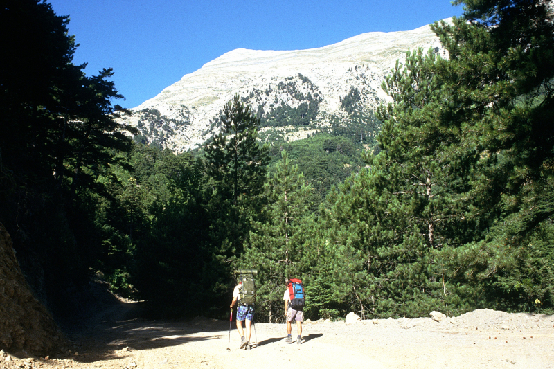
Photo source: Wikipedia


