


Top 5 Highest Mountains In Montenegro

Though montenegro has not been completely developed as an adventure travel destination, hiking fans will know that this country is a heaven for mountain and ... read more...wilderness lovers. Montenegro is an ideal location for nature lovers, with many peaks above 2000 meters (6561 feet) in height. Almost half of Montenegro is over 1000 meters (3280 feet) above sea level. Here are some of highest mountains in Montenegro.
-
The summit of Bobotov Kuk is located in northern Montenegro. It is the tallest peak in the Durmitor mountain range, at 2,523 meters (8,278 feet), and was previously regarded to be Montenegro's highest point. According to new studies, there are three higher peaks near the Albanian border. The majority of Montenegrin mountains can be seen from Bobotov Kuk, including Loven (above the Adriatic Sea), Kopaonik and Tara (in Serbia), and Magli (in Montenegro) (in Bosnia and Herzegovina). The compact summit pyramid, which stands roughly 200 meters tall, rises over steep scree slopes that descend into Valoviti Do, a vast rocky basin at around 2000 to 2100 meters. The entire summer is partially covered in snow in this basin, which is studded with massive stones. The western side of Bobotov Kuk is most impressive. Together with Bezimeni Vrh and Djevojka peaks, Bobotov Kuk (which is between them) form a large mountain wall and a type of natural amphitheatre.
The point of departure is from Zabljak, a resort town with all the amenities for a comfortable stay. Zabljak can be easily reached by a direct bus from the capital, Podgorica. From Zabljak itself the route to the peak is well marked with clear signposts and trail markings. It is approximately a ten-hour round trip as long as a moderate pace is maintained. The outward walk consists of approximately four to five hours hiking until the last ascent where it is a scramble to just below the peak. Climbers are then directed to a potentially dangerous trail that twists its way up to the summit. Climbers should be advised that this is a demanding hike that should only be attempted by experienced hikers. The book 'The Mountains of Montenegro - A Walker's and Trekker's Guide' by Rudolf Abraham contains a comprehensive and easy-to-follow account of the route and other Montenegrin treks.
Oscar Baumann, an Austrian geographer, made the first reported ascent of Bobotov Kuk in 1883. In 1926, the first organized mountaineering party from Zagreb arrived in Durmitor. Two Austrians made the first winter climb of Bezimeni vrh in 1931.Elevation: 2523 m (8728 ft)
Range: Durmitor
Location: northwest of the Montenegro

Photo source: The Sandy Feet 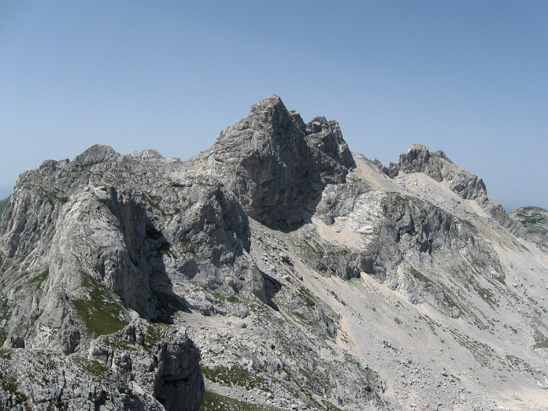
Photo source: Wikipedia -
Maja Rosit is a 2524 m high peak on the Albanian-Montenegrin border in Prokletije. After the Zla Kolata and before the Bobotov Kuk near Durmitor, it is Montenegro's second highest peak.
The Jezerca, the highest mountain in the Prokletije at 2694 meters above sea level, is located slightly over five kilometers southwest. The peak rises between the Jezerca and Kollata massifs (2552 m above sea level). Valbona Valley, in the south, has a severe drop in elevation. The Maja Rosit is hidden by the Maja e That (2405 m above sea level) on the pointed southeast ridge, making it impossible to see from Valbona. It is somewhat flatter in the north following initial rock faces in the top area, therefore Herbert Louis writes of a vast "plateu-like mountain mass" that forms the watershed between Drin and Lim or Danube here in the north of the Valbona valley. Maja Rosit, like the rest of the region, is made of limestone.
The climb over the saddle in the west is long and steep, but it is problem-free due to the lack of climbing points. Steep meadow slopes make up the summit area. On the Montenegrin side, the mountain is climbed through the Ropojana Valley and the AlmRoman from Vusanje near Gusinje. A panoramic vista of the mountains of Prokletije may be seen from the peak.Elevation: 2522 m (8274 ft),
Range: Prokletje,
Location: eastern Montenegro
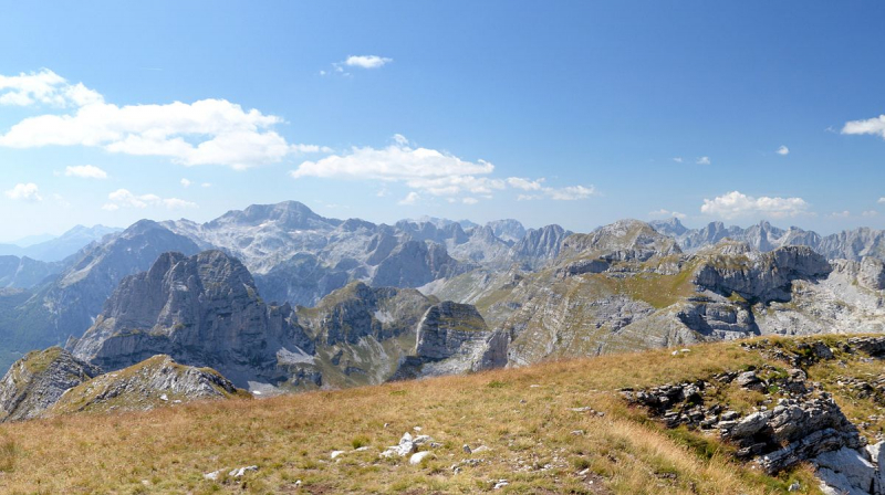
Photo source: Wikipedia 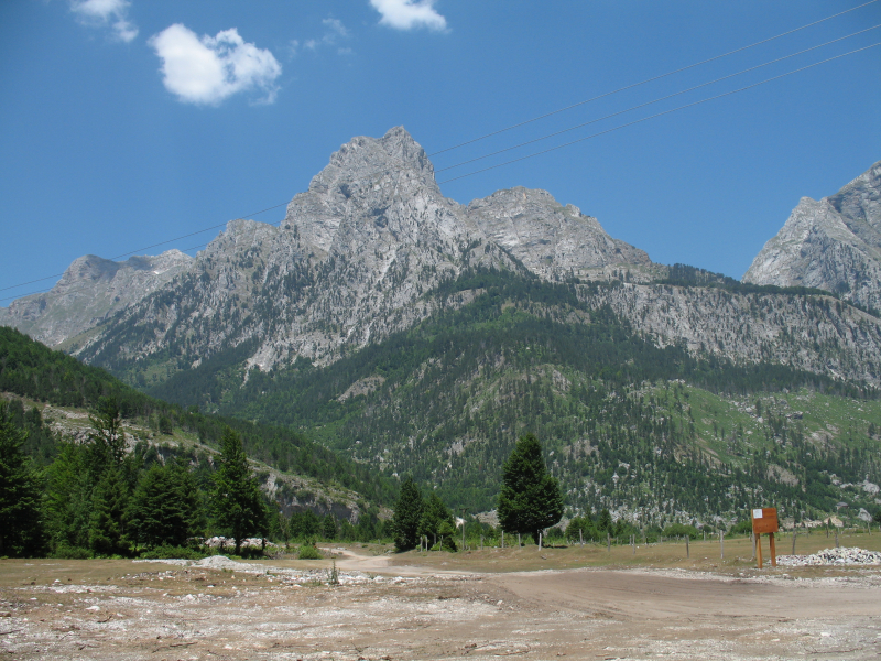
Photo source: Wikipedia -
Komovi is one of Montenegro's most stunning and majestic mountain ranges, if not the entire Dinaric Alps. Kom Kucki (2487 m), the tallest peak in the Komovi massif, is located in the middle of the mountain. From all sides, Kom Kucki is stunning and lovely, but its N face, which faces Kom Ljevorijecki, is the most impressive (2469 m). The southern side of Kom Kucki has rocky slopes and is fairly wild. The final path to the peak leads from this side.
Climbing Kom Kucki is a once-in-a-lifetime opportunity and first-class adventure. During the ascent, you will be able to witness all of Komovi's remarkable natural beauty and diversity. It will take roughly 5 hours to reach the summit from Stavna. The summit view from the top of Kom Kucki (2487 m) is one of the most stunning vistas from any of Montenegro's summits, if not the entire Dinaric Alps. The summit view from Kom Kucki is strikingly similar to many other stunning Julian Alps summit vistas. The views of Stari Vrh (2483 m), Kom Ljevorijecki (2469 m), Kom Vasojevicki (2460 m), and, of course, the massive Prokletije mountain with its highest peak Maja Jezerce are the most stunning (2694 m).
On the broad plateau of Stavna, the route begins at Eko Katun. The trail leads below the SE side of Kom Ljevorijecki (2469 m) and over the lovely Medjukomlje Pass (2171 m), which is located below the W side of Kom Vasojevicki (2460 m). The route will take you below the western slope of Bavan (2252 m) and below the southern side of Kom Kucki. That's a pretty rough and wild region. Following the indicated trail, you will approach Kom Kucki from the left side, where you will need to use your hands. You will reach the peak ridge of Kom Kucki after 20 minutes of climbing. 50 meters before the summit, on the summit ridge, there is one exposed spot that requires careful attention. Then you'll climb to the summit of Kom Kucki (2487 m) and take in the many breathtaking summit panoramas.Elevation: 2487 m (8159 ft)
Range: Komovi
Location: eastern Montengro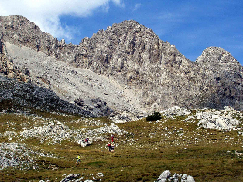
Photo source: Peakery 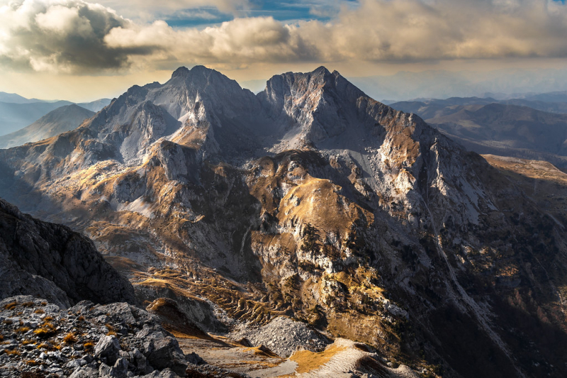
Photo source: Flickr -
When approaching the Komovi massif from the north, on the huge plateau of Stavna, your initial gaze will be drawn to one outstanding peak on the left. That's Kom Vasojevići (2460 m), the Komovi massif's tallest and most eastern peak. Vasojevići Kom (2460 m) is one of Komovi's highest and most magnificent summits, along with Kom Kucki (2487 m), Stari Vrh (2483 m), and Kom Ljevorijecki (2469 m).
Vasojevići Kom is surrounded on the north by the beautiful vast plateau Stavna, on the south by Bavan (2252 m) and the beautiful Carine plateau, on the west by Kom Kucki (2487 m), Stari Vrh (2483 m), Kom Ljevorijecki (2469 m), and Rogamski Vrh (2303 m), and on the east by Zeletin (2112 m) and Visitor (2211 m).
Many stunning panoramas can be seen from the summit of Kom Vasojevići (2460 m). Two of them stand out: the W view of Kom Kucki (2487 m) and its neighbor Kom Ljevorijecki (2469 m). However, you can also enjoy the wonderful splendor of Tara Canyon, which is located below. Finally, in the distance, you can see the beautiful Durmitor range with its two tallest peaks, Bobotov Kuk (2523 m) and Bezimeni Vrh (2487 m), which reach to the sky.
The path to Vasojevići Kom (2460 m) starts at Eko Katun on the huge plateau of Stavna, on the north side of the rocky massif of Kom Vasojevići. The path continues below Kom Vasojevići's NW and W sides, passing through grassy and rocky terrain. After around 2 hours of climbing, you'll arrive at the picturesque Vera Pass (2200 m), which offers views of Albania's border highlands. From there, follow the way to the summit, where you'll have the opportunity to see some of the most beautiful and truly amazing landscapes you'll see when ascending Kom Vasojevići - the high north rocky crest of Kom Vasojevići and the impressive eastern side of Kom Ljevorijecki (2469 m) behind you.
Elevation: 2460 m (8070 ft)
Range: Komovi
Location: eastern Montengro
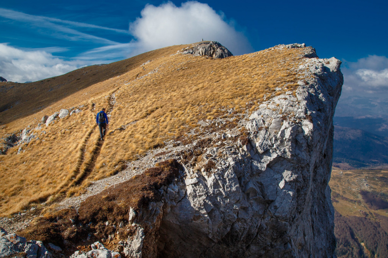
Photo source: Flickr 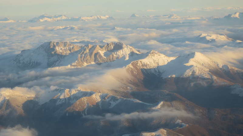
Photo source: Wikimedia Commons -
After Bobotov Kuk (2523 m) and Bezimeni Vrh (2455 m), Šljeme (read "Shljeme") is the third highest peak in the DURMITOR massif (2487 m). Actually, this isn't like any other peak. Šljeme is a 2-kilometer-long high rocky plateau with an average elevation of more than 2400 meters. There are various peaks on the Šljeme plateau, the most well-known of which are Istocni Vrh (East Peak, 2445 m) and Vrh Sljemena (ljeme Summit, 2455 m). Above the Jezerska Povrs, Šljeme and Savin Kuk (2313 m) form the eastern limit of central Durmitor (Plateau of Lakes).
Former glacial cirques, Šljeme is a mix of long grassy slopes and scree valleys or small scree basins. The northern and eastern sides of the Šljeme are completely different. The eastern side of the Šljeme proudly stands above the "tibetian" Jezerska Povrs (Lakes Plateau) vasted plateau, while the northern and most impressive side proudly stands above the Ledeni Do basin and Velika Kalica valley, above the famous glacier Debeli Namet, which is always covered in snow and ice. Šljeme is separated from Savin Kuk on the north end by a narrow pass at the highest portion and the Korita valley that runs between them. The spectacular Osojna Greda face of Šljeme falls into Korita valley.
The entire Šljeme crest, like the entire Durmitor massif, is well delineated. The typical Šljeme climbing path begins from Crno Jezero Lake and continues to Savin Kuk, where the route follows the eastern slope of Šljeme, known as Cista Strana, to Istocni Vrh (East Mountain, 2445 m), and then to Vrh Sljemena (Sljeme Summit, 2455 m), the highest peak in the Šljeme massif. Also, Šljeme can be reached directly from Savin Kuk top by Zdrijelo colouir, however this is a peculiar ascending portion that leads to the Šljeme ridge. As a result, Šljeme does not receive a large number of visitors. However, staying on the 2 km long and 2455 m high summit of Šljeme might make you feel like you're on top of the world, with ultimate freedom and unboundedness. Being so high and walking 2 kilometers at this altitude is very remarkable! Climbing Šljeme and staying on its summit is an incredible trip!
Elevation: 2445 m (8021 ft)
Range: Durmitor
Location: northwest of the Montengro
Photo source: BERGFEX 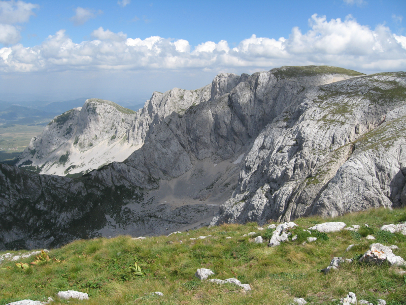
Photo source: Wikimedia Commons


