Top 10 Highest Mountains in Nepal

Nepal, the land of the Himalayas, is known around the world as a mountaineers' and trekkers' paradise because of many highest mountains in the world. Nepal ... read more...Himalaya has around 1310 mountains ranging in elevation from 5500m/18,090ft to 8848m/29,028ft above sea level. Nepal's mountains/peaks were first opened for climbing in 1949, and the Nepal government has since allowed 414 peaks for climbing, which are jointly maintained by the Department of Tourism and the Nepal Mountaineering Association. This article will discuss about top 10 highest mountains in Nepal.
-
Mt. Everest, at an elevation of 8,848 meters (29,029 feet), is the world's tallest summit, recognized by both China and Nepal. It was discovered by an Indian survey in 1955 and confirmed by a Chinese survey in 1975. Two primary climbing routes are used by commercial Everest climbers (South and North).
Out of all the fourteen 8000m summits in the world, Everest has the most summiteers. The climb to Everest base camp is also a popular walking vacation, with over 35000 people going each year. The hike brings you to the world's tallest mountain's base camp.
Despite the fact that smaller mountains have longer or steeper climbs, Everest is so high that it can be impacted by the jet stream. When the weather changes, climbers may encounter gusts of up to 320 km/h (200 mph). The jet stream swings north at different times of the year, allowing for periods of relative calm on the peak.
Location: Mahalangur Himalaya
Elevation: 8848m
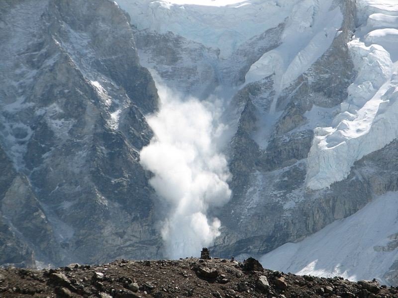
Photo source: Wikipedia 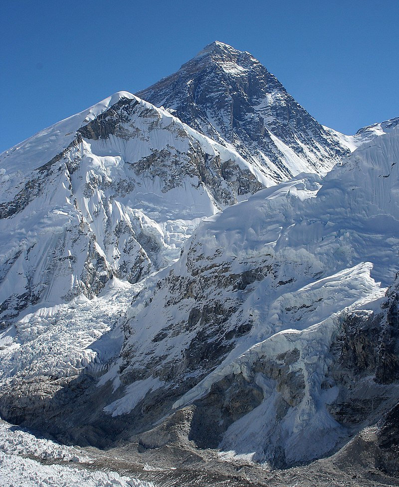
Photo source: Wikipedia -
Kanchenjunga, once regarded to be the world's highest mountain, is located in Nepal's eastern border region with India. Kangchenjunga and its satellite summits make up a massive mountain massif that includes five of the world's tallest peaks (Kanchenjunga Main, West, Central, South and Khangbachen). Kanchenjunga ranked second among the highest mountains in Nepal and the world's third highest peak.
There are four climbing routes to Kangchenjunga's summit, three in Nepal from the southwest, northwest, and northeast, and one in India from northeastern Sikkim. Only three times has the northeastern route from Sikkim been successfully used to date. Expeditions to Kanchenjunga are prohibited by the Indian government, hence this route has been closed since 2000.
Location: Kanchenjunga Himalaya
Elevation: 8,586m
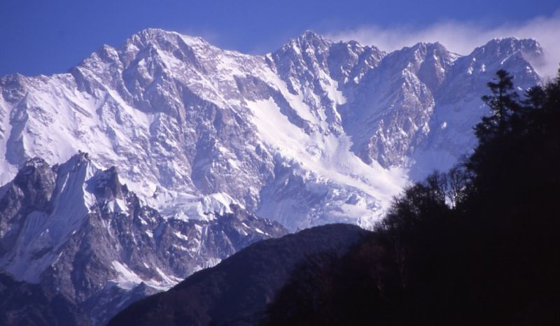
Photo source: Wikipedia 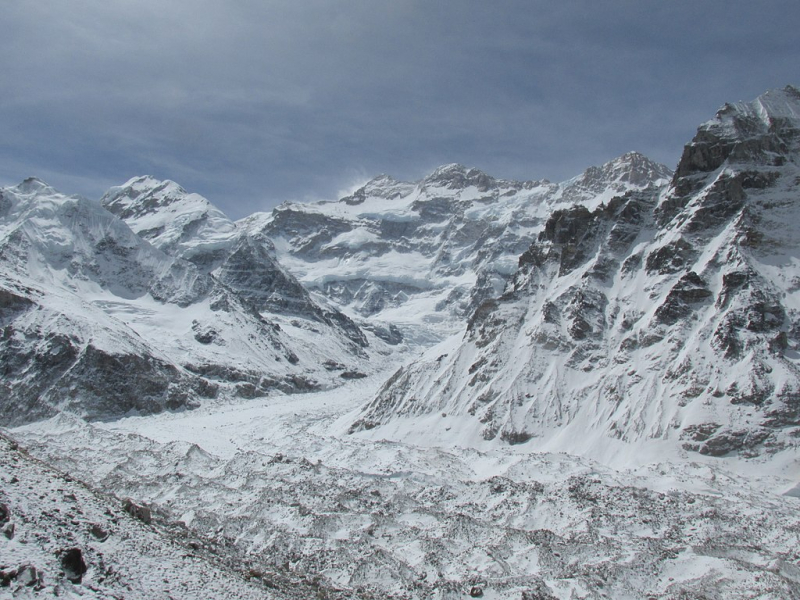
Photo source: Wikipedia -
Lhotse, ranked third among the highest mountains in Nepal, is part of the Everest range and is linked to the latter by the south col. Up to Camp 3, Lhotse and Everest share the same climbing path. Lhotse is made up of two peaks: Lhotse Middle and Lhotse Shar, in addition to the main summit. Climbers on Lhotse and Everest share the same base camp, and the ascending route is paired until Camp 3.
The mountain's main ridge has four distinct summits: Lhotse Main (also known as Lhotse Central I or Lhotse East) at 8,516 meters (27,940 feet), Lhotse Middle (also known as Lhotse Central II or Lhotse East) at 8,414 meters (27,605 feet), Lhotse Central II at 8,372 meters (27,467 feet), and Lhotse Shar at 8,383 meters (27, (27,503 ft). When ascended using the normal Reiss Couloir route, Lhotse Main is rated an intermediately difficult eight-thousander, but its secondary summits and extremely steep South Face are recognized as some of the world's most difficult and perilous climbs. Its icy Northeastern Face has yet to be scaled.
Location: Mahalangur Himalaya
Elevation: 8,516m
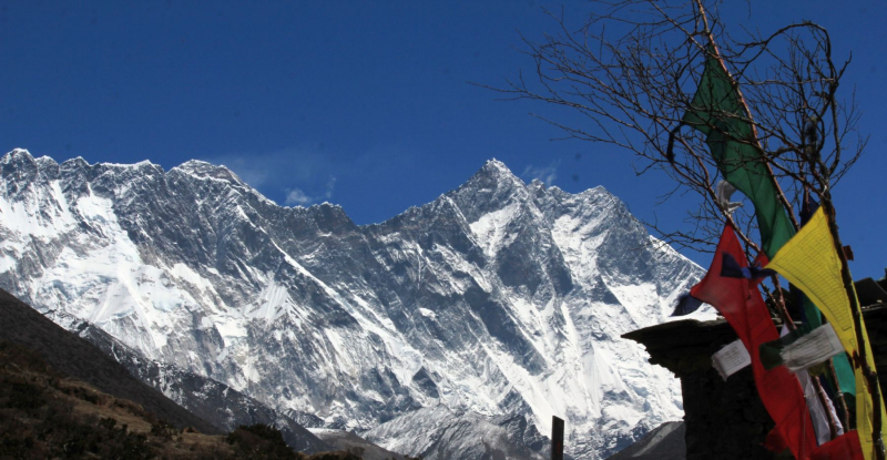
Photo source: Wikipedia 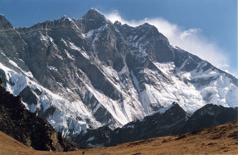
Photo source: Wikipedia -
At an elevation of 8,485m/27,838ft, Makalu is one of the highest mountains in Nepal and the world's fifth highest. Because to its high slopes and knife-edge ridges, it is regarded one of the most difficult eight thousand meter mountains. On May 15, 1955, Mr. Jean Couzy of France became the first person to summit Mt. Makalu via the west face. On May 1, 1978, Mr Ang Chepal Sherpa became the first Nepali to summit Mt Makalu.
There are two significant subsidiary summits on Makalu. Kangchungtse (7,678 m), also known as Makalu II, is located three kilometers (two miles) north of the main summit. Chomo Lonzo rises around 5 kilometers (3 miles) north-northeast of the main summit across a vast plateau, linking to Kangchungtse by a small 7,200-meter saddle (7,804 m)
Location: Mahalangur Himalaya
Elevation: 8,485m
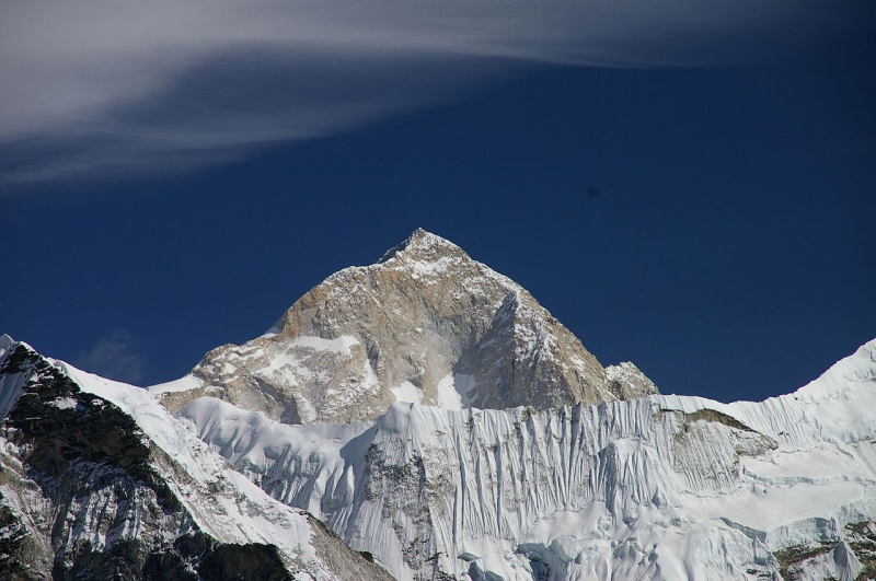
Photo source: Wikipedia 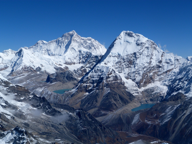
Photo source: Wikimedia Commons -
Mt. Cho Oyu, one of the fifth highest mountain in Nepal, remains the safest and most accessible of all the 8000m peaks. It is situated on the Nepalese-Tibetan border. It is located in the Khumbu Region of Nepal, in the eastern section of the country. The most popular climbing route for Cho Oyu is the North West ridge from Tibet. On both sides, Cho, you share a base camp (Nepal and Tibet, China). The majority of climbers approach Cho Oyu from the north side (Tibet side).
Cho Oyu is regarded as the simplest of the eight-thousanders, having the lowest death-to-summit ratio (a quarter of that of Annapurna). After Everest (whose height makes it the most popular), it is the second most climbed eight-thousander, with nearly four times the number of ascents as the third most popular eight-thousander, Gasherbrum II. It's touted as a "trekking peak" that climbers with good fitness but little mountaineering expertise may reach.
It features a flat summit plateau with no cairn (traditional prayer flags on Cho Oyu's summit plateau do not indicate the "technical" summit), which can cause misunderstanding and controversy among climbers (see Elizabeth Hawley).
Location: Mahalangur Himalaya
Elevation: 8,201m
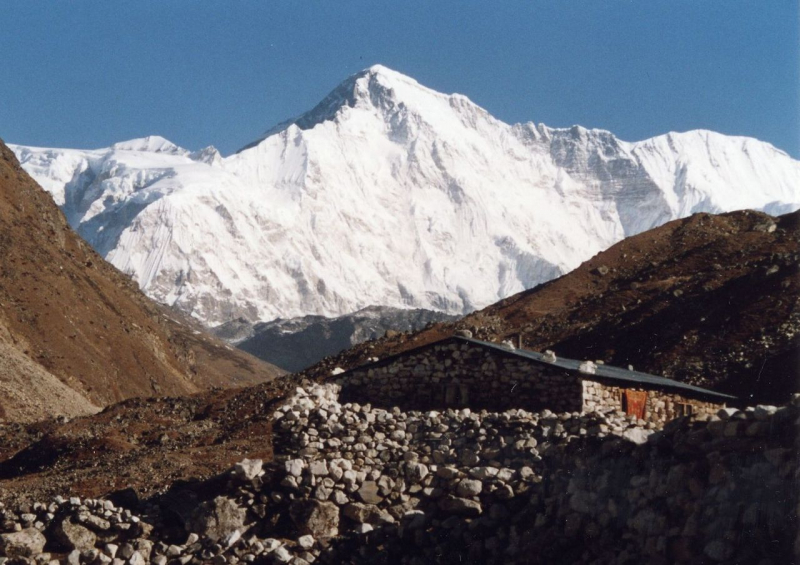
Photo source: Wikipedia 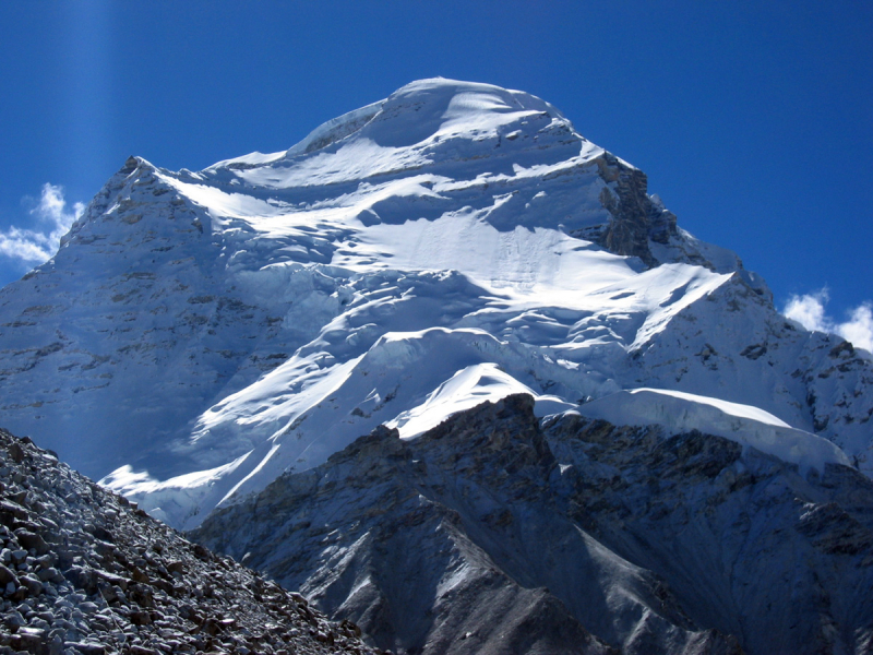
Photo source: Alpine Ascents -
Dhaulagiri, at 8,167 meters (26,795 feet) above sea level, is the world's seventh highest mountain and the highest mountain inside a single country's borders (Nepal). A Swiss-Austrian-Nepali expedition climbed it for the first time on May 13, 1960. Dhaulagiri is 34 kilometers (21 miles) east of Annapurna I (8,091 m (26,545 ft)).
In the Kaligandaki Gorge, which is said to be the world's deepest, the Kali Gandaki River flows between the two. Pokhara is a major regional city and the gateway for climbers and trekkers exploring both ranges, as well as a tourist destination in its own right, located south of the Annapurnas.
The majority of ascents have followed the initial ascent's northeast ridge approach, however climbs have been undertaken from other directions. There had been 358 successful ascents and 58 fatalities as of 2007, resulting in a fatality rate of 16.2%. [8] 2.88 percent of the 2,016 expedition members and crew that went above base camp on Dhaulagiri I died between 1950 and 2006. The death rate was 1.63 percent on all 8,000-meter peaks in Nepal, ranging from 0.65 percent on Cho Oyu to 4.04 percent on Annapurna I and 3.05 percent on Manaslu.
Location: Dhaulagiri Himalaya
Elevation: 8,167m
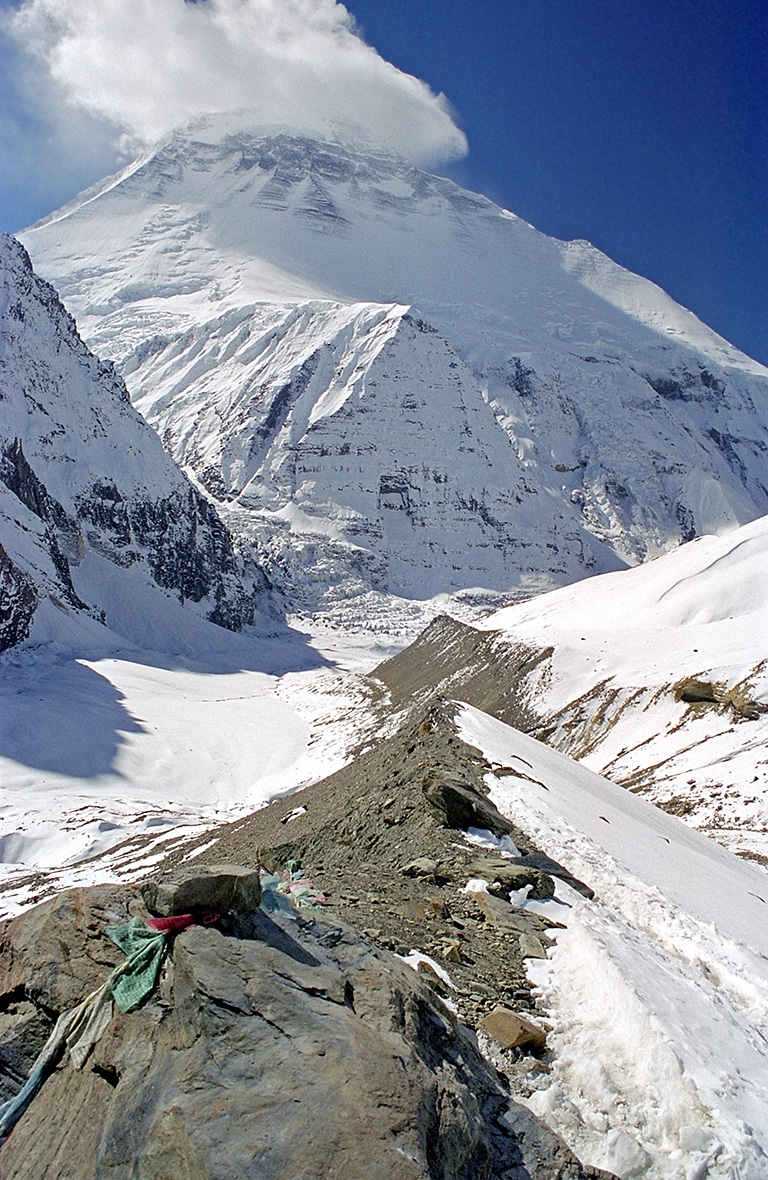
Photo source: Wikipedia 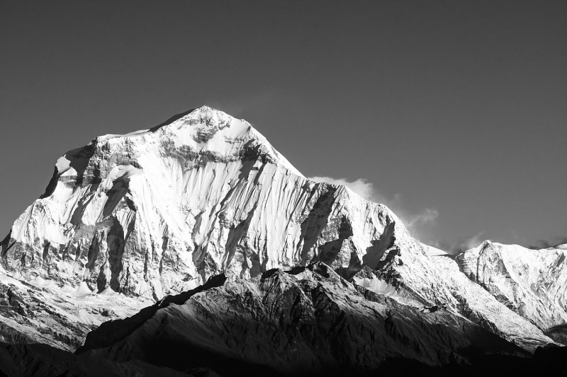
Photo source: Wikipedia -
Manaslu is roughly 64 kilometers east of Annapurna and is the highest mountain in the Gorkha District. Long ridges and valley glaciers provide access from all sides, culminating in a peak that rises high above the surrounding landscape and is a prominent feature when seen from afar. There are numerous trekking alternatives in the Manaslu region.
The popular 177-kilometer Manaslu trekking path skirts the Manaslu peak, passing via the pass and down to Annapurna. Only in 1991 did the Nepalese government allow hiking on this route. Along the Budhi Gandaki River, the walking track follows an ancient salt-trading route. Ten peaks over 6,500 meters, including a few over 7,000 meters, can be seen along the way. The Larkya La, at a height of 5,106 meters, is the highest peak reached along the journey route.
Location: Manaslu Himalaya
Elevation: 8,163m
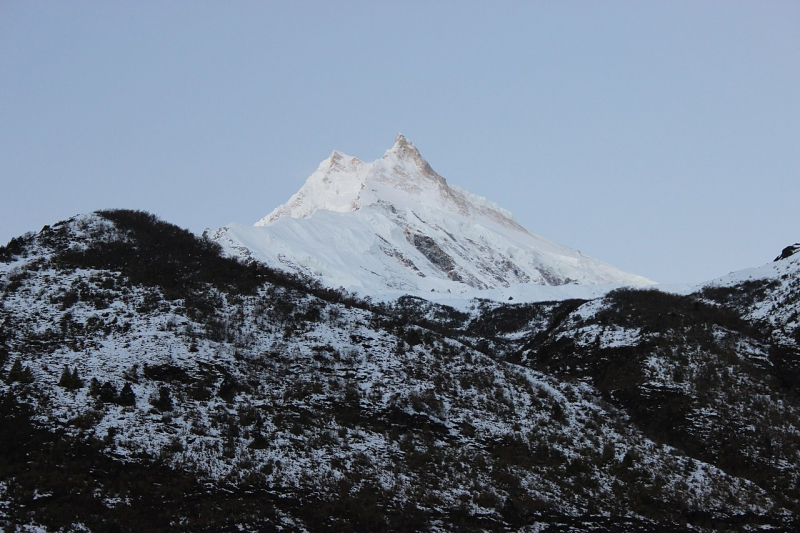
Photo source: Wikipedia 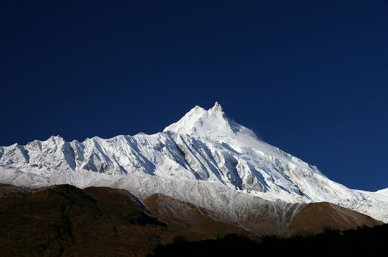
Photo: WIkipedia -
Annapurna, one of the highest mountains in Nepal is a mountain in Nepal's Gandaki Province's Annapurna mountain range in north-central Nepal. At 8,091 meters above sea level, it is the world's tenth highest mountain, and its ascent is notorious for its difficulty and risk.
In 1950, Maurice Herzog led a French expedition up the north face to the summit, making it the first eight-thousand-meter peak to be successfully climbed. The 7,629-square-kilometer Annapurna Conservation Area, Nepal's first and largest conservation area, protects the entire massif and surrounding area. Annapurna Sanctuary and Annapurna Circuit are two world-class hikes available in the Annapurna Conservation Area.
Annapurna I Main had the greatest mortality-to-summit rate of all the main eight-thousander summits for decades; nevertheless, it has witnessed considerable climbing success in recent years, with the fatality rate reducing from 32% to just under 20% from 2012 to 2022. This value is just below the most recent fatality rate estimates for K2, which are around 24%. Avalanche hazard, unpredictable weather, and the highly steep and committing character of the mountain's climbing routes, particularly its 3,000 meter south face, regarded as one of the world's most difficult climbs, continue to pose serious threats to climbers.
It is also a deadly peak for trekkers, as evidenced by the deaths of at least 43 trekkers in a 2014 snowfall near it and Dhaulagiri. In 2022, 365 people had reached the peak of Annapurna I, with 72 people dying in the process.
Location: Annapurna Himalaya
Elevation: 8,091m
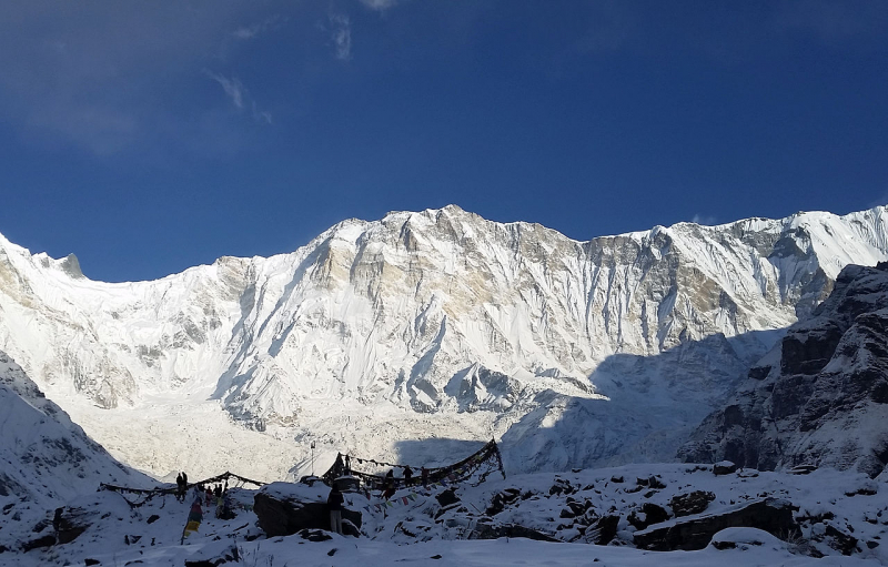
Photo source: Wikipedia 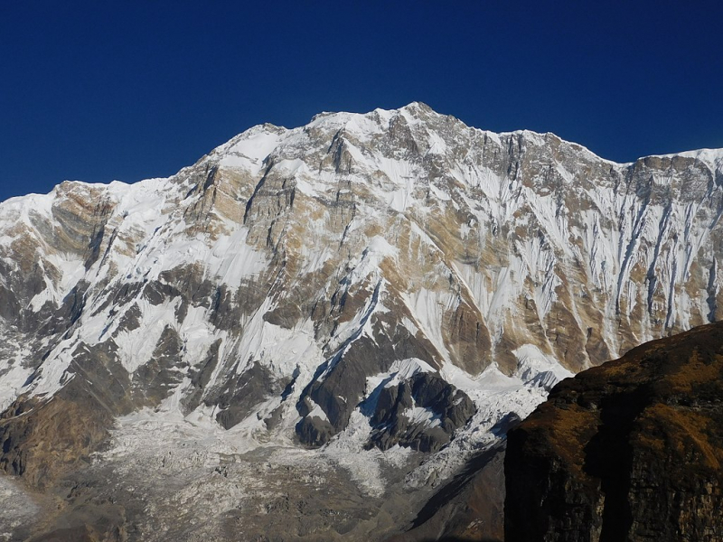
Photo source: Wikipedia -
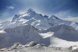
Gyachung Kang (Nepali: Gyachung Kng; Chinese: Gézhngkng Fng) is the highest mountain in the Mahalangur Himal portion of the Himalayas, and is the highest peak between Cho Oyu (8,201 m) and Mount Everest (8,848 m). It is located on the Nepal-China border. It is the world's fifteenth-highest mountain, as well as the tallest peak that is not over 8,000 meters tall; as a result, it is significantly less well-known than the lowest of the eight-thousanders, which are only around 100 meters higher. The lack of prominence (700 m) of the summit also contributes to its relative obscurity.
Y. Kato, K. Sakaizawa, and Pasang Phutar were the first to summit the mountain on April 10, 1964, followed by K. Machida and K. Yasuhisa the next day.
A Slovene expedition climbed the north face for the first time in 1999, and Yasushi Yamanoi repeated the feat in 2002.Location: Mahalangur Himalaya
Elevation: 7,952m
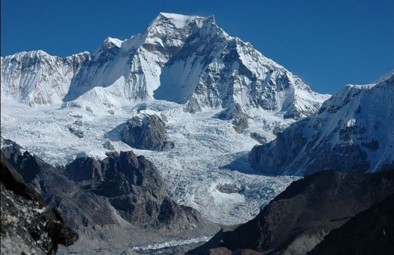
Photo source: caingram.info 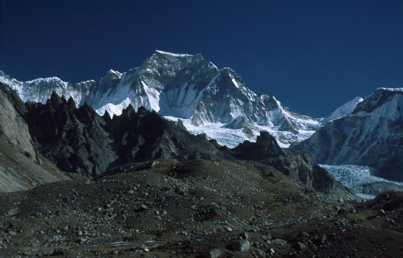
Photo source: Wikipedia -
Annapurna II, along with the shorter Annapurna IV, are separated from the main crest of the Annapurna Massif. Its summit proper lies along a steep rock ridge that declines in altitude to run west to the top of the smaller peak, and is mostly free of snow near its highest point. The South Face is a massive pyramidal wall with only the central spur to break it up, whereas the North Face is more complicated, with steep walls cascading between ice fields between the summit and base of the mountain.
A big hanging glacier dominates the slope between it and Annapurna IV to the northwest, while the Northeastern wall has a characteristic, recurring pattern of cornices and rock bands that resemble a human face or skull, as seen in the accompanying shot.
Large avalanches, particularly those emanating from the high snowpack behind the North-central buttress, are a feature of Annapurna II. Rockfall, massive ice overhangs, and regular storms are all potential hazards. The traditional route of ascent uses the central connecting ridge with Annapurna IV to avoid many of its objective hazards, limiting the scope of mountaineering excursions.
Location: Annapurna Himalaya
Elevation: 7,937m
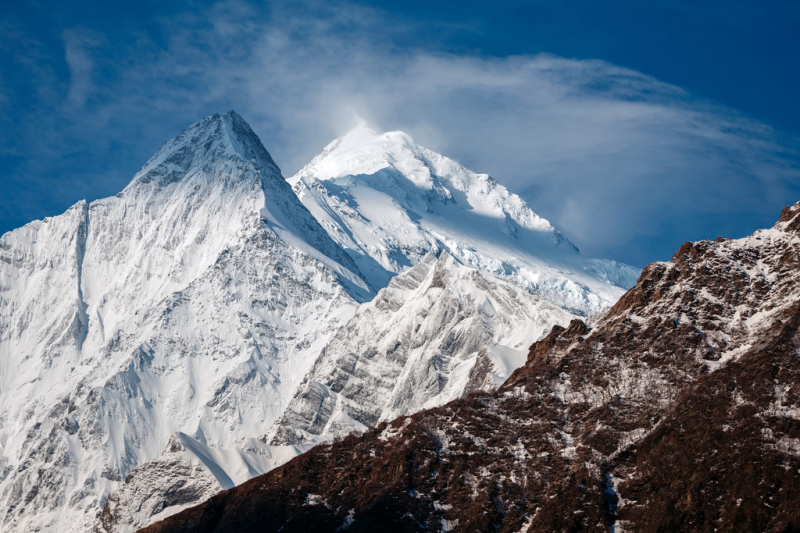
Photo source: Peakvisor 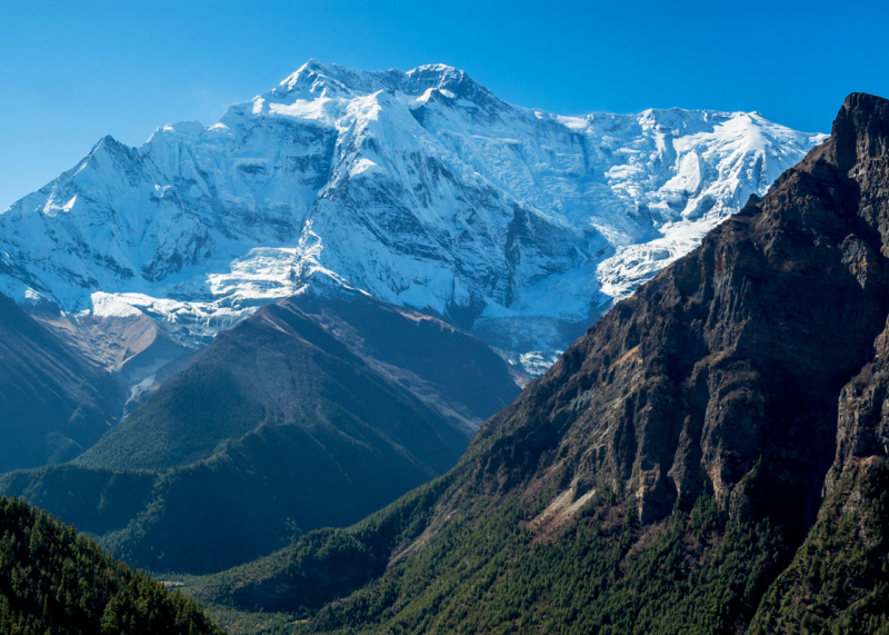
Photo source: Les Koppe Photography